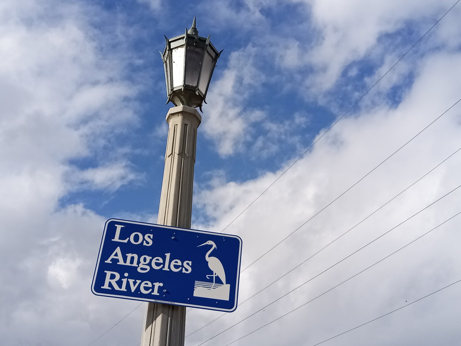
L.A. has pinned a lot of its hopes on the Los Angeles River. And well that it should; the river serves as a sort of litmus test for where the city is at, environmentally speaking. In its course can be traced the history of the city’s development, and the truthfulness of any claims of us becoming a greener or more sustainable city will be laid bare upon its stark expanse of concrete.
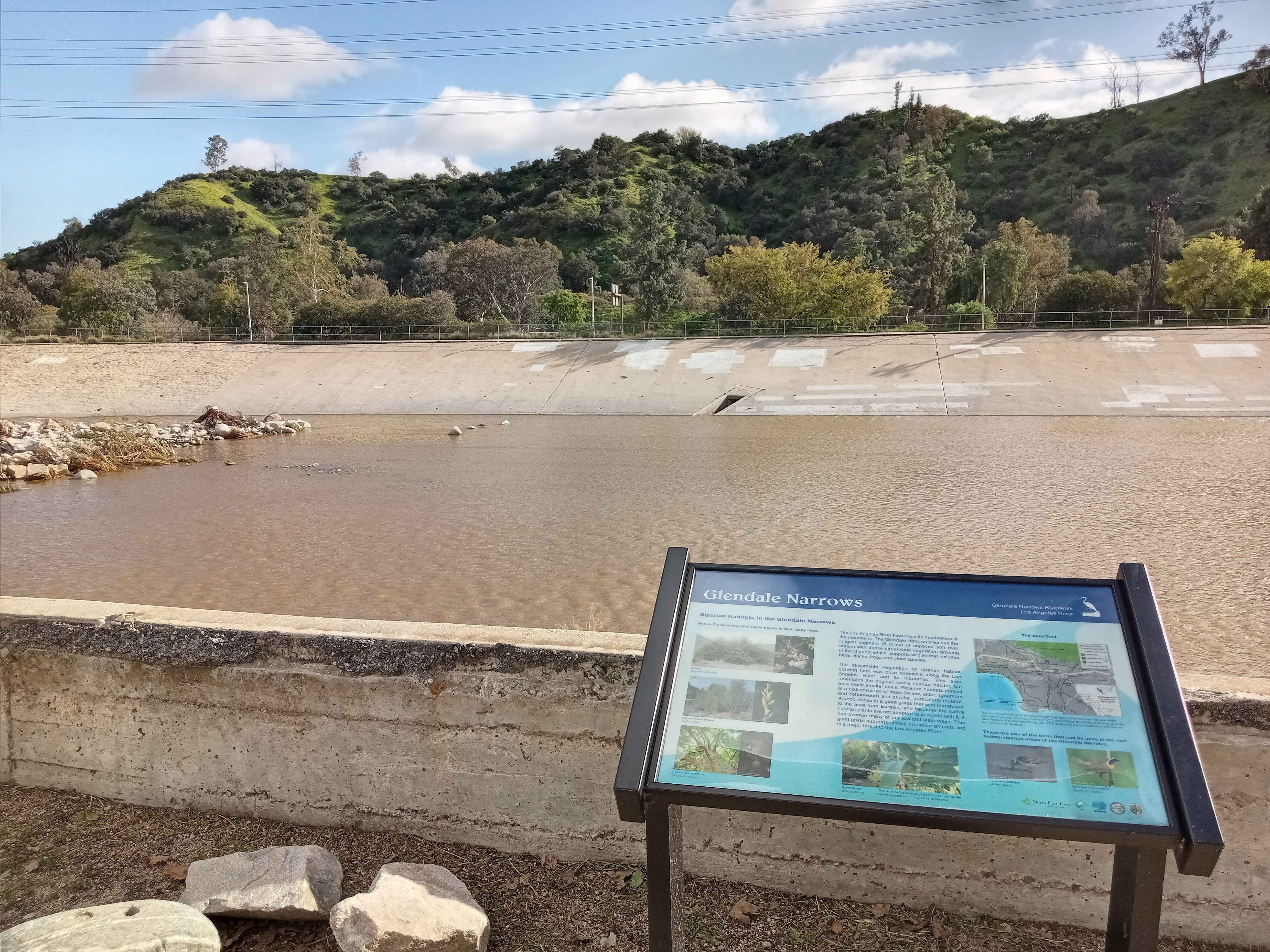
But there is one stretch of the river that isn’t quite so grey. Away from the empty concrete channel near Downtown, made iconic in movies like Grease, there’s one part of the river that’s full of trees, rocks, rapids, birds, life. You may have seen this part of the river in pictures, but have no idea where to find it. It’s a relatively isolated, seven-mile stretch of the river that passes between Griffith Park and Glendale before flowing down through the Elysian Valley, known as the Glendale Narrows.
Even here, there is much work to be done. While a soft-bottomed river course—left in place because the water table was too high to bury it in concrete—allows for trees to grow, the river walls are still cement. Trash and graffiti are common, and the river water (primarily urban runoff) is heavily polluted. You won’t find pristine nature here. What’s more, the city’s revitalization efforts have had an unfortunate “two steps forward, one step back” tendency; you can already see some of the pocket parks and plazas established along the river decaying from a lack of proper upkeep and maintenance.
But I don’t say this to frighten you away from the river. You should still come see it, because in spite of all the issues that have to be addressed, there is still beauty here. This stretch of the river has become a beloved open space, as evidenced by all the people you’ll pass along the way, each enjoying the river in their own right. The Glendale Narrows is where efforts to revitalize the river first took hold; the beachhead where advocates could get Angelenos to start imagining a new river.
Los Angeles is experiencing a reckoning with how it engages with nature, and right here, in this spot, is where a new world struggles to be born. You must come see the river, in order to understand what the future holds and what’s at stake.
The southern end of the Los Angeles River Trail (at least, the Glendale Narrows portion) is a fairly short, 1/2 mile walk or bus ride from the Lincoln/Cypress station on the Metro A Line. Unfortunately, it’s a rather unpleasant walk that skirts the edge of a major freeway interchange, requiring you to cross past multiple on/off-ramps and walk close to lots of fast-moving traffic. It’s do-able, but you should know what you’re getting into and take care. A safer alternative is to use one of the multiple Metro bus routes that stop near a trailhead (#90, #92, #94, #180, #182, #296, and #603; see map below for access points), which are far more forgiving than the walk from the A Line station.
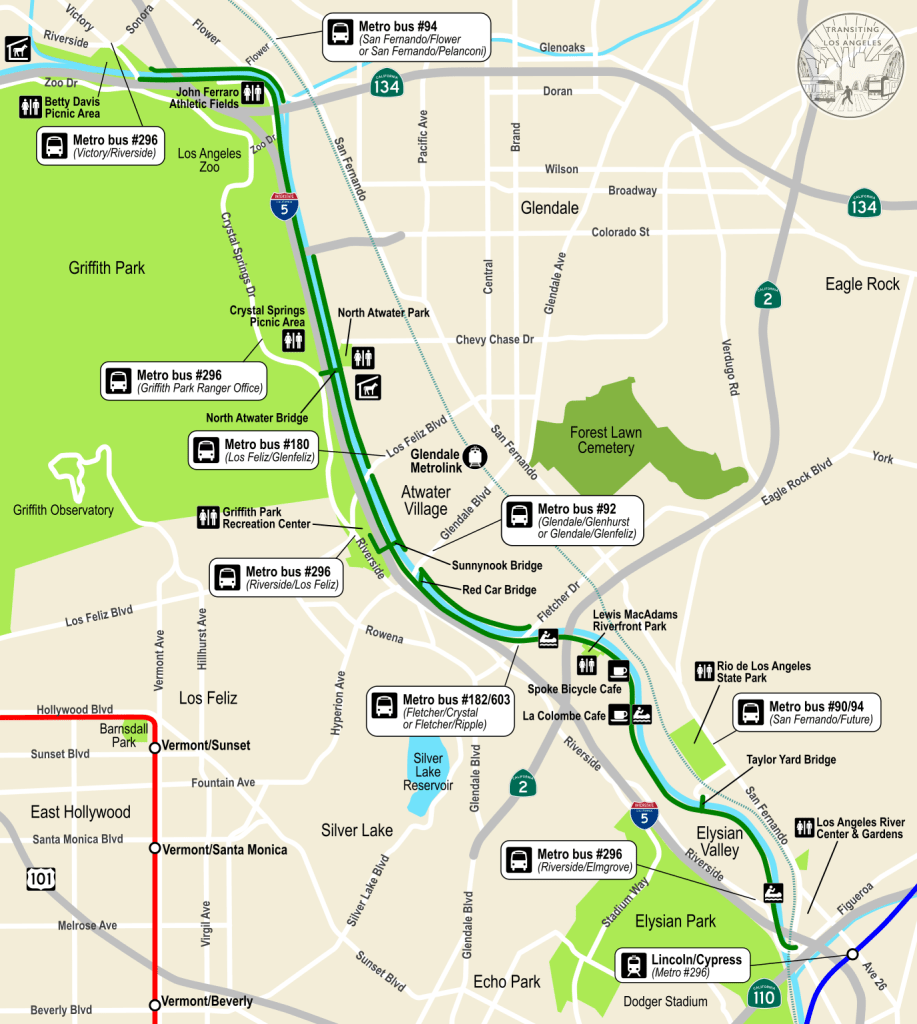
If you do decide to take the A Line, the Lincoln/Cypress station has some public art related to the river: on one platform is a poem with a depiction of a coyote, referencing the native Tongva people and their connection to the river, while on the opposite platform is a bronze statue of a Tongva woman pouring water into a basket.


From the Lincoln/Cypress station, you can take Metro bus #296 (use the stop across the street from the station) across the river to the stop at Riverside/Elmgrove, and then backtrack a few blocks to access the path. However, this bus only runs about once an hour, so if you would rather not wait and must walk: head north on Ave 26, cross under the 110 freeway and over the Arroyo Seco, then turn left onto Figueroa. You’ll pass a gas station, a McDonalds, and an auto repair shop before crossing a pair of on/off-ramps and then passing under the 5 freeway. Here, you’ll reach a very busy roundabout (be extremely careful for fast-moving traffic), on the opposite side of which is a bridge carrying Riverside Drive over the river, where you’ll finally be safely on the river trail. This whole process getting from the A Line is quite annoying, but serves as a good metaphor for the L.A. River as a whole: loving it takes some initial effort.
If you’re willing to make a detour on your way from the A Line to the L.A. River Trail, a block north of Figueroa on Ave 26 is the Los Angeles River Center & Gardens, a beautiful complex of Mission Revival-style buildings and courtyards that’s home to the offices for several local and regional conservation organizations, including the Mountains Recreation and Conservation Authority, the Santa Monica Mountains Conservancy, and the Friends of the L.A. River.
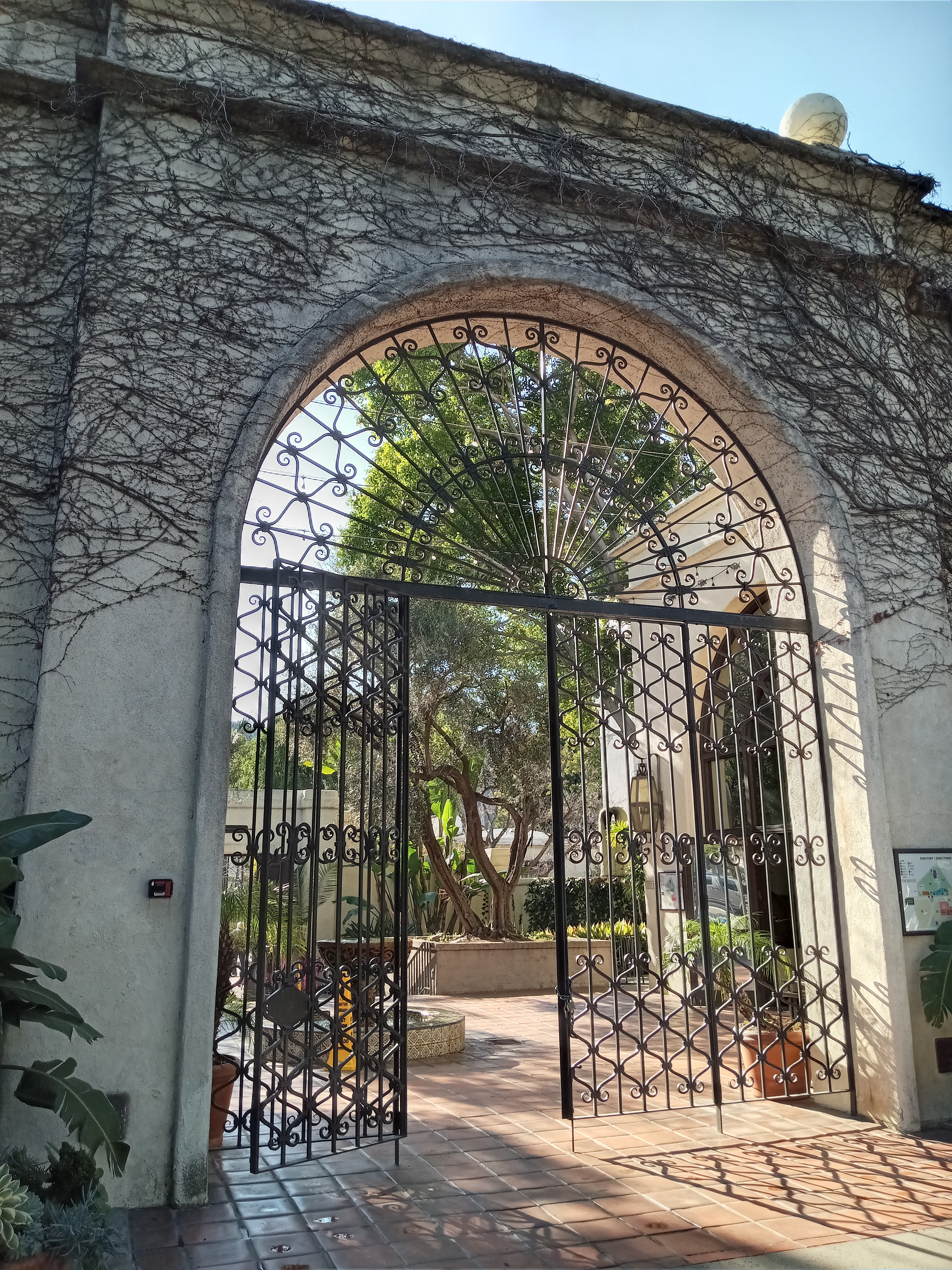
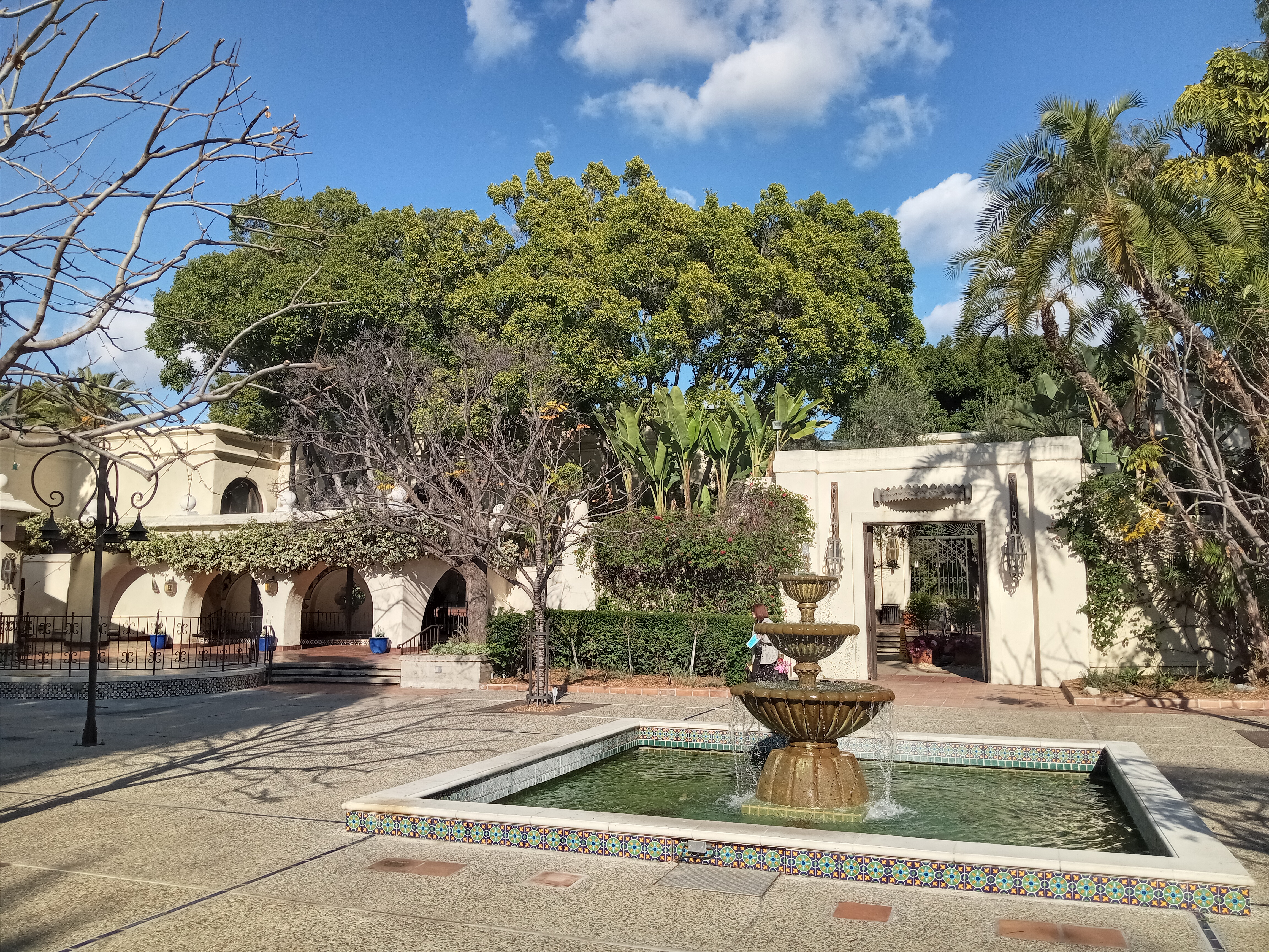
The complex dates back to the 1950s, when it served as the corporate headquarters and spice factory, as well as a restaurant, for Lawry’s Foods, a formerly popular brand of seasoned salt. The facility closed in the ’90s after Lawry’s was bought out, and in 2000 it was converted to its current use. Wandering the courtyards, you’ll see plenty of lush foliage and burbling fountains, as well as a nice little exhibit about the history of the L.A. River on the ground floor of the California Building (open Monday-Friday 9am-5pm, unless an event is going on), as well as some restrooms and a drinking fountain.

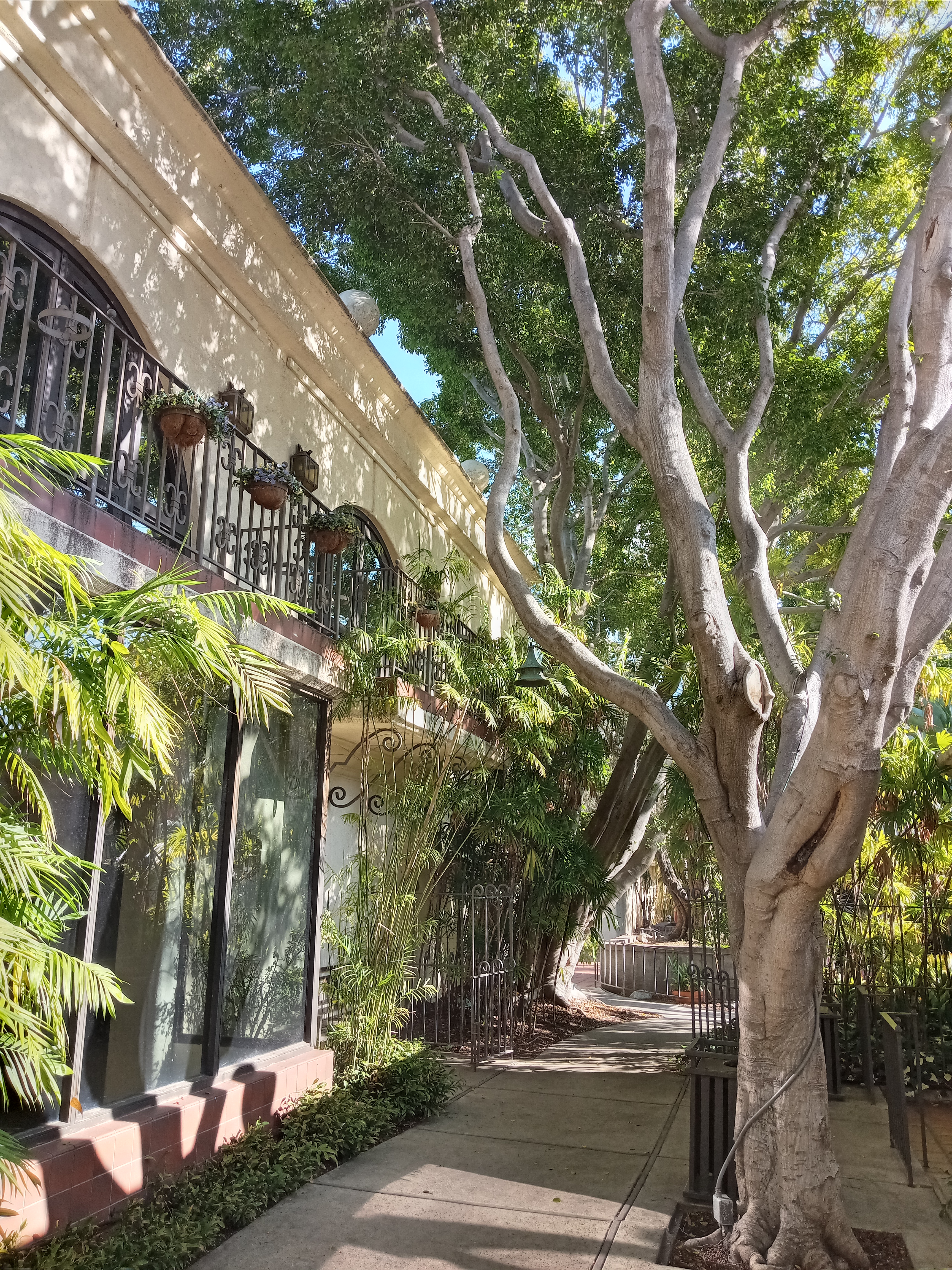
That said, the one major drawback is that walking here is a pain. Not only are the surrounding streets busy and full of traffic, but you have to enter through the driveway which lacks any kind of sidewalk. But if you’re willing to brave that, it is quite a hidden gem.
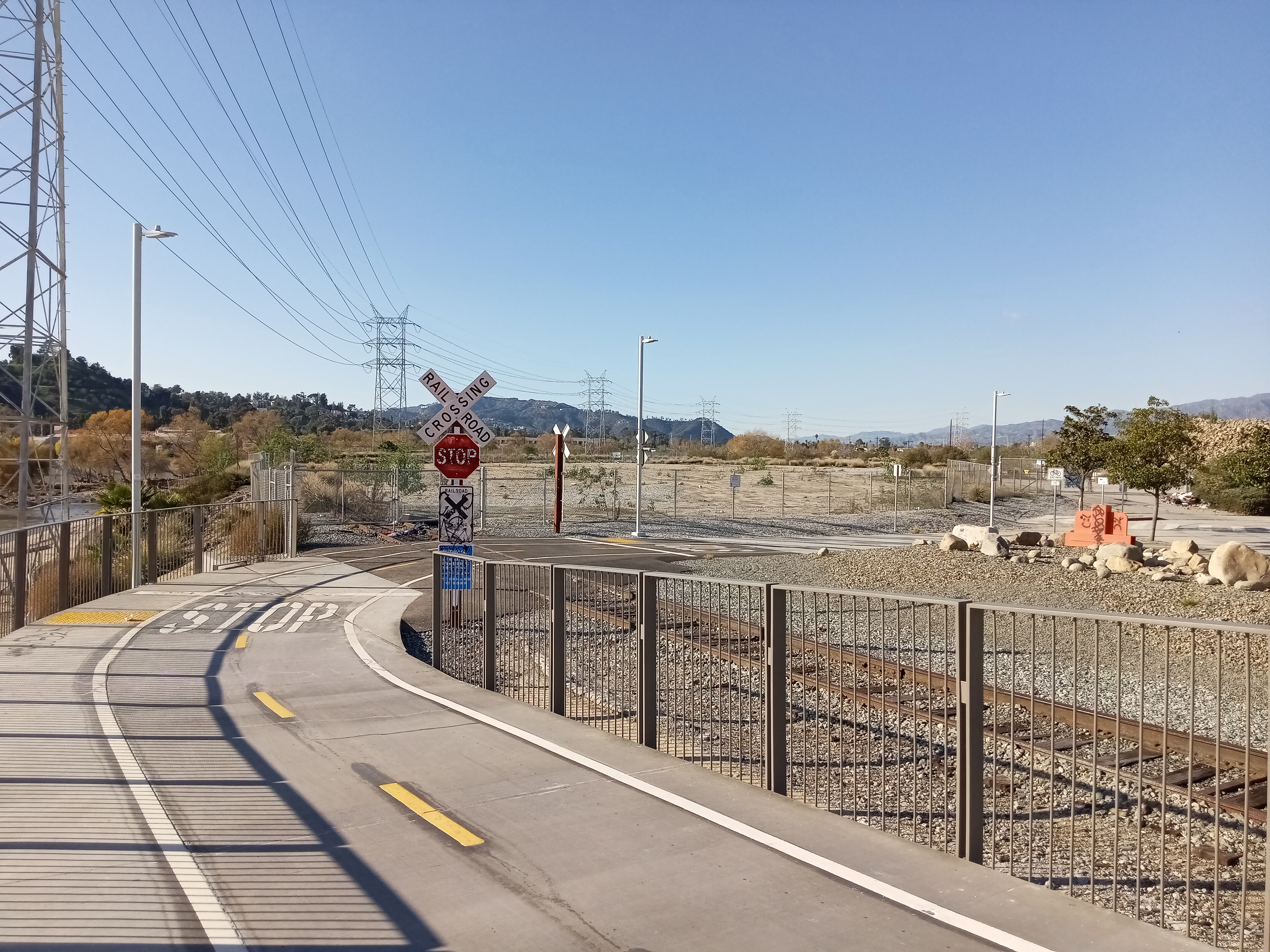
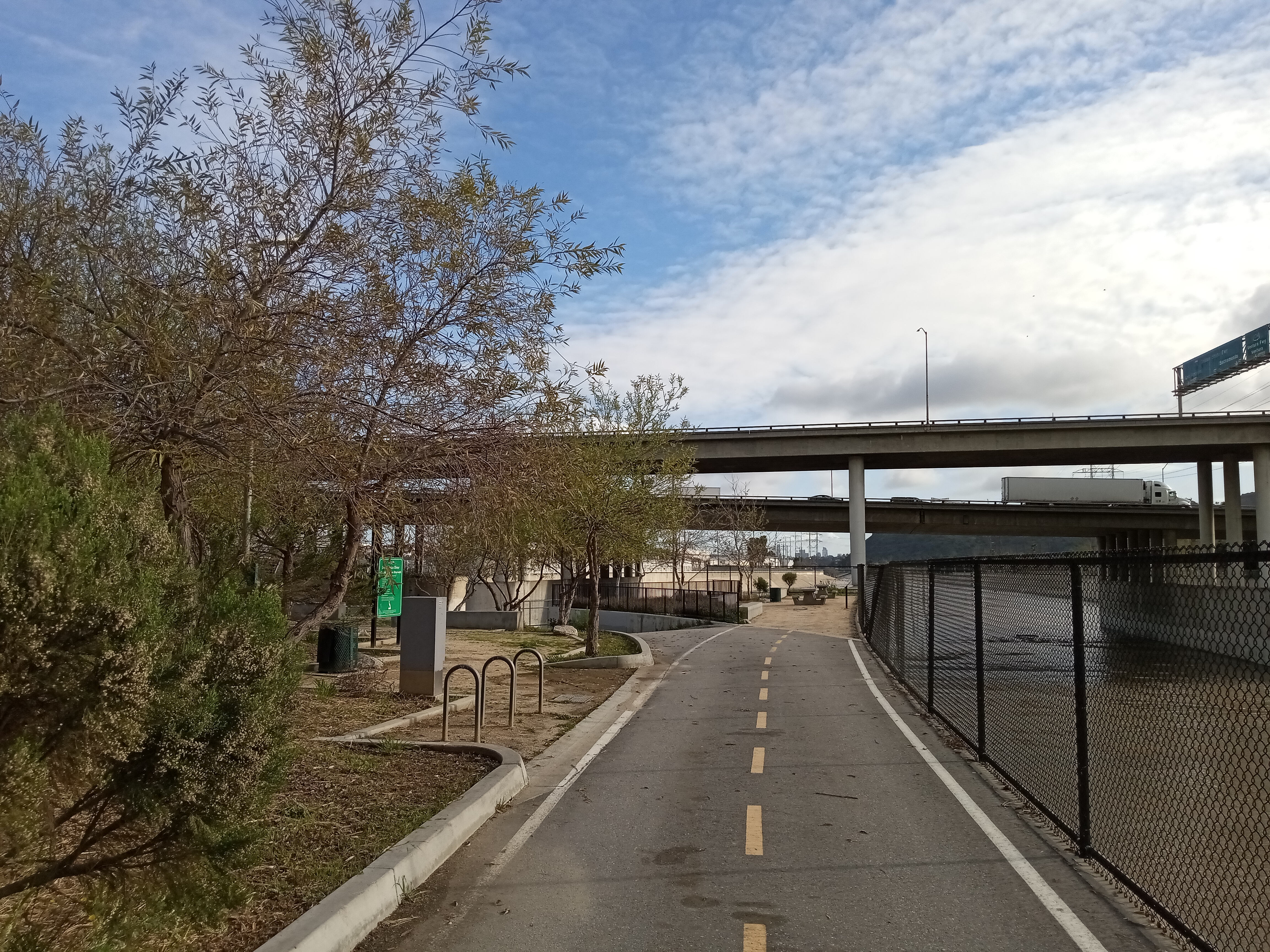
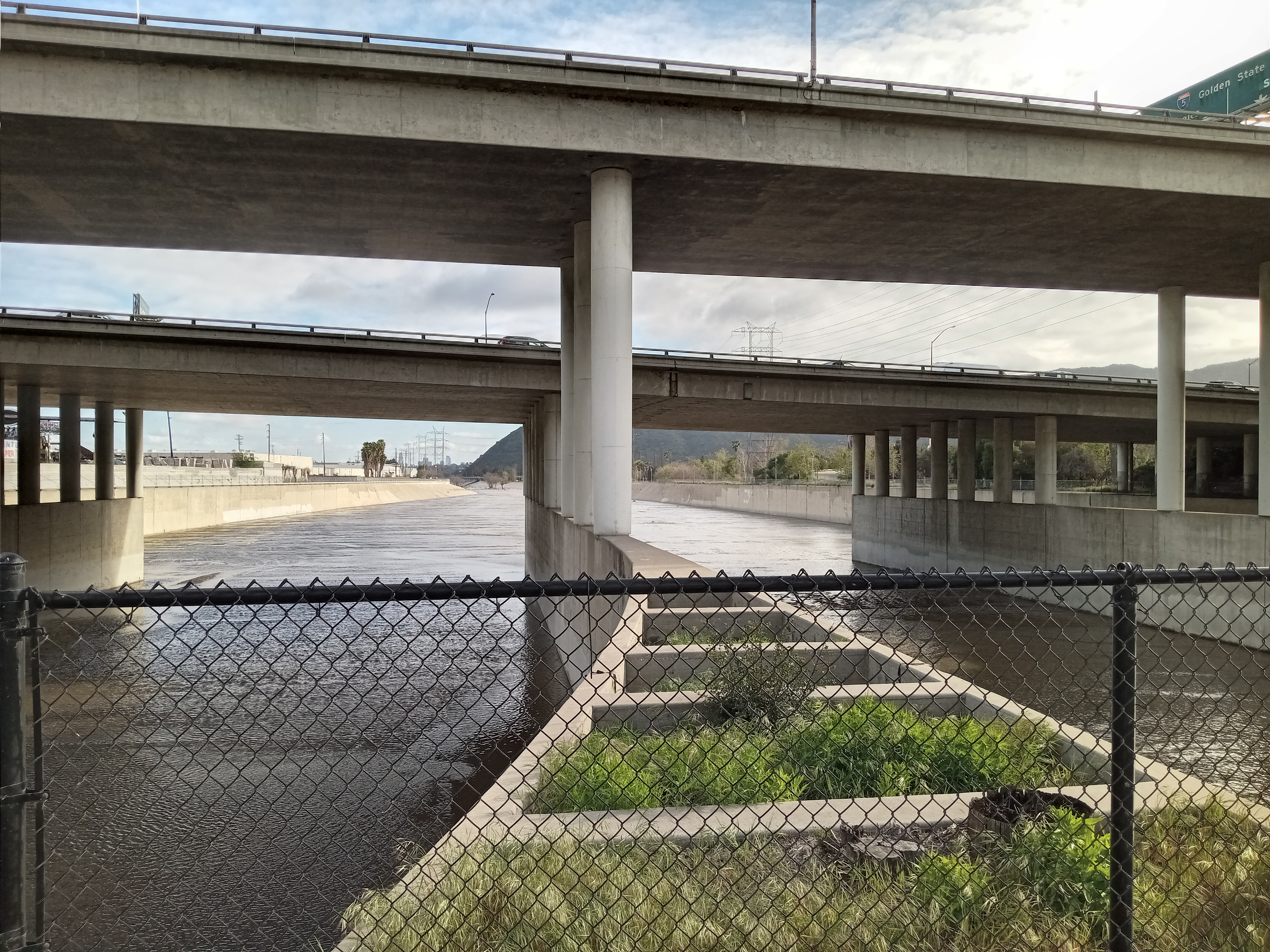
The roundabout at Figueroa and San Fernando serves as the start of the L.A. River Trail. It also has proven to be something of a disaster; across the street from the trailhead is a small patch of concrete dubbed “Confluence Plaza,” named for the nearby confluence of the Arroyo Seco and the L.A. River, and originally envisioned as the first part of a larger park that would open up the confluence itself to public access and restore some of the natural environment. Instead, more than a decade after it opened, this tiny, uninviting plaza is still hemmed in by industrial lots and freeway underpasses. It originally had a dancing fountain, but that was damaged years ago and has never been repaired.
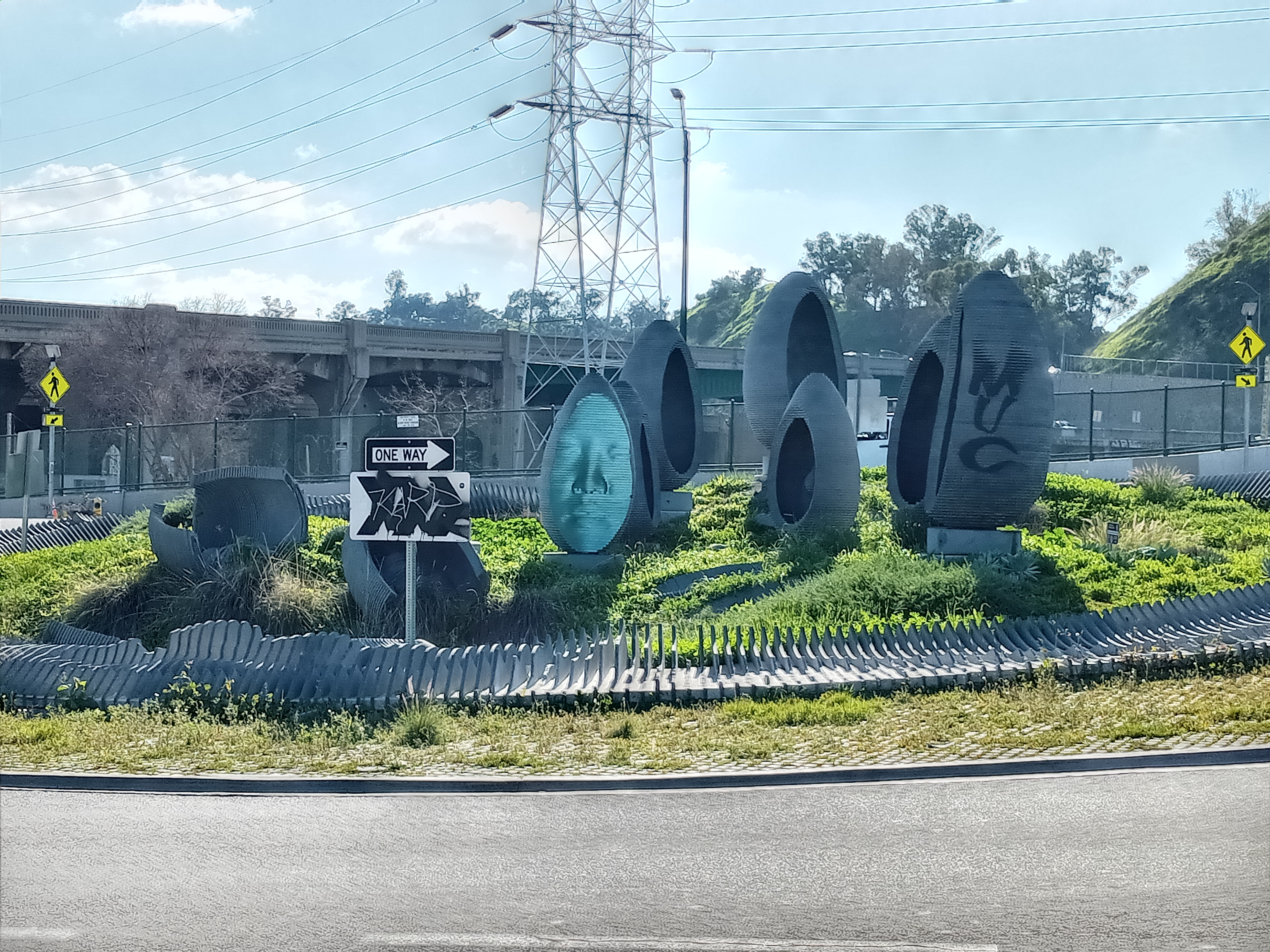

And then there’s the strange piece of public art that occupies the circle in the middle of the roundabout. Faces of Elysian Valley is a set of egg-shaped granite sculptures that have the impressions of 3D-scanned faces peering out at passing traffic, giving the whole thing an unnerving aura. Although that aura was somewhat undercut when the sculptures were graffiti-tagged and a couple were even destroyed when a car smashed into them, but the city has recently restored the sculpture.
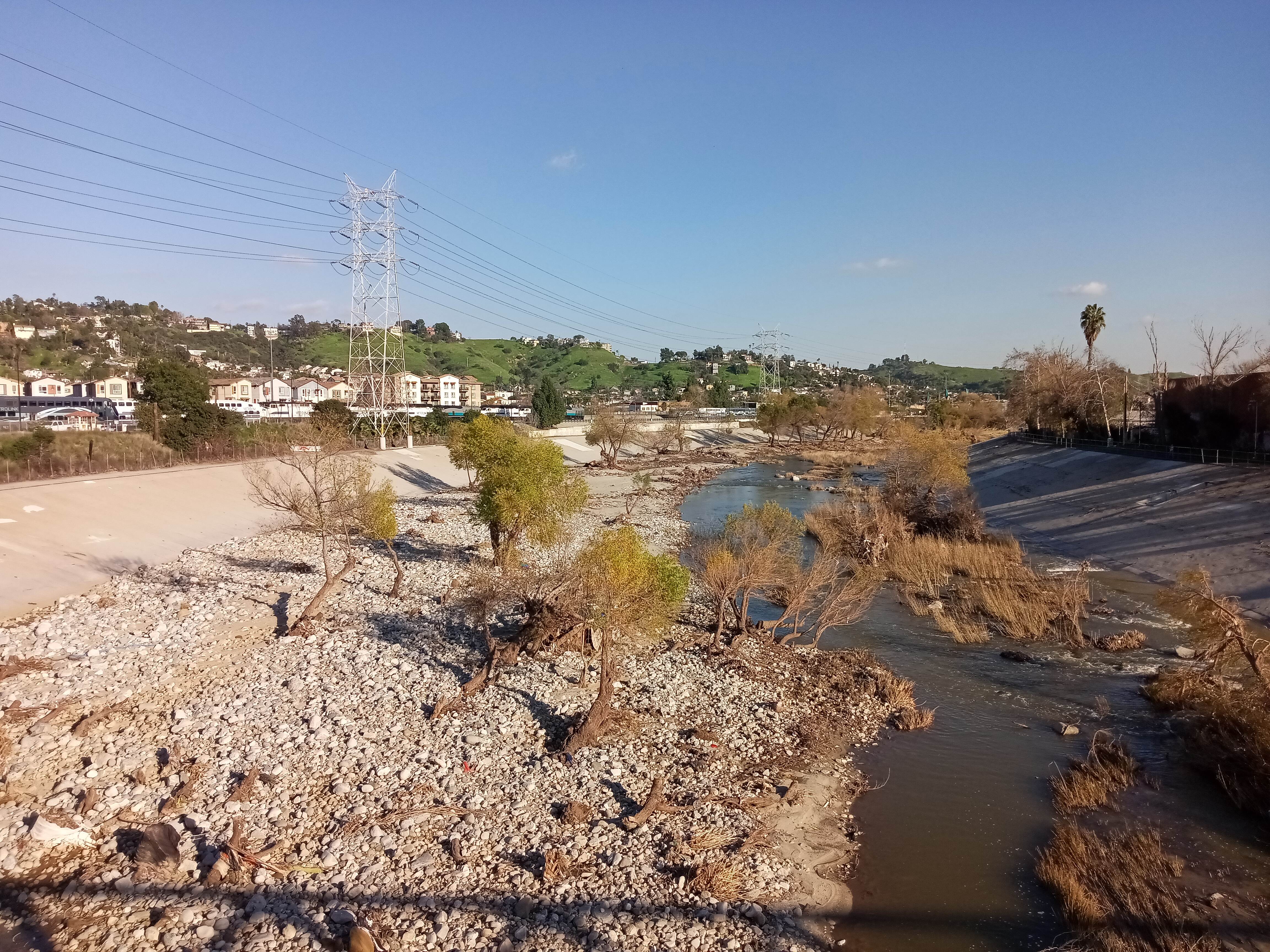
But enough of this embarrassing stuff, let’s see the river itself. Cross the roundabout and ascend the Riverside Drive bridge, which carries the start of the bike/pedestrian path across the river. A couple of overlooks are built into the bridge, although the view from up here is still mostly industrial; the 5 freeway crosses over the river just to the north and has to be passed under again, while Amtrak and Metrolink trains rumble past underneath. The river channel here is still entirely concrete, often coated in algae, although past the freeway you can catch the first glimpse of trees and vegetation in the river.
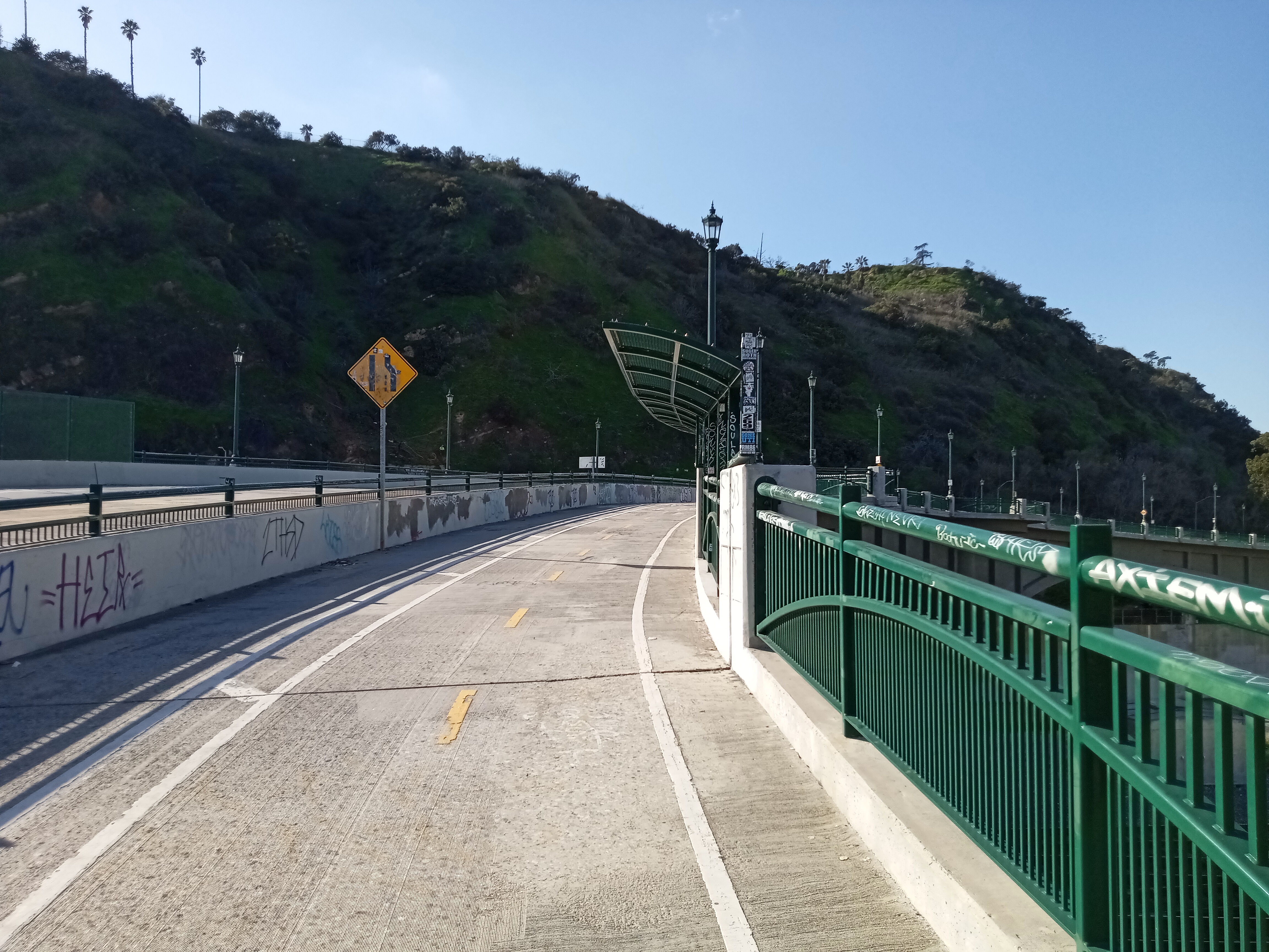

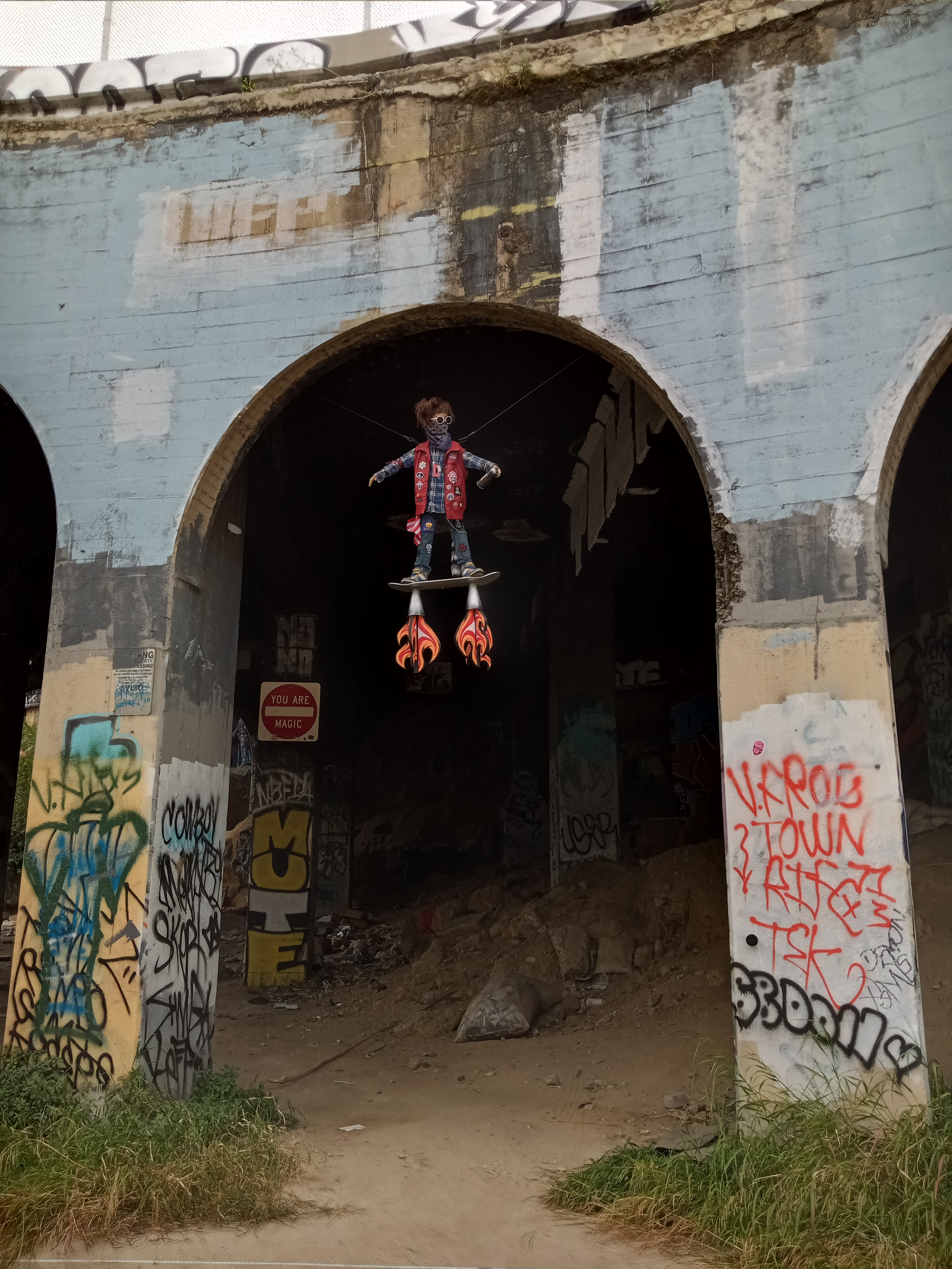
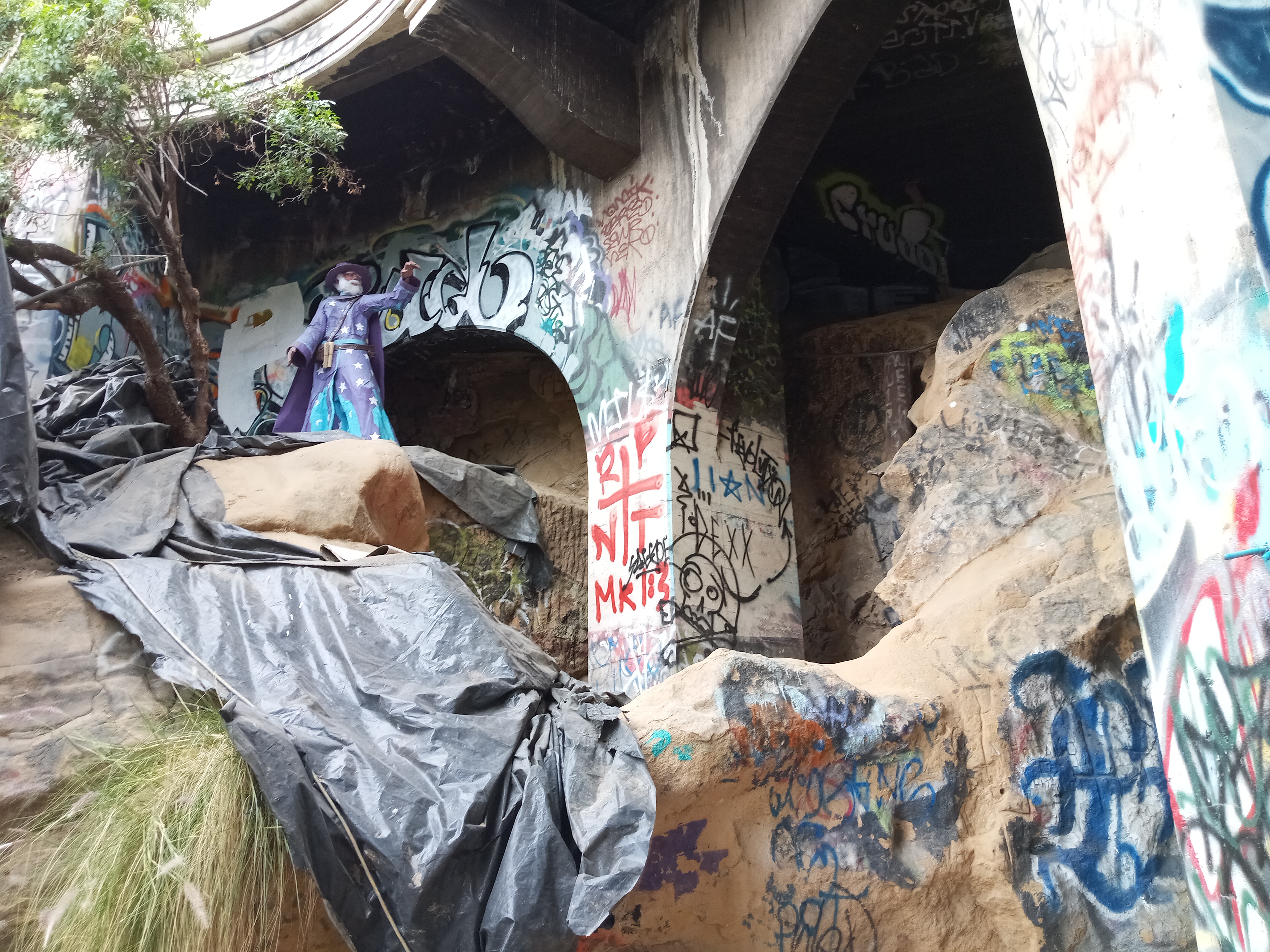
The bridge you’re standing on was built relatively recently, having replaced the former Riverside Figueroa Bridge, which was built in 1940 and stood as recently as 2014. Despite community protests to preserve the old bridge (well documented in this Tom Explores Los Angeles video), the city knocked it down in favor of a high-speed bridge for cars. However, one element of the old bridge still exists: just to the south of the current span on the west side of the river sits the arcade that supported an even earlier bridge on the site, dating back to 1927. It sits abandoned, occasionally holding some nifty bit of street art, and while technically off-limits, is easily accessed from the path that goes below the western end of the current bridge.

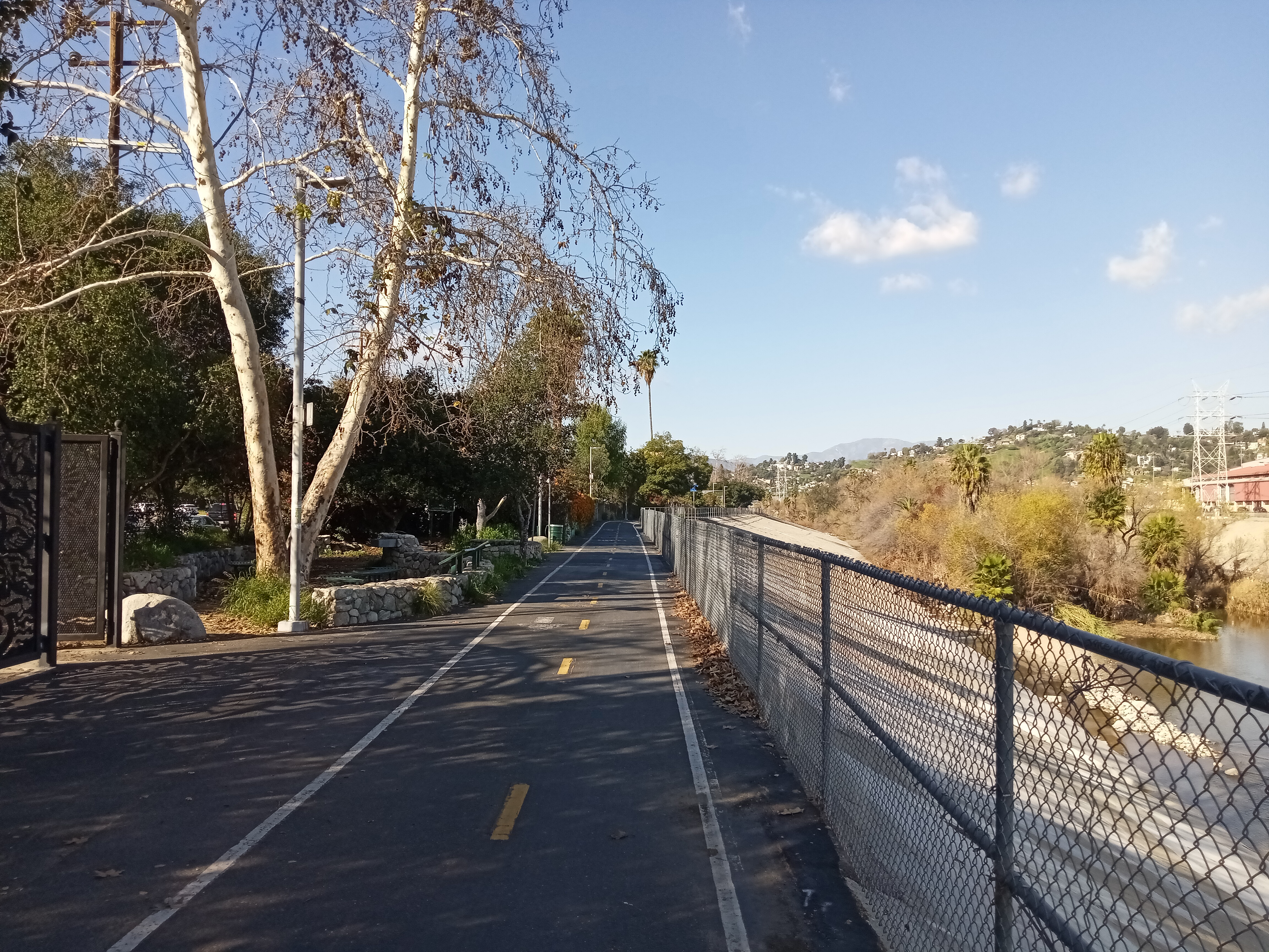
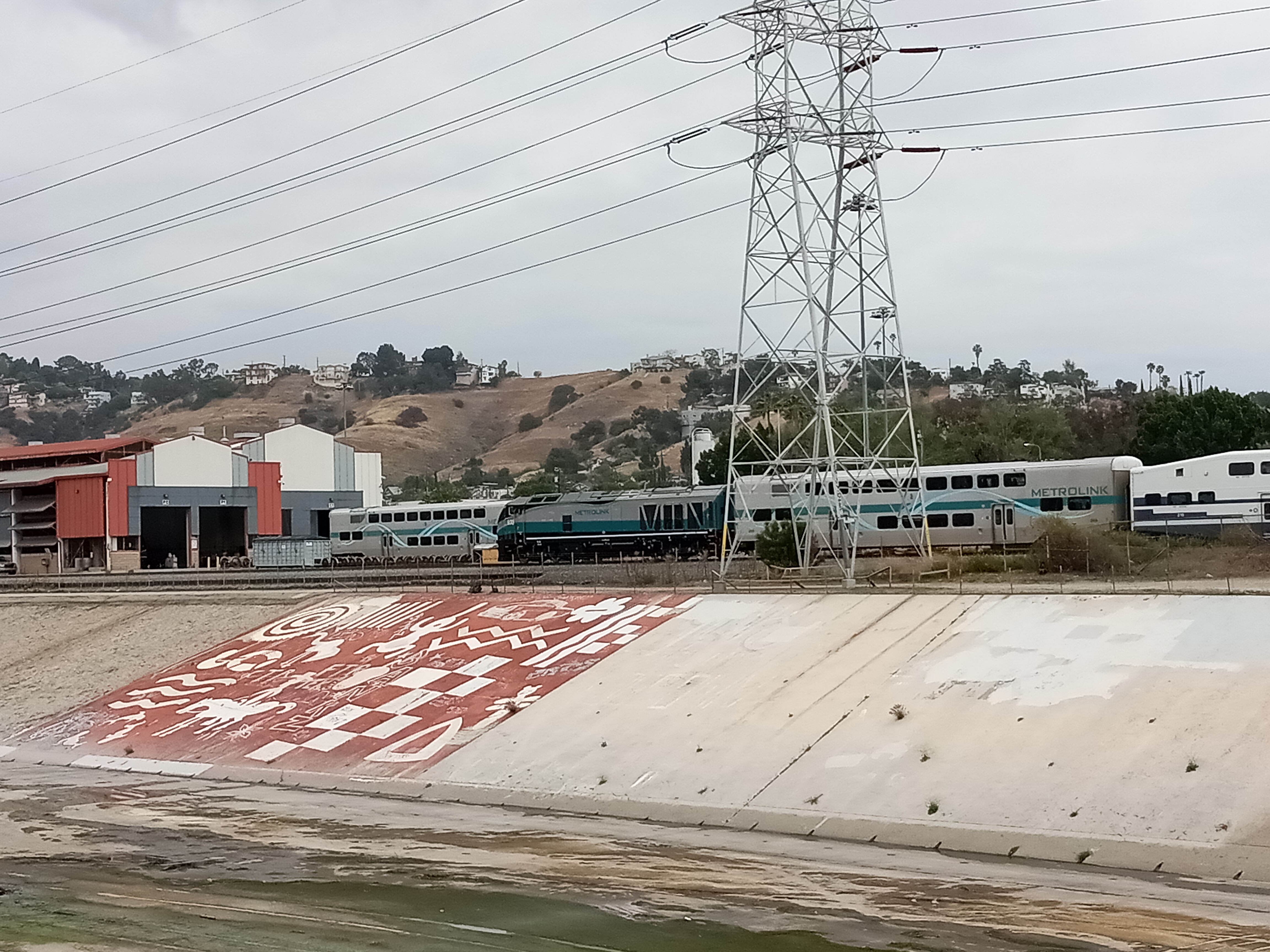
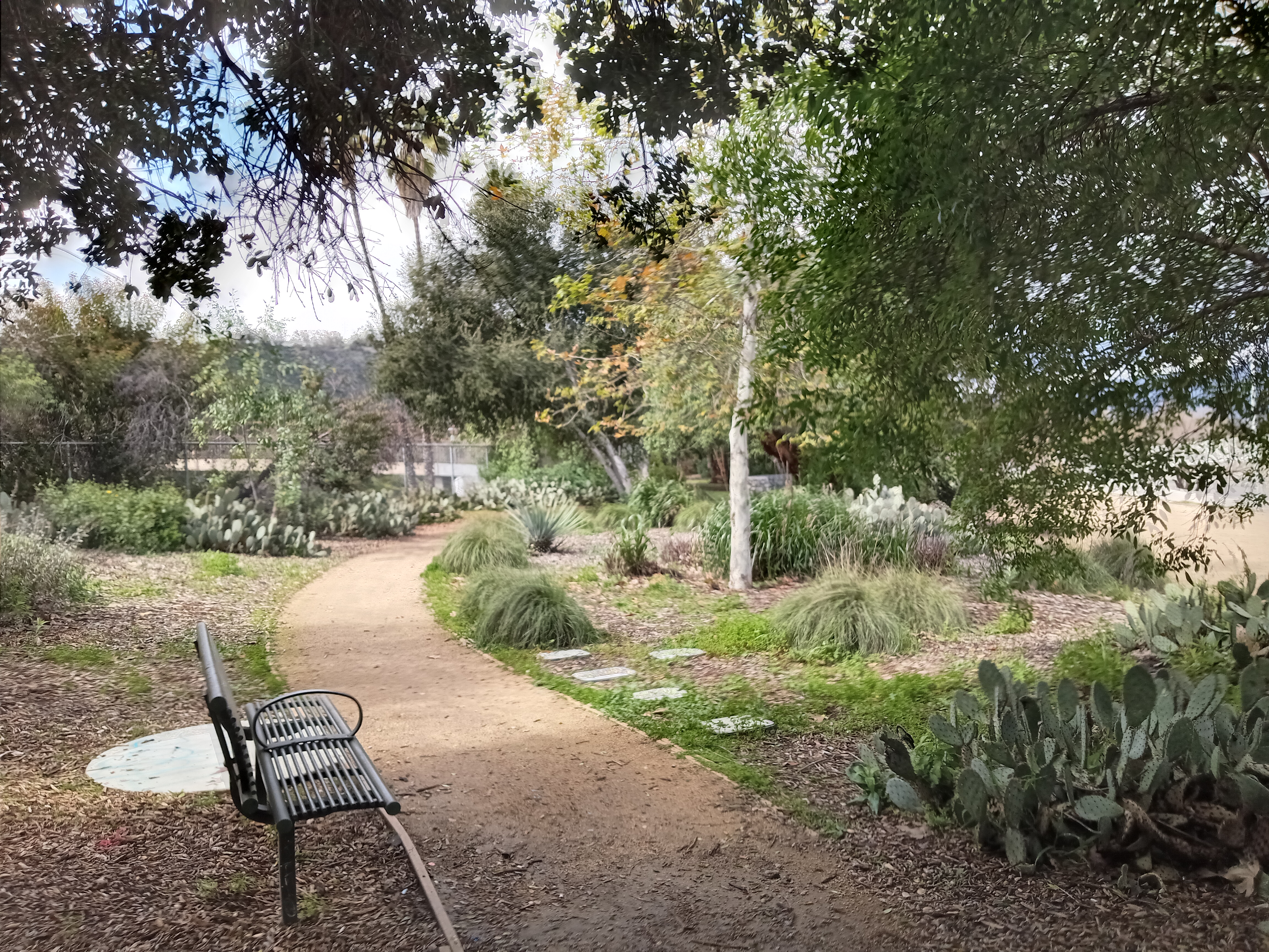
After passing under the 5, the path splits off from Riverside Drive and we’re finally able to enjoy some serenity. Egret Park, a tiny triangle-shaped pocket park, marks the spot where the bike path splits off, with some benches giving you a chance to sit and look out over the river. The concrete bottom of the river abruptly gives way to foliage, with a mural of traditional indigenous designs marking the spot on the concrete river bank opposite. Directly above the mural, Metrolink trains rumble in and out of their central maintenance yard. A couple blocks further on is Steelhead Park, another pocket park, this one with trout adorning the wrought-iron fencing.
(One thing to note about the path: if you’re walking, know that bicyclists will approach very quickly, so check both ways before crossing the path at any point. And if you’re bicycling, slow down for pedestrians!)
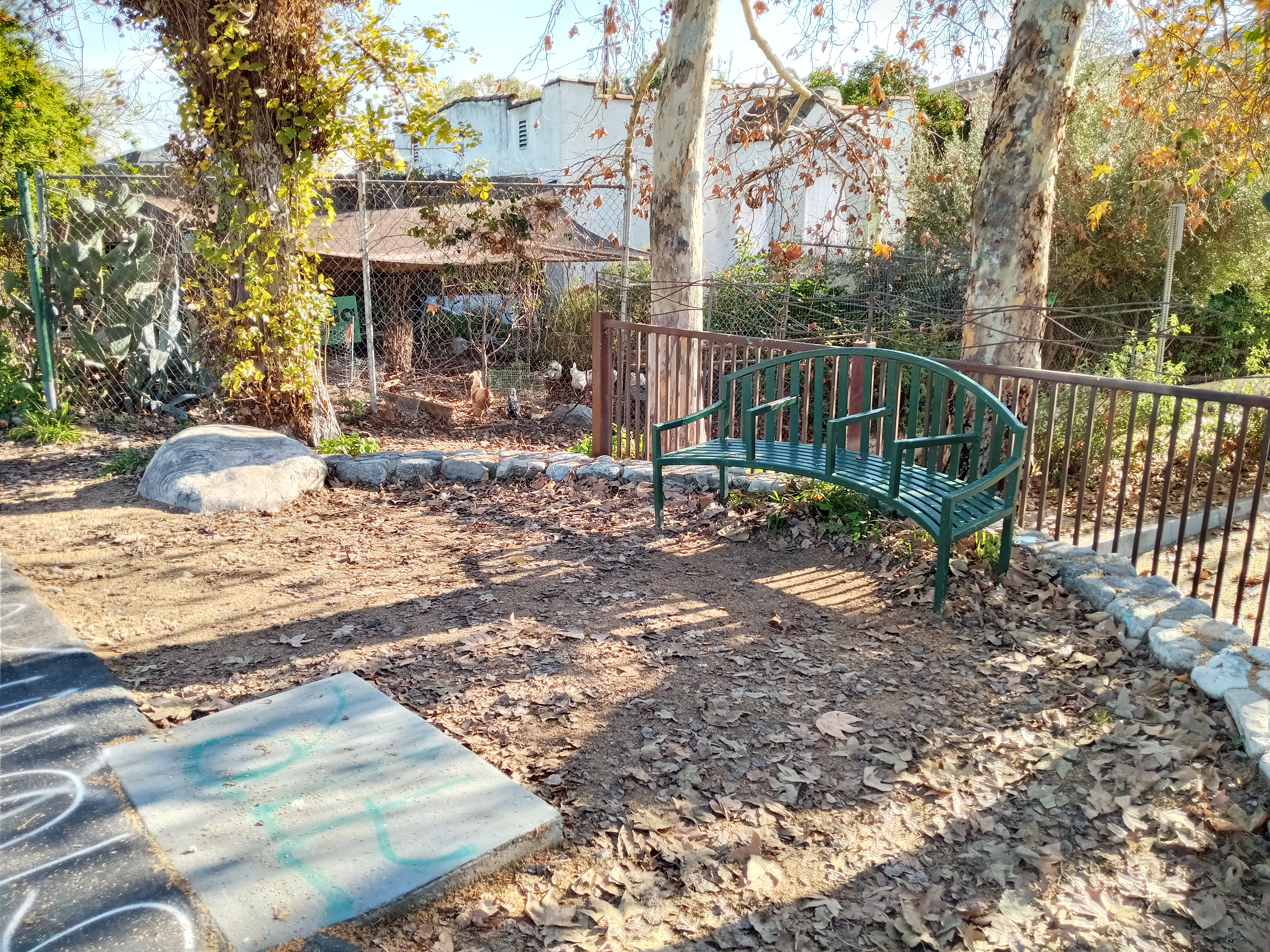
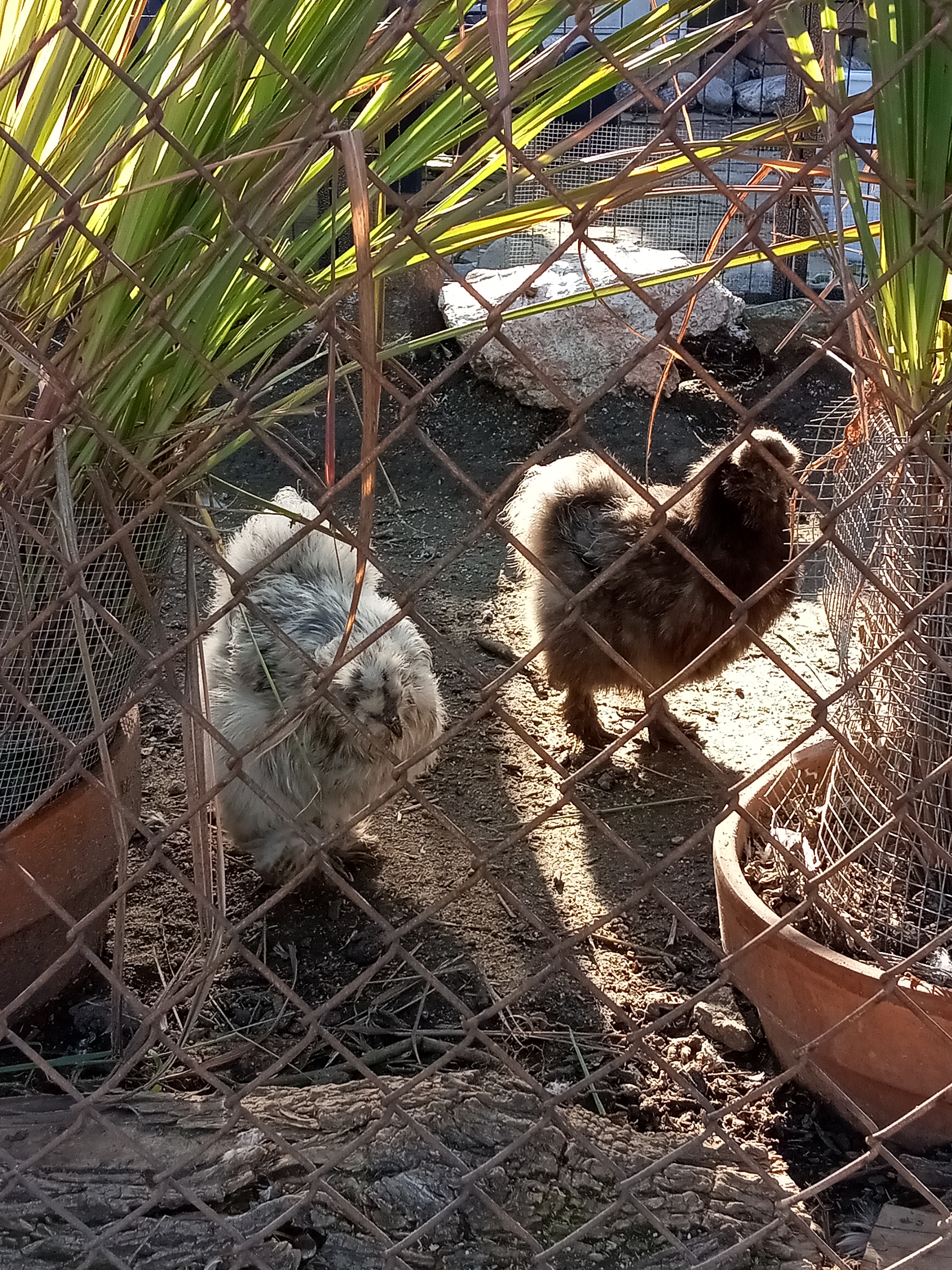
The path itself is perched at the top of the concrete embankment, filling the narrow gap between the river channel and the houses of Elysian Valley, more commonly known by its nickname, Frogtown. The neighborhood is tiny, relatively isolated and wedged between the two barriers of the river on one side and the 5 freeway on the other. But the introduction of the bike path and the efforts to revitalize the river have brought a lot of attention to Frogtown, especially from real estate interests. However, the more visible signs of gentrification are still concentrated on the northern end of the neighborhood; down here, it’s block after block of cute older houses and small churches. Most of the streets that dead-end at the river have informal entrances to the bike path, and if you keep your eyes peeled, you can even spot some backyard chickens from the path itself.
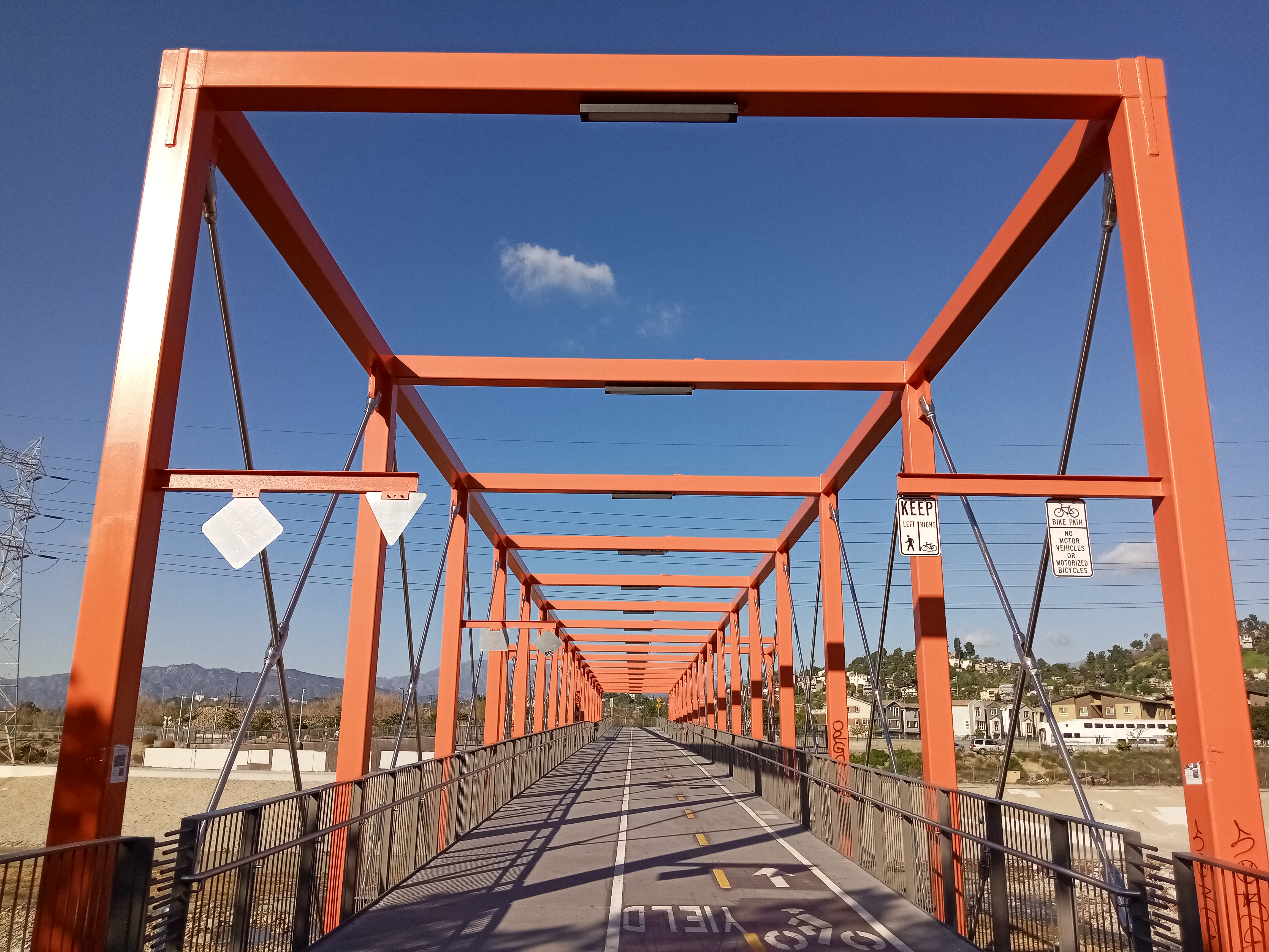
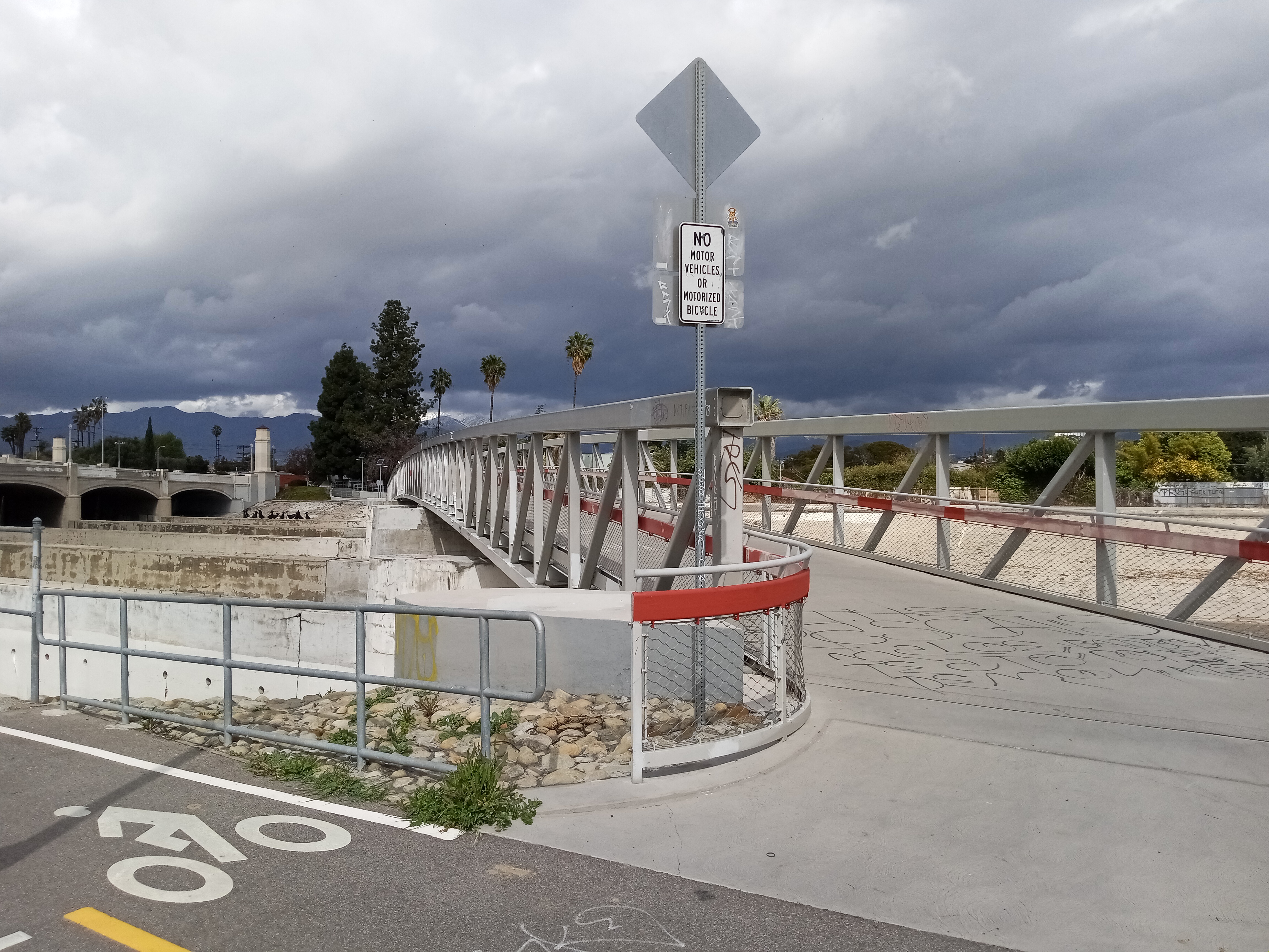
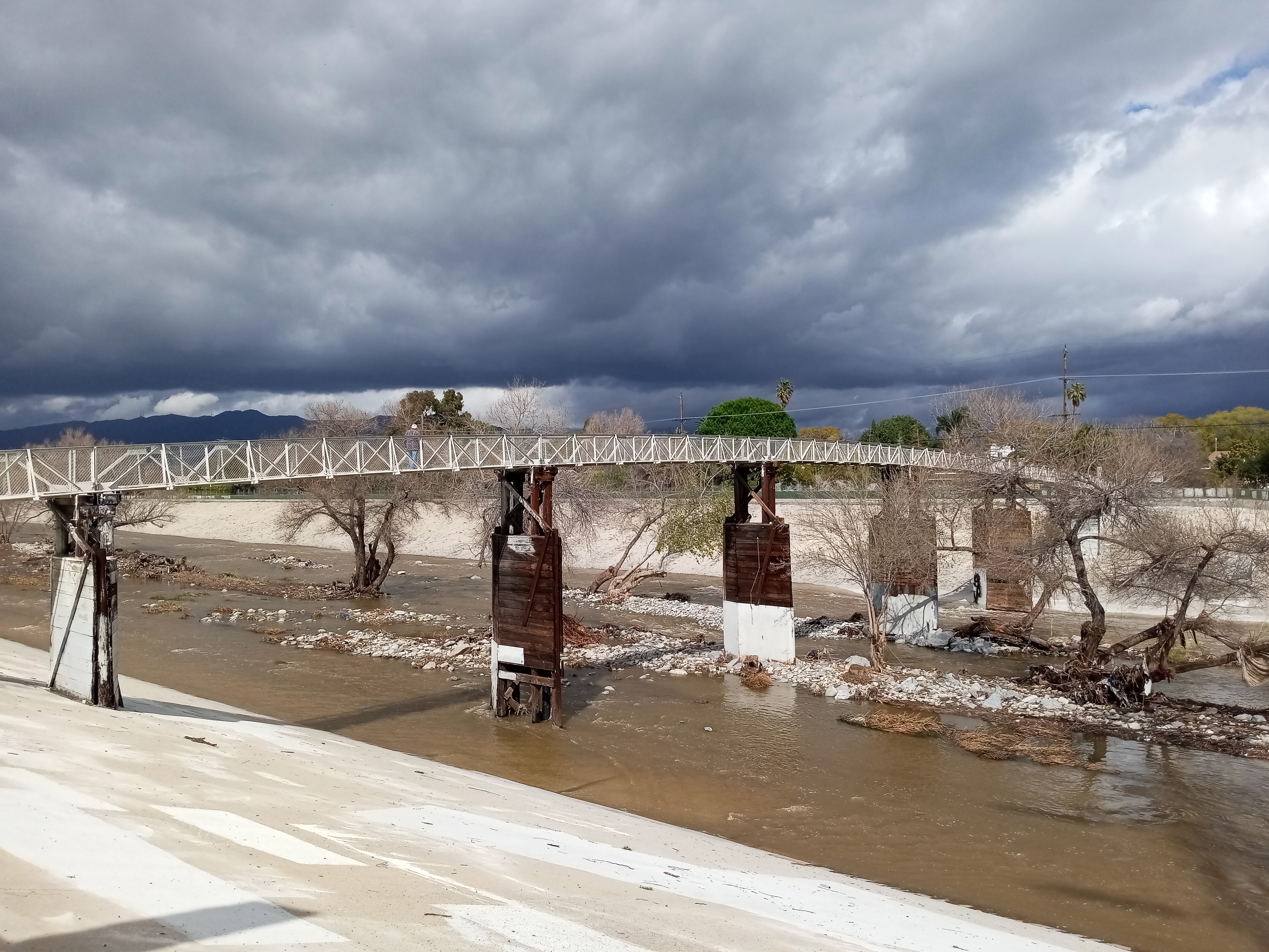
The river arcs gradually to the west as you continue up the channel, eventually bringing into view the Taylor Yard Bridge, the newest of several pedestrian/bike bridges that now cross the Glendale Narrows. This is one of the more dramatic, with the bridge deck suspended within a steel truss painted bright orange. From the bridge itself, a pair of overlooks give a great view over the river and the surrounding area. Surprisingly enough, since the channel runs almost exactly east-west at this point, you can look upriver at the Hollywood Sign in the distance.

The other side of the bridge is a bit of a wasteland, but that may change in the near future. To the right is the entrance to Metrolink’s maintenance yard, while on the left is a giant empty lot. This is the site of the former Taylor Yard, a major railyard and the Southern California headquarters for the Southern Pacific Railroad from its construction in 1911 to its closure in 1985. The city owns the land now, and is planning to turn it into a massive park facing the river that will be the centerpiece of the city’s river revitalization plans. However, progress is slow; a significant amount of environmental cleanup has to happen first, which requires a lot of funding. A lot of work has been done to get the project moving, and it might even start seeing construction soon, but it’ll still be a long time before it’s ready to open up to the public.
However, part of the park is already finished. If you continue up the street, under the railroad tracks, and over to San Fernando Road, you’ll find Rio de Los Angeles State Park, which is also built on part of the old Taylor Yard. It’s a very large park, mostly given over to sports fields, lawns, and a big playground, although the backside of the park along the train tracks does hold a nice little native woodland with a quiet trail looping through it. At one point, you’ll find a bench with ceramic tiles which reference the history and nature of Taylor Yard, the river, and the new park. Getting there does require a lengthy detour from the bike path, but it’s a very pleasant space and worth the time.
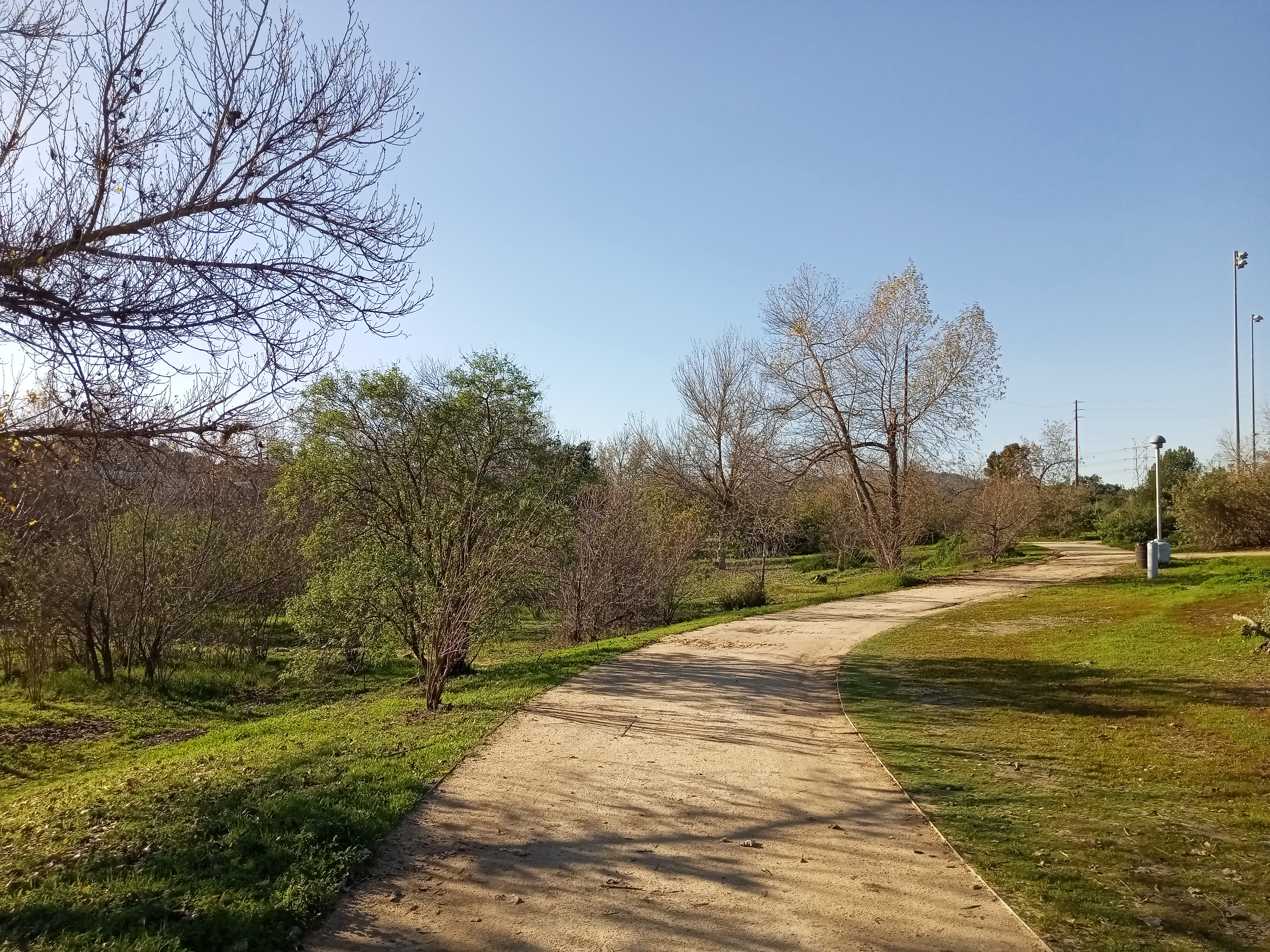

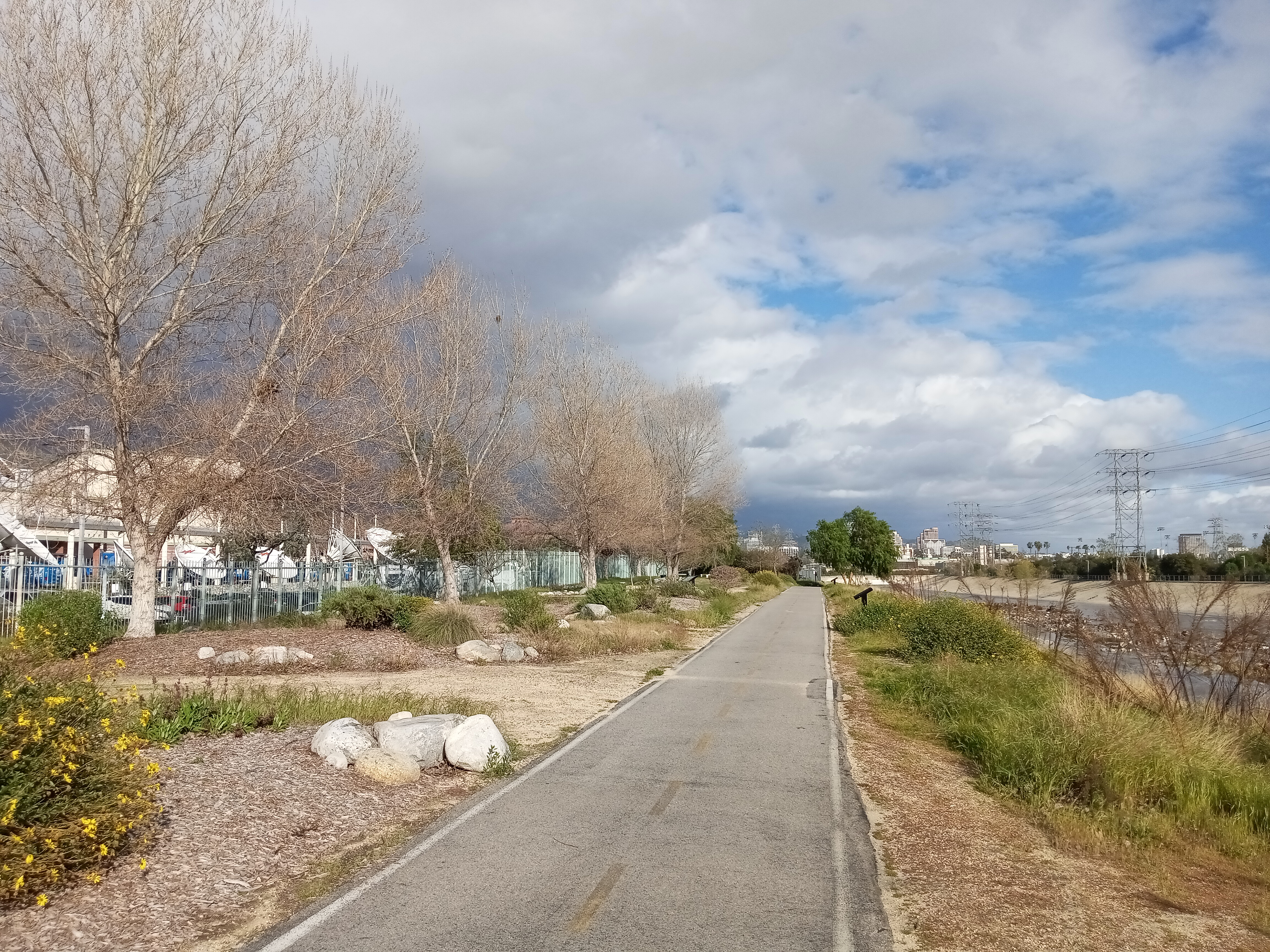
Returning to the bike path and continuing upriver, you’ll pass a more industrial section of Frogtown, with small warehouses, studios, and tow lots backed up against the bike path. This section of the river along Frogtown is an officially designated “recreation zone,” where in the summer months you’re allowed to climb down into the river channel itself and walk, fish, and even kayak in the river (it’s closed in the winter months due to flood risk). In fact, there’s even a couple of private tour operators along the river that rent out kayaks in season.
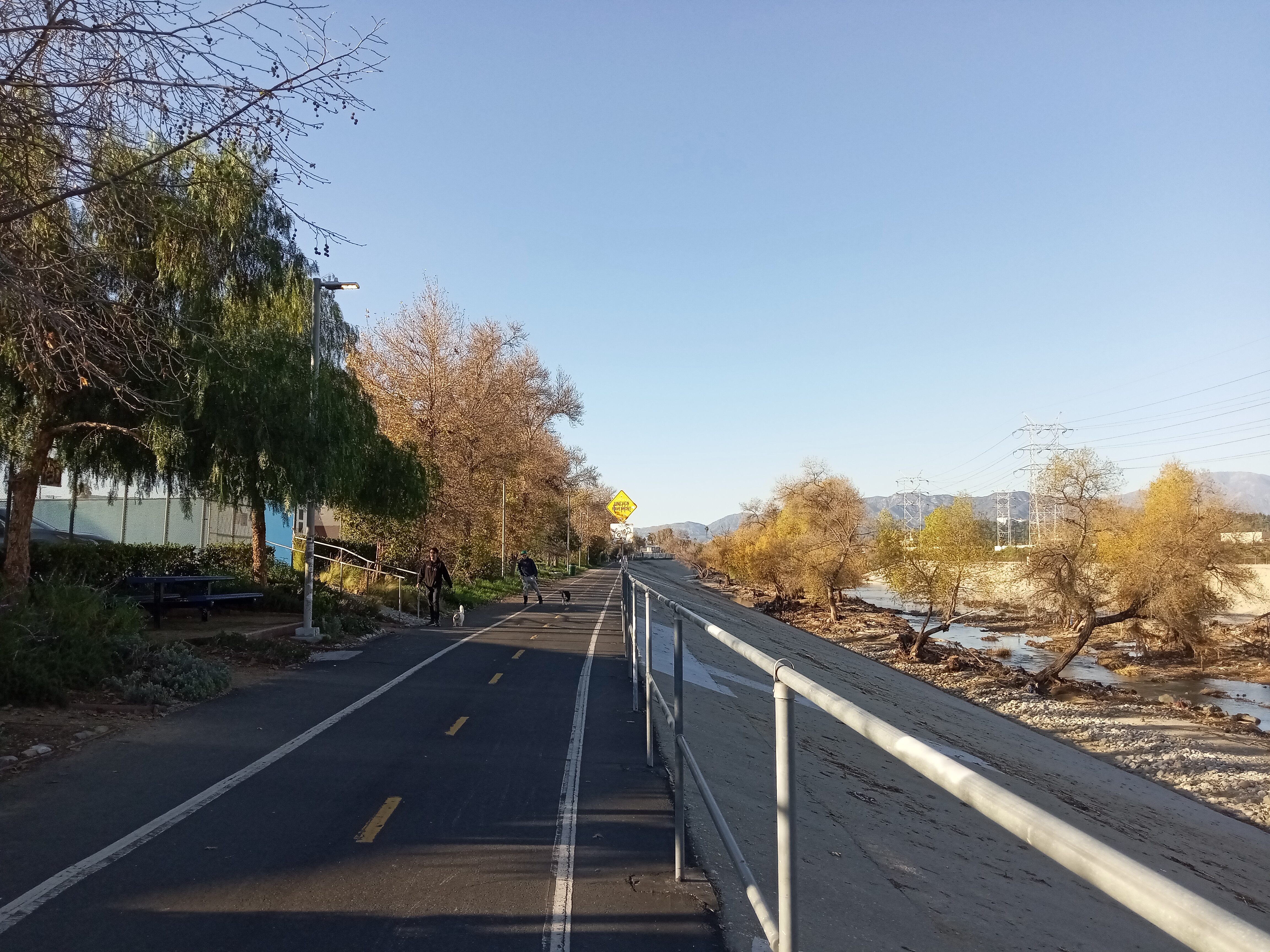
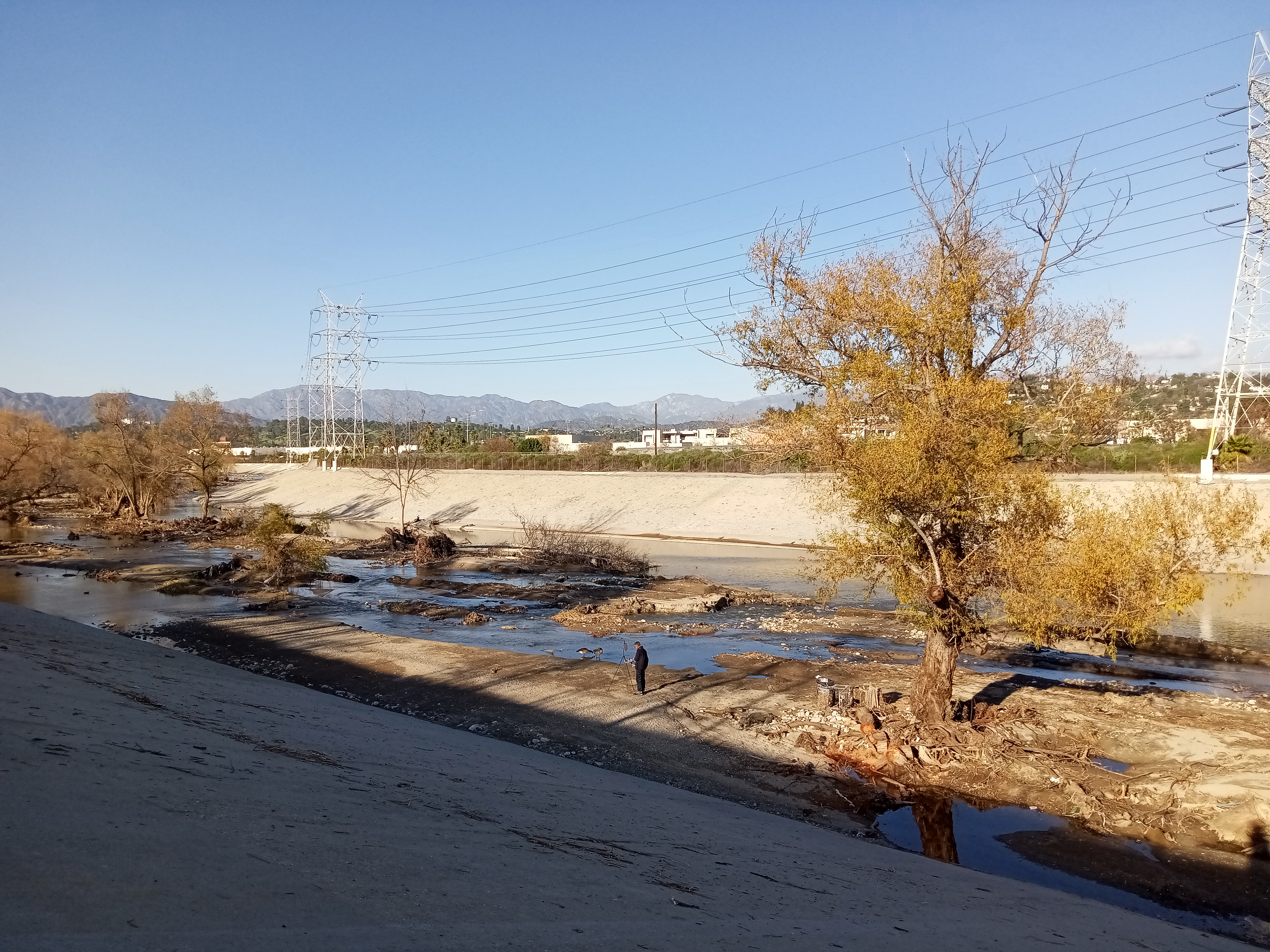
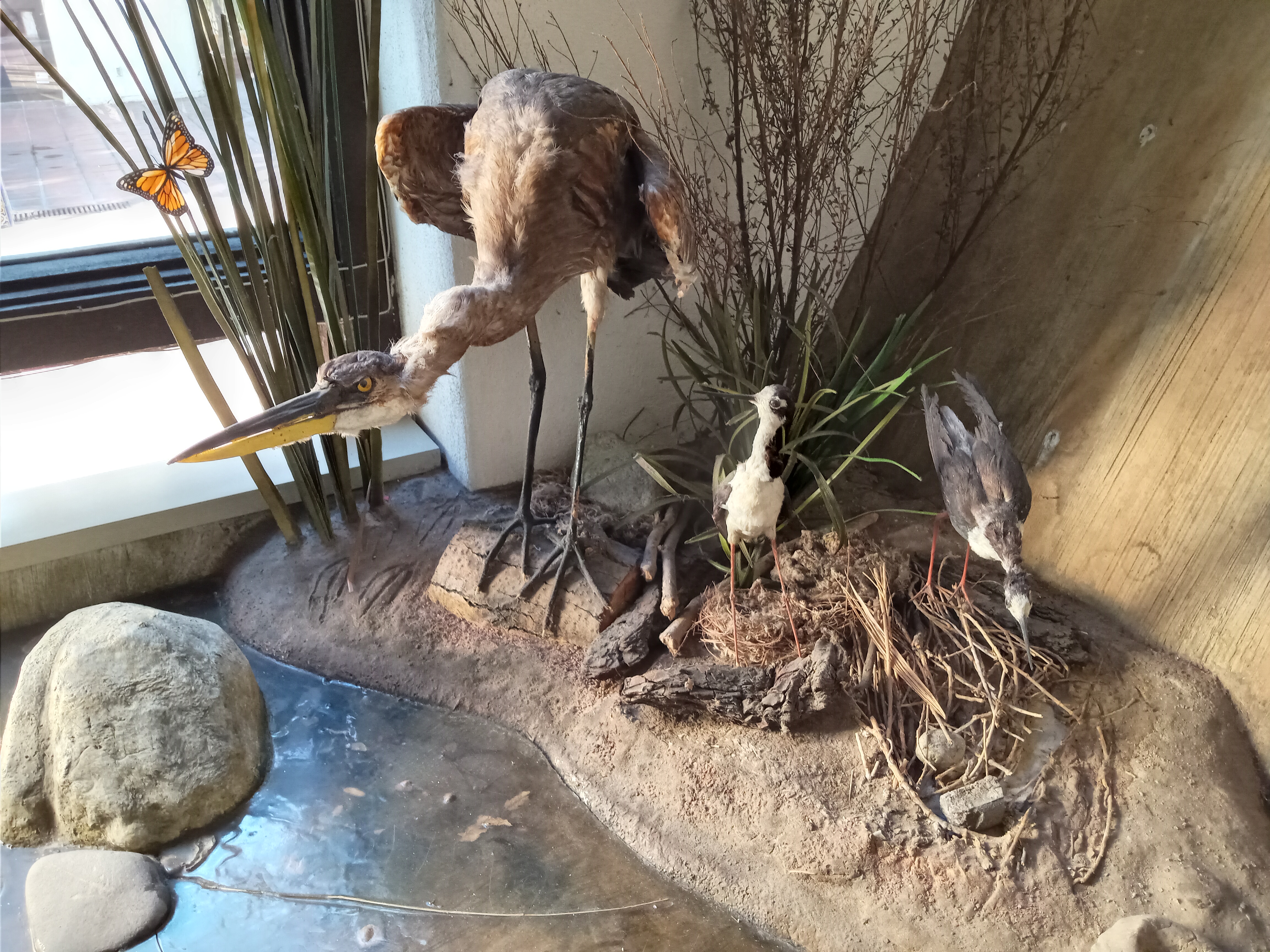
A lot of birds call the L.A. River home, and you’re certain to see some anytime of the year. Peering down at the banks of the river, you can watch birds floating on the water and flitting between the trees. Ducks, geese, egrets, and herons are all very common and easy to spot, and you might be lucky enough to spot the occasional hawk or even a seagull, drawn upriver by the water. And there are indeed fish in the river, although mostly species that have been introduced by humans.
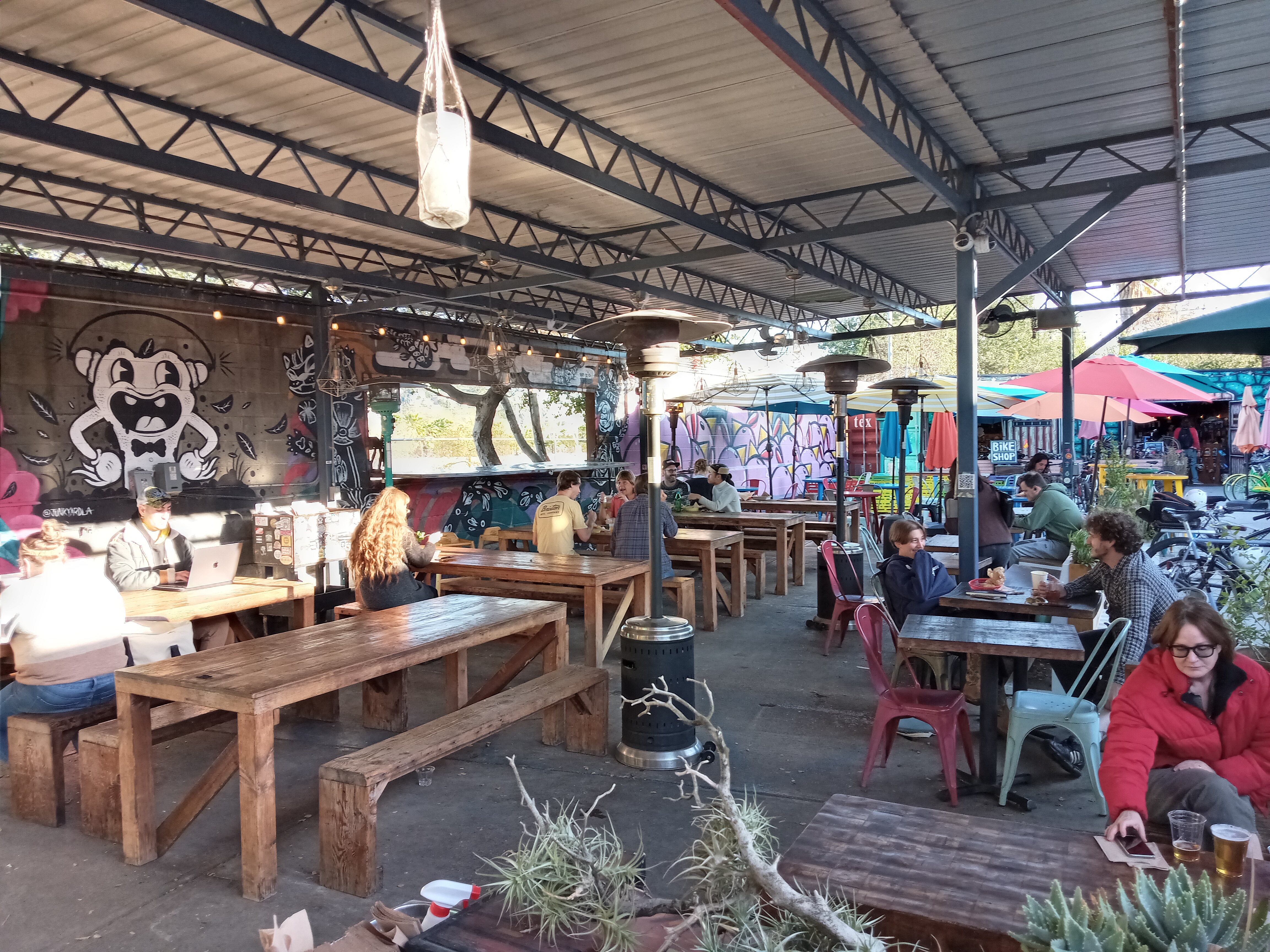
A little further up, you’ll find a few commercial businesses mixed in with the various warehouses and studio spaces along the river, including a pair of cafes that are oriented towards the path. The first is La Colombe, a roastery that serves very good (if pricey) coffees and lattes in a converted warehouse space. The other is Spoke Bicycle Cafe, a much more colorful spot a few blocks further up that specifically caters to the bike path crowd. Spoke is much more focused on the food offerings (although they also have coffees and beers), with a decent breakfast and lunch menu, with all the seating outdoors in a nice yard right off the path. They also have a bike rental shop on the premises.

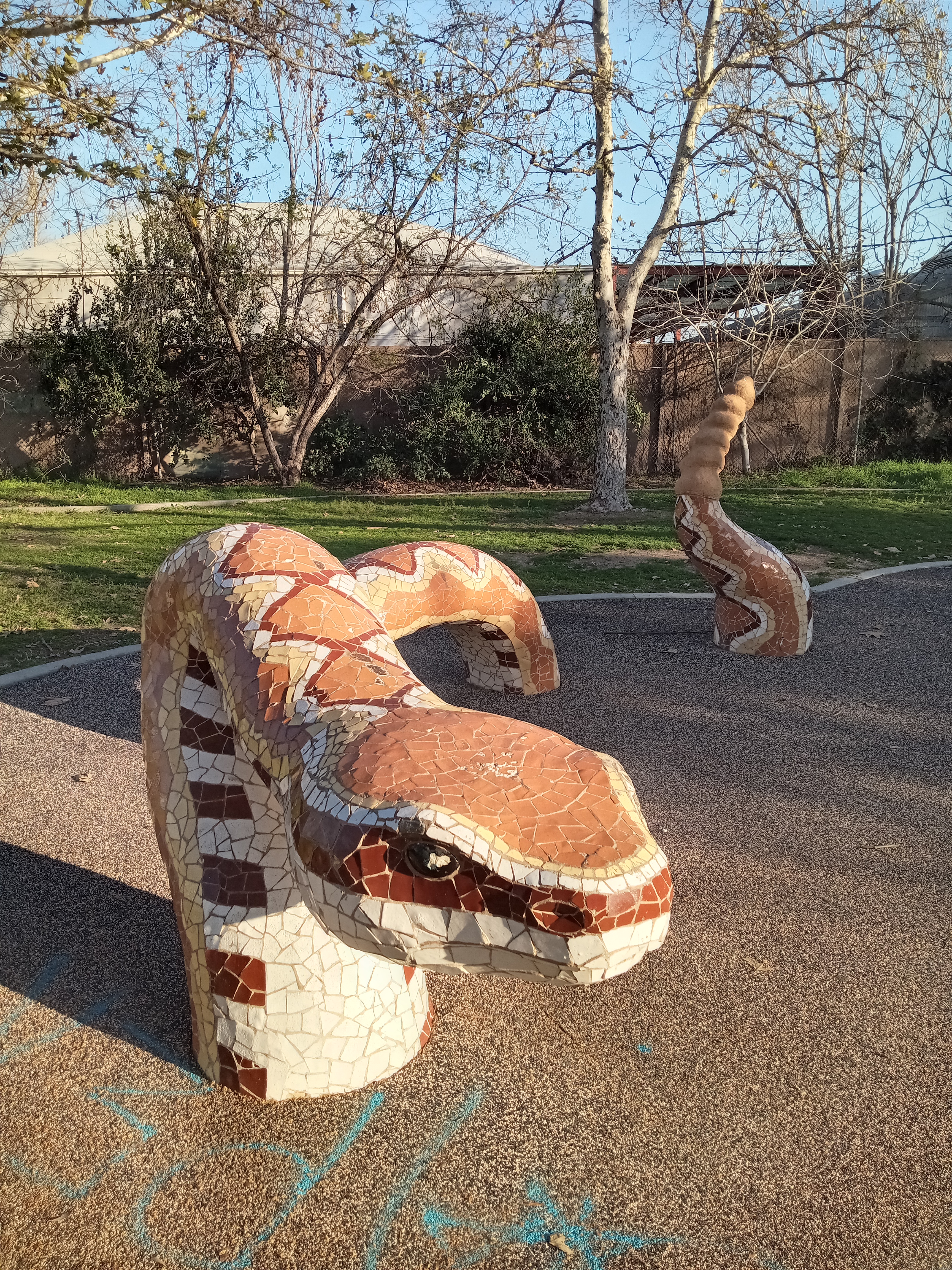
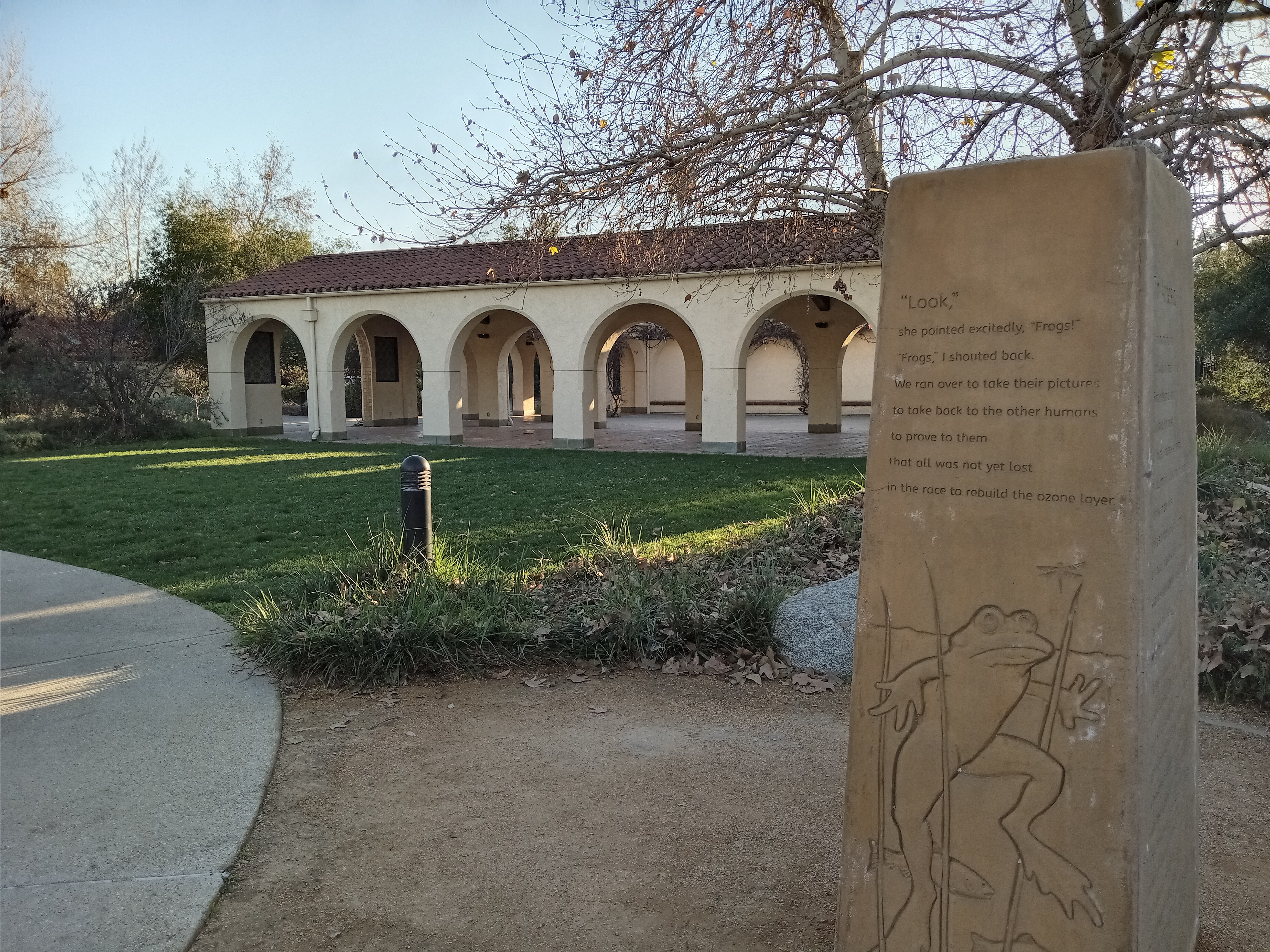
As you approach the 2 freeway, you’ll pass by Frogtown’s largest and most interesting park. Marsh Park, officially the Lewis MacAdams Riverfront Park, wraps around a warehouse with two access points from the bike path. Through the park you’ll find a kids play area, a skate park, a lawn surrounded by native plantings, and a very nice little events pavilion done in a Mission Revival style. The kids play area has the fun feature of a trio of colorful sculptures—a snake, a frog, and a turtle—representing the local wildlife.

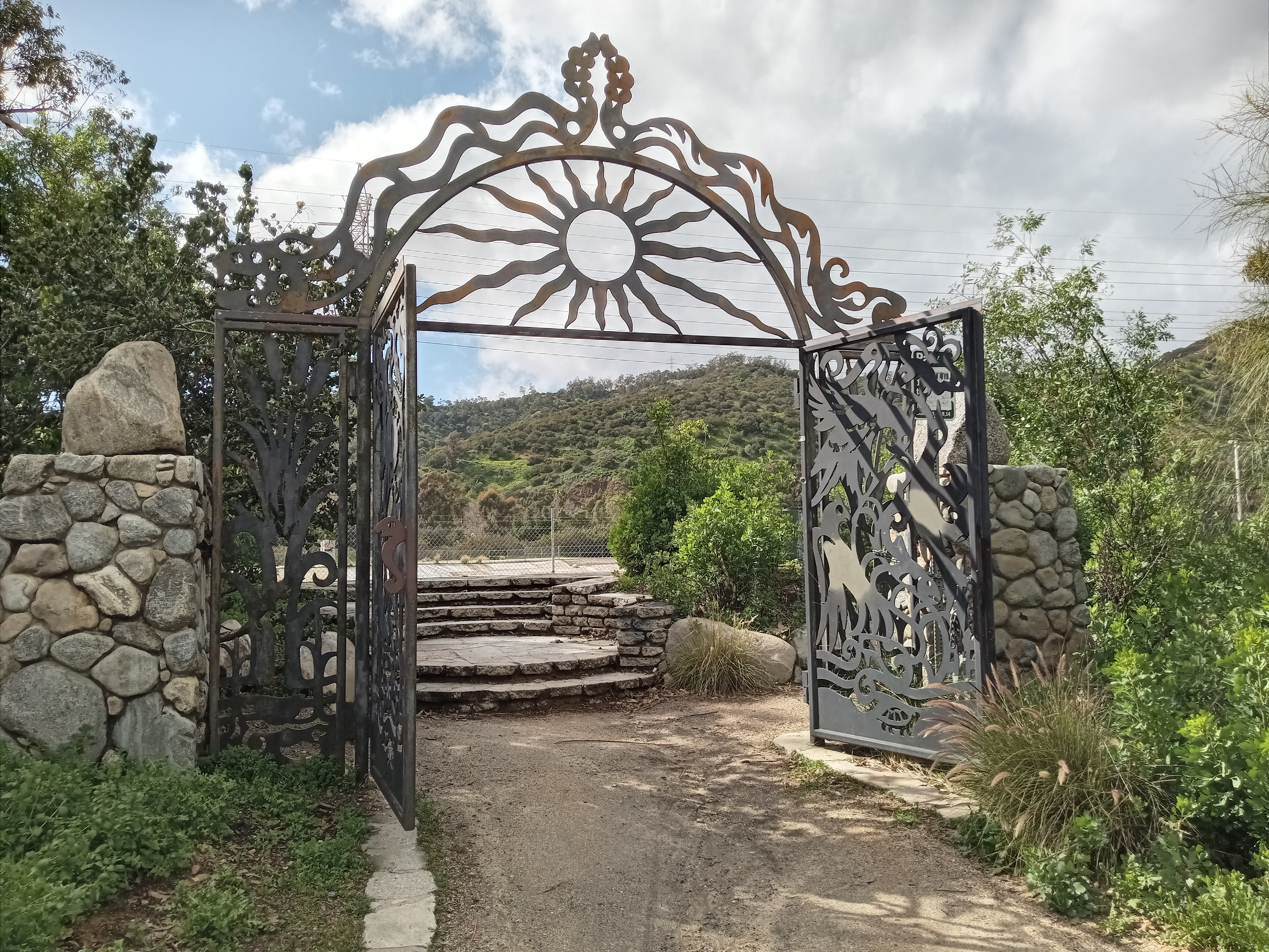
Continuing on, you’ll pass under the 2 freeway and the Fletcher Drive Bridge in quick succession. Fletcher Drive is marked by another pocket park, Rattlesnake Park, which has a lovely wrought-iron gate adorned with a pair of herons. Just down Fletcher Drive is Zebulon, a cool venue that often plays host to interesting local acts. From this stretch of trail, you can get a great view of the Forest Lawn cemetery, with its chapel and cross towering atop the hill above Glendale, against the backdrop of the San Gabriel Mountains.


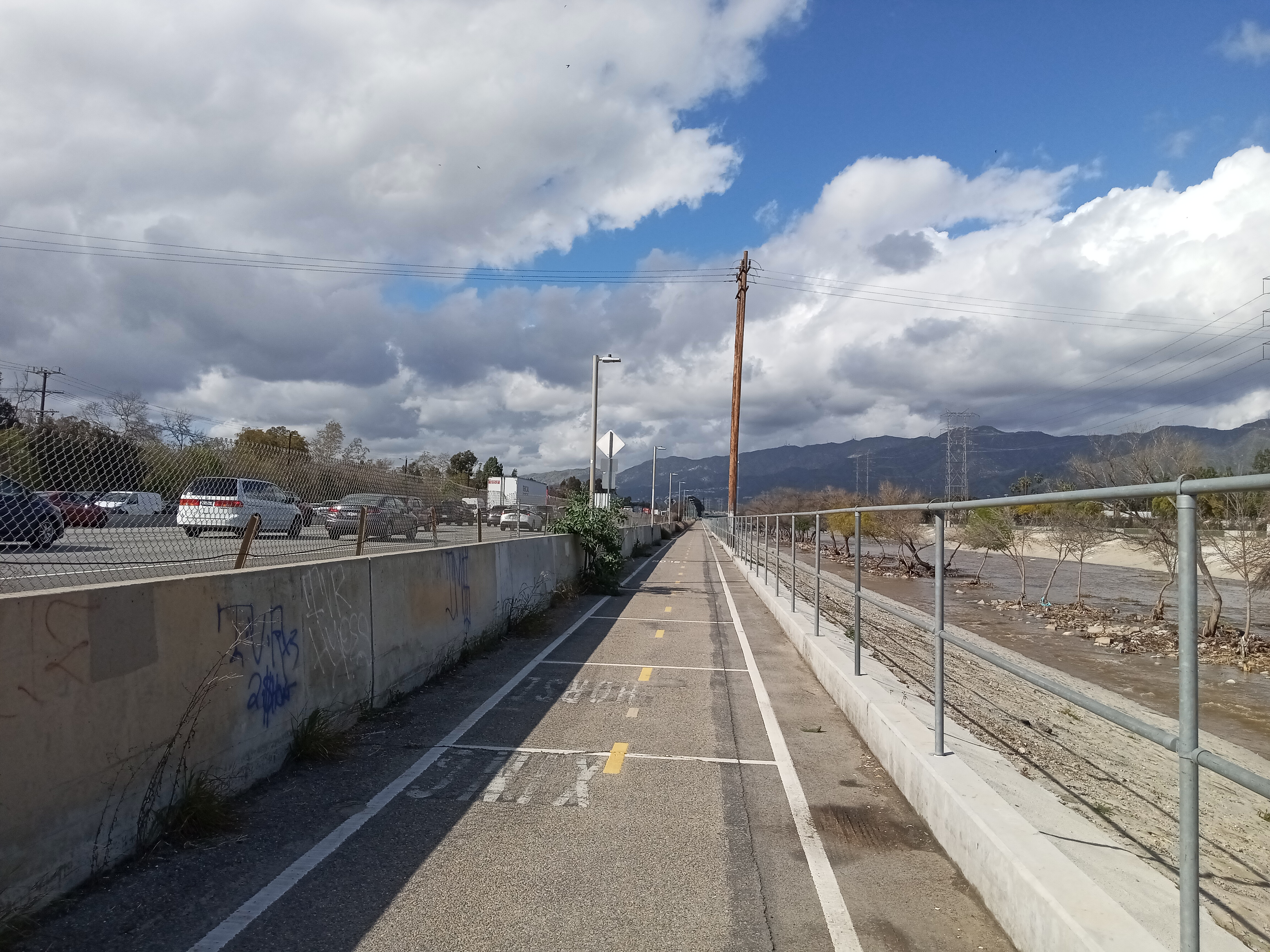
Fletcher Drive marks the transition point from Frogtown to Atwater Village, a very pleasant neighborhood on the opposite bank, tucked between the river and Glendale. Atwater has plenty of great places to eat or get a drink along any of its three main roads (Fletcher Drive, Glendale Blvd, and Los Feliz Blvd). Atwater also has its own path on the other side of the river, which can be a lot more pleasant to stroll on since the main bike path now begins to run alongside the 5 freeway. Unfortunately, the Atwater path doesn’t pass under any of the main road crossings over the river, so you have to do some zig-zagging if you want to get away from the freeway but also continue upriver.
The next bridge is the historic Glendale-Hyperion Bridge, a historic and somewhat iconic Art Deco bridge that connects Silver Lake to Atwater Village, swooping down from the hill and crossing over the freeway and the river. It’s essentially two bridges, one for Glendale Blvd and one for Hyperion Avenue, stacked on top of each other, knitting together the tangle of roads and freeway onramps on the west side of the river. Its arches and stylish towers are worth admiring from the bike path as you pass under. On the southern side of the bridge, a separate pedestrian bridge, the Red Car Bridge, occupies the space of a former Pacific Electric bridge that carried streetcars across the river on their way to Glendale.


The Glendale-Hyperion Bridge is also the setting of a delightfully whimsical UFO story, courtesy of a man named Orfeo Angelucci. A sickly man who moved from New Jersey to California in the 1940s, Angelucci worked at the Lockheed aircraft plant in Burbank and, as he tells it, had a series of encounters with flying saucers and heavenly extraterrestrial beings on the edge of Griffith Park and under the Glendale-Hyperion Bridge in the summer of 1952, prior to the construction of the 5 freeway. In his later book about his experiences, Secret of the Saucers, he describes the aliens as humanlike, benevolent, exceedingly handsome, capable of speaking telepathically, and claimed they had selected him to spread their message of peace and universal brotherhood (tellingly, his supposed encounters bear a certain resemblance to 1951’s The Day the Earth Stood Still). On one occasion, he claims he boarded a glowing, igloo-shaped craft under the bridge, which then whisked him to a mothership hovering in Earth’s orbit, while in another instance he had a pleasant conversation with one of the heavenly beings while sitting on the concrete bank of the river. Angelucci’s accounts come from a time when aliens were still fun and whimsical, before the scary gray abductors that took over UFO culture in later decades.
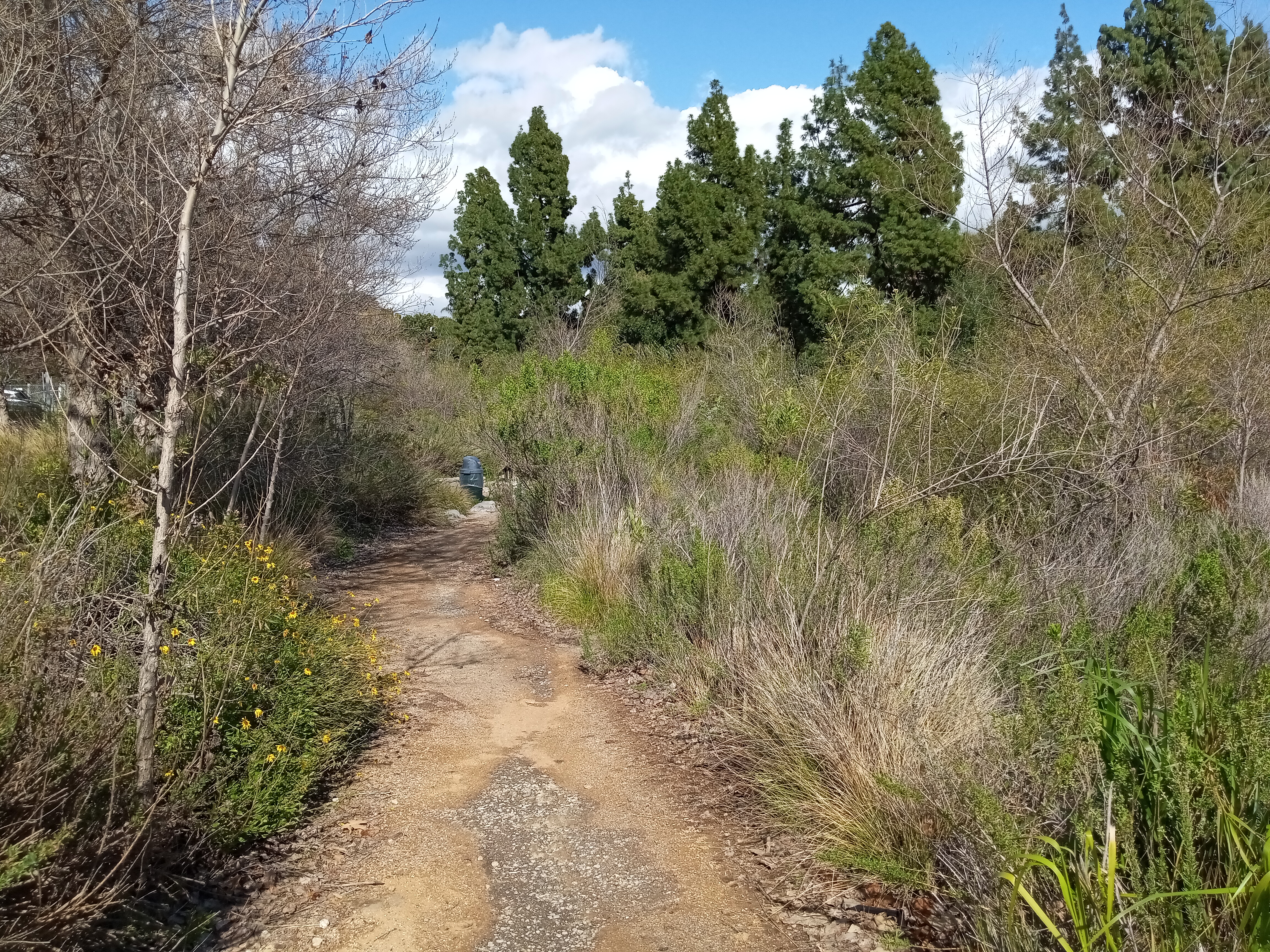
Just past the Glendale-Hyperion Bridge, you’ll pass Sunnynook River Park, a very nicely landscaped native garden tucked between the bike path and the freeway, although you will often find homeless encampments in the park. At the northern end of the park, you will find a charming old pedestrian bridge, just wide enough for two people to squeeze past, that arcs between the trees across to the path on the Atwater Village side. Its chain-link fencing is adorned with numerous love locks that glimmer in the sunlight. There’s also a handy pedestrian bridge that crosses over the 5 from here, connecting to the Griffith Park Recreation Center.

As you approach the slopes of Griffith Park on the left, you’ll reach the Los Feliz Blvd Bridge. The bicycle path actually crosses on its own bridge over Los Feliz Blvd, allowing you to safely cross the busy traffic below. The path on the Atwater Village side offers no such crossing, so you either have to take the bike path bridge or walk a block east to the traffic light at Glenfeliz Blvd and cross there.


The bike path hugs the freeway here, so I recommend taking the path on the Atwater Village side of the river (which is marked with a nice gate facing Los Feliz Blvd) if you’re on foot. Not only is it quieter, but you’ll enjoy some pleasant scenery as the path passes a small golf course before reaching a set of equestrian stables. While you won’t be able to get very close, you can almost always spot horses chilling in their paddock or stable from the path.
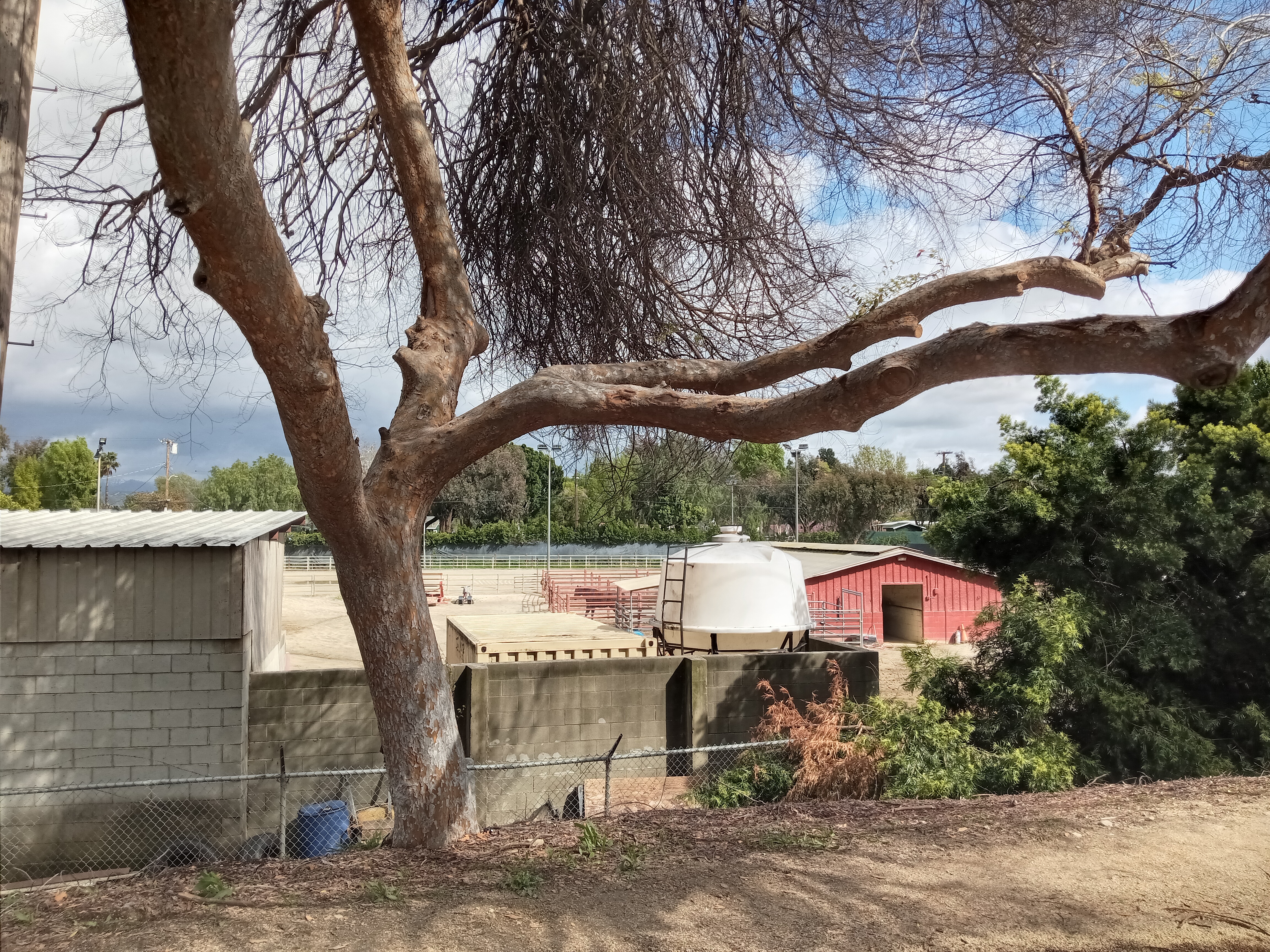
The next, and final pedestrian bridge along the route, is the towering North Atwater Bridge, an impressive cable-stayed bridge with a dramatic white tower jaggedly piercing the sky. The bridge serves the dual purpose of not just giving pedestrians and bicyclists a place to cross the river, but also serving the nearby stables so that equestrians have a safe route into Griffith Park. As such, the bridge is divided into two, with one side padded for those on hooves and the other for everyone else.


Unfortunately, while the bridge itself is impressive, the city didn’t do anything to improve the underpass that crosses beneath the 5 into the Crystal Springs Picnic Area in Griffith Park. If you need to access the park, it’s there, but it’s just a dirt path through a dim, narrow tunnel (and watch your step for horse droppings!).
On the Glendale side of the bridge, North Atwater Park sits just past the bridge and is a nice spot to stop and relax for a bit. The park has two sections: a natural wash next to the river that’s planted with native foliage which help clean any runoff, and a more formal park past the parking lot and facing the street which holds a playground, picnic tables, a basketball court, and some restrooms.

The bike path hugs the freeway from here, and unfortunately if you want to continue north, you have to stick to it as the Atwater Village path dead-ends at the Colorado Street freeway off-ramp, forcing you to backtrack all the way to North Atwater Park. This stretch of the bike path has virtually no shade, although you do get a great view of the mountains ahead and the Glendale skyline to the east, across the industrial flats on the other side of the river.

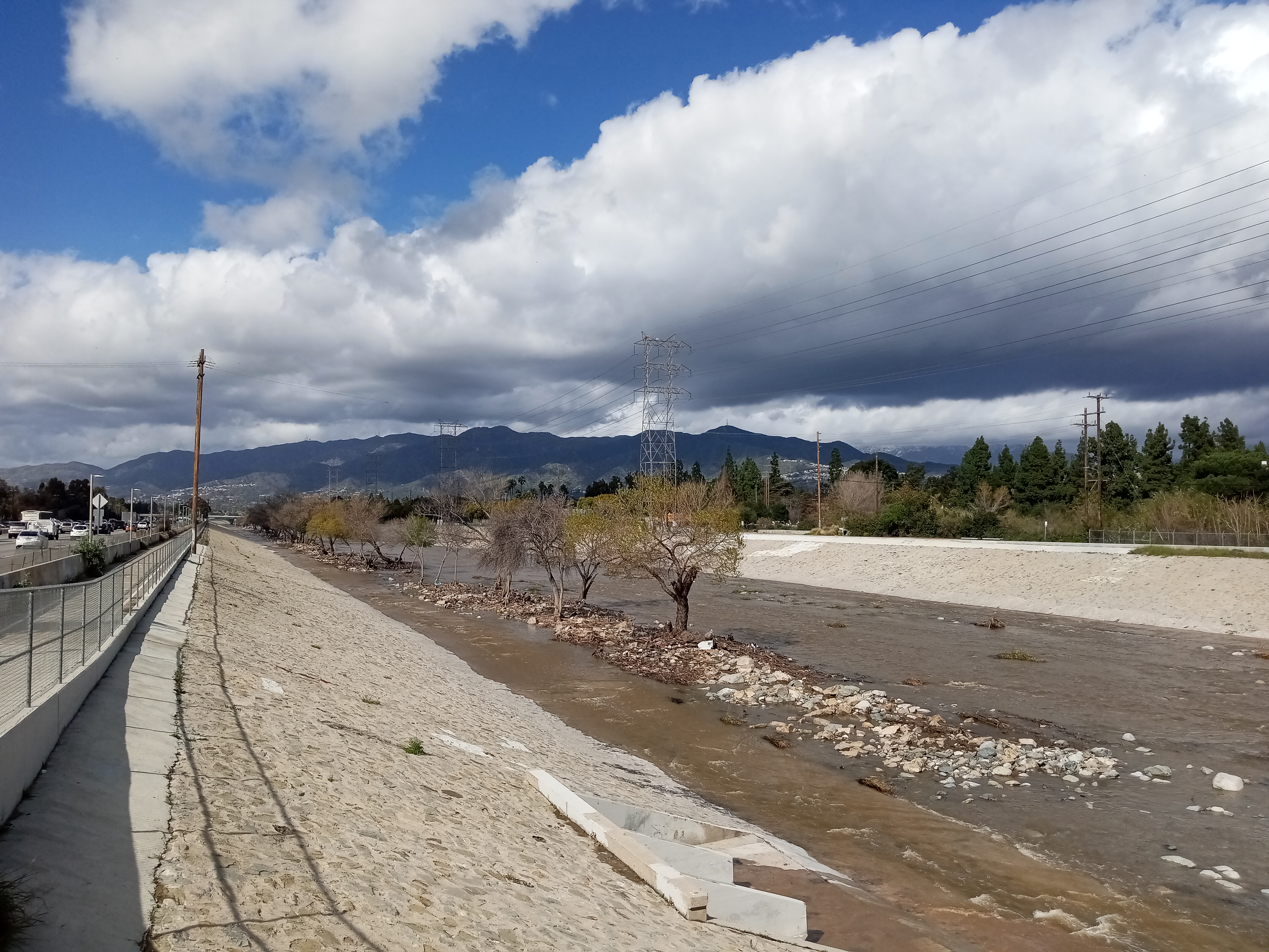
The trees in the river fade away as you approach the 134 freeway, where the concrete river bottom returns for the sharp bend around the northeastern corner of Griffith Park. Past the freeway, Glendale’s massive power plant looms over the other side of the river, beneath the dramatic backdrop of the Verdugo Mountains.


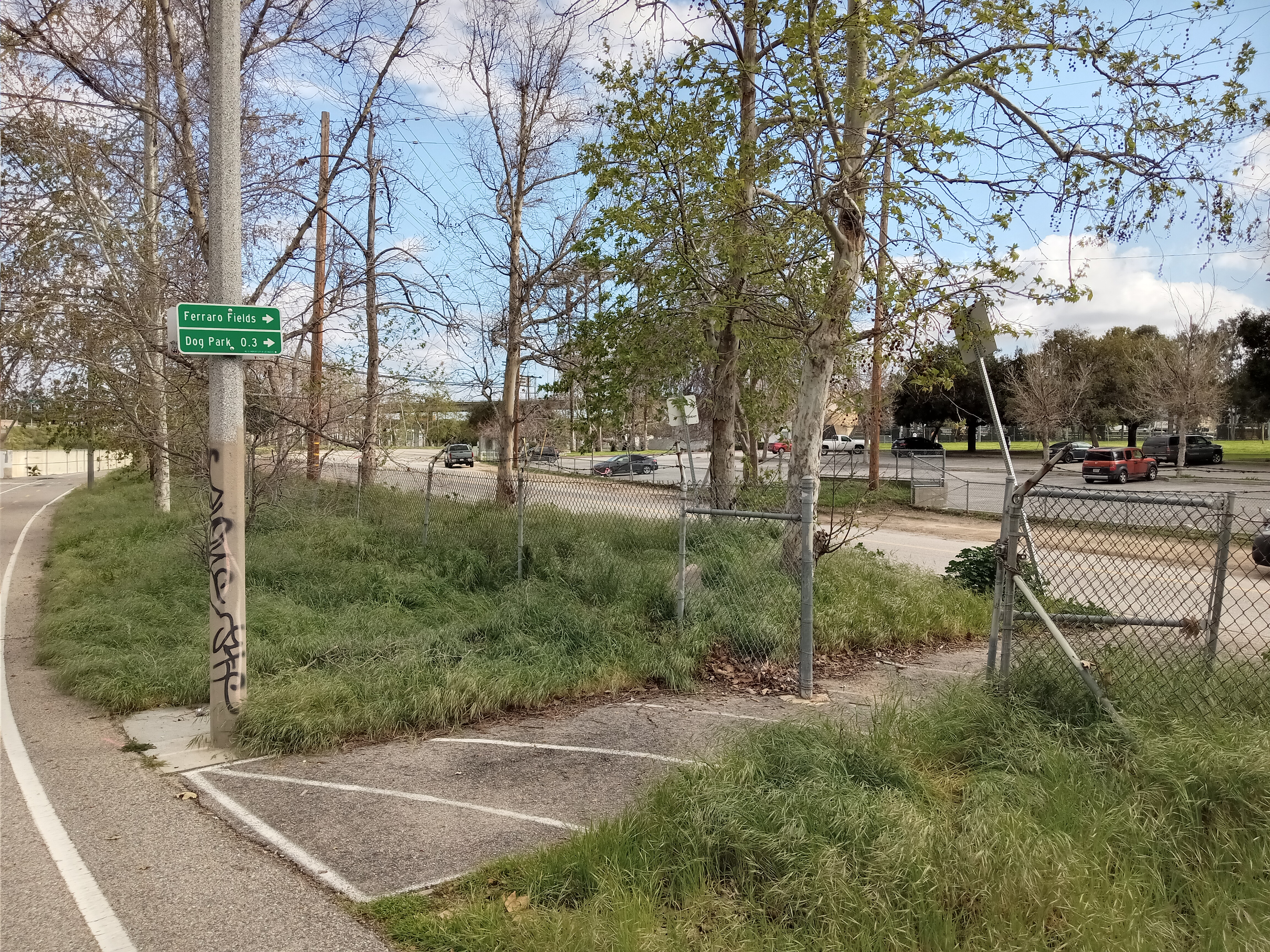
The path briefly follows Zoo Drive as it takes the curve around Griffith Park, with a couple of access points to the street (though I do not recommend trying to access Griffith Park or the zoo from here, given the lack of safe walkways across the freeways). One of the access points is right across the street from the John Ferraro Athletic Fields, a large complex of soccer fields with a handy set of restrooms and a drinking fountain next to a giant soccer ball. A little ways up Zoo Drive from the fields is a large dog park, which you can spot from the path as you continue on.

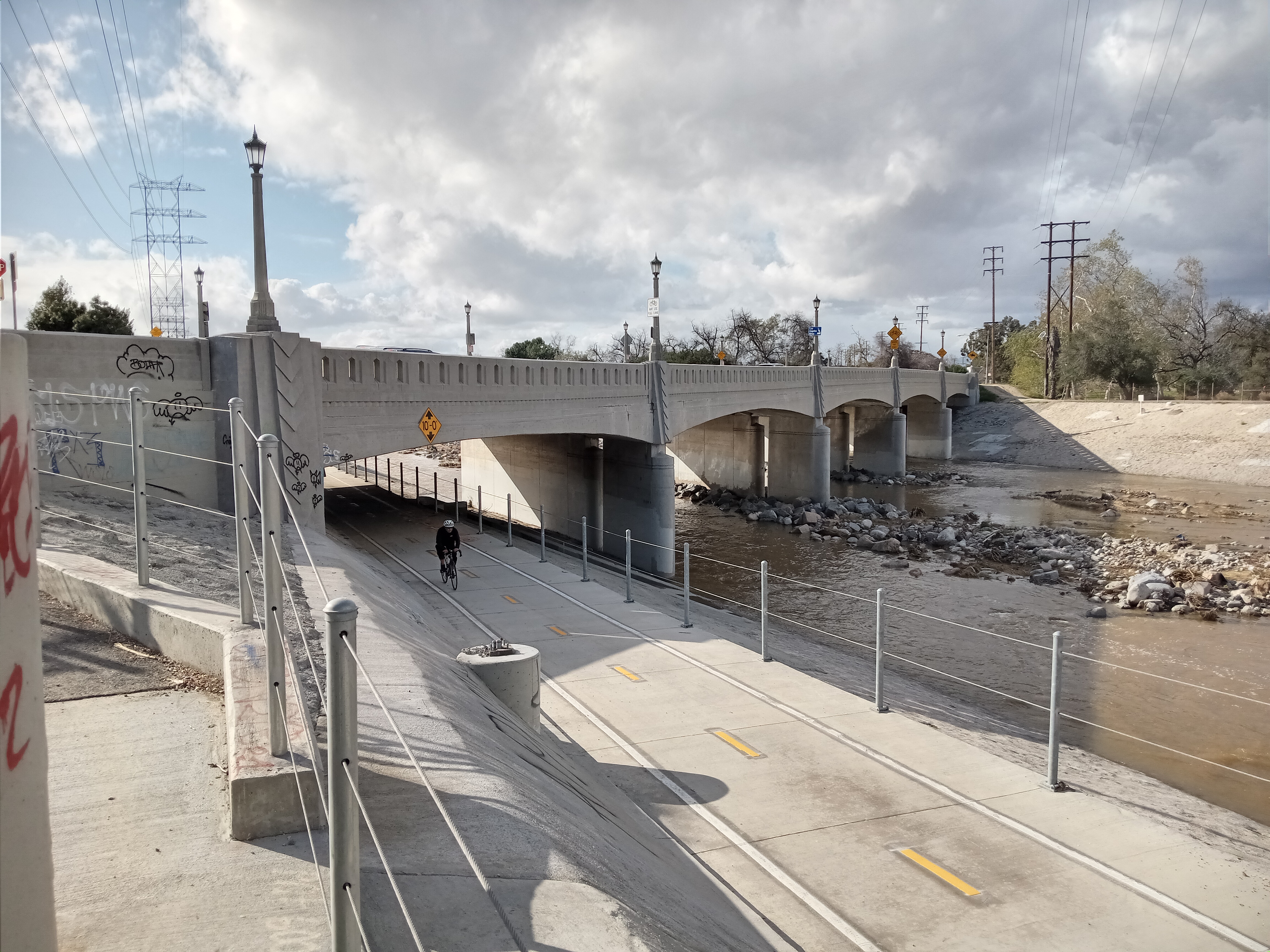
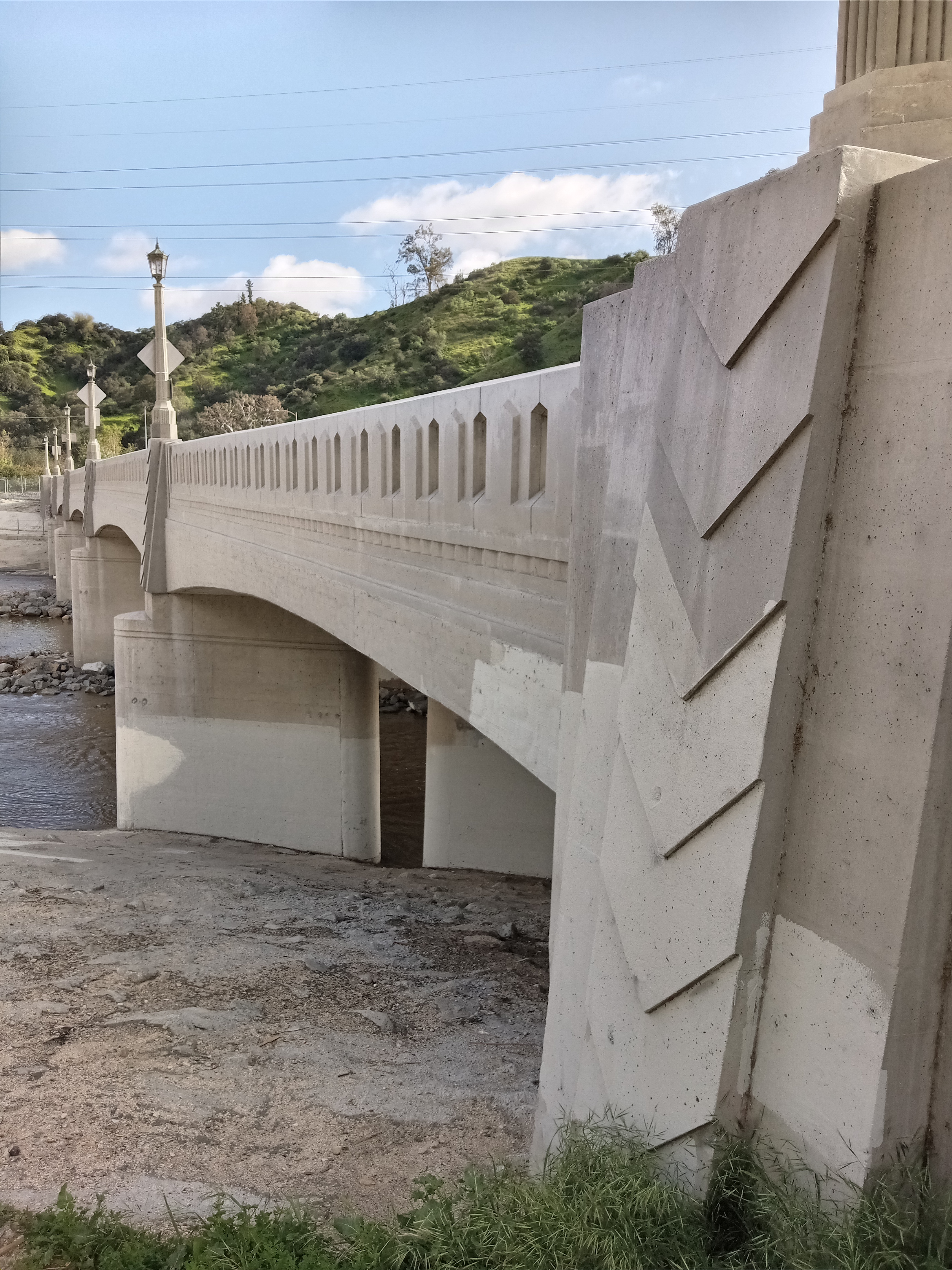
After you pass under the 5, the path joins the 134 freeway as you continue west. The soft-bottomed river channel returns as you approach the Riverside Drive Bridge, which is quite beautifully designed, with some very nice Art Deco touches and stylish street lanterns. Here, the bike path comes to an end, giving you the option to either cross the bridge into Glendale or cross the freeway into Griffith Park.

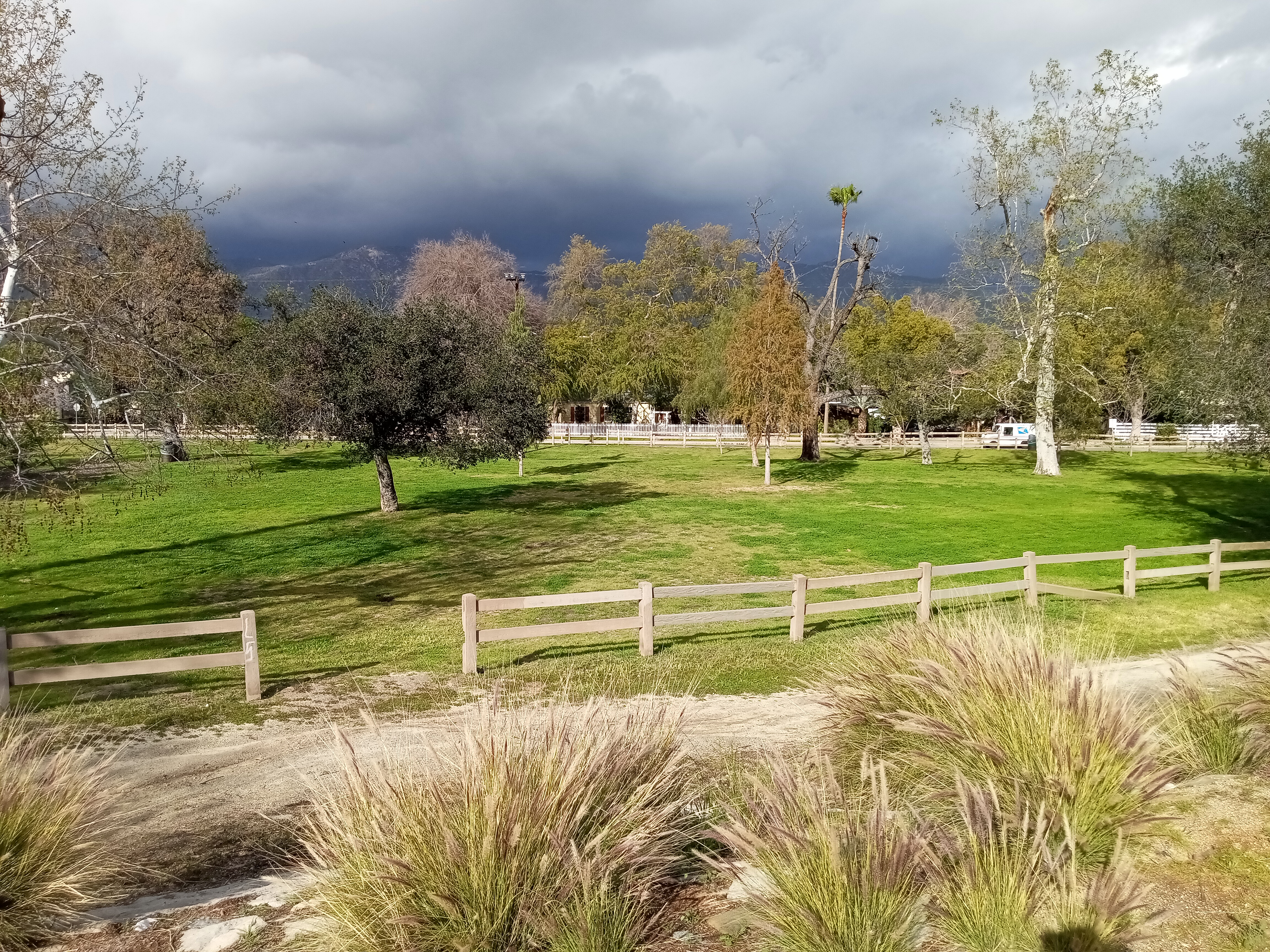
While Riverside Drive Bridge does have some nice sidewalks, once you get to the other side of the river, those sidewalks abruptly end and you are rather unceremoniously dumped into the park at the other end of the bridge. Fortunately, the park, the Bette Davis Picnic Area, is rather nice, with lush lawns, plenty of picnic tables, and some horse trails given its proximity to the Los Angeles Equestrian Center just a little bit further up the river.

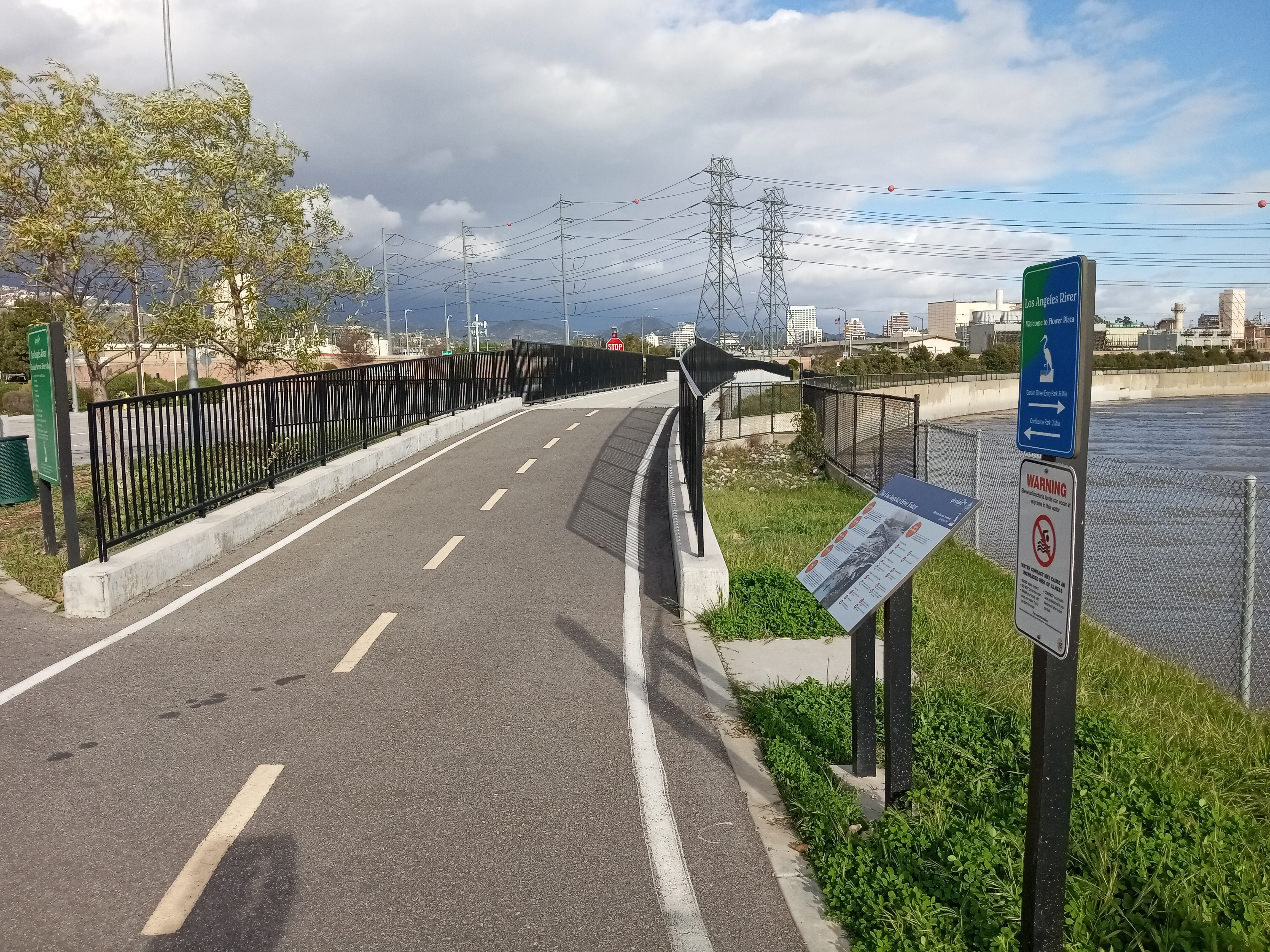
The last section of trail to explore is the Glendale Narrows Riverwalk, a relatively short, one mile stretch of trail that’s maintained by the City of Glendale. This path has actually been kept up in good condition, with plenty of pocket parks, benches, and informational sign boards along the way. The trailhead is located at the far southeastern corner of the Bette Davis Picnic Area, where you’ll find plenty of signage (some of it a little baffling).


After crossing under the 5, the path passes by the ABC Channel 7 studios (marked with a giant towering sign) and the Dreamworks Animation studio complex, housed in a set of eye-catching yellow buildings. Straight ahead, the Glendale skyline gleams in the sunlight.

Just past the Dreamworks studios, there’s an access point at the intersection of Flower Street and Fairmont Avenue, just a couple blocks from San Fernando Road. Here, the path crosses a small bridge over a wash that empties into the river. A set of concrete benches overlooking the river are tucked under the path on the other side. There are plans to build a pedestrian bridge over the river at this spot, connecting Glendale to the athletic fields in Griffith Park directly across, though we’re several years away from seeing that project completed.

Finally, the path rounds the bend of the river before coming to an end at a tiny picnic area perched above the confluence of the L.A. River and the Verdugo Wash, which carries water from the Verdugo Mountains through Glendale before emptying here at the river. A service road dips down into the channel itself. Here, you can rest a bit and watch the flow of the streams below and the hum of traffic above. The two bridges of the 134 freeway dominate your view, but just beneath the bridges, way off in the distance, you can spot the skyline of Downtown Los Angeles downriver.
For now, the confluence is a dead end. But it points optimistically towards our future. One day, hopefully sooner rather than later, the river path will reach downtown and you’ll be able to go all the way there along a flourishing, revitalized river. If you squint your eyes, you can almost see it, but we’ve got a long ways to go to make it a reality.

3 thoughts on “The Glendale Narrows of the L.A. River”