
Few sites are as significant to the city’s history as Los Angeles State Historic Park. Situated just north of El Pueblo and on the edge of Chinatown, this piece of land played a vital role in the development of the Spanish settlement of Los Angeles and its boom into an American city. And since its transformation into a lovely state park, it also stands to play a significant role in the city’s future.
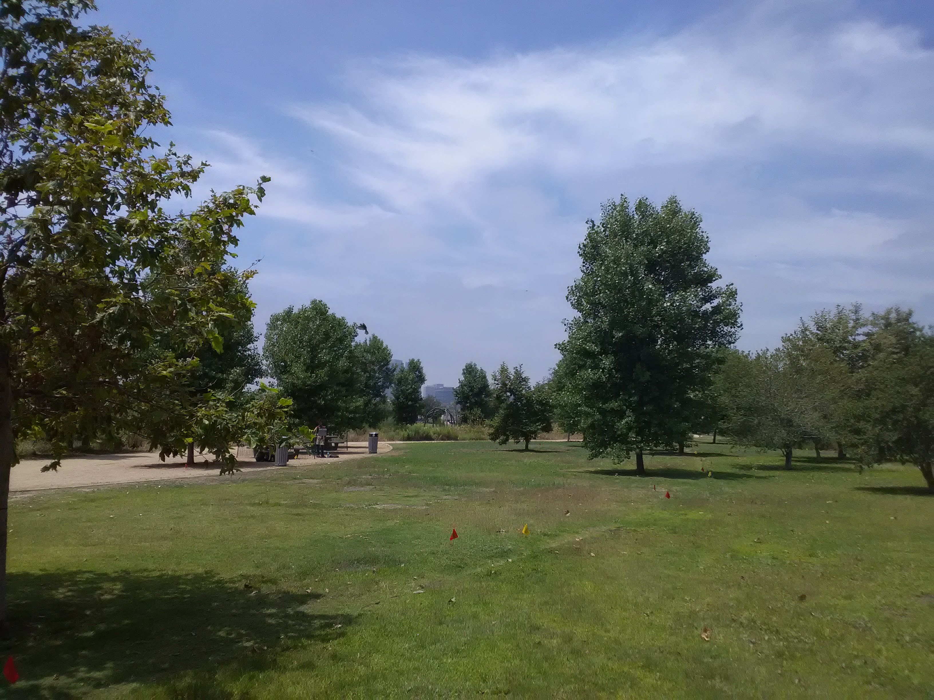
For such a relatively new park, it has become one of the most cherished green spaces in the city. And it has been delightful to watch it gradually mature, the canopy slowly expanding as the trees grow and new trees are planted. In the spring, the foliage is lush and green after a good wet season. In the summer, elaborate music festival stages are a common sight on the lawn. And at all times, you can observe a good cross-section of city life: joggers tracing the loop around the park, young couples lounging under a tree, elderly Chinatown residents enjoying a quiet stroll, and kids playing sports on the lawn.
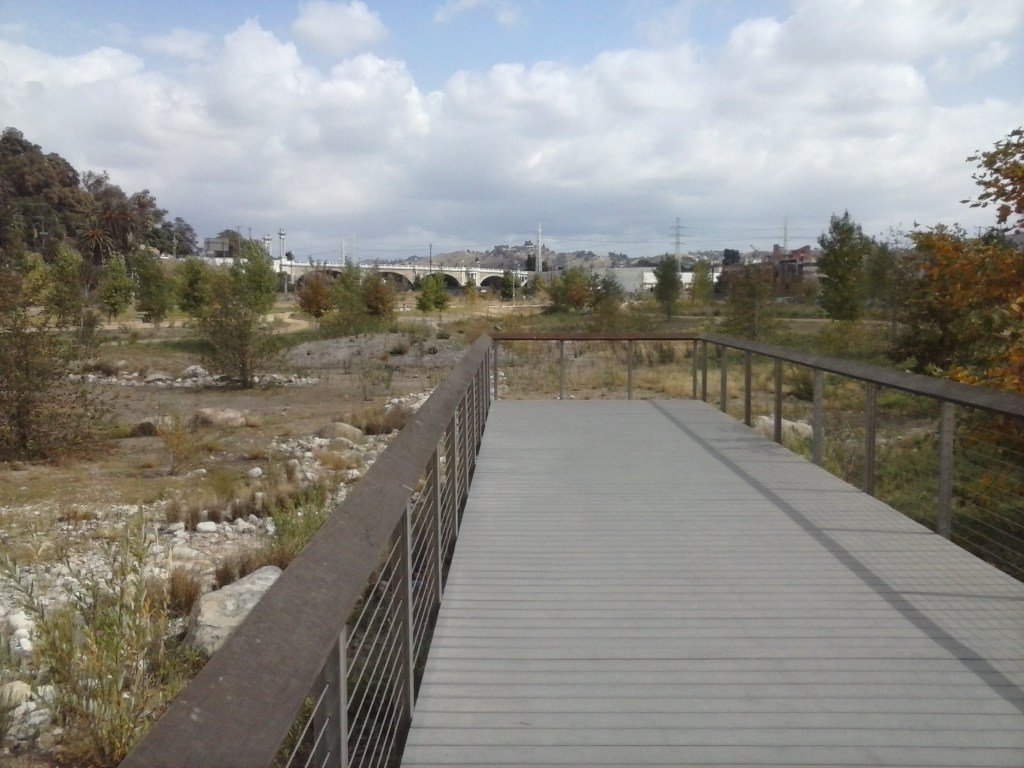
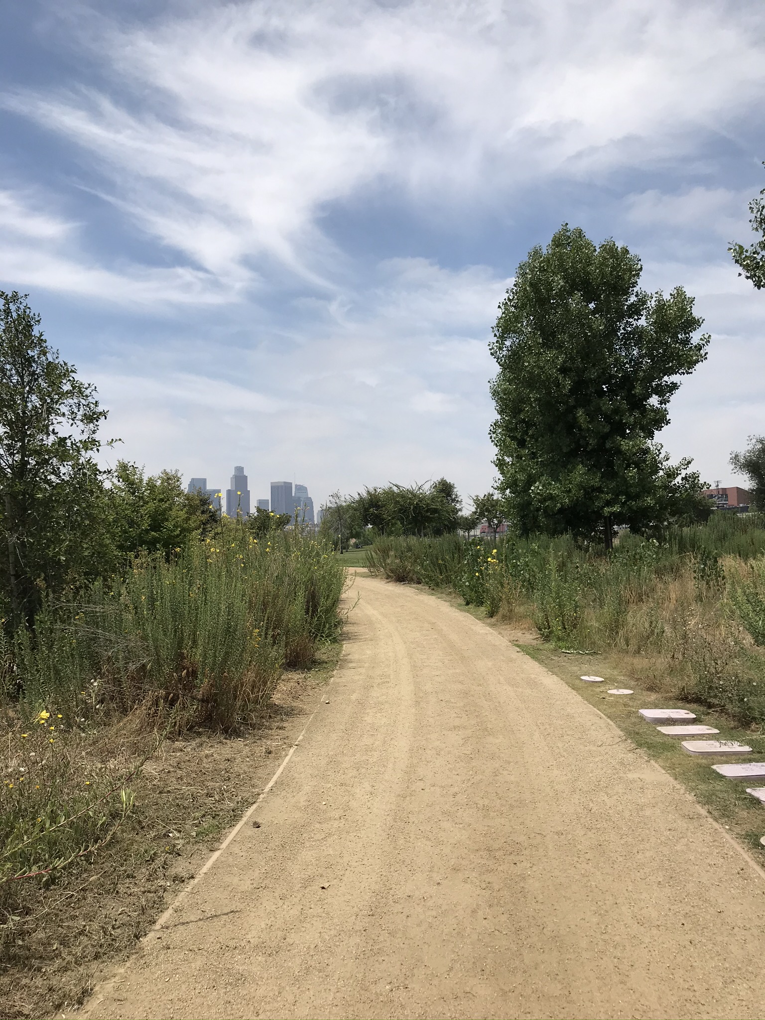
At the north end of the park, a short wooden deck sits perched over a dry creek bed that’s part of a restored wetland habitat. In previous years, the vegetation was sparse enough that you had a clear view of the North Broadway Bridge, with its beautiful arches over the LA River. Now, the foliage is dense enough that you can barely make out the bridge. The trees have grown close together and flowers and tall grass cover the ground. It’s really starting to feel like a native landscape, and when you walk between the trees of the nearby picnic area, you can almost lose yourself in the park.

As the vegetation grows and the tree canopy expands, the different parts of the park are becoming more distinct from each other. The field at the center of the park is more defined now that there are fully-grown trees surrounding it, and the more naturalistic areas are feeling more wooded. As the park matures and softens, it’s hard to believe that this spot was once central to the development of Los Angeles.
The park before
For a park created specifically because of the rich history of the site, there’s surprisingly little information at the park itself to convey that history to visitors. If you want a short, entertaining explanation, Tom Carroll of Tom Explores Los Angeles did a four-part series on the history of the site, which he refers to as, “The Cradle of Los Angeles.” Part one is embedded below.
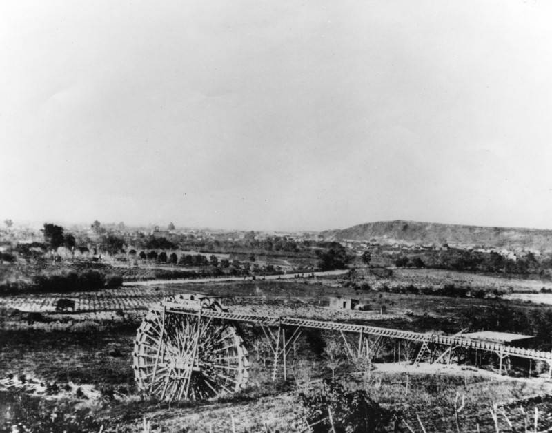
Sitting just south of the confluence of the Arroyo Seco and the Los Angeles River, this area was one of the few in the region that had a reliable year-round supply of water. That made it very appealing to the Tongva, who established their largest known settlement, Yaanga, just south of here near the site of present-day Union Station. Access to water also made the area appealing to the Spanish, who built a town, El Pueblo de Los Angeles, just west of Yaanga. A ditch—the Zanja Madre—was carved along the bottom of the hill leading from the river to the town. Fittingly named, the Zanja Madre (“mother ditch”) was the life-giver of the Pueblo.
If you had been standing on this site in the 1850s, you would have been surrounded by fields of corn and grapes. Water would be trickling through the narrow ditches between the crops while men with shovels tend to the steady stream running along the base of the hill, keeping the Zanja Madre free of obstructions. If you had followed the Zanja up to the river, you would have found a creaking water wheel lifting river water into the ditch, flowing to a bustling and thirsty pueblo in the distance.
As the pueblo grew, the open ditch was lined with brick and buried beneath the ground. By the 1900s, the Zanja could no longer support the water needs of the town and was abandoned. Today, only an excavated portion of brick tunnel is visible, sitting exposed just across the train tracks and rather unceremoniously marked with a painted sign mounted to the chain-link fence.

In 1876, this site—and Los Angeles—was changed forever when the Southern Pacific Railroad arrived, linking Southern California to the transcontinental railroad system for the first time. The park site was used as the main Los Angeles station and railyard, becoming the entry point for a flood of travelers and newcomers to Southern California. Instead of water, steam locomotives belching coal smoke were now streaming in and out of the railyard, bringing people in and box cars full of produce out. The “River Station,” as it was known, welcomed thousands of migrants during the land boom of the 1880s and sparked the explosion of Los Angeles into a major American city. Factories and mills sprouted up around the tracks, forming the city’s first industrial district.
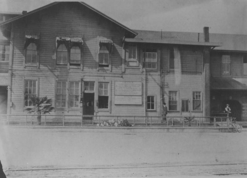
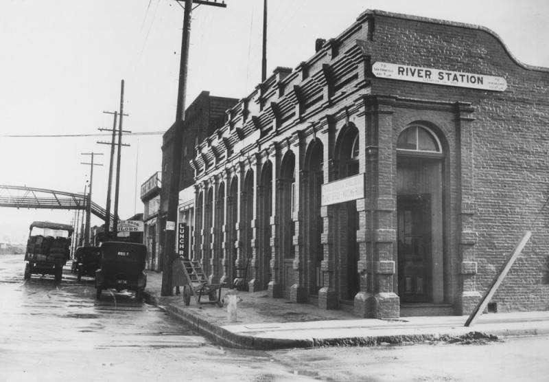
The original River Station was a rustic wooden building, joined by a handful of restaurants and a hotel. In 1887, it was replaced by a brick Romanesque station building, but this served as Southern Pacific’s main Los Angeles station for only a year before they built a new, even grander station at Alameda and 5th, closer to Downtown Los Angeles. This would lead to River Station’s closure, but the land was still used as a railyard for over a century.

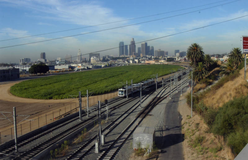
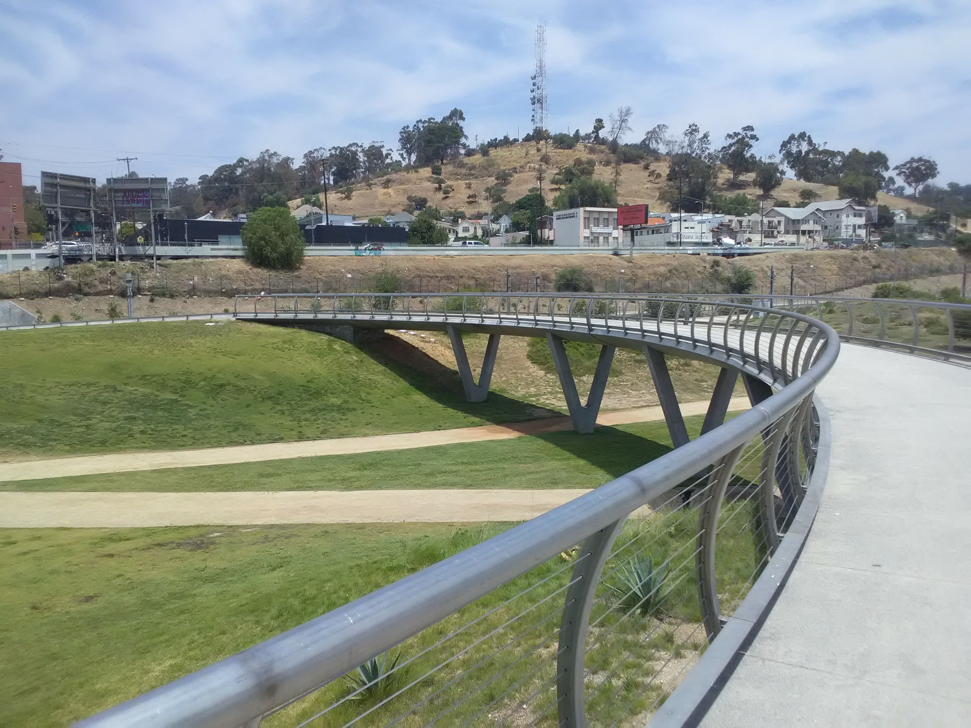
Today, there are two reminders of the site’s railroad history in the park. One is the circular elevated walkway, which marks the outline of a former roundhouse at the yard’s center. The second and more apparent one are the Metro trains which pass by the park every few minutes, tracing the edge of the old railyard before joining the former route of the Santa Fe Railroad line to Pasadena. A few old industrial buildings remain, although they have been converted into other uses. The most prominent is the Capitol Milling Company, a flour mill that was constructed in the 1880s on top of the Zanja Madre. Today it stands in the shadow of the Chinatown Metro station.
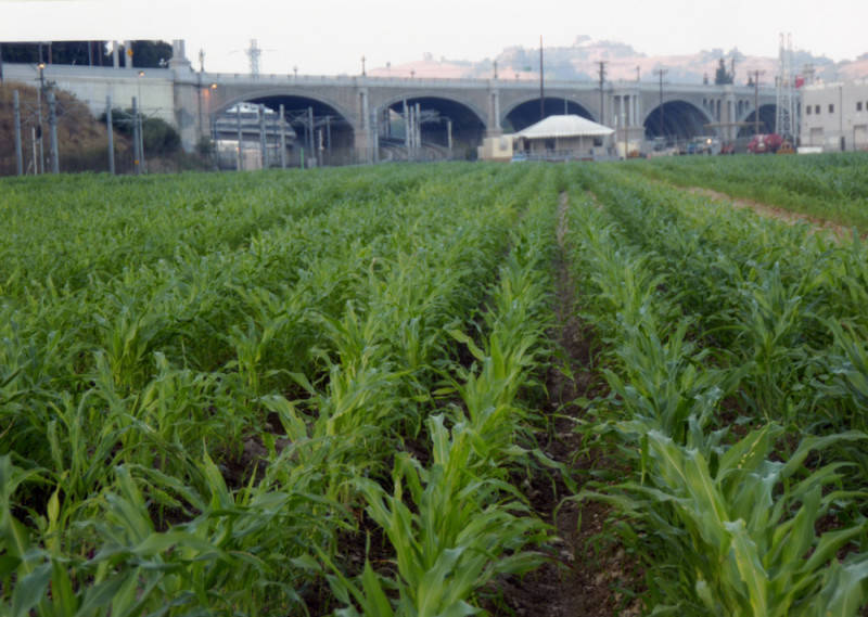
The year is now 2005. The freight trains are gone, but Metro trains on a newly built line—now only two years old—zip by on electric wires. The factories and mills are gone, leaving a bunch of warehouses across the street. A skyline now looms in the distance. And stalks of corn once again gently sway in the breeze.
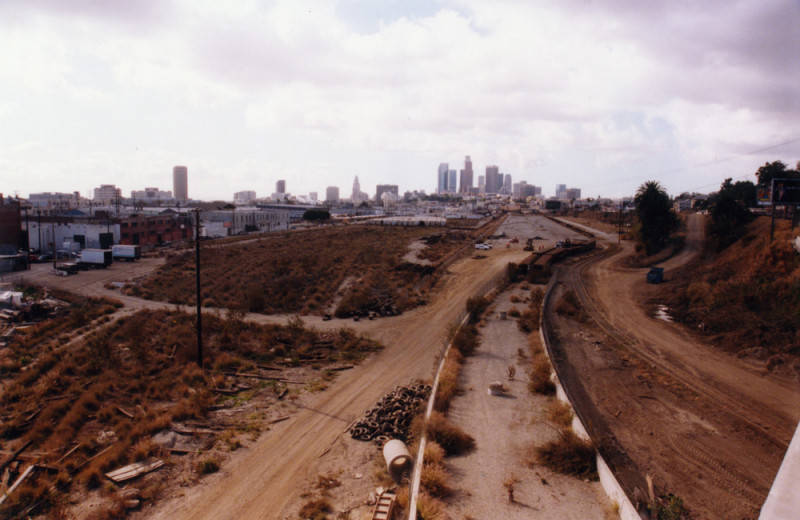
When the railyard was abandoned in the 1990s, it left behind a vast, empty lot that had gained the nickname “The Cornfield.” Where this name comes from is anyone’s guess, although the most common story is that corn seeds used to fall out of the freight cars and grow around the tracks. Whatever the origin, the name inspired a striking artwork that transformed the site: Not a Cornfield. Led by artist Lauren Bon, the project turned the abandoned lot into a productive cornfield for one agricultural season in the mid-2000s.
By this point, a community-led effort had successfully beaten a proposal to turn the former railyard into a warehouse complex. They campaigned for a park—an effort commemorated by a handful of recreated protest signs near the elevated walkway—and managed to convince the State of California to purchase the land for its eventual transformation into a state park. While the planning process for the park dragged on, Not a Cornfield both kept the site in the public eye and revitalized the soil, undoing years of toxic contamination.
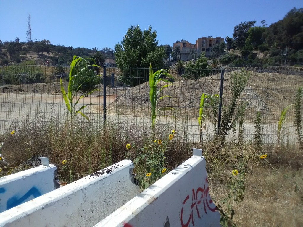
Only one trace of the cornfield remains today. At the northern end of the park sits a fenced off area. Park maps label it as open, with the green space gracefully tapering to a point under the Broadway Bridge. But reality hasn’t quite caught up with this vision, as this part of the park is still closed off. Maintenance equipment is scattered around, but the beginnings of a park are visible if you squint: little hills of soil, a smattering of young trees, even some rudimentary pathways. And as you walk up Baker Street along the chain link fence, behind some concrete barriers and a pile of debris, a few solitary corn stalks remain.
The park today
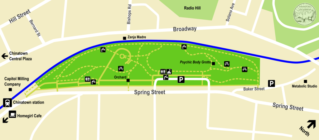
Los Angeles State Historic Park is composed of three main parts. The most obvious one is the big lawn in the center, surrounding the site of the old roundhouse. This is where the most recreational uses of the park take place: people playing sports, throwing frisbees around, jogging along the main track, etc. It’s also where events and concerts are held, sometimes resulting in the closure of the lawn to all but event participants.
From atop the elevated walkway, the trees frame a beautiful view of the Downtown skyline. You can trace the path of jets making their descent into LAX while helicopters buzz overhead. Freight trains occasionally blast their horn nearby while Metro trains frequently hum past. The little grassy hills are topped with cacti and shrubs, just out of reach of the little kids racing each other on the lawn below.


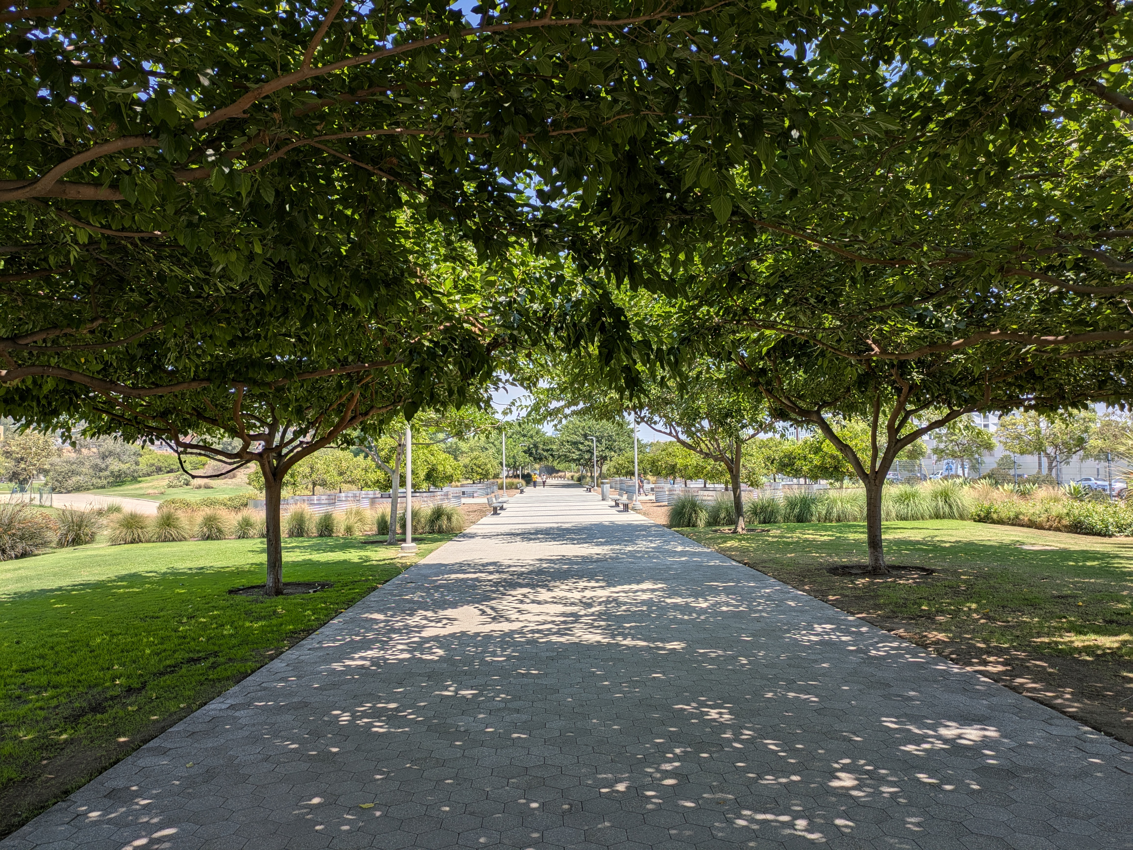
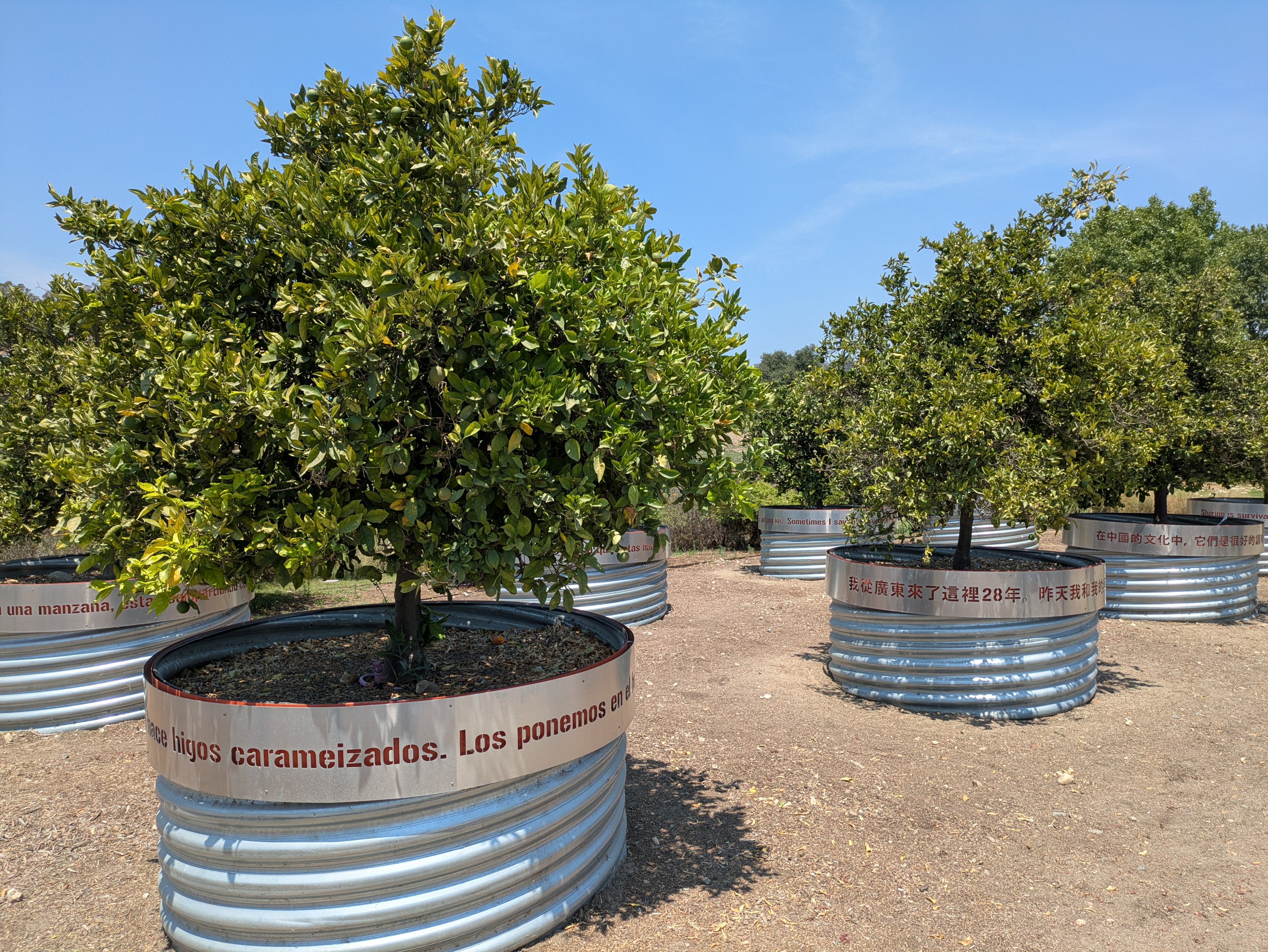
Separated from the lawn by a dry creek bed is the entry path along Spring Street. This is where you’ll find the park’s primary facilities, such as the ranger station and restrooms, as well as a nice cafe at the southern entrance. A farmers market takes place at the entrance to the park every Thursday afternoon, in the shadow of the Metro station. You’ll find plenty of welcome shade from the trees lining the path. This is also where you can look at the orchard, a set of orange trees that serve as a public orchard and as a nod to the agricultural history of the site. As you walk past, you’ll see quotes from local community members inscribed on the metal planters in English, Spanish, and Chinese characters.
Lastly, at the northern end of the park the lawn gives way to a wooded area which offers some seclusion. Being the furthest part of the park from the entrance, it’s the quietest. A seasonal wetland area, usually dry, sits here with a little deck serving as an overlook. There’s also a cool piece of public art on the edge of the lawn which feels like a cross between a hut and the legs of a giant spider. This is Psychic Body Grotto, which the artist describes as a “figurative gazebo.”

The park site has long sat at the crossroads of the city’s history. But it could also have huge ramifications for the city’s future, sitting as the most visible example of the reclamation of industrial land for community and green space. In the land surrounding the park, you can see competing visions for LA’s future.
Immediately surrounding the park you have the gentrification of an urban neighborhood, reflecting the ongoing gentrification of Chinatown which has been further bolstered by the park. The warehouses across the street are filling up with offices and art studios, restaurants are creeping in, and the confusingly-named Highland Park Brewery (which has great bar food, not gonna lie) sits across the street, next to a tall new residential development.
But a couple blocks south of the park is an establishment more grounded in the community, one which also happens to be a great place to eat. Just a block down Spring Street from the Chinatown Metro station and literally standing in the shadow of the Metro tracks is the headquarters of Homeboy Industries, the local non-profit that provides job training and support to former gang members. Homegirl Cafe is open for breakfast and lunch, and the food there is fantastic. Even if you just go in for a cup of coffee, it’s still one of the best coffee shops nearby.
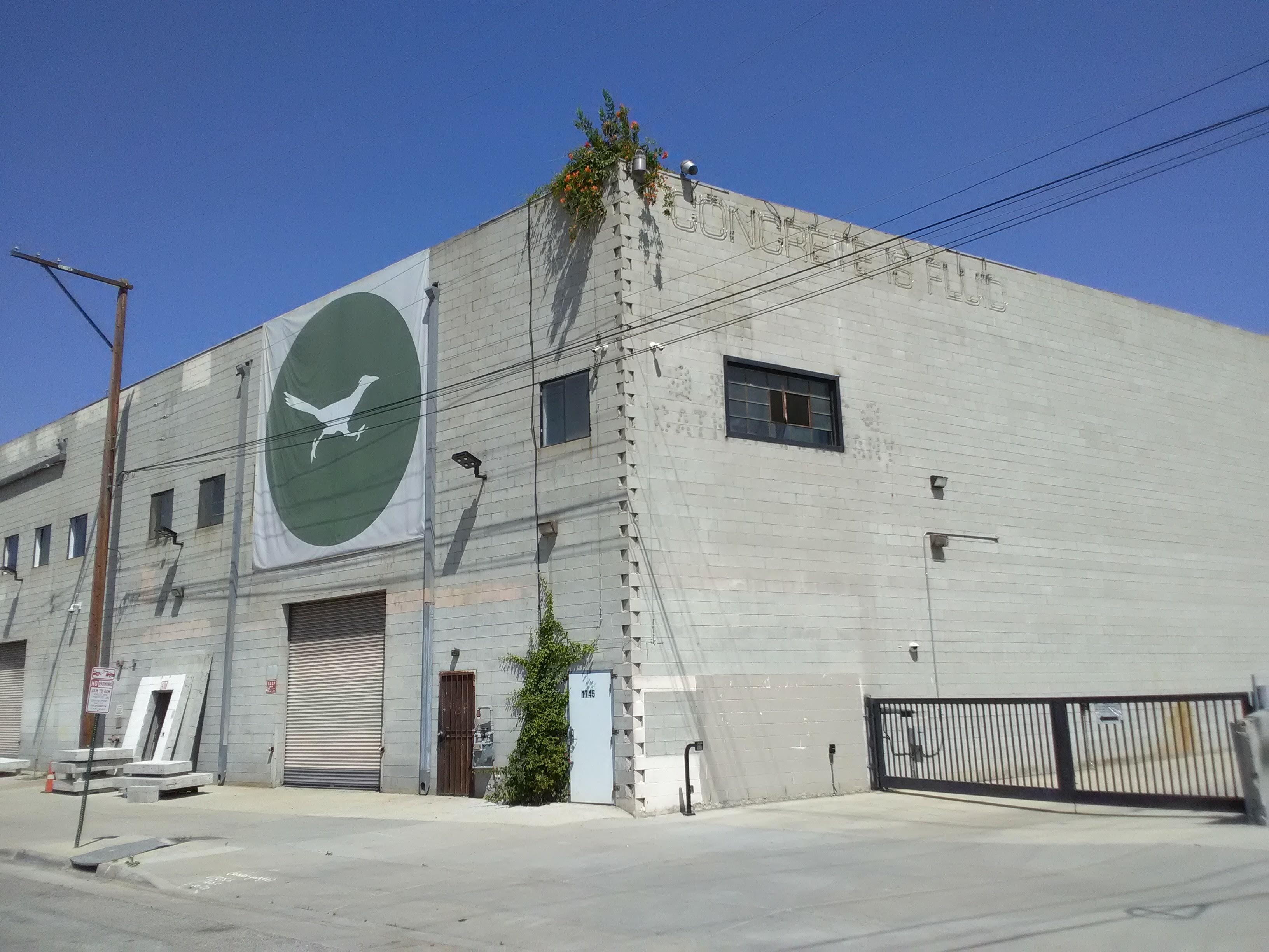
At the north end of the park, at the end of Baker Street, an attempt is being made to reconnect the neighborhood with the broader natural environment. Following Not a Cornfield, Lauren Bon established Metabolic Studio, which now occupies a warehouse at the north end of the park. A burst of orange flowers emerge from the corner of the rooftop. Concrete is mostly what you see along Baker Street, but as you approach the end where an imposing gated entrance to a Metro rail yard sits, something fascinating emerges. Behind Metabolic’s warehouse, on the side facing the Los Angeles River, is an experimental garden of drought-tolerant vegetation, hydroponic plants and water collection methods. Even from a distance and behind a chain-link fence, the unmistakable sound of dozens of frogs emanates from somewhere in the garden. At night, you can spot their neon “CONCRETE IS FLUID” sign mounted on their facility across the river.

Concrete is indeed fluid. It can be molded, shattered, or broken through. Metabolic’s current project aims to draw water from the Los Angeles River into a treatment facility on Metabolic’s grounds before distributing it to the surrounding parks. Should it be completed, it would essentially be the first project to break the concrete straitjacket that has held the river.
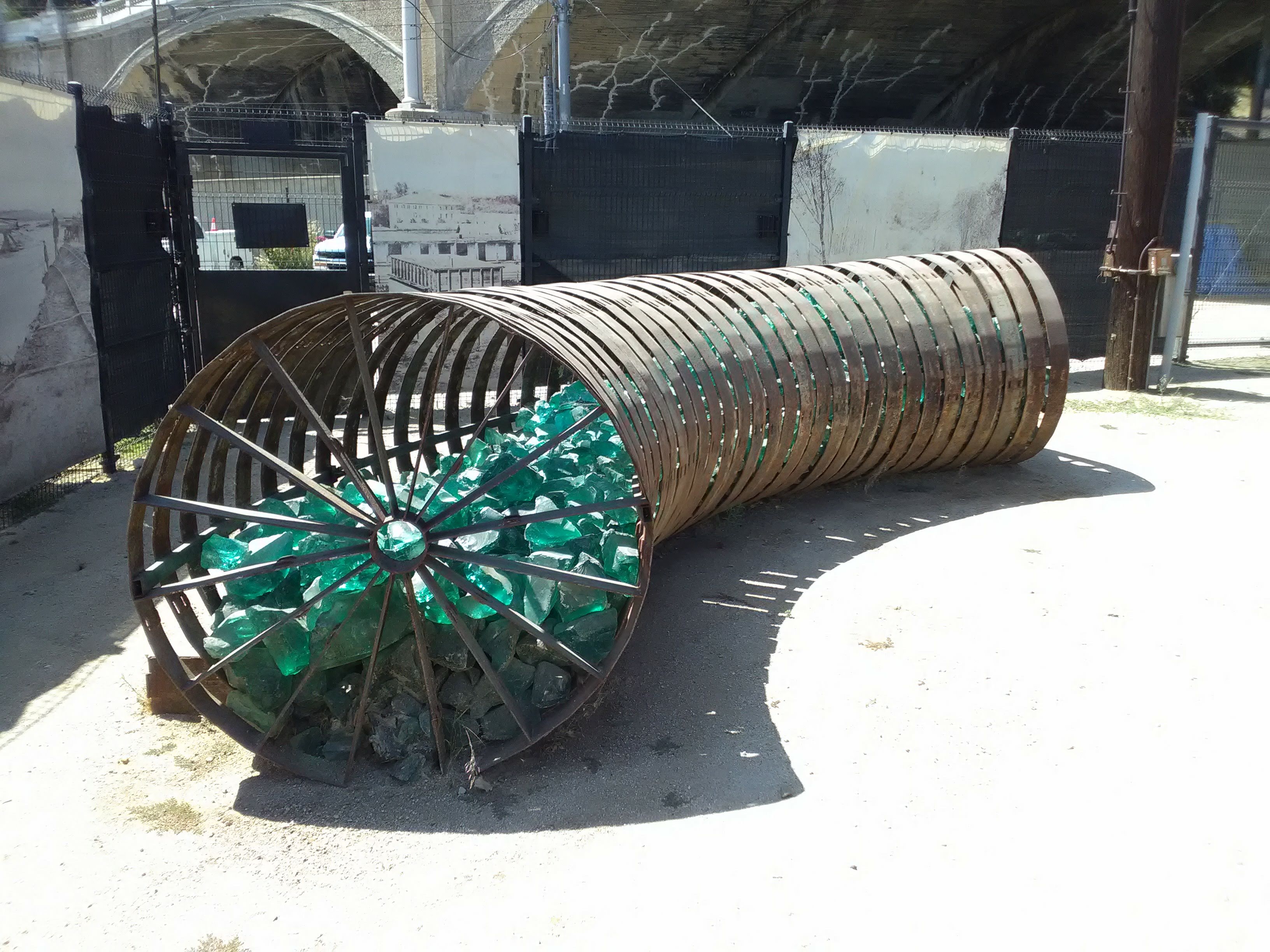
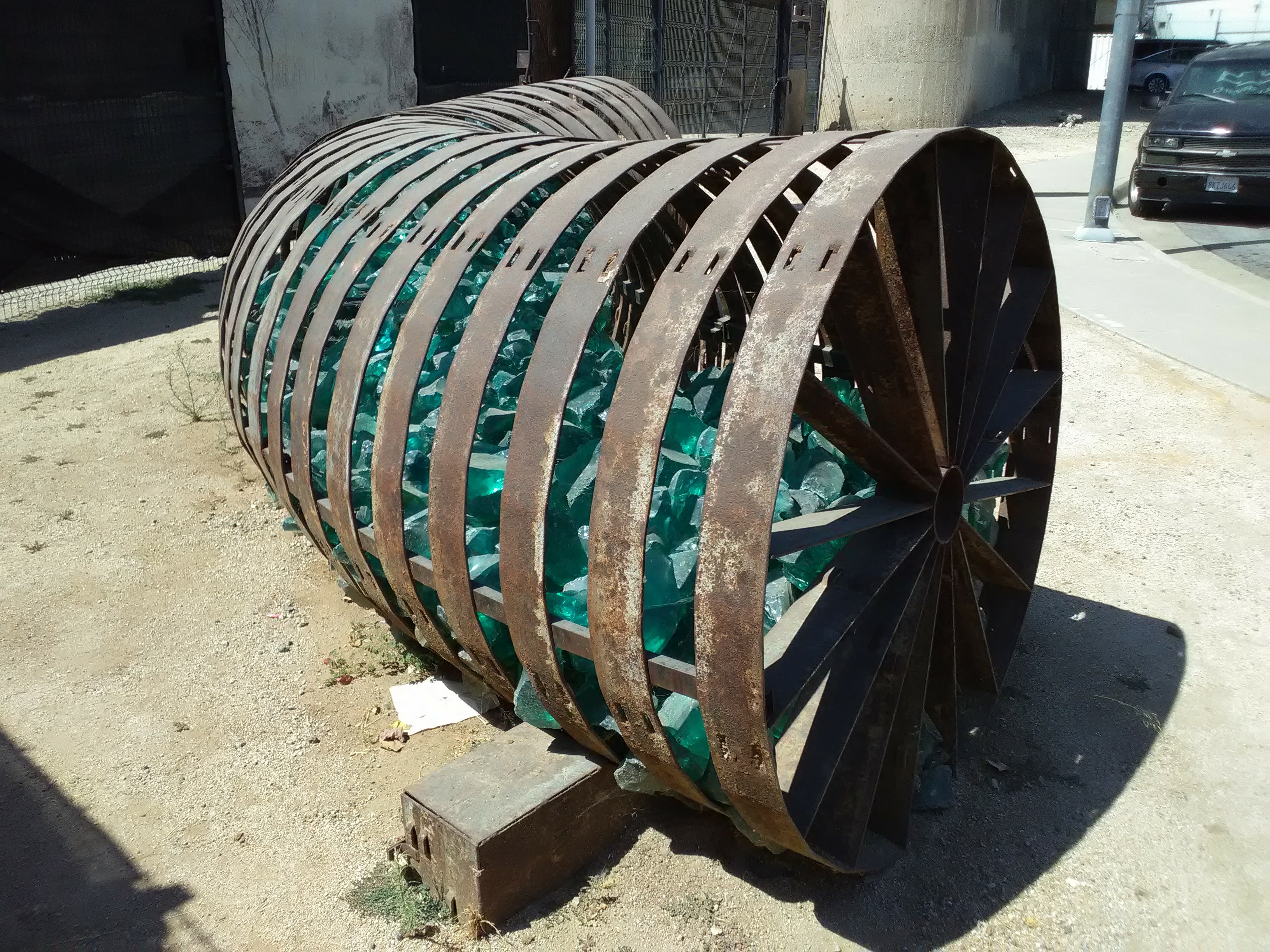
Across the street from Metabolic Studios sits an interesting sculpture. A stream of translucent green rocks sits within the rusty confines of a series of metal bands. The organic matter within is visible, and tantalizingly within reach—but someone must break the cage.
Metabolic isn’t the only one eyeing the potential for the river. The decades-long effort to transform the Los Angeles River into parkland and a more naturalistic state has begun to bear fruit, with a new park sitting just across the river in Lincoln Heights and another state park—Rio de Los Angeles State Park—taking shape on another former railyard just a couple miles up the river. Numerous plans are on the books to revitalize the river, with the promise of connecting Los Angeles State Historic Park to a miles-long network of trails and parks.
Until that happens, the neighborhoods and hills north of the park remain isolated from green space, hemmed in by freeways, rail lines, and busy roads. Elysian Park, one of the city’s oldest and largest parks, but also one of its most neglected, fragmented, and inaccessible, looms over Los Angeles State Historic Park but is cut off from it. Perhaps the gleaming new park at its base can serve as inspiration for the eventual rejuvenation of Elysian.

2 thoughts on “Urban Nature: Los Angeles State Historic Park”