(If you would like a printed guide to Debs Park, you can purchase a lovely guide from us on our Etsy page! The printed version is inspired by national park brochures, with a full-color map, photographs, and information on the park’s history, wildlife, and attractions.)
I admit, the Southwest Museum station—and Northeast LA overall—is overrepresented on this blog. From the museum itself to the house of its founder to the scenic stairways of the hill above. Chalk it up to personal bias; the Southwest Museum station is my favorite, and the surrounding neighborhoods are some of the most beautiful and historic in the whole city. Highland Park dates from the 1880s, when a railroad was built along the Arroyo Seco between Los Angeles and Pasadena (which the Metro A Line now follows). By the turn of the century, the neighborhoods along the rail line were home to many handsome Craftsman houses and a burgeoning artist community. The 1910s saw the construction of the Southwest Museum and the development of Mt. Washington, aided by a cable car railway that took riders to a glamourous hotel at the top of the mountain.
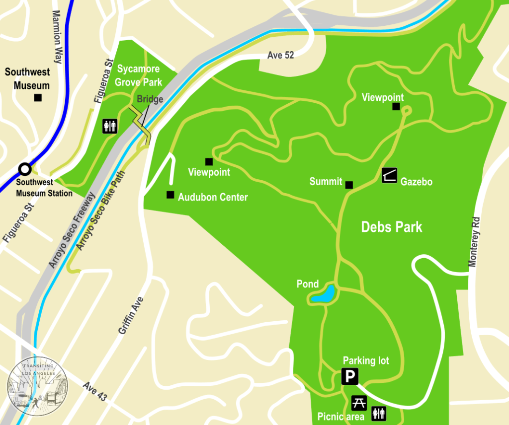
But through all of this, there was one nearby hill that somehow managed to escape development. And not for lack of trying; there were multiple failed attempts to build atop the hill before the entire thing was set aside as one of the largest parks in the city, with views and scenery to rival Griffith Park. This time, we return to the Southwest Museum station to climb to the top of Ernest E. Debs Park. The station offers very easy access to the park, with a nature center that’s only 2/3 mile walk from the station and a scenic pond at the top of the hill that’s a 1.5 mile climb from the station.
It’s a short but scenic walk from the Southwest Museum station to the edge of Debs Park. Or if you prefer, you can use Metro’s on-demand shared ride service, Metro Micro, to get to the edge of the park from anywhere within the Highland Park/Eagle Rock/Glendale zone (see the website for details and instructions). While the Micro vans won’t enter the park itself, you can at least have them drop you off at the entrance to the Audubon Center.
If walking from the Southwest Museum station, head down the stairs towards Figueroa Street, away from the Southwest Museum. At the corner, you can cross the street straight into Sycamore Grove Park, although I recommend a small detour up the staircase to Casa de Adobe. At the corner of Figueroa, opposite the park, you’ll spy a stone staircase leading to a sidewalk elevated just above the street, which serves a collection of charming old houses and apartment buildings hidden from Figueroa.


The first house you’ll pass is the Ziegler Estate, a stately Queen Anne house that dates from the 1900s, with curved balconies overlooking the station and a pleasing coat of green paint. The very next building is the Casa de Adobe, an authentic adobe that was built in the 1910s for the Hispanic Society of California to serve as a re-creation of the state’s Spanish history. It was later bought by the Southwest Museum and run as a cultural museum, until the museum’s financial problems led to its closure. Sadly, it has never reopened, but it still stands behind the iron fence, awaiting the day when people can reenter.
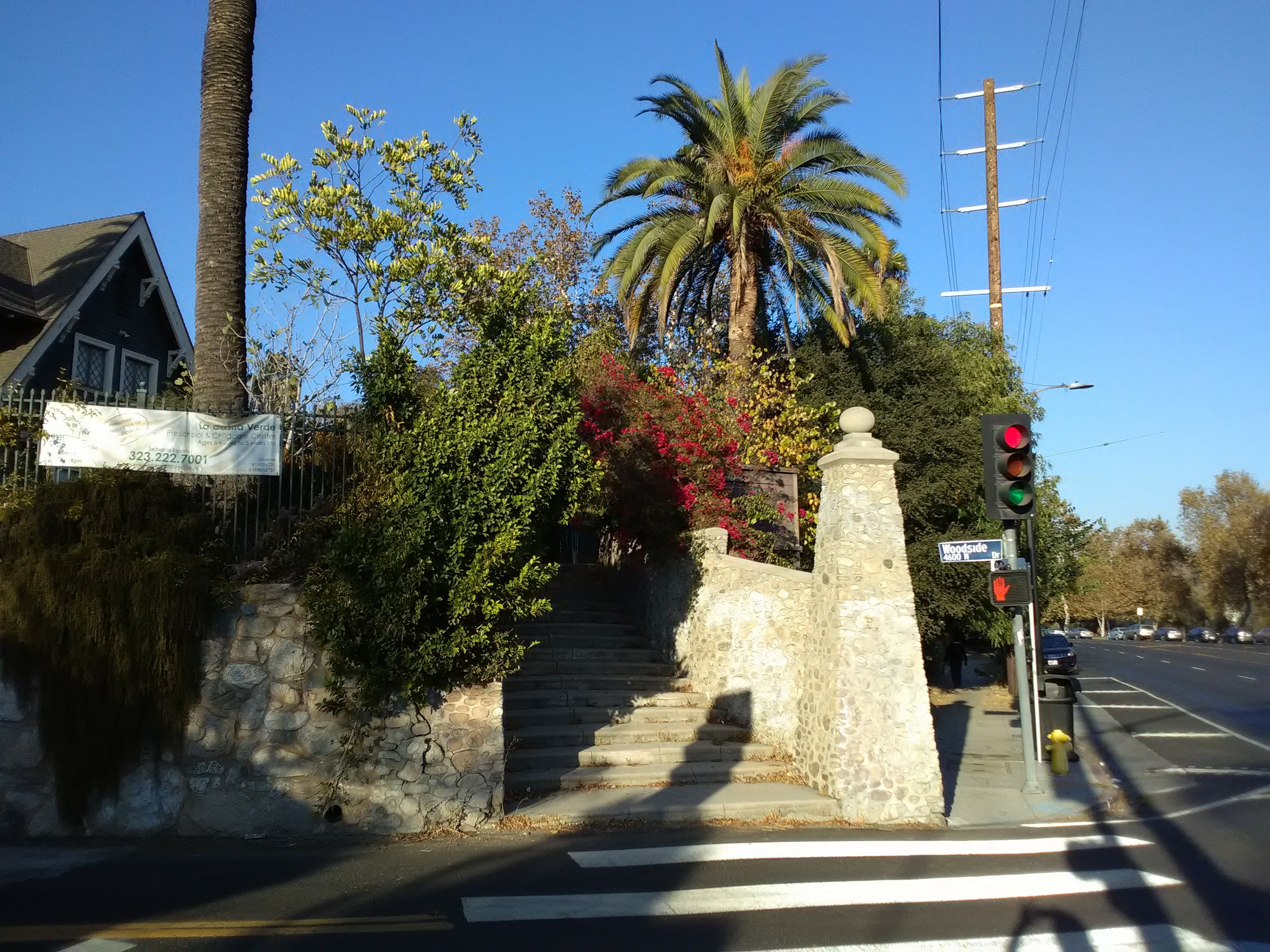
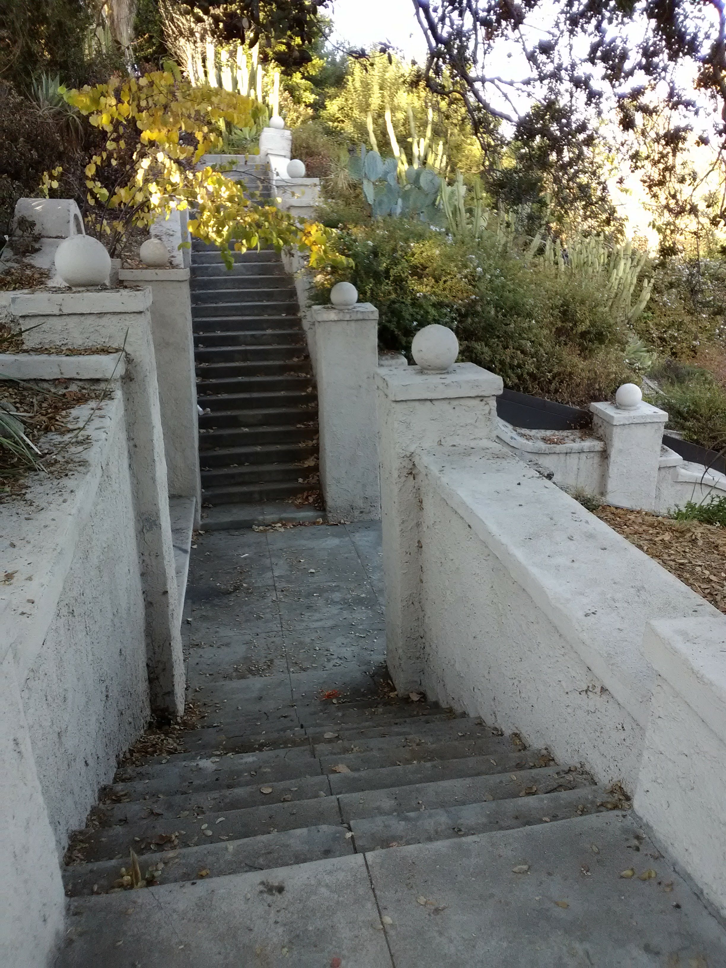
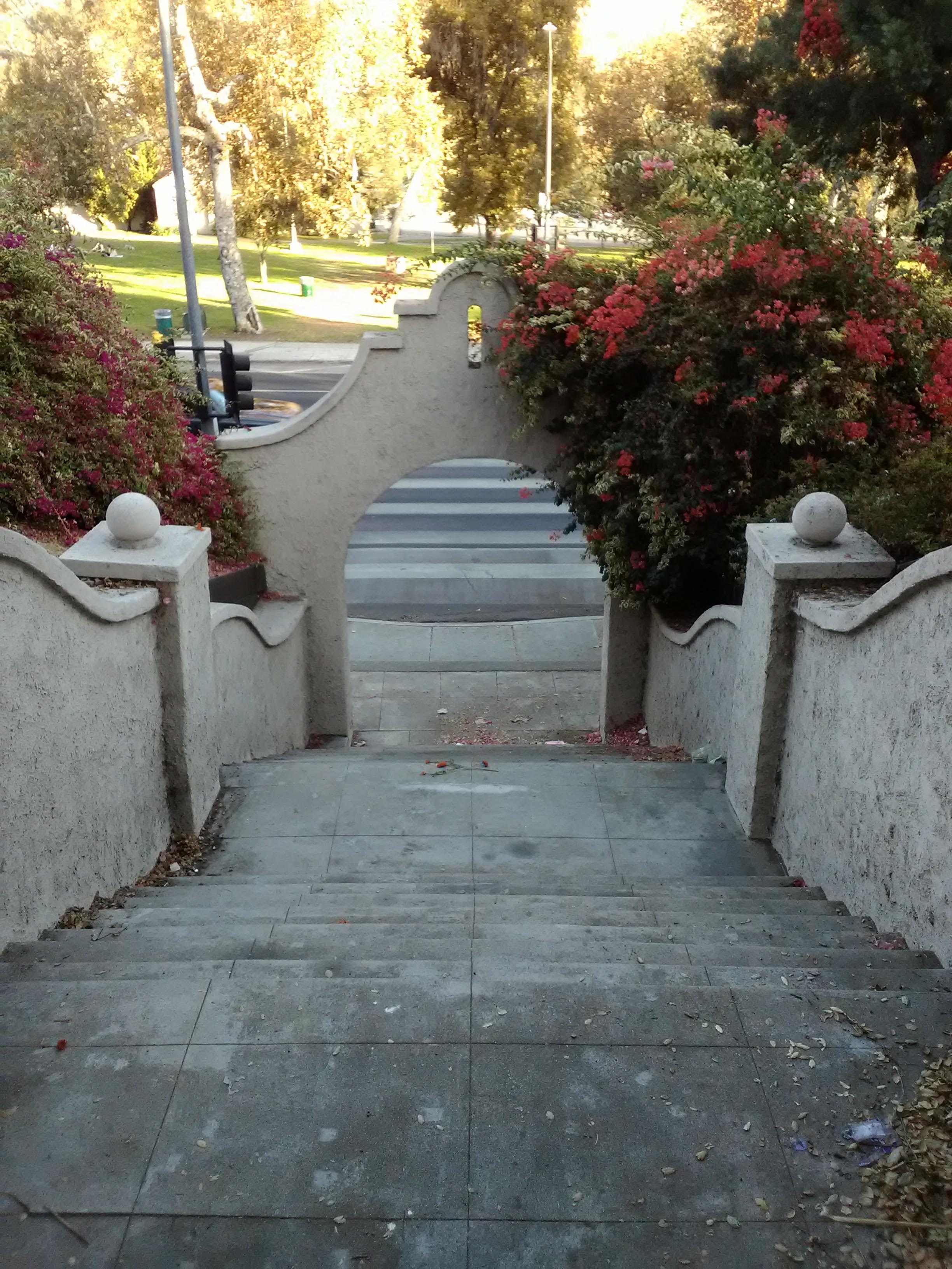
Continue along the pathway, under shady trees and past charming houses, until you reach a long stairway that lead to a Mission-style archway facing Figueroa. This is the Glenmary Archway, built to serve an old streetcar stop that once occupied this stretch of Figueroa. At the top of the stairs, a small alcove holds a statue of the Virgin Mary. Across the street sits Sycamore Grove Park, and a signalized crosswalk at the foot of the stairs allows you to safely cross busy Figueroa.
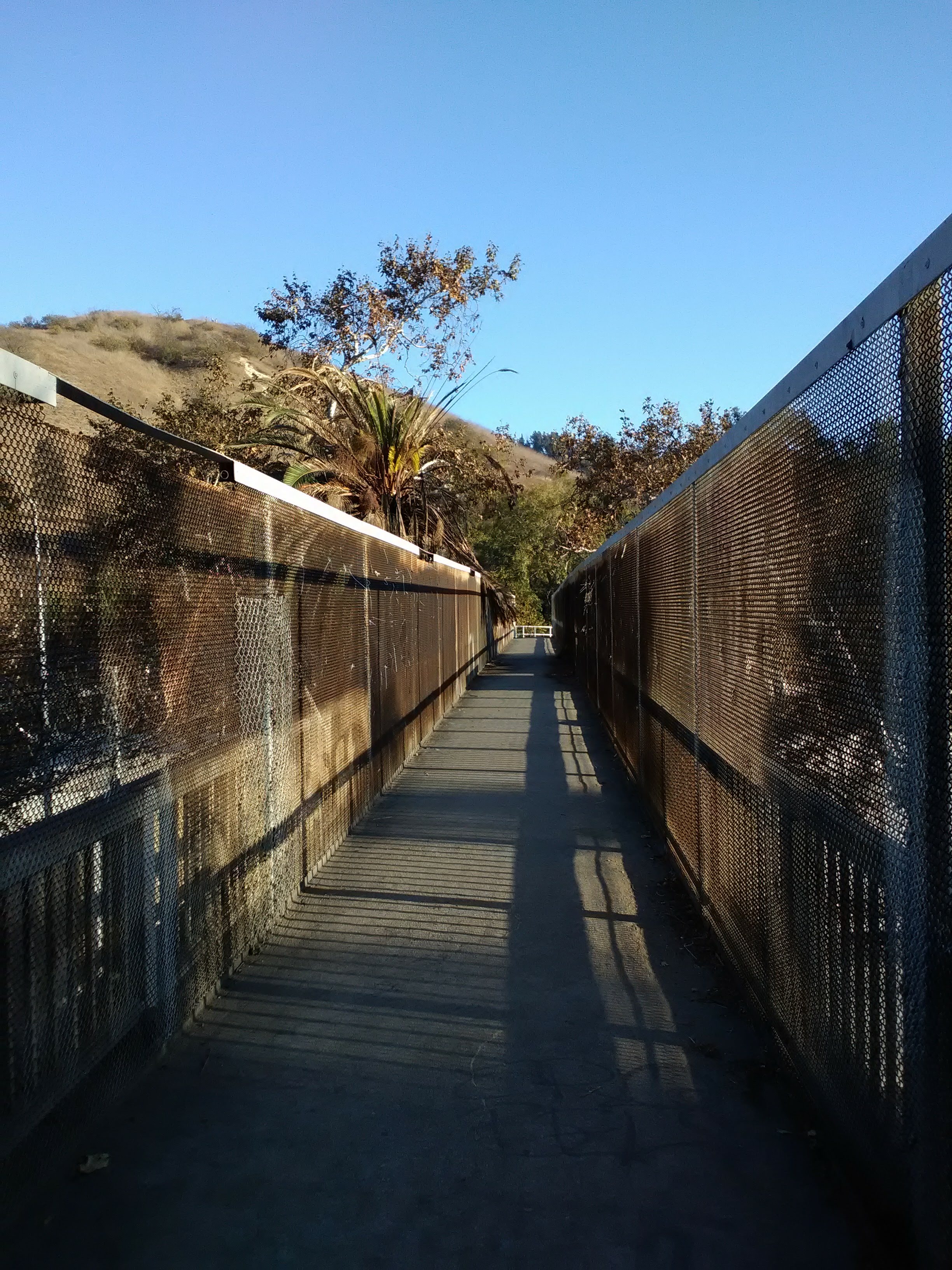
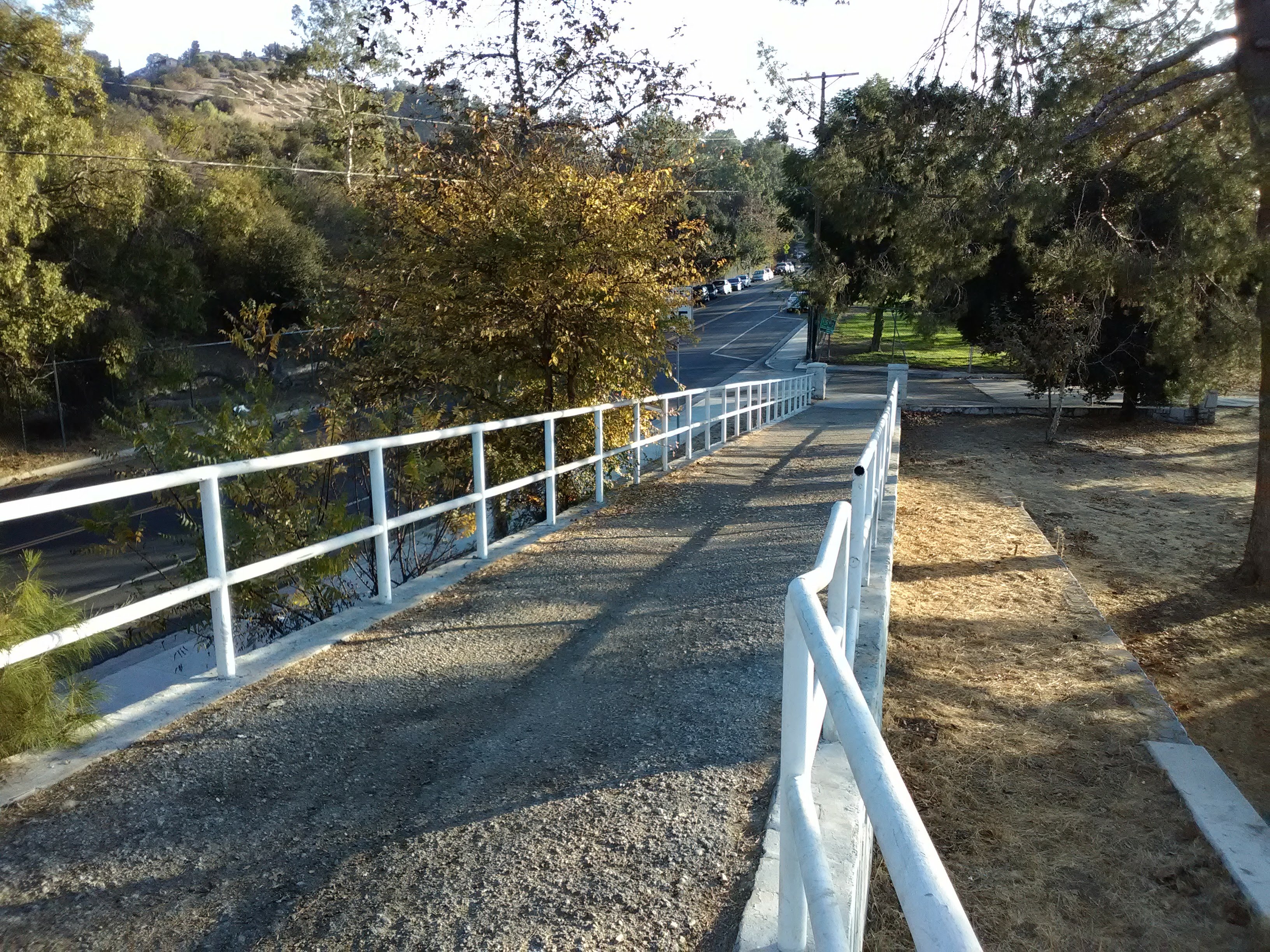
Sycamore Grove Park is one of the oldest parks in the city, dating back to the 1900s, and provides a green oasis for the surrounding neighborhoods. On the weekends you’ll often find families picnicking under the shady trees. From here, you can cross the Arroyo Seco Freeway to reach Debs Park. Just go behind the bandshell in the middle of the park and take the tunnel that leads to the pedestrian bridge over the freeway. The aging bridge, with its stained concrete and encroaching palm fronds, spans the freeway and the concrete channel of the Arroyo Seco. A trickle of water flows down the Arroyo year-round, with the occasional patch of grass or moss breaking through the concrete. You might also see some bicyclists riding on the path along the stream, heading up towards South Pasadena.


When you reach the other side of the bridge, continue straight up the street past the fenced-off park fields. After a little ways, you’ll come across the driveway to the Audubon Center at Debs Park, which is marked with a pedestrian crosswalk (although the traffic along this street is pretty light).

A dirt path parallels the driveway up the hill, eventually joining the road just before the driveway swings around to the right. From here you can continue straight on the trail up the hill or follow the driveway to the Audubon Center. If it’s open when you visit (currently it’s open Wednesdays-Mondays 8am-4pm), it’s definitely worth a stop.

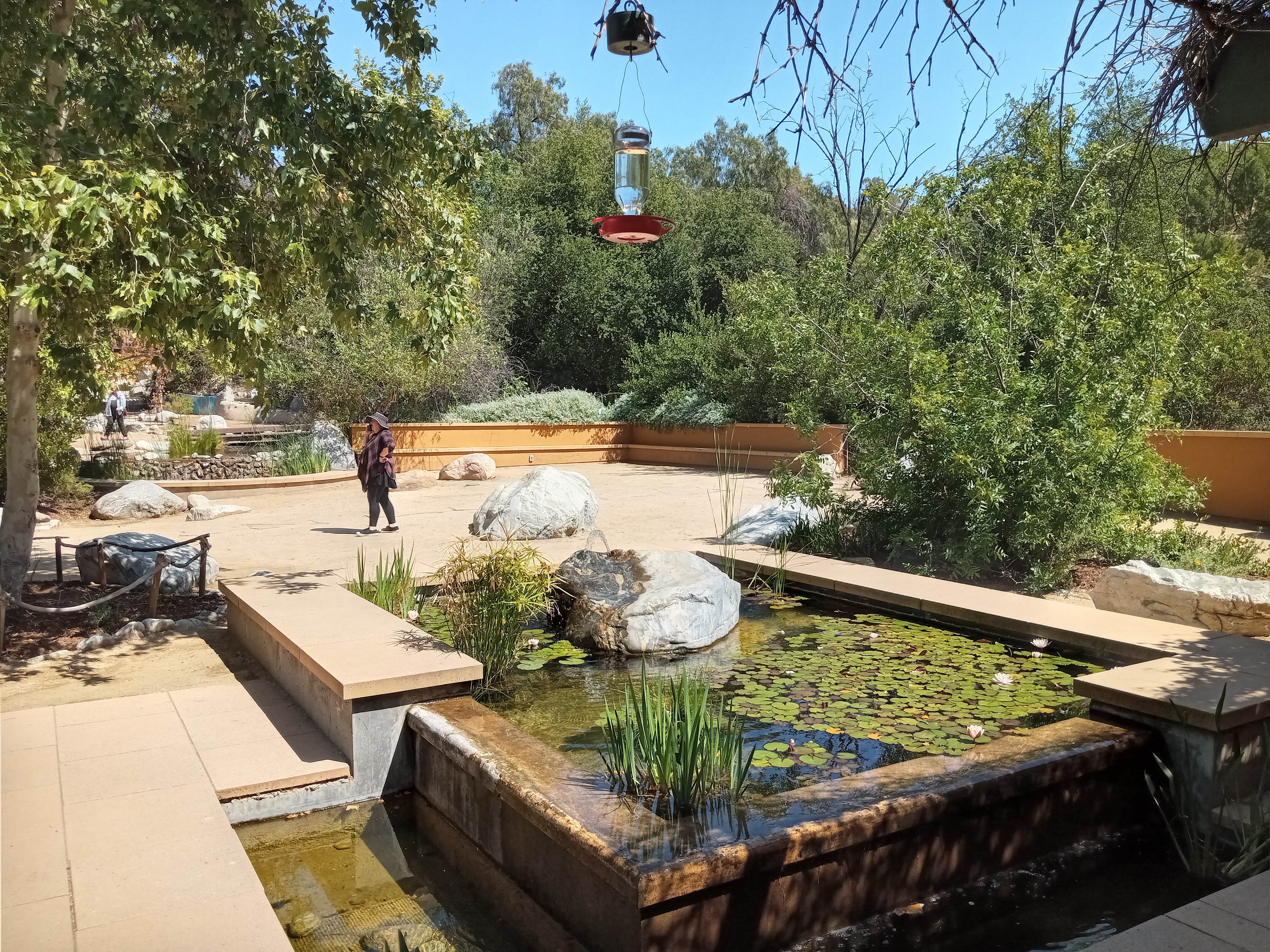
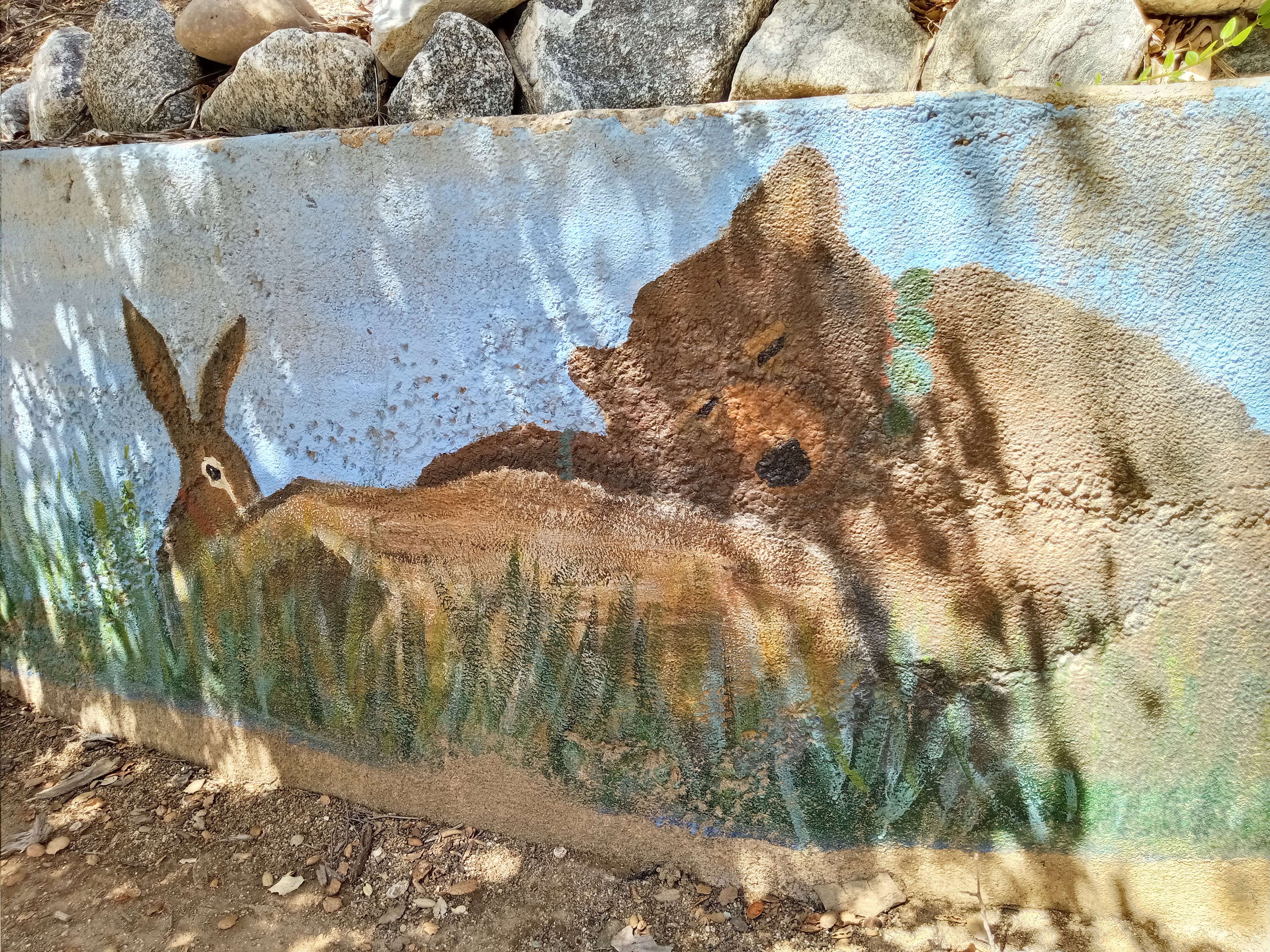
The Audubon Center is a lovely little nature center, which serves as a both an educational center on the local environment and a beautiful setting for community activities. The entrance is flanked by a classroom/community room on one side and an office on the other with info about Debs Park, some merchandise, a kid’s coloring table, and a snake in a little cage. Behind is a courtyard garden, with a lily pond fountain and a water stream, as well as restrooms and a water fountain. If you continue under the trellis past the stream, you’ll enter a little clearing with exhibits on local flora and fauna, as well as on the native Tongva people.

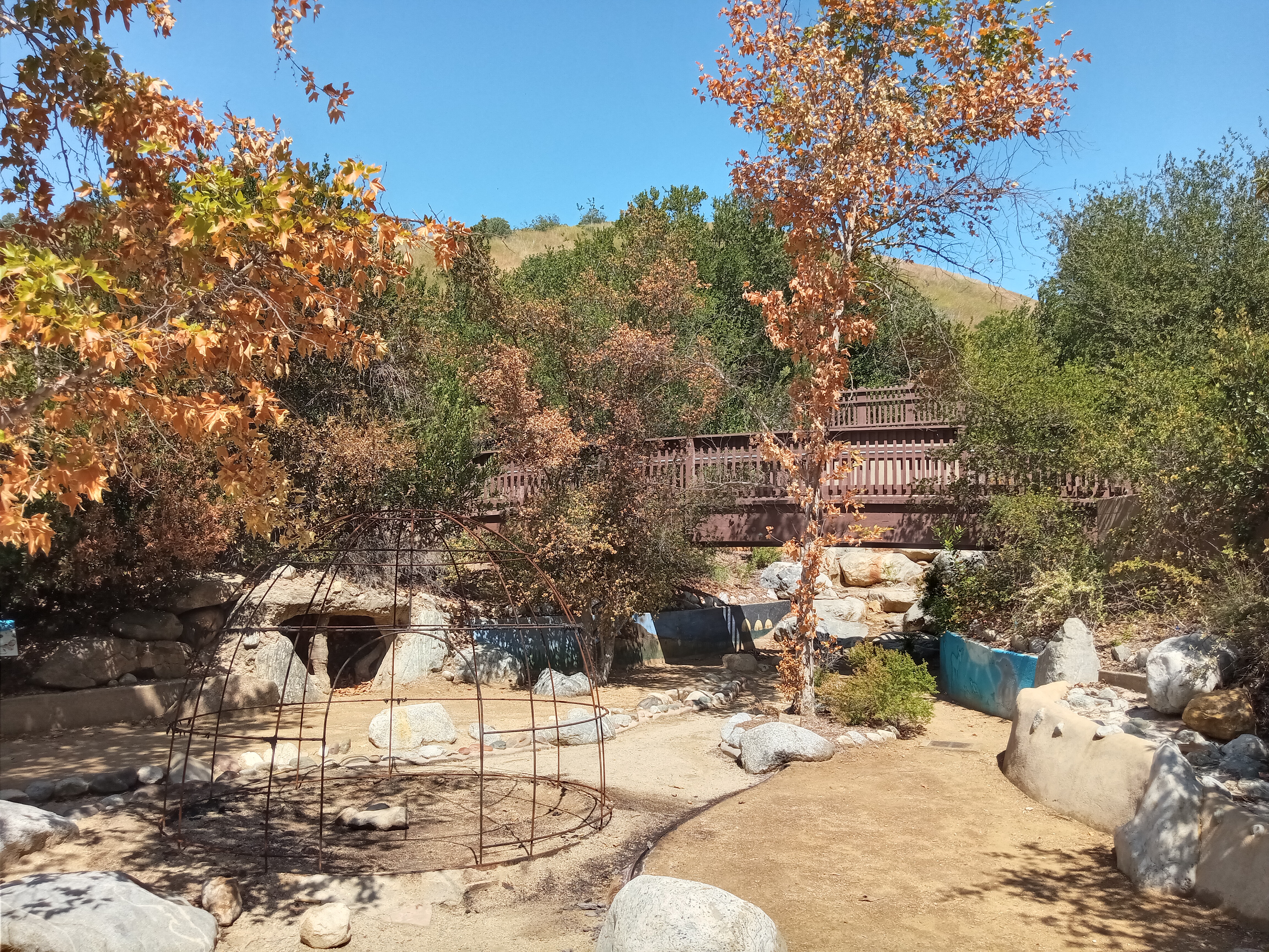
Continuing past this takes you to a little trail that loops a little ways up the hillside, passing some shady oak trees before reaching a little bird watching area where you can peer at some feeders through some conveniently carved holes in the fence.

When you’re done with the Audubon Center, return to where the driveway split off from the trail. From here, the path climbs the hill pretty quickly, offering a nice view of the Southwest Museum across the canyon and a spectacular vista of Highland Park and the San Gabriel Mountains to the north. The trail is a little steep, but nice and wide as it switchbacks up the hill—picture any of the main Griffith Park trails and you’ll have a good sense of what climbing this one is like.

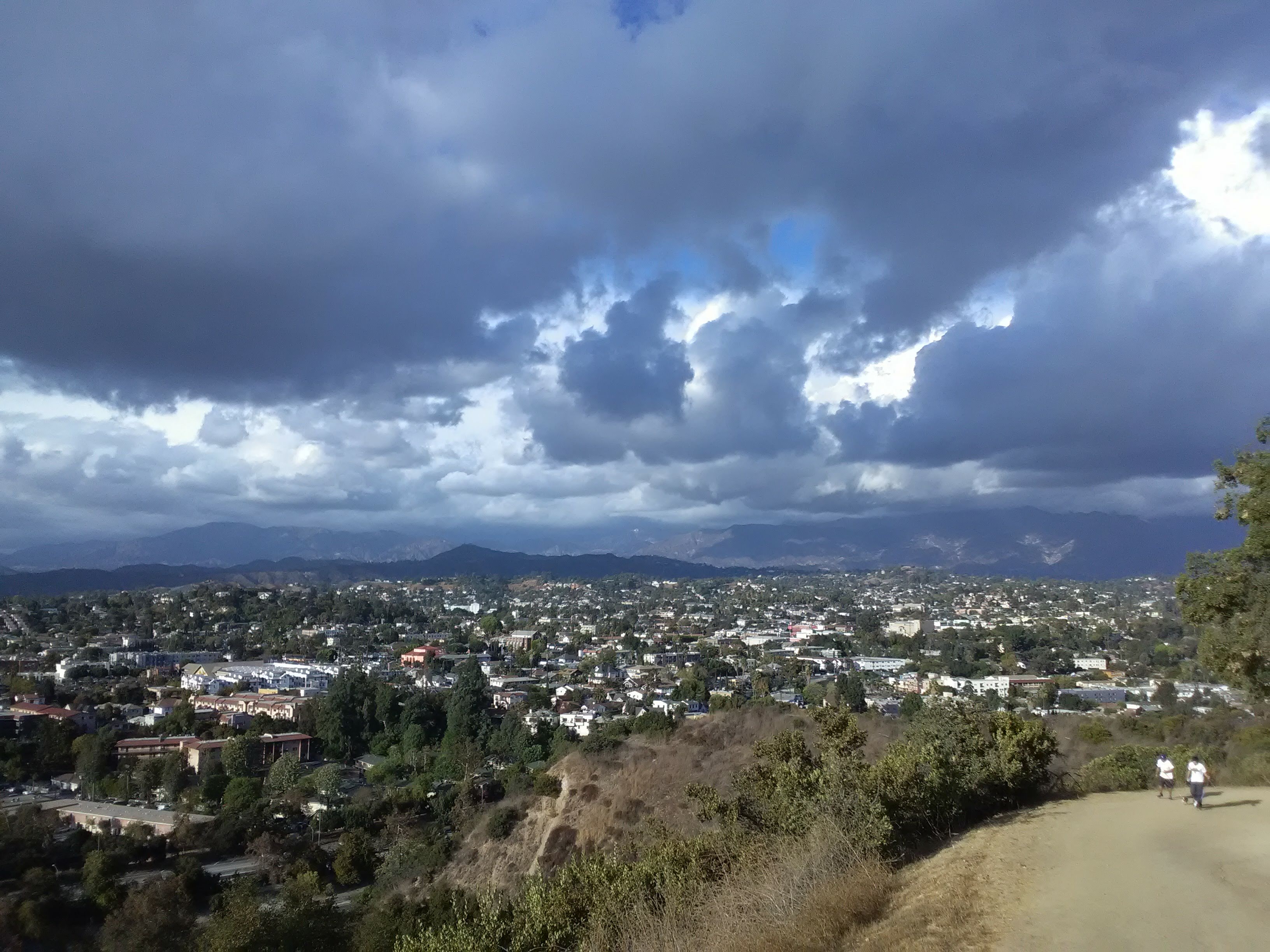
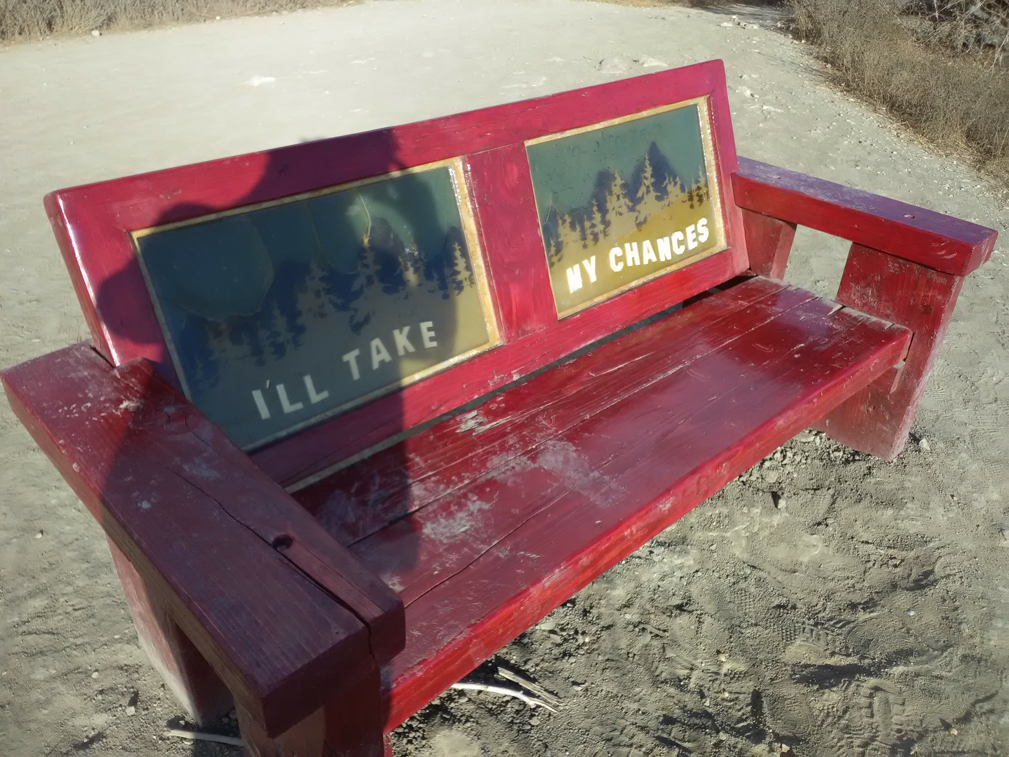
At the first major fork in the trail, take the right path to continue up to the top of the hill (unless you want to take the really long way around the north slope of the hill). Don’t bother with the weird little stairway ahead of you—it just leads to a steep wash that is a little hairy to climb (although some hikers clearly do). After a steep bit of trail, you’ll crest the ridge and immediately be presented with a gorgeous view of the Downtown skyline laid out before you. A pair of benches nearby allow you to take a breather and enjoy the incredible view.

From here, you have two options to continue to the very top. You can either take the straight, narrow path that follows the crest of the ridge, or you can take the nice wide, curving trail along the north side of the hill that dips a little before reaching the top. Either way, you’ll eventually reach a paved trail called the Summit Ridge Trail (although there aren’t a lot of signs to indicate this, but it is special by virtue of being the only paved trail in the park). A lot of Debs Park’s most interesting sights are along this trail.
At the northern end of the Summit Ridge Trail, the path loops around a small grove of trees which offer a wonderful view to the north. From here you can see the mountains, Pasadena, and even the skyline of Glendale on the other side of Eagle Rock. Highland Park is so far below you now that you can look down into its streets, watching the activity below. A little bit to the south is a large gazebo that serves as a picnic shelter, with a great view over Pasadena and the mountains.


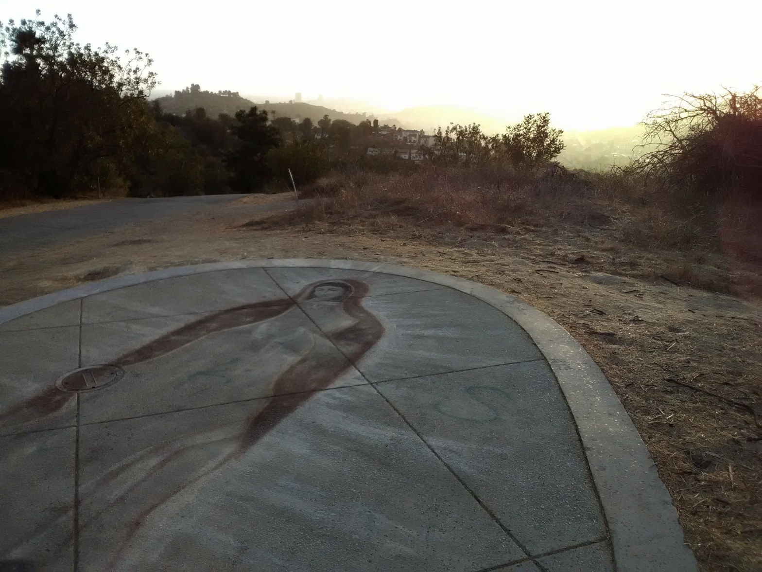
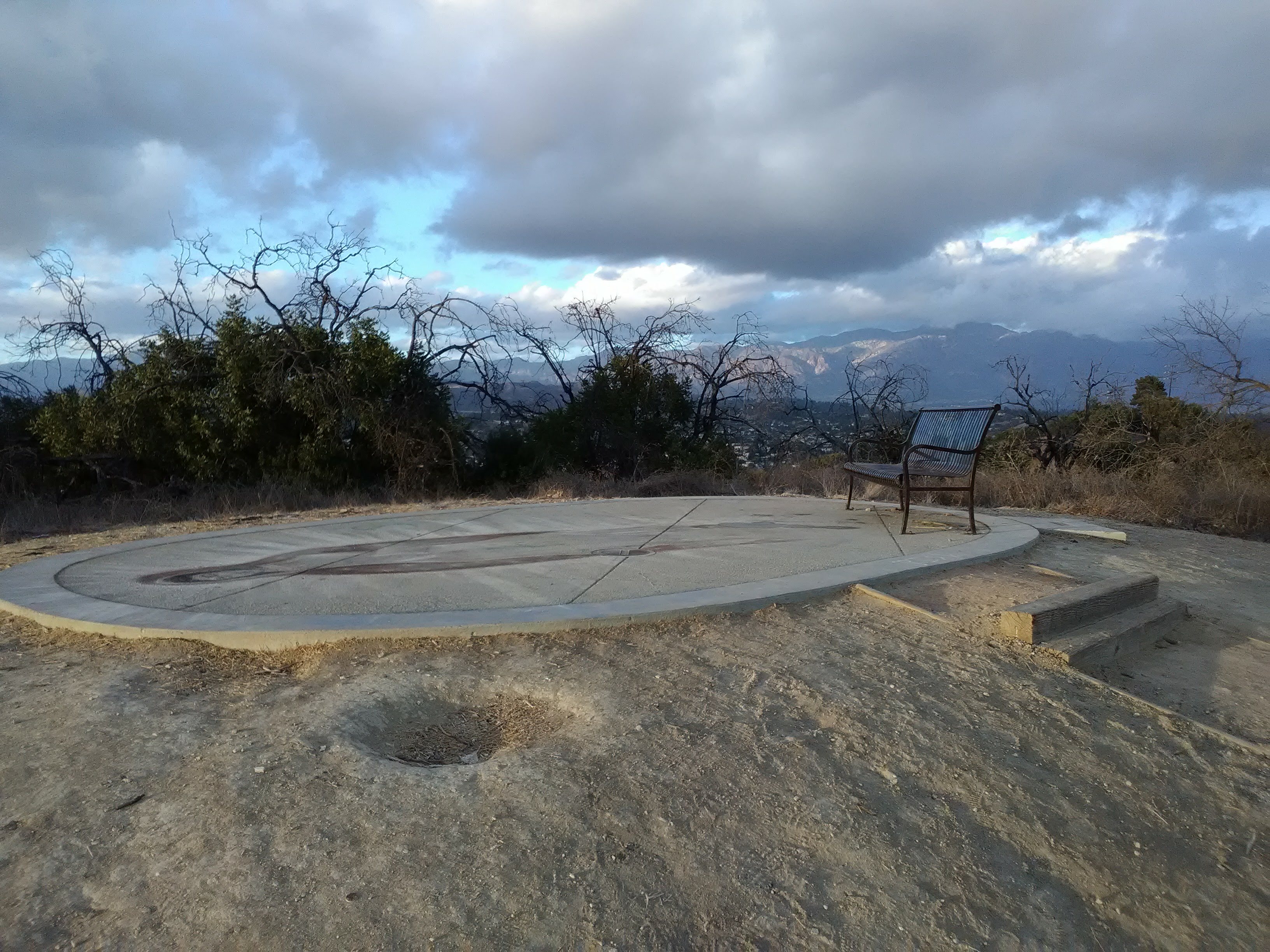
A little bit further to the south, at the true summit of Debs Park, sits a very unusual feature. An oval-shaped platform tops the summit, adorned with a simple bench facing south. And on its surface is painted a beautiful depiction of the Virgin Mary. When I first saw it, it was at sunset on the first day of rain LA had seen in months. As a golden glow engulfed the southern sky, rain drops began to gently fall on the summit as I gazed upon the Holy Mother’s image. No church could match that.

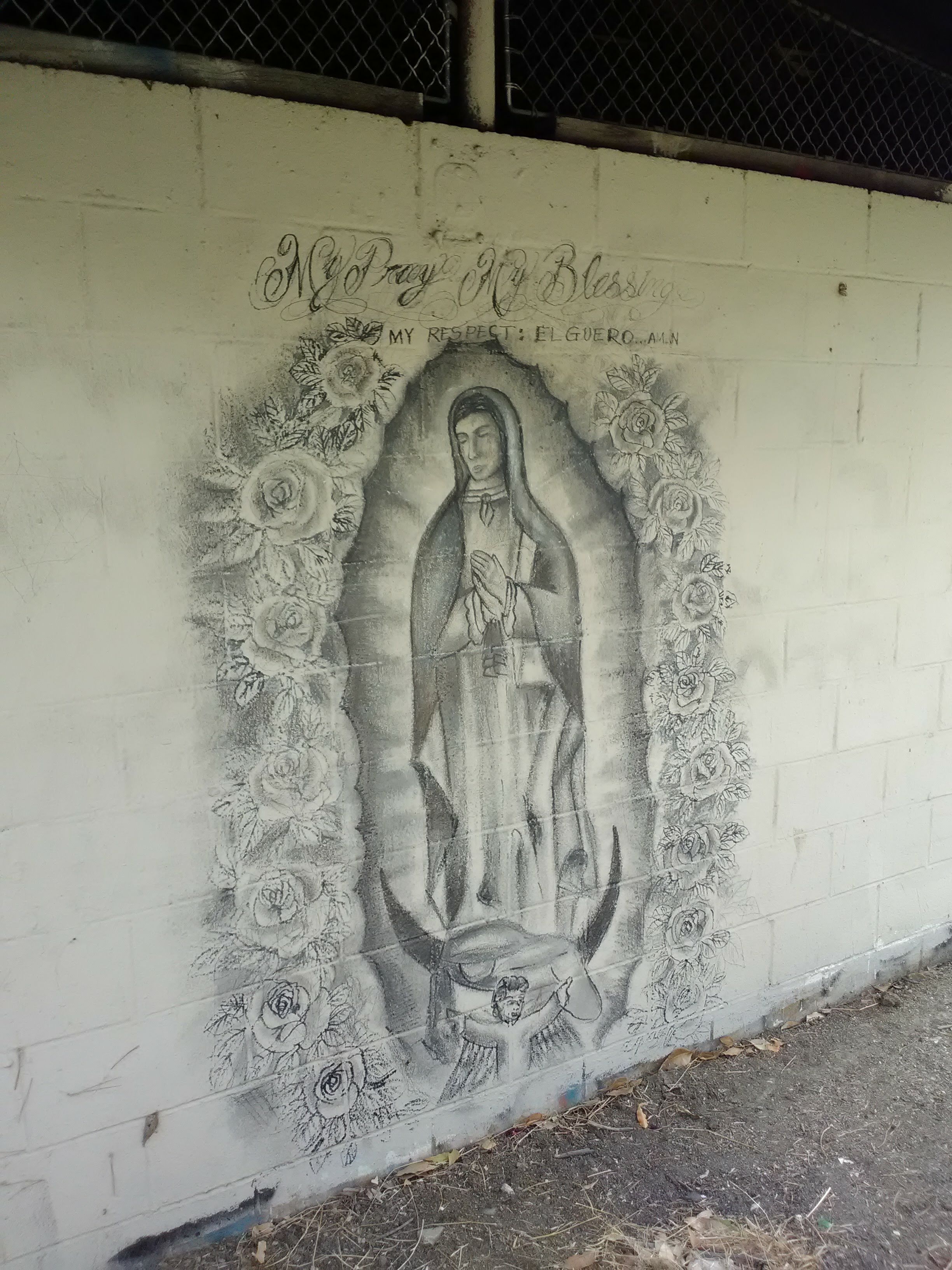
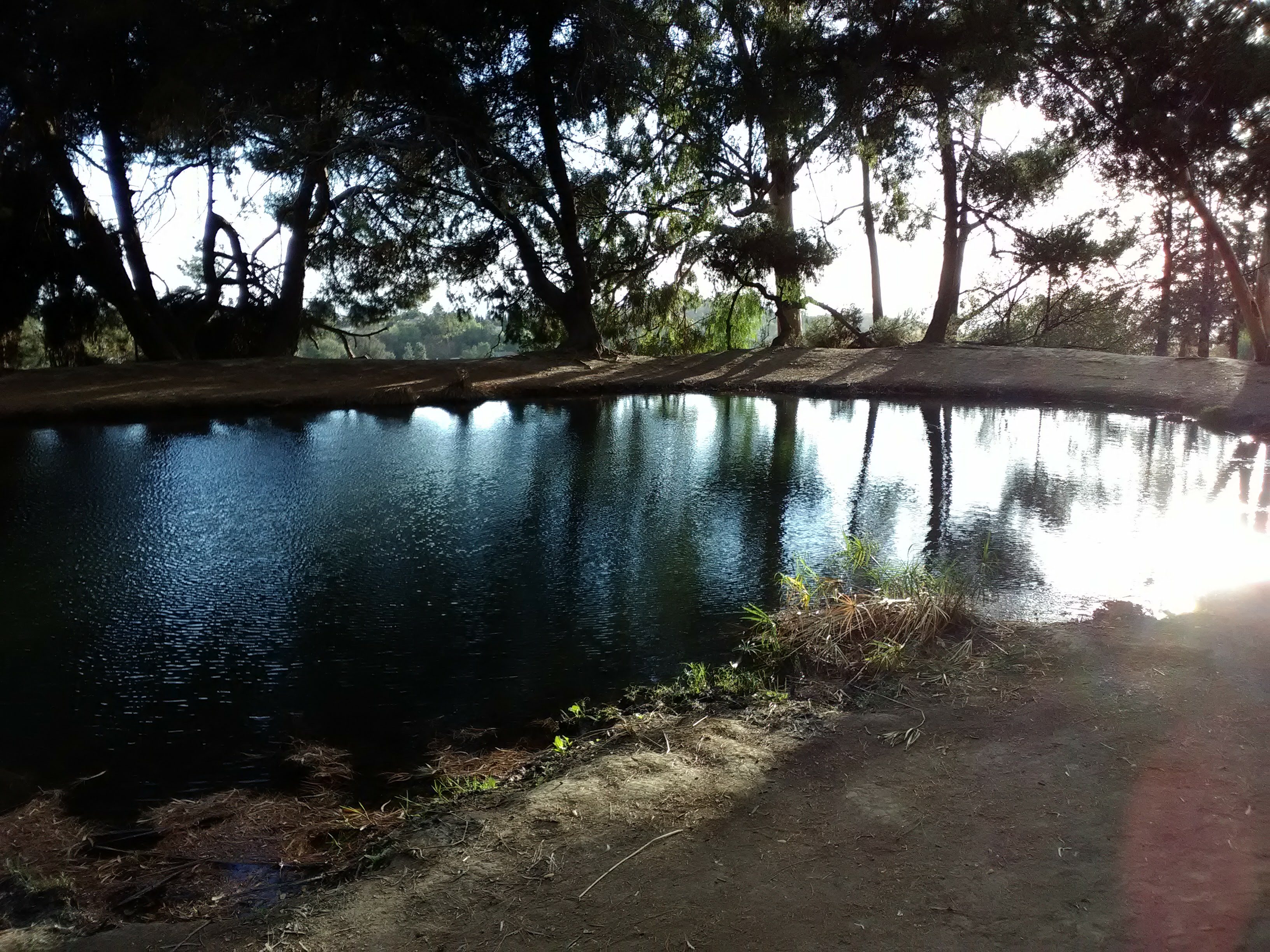
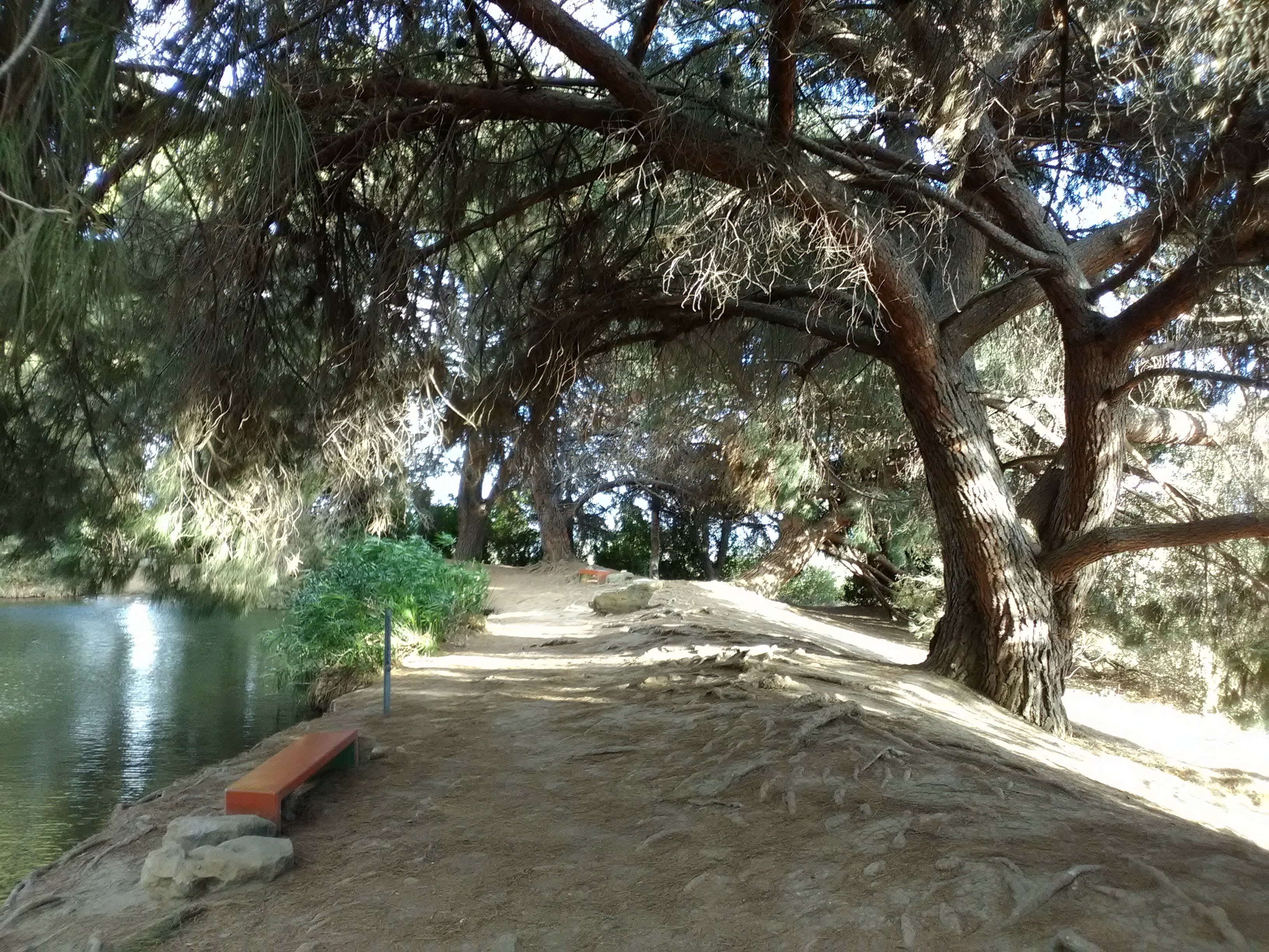
Another beautiful depiction of the Virgin Mary lies further down the path, adorning an abandoned set of park restrooms that have been closed up. Follow the path straight on into a grove of trees, and you’ll reach the highlight of Debs Park: the pond at the top of the park, encircled by a lush grove of pine and eucalyptus trees.


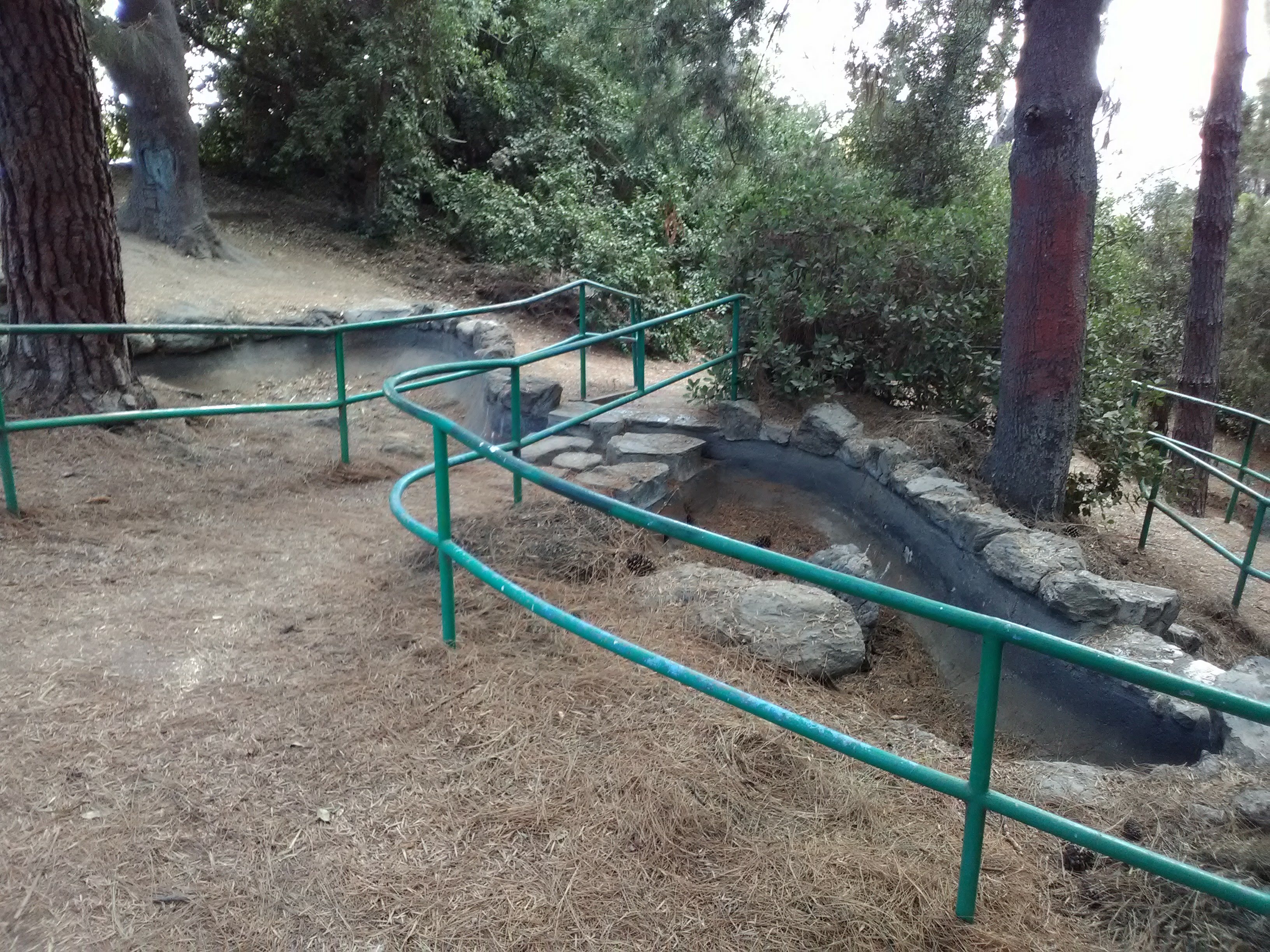
The pond isn’t a natural feature, it’s a reservoir fed by an underground pipe that was laid when the county built the park. The pond itself is very serene, with tall grasses growing on the banks and still water only disturbed by the wind. It’s easy to see to the bottom, where you can watch fish lazily circle through the water. On one side of the pond is a crumbling water feature that is now dry, but it looks like it once carried water through a set of small pond and waterfalls down the slope. I was surprised when I learned that Debs Park only dates back to the 1970s, because the water feature really captures the rustic Park Style of 1930s Civilian Conservation Corps projects.


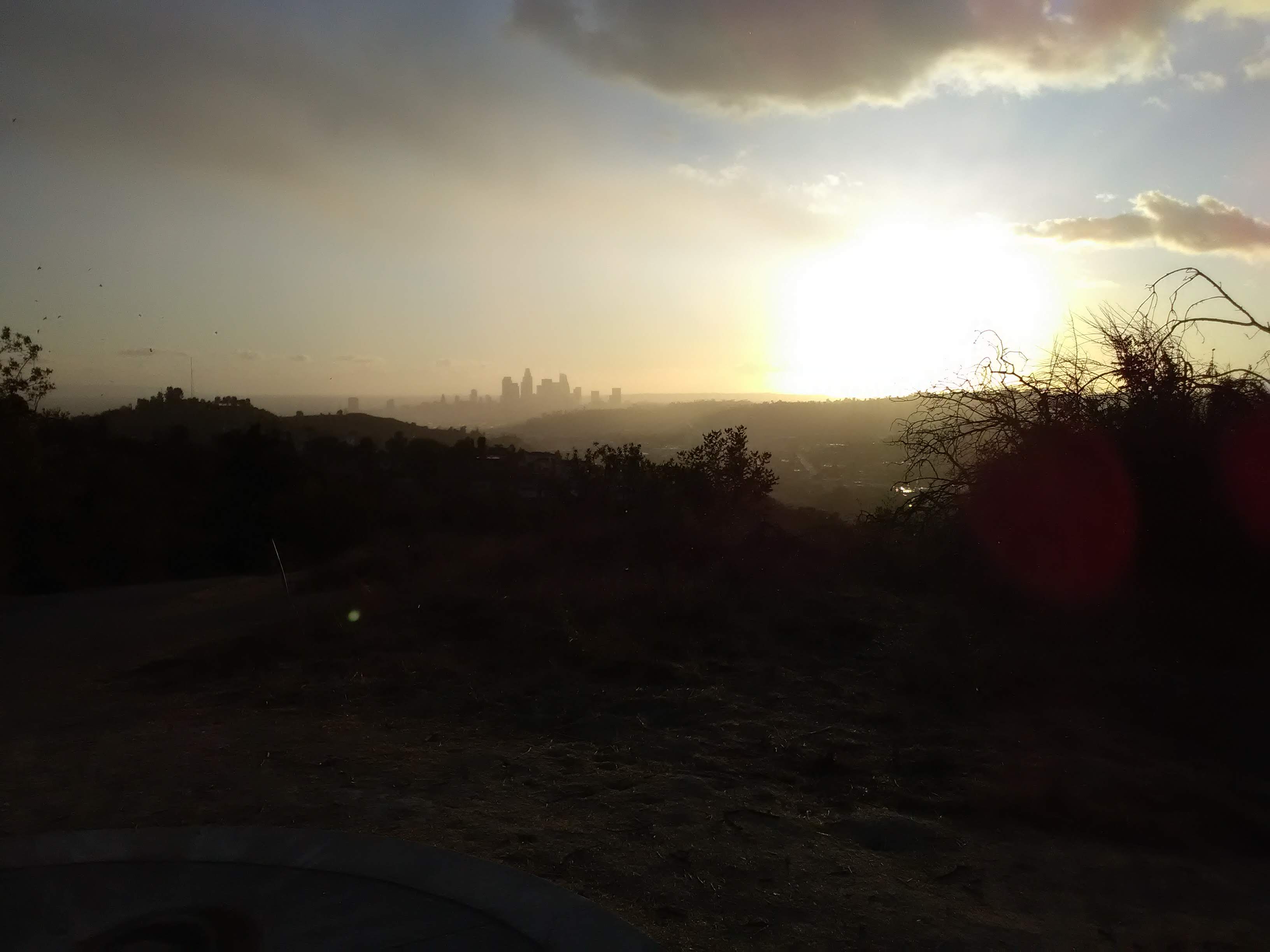
One end of the pond offers another great view of the Downtown skyline. On a clear day, you can see all the way to Palos Verdes. As you circle around, you’ll also get excellent views of the Eastside and the San Gabriel Valley, with Alhambra laid out below you. Through one gap in the hills, you can even just barely make out the skyline of Long Beach on a clear day.


The preservation of the open space that became Debs Park was largely an accident of history. Unlike Mt. Washington, various attempts to develop the hills through the early to mid-20th century fell apart. In the late 1940s, amidst a housing shortage after WWII, there was a proposal to turn the hills into a massive public housing complex with over 2,000 units. It was planned as an expansion of the Rose Hill Courts, a 100-unit public housing complex that still occupies a couple of blocks at the southern end of the park today. The project got so far along that 90 “shacks” (as described by a local newspaper) were cleared to make way for the project.


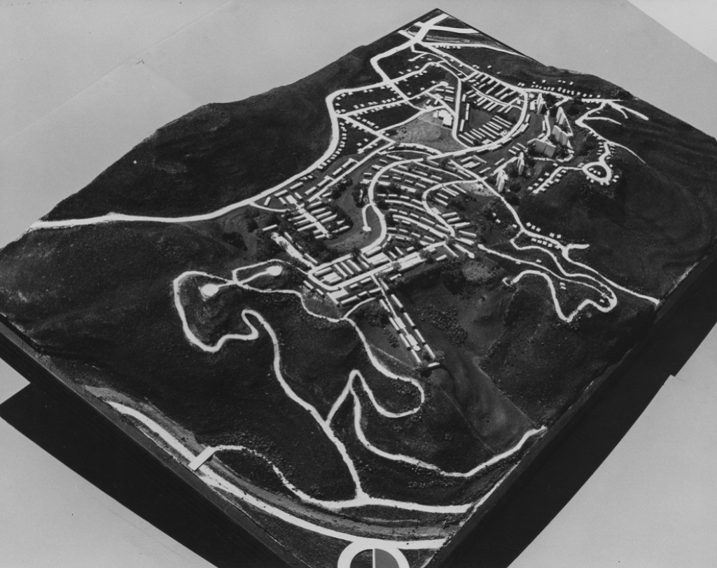
However, in a story familiar to anyone who knows the history of Chavez Ravine, the public housing project was attacked as “socialist” amidst the McCarthyism that engulfed the nation in the postwar years. In the early ’50s, the city abandoned the project, but they still had all the hilltop land they had acquired for it. One city councilmember suggested that the land could be used for a campus for Cal State University, which at the time was sharing a campus with Los Angeles City College and was seeking its own campus. However, Cal State opted for a chunk of state-owned land along the San Bernardino Freeway instead.
The land remained undeveloped open space until the late ’60s, when moves to turn it into a park began to take fruit. The city agreed to lease the land to the county for 25 years for development into a park, and the motion to create the park was made by county supervisor Ernest E. Debs (no relation to famed American socialist Eugene Debs), hence the park’s name. Debs was a major figure in Los Angeles politics, with an unbroken 32-year career in politics that covered stints in the state assembly, the city council, and the county board of supervisors. Despite his lengthy career, Debs governed as a conservative Democrat and has few major policy achievements credited to his name. He was a career politician, the kind that knew how to negotiate deals. His influence on the city is reflected in the role he played in a thousand decisions, both big and small, that collectively shaped the landscape of the city. The decision to name the park after him seems to have been a parting gift from his colleagues after Debs stepped down from the board of supervisors in 1974.
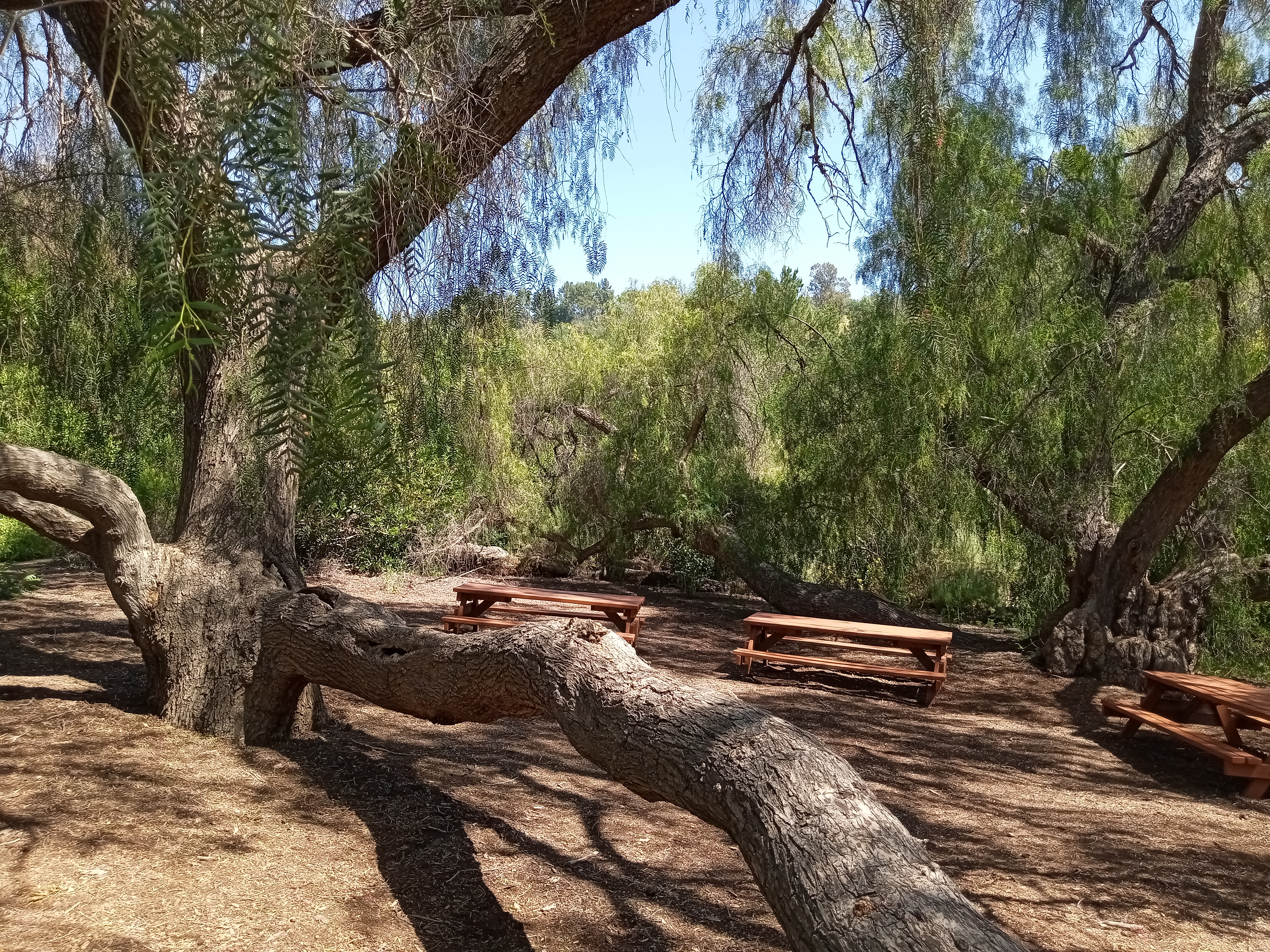
More of Debs Park lies to the south of the pond, but you’ve already seen the most spectacular stuff. From the pond, the trails lead downhill to the main parking lot for the park, which sits next to a nice big picnic area situated in a pleasant meadow. Returning to Southwest Museum station is a simple matter of retracing your steps back down, and if you time it right you can enjoy a beautiful sunset on the way back.


2 thoughts on “Climbing to the Top of Debs Park”