Los Angeles has a lot of wonderful places to walk, including scenic public stairways throughout the city’s older, hilly neighborhoods. Silver Lake is probably the most famous for these stairways, with those in Los Feliz and above Hollywood also pretty well-known.
But less well-known are the wonderful stairways of the city’s northeast side. The walks are tranquil, the views are great, the neighborhoods are a little more down-to-earth, and in the case of Mount Washington, incredibly easy to access by transit. One of the stairways is literally right across the street from a Metro rail station, which makes it the perfect place to start.
We’ve broken our itinerary down into two parts. The first is a nice short loop of the most scenic stairways, which clocks in at just under a mile if all you want is a nice relaxing neighborhood walk. The second part is a more strenuous climb to the top of Mt. Washington, which you can do on its own or treat as an extension to the first part, which adds about two miles to the hike.

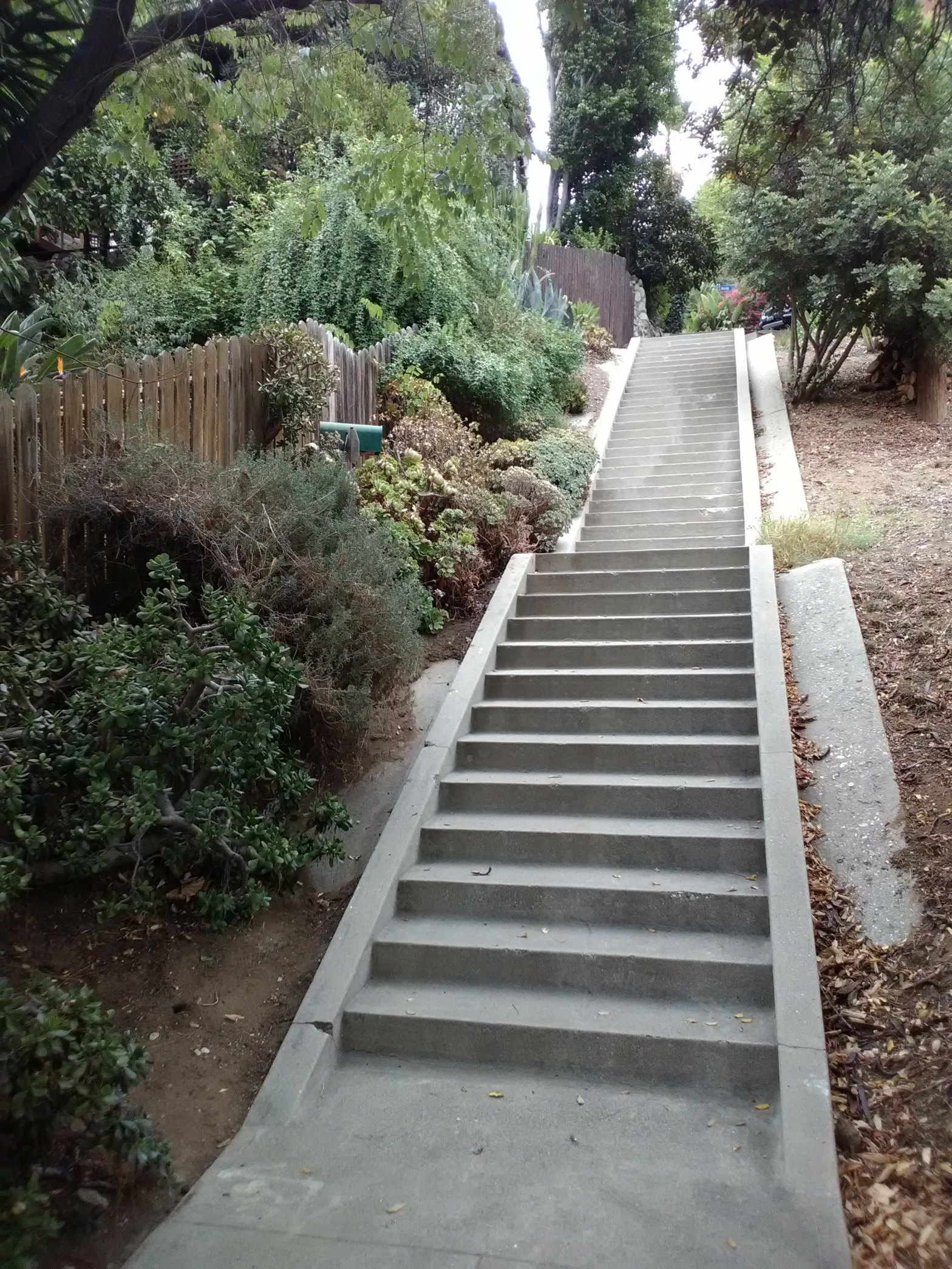
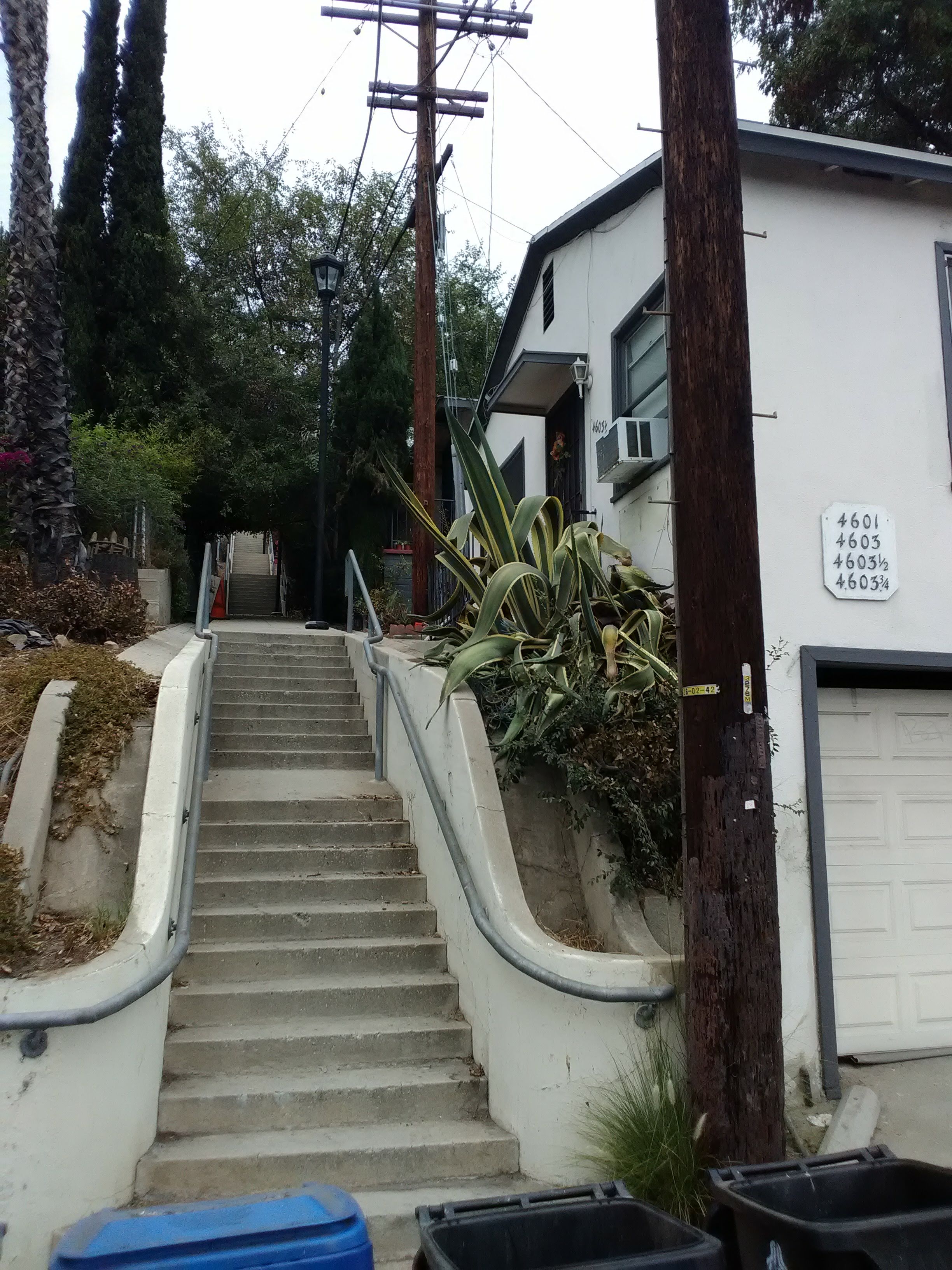
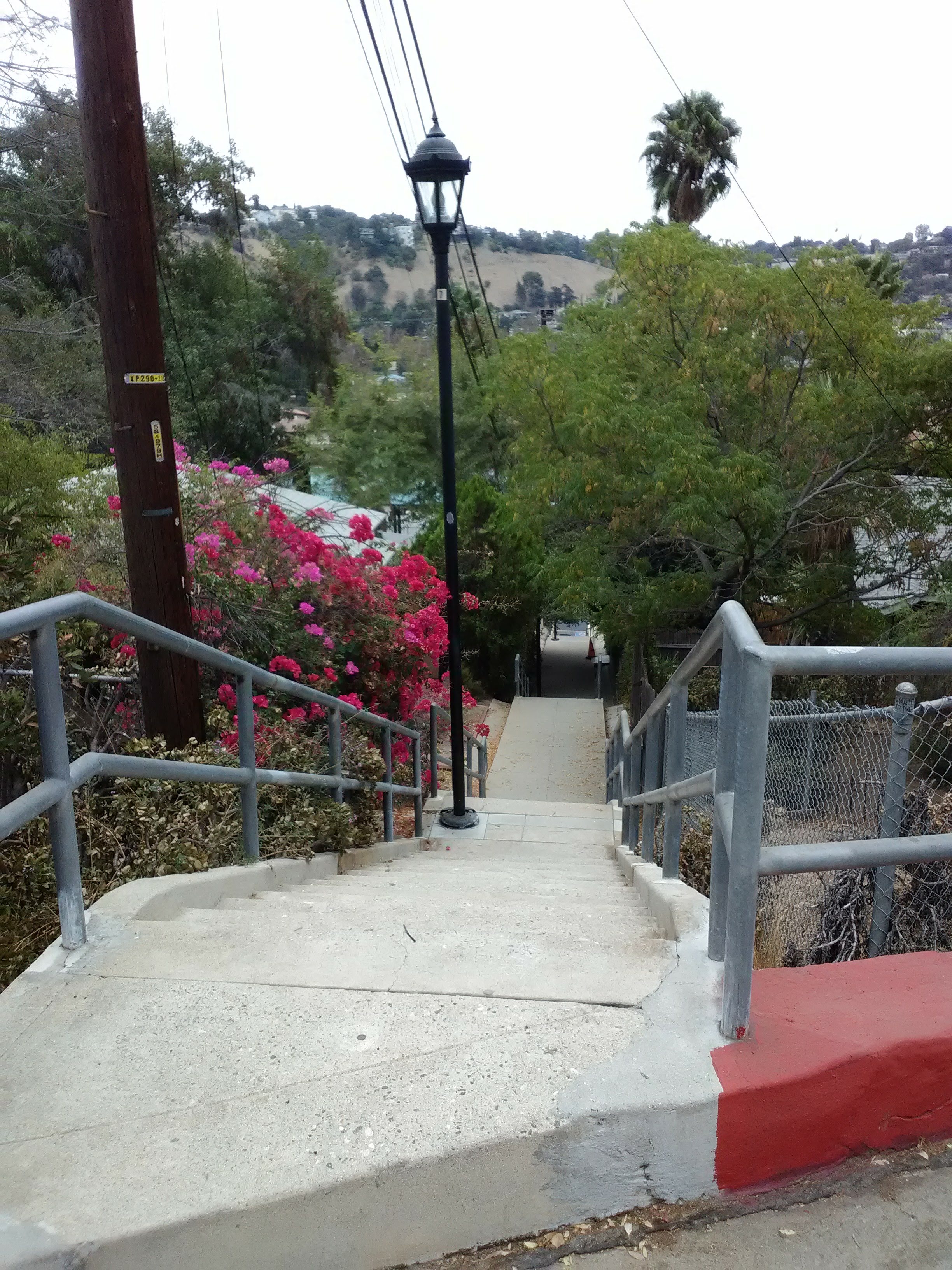
Starting at the Southwest Museum station on the A Line (formerly the Gold Line), you can actually see the first staircase from the platform. Just across the street from the station, next to 4601 Marmion Way, is a lovely and clearly visible stairway that promptly takes you up the hill into the neighborhood. This first stairway is nice and shady, passing some little apartments and houses with some long but steep landings between the steps. This stairway is also the best maintained of the ones you’ll encounter on this walk, with sturdy railings and street lanterns.
At the top of the stairs you’ll reach Glenalbyn Drive. Like most of the streets in this neighborhood, there are no sidewalks. However, traffic is light enough that this isn’t really much of a problem. Turn right and continue uphill, around the bend. You’ll ascend pretty quickly, passing some houses that use spectacular use of the terrain. Those on your left will have balconies perched high above you, while those on your right will be hovering above the steep hillside that drops off towards Museum Drive. You can catch glimpses of the Southwest Museum on the hill across, above the steep, private stairways that run between the houses.
As Glenalbyn straightens out, you’ll reach the intersection with Starling Way, which is overshadowed by a massive retaining wall. Across the street from the retaining wall, you can see a street sign for Starling listing over and half-buried in a flower bush. Make a sharp left and head uphill on Starling.


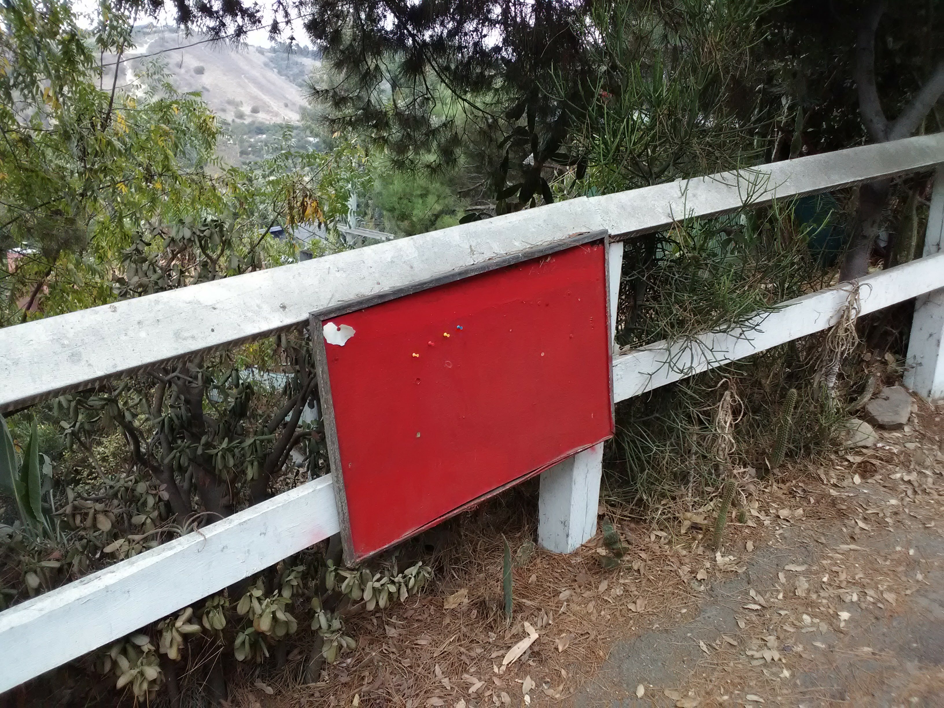
Starling Way is quite steep and ascends the hill quickly. As you climb, you’ll get a nice view of the Southwest Museum campus on your left, with a short wood-post fence serving as the barrier. As the street reaches the top, you’ll see a corkboard mounted to the fence which serves as a community bulletin board for the small collection of houses at the top.

As you reach the houses at the top of the street, you want to take the very first stairway on your right. This is important, because this particular spot can be confusing. Another, more visible stairway (this one private) sits just past the first one. Also, Google Maps has the location of the public stairway incorrectly labeled, showing it to be much further down Starling Way than it actually is. Again, take the first stairway on your right, with the wooden railing.


This stairway is the roughest along this walk. At the top of the concrete stairs, you’ll see a worn dirt path running along a wooden fence. At this point you might start to worry that you’re entering a private yard. But fret not: it is a public walkway, so carry on. The path will continue past a bare slope and turn to the right, where it leads you to an old wooden staircase made of railroad ties.
At the top of the steps, you’ll emerge onto Mavis Drive, another quiet residential street. Turn left and follow it around the bend. Mavis is lined with more modernist houses, as well as a lot of flowering bushes towering over the street. After you walk up the street a little ways, you’ll reach the top of the Clermont Staircase on your left, the only named stairway on this walk. You’ll want to keep your eye out, because the top of the stairway isn’t very well-marked. It’s located immediately after a carport on your left, across the street from a long and very dense hedge. Technically there is a street sign marking the staircase, but it’s so obscured by the hedge across the street that you can be excused for missing it.


The Clermont Staircase is by far the longest stairway you’ll encounter on this walk. In fact, it technically qualifies as a city street, with addresses along the way. Walking down is a delight, taking you under shady trees and past picturesque houses and gardens, with lovely views across the canyon and out to Lincoln Heights. There are also plenty of long, flat landings on the way down, making it a fairly leisurely walk.

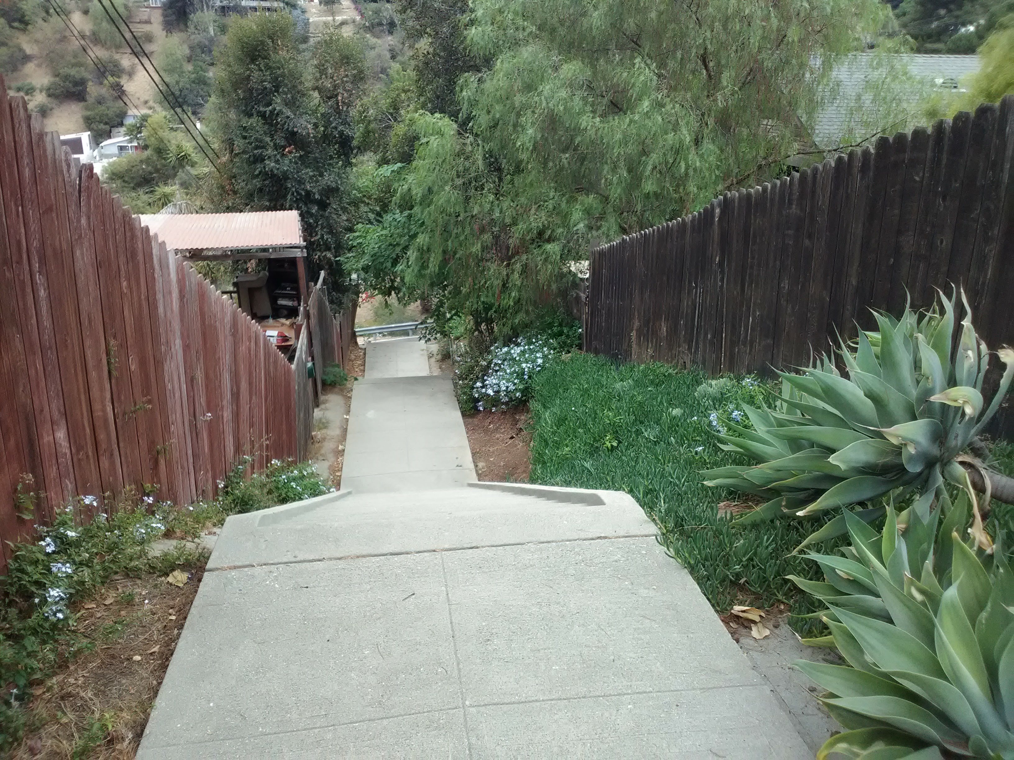
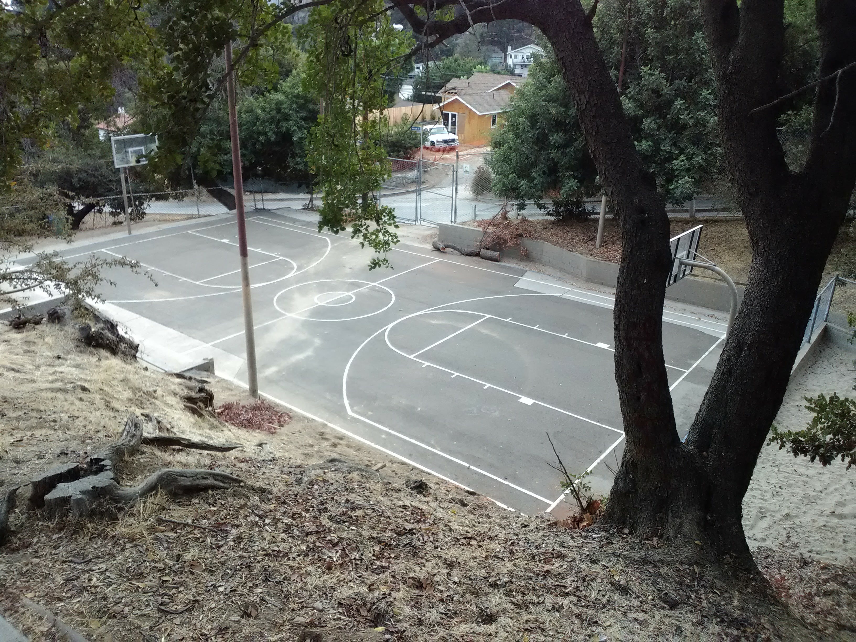
At the bottom of the staircase, you’ll be deposited on Canon Crest Avenue, a narrow and curving residential street that marks the eastern side of a steep gully between Canon Crest and Ave 45. It may not look like it at first glance, but the gully is technically a park, managed as part of the city’s Carlin G. Smith Recreation Center. However, the actual rec center is uphill at the top of the gully. Here, there’s just a worn path running along the bottom, and a short staircase just uphill from the base of the Clermont Staircase.


From here, it’s a simple matter of walking downhill back to Marmion Way. Canon Crest ends at Ave 45 at the base of the gully. Continue downhill on Ave 45, which gains sidewalks about a block before you reach Marmion Way. At the stoplight with Marmion, make a left around the corner, past the hilly abandoned lot with the crumbling staircases, and you’ll be across the street from the A Line tracks. The Southwest Museum station will be visible just up the street.
Walk 2: Climbing to the Top
This part involves a much steeper climb and covers much more ground, taking you all the way to the top of Mt. Washington. We’ve written it as a separate walk starting from the Southwest Museum station, but you can easily treat it as a part two to the first walk, starting either from Marmion Way and Ave 45 and following the directions below, or turning right from the base of the Clermont Staircase and following these steps in reverse.
From the Southwest Museum station, cross the street and walk down Marmion towards Downtown, crossing the stoplight at Ave 45 and continuing for another block until you reach Ave 43. This site once served as the base of the Los Angeles and Mount Washington Railway, a cable car modeled after Angels Flight that ran from 1909 to 1919, taking passengers up to the luxurious Mount Washington Hotel at the summit. The walk you’re about to take is actually going to follow the route of the old cable car up Ave 43. Although the tracks have been paved over, there is one noticeable remnant of the railway: the station at the bottom still stands and is still recognizable, even though it has long since been converted into housing.


Walk up Ave 43. It must be noted that this is a very steep street, and makes for a somewhat grueling climb. The steepest section is the second block, after Glenalbyn Drive, which looms above you as you approach it. But at least there’s a staircase afterwards. As Ave 43 swerves to the right, a stairway continues uphill from the left side of the street. This is a fairly long staircase with a lot of landings, and if you turn around you’ll get a good view over the canyon. You’re still following the path of the old railway; here, the hill was simply too steep to pave it over with a road.


At the top of the stairway, you’ll be at the base of Canyon Vista Drive, a wide, steep street that continues uphill along the path of the old railway. This is one of the few streets on Mt. Washington that doesn’t offer much in the way of shade, so keep this in mind if it’s hot out. Several blocks up the hill—and it will feel like more, on account of how steep the street is—Canyon Vista will finally curve to the left and end at a fork in the road.
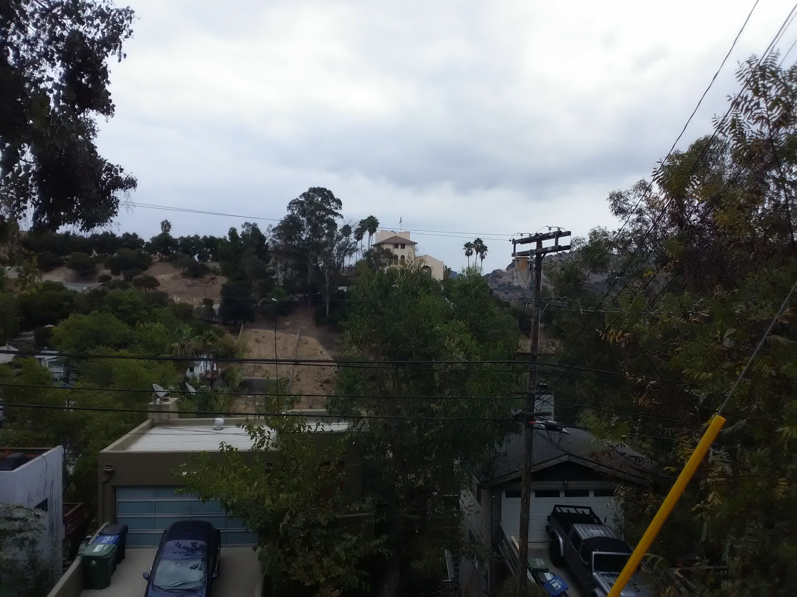
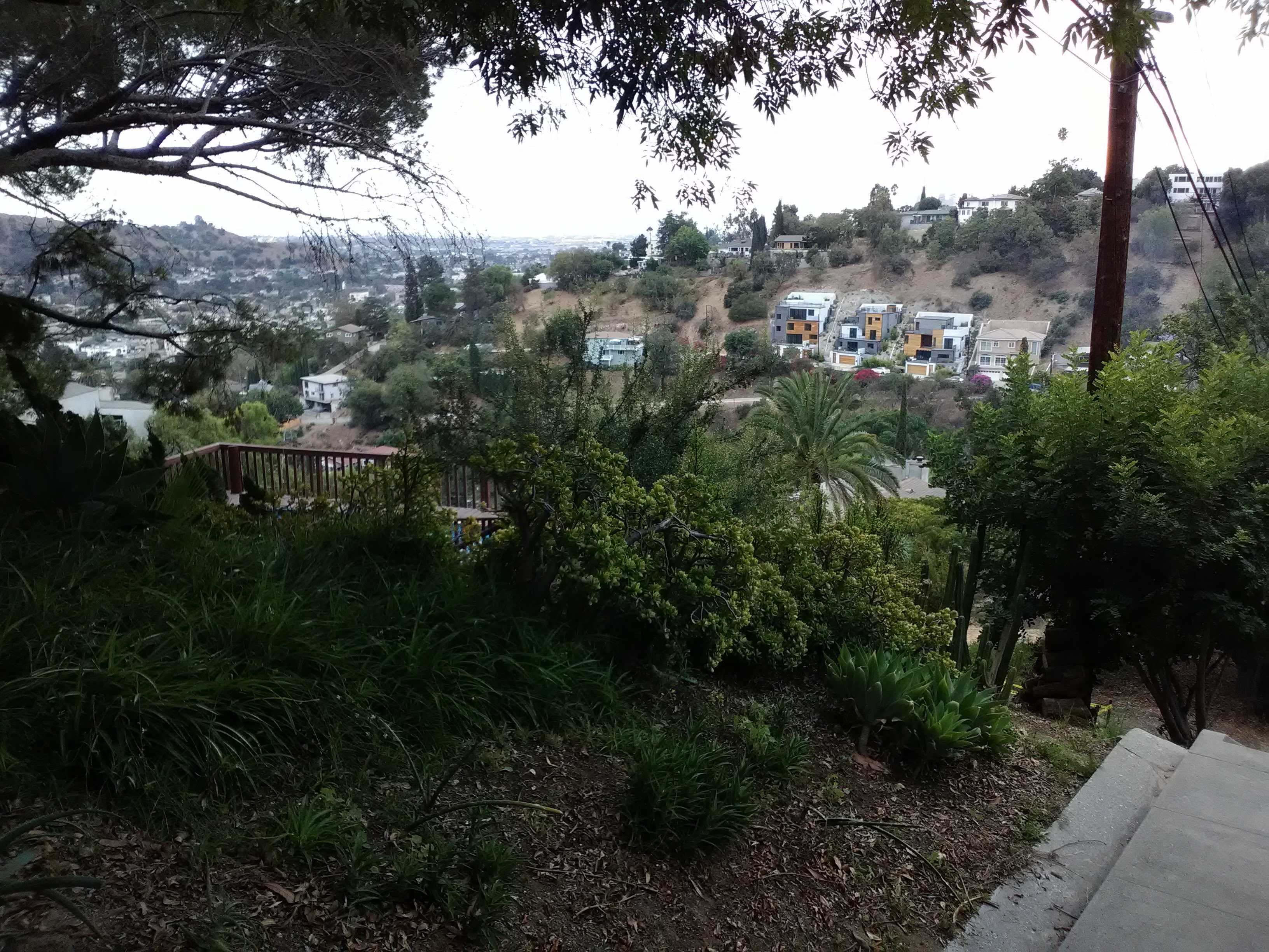
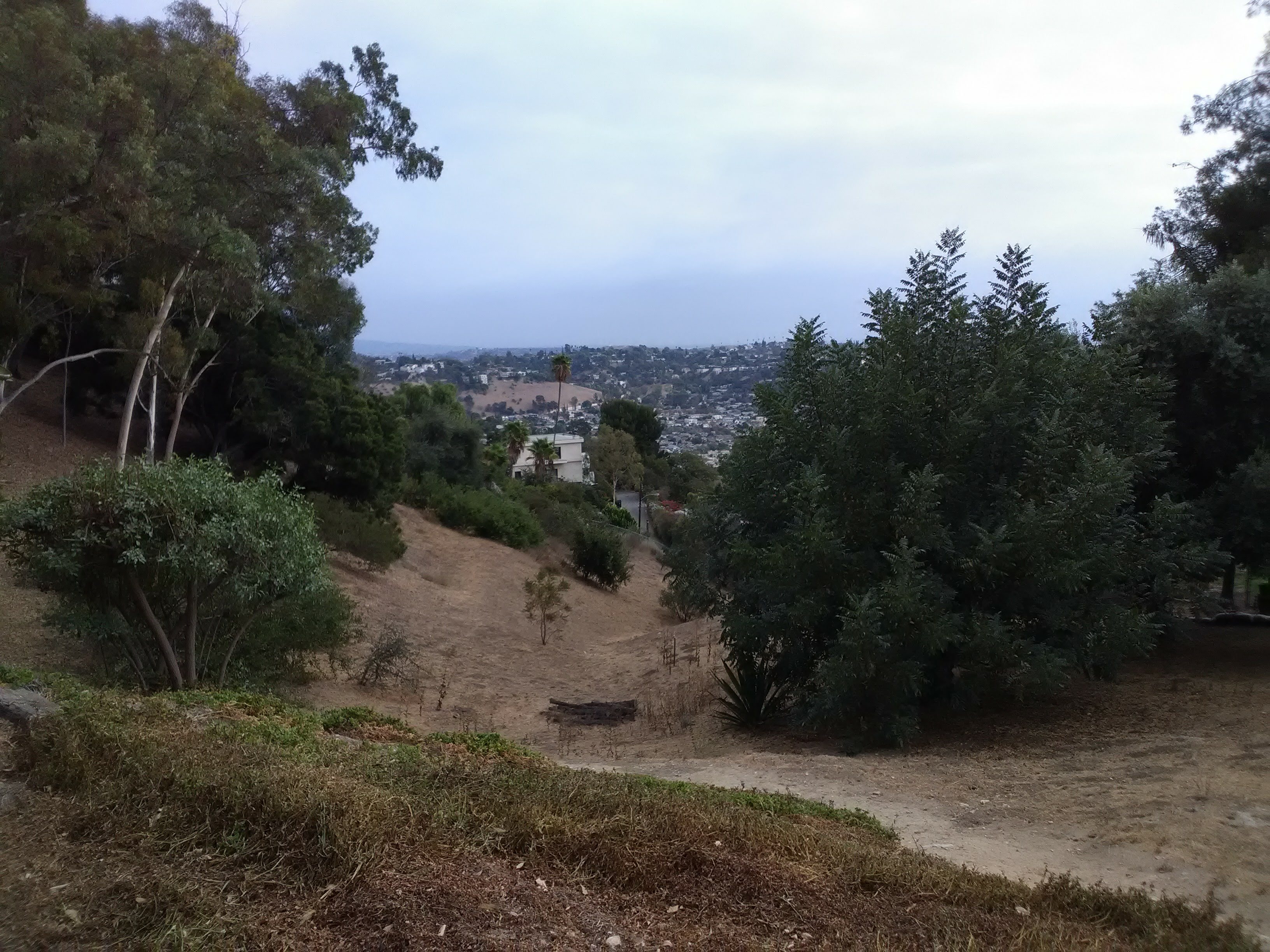
Take the right fork (the one continuing uphill) and you’ll be on Mt. Washington Drive, a winding road that curves its way up the mountain from Cypress Park. A protected sidewalk runs along the left side of the street, with a wood-post fence separating you from the traffic. Here, you’ll get the best views of any spot along the walk: the southern face of the hill is laid out before you, where you can trace the road snaking its way up the slope. In the distance, you can clearly see the downtown skyline poking out above the hill. And on a clear day, you can see all the way to Catalina Island. Even during the dry season, the slope next to the road maintains some greenery, but during the wet season these hills are lush with green and feel more akin to a Northern California landscape.


After bending along the hill several times, Mt. Washington Drive intersects San Rafael Avenue. Make a right and walk along the fence until you reach the entry gate to the Self-Realization Fellowship. The Fellowship has multiple temples and retreats throughout California, but this one, built on the grounds of the former Mount Washington Hotel, has served as the headquarters of the organization since 1925.
Above the gate you’ll see a depiction of the Fellowship’s founder, Paramahansa Yogananda. Yogananda was an Indian guru and monk who was one of the first to find success in the West, coming to the United States in the 1920s and gaining thousands of followers. Indeed, he was one of the first to introduce Yoga to the West, although “Yoga” in this context refers not to the exercise routine, but the broader set of spiritual practices based in Hindu beliefs. When Yogananda arrived in Los Angeles, he acquired the then-abandoned Mount Washington Hotel and converted it into a mountaintop monastery.

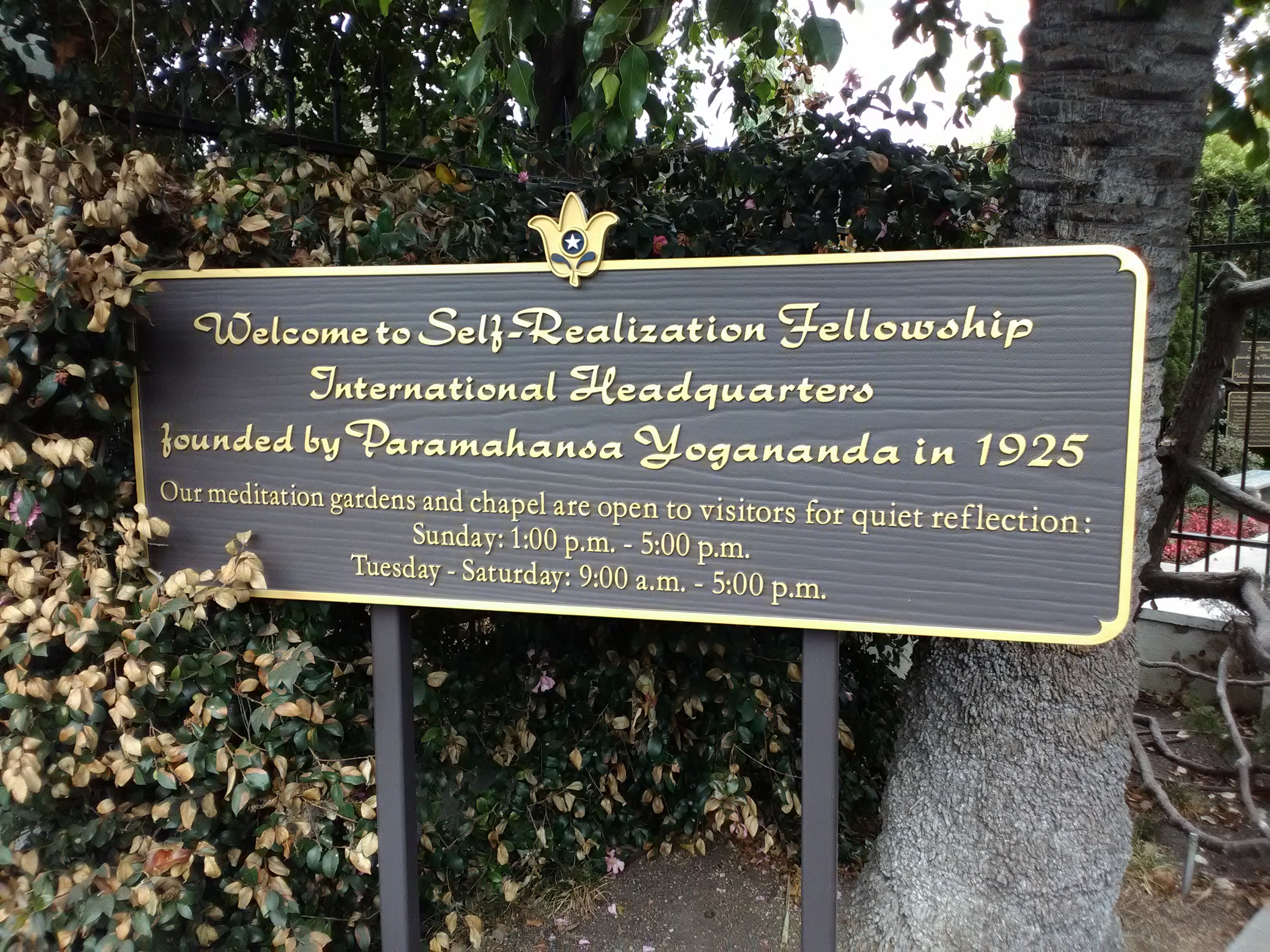
Although it’s gated, the Fellowship is open to the public during limited hours. Past the gate is a little gift shop and a shrine, and down a long, tree-lined driveway is the original hotel building, now used as offices. Down one side of the driveway is a lawn, the former tennis court, and a small meditation garden in the back corner. When it’s open, you’ll often see neighbors taking a stroll through the grounds.
That being said, we’re not huge fans of the visiting experience. Most of the grounds are off-limits (it is a monastery, after all), the garden is rather disappointingly small, and while the views are nice, they’re no less spectacular than what you just saw walking up Mt. Washington Drive. What’s more, each person we passed seemed to be staring quite intently at us as we walked by, which lent a weirdly passive-aggressive feeling to the whole experience. On the other hand, there is a public restroom behind the gift shop and plenty of places to sit, which are in short supply along this walk. So while we don’t enthusiastically recommend a visit, I can’t bring myself to advise against it.
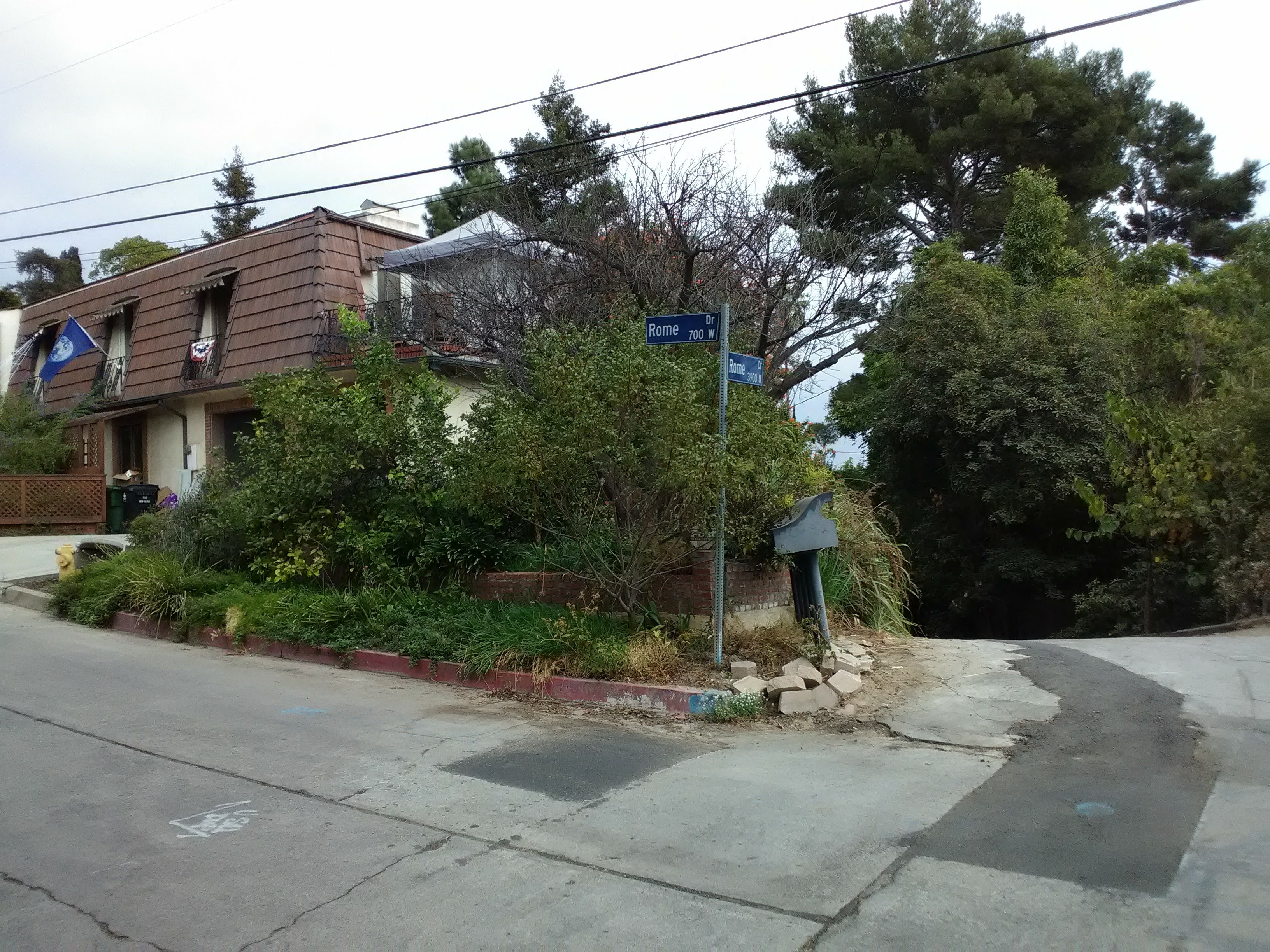
Returning to San Rafael Avenue, continue along the fence and make a right at the next street, Rome Drive. This will take you along the back of the Fellowship, and actually provide a better view of the old hotel building than what you get within the grounds proper. After a block, Rome Drive will swerve sharply to the left, while Rome Court splits off and dead-ends a short ways down the hill. Stick to Rome Drive. Between the houses, you’ll get some nice long views down the hill back towards your starting point.
After a brief ascent, Rome Drive turns sharply to the right and becomes Ave 46. Why it undergoes the name change is unclear, because they’re effectively the same street, but c’est la vie. Where they intersect, a short cul-de-sac splits off to your left, with a radio tower visible just past the end, marking the summit of Mount Washington.
Ave 46 runs along the ridge of the hill, giving you views both of the downtown skyline to your right and the San Gabriel Mountains to your left, catching glimpses between the houses. And speaking of the houses, the ones lining this street are unusually colorful, coming in a wide array of styles. The houses of Mt. Washington are generally charming, but the denizens of Ave 46 seem to be extra willing to call attention to their residences.


And after a short bend, something else will come into view. Ave 46 points you directly back to the Southwest Museum, with its iconic tower visible straight ahead down the street. If you needed any kind of assurance that you were being led in the right direction, I can’t think of a better sight than that.
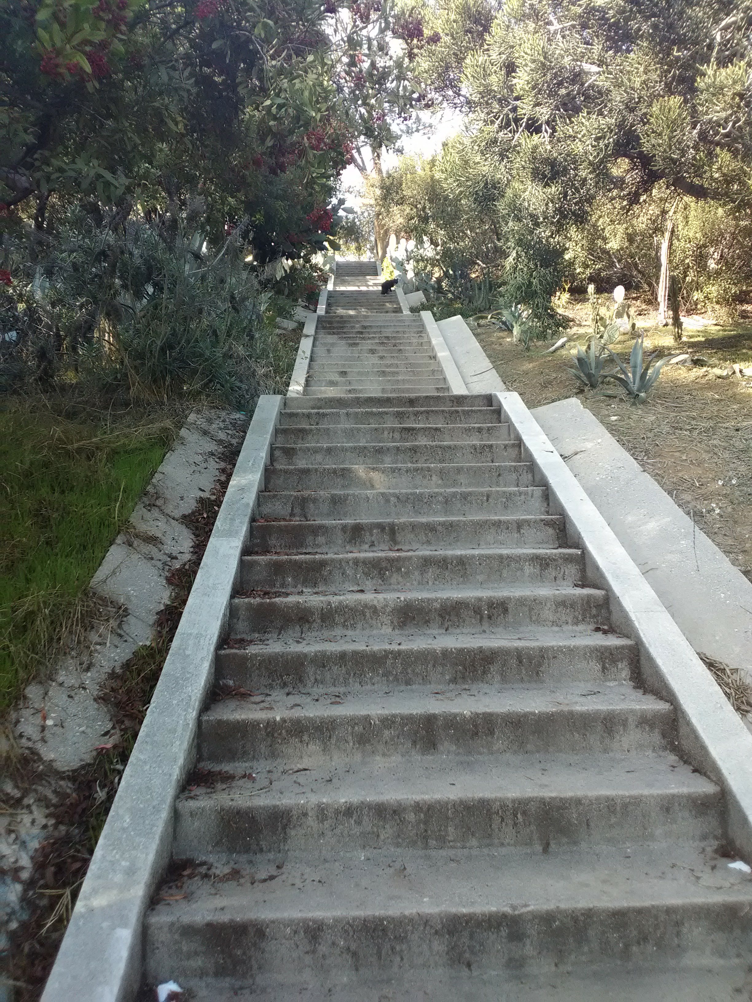
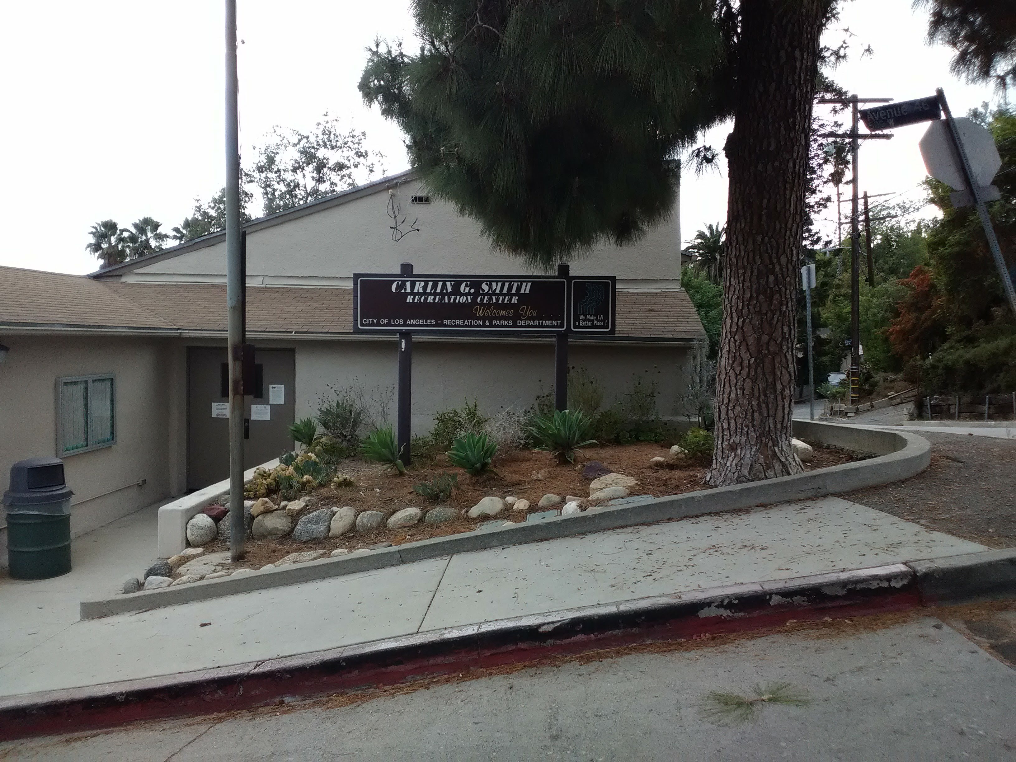
After curving to the right, Ave 46 intersects with Frontenac Avenue, where you’ll pass the Carlin G. Smith Recreation Center. Although the building looks pretty standard at first glance, the rec center makes pretty creative use of the terrain. What initially appears to be a one-story structure turns out to be two floors as you walk past, with a playground just outside at its base. Here, Canon Crest Avenue splits off from Ave 46, allowing you to walk downhill and see the remaining features of the rec center: namely, a long staircase running down the middle of a steep gully, linking the main building with a basketball court carved out of the narrow space between Canon Crest and Ave 45.

Follow Canon Crest downhill and you’ll reach the base of the Clermont Staircase, joining the route of the first walk. If you didn’t do that walk, you can start now by ascending the staircase and following the steps described above in reverse. Otherwise, just carry on downhill, taking Canon Crest to Ave 45 to Marmion Way, making a left on Marmion and returning to the Southwest Museum station.
P.S.: In case you were waiting for us to talk about the Eldred Street Steps, arguably Mt. Washington’s most famous staircase (although there’s not much of a fight for that title), it sits on the other side of the hill, on the north slope facing Highland Park. Those steps are more famous by virtue of sitting at the top of one of the steepest streets in the world, and arguably the steepest in California. We didn’t include it here because it requires a pretty long walk from any of the places described in this walk. However, if you want to know more about that spot, we recommend the Tom Explores Los Angeles video on the subject:

2 thoughts on “The Mt. Washington Stairway Walk”