We’re not golf fans, but we do have a great appreciation for its more colorful and far more fun cousin: miniature golf. And as it turns out, there is a humble mini-golf course in South Pasadena, within walking distance of the Metro A Line (formerly the Gold Line) station and surrounded by a bunch of fun, outdoorsy things to see. So we went to check out South Pasadena’s stretch of the Arroyo Seco.

The Arroyo Seco Golf Course is about a 20 minute walk from the South Pasadena station on the A Line. It’s a very straightforward route: from the station, just walk west on Mission Street downhill. On the way, you’ll pass a small park and a Trader Joe’s. As you get near the park grounds, the road veers left and continues as Pasadena Avenue; you want to cross the street and continue straight. There is a pedestrian crosswalk with warning lights you can activate here, but take care: traffic is light but still moves quite fast through here.
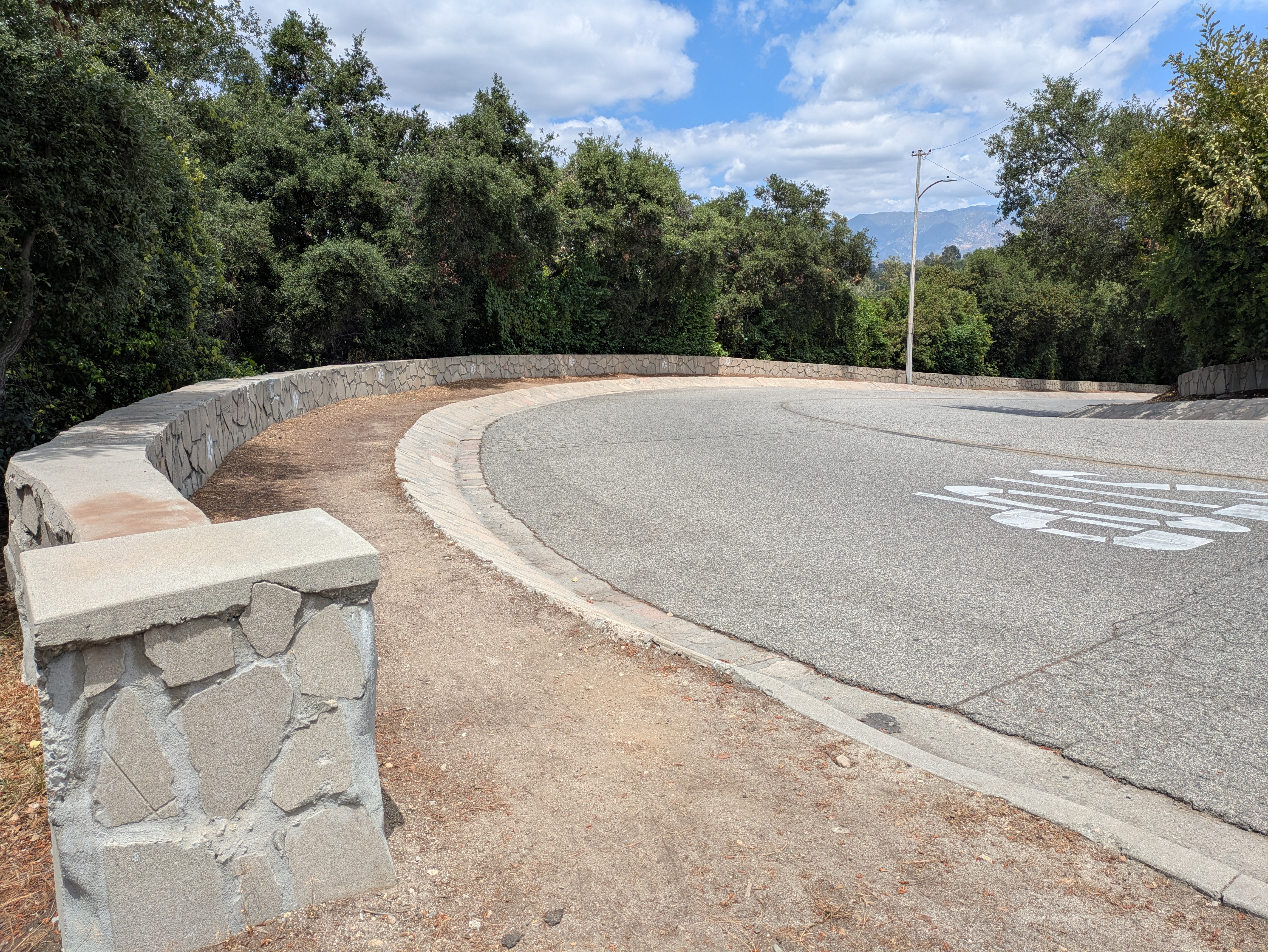
After another block, Mission Street ends at Arroyo Drive, above the park grounds. Directly across the street will be the entrance, with a sign for the golf course. The road down doesn’t have a sidewalk, but there is a dirt track on one side wide enough to safely walk down, with a short stone wall marked with paw prints to direct people to the dog park at the bottom.

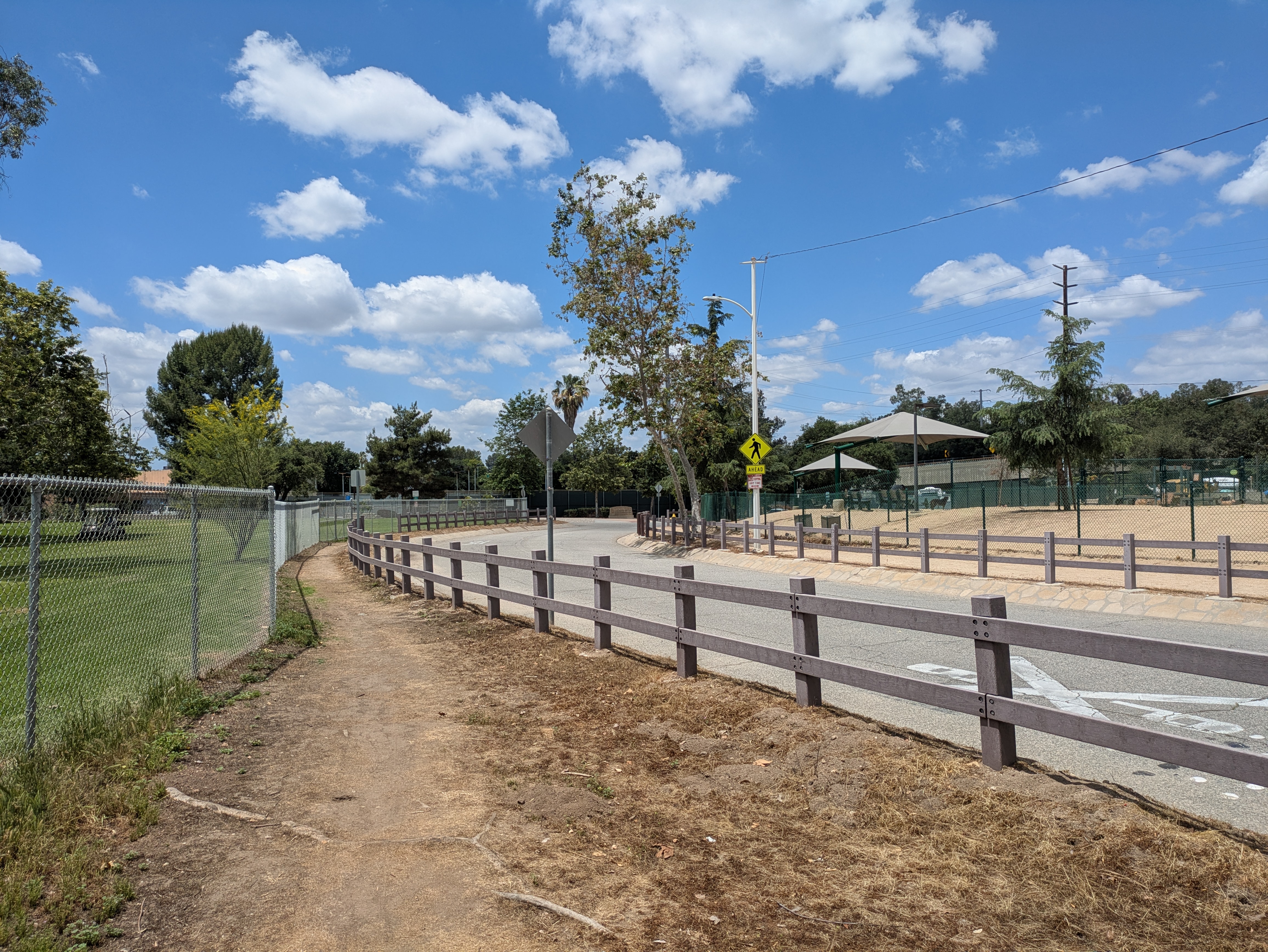
At the bottom of the hill, you’ll pass by the dog park and a skate park across the street, as well as the edge of the golf course. A wooden barrier separates you from the road, offering you a little protection from the traffic. When you reach the next intersection, there will be a sign for the “Arroyo Seco Bicycle and Pedestrian Trail.” However, the first part of the “trail” is more of a glorified sidewalk leading past the tennis courts, but it at least has the same wooden barriers separating you from traffic.

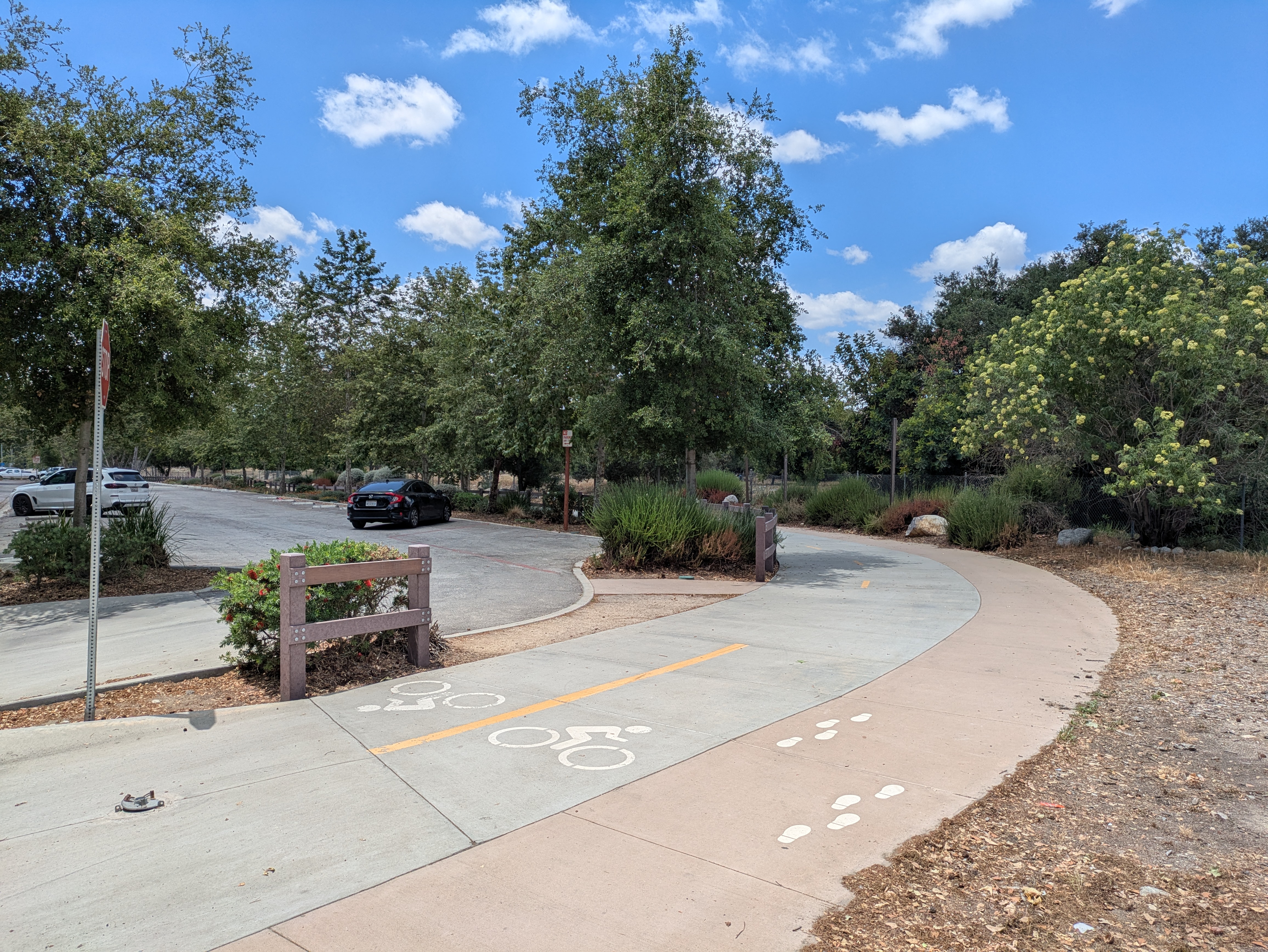
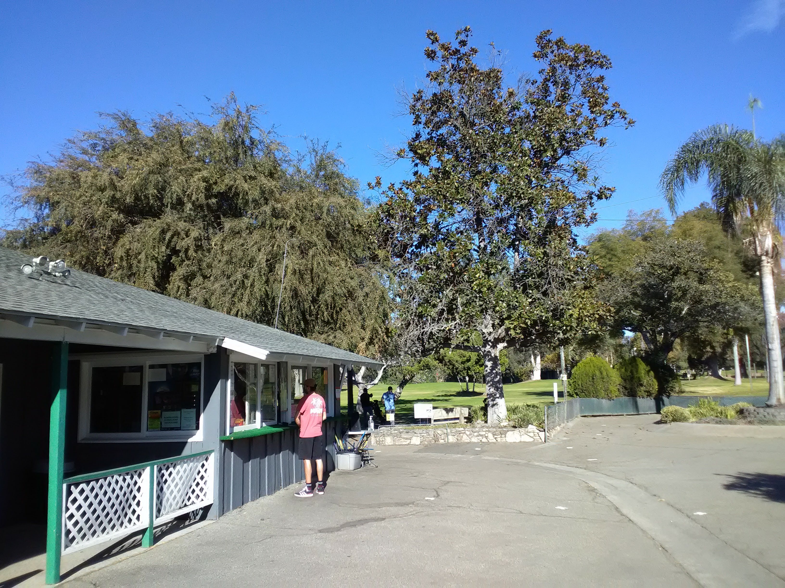
After you pass the tennis courts, you’ll reach the parking lot for the golf course, where the sidewalk actually becomes a proper trail and joins the edge of the Arroyo Seco. This is a nice shady stretch of the trail, with a water fountain on the way. At the end of the parking lot is the actual entrance to the golf course, which is run by the City of South Pasadena. And here is where the mini-golf fun begins.

An initial round of mini-golf costs $7 per person, and $4 per person for any additional rounds. You also get a little scorecard which gives you the par for each hole, but we’re such terrible players that par is going to mean little to us.

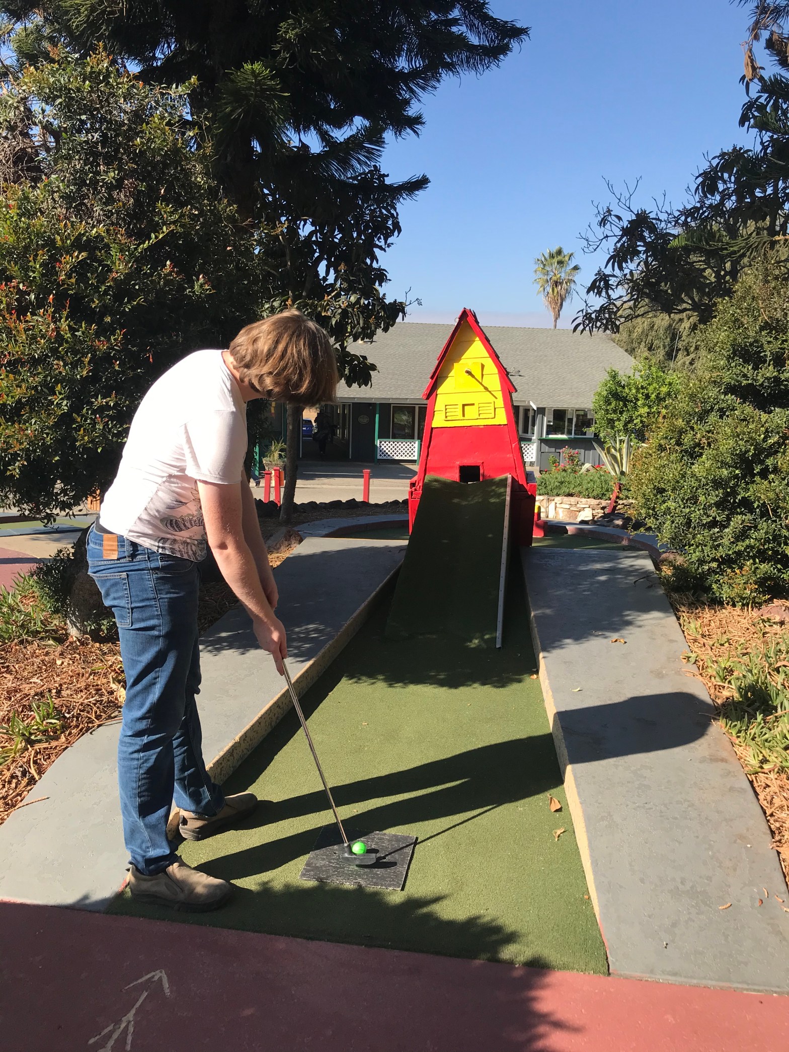
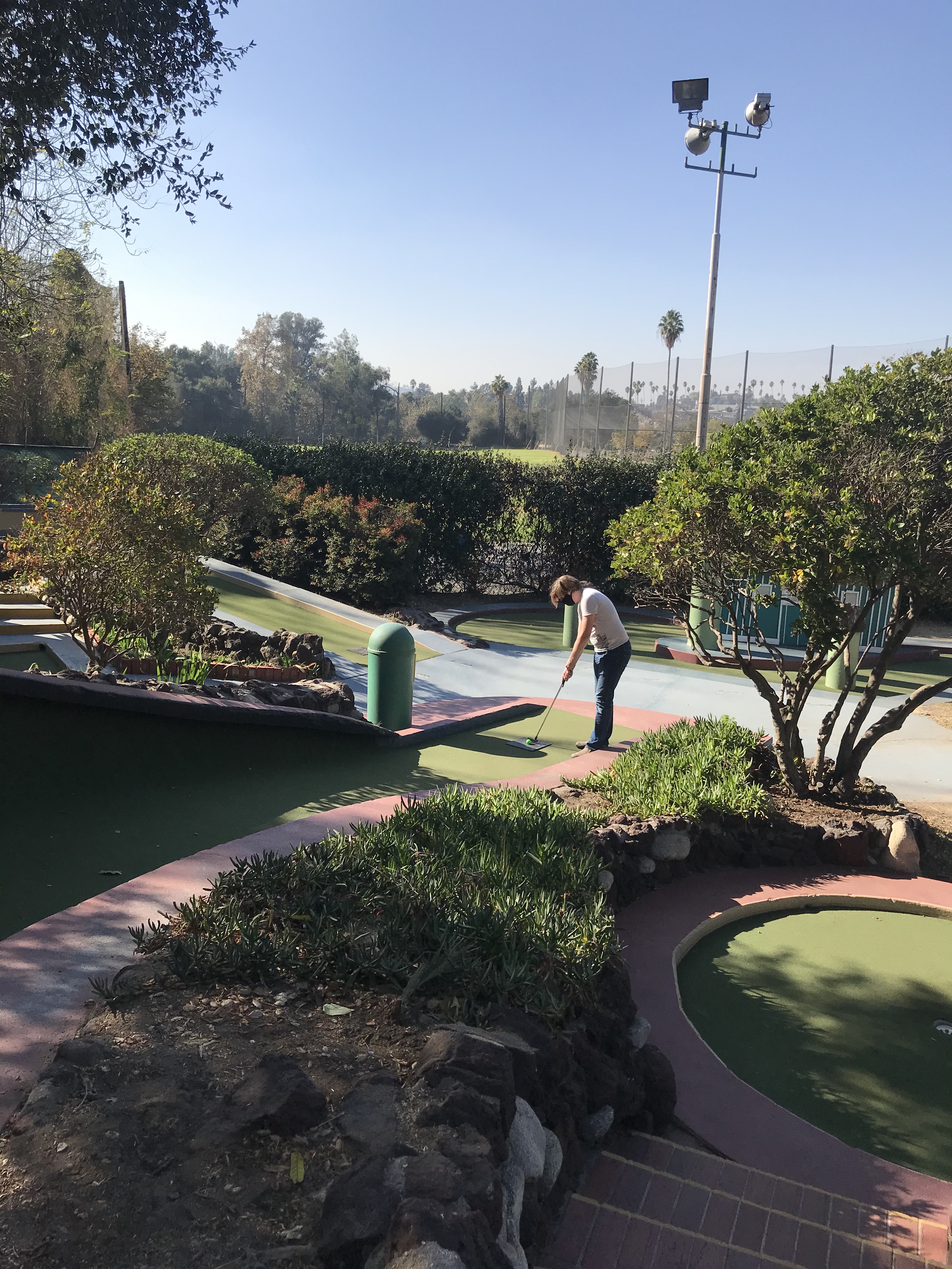
The mini-golf course is a compact little course located right behind the main building; you’ll see it right after you walk inside. We went on a weekday afternoon, so we had the whole thing to ourselves, but there will definitely be other people around if you go on the weekend (or even on some evenings), so keep that in mind. The mini-golf course is 9 holes, and it’s really quaint and charming, if a little rough around the edges from a general lack of upkeep. The holes start out pretty straightforward and gradually get more and more complex and the obstacles more zany as you go on.


The most difficult hole is definitely #3: the Ant Hill. It’s deceptively simple: at the end is a rounded hill with the hole sitting in a little depression on the top. But the devil lies in the details. It is incredibly easy to overshoot the hill and send your ball flying down the other side. The portion of the hill facing the start of the course isn’t raised, making for a tempting entry point but also making it nearly impossible to keep your ball on top of the hill near the hole. And most damningly, the ground surrounding the hill sits at an incline, causing your ball to roll against one side and frequently trapping you in a corner. This hole is so frustrating that we even did markedly worse on it across multiple rounds.
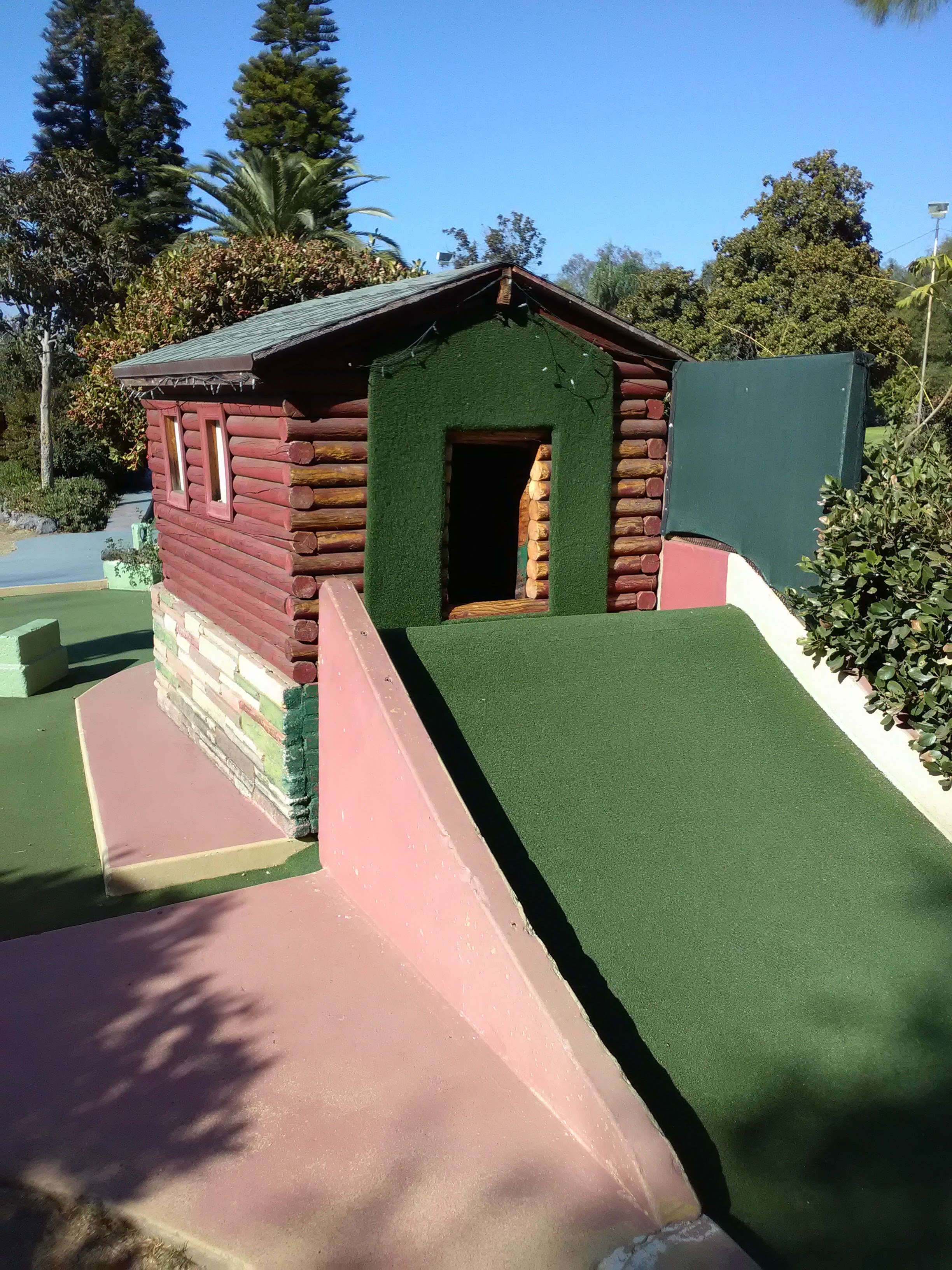
But the rest of the holes are a breeze, even with all the zany obstacles. This is where you get all the fun holes with buildings in the way. Most of these follow a similar pattern: you can aim for the hole through the building for a shortcut, or take the longer but more predictable way around. In these cases, fortune often favors the bold.

Our favorite holes were at the back of the course. #5 (Church) and #6 (Big Three) both have multiple levels built up the side of the hill. Both require you to hit your way up a big hill to start with, then hit a set of holes that’ll drop your ball to a lower level where the hole is located. #6 definitely appears the most intimidating at first glance, but it just requires a good strong putt to start with.

The last hole is the classic Windmill, although the windmill itself is looking a little worse for wear. The structure is listing at an angle and the spinning windmill apparatus has long since been removed. However, the hole is difficult enough as is that adding a spinning contraption seems almost unnecessary.
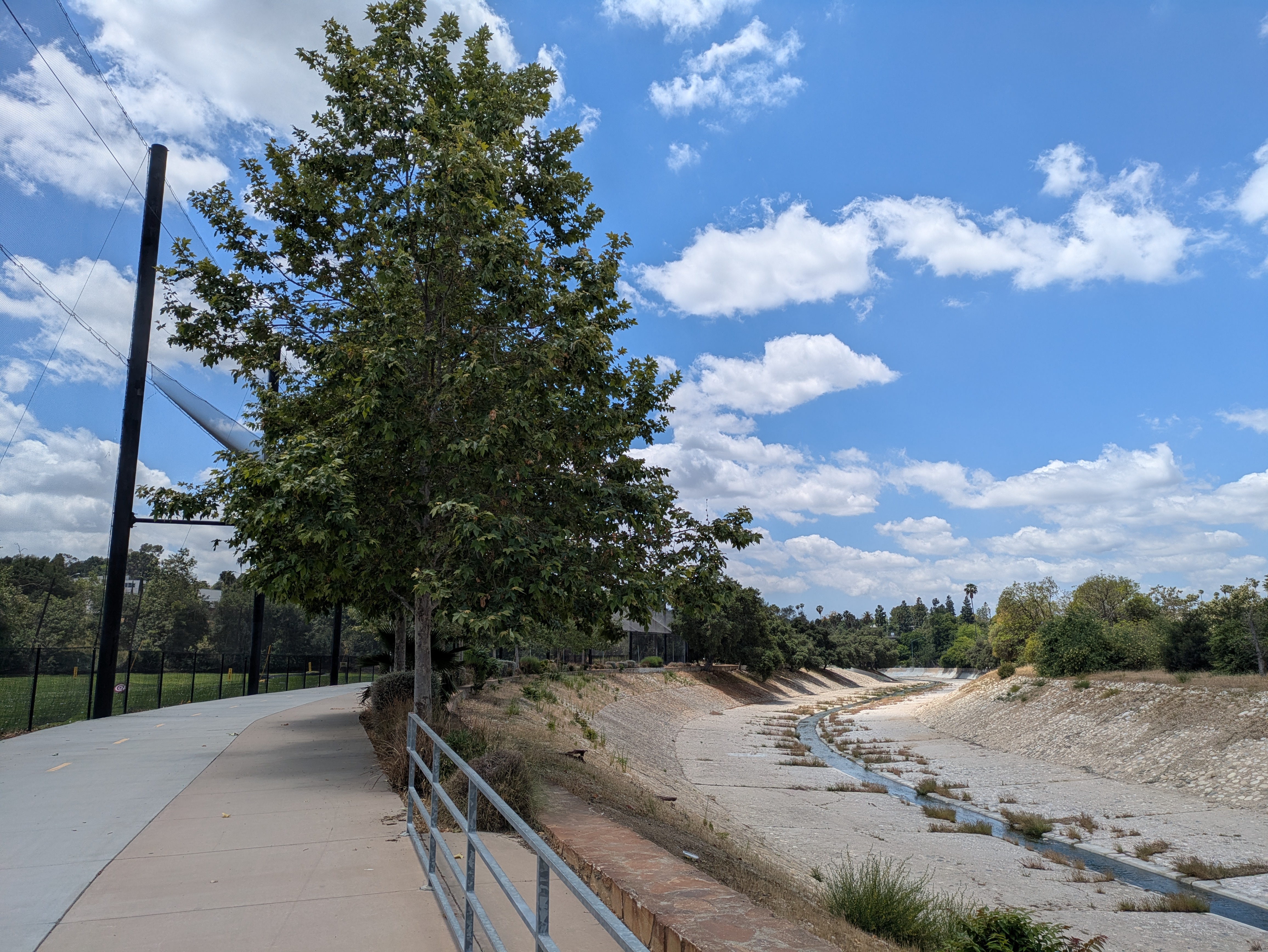
Departing the golf course, the Arroyo Seco trail continues south into Los Angeles. The first portion of the trail is newly built and well-kept, with separate sections for bicycles and pedestrians. It also goes past the golf course’s driving range, necessitating a large net covering the trail to shield passersby from golf balls, which collect in little piles along the fence.

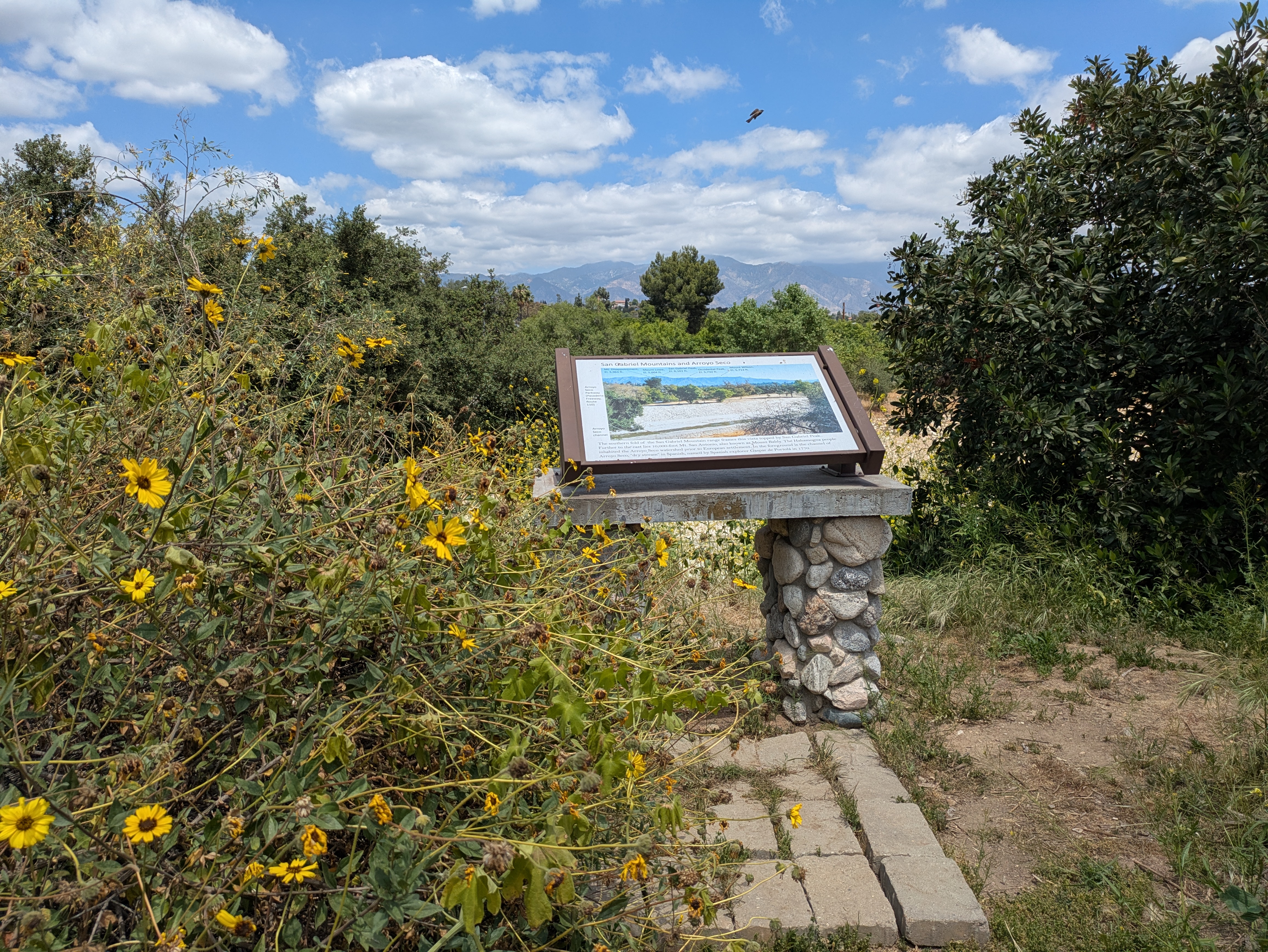
After you pass the driving range, you’ll reach an entrance to the South Pasadena Nature Park. This little triangle of land is a small, naturalistic garden with native vegetation and some nice, short little trails marked with stones. For such a small space, they pack a surprising amount of features in: there’s a small butterfly garden, a little spiral labyrinth, a couple of overlooks with views over the Arroyo Seco and the mountains, and a stairway leading up to Pasadena Avenue on the hill above.

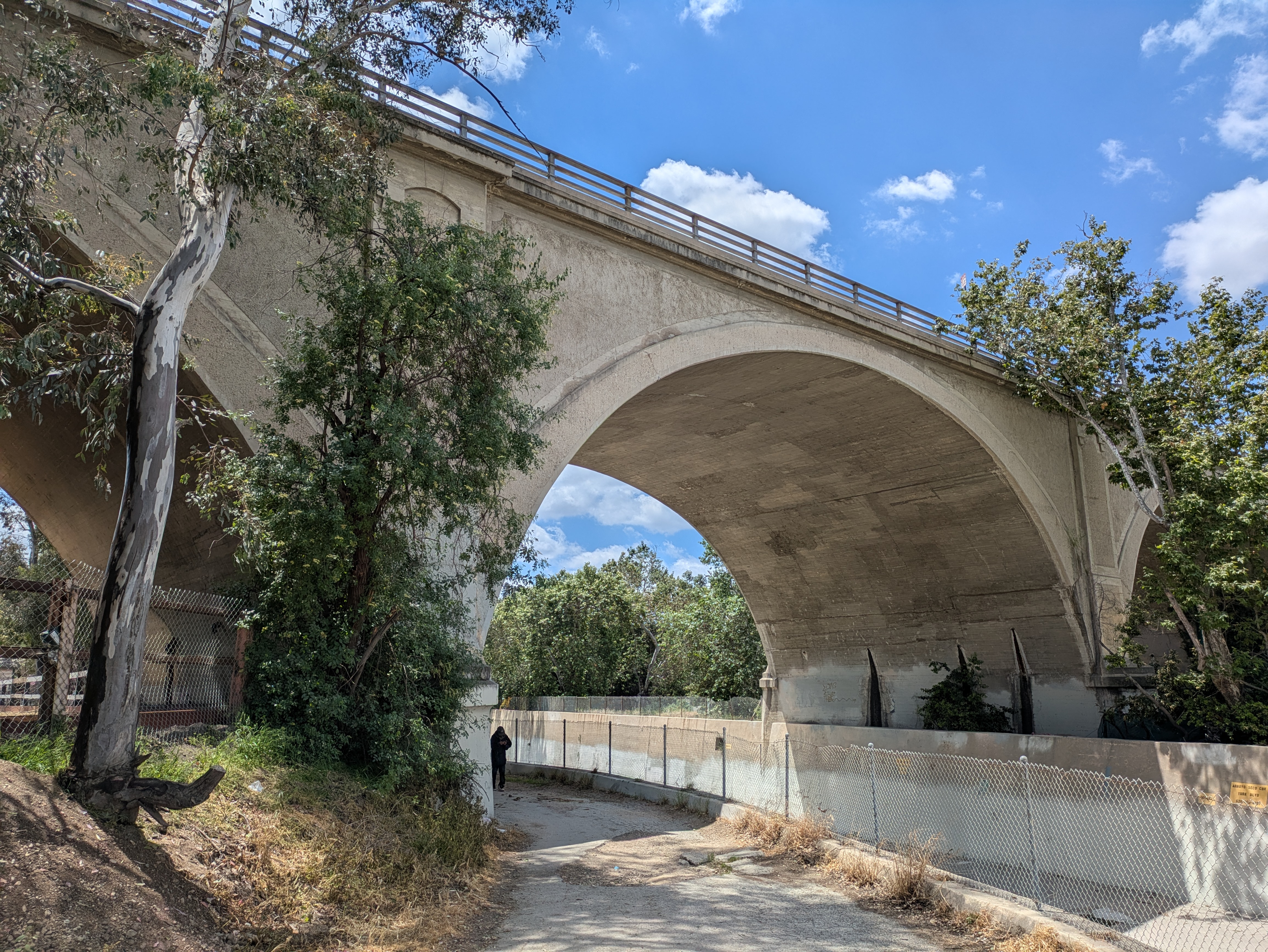
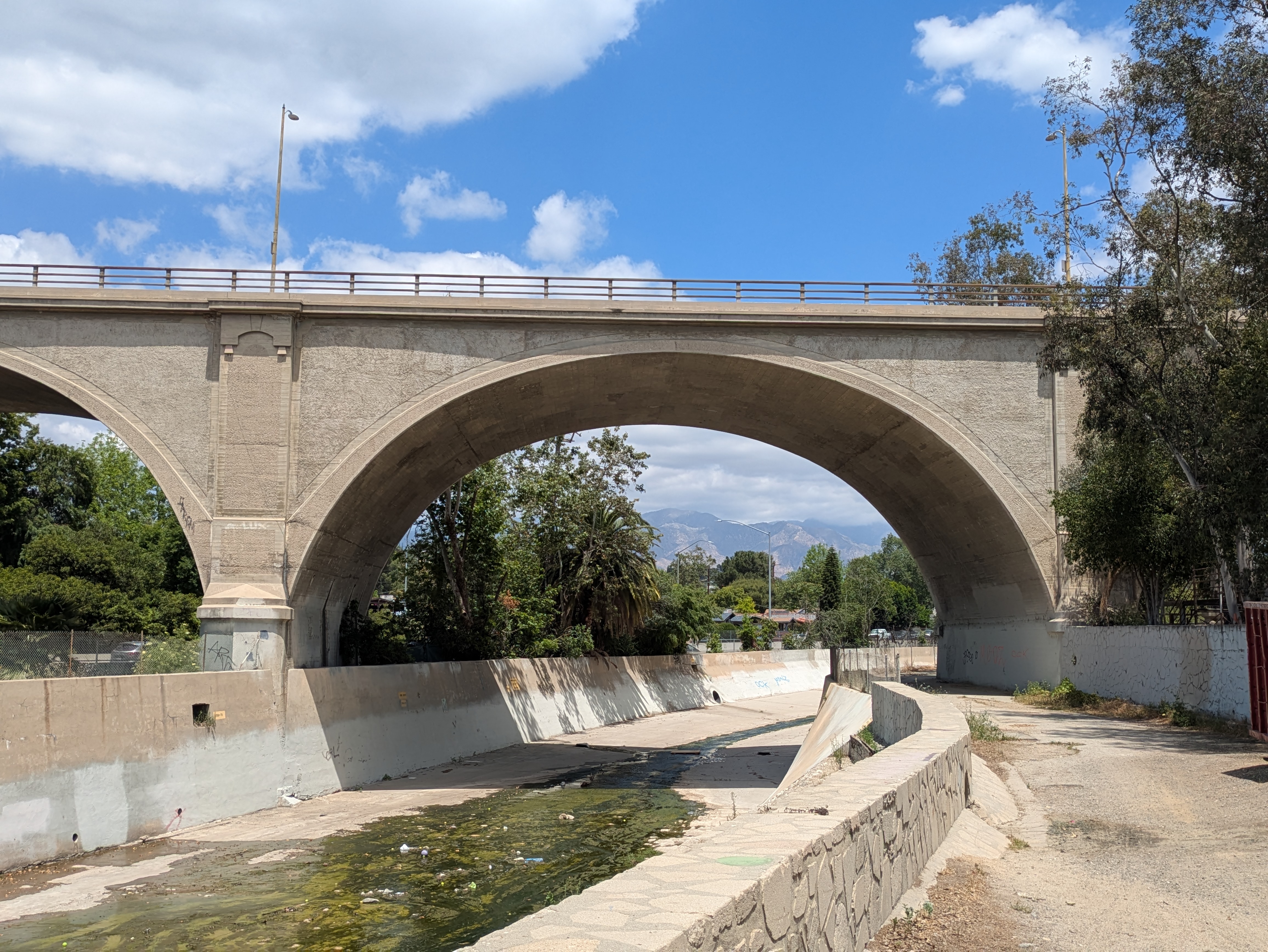
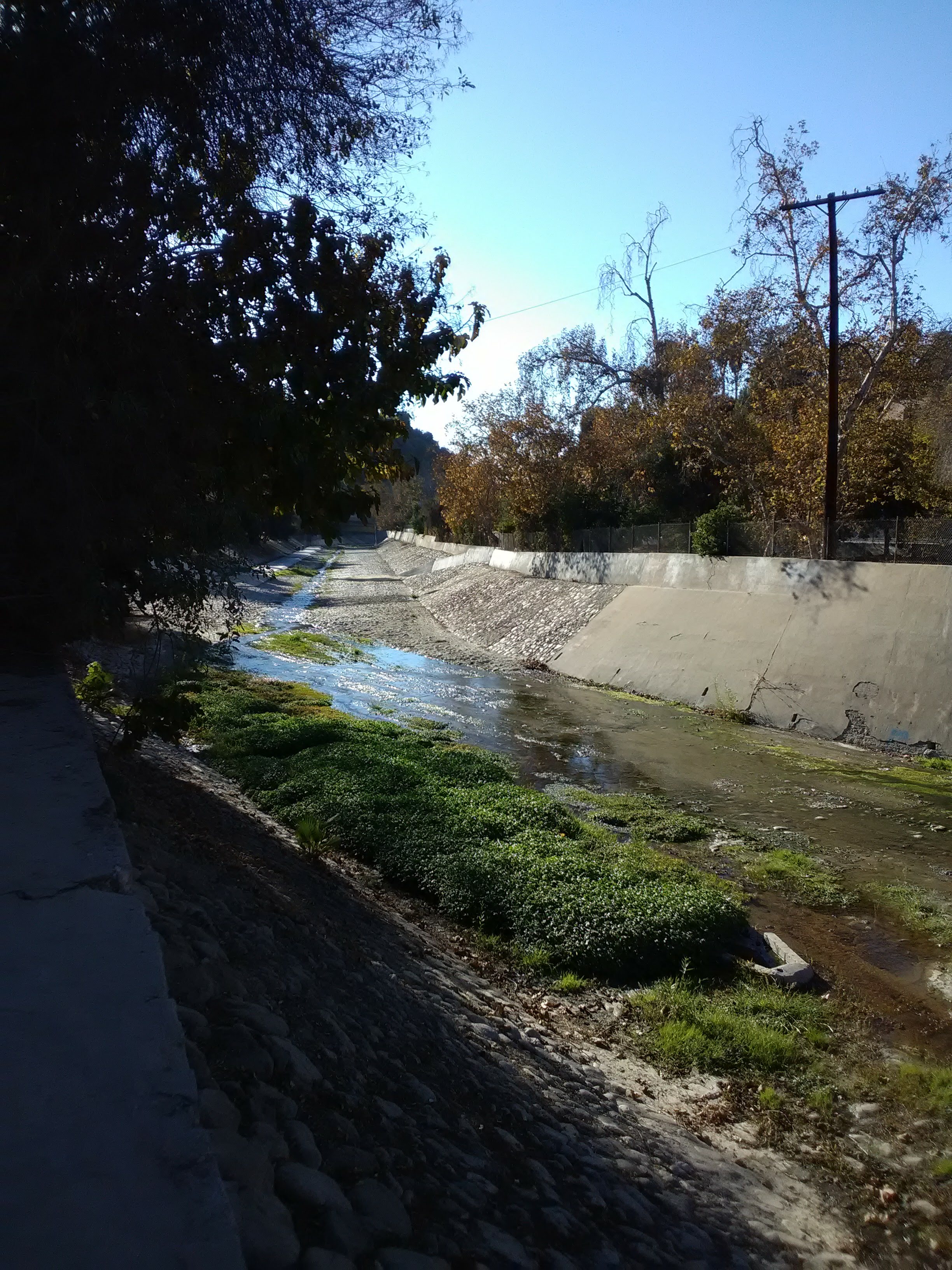
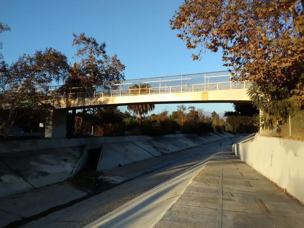
Back on the Arroyo Seco, South Pasadena’s nice bike trail doesn’t last long. As you pass the nature park, the well-kept trail abruptly gives way to a pockmarked asphalt surface that marks the City of Los Angeles’ very poorly maintained stretch of trail. Here, the freeway joins the Arroyo Seco across the channel from you. After a short distance, you’ll pass under the lovely York Blvd bridge, the most impressive of the bridges that traverse this section of the Arroyo Seco.
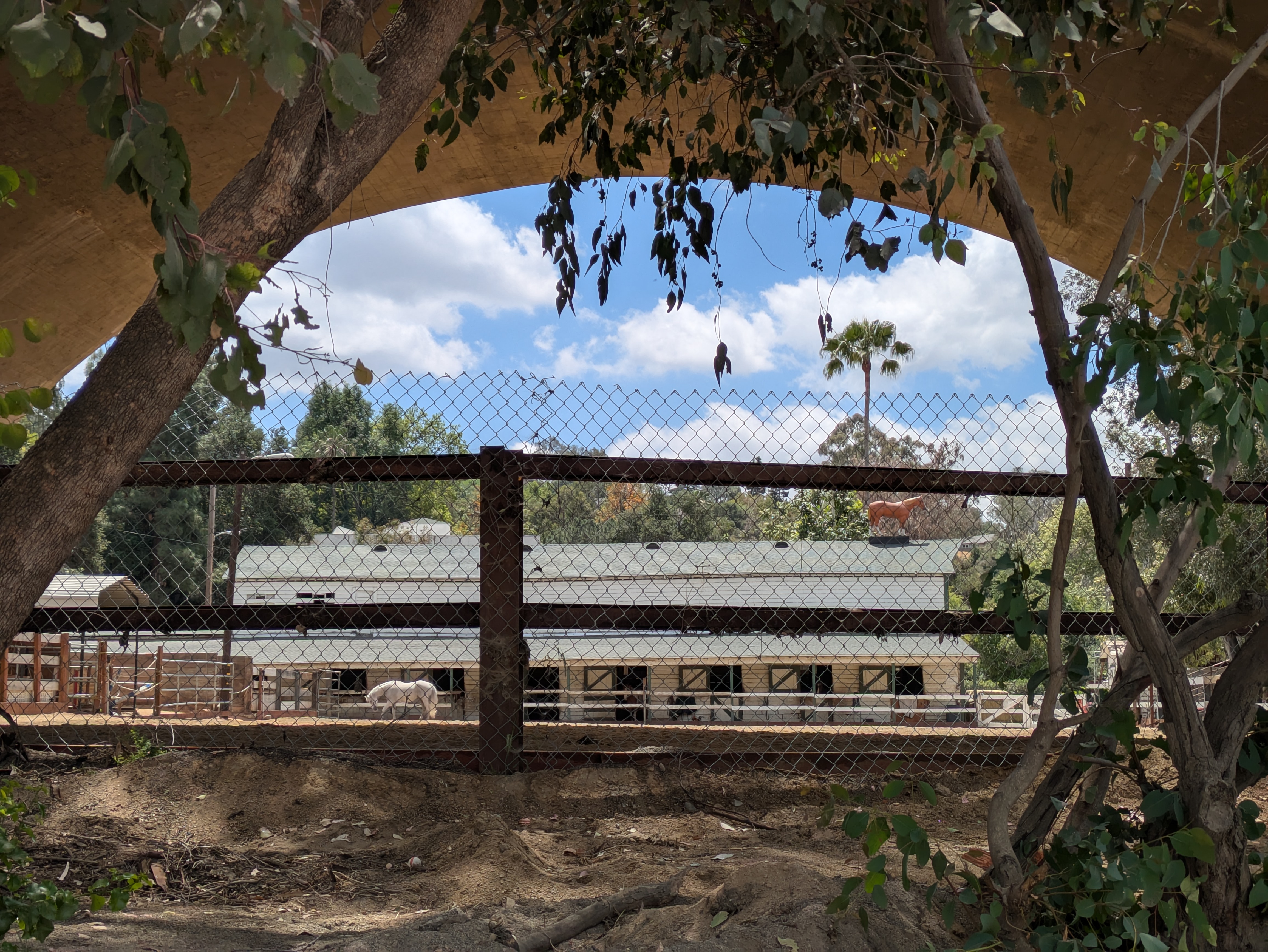
Beneath this bridge is a very unique sight: horses! The Arroyo Seco Stables, which dates from the 1920s, sit adjacent to this section of the trail, close enough that the back of some of the stables actually face the trail. And the stables are occupied: when we went, a few horses popped their heads out to gaze at us, and a couple of them even seemed to enjoy the company. This short stretch of trail is used for horseback riding, with an equestrian trail winding through the nature park and behind the golf course to link up with the trails further up the Arroyo Seco.

At the front of the stables, the trail reaches a parking lot where the entrance to the trail is, confusingly, gated off (although a small opening on one side allows you to pass through). If you were approaching from the other side, you’d be forgiven for thinking that this stretch of trail was off-limits.

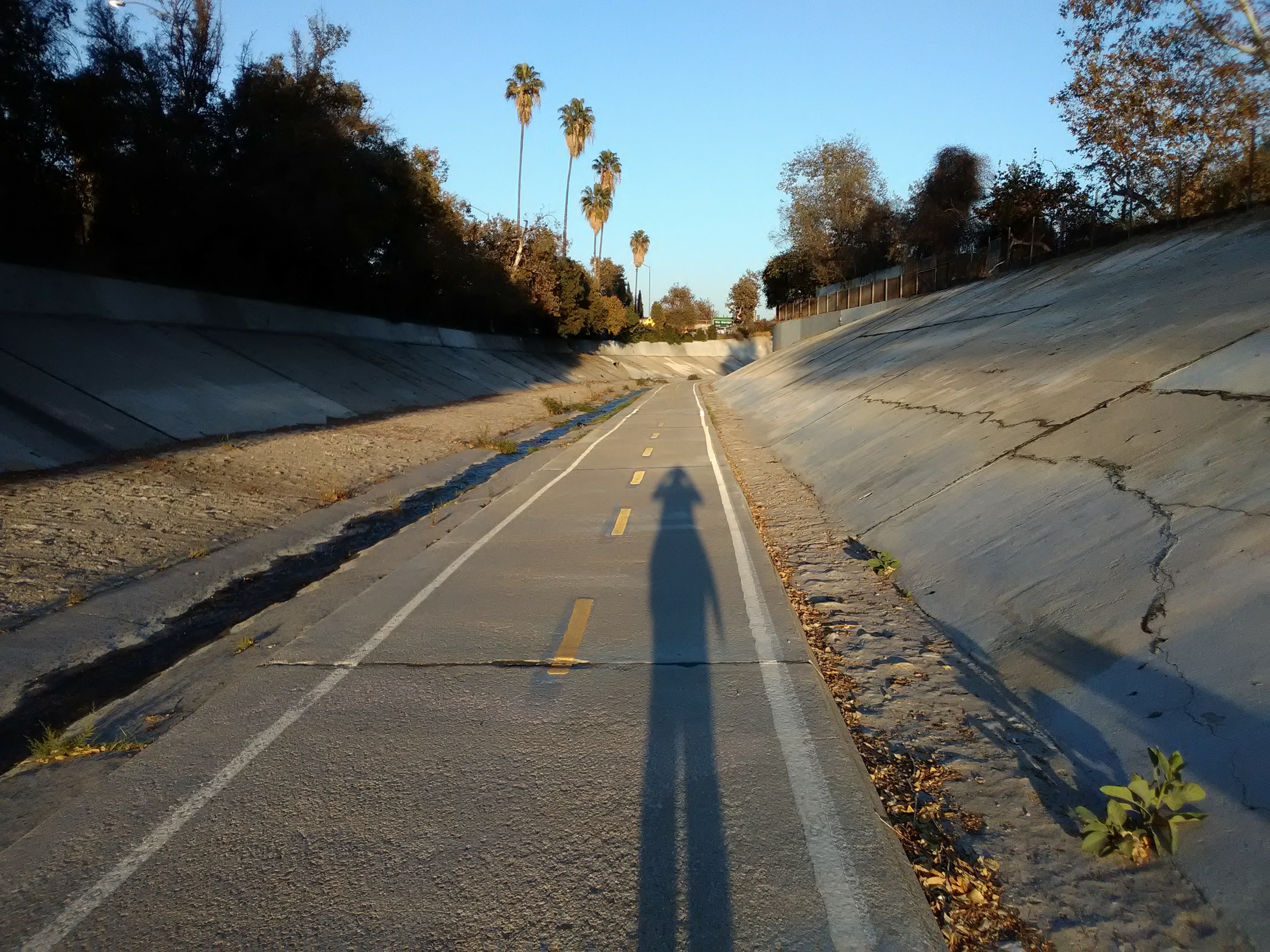
From the parking lot, the Arroyo Seco trail continues south as a formal bike path running along the bottom of the stream channel. You can either walk back to the South Pasadena station the way you came, or if you’re up for a hike, you can walk down the Arroyo Seco to the Southwest Museum station (about a 45 minute walk or a 15 minute bike ride, give or take). There’s only one egress point along the way, so if you do proceed you are basically committing to either seeing it through or turning back.
Despite running alongside a freeway, the Arroyo Seco channel is surprisingly tranquil. A trickle of water runs along the bike path year-round, and there are many spots where moss and blades of grass have pushed through the cracks in the cement, gaining a foothold in this concrete landscape. You might even see some water fowl treading along the water. Not to oversell the natural beauty; there are some small homeless encampments along the top of the channel and a fair amount of trash lying around. But given the circumstances, it’s surprisingly pleasant.
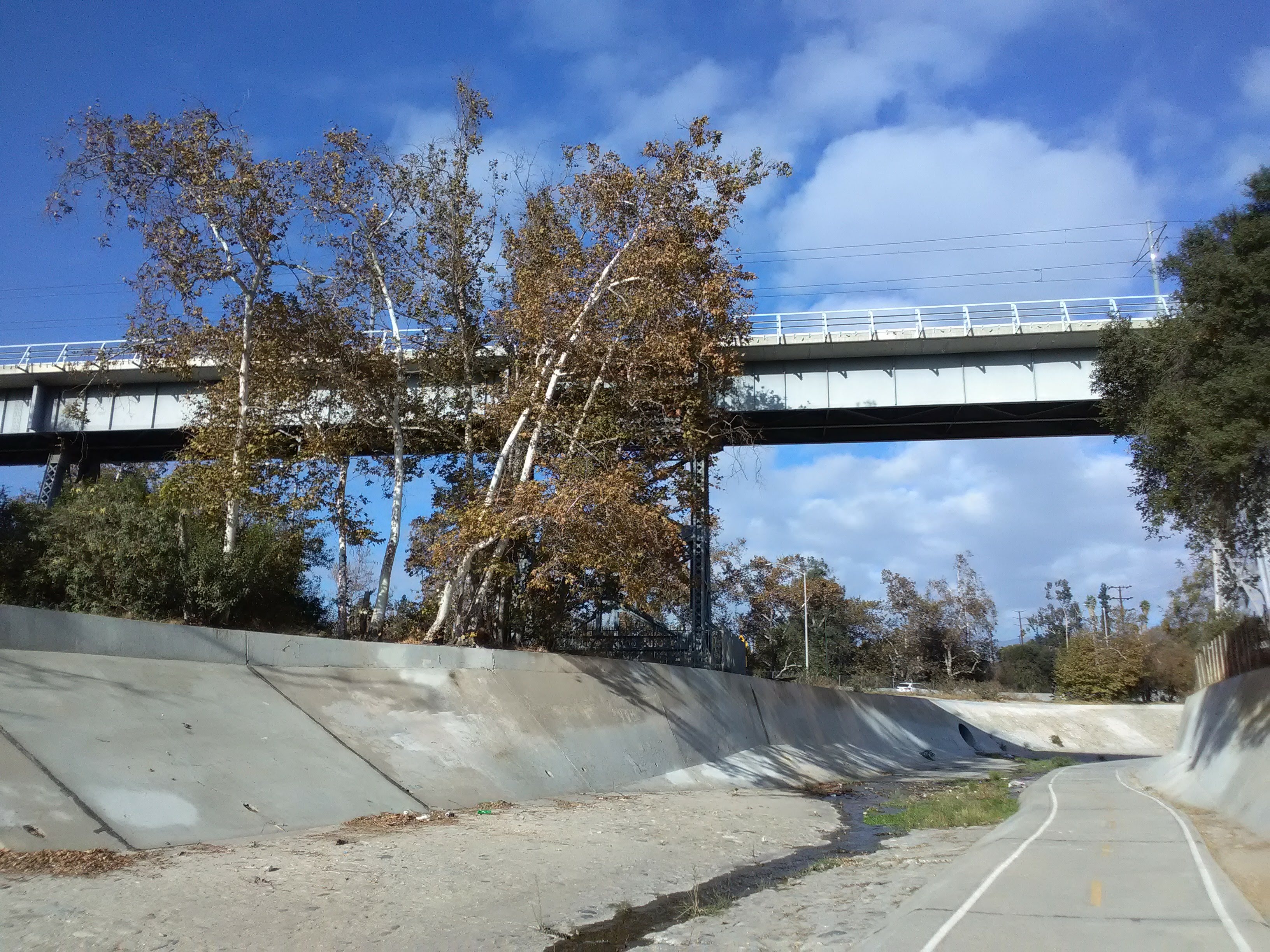
There’s very little shade, except early in the morning and late in the afternoon, so winter is actually the perfect time of the year to take a walk along the Arroyo Seco if you’re so inclined. It’s definitely not a pleasant walk on a hot day. Along the way, you’ll pass under several bridges, the most notable being the Santa Fe Arroyo Seco Railroad Bridge, which carries Metro trains into Highland Park. The bridge is surprisingly old, dating from 1896, and is held up by iron trestles. Allegedly, it is the tallest, longest, and oldest railroad bridge standing in Los Angeles.
After a while, you’ll pass the wooded slopes of Debs Park, which we covered in an earlier post. Soon you’ll be reaching another landmark featured in that post: the pedestrian bridge that crosses the Arroyo Seco to Sycamore Grove Park, which sits just a couple blocks from the Southwest Museum station. Just cross the bridge, make a left, head to the southern end of the park, cross Figueroa at the traffic light, and walk up Woodside Drive to the Southwest Museum station. Or follow the instructions from our Debs Park post to take a short stairway walk past the Casa de Adobe on your way to the station.
