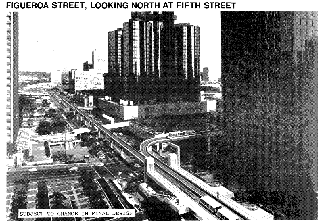
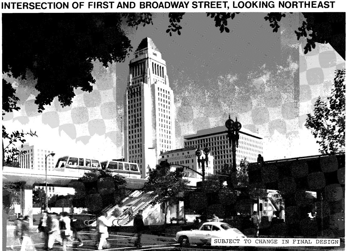
In the 1970s, there was a rather ambitious—if deeply flawed—transit proposal that thrilled LA’s civic leaders. Cementing the 30-year transformation of Bunker Hill from residential neighborhood to “slum clearance” project to the city’s designated financial high-rise district, the proposal was to construct an elevated people mover (much like the one currently being built at LAX) that would carry passengers from parking garages on the edge of Downtown into the heart of the financial district, relieving traffic pressure on the streets below.
The proposed people mover route would have gone from Union Station, south past City Hall, briefly pass through a tunnel under Bunker Hill, then follow Figueroa south to the convention center. The tunnel under Bunker Hill would start from next to Angels Flight, pass under what became Cal Plaza and Wells Fargo Plaza, and re-emerge out of the Bank of America building. In fact, construction actually began on this tunnel before federal funding was pulled in 1981 by the new Reagan administration, killing the project for good. The tunnel couldn’t really be utilized for anything else and was eventually repurposed back into the underground parking garages.


Renderings of the proposed People Mover; images taken from the Final Environmental Impact Statement, Los Angeles Downtown People Mover Project, June 1980, courtesy of the Metro Transportation Library and Archive
Before anyone bemoans the death of the people mover project, it’s worth remembering that this would have been a lot of money for something that barely anyone would have used. The people mover was essentially a glorified park-and-ride solely for office commuters, and it’s questionable whether they would have even used it since all the office buildings in question had parking garages of their own. In the same era, Detroit and Jacksonville successfully built downtown people movers of their own and both are almost universally regarded as miserable failures (the only other American example from the time, in Miami, fared a lot better because it’s actually somewhat extensive and serves a lot of major destinations). It was always a boondoggle, intended more to elevate Bunker Hill’s status as an office district than for any transportation benefit, and we should count ourselves grateful that it was never built.
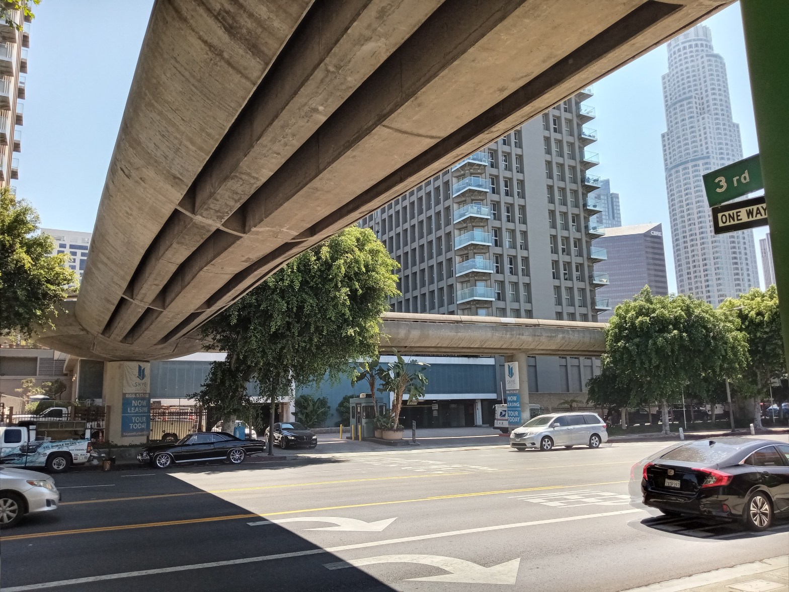
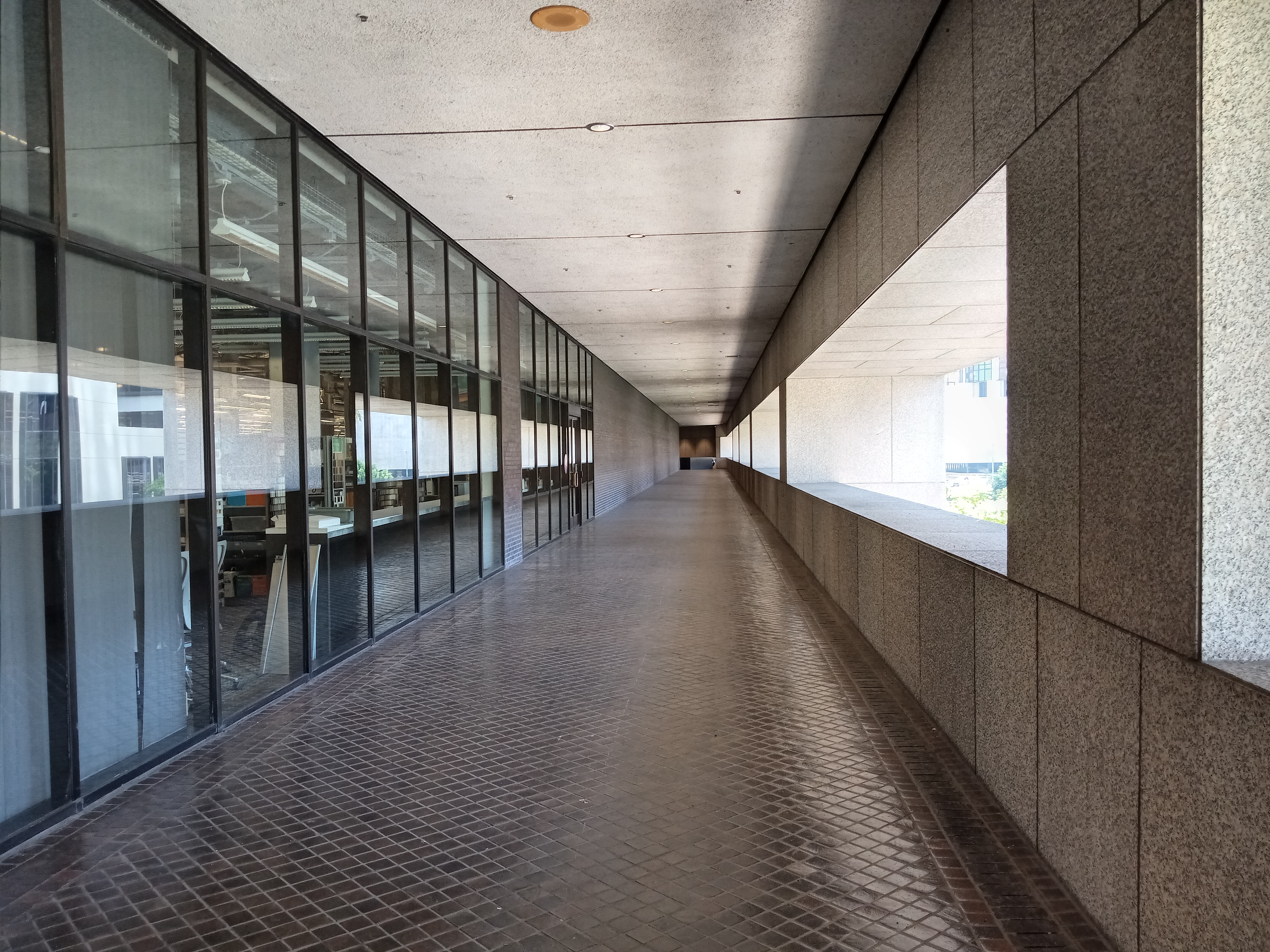
But there was one component to the overall people mover plan that was built. Part of the vision was a network of pedestrian bridges that would connect the elevated people mover stations to the various hotels and office buildings of Bunker Hill, soaring over the streets so pedestrians wouldn’t have to mingle with the fast-moving car traffic below. The result is the “Pedway,” a network of pedestrian bridges that spans a few blocks along Figueroa and Flower, tying together the various towers and office blocks on the backside of Bunker Hill. Besides being an intriguing look at a side of Downtown not often seen, they’re a glimpse into a vision of Los Angeles that was never realized.
Pedways were all the rage with urban planners in the ’60s and ’70s, when the focus was on separating pedestrian and auto traffic as much as possible. But they have largely fallen out of favor with contemporary urban planners, who tend to see pedways as sapping vitality from the streetscape. The exceptions are those in places where the weather is so harsh that some climate-controlled passageways are welcome, like the expansive “Skyway” system in Downtown Minneapolis or those in several Canadian cities. But in most cases, the pedestrian bridge is an admission of failure: we screwed up the ground so badly, we have no choice but to have you just walk over it.
All that said, LA’s pedway system feels a little more justified in large part because of the confusing terrain of Bunker Hill. Back when all of this was a charming residential neighborhood, things were a lot more straightforward: there was the stuff on the surface, and then a handful of tunnels going underneath. But since the neighborhood’s transformation into its current form, the hill has become a bewildering M.C. Escher-esque jumble of streets, plazas, terraces, escalators, tunnels, bridges, atriums, garages, floors, decks, stairs, and passageways. For the pedestrian, the pedways actually help to level out the terrain a little bit, and can actually help you master the confusing geography of Bunker Hill.
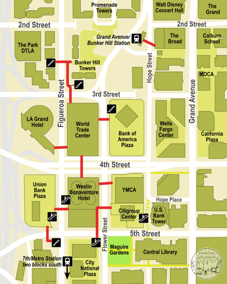
The Pedway network extends for about three blocks, starting at 5th Street on the south end and stopping just short of 2nd Street on the north. There’s very little signage for the system, so be prepared to get a little lost. The whole network is centered around two buildings: the Westin Bonaventure Hotel and the World Trade Center. The pedway entrances to the Westin Bonaventure lock at 9pm nightly, with a hotel keycard needed for entrance afterwards. The World Trade Center, being an office building, is generally closed to the public outside of office hours.
We’re going to start this tour on the south end, in the heart of the financial district and just two blocks north of the 7th/Metro station (on the B/D and A/E Lines). The northern end of the Pedway is just a block from the Grand Avenue/Bunker Hill station (A/E Lines).
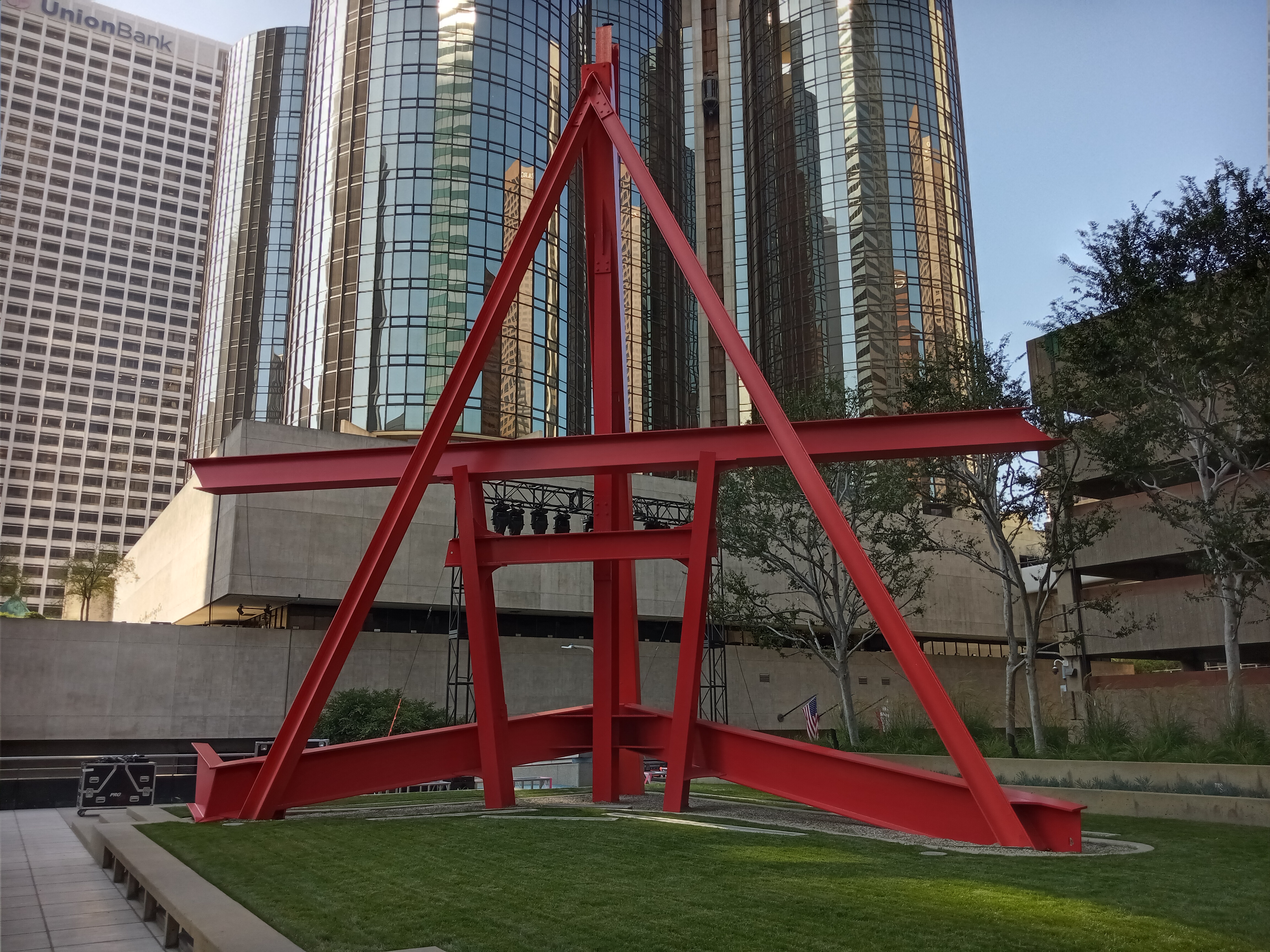
There are two Pedway entrances on 5th Street. We’ll start with the one on the corner of 5th & Flower, on the block of City National Plaza and across the street from the Central Library. There’s both a stairway and an escalator that’ll take you up to the pedestrian bridge over 5th, which will carry you over to the 2nd floor of the Westin Bonaventure (although this entrance into the Bonaventure will often be locked). From there, the bridge continues across Flower into Citigroup Center, ending on a 2nd floor terrace that holds the giant steel sculpture Shoshone by Mark di Suvero, which looks like a giant red easel. Citigroup Center holds a shocking amount of very high-end public art, which we covered in detail in an earlier post.
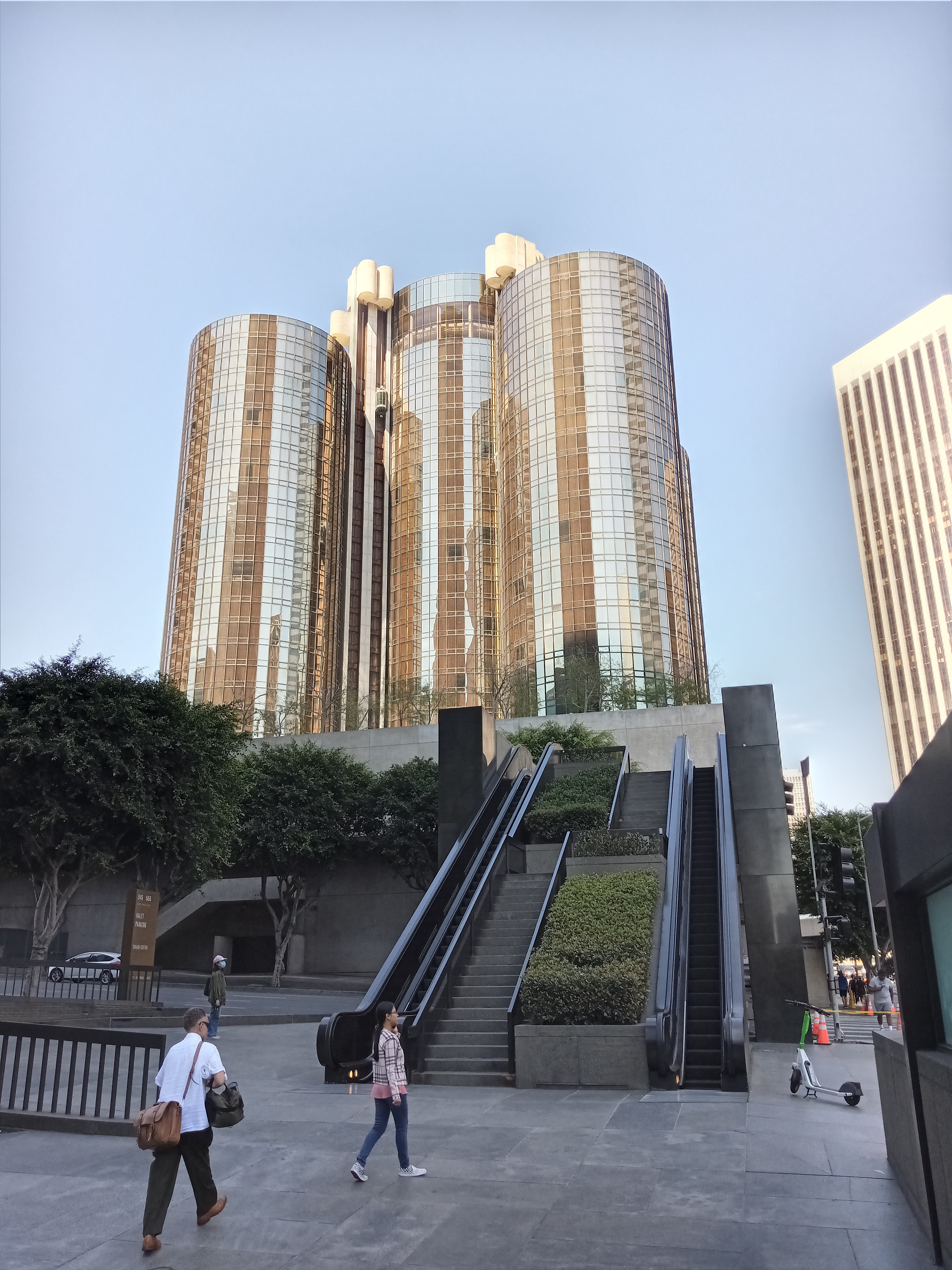
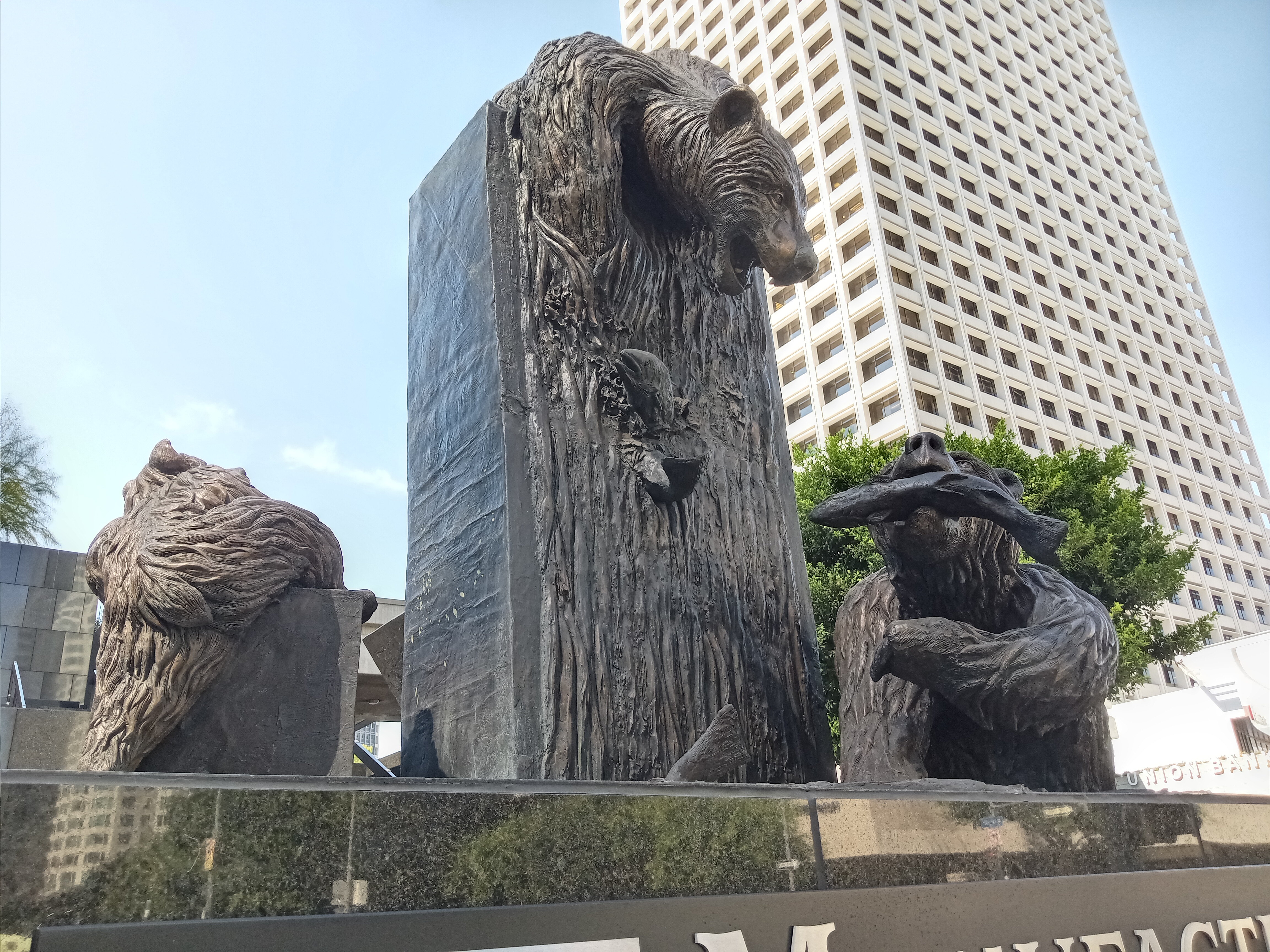
The other Pedway entrance is on the corner of 5th & Figueroa, marked by the goofy and fun statue Salmon Run, which depicts a family of bears fishing for salmon. A stairway leads up to the bridge over 5th, and if you happen to be crossing during the afternoon rush hour, when there’s a mad scramble to get out of Downtown, it’s easy to feel grateful to be up and out of harm’s way.

The bridge alights with the nicely landscaped Union Bank Plaza, which tops the second floor of the building in the shadow of the Union Bank tower, and is also connected to the ground by a set of escalators. From here, a separate bridge crosses over Figueroa to the pool deck (4th floor) of the Westin Bonaventure.
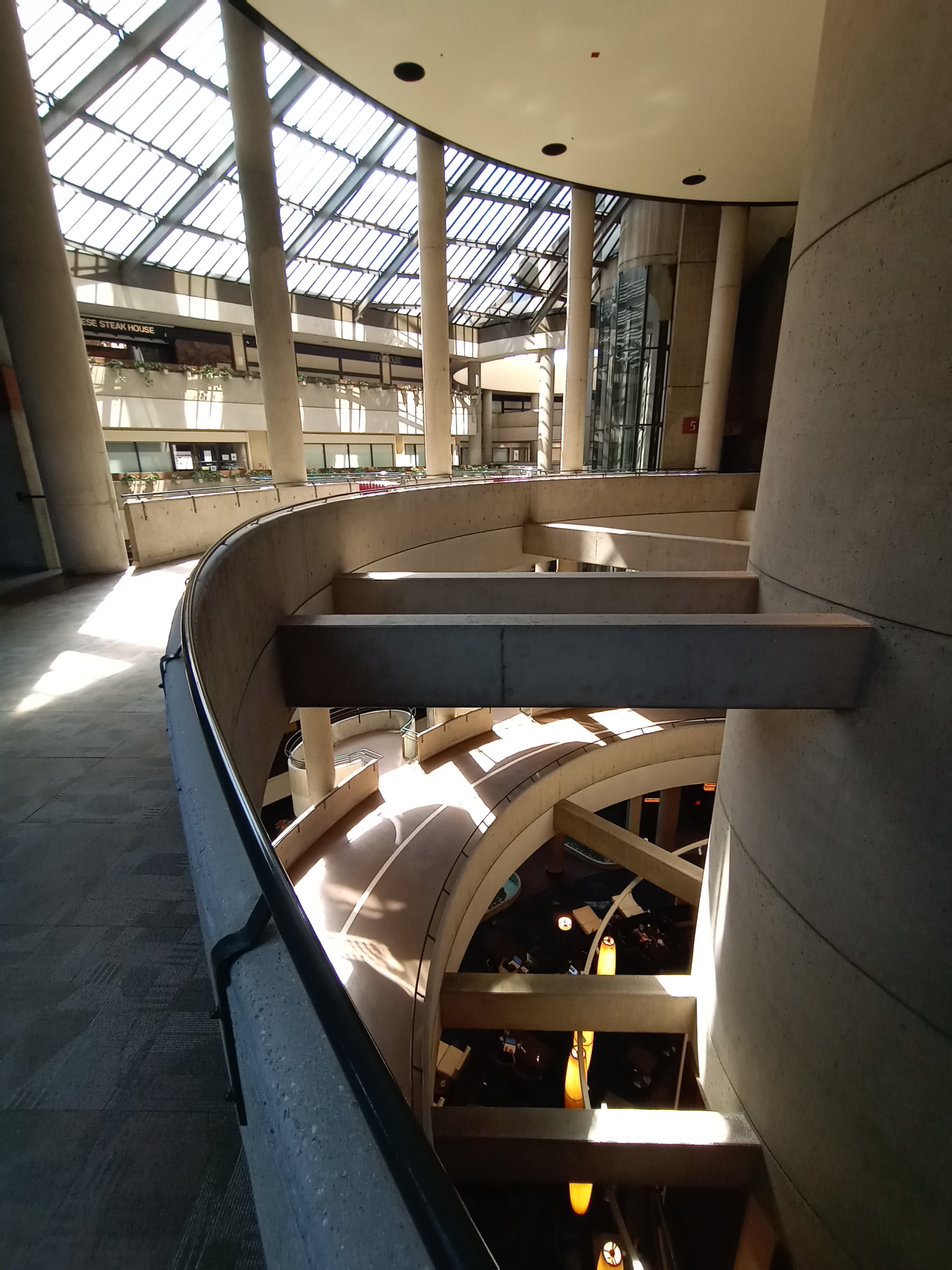
Even if you don’t know the Bonaventure by name, you will almost certainly recognize it. It’s a high-rise building that’s essentially four giant cylindrical glass towers connected to a middle tower. It’s been an iconic feature of the LA skyline since its debut in 1976, and it probably represents the pinnacle of ’70s postmodern architecture. But to really appreciate it, you have to go inside.
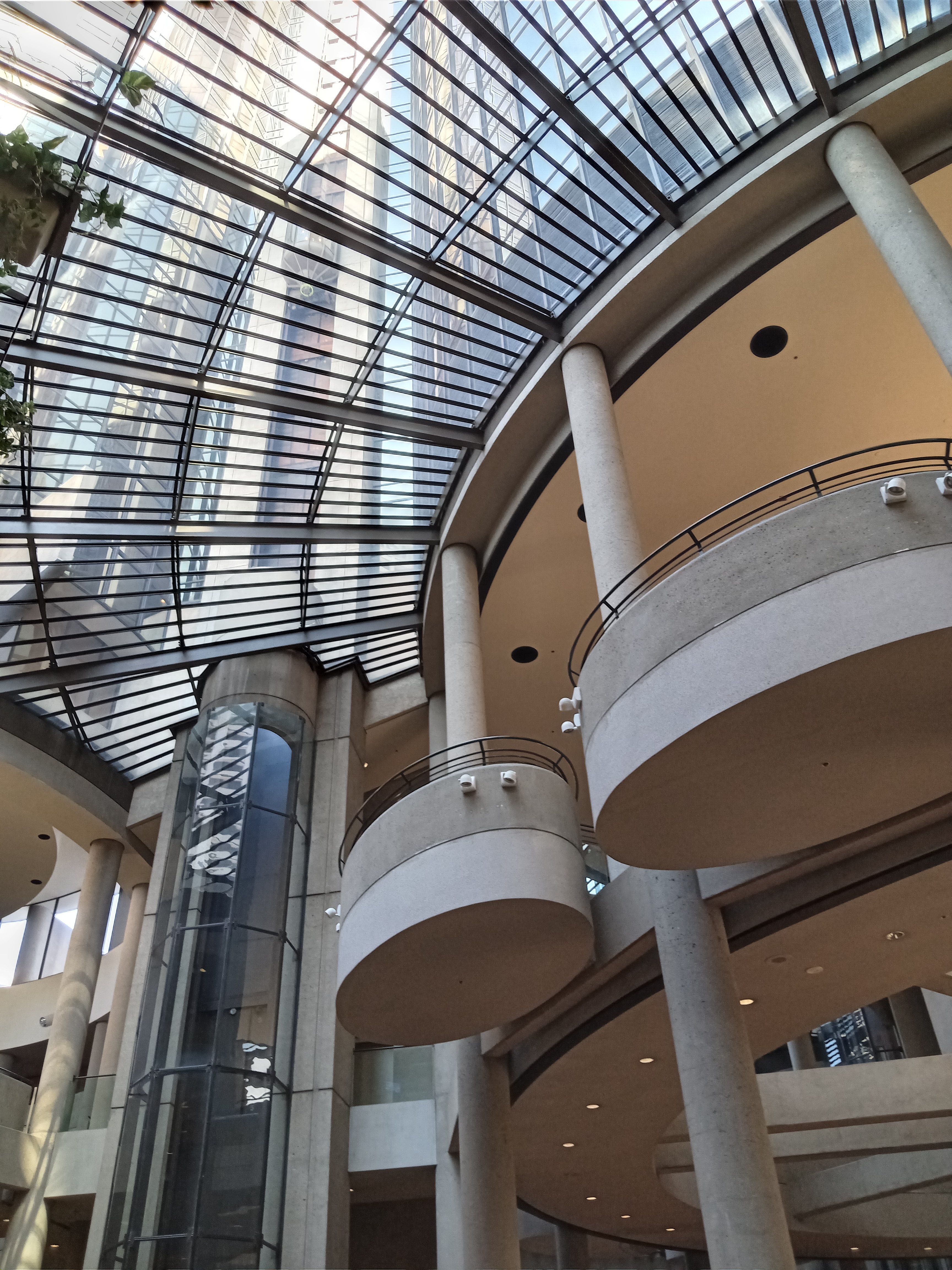
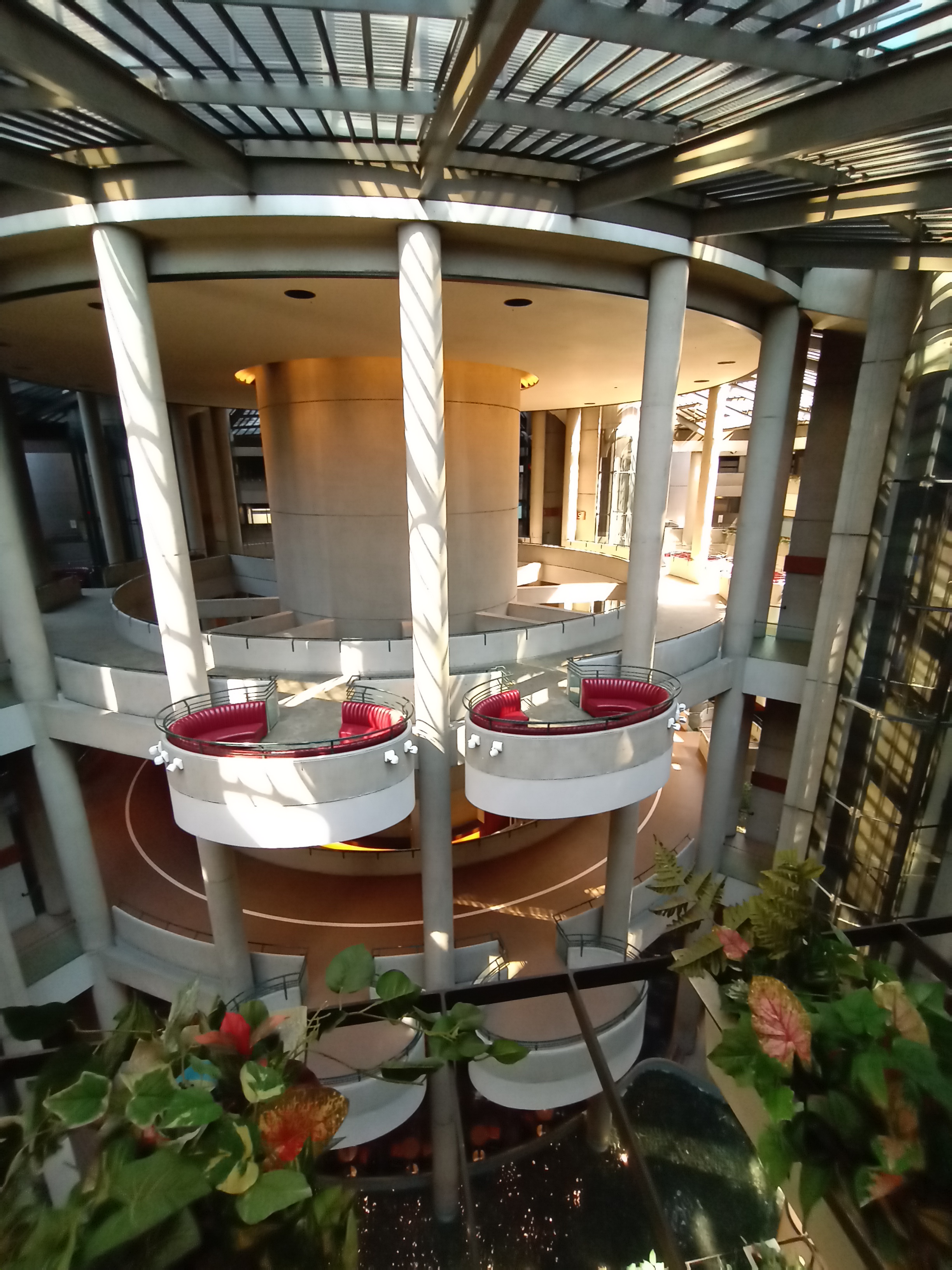
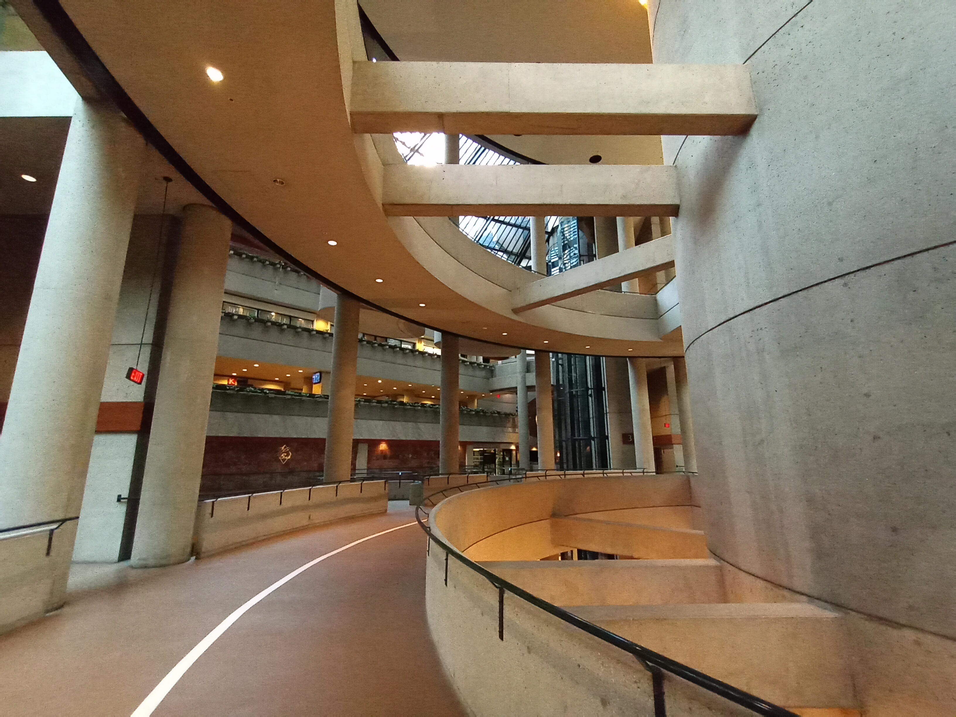
The base of the Westin Bonaventure is made up of a vast six-story atrium, interlaced by pedestrian bridges that link the four main elevator towers with the various shops and conference rooms surrounding the atrium. The architecture is gloriously sleek and futuristic, with shimmering pools at the bottom, a glass ceiling above, and glass elevators that streak from within the atrium to the outside of the towers above.


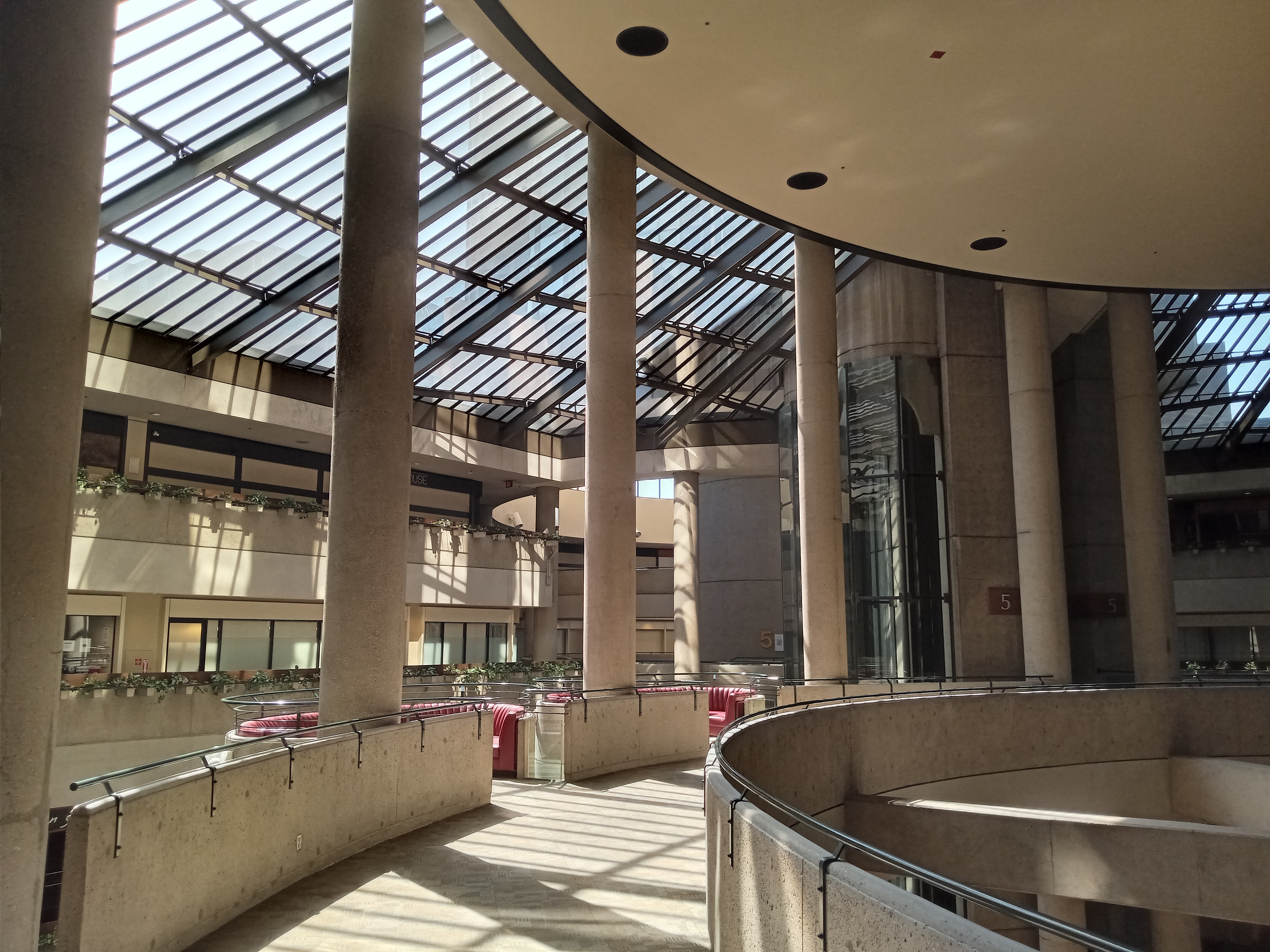
Initially, the atrium feels like an inescapable maze, but navigating it becomes easy with a little exploration. Large circular stairwells sit at the four corners of the building, and a bank of escalators links all the floors on the Figueroa Street side. The pedestrian bridges cross through the atrium on the 3rd and 5th floors, with the 3rd floor bridge also serving as a jogging track. Both levels are lined with small, oval-shaped vestibules fitted with plush couches that invite you to relax and take in the views.

If you get a chance to ride one of the glass elevators, I highly recommend it. Sadly, they require a hotel keycard to ascend above the 5th floor. There is one exception, which is the red tower elevator (follow the signs) which provides access to a restaurant on the top floor, but the restaurant doesn’t open until 5pm Thursday-Sunday, and during closing times the button won’t work. Otherwise, you can try your luck with getting in an elevator and waiting for a guest to call it up.
If the architecture seems vaguely familiar to you, then you’ve probably seen it in a movie. Hollywood has been very fond of the Bonaventure, with the exterior falling into that perfect distinctive-but-not-too-distinctive valley; interesting enough that it can believably stand in for any kind of notable large building, but not so iconic that viewers will get distracted by it or recognize it as something else. Science fiction films are particularly fond of the interior, turning it into everything from a space base to the headquarters of an evil mega-corporation of the future.

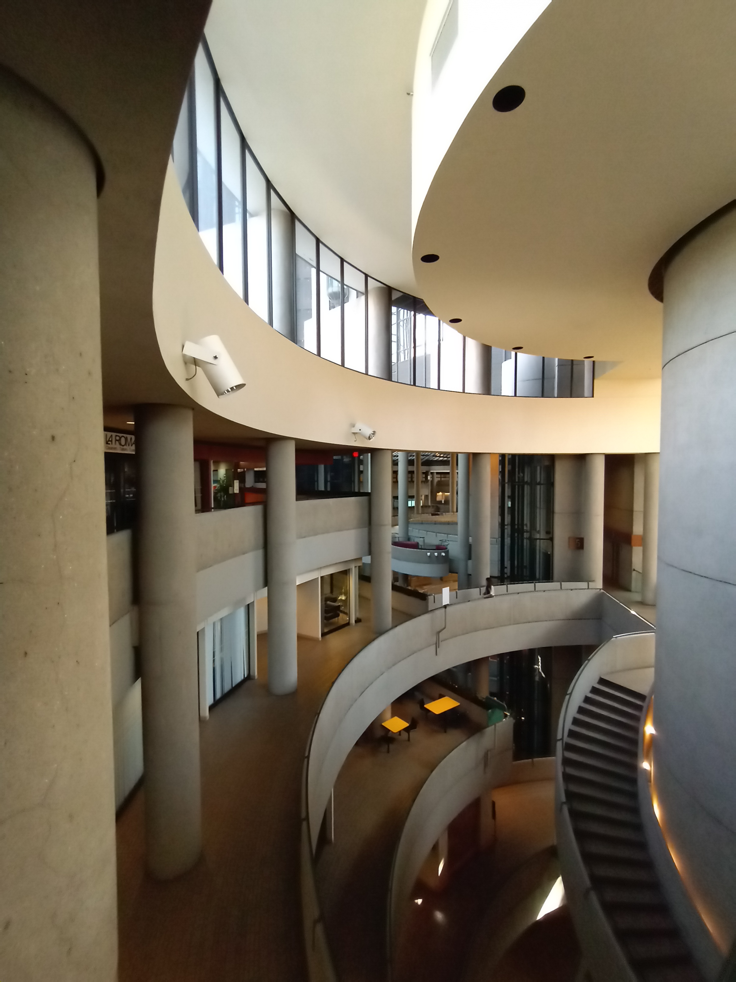
Despite its status, when you enter the Bonaventure, you’ll usually find a surreal, almost eerie stillness. The elevated walkways that ring the atrium are almost entirely devoid of people, and the various businesses that line the different floors—lunch places, a convenience store, a dental office, a beauty salon—will rarely have more than one or two customers at a time, begging the question how any business stays open in here.
The Pedways continue on from the 6th floor of the Bonaventure; look for the signs that say “YMCA Bridge” and “World Trade Center Bridge.” The YMCA Bridge crosses Flower Street to the YMCA building, and is the highest off the ground of any of the Pedways; this is the one that transitions you to the top of Bunker Hill. The little plaza in front of the YMCA has some nice public art, some of it abstract and some of it generally athletics-themed, as well as some good views of the surrounding buildings. If you continue across the plaza along 4th Street, you’ll find the most direct route over to Grand Avenue, if you intend to visit any of the attractions over there.


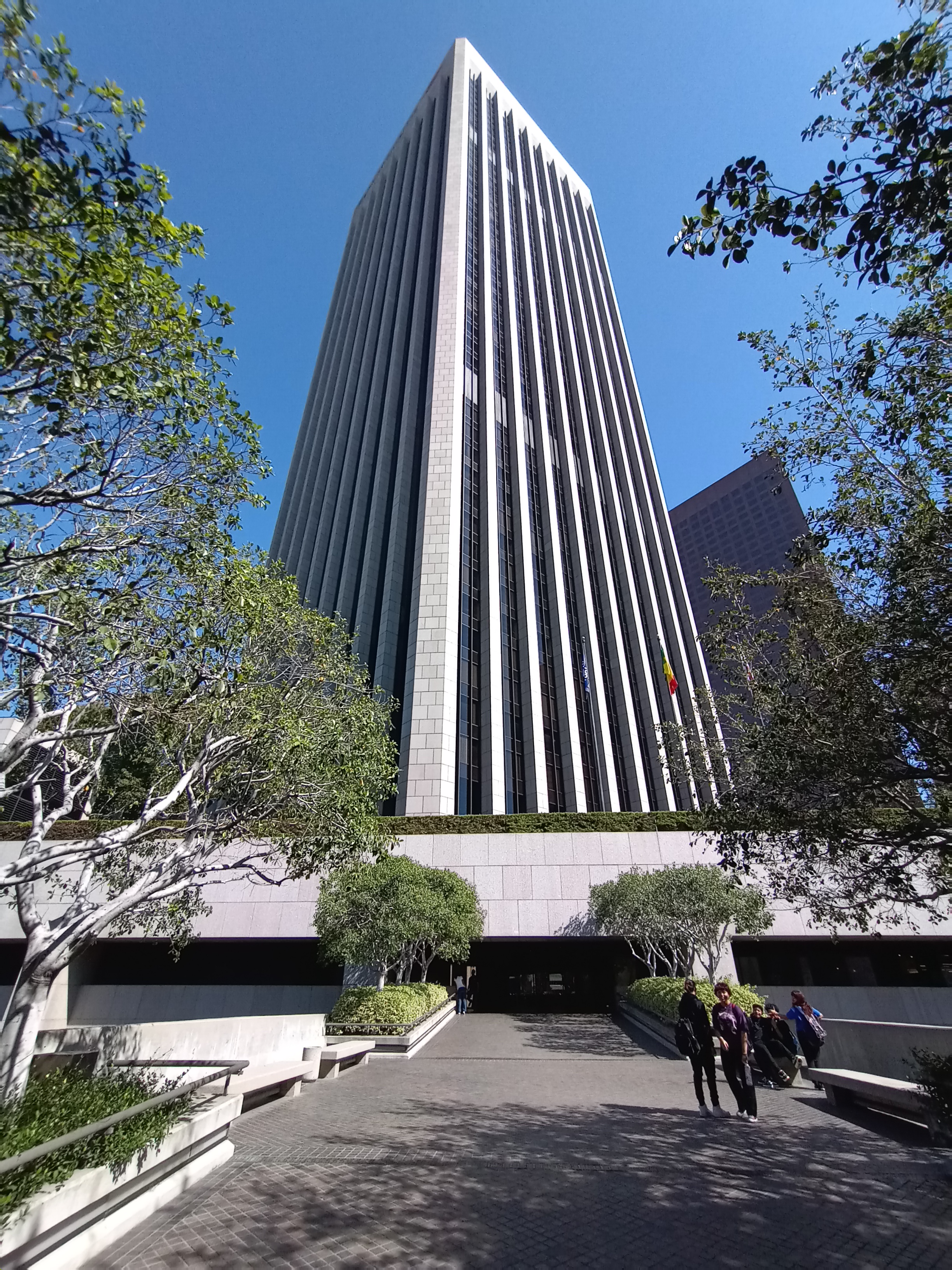
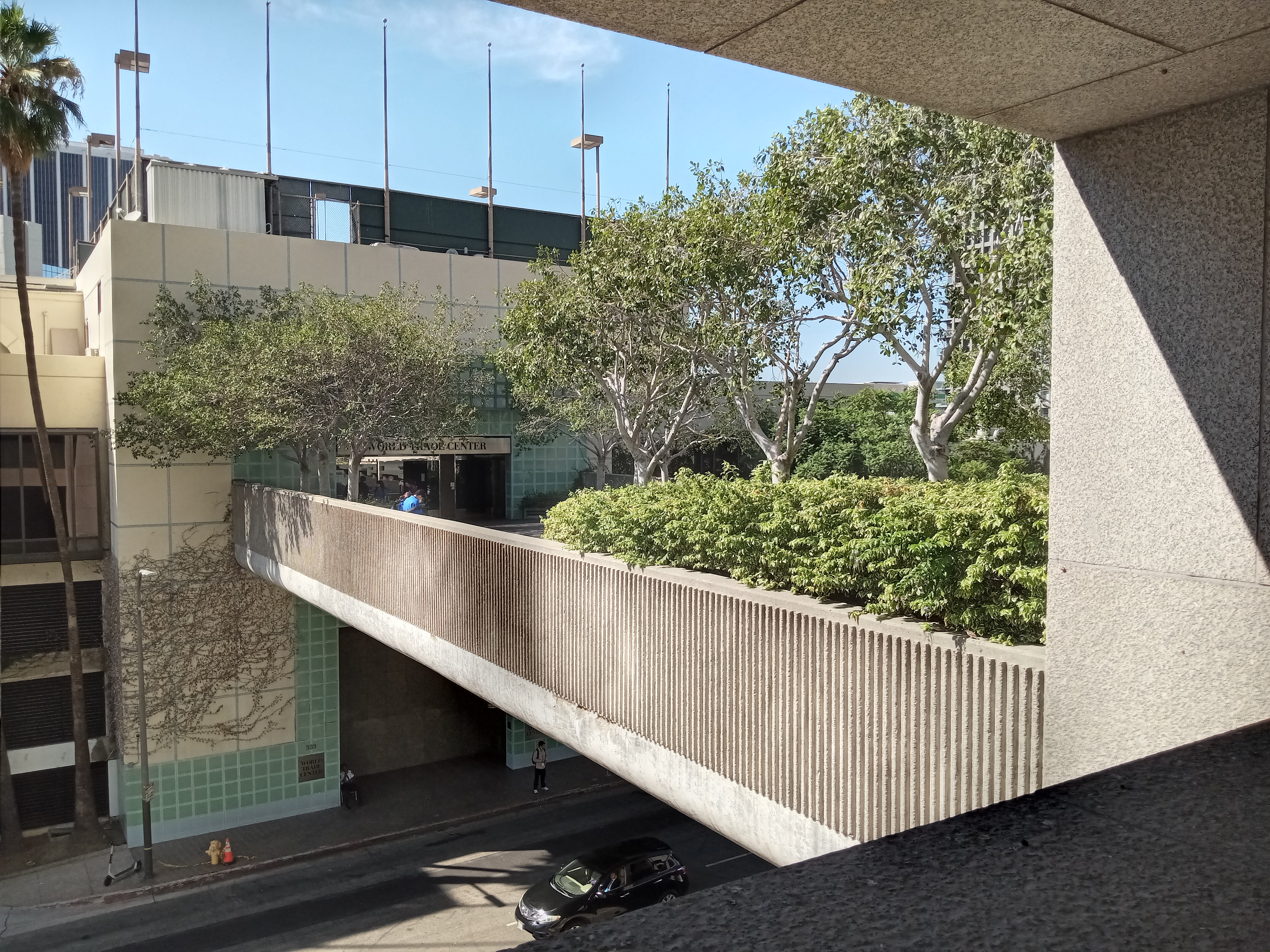
The World Trade Center Bridge crosses over 4th Street, past some tall eucalyptus trees directly into the grandiosely-named World Trade Center office building, a rather humble and nondescript 10-story building. Even upon its opening in 1974, it would have been dwarfed by the adjacent Bank of America Plaza, which opened the same year. However, the name does speak to the important, unrealized function the building was to serve. But first let’s talk about what’s actually inside.


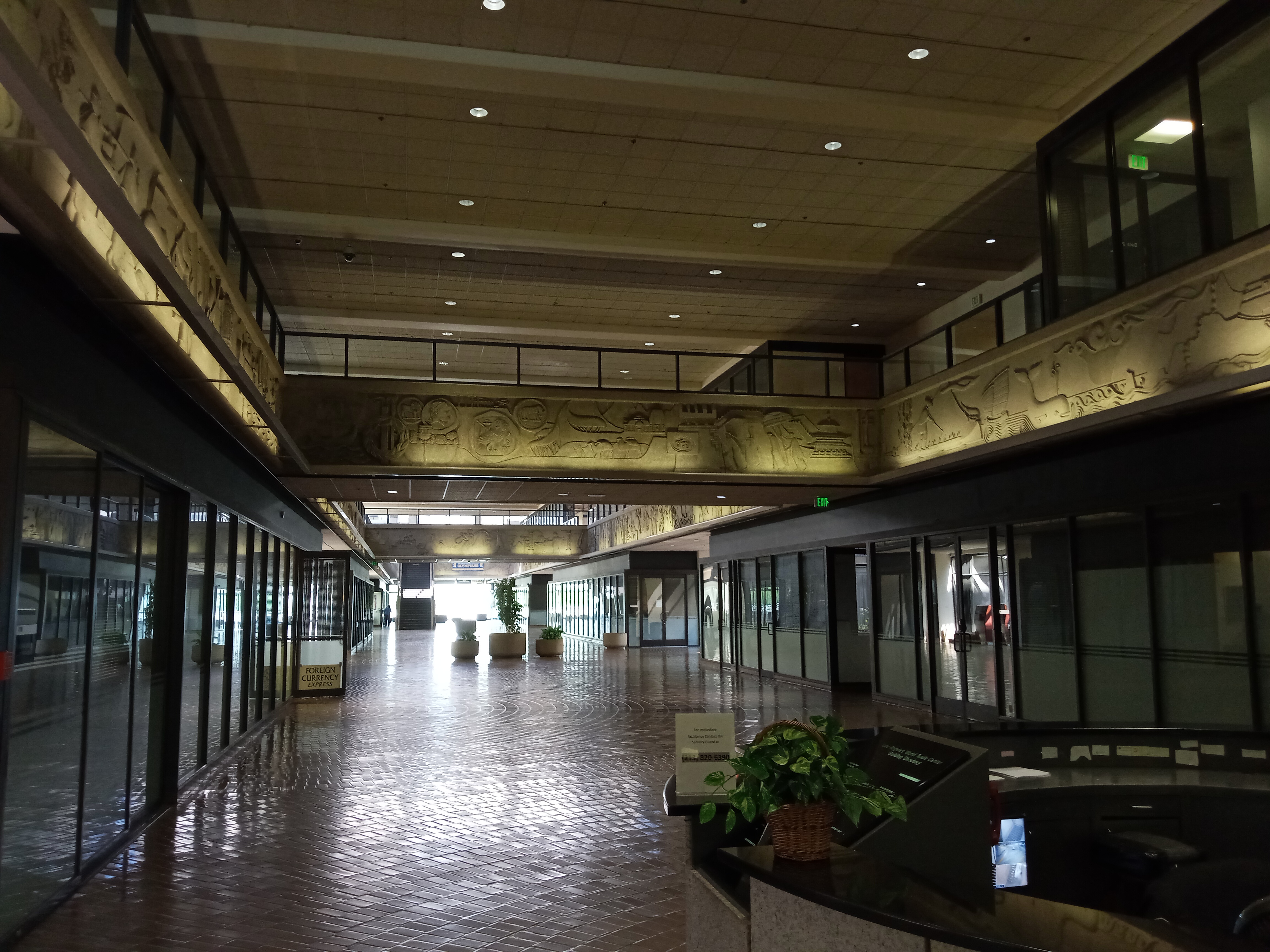
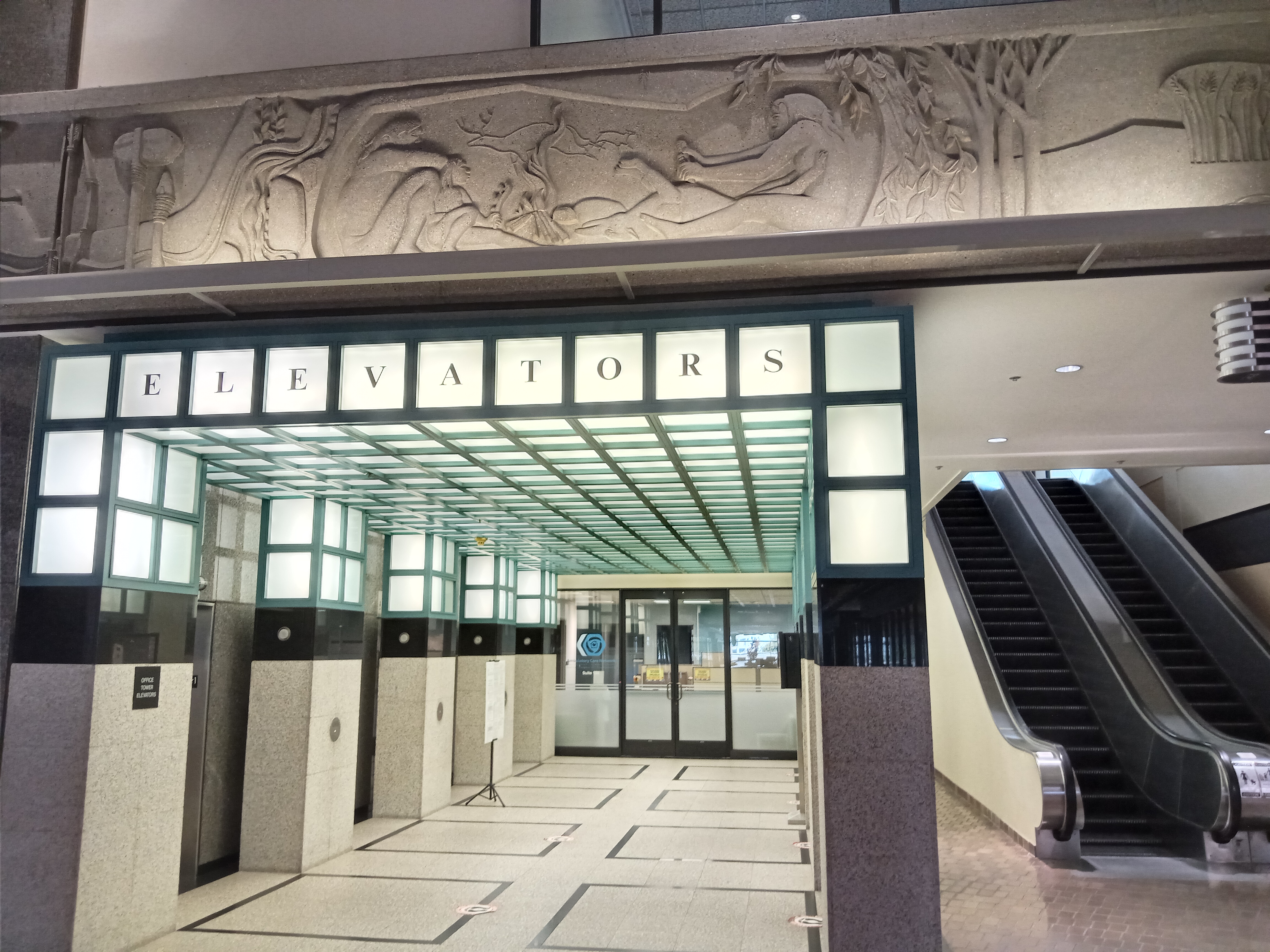
Just past the entrance, a set of escalators will take you down to the main floor of the lobby, which stretches the length of the building. A hallway to the left leads to a pedway crossing Figueroa into the LA Grand Hotel, although a hotel keycard is needed to enter that building. The main architectural feature of the World Trade Center’s lobby is an elaborate frieze mounted on the walls that depicts commerce across human history, from early man sharing pelts around a campfire right up to the industrial revolution, with a bunch of ancient cultures represented on the way. It’s the one feature that suggests this building was intended for more than just another nondescript office complex. Today, its most visible function is as the home of a college preparatory school, and if you visit on a weekday afternoon you’ll likely see a bunch of middle school kids in blue uniforms spilling out of class.
At the other end of the lobby, on the 3rd Street side of the building, the lobby doors open onto an empty rooftop deck, totally featureless save for some utility boxes and rather sad concrete planters. And believe it or not, this is the feature that would have made the World Trade Center an important hub in Bunker Hill. This deck was to be the site of one of the main people mover stations, depositing passengers who would then utilize the Pedway network to traverse into any of the surrounding buildings. This was to be the heart of a heavily trafficked Pedway system.
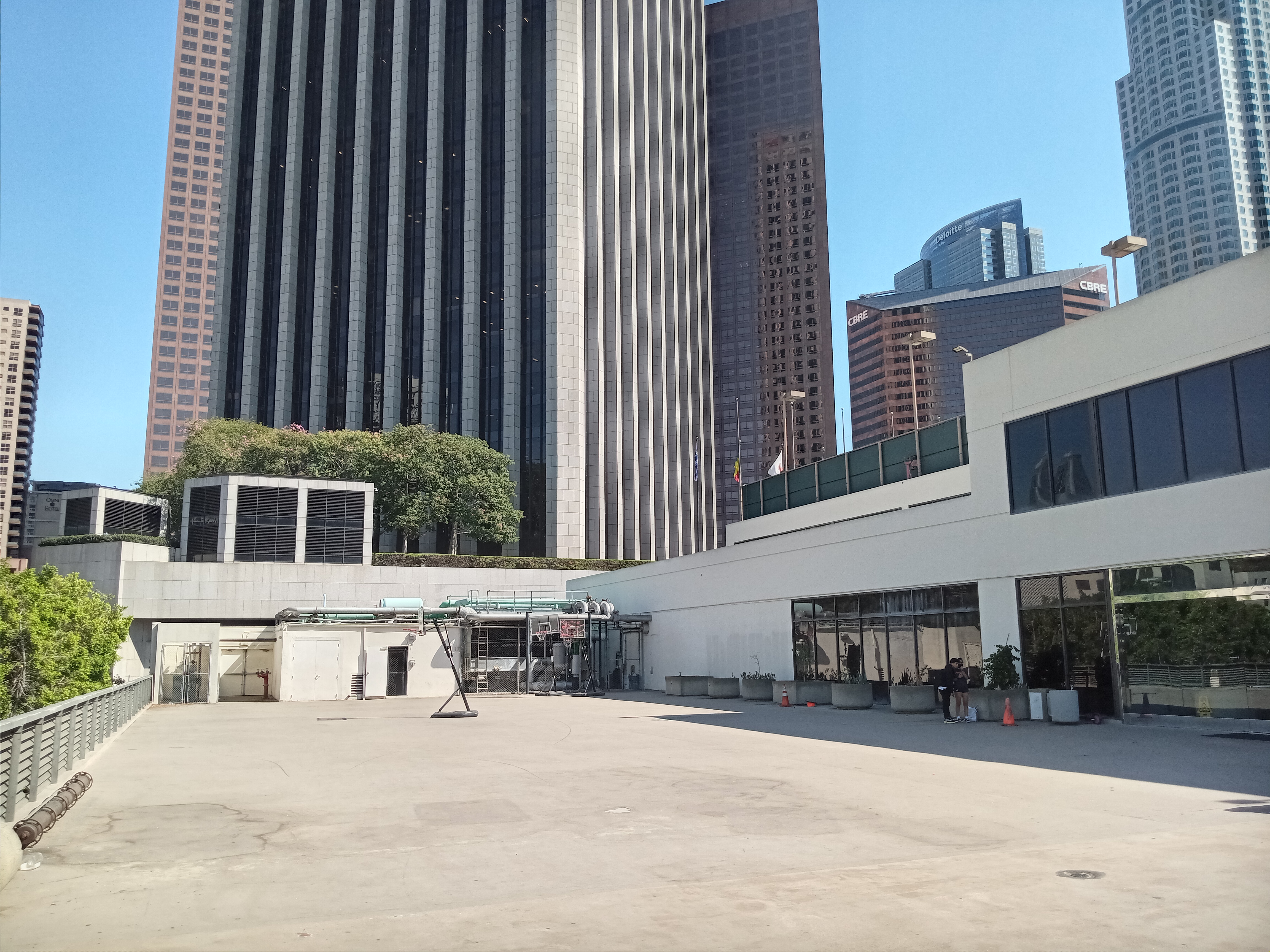

Obviously, this didn’t pan out. But the empty deck has taken on an interesting new life. The college prep school that now occupies the World Trade Center uses the deck as an impromptu schoolyard, and on one visit I found the school kids having a very rambunctious and enthusiastic game of tug-of-war on the deck, overseen by the school staff. In fact, the school children have become the most regular users of the Pedway bridges spanning out of the building, an outcome the architects and planners of the ’70s almost certainly did not intend, but a welcome one nonetheless.
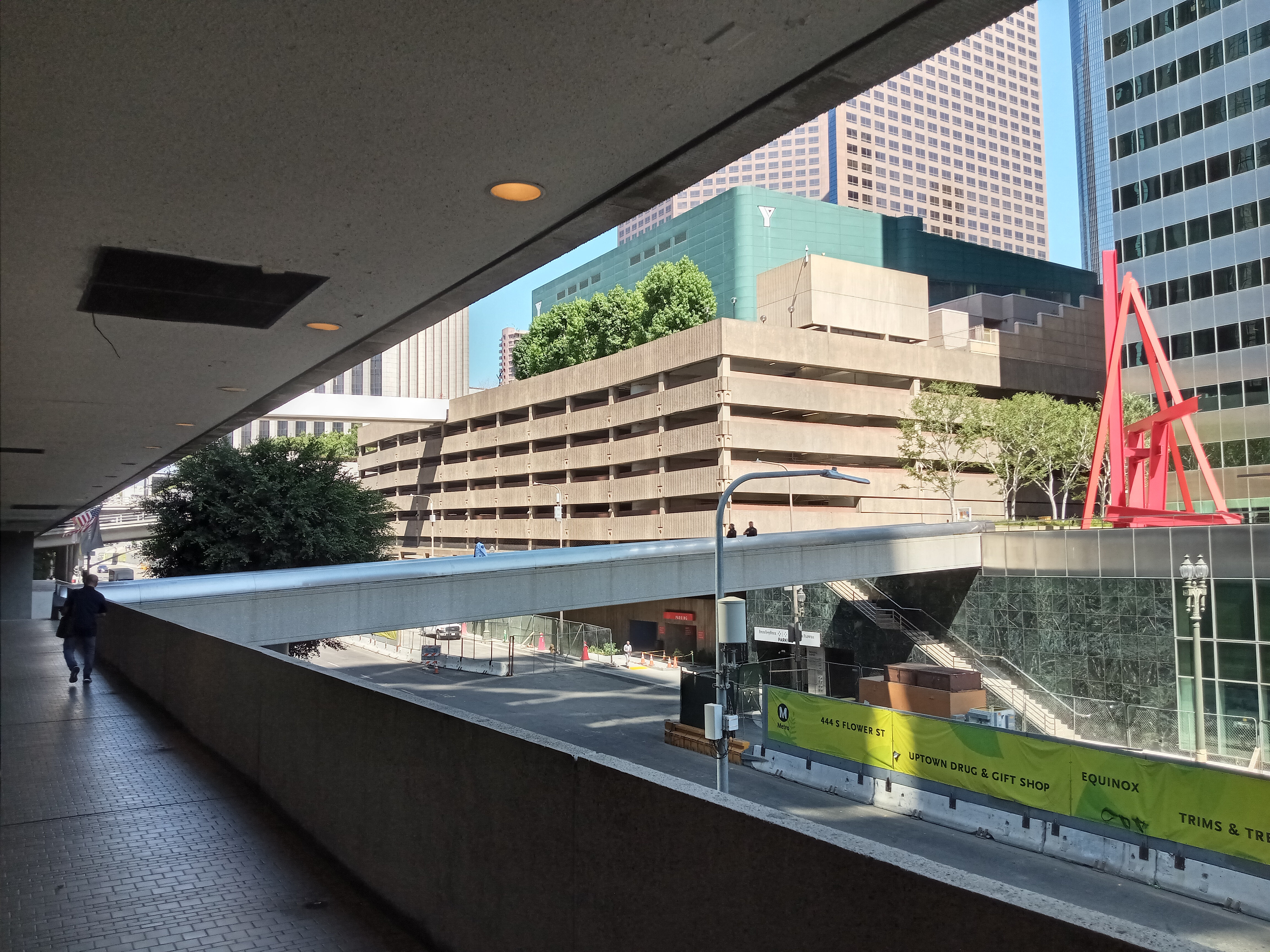
From the northern end of the lobby, a separate hallway leads to a bridge crossing over Flower Street into Bank of America Plaza. From here, you can either enter the Bank of America building or take a stairway that leads up to the plaza, either of which you can cross through to get over to Hope Street and enter the Grand Avenue district. You can also find an abandoned and rather eerie portion of the Pedway system.
As soon as you cross over the bridge into the Bank of America building, you’ll see a long passageway on your right overlooking Flower, leading all the way to the southwestern corner of the building. At the very end, an abandoned set of escalators has been blocked off, with a staircase leading down to what looks like an emergency exit onto another pedestrian bridge, this one crossing under the 4th Street overpass into the parking garage under the YMCA. It seems like this bridge was built to provide access to the parking garage for bank employees, but now it has been blocked off.


A word of warning, if you do explore this area, you will likely have security coming down to shoo you out. However, security is almost certainly the ones to blame for me venturing down here in the first place, as it was on a quiet evening walking nearby that I heard strange sounds coming from the bottom of the non-functioning escalators. When I got down to the bottom, I found a loudspeaker loudly playing the audio from an episode of the Buzzfeed Unsolved Youtube series. I’m not sure if this was a mistake or intended to keep homeless people from sleeping in the stairwell, but it kicked off my fascination with this abandoned piece of downtown infrastructure. It all has some very liminal space vibes.
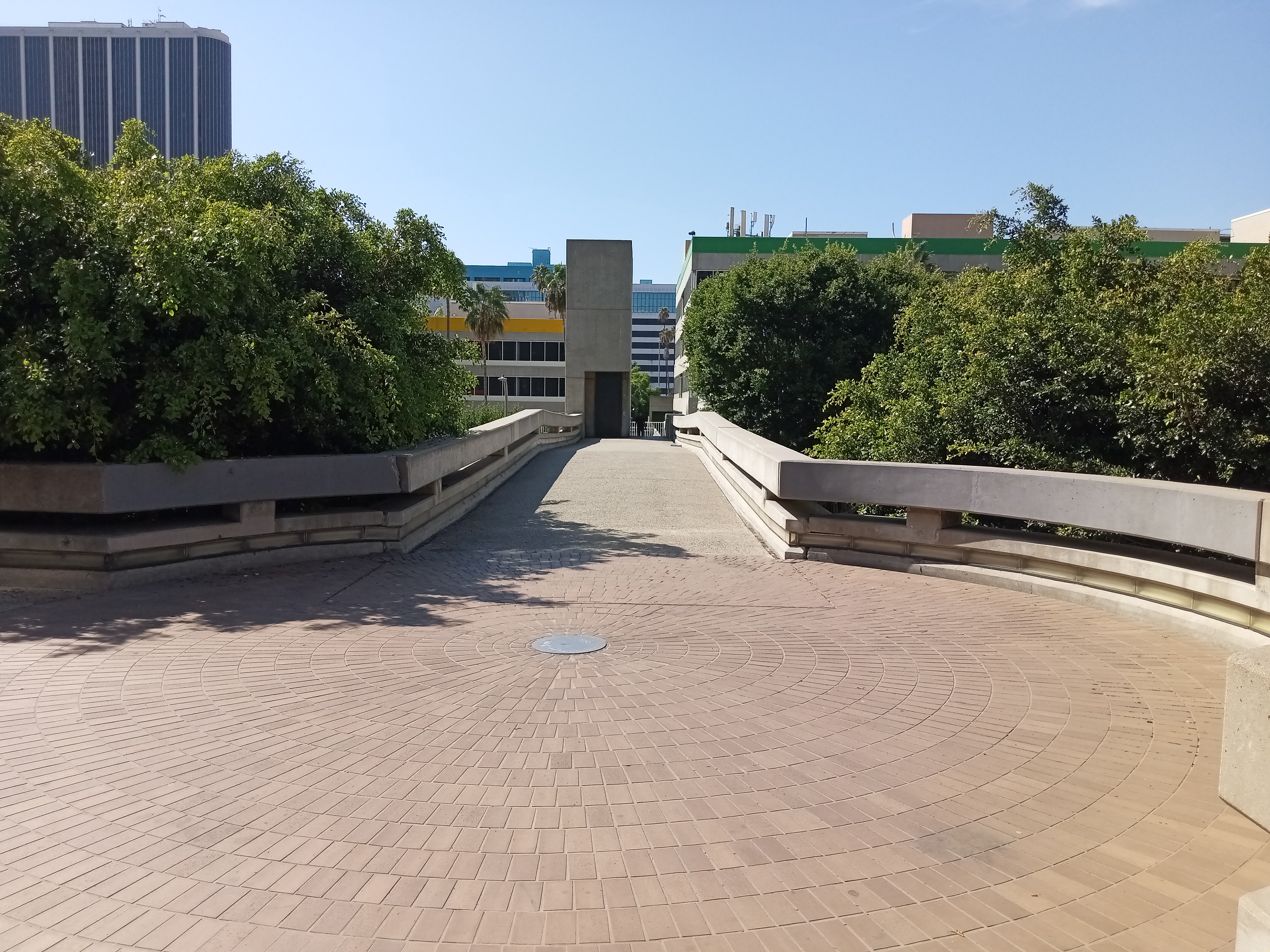
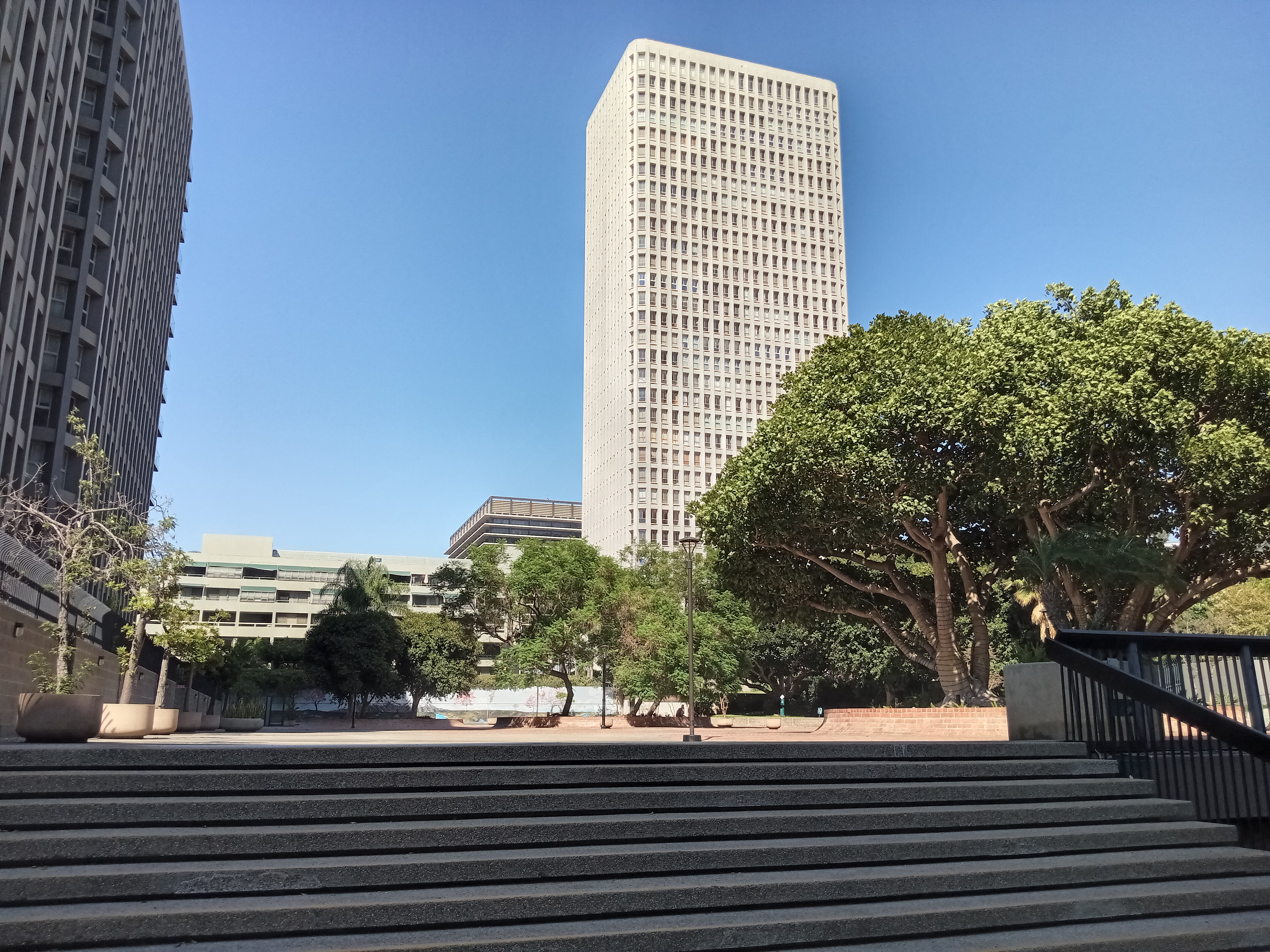
Returning to the World Trade Center and exiting onto the rooftop deck, the longest bridge of the Pedway system extends from the deck over 3rd Street and follows Figueroa for half a block, passing a circular stairway that leads down to the corner of 3rd & Fig. This stretch of pedway passes the southernmost of the Bunker Hill Towers, a massive residential complex built in the late ’60s to replace some of the housing stock lost when the city cleared away the old neighborhood. Many of the residents of Bunker Hill relocated into these towers, although most were scattered across the city.

About halfway between 3rd and 2nd, the bridge comes to a fork, with the left bridge crossing over Figueroa and terminating at a bland office campus currently dubbed The Park DTLA. Here, at the northernmost extent of the Pedway network, a small, weathered plaque embedded in the ground offers the only visible marker of the whole system, as well as its official name: the Calvin S. Hamilton Pedway, named in honor of the city’s director of planning at the time, who was probably the Pedway’s biggest advocate. Hamilton’s face adorns the plaque next to a map of the entire network.
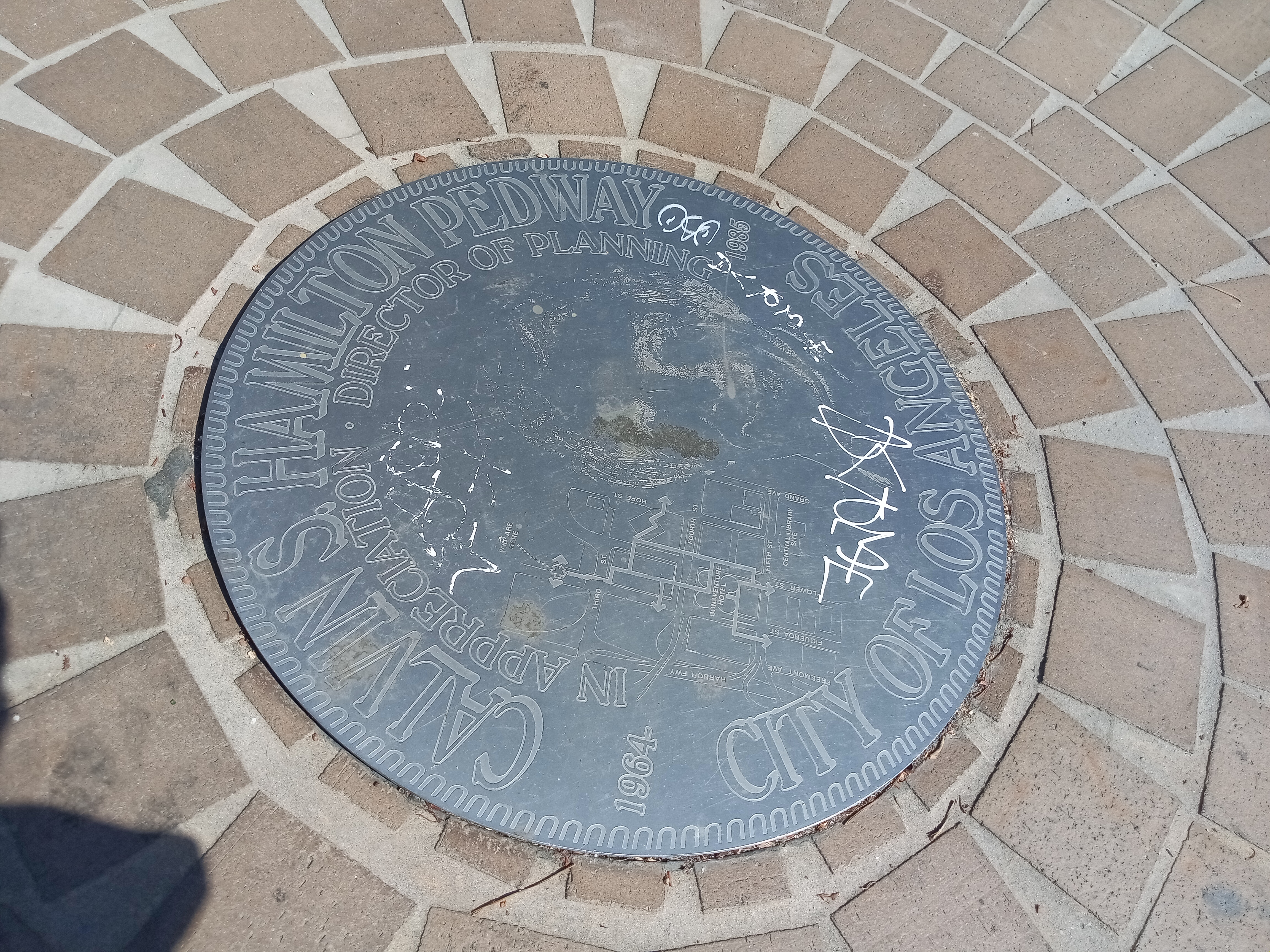
Had Hamilton’s full proposal been built, the pedways would have extended south all the way to 8th Street and east to Pershing Square. But the death of the people mover proposal and changing attitudes in urban planning foreclosed the possibility of new pedways. Even when planners had long since become disillusioned with the idea, Hamilton defended the pedways, telling the LA Times in 1989, “If pedways had been done the way we recommended, it would have created a much better pedestrian environment in the central business district. It would certainly have made it easier to walk around, and would have eased the traffic congestion.” To the bitter end, Hamilton was convinced that the ideal city was one in which automobile and pedestrian never interacted, ignoring the fact that such a setup naturally favored the car.
Making a right at the plaque will take you into the wide plaza of the Bunker Hill Towers complex, a fairly pleasant but definitely dated space that has all the hallmarks of ’70s landscape architecture: too many stairways, bulky concrete planters, lots of featureless space, and an unnecessary amount of brick.

Continuing straight through will place you right across the street from the Grand Avenue/Bunker Hill Metro station. The station is the site of Bunker Hill’s newest pedestrian bridge, which connects the station’s elevators to the plaza adjacent to The Broad, making for an easy pedestrian connection to Grand Avenue that avoids navigating the hill’s difficult terrain. Ironically, this bridge actually fulfills the goal the original Pedway system never realized: connecting the destinations of Bunker Hill to a major transit hub.


Per the map, it’s not the Citigroup Center anymore, just street address (and it’s in foreclosure).
LikeLike
Very cool. Can you recommend any location with dystopian/sci-fi vibes?
LikeLike
Here is hyperlapse video of the version of the pedway loop that I (Dan Gutierrez creator of SoCal Stair Climbers) use on the group walks I lead in the area, starting and ending at the Source Figure sculpture in the plaza at the top of the Bunker Hill steps.https://www.youtube.com/watch?v=vjRQ2q1V7GM
LikeLike
Thanks for the recommendation Dan, will check it out this weekend!
LikeLike