San Pedro feels a lot further from Los Angeles than it actually is. In fact, it is Los Angeles, still located within the official city limits, but you could be forgiven for thinking that it’s a completely different city. It’s still heavily working-class (though gentrifying, as with the rest of LA), its identity still firmly tied to the port and industry. It’s hugely important to the history of Southern California’s development, and to this day just about anything with a “Made in China” sticker likely came through these waters.
But, to be fair, it is a long ride down the 110 to get there. Point Fermin, the southern tip of Los Angeles, is almost exactly as far from Union Station as Disneyland is. And it’s that southern tip that we’re exploring in this post, with its many interesting attractions and beautiful, though surprisingly quiet coastal scenery.
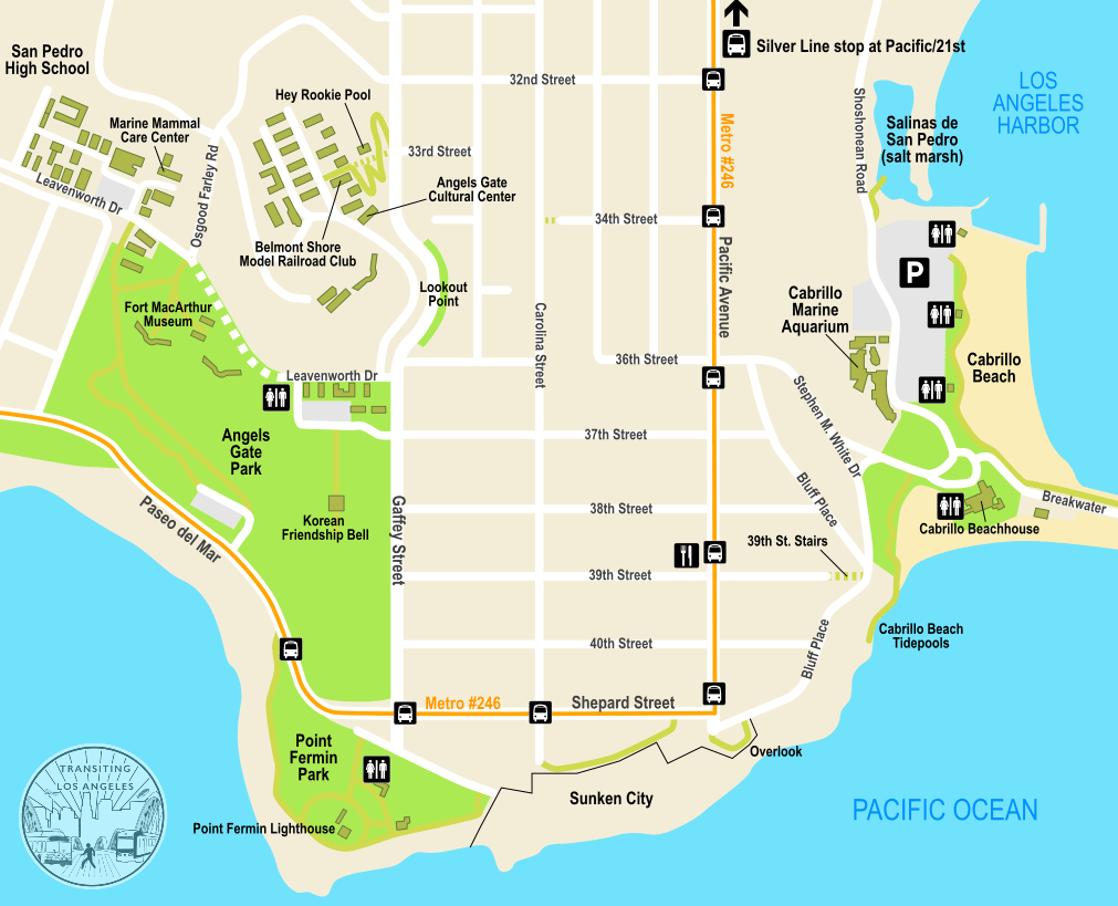
Getting to San Pedro by transit takes some time, depending on where you’re coming from, so you want to make sure you take that into account when planning your trip. The best option into San Pedro is the Silver Line (now renamed to the J line), an express bus service that mostly operates in freeway bus lanes between El Monte, Downtown LA, and San Pedro. It takes a little over an hour to get from Union Station (use the El Monte Busway stop) to San Pedro.
One important thing to remember about the Silver Line is that it’s actually two overlapping lines, the #910 and the #950. The #910 only goes as far as Harbor Gateway, so you want the #950 to go all the way to San Pedro.
Ride the #950 all the way to the very last stop, at Pacific Avenue and 21st Street. From here, you can take Metro Bus #246 the rest of the way down Pacific Avenue to the coast, which runs every half-hour until 7pm. Or, if you don’t want to wait for the 246, you can also walk just a little over one mile to get to the neighborhood.
We’re going to list the attractions starting with Cabrillo Beach facing the harbor, then work our way around and up the coast to the sights at the top of the hill. But whichever order you tackle these is completely up to you. Some of these places have pretty limited hours, so keep that in mind when planning when to go.
From the Silver Line stop at Pacific/21st, you can take the #246 bus down Pacific to 36th Street, then walk down Stephen M. White Drive to the roundabout with the statue, which marks the entrance to Cabrillo Beach. Or if you prefer to walk, we recommend walking down 22nd Street towards the harbor, then make a right on Via Cabrillo Marina and follow the signs to the aquarium along this rather scenic stretch of road.
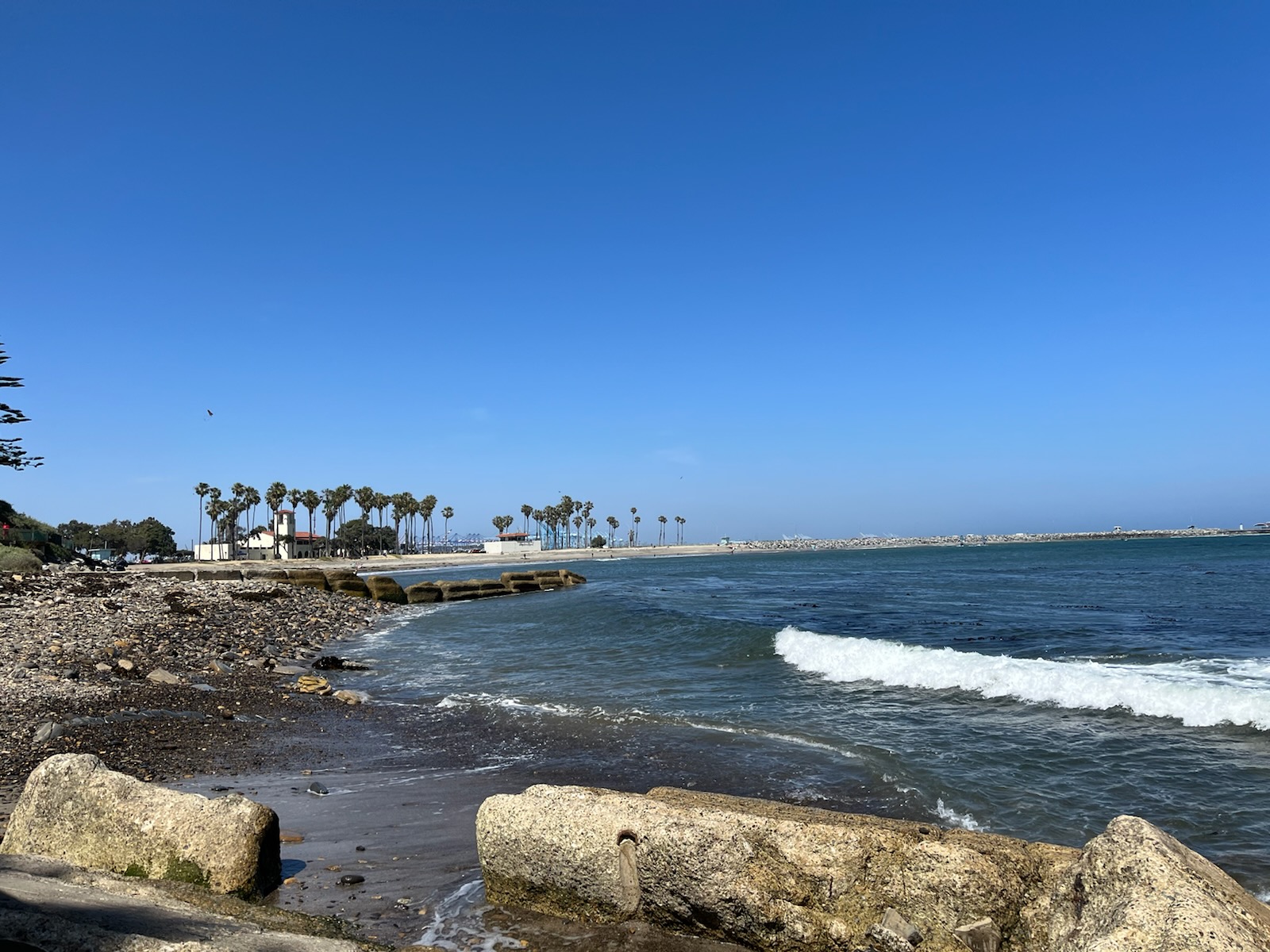
Cabrillo Beach sits on the southeastern corner of San Pedro, where the harbor meets the sea. It’s broken up into two very distinct beaches, an inner (harbor) and outer (ocean) side, separated by a breakwater which extends almost two miles out into the water, ending at a lighthouse that’s just barely visible in the distance.

The beach is named for Juan Rodriguez Cabrillo, a Portuguese sailor and conquistador who led the first European expedition to set foot in California. They probably didn’t land on this particular beach, but they likely anchored out in the bay, which they dubbed Baya de los Fumos, the Bay of Smoke. Where the name comes from isn’t clear; it might be referring to the campfire smoke from the numerous indigenous villages that would have populated the Los Angeles Basin, or perhaps Cabrillo’s men visited during a wildfire. At any rate, it started the proud tradition of people remarking upon LA’s poor air quality.
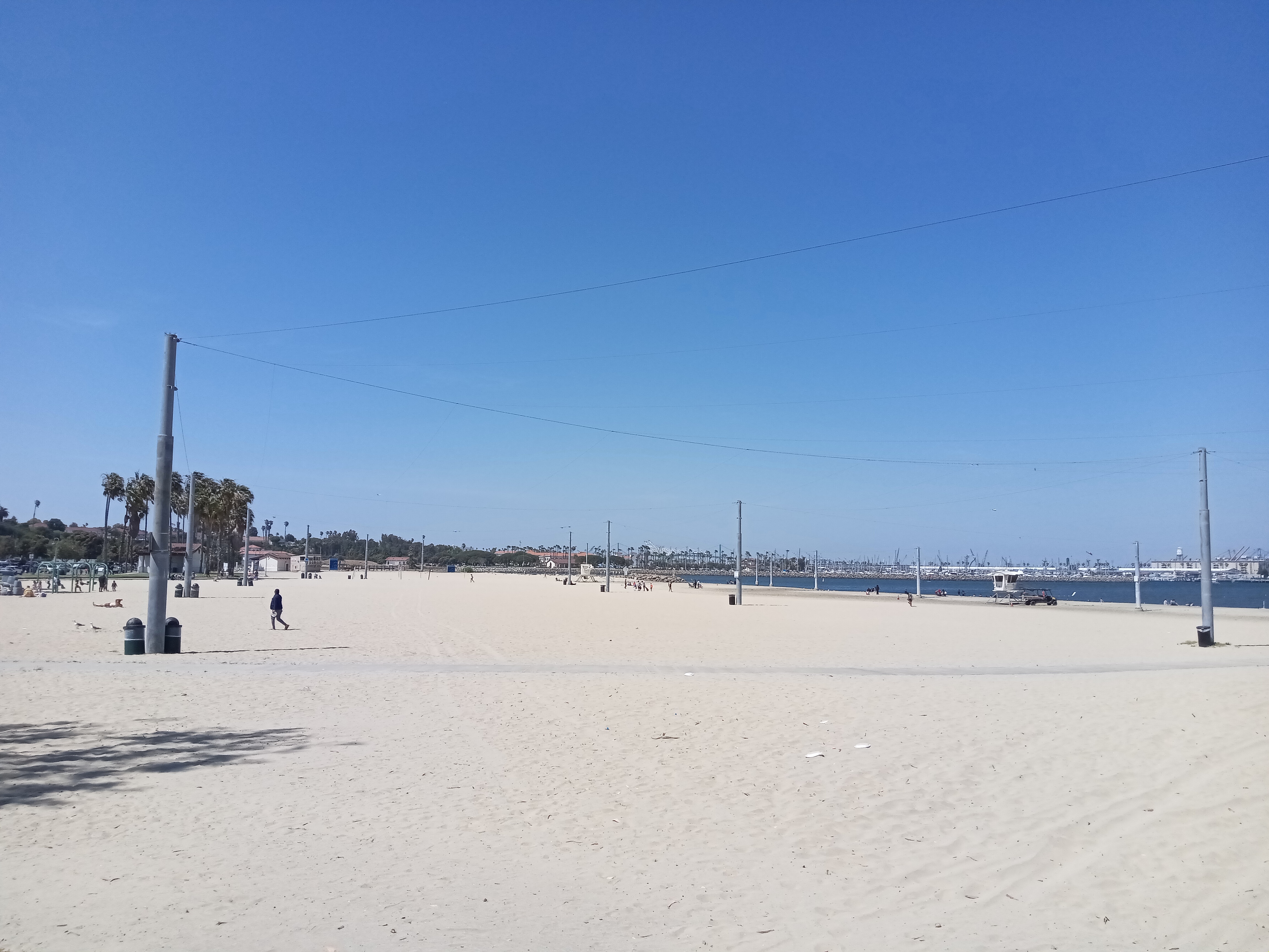
The inner beach, facing the harbor and fronted by the large parking lot, is naturally the calmer one. It’s a wide expanse of white sand that’s popular with families, swimmers, and casual beachgoers. At the northern end of the beach, past the parking lot, a restored salt marsh provides critical habitat for wading birds and aquatic life.

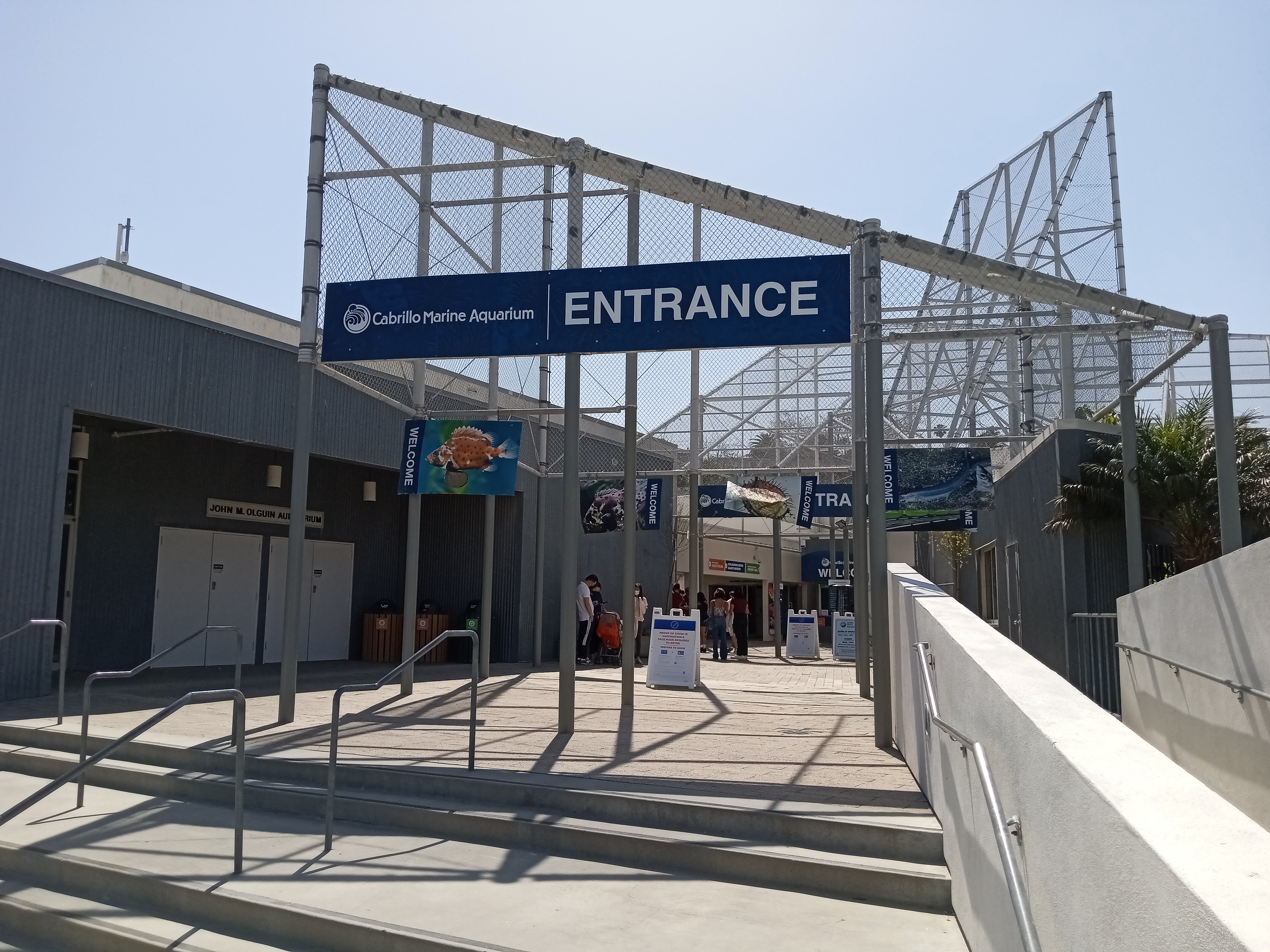
However, the real highlight of the inner beach is the Cabrillo Marine Aquarium, fronting the other side of the parking lot. It’s open Tuesdays through Sundays and runs solely on donations. Inside, you can find plenty of great exhibits and information on the coastal environment and marine life. In fact, one of the handouts you can pick up is a detailed walking guide to the various habitats of Cabrillo Beach.
Despite being housed in a Frank Gehry-designed building, the aquarium is not very flashy, with a heavier focused on education than the touristy Aquarium of the Pacific across the harbor in Long Beach. But don’t let that dissuade you, because this aquarium has some of the strangest and most unique exhibits I’ve ever seen in an aquarium.

Most of the exhibits are what you’d expect. The main hall (currently closed for renovations through late 2025) is full of displays about California marine life, with lots of tanks showing off smaller marine animals like huge crabs, lobsters, jellyfish, moray eels, fish, and small sharks. In the back is a big touchpool that’s popular with the kids, with your typical tidepool inhabitants such as starfish and sea urchins.


Where it gets unusual is the level of detail the aquarium is willing to go to to show how certain animals behave. A two-sided sea urchin tank has their food plastered on the glass, so you can actually see the mouths on the bottom of the sea urchins munch away at the kelp. In the next tank, carnivorous sea snails show off their long appendages, which reach through slots in their tank to feed off the carcass of a fish several inches away. Icky, but fascinating stuff.


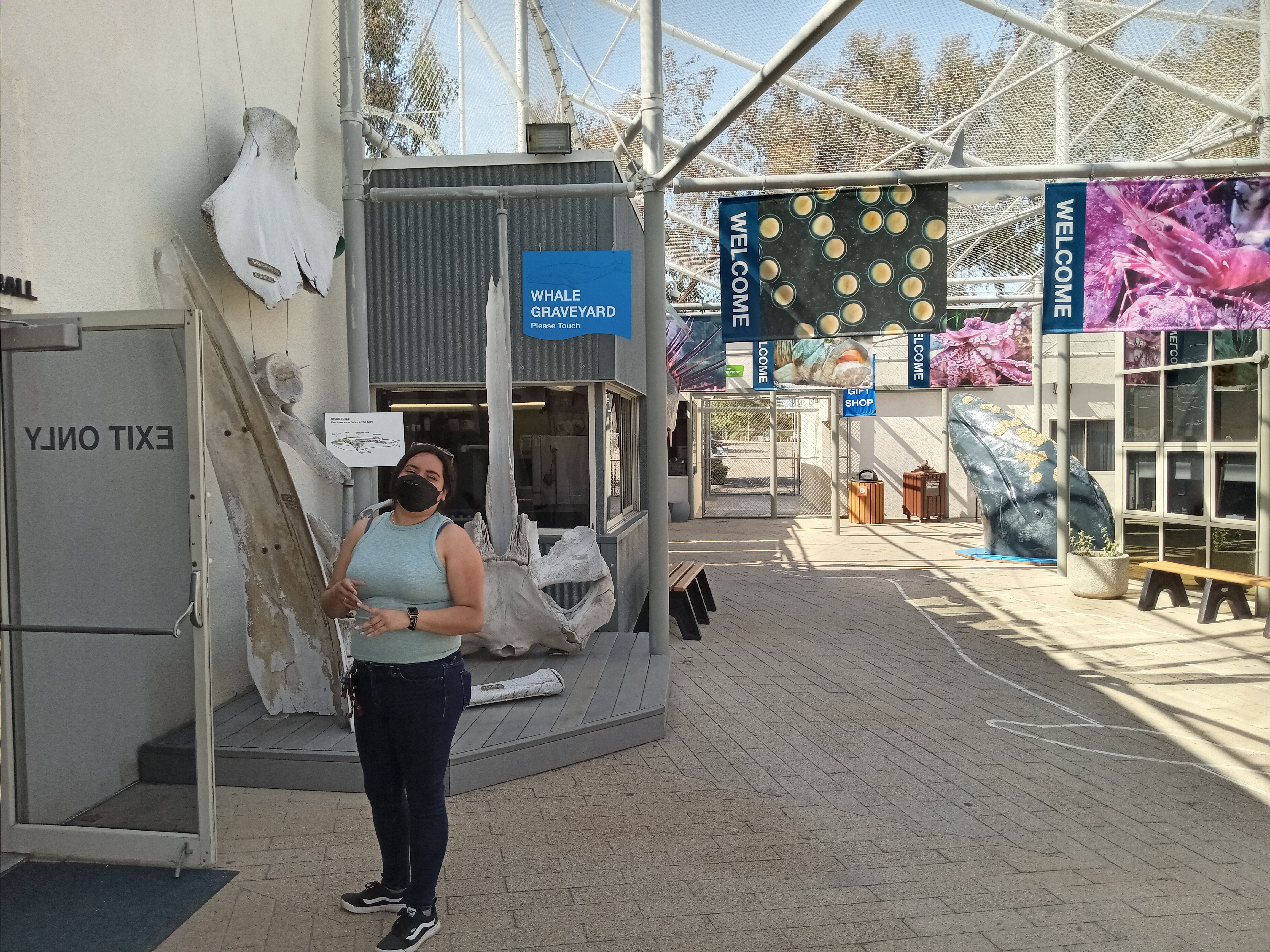
This is also the only aquarium I’ve ever been to that really shows off their nursery, which is open to visitors and has lots of exhibits showing how they grow marine life and all the factors they have to take into consideration, like the pH level of the water and the amount of light to provide and, honestly, far, far too much chemistry and detail for casual viewers like ourselves, but very educational for anyone who wants to learn how you grow jellyfish in a tank. Next door is the Exploration Center, basically a large children’s area with plenty of interactive exhibits, while out in the courtyard you might see occasional demonstrations like grunion hatching.


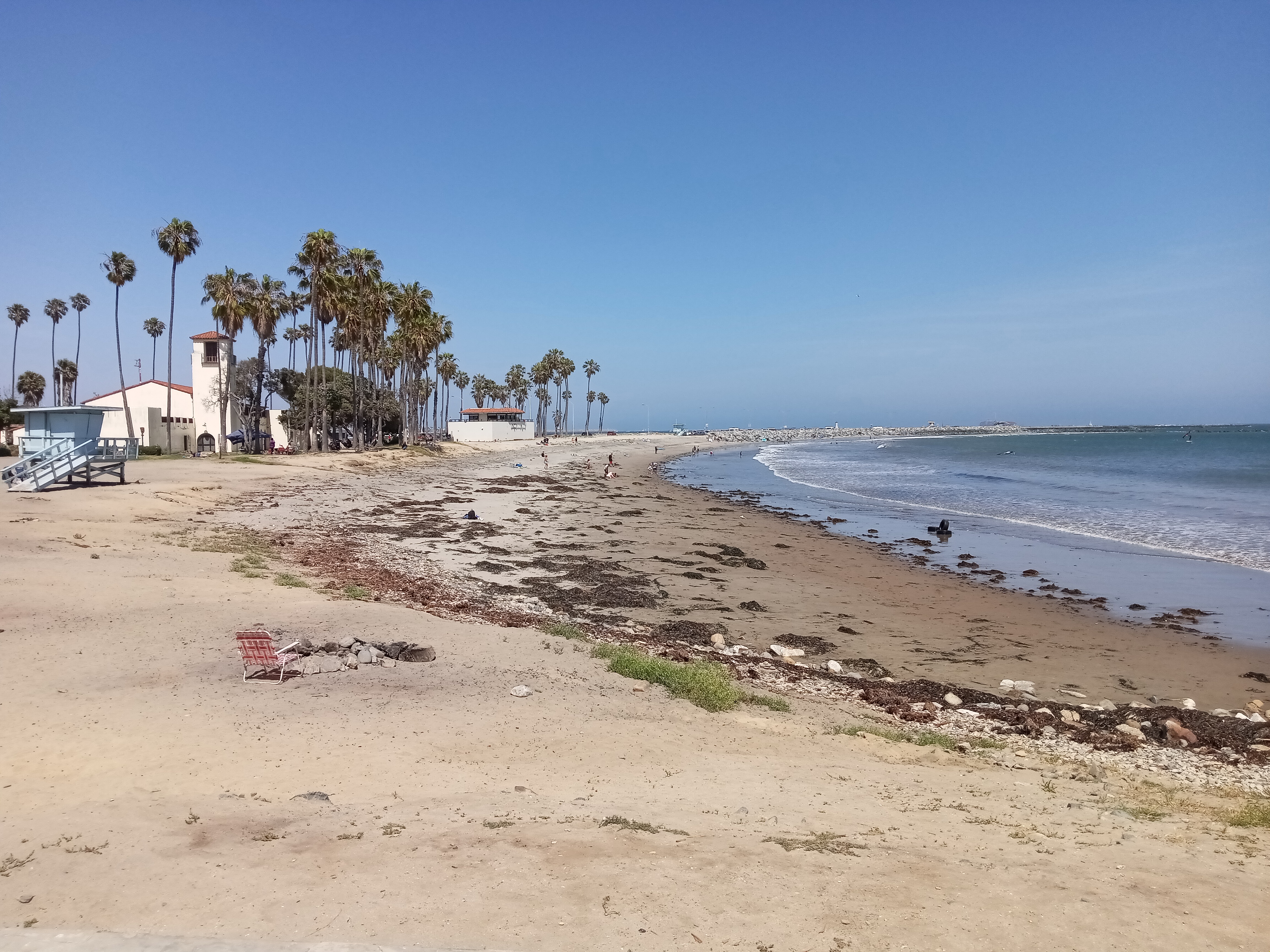
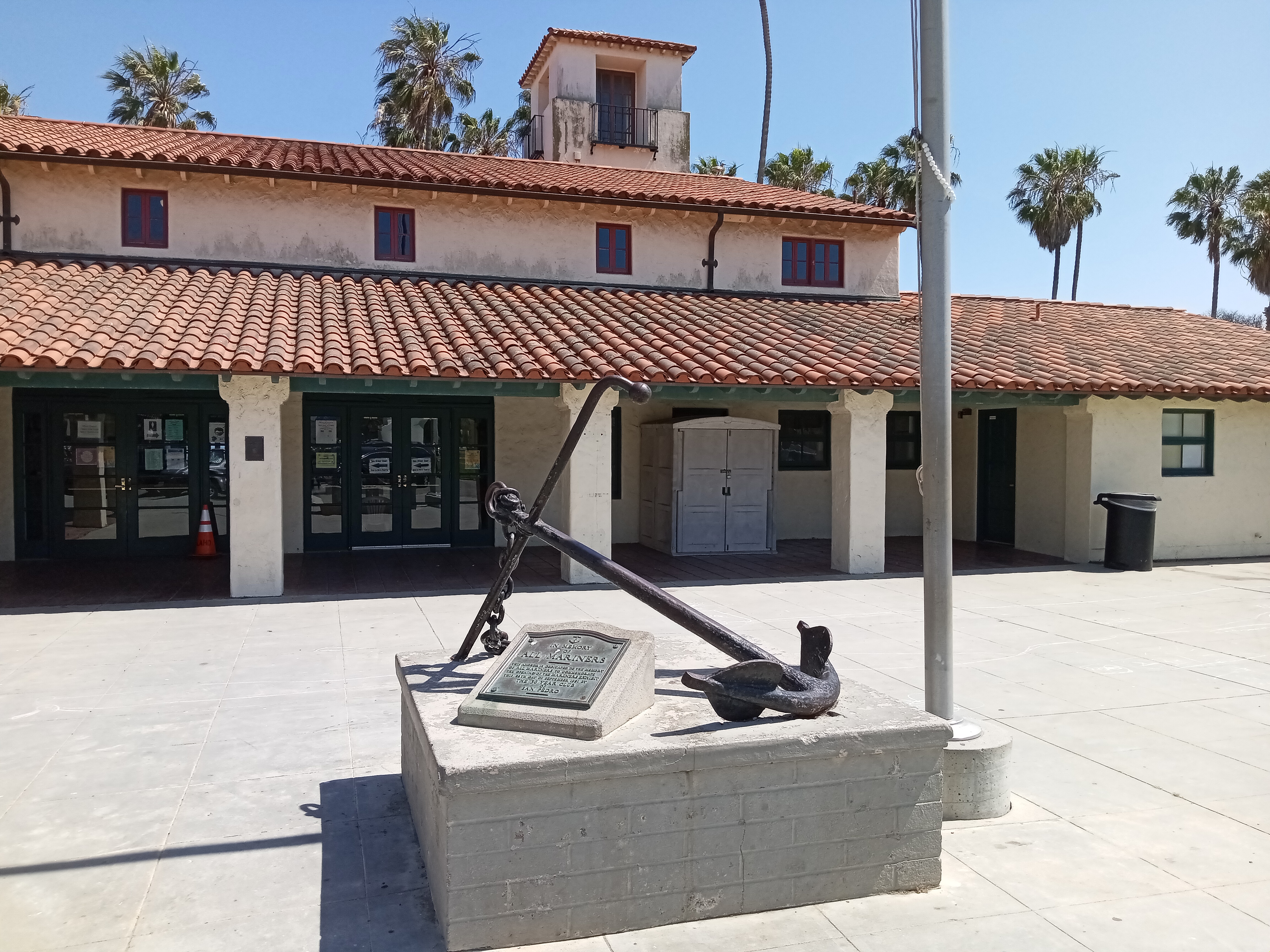
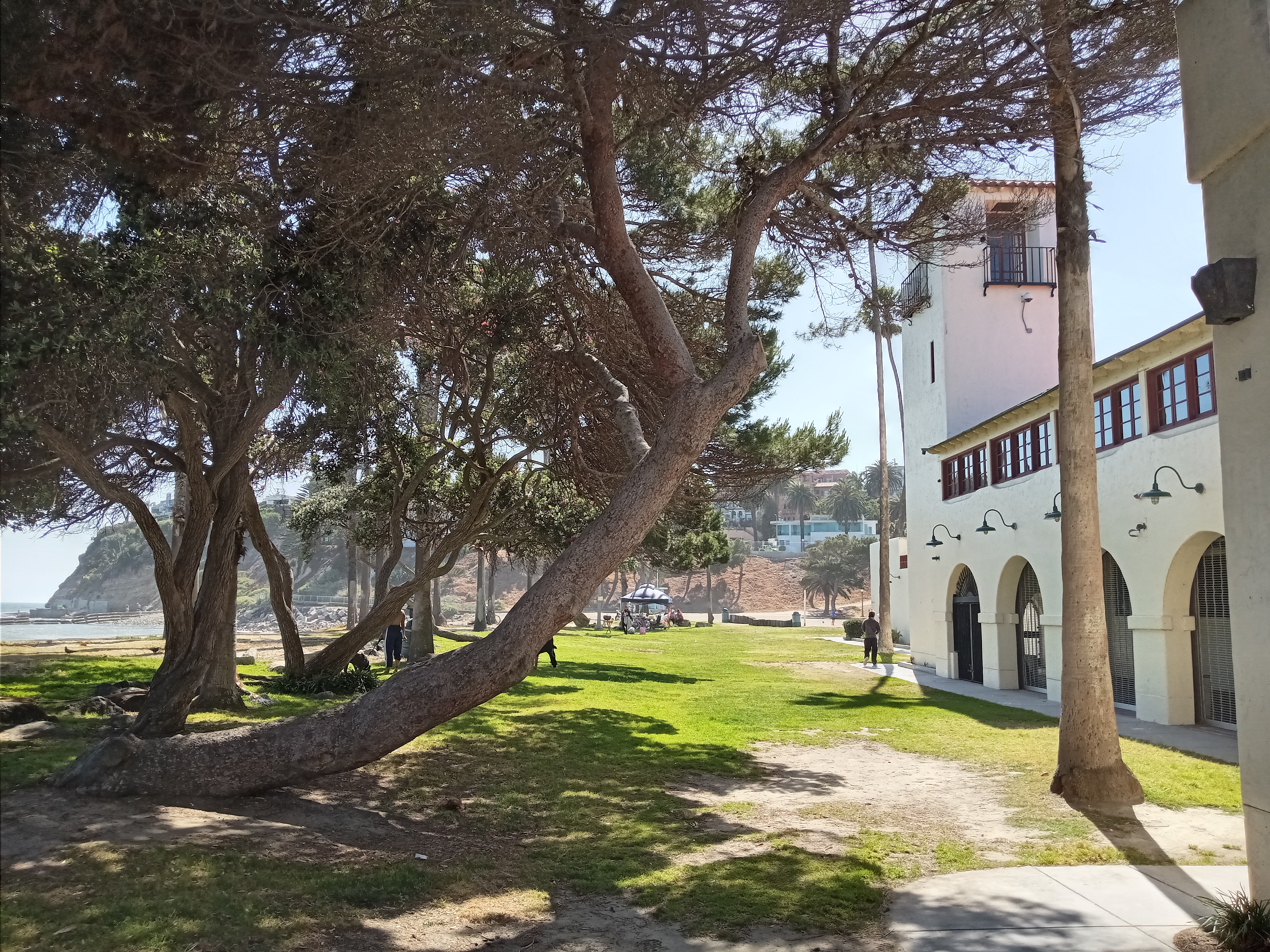
Returning to the beach and turning our attention towards the ocean, the outer beach is centered around the Cabrillo Beach Bathhouse, a charming 1930s red-tiled roof structure that once served as the original home of the aquarium and has plenty of restrooms, beach showers, and a community center that hosts recreational programs. In contrast to the inner beach, the outer beach gets the full brunt of the ocean, with high winds and turbulent surf that make it popular for windsurfing.
The outer beach is also home to some really scenic tidepools that are very easy to access. Head towards the point where the beach meets the cliffs and you should find the nice, elevated boardwalk that will take you along the cliff to the rocky outcropping amongst the crashing waves. You’ll always find families enjoying themselves out here, tossing rocks into the water, exploring the tidepools at low tide, or scrambling around the massive, graffiti-covered concrete remains of a huge structure that once stood here.


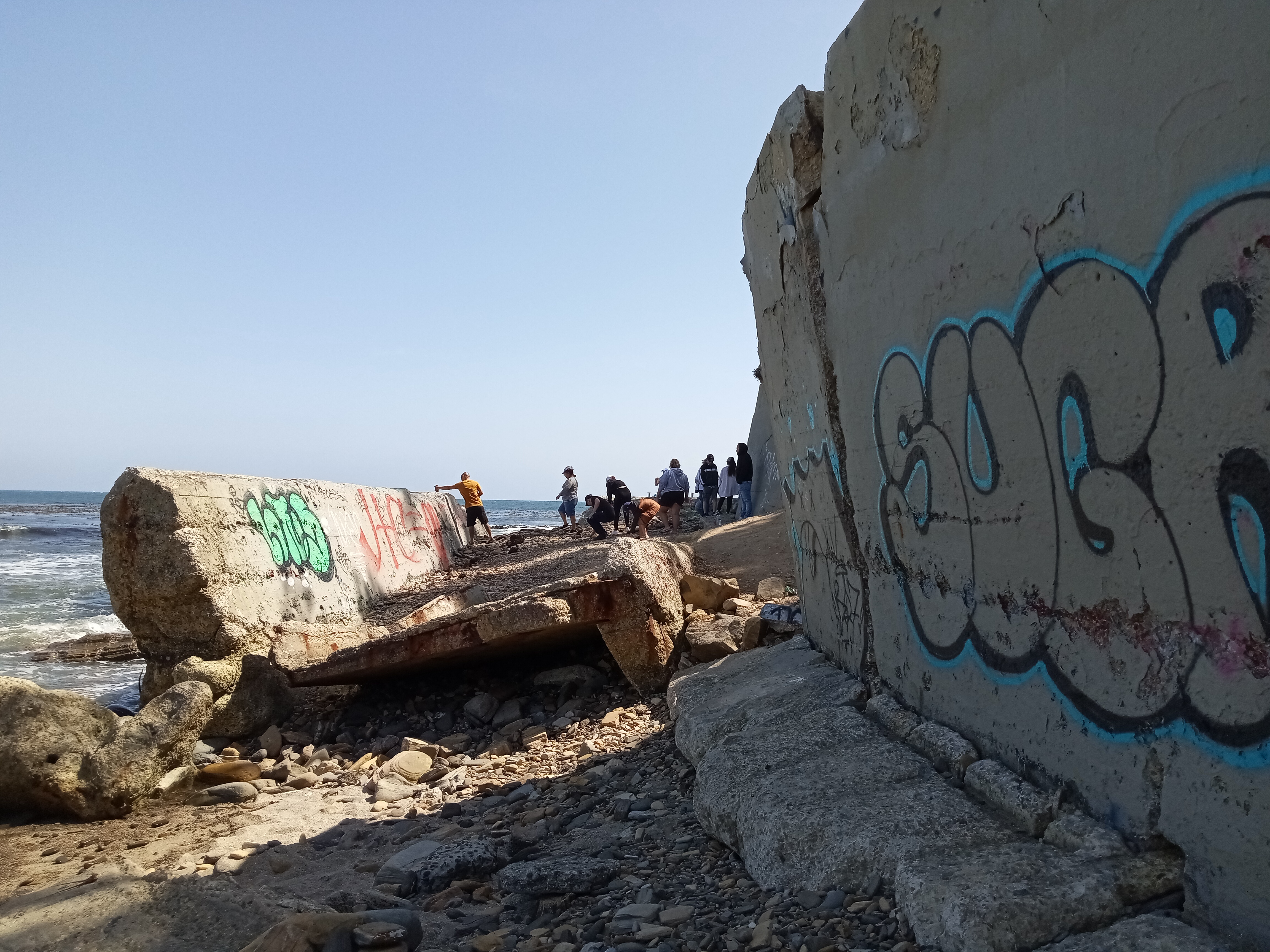
These huge concrete slabs are the remains of a military bunker that was built here, intended for coastal defense during WWII as a control center where mines floating outside the harbor could be detonated remotely, although it was never used for this purpose. Today the ruins lend a distinctly post-apocalyptic vibe to the beach.
Returning to the Bathhouse and heading uphill, the entrance to the beach is marked by a roundabout with a statue of former California senator Stephen M. White, for whom the street is also named. In the 1890s, White returned to San Pedro a local hero after defeating efforts led by Collis Huntington of the Southern Pacific Railroad (and uncle of local streetcar magnate Henry Huntington) to move all port business to an entirely Southern Pacific-controlled port at Santa Monica.
Thus began the “Free Harbor Fight,” with the winner being determined by which port would receive federal funds to build a breakwater. San Pedro was regarded by experts as the natural location, given that it was relatively protected from the ocean, but Huntington held considerable political influence in congress. White successfully introduced a measure that if Santa Monica was chosen, any railroad would be allowed access, crippling Huntington’s potential monopoly. Before long, the government sided with San Pedro and construction on the breakwater began.
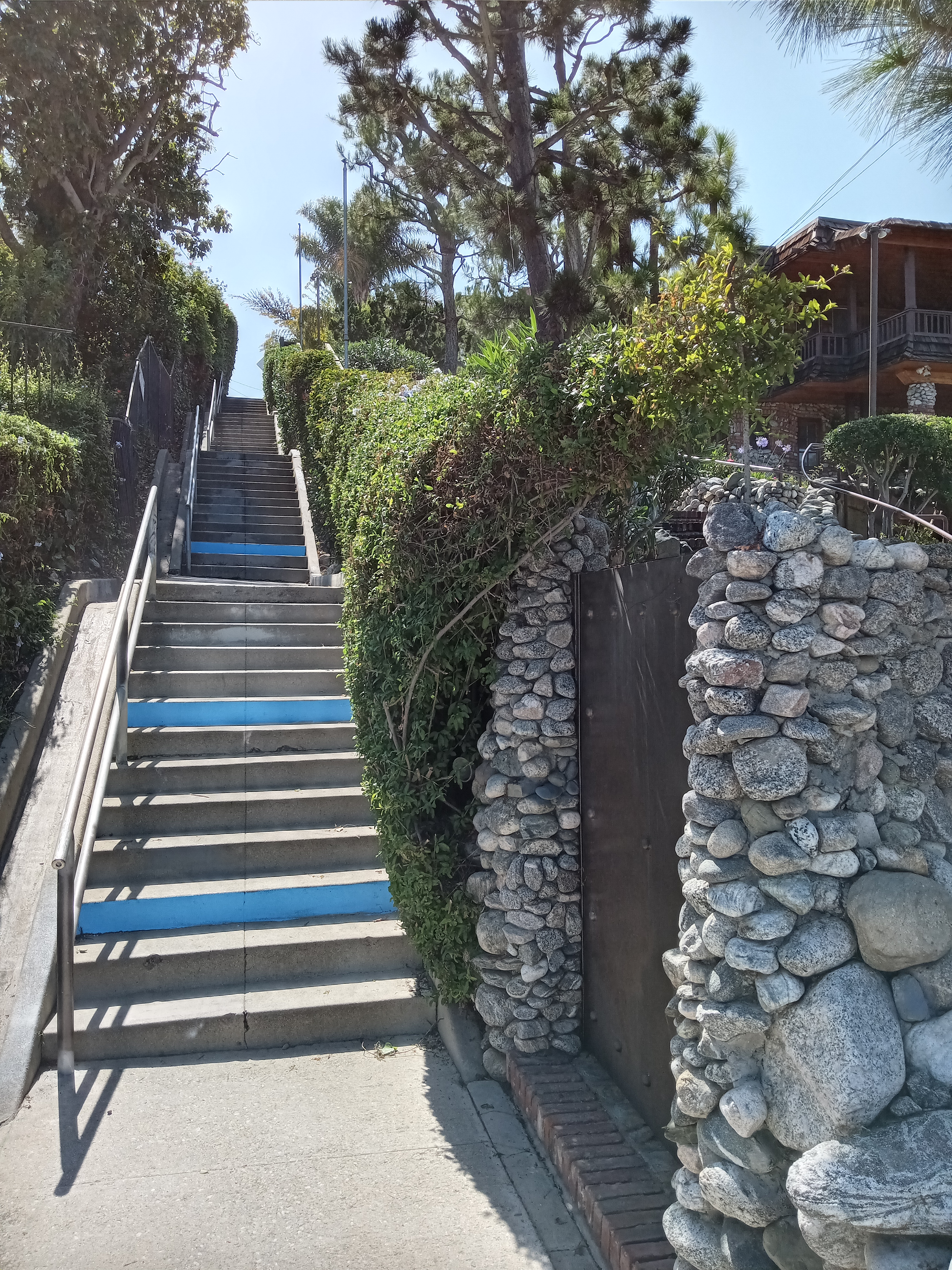


From the roundabout, make a left (towards the coast) and walk a block to Bluff Place. Just past the intersection, and just past a gorgeous house on your left with beautiful stone walls, you’ll find the base of the 39th Street Stairs, a handy and scenic way to ascend into the neighborhood proper. From the top of the stairs, you’ll get some really nice views over the harbor. Continue up 39th Street and you’ll reach Pacific Avenue, where there’s a cute little corner store next door to a pair of diners, the Pacific Diner and the Lighthouse Cafe, which are both open for breakfast and lunch and are a great place to grab a bite and relax a bit before continuing on.
Make a left onto Pacific Avenue and head down a couple blocks to the coast. Just past Shepard Street, Pacific ends at the top of Bluff Place and a nice overlook perched at the top of the sea cliff, with great views over the ocean, the breakwater, and out to Catalina Island. From here, head west on Shepard Street towards Point Fermin Park.
You may have noticed that Pacific Avenue ends rather abruptly and awkwardly at the coast, with pavement extending past the sidewalk and under a tall fence before seemingly dropping off the cliff. As you walk along Shepard, you might see the empty, overgrown lots facing the ocean. These are the first signs you’ll spot of one of the strangest locations in all of Los Angeles: the infamous Sunken City.
It’s an incredibly evocative name, but surprisingly a reasonably accurate one (although it’s less “city” and more “block or two”). In the 1920s, San Francisco-based real estate developer George H. Peck established an exclusive development of cliffside bungalows on this spot overlooking the Pacific Ocean. But in 1929, water and gas lines began rupturing and a massive crack became visible on the surface, forming a semicircle running from the east end of Point Fermin Park to Pacific Avenue, encompassing two square blocks of houses. The landslide progressed slowly through the 1930s and ’40s, giving residents plenty of opportunity to relocate and even offering enough time to move all but two of the houses off their foundations. But the infrastructure couldn’t be moved, and the section of street east of Point Fermin Park slid down the cliff.
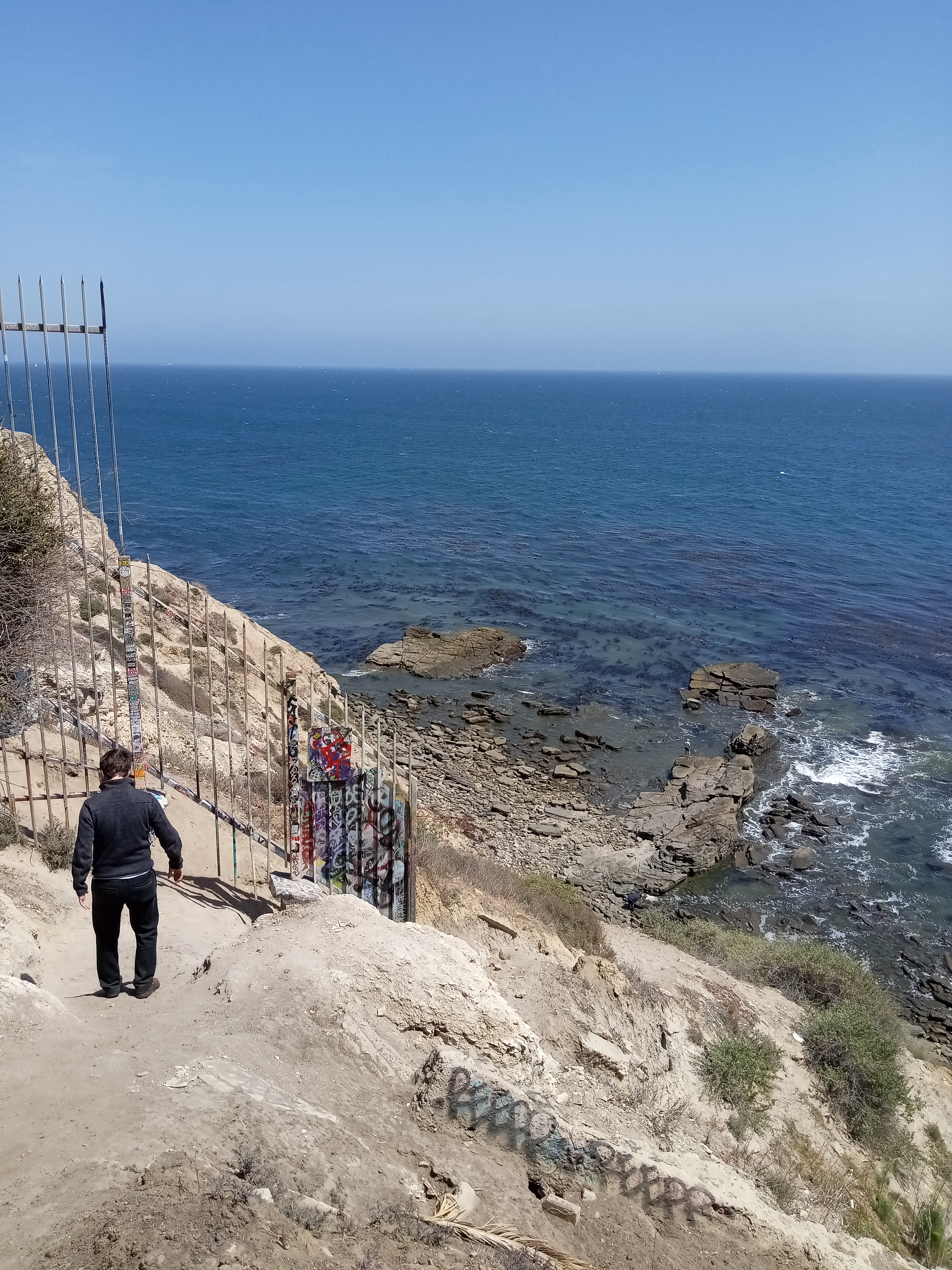
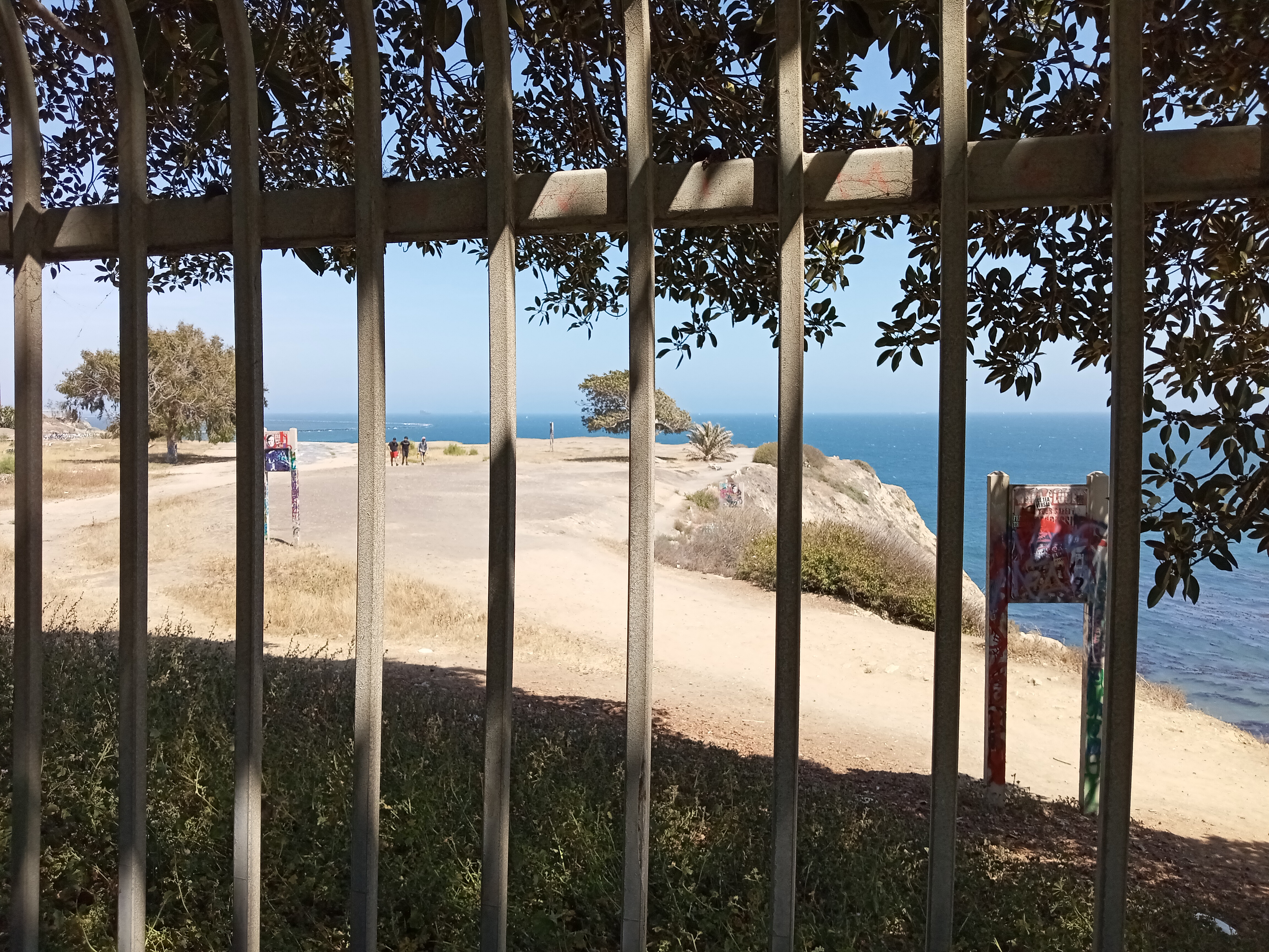

With the area fenced off by the city for safety purposes, the Sunken City took on its new identity as a semi-notorious attraction, drawing urban explorers and thrill-seeking teenagers. On any day you’ll likely see people clambering through a hole in the fence on the Point Fermin side and making their way down the cliff, where buckled remains of the street mix with protruding pipes and slabs of graffiti-covered concrete. Despite the popularity of the site, going past the fence is still illegal and carries the risk of a hefty fine if the police catch you, and they do seem to make a point of routinely dropping by (in fact, on our very first visit to San Pedro we got to the fence only to see the police already parked at the edge of the cliff, shooing out some teenagers). The closest you can get without crossing the fence is a little footpath from the end of Carolina Street, although you won’t see much from here except a few concrete foundations.
The good news is that there are a lot of photos and videos of the Sunken City on the internet, including this nice explainer video from Tom Explores Los Angeles. Ultimately, use your best judgement whether you should visit or not.
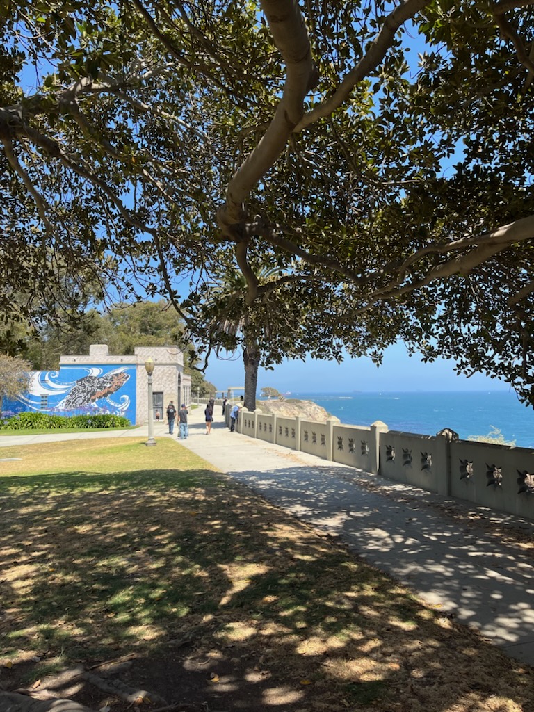
At Shepard and Gaffey Avenue, you’ll spot grassy Point Fermin Park perched above the coast. This wonderful park is full of lush lawns and huge, shady fig trees that make it the ideal spot for a picnic, not to mention the cliffside walkway that offers great views of the crashing waves below. A playground and a decent pair of public restrooms are also located here, on the backside of a little park amphitheater.


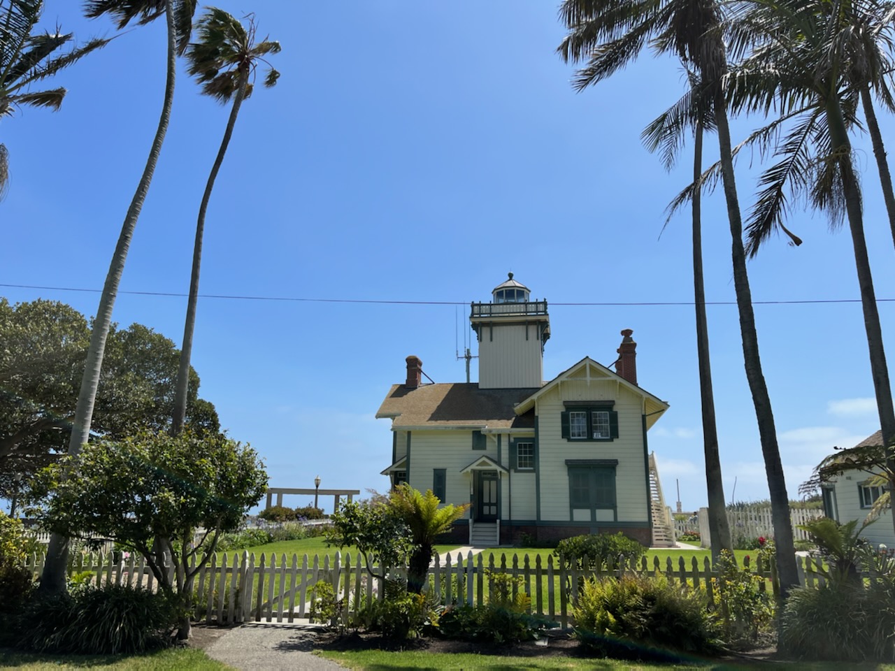
The main highlight of the park is the Point Fermin Lighthouse, a beautiful Victorian-style structure that looks more typical of New England than Southern California, with its wood siding, gabled roofs, and white picket fence. The lighthouse was built in 1874 and helped guide ships into the harbor until WWII, when the coastline went dark amid fears of a Japanese attack on the mainland. After the war, the lighthouse remained a private residence for many decades until opening to the public in the 2000s.

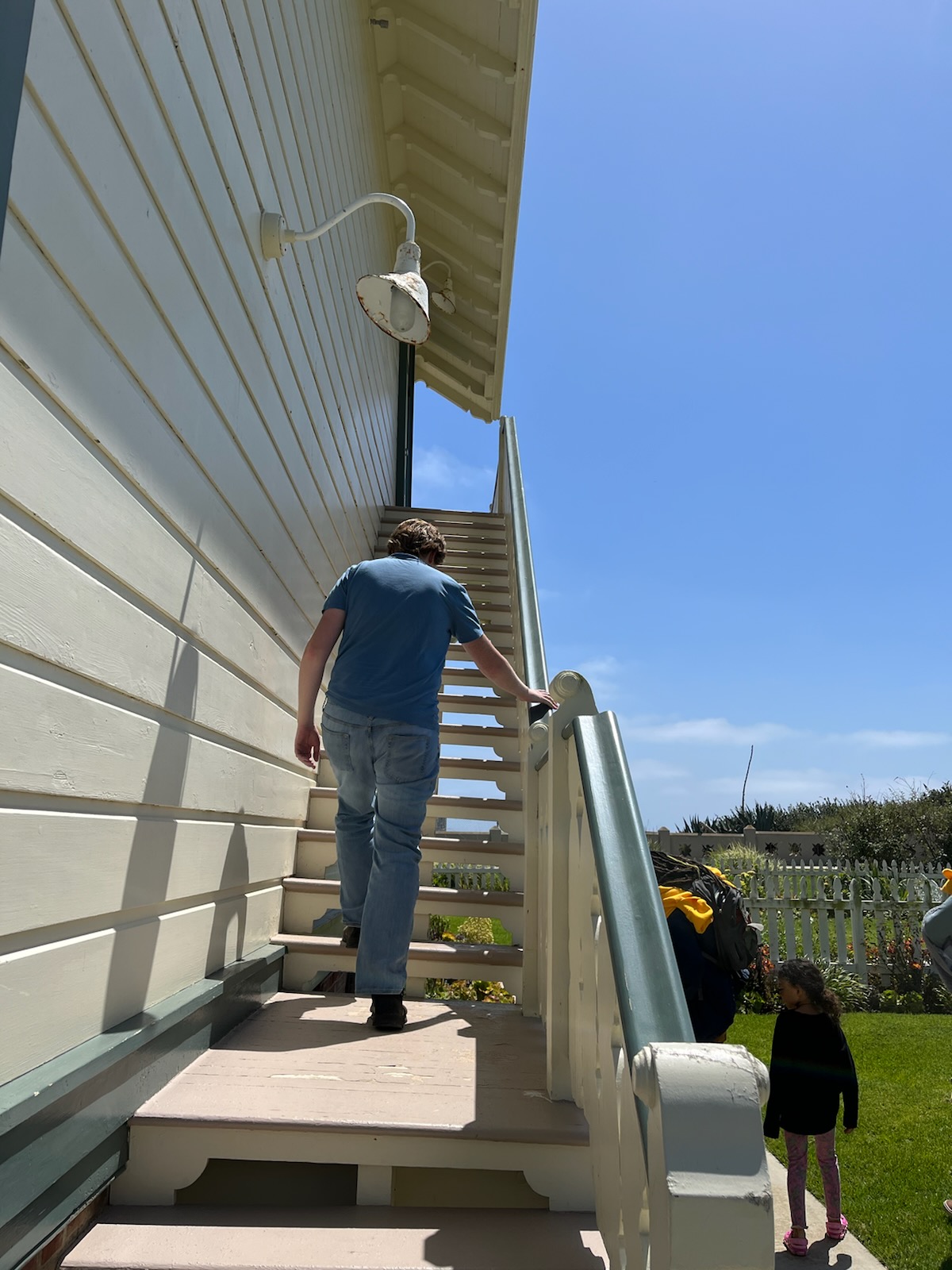
The grounds are open to the public Tuesdays-Sundays from 1-4pm (enter by the parking lot gate, where you’ll find the little gift shop in the side building), although you can only go inside the lighthouse by signing up for a guided tour at 1pm, 2pm, and 3pm. If you don’t want to take a tour, you can still walk up onto the porch and peek inside through the windows, and even walk up the very precarious-looking stairs to the second-floor balcony.
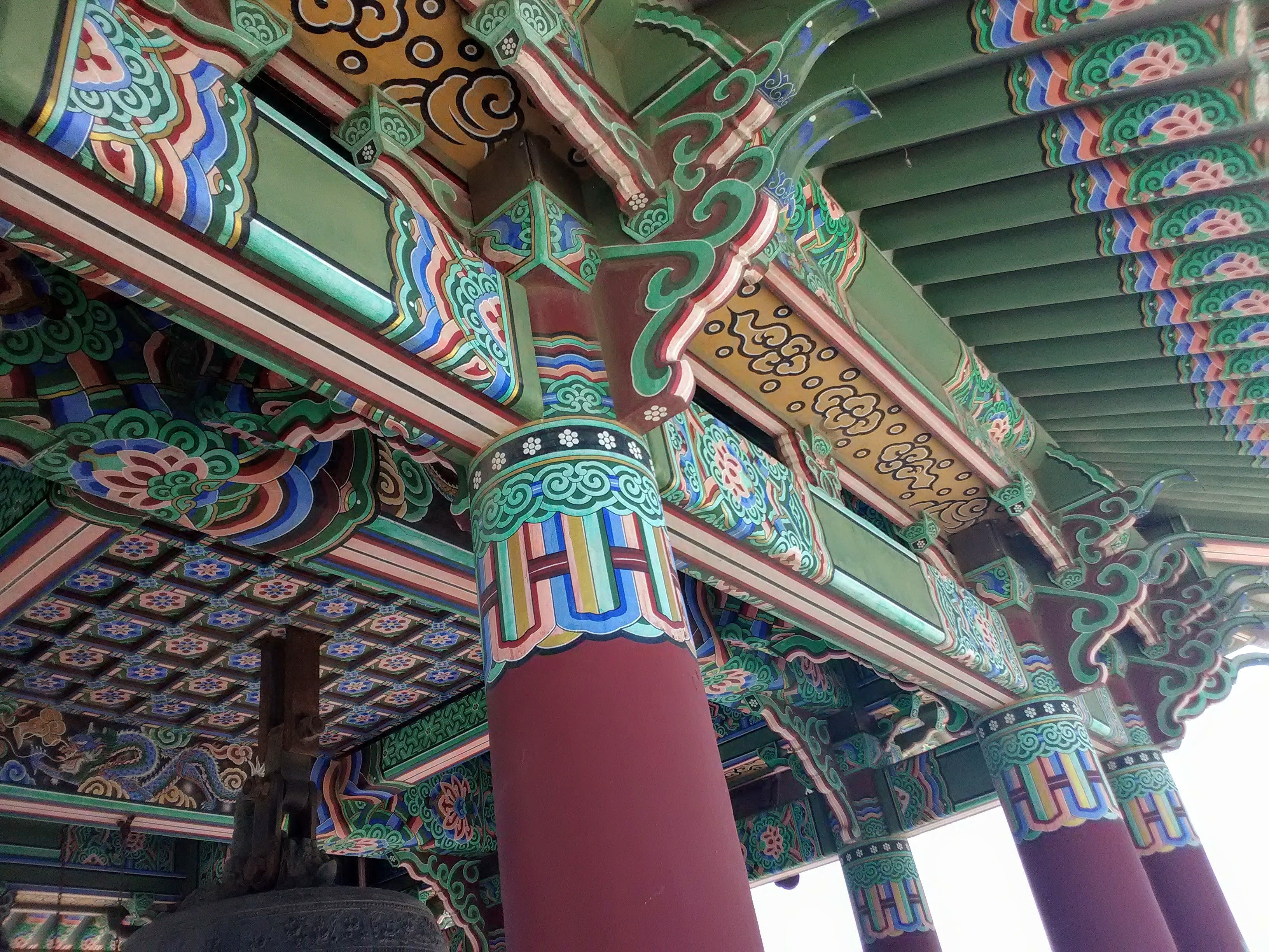
From Point Fermin, head up Gaffey Street, which climbs uphill next to Angels Gate Park, a mostly barren-looking hill that will either look very green or very brown depending on the amount of rain recently. You won’t actually be able to access the park until you reach the gate at Gaffey and 37th Street, where you’ll find the parking lot for the Korean Friendship Bell, a beautifully ornate pagoda that houses a massive bell gifted by the South Korean government in 1975. A ceremonial ringing of the bell occurs at noon on the first Saturday of each month. But the bell is perhaps more popular for the spectacular view you get over the Pacific Ocean from the top of the hill.

You might notice the heavy amount of fencing encircling the park. That’s because Angels Gate Park is the site of a former military base, Fort MacArthur. The fort was built in 1914, at the outset of WWI, and was used as a training center with large gun batteries installed for harbor defense. It saw its heaviest use during WWII, when Fort MacArthur was designated a harbor defense command post, tasked with protecting the vital shipyards, aircraft factories, oil fields, and harbor of Los Angeles. In the Cold War, the massive guns were replaced with anti-aircraft installations and a radar station, which remained in use until the fort was decommissioned in the 1970s.
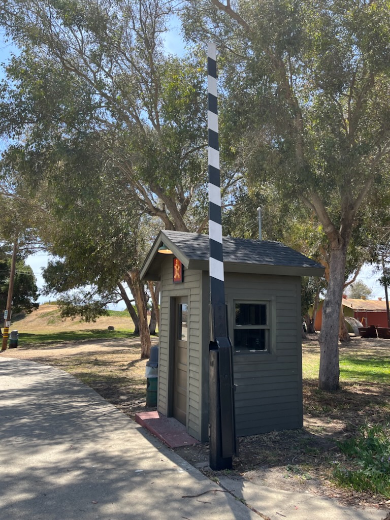
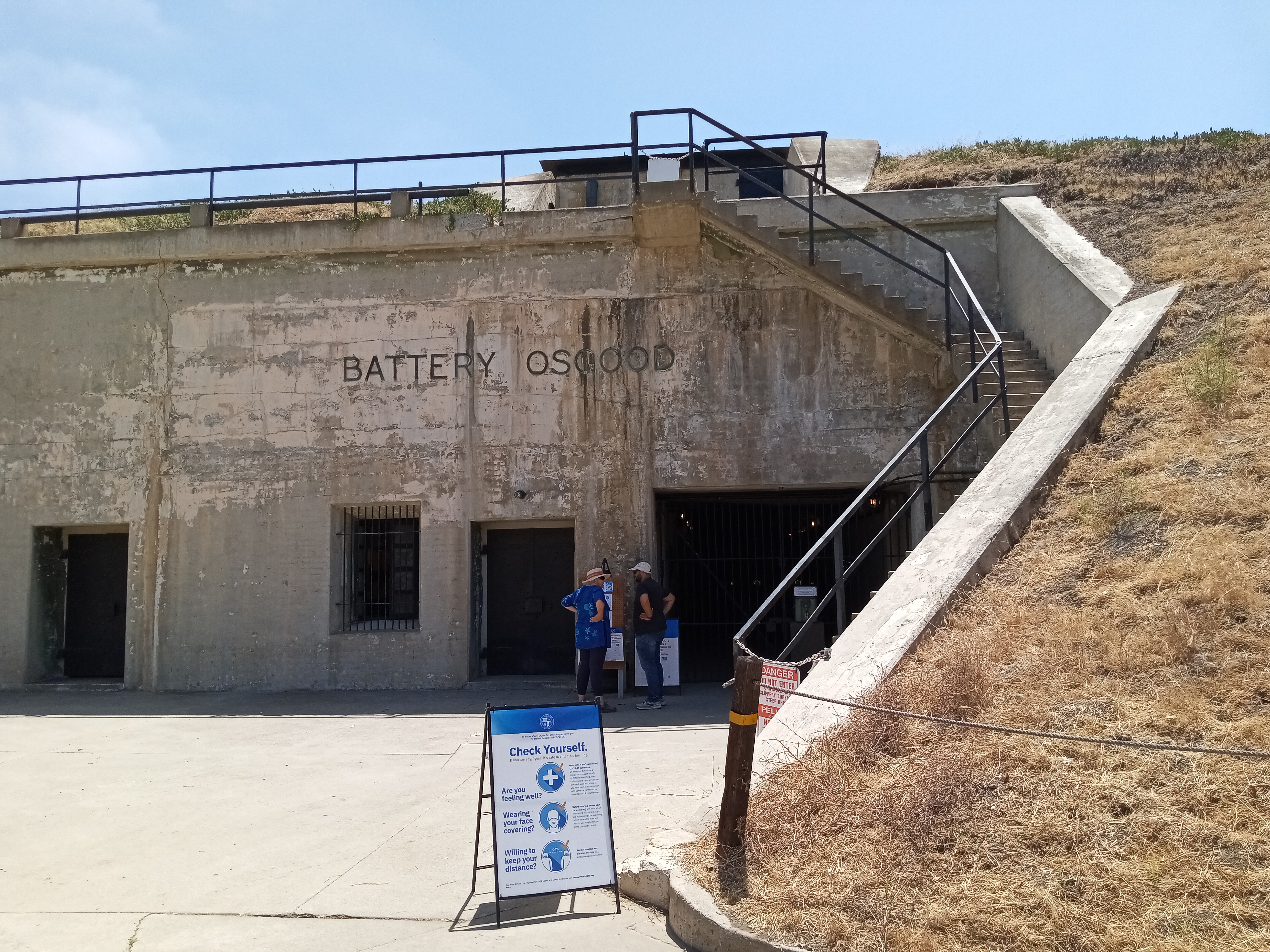
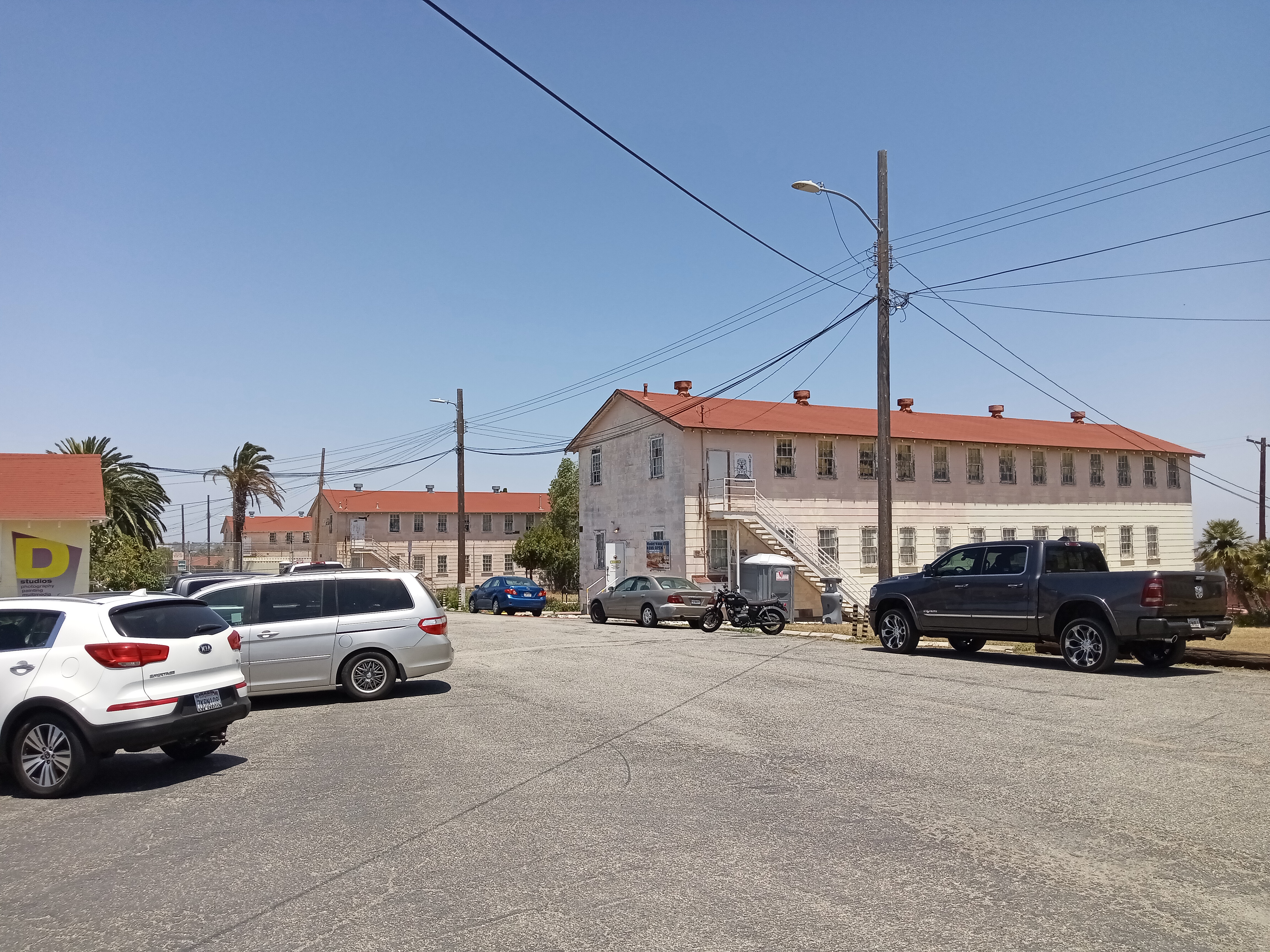
Today, you can see remnants of the fort all over the place, from the circular remains of gun batteries down the hill from the Korean Bell to the long, thin, red-roofed former barracks buildings, which make the whole hill look remarkably similar to the Presidio in San Francisco. But the most obvious reminder of the old fort is the Fort MacArthur Museum, which preserves two of the batteries and an entire underground bunker just to the west of the Korean Bell. From the bell, just take Leavenworth Drive (the street that continues west past the bell), which has a section closed off to cars but open to pedestrians and cyclists. At the next corner, you’ll see the entrance to the museum on your left, marked by an old guard post.

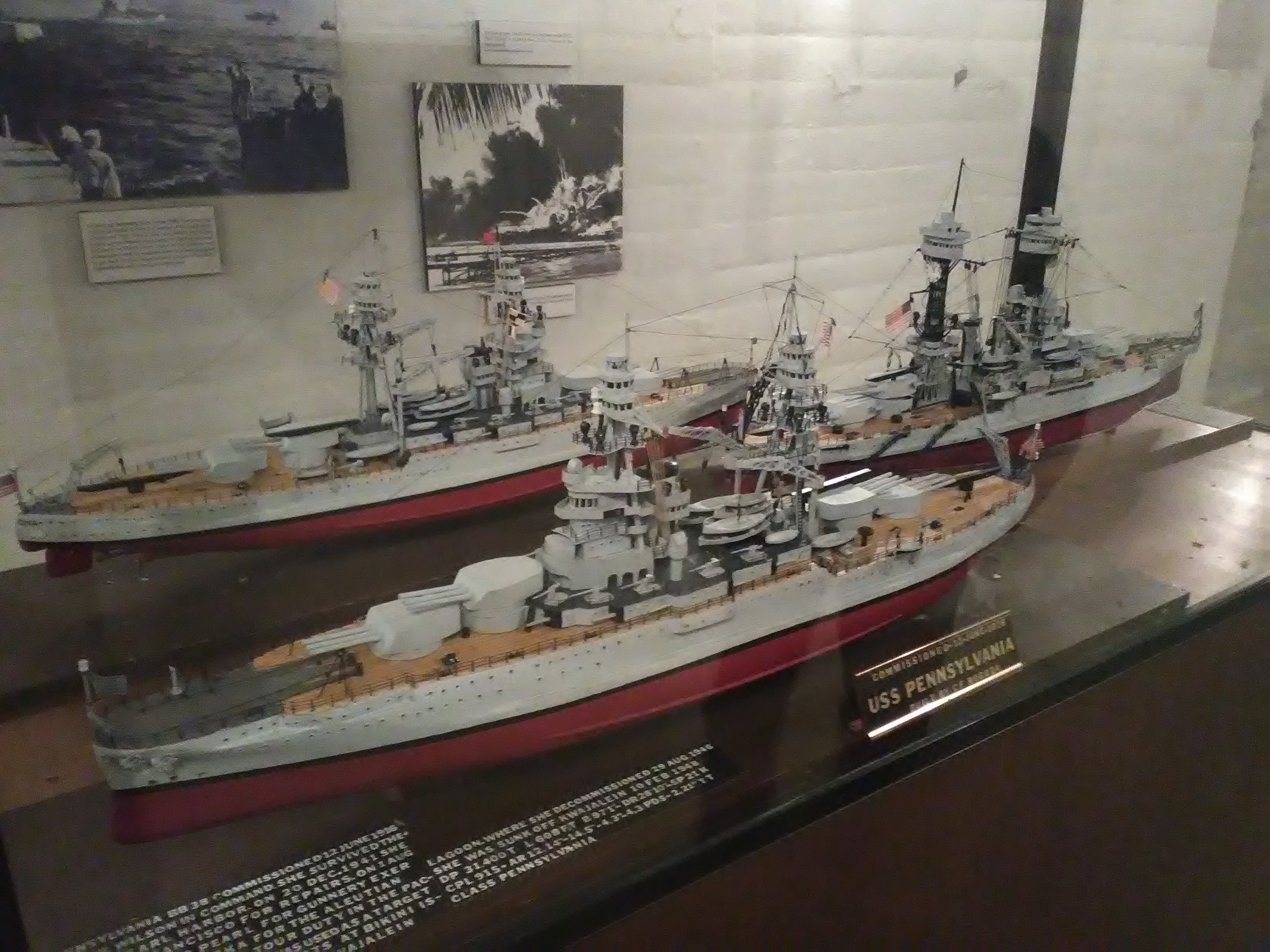
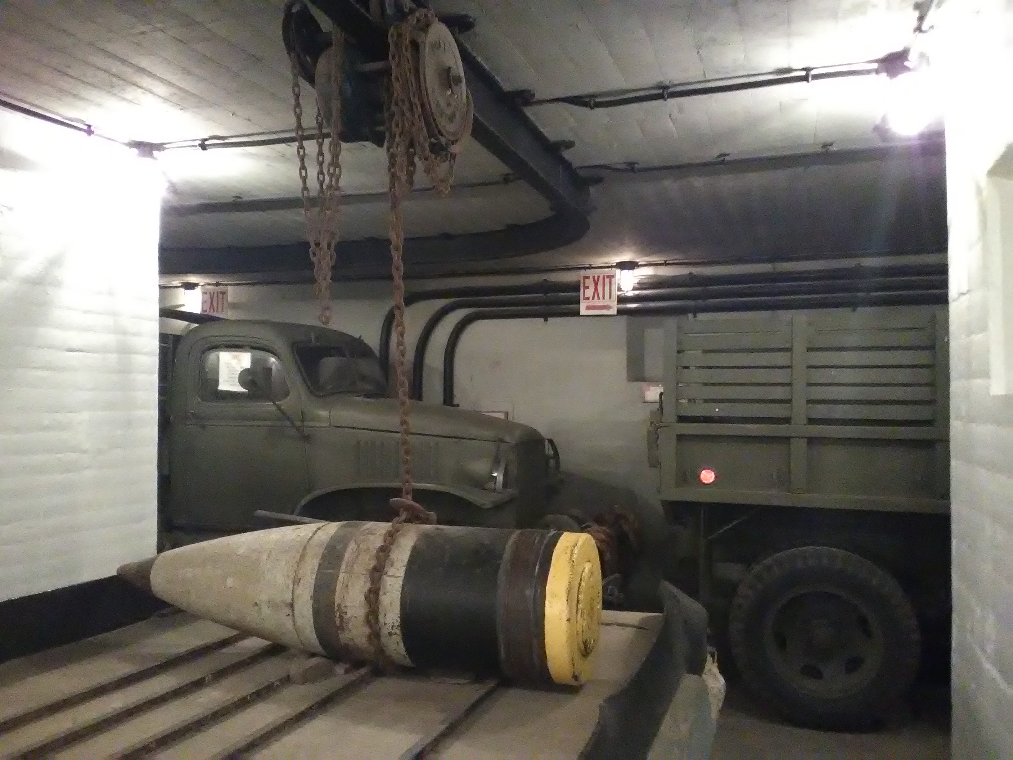
The museum is open Tuesday, Thursdays, Saturdays and Sundays from noon-5pm, with access to the bunker only by guided tour (check the sign at the entrance for the next tour time). If you have time, I recommend the tour as the bunker is full of really great exhibits on the history of the fort, with old WWII jeeps, displays with pictures of the fort, recreations of military offices, and perhaps most interesting of all, a display of newspapers from the time that are incredibly revealing. One set of newspapers is from the one-year anniversary of the Pearl Harbor attack, which turns out to be the first time pictures of the attack were released to the public, a fact that astounds me. Another set of newspapers covers the internment of Japanese Americans, and the tone of the coverage is really astounding; one front-page headline speaks of the “evacuation” of local Japanese Americans in suspiciously neutral terms, while another article accounts how leaders in New Mexico were in near revolt over the prospect of Japanese American “colonists” buying property in the state. Even for those familiar with the history, it’s a rare unvarnished glimpse into attitudes of the time.


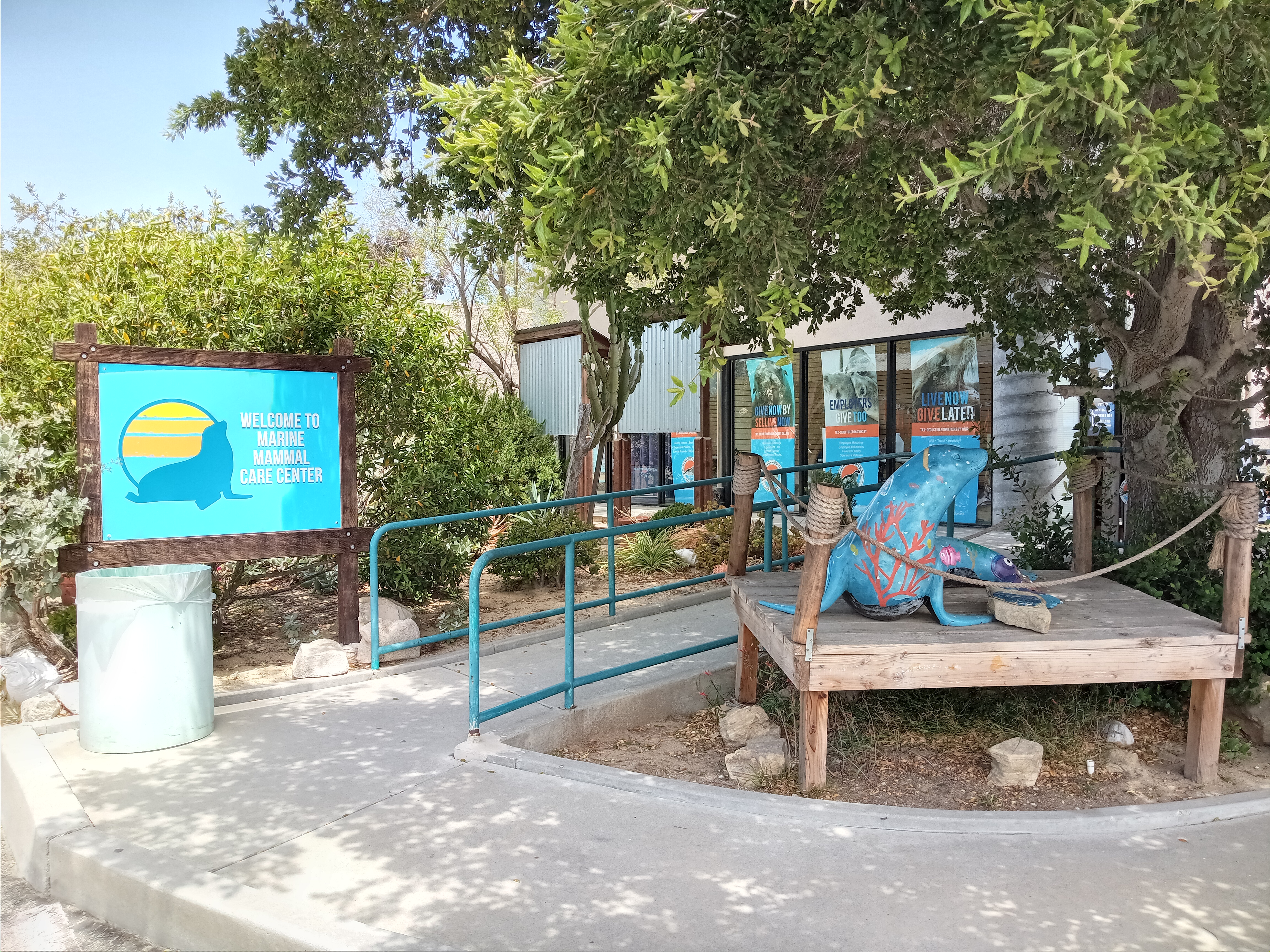
Just across the street from the Fort MacArthur Museum, on the grounds of Angels Gate High School, you’ll find a truly special institution and great attraction: the Marine Mammal Care Center. Housed in a nondescript building tucked in the back corner of a parking lot, the MMCC is a hospital for seals and sea lions, where marine animals that get injured or ill can be rehabilitated before being released back into the wild. The Center (which sits next door to a hospital that treats sick or injured sea birds) is the surprising legacy of Marineland of the Pacific, a marine theme park just up the coast in Palos Verdes which ran from the 1950s to the ’80s before being bought out and shut down by Sea World. In its final years, Marineland ran a hospital for injured marine animals, which was relocated here after the park’s closure.
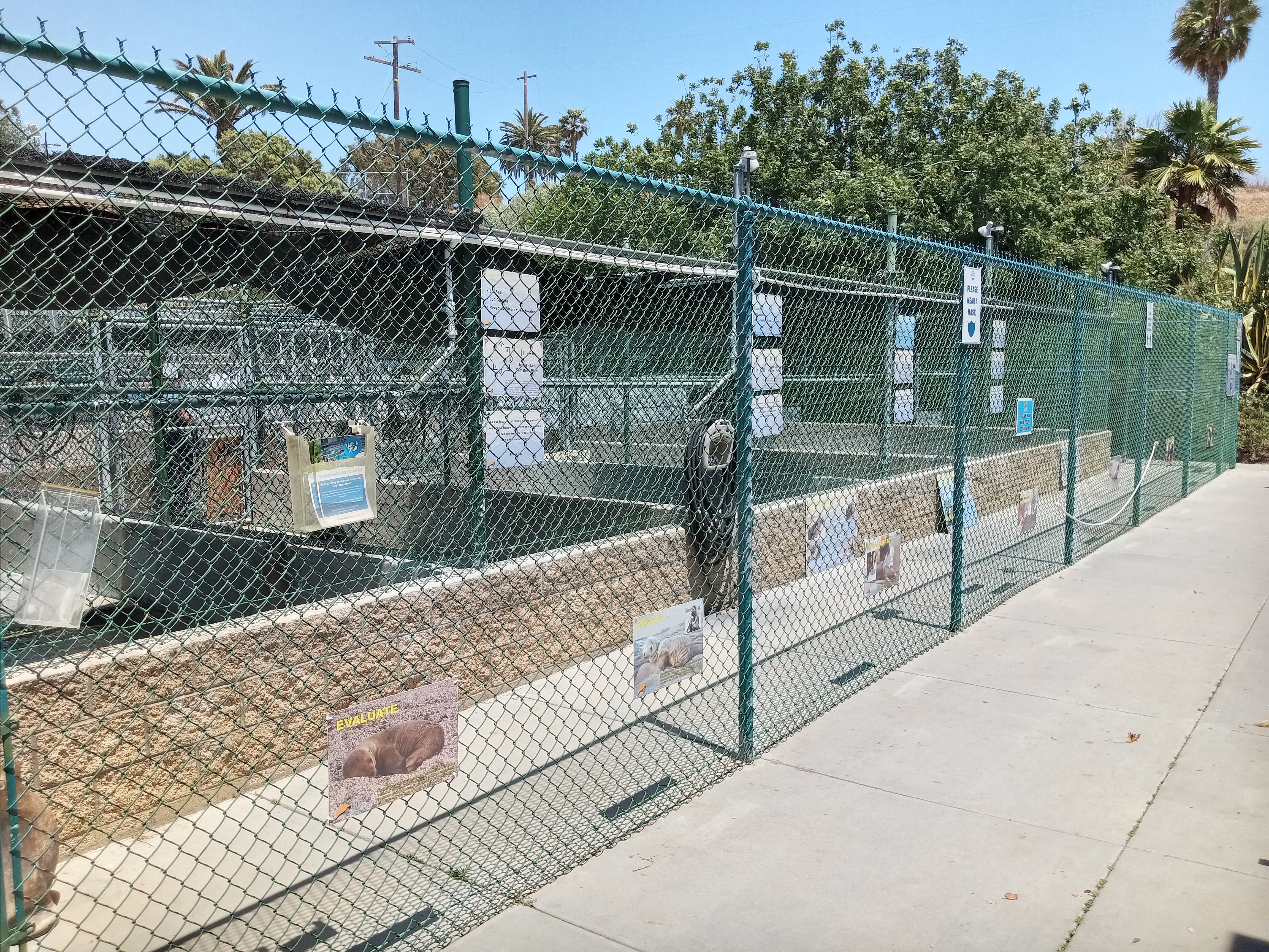
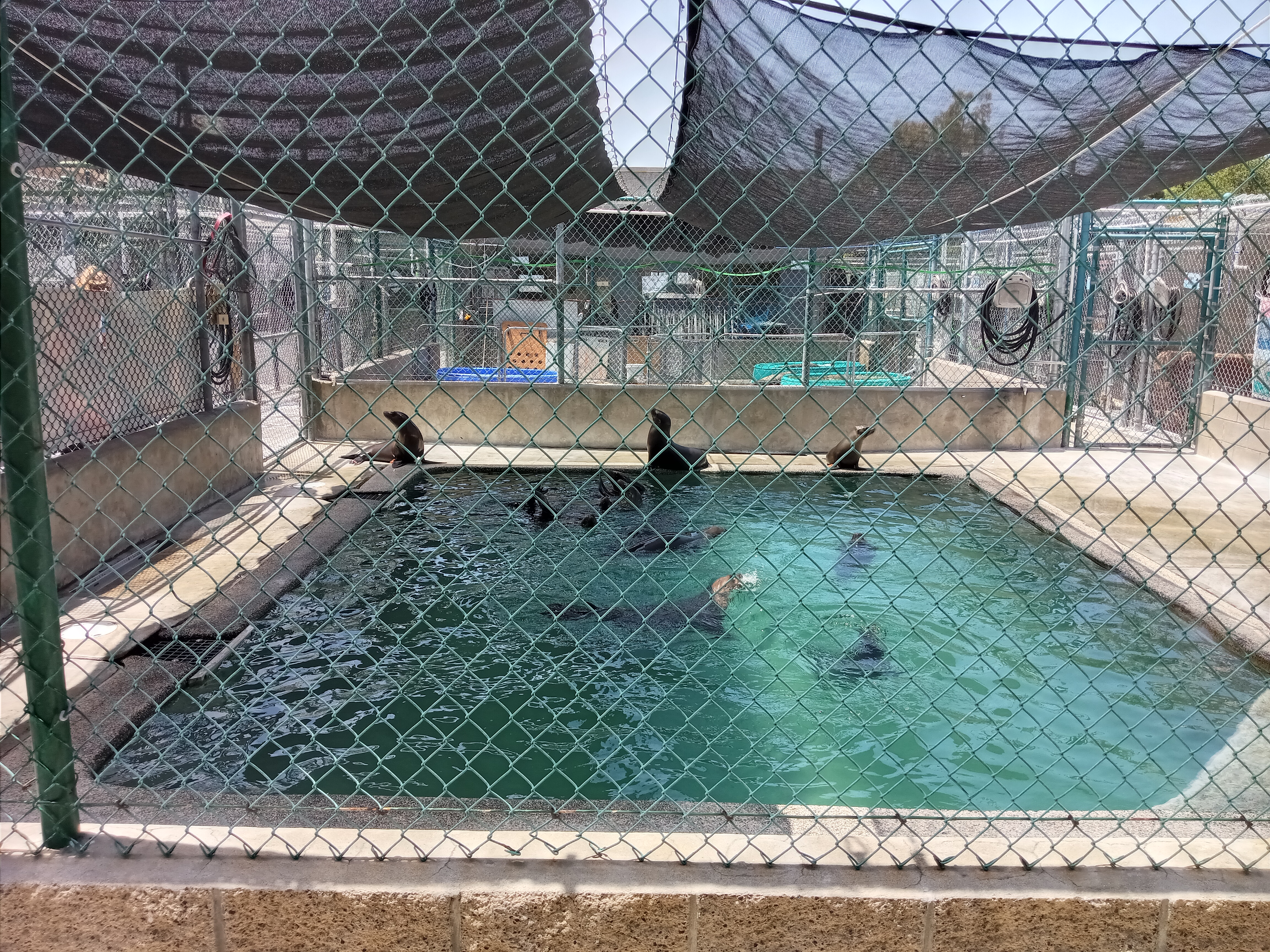
The center is currently open to the public Fridays-Mondays 10am-4pm. While they recommend reserving a time on their website, we found it quiet enough that we were able to just walk up without a reservation and immediately get a tour. On the back side of the building, you’ll find a series of pools separated by chain link fences, with certain patients isolated for their health and safety while those who are closer to full recovery get to play in groups in larger pools. The group pools are a delight to watch, as you’ll see the sea lions splashing around and barking (you might also spot the massive heron that occasionally swoops in and perches on the roof, waiting to steal any fish meant for the seals).


You’ll see plenty of informative signs about seals and sea lions, such as how to tell them apart, how they live, and what kinds of injuries the center addresses. The volunteers who lead tours are extremely friendly and eager to answer any questions, and there’s also a little gift shop with plenty of adorable merchandise for sale, all of which helps keep the center running and doing its extremely important work.
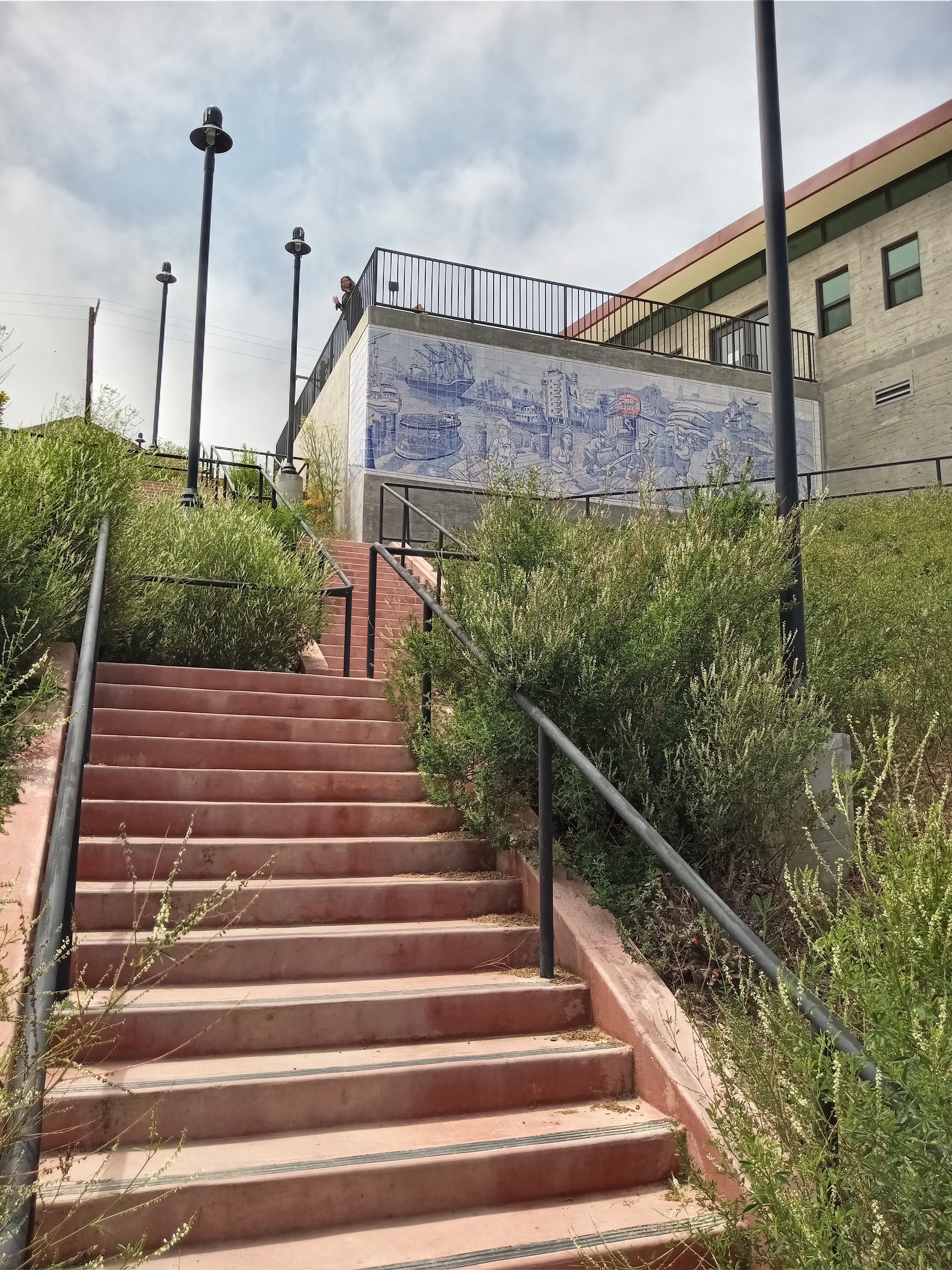
Returning to Gaffey Street and heading north, you’ll reach Lookout Point at the top of the street, which is basically just a pullout with a great view over San Pedro and the harbor. Continuing (now downhill) along Gaffey to 33rd Street, you’ll reach our last attraction. On the corner, behind a gate that should be unlocked during the day, you’ll spot a newly-built staircase and ramp leading up into another complex of old fort buildings at the top of the hill. These were also part of Fort MacArthur, although all of these buildings have been turned over to community uses, particularly art studios and classrooms (the most notable being the Angels Gate Cultural Center, whose galleries are open to the public Thursdays through Saturdays), as well as the newly refurbished Hey Rookie Pool, which you’ll pass on the way up the stairs.

But the real highlight is in the building right next to the very top of the stairs: the Belmont Shore Model Railroad Club, open only on Tuesday evenings and Saturday afternoons, but very much worth a visit if you have the opportunity. Inside, you’ll find lots of great railroad memorabilia and a great model railroad layout on the first floor, but it’s the massive layout which takes up the entire second floor that steals the show.


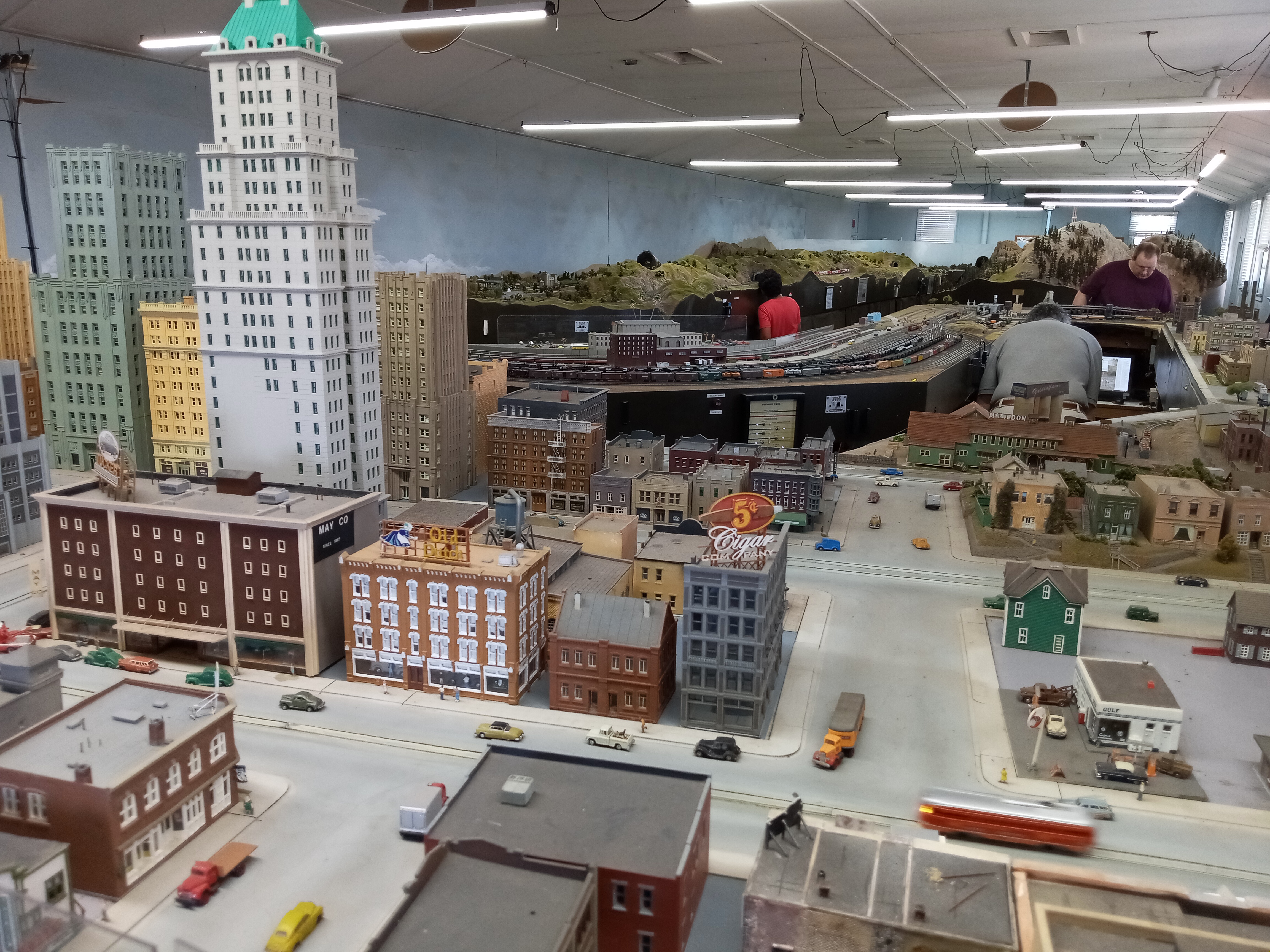

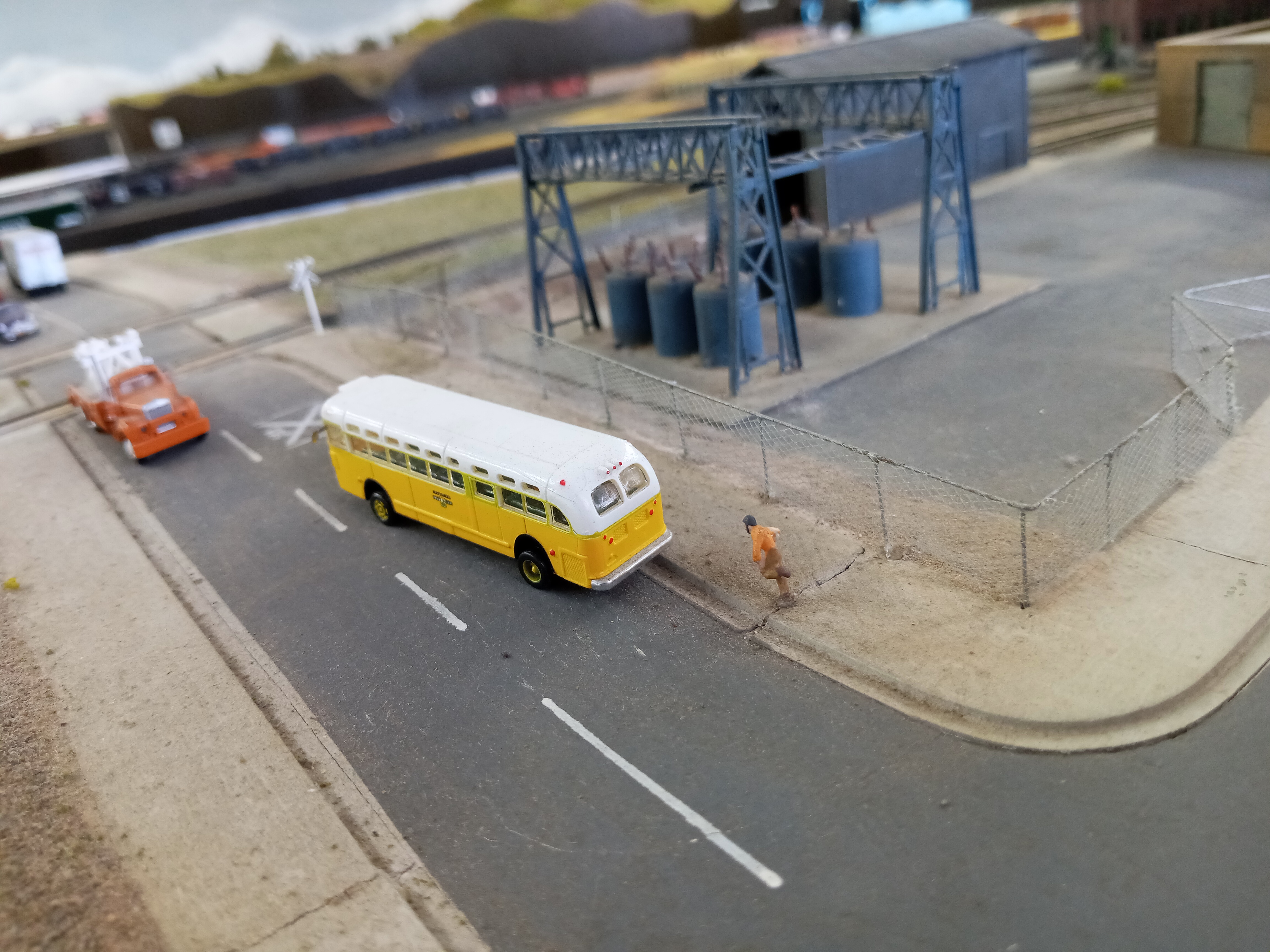
The mark of a good model railroad is attention to the little details, and this one excels with plenty of humorous scenes scattered throughout. From a man running to catch the bus to bears in the woods to a terrible car accident punctuated with a billboard that says, “Next Time, Try the Train,” there’s so much to immerse yourself in this little world. The walkways can get a little cramped; nothing upstairs is really off-limits, which means negotiating through the space with the modelers themselves (so take care not to bump into any switches!), but everyone is very pleasant. Take your time and really enjoy it all.


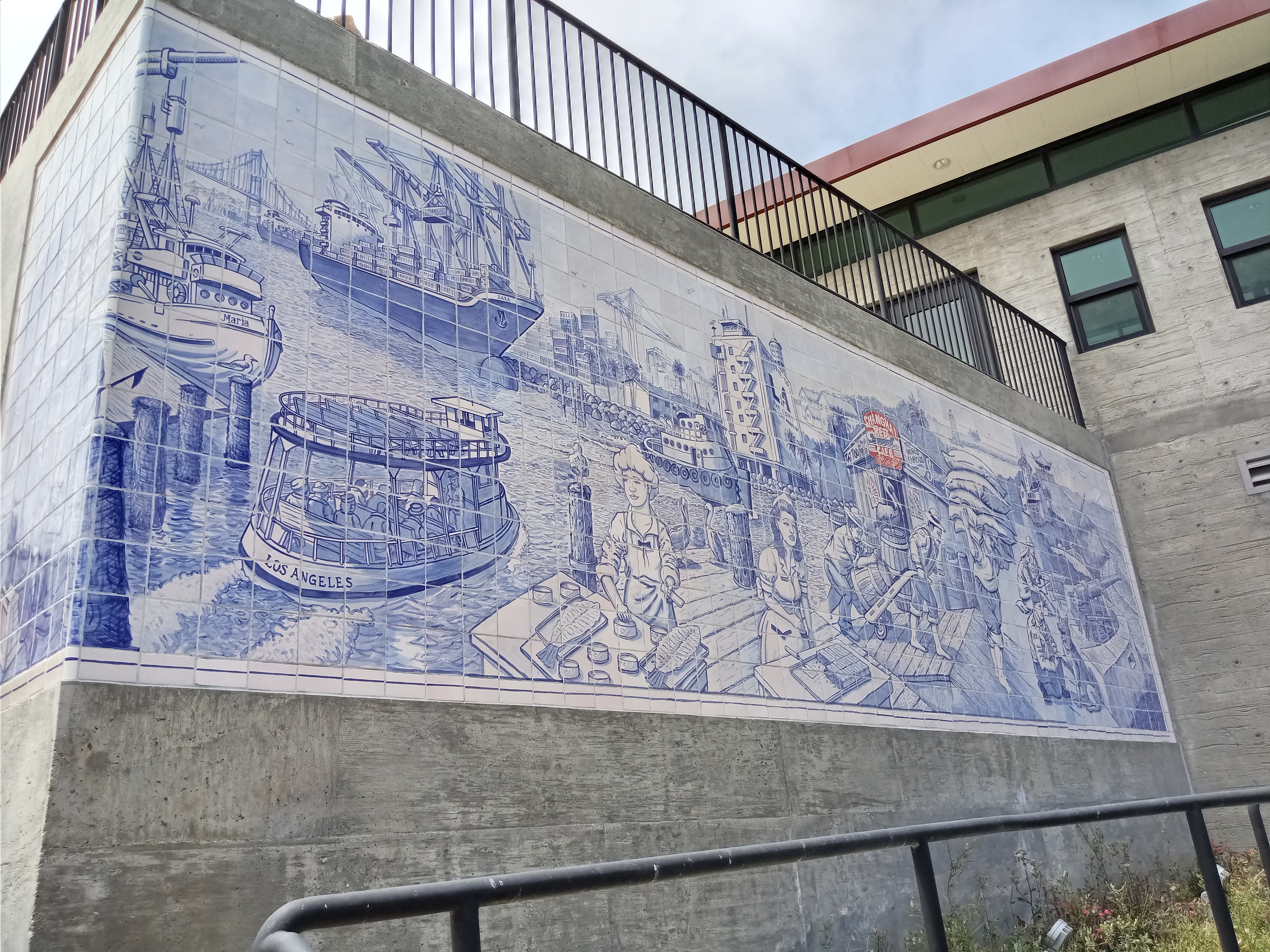
Before heading back down to the street, take a moment to enjoy the little overlook at the top of the stairs. Here you can admire the spectacular view of San Pedro before descending back into town. On the way down, you can also admire the beautiful blue-and-white tile mural on the wall facing the stairs outside of the pool, which depicts a historical maritime scene from San Pedro’s heyday as a bustling port town. The tall-mast ships and wooden docks might be gone, but that port still awaits you in town.

From the bottom of the stairs, it’s a mile walk back to the Silver Line stop at Pacific/21st, or you can walk down 32nd Street to catch the #246 at Pacific/32nd.

Hello John and Janeth!!! Great article on San Pedro!!! Brings back great memories of my trips to the area!!! I’ll have to visit some of the spots you’ve mentioned that I haven’t seen yet especially the train museum!!! I went to a tour of the Point Fermin lighthouse one year for my birthday and it was really good!!! The tour guide was very knowledgeable and it was a great tour especially being able to climb to the top of the lighthouse for the beautiful ocean views. Before they fenced off the Sunken City years ago I also bravely climbed down with my friend to explore the area … very cool place indeed with all the graffiti and broken concrete 😜 Thanks for the wonderful research and article!!! All of them are so so good!!! Always looking forward to the next one!!! Best, Liz Woo
Sent from my iPhone
>
LikeLiked by 1 person
Beautiful parts of our little town. Too bad it’s being ruined with all the construction going up in the smallest places they can be jammed into. And horrible traffic all day that’s only going to be so much worse. Very sad
LikeLike
Sunken city is not open to the public. Is a resident who lives there, in point for men, the amount of trash in sunken city, by the trespassers that go down there is ridiculous and disheartening. I don’t know why people keep advertising it when there’s clearly a fence around it stating they shouldn’t go in there
LikeLike