
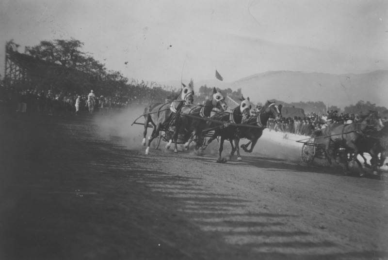
When it was first held in 1890, the Tournament of Roses was conceived as a classic bit of California boosterism. While East Coasters and Midwesterners were freezing in the dead of winter, the denizens of Pasadena had so many flowers blooming that they could cover their horse-drawn carriages in them. So that’s exactly what they did, creating a parade that ended with a tournament held in an empty lot on the southern end of what is now Caltech. The exact nature of the tournament varied through the early years of the event; initially, it started out as some foot races and a tug-of-war match, but in subsequent years it became much more elaborate, with grandstands built on the empty lot (now dubbed “Tournament Park”) hosting chariot races, ostrich races, bronco busting competitions, and in one year, a football game.
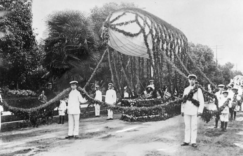
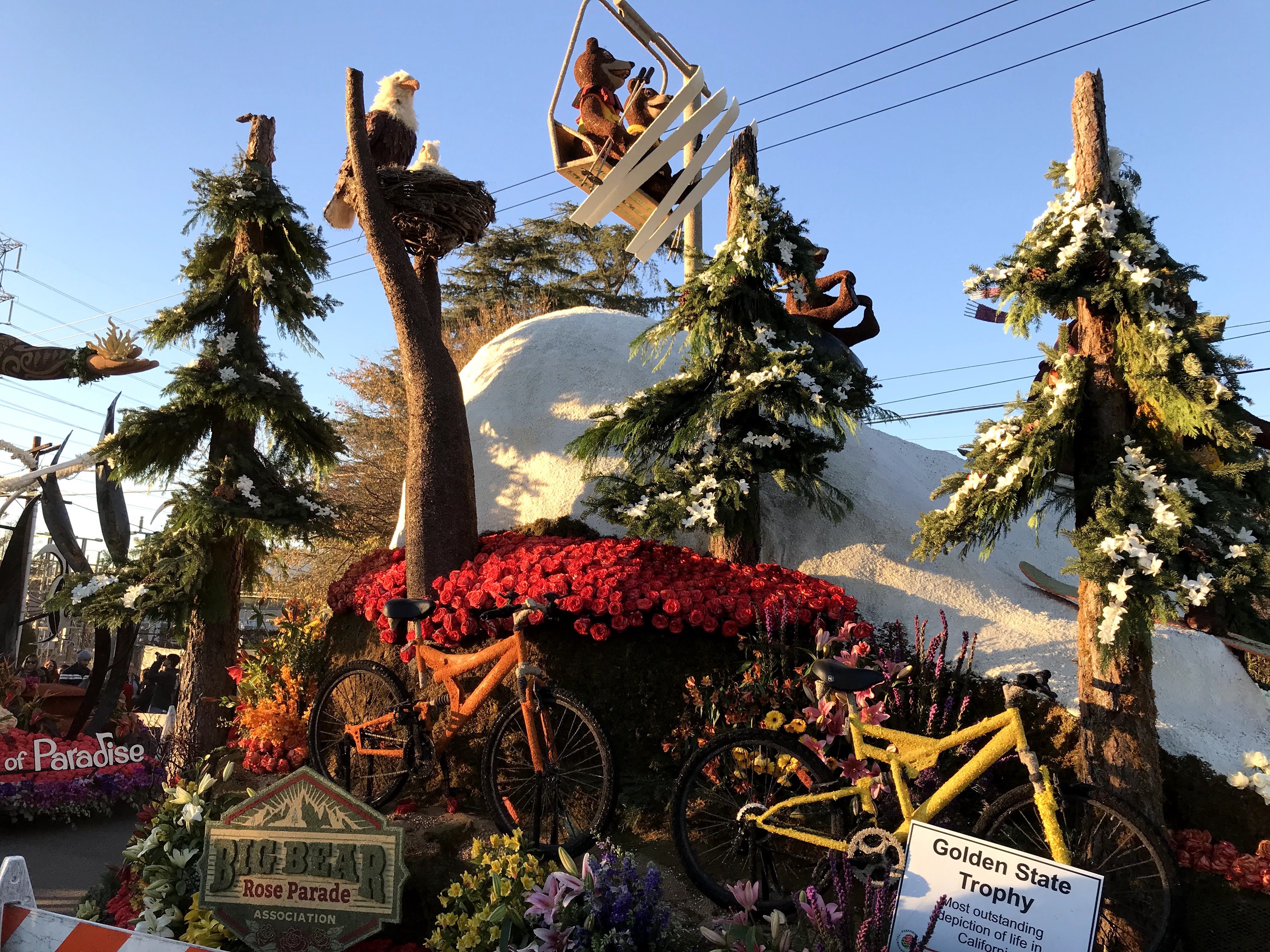
By the 1920s, the event organizers settled on the football game as the event of choice, and a new stadium was built in the Arroyo Seco to host it. The rose-covered horse-drawn carriages were swapped out for motorized parade floats, and each year the floats became more and more technically elaborate and impressive. Equestrians are still a prominent part of the parade though, along with lots of marching bands from across the country.
Here we present our guide to the event, with information on the parade itself, how to use transit to get there, what to expect, and what else you can explore along the parade route.

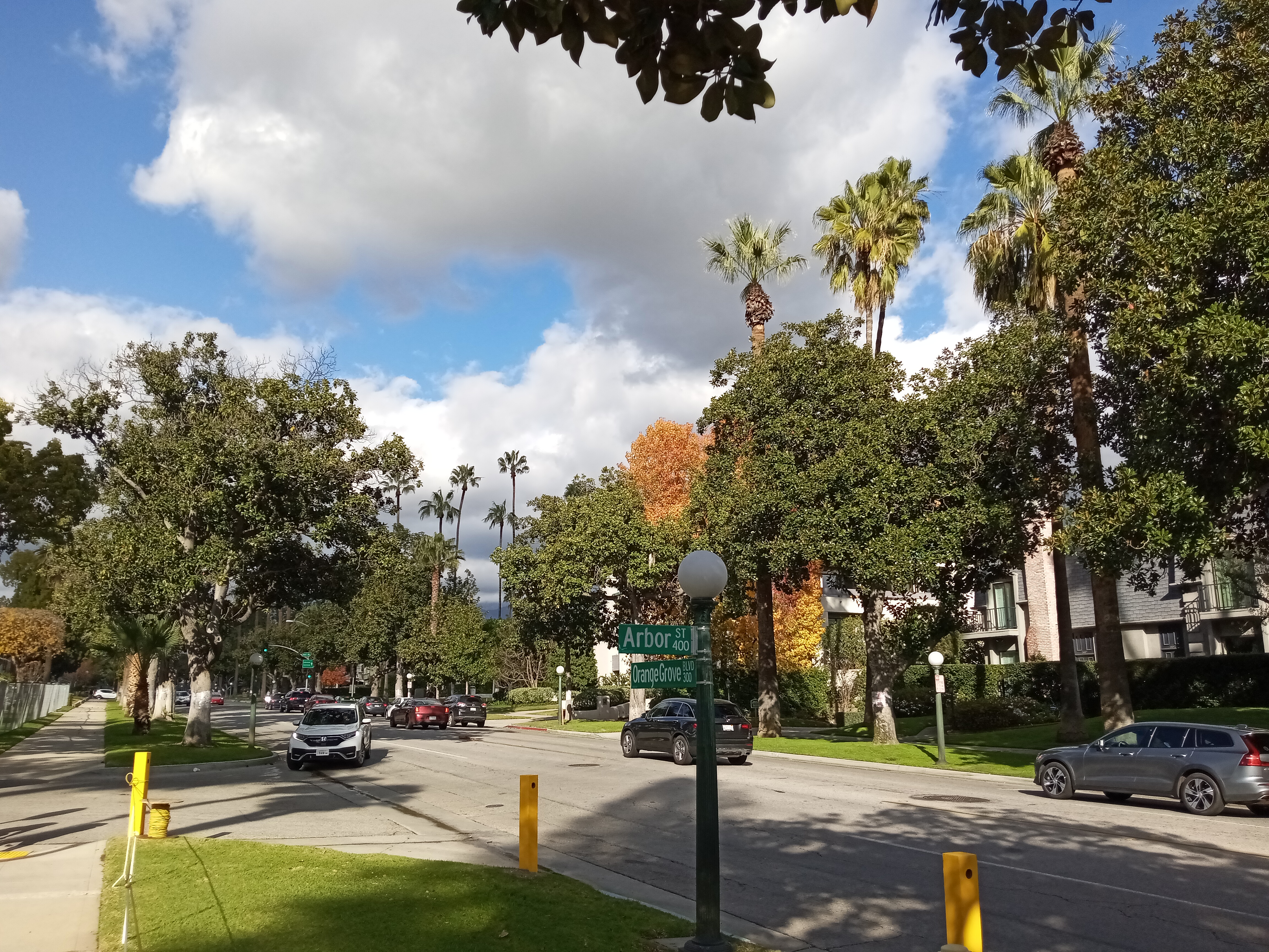
The parade route covers about five miles of Colorado Boulevard, staging on Orange Grove Boulevard on the west side of town and traveling east on Colorado across Pasadena until reaching Sierra Madre Blvd, where the parade ends while the floats travel a little further north up Sierra Madre to Victory Park for public viewing.
Tickets are required to sit in one of the bleacher stands the city sets up along the parade route (and can be quite expensive), as well as to enter the float viewing area ($26.50) on Sierra Madre Blvd, called Floatfest, which is open on the afternoon after the parade as well as the following two days, and allows you to really get up-close to the floats and admire the finer details. But most people just find a spot somewhere along Colorado Blvd and enjoy the parade for free. The experienced know to bundle up, bring a camp chair and a thermos of something warm to drink, and find a spot early (a lot of people even camp out the night before). Another tip I recommend is to try to find a spot on the south side of Colorado, so you’re not facing the sun for most of the parade (which makes taking pictures a lot easier too). The parade kicks off at 8am, with the floats taking about two hours to reach the end.

The obvious transit option to reach the Rose Parade is the Metro A Line, which runs between Long Beach and Pomona and completely avoids all the traffic that plagues Pasadena each New Year’s. Train service starts earlier on Rose Parade day, with the normal $1.75 fare. The closest stop to the parade route is Memorial Park station, just two short blocks north of Colorado in Old Pasadena, with Del Mar station also being a good option, just three blocks south of Colorado (and a lot prettier, located next to the former Santa Fe Railroad station). Lake and Allen stations are also good options, both a 10-minute walk north of slightly quieter (but still very busy) sections of the parade route. The closest stop to Floatfest after the parade is Sierra Madre Villa, with a Metro shuttle to take you straight there from the station (normal Metro fares apply). There’s also a free shuttle to the Rose Bowl game, which picks up on Corson Street a few blocks northwest of Memorial Park station.
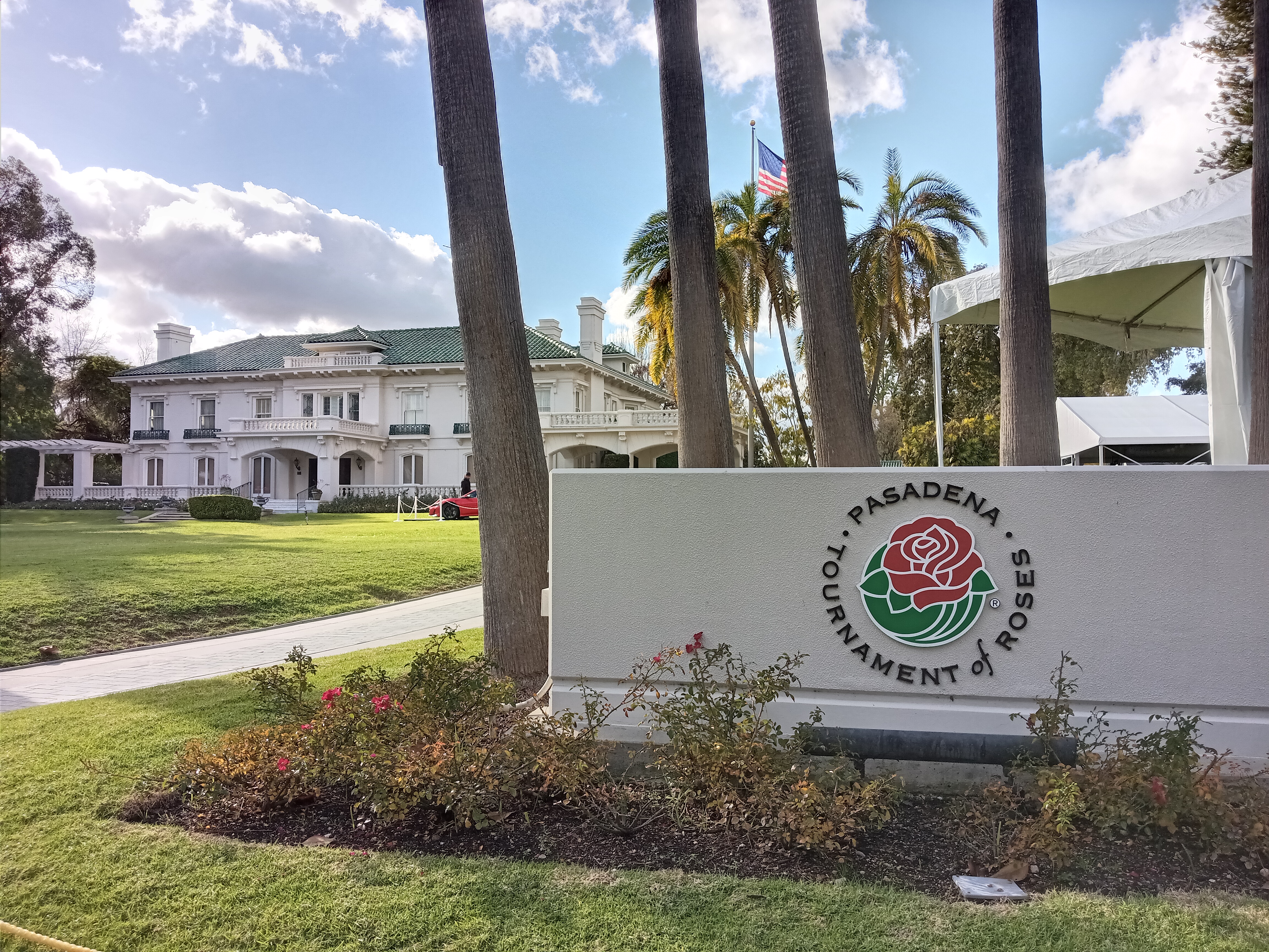
The day before the parade, the floats are lined up on Orange Grove Boulevard just south of Colorado Blvd, the historic “Millionaire’s Row” of Pasadena. The surrounding blocks are filled with stately Craftsman homes and condominium buildings, but once were occupied by lavish mansions where the wealthiest of the city lived. One of those mansions still stands and plays a big role in the Rose Parade: the Wrigley Mansion, former residence of the chewing gum magnate, which sits on Orange Grove a block south of Del Mar Blvd. After Wrigley’s death, the mansion was turned over to the Tournament of Roses Association, the organizers of the parade, to serve as their headquarters. Before the parade, the floats are presented in front of the mansion for approval before being released. The mansion is closed off during the parade for an exclusive party, but the rest of the year you can stroll the grounds and enjoy the little rose garden next to the mansion.
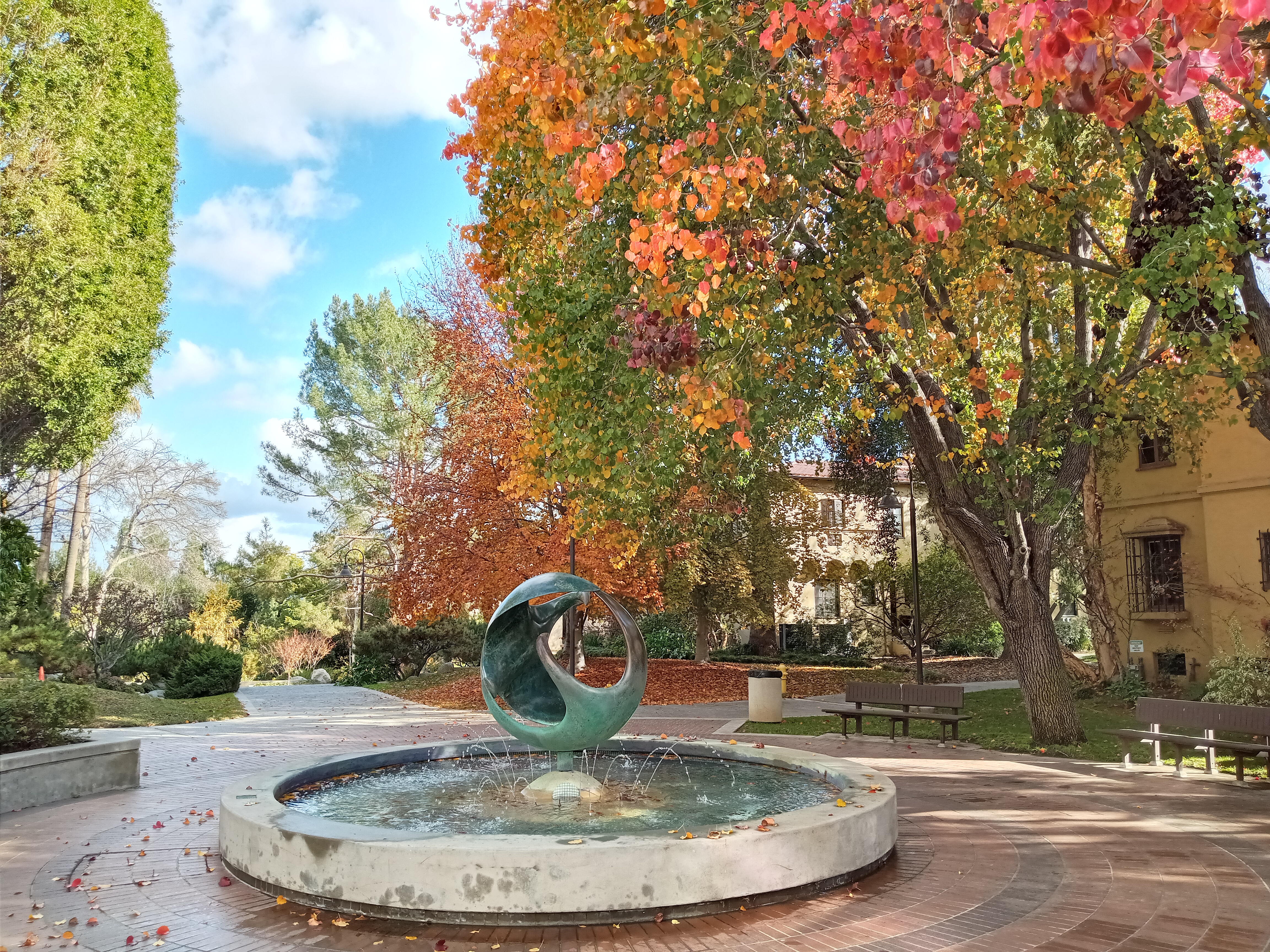
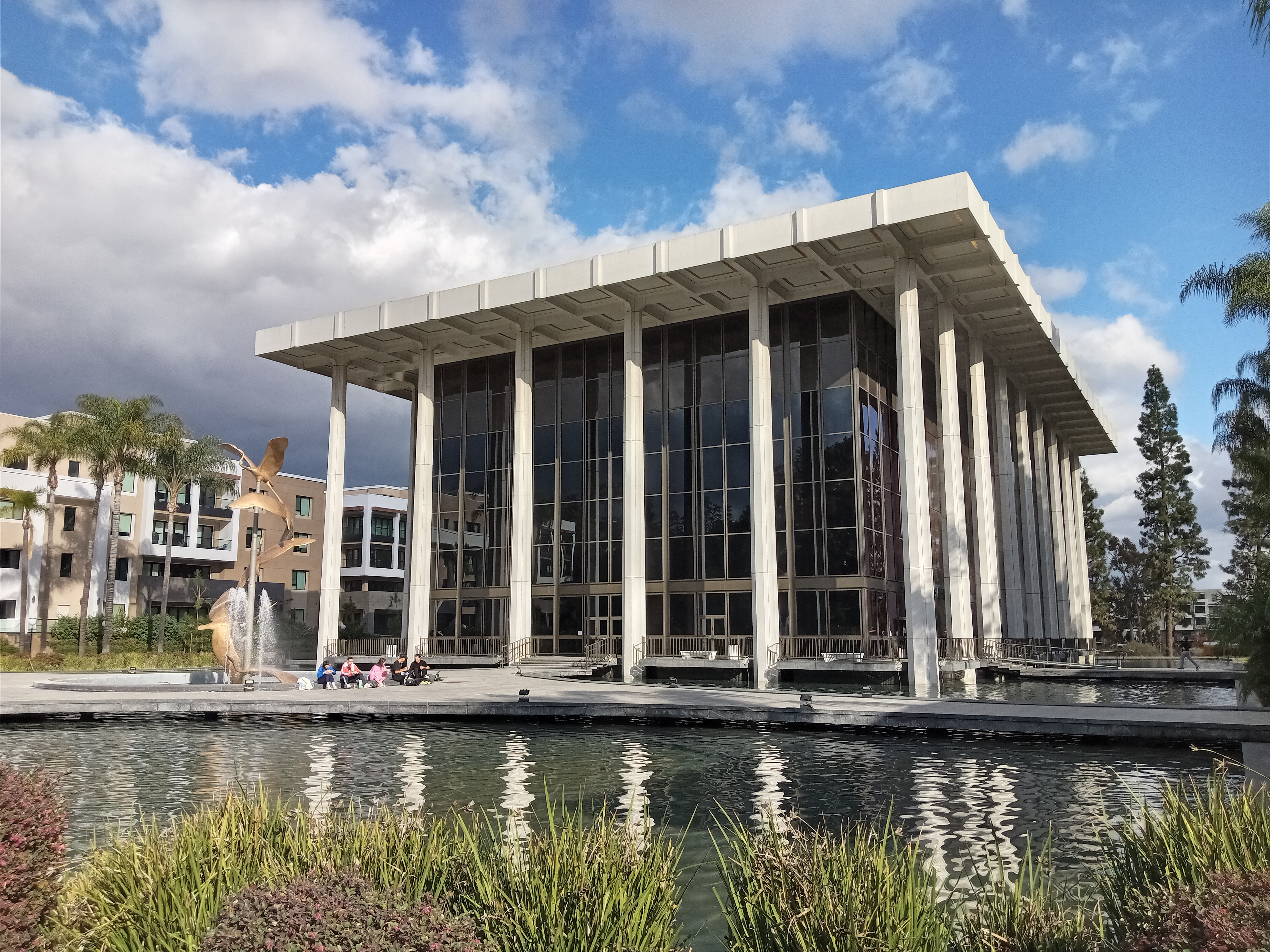
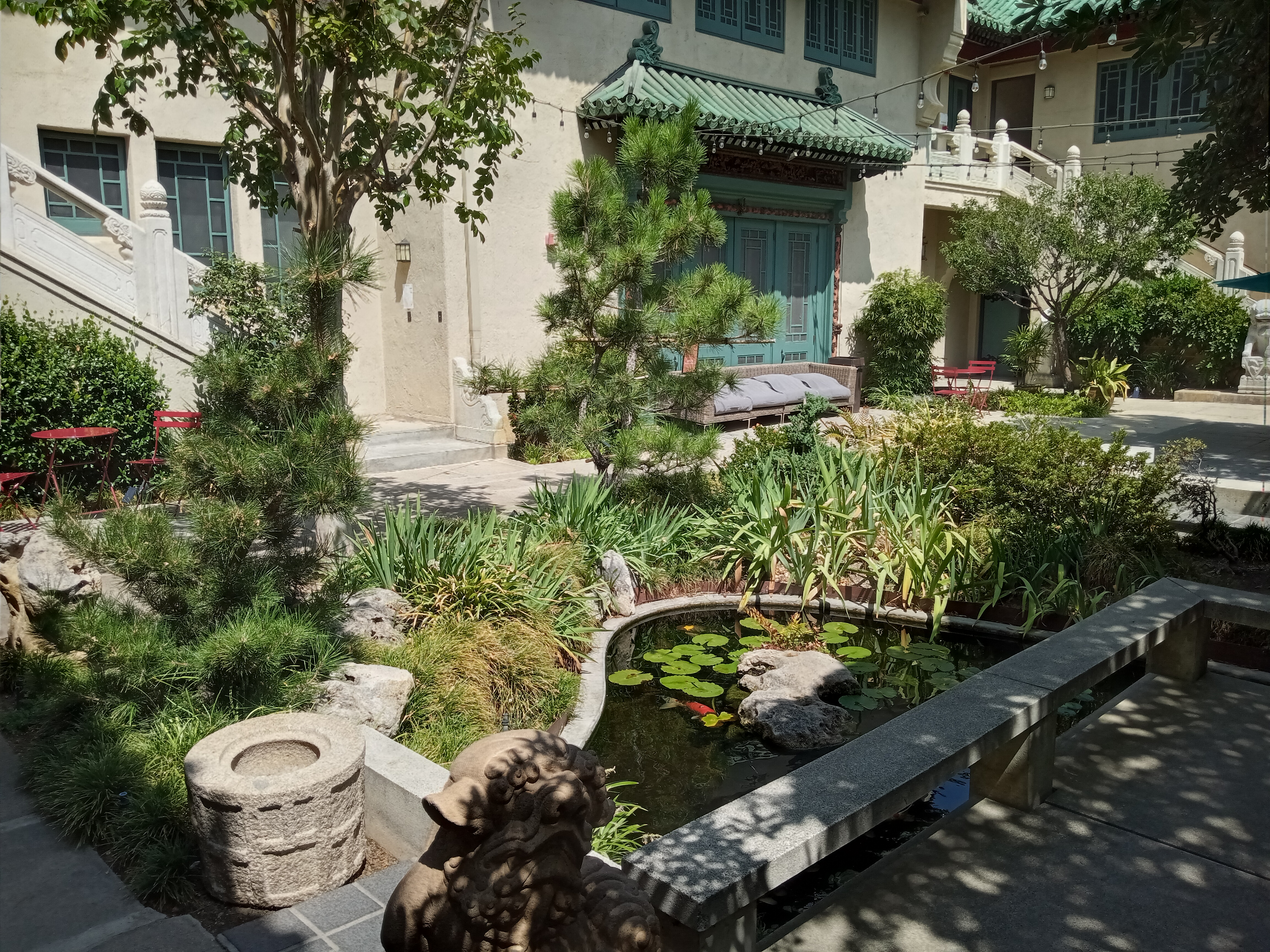
Just to the east of Orange Grove, located between Del Mar and Green Street, is the campus of the former Ambassador College, a former university run by an evangelical ministry. Most of the campus has been redeveloped into housing, although portions of the old college remain, namely the modernist auditorium building with its reflecting pool and striking crane sculpture. The best feature of the campus, however, is the little Japanese-style garden with a running stream, tucked on the hillside beneath another preserved mansion.
The intersection of Orange Grove and Colorado is the most active spot on the Rose Parade, where most of the bleachers for spectators are set up, as well as the media stands where the television broadcast is filmed. Just across the street is the Norton Simon Museum, L.A.’s first modern art museum, which has an exceptionally well-curated collection of vibrant European paintings, modern art, a lovely sculpture garden, and an entire wing devoted to Southeast Asia, with incredible Buddhist and Hindu stone sculptures (see their website for current hours and admission; note that they always close on Rose Parade day).
Another attraction of the neighborhood is the steep canyon of the Arroyo Seco just to the west, beneath the majestic Colorado Street Bridge. This is something we cover extensively in another guide.
The Rose Parade was probably at the zenith of its cultural influence in the middle decades of the 20th Century. Don’t get me wrong, it’s still a big deal today and a lot of people turn out for it or watch it on TV. But there was a time when the Rose Parade was right up there with the Macy’s Thanksgiving Parade as a firmly national ritual. This is probably best exemplified in the waning prestige of the Grand Marshal, an honorary position given to some person of note invited to the parade, usually a beloved celebrity. In the ’60s and ’70s, the list of Grand Marshals includes former presidents and cultural titans of the era like Walt Disney, Bob Hope, John Wayne, Charles Schulz, and Hank Aaron. But over time, you see fewer of these massive, culture-defining figures showing up, in favor of more generic, crowd-pleasing celebrities.
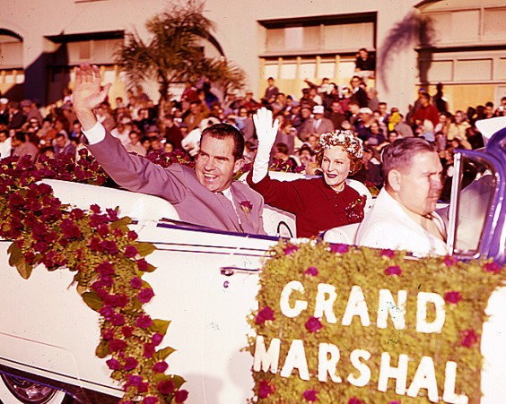
Another thing that becomes clear from the list of Grand Marshals is how much the Rose Parade once reflected Republican Party domination of Californian politics and culture in the post-WWII decades, and the very conservative, buttoned-down culture of Pasadena at the time. In an era when the Democratic Party was at its strongest, prominent Democrats are notably absent. Meanwhile, four consecutive Republican presidents served as Grand Marshal: Herbert Hoover in 1945, Dwight Eisenhower in 1964, Gerald Ford in 1978 (a mere fourteen months after losing to Jimmy Carter), and native Californian Richard Nixon twice, once as the Vice President-elect in 1953 and again as the current Vice President in 1960, right when he was gearing up for the next presidential election (and the same year that fellow future president Ronald Reagan hosted the ABC televised broadcast of the parade). Earl Warren shows up both as the newly elected Republican Governor of California and as the Chief Justice of the Supreme Court. Even the cultural figures selected for the role reflect conservative tastes of the time: Walt Disney, Bob Hope, John Wayne, Billy Graham, Roy Rogers, Kate Smith, Frank Sinatra… it all underscores what a very different political landscape California was back then.
As the parade moves east down Colorado, it crosses the 710 freeway trench into Old Pasadena, the historic center of town. Covering the four-block stretch of Colorado between the 710 and Arroyo Parkway, the district is a shopping and dining destination full of charming brick buildings and ornate architecture. Cute brick alleyways are tucked around the neighborhood (particularly in the One Colorado mall, on the north side of Colorado between De Lacey and Fair Oaks), and walking around the district is a joy.
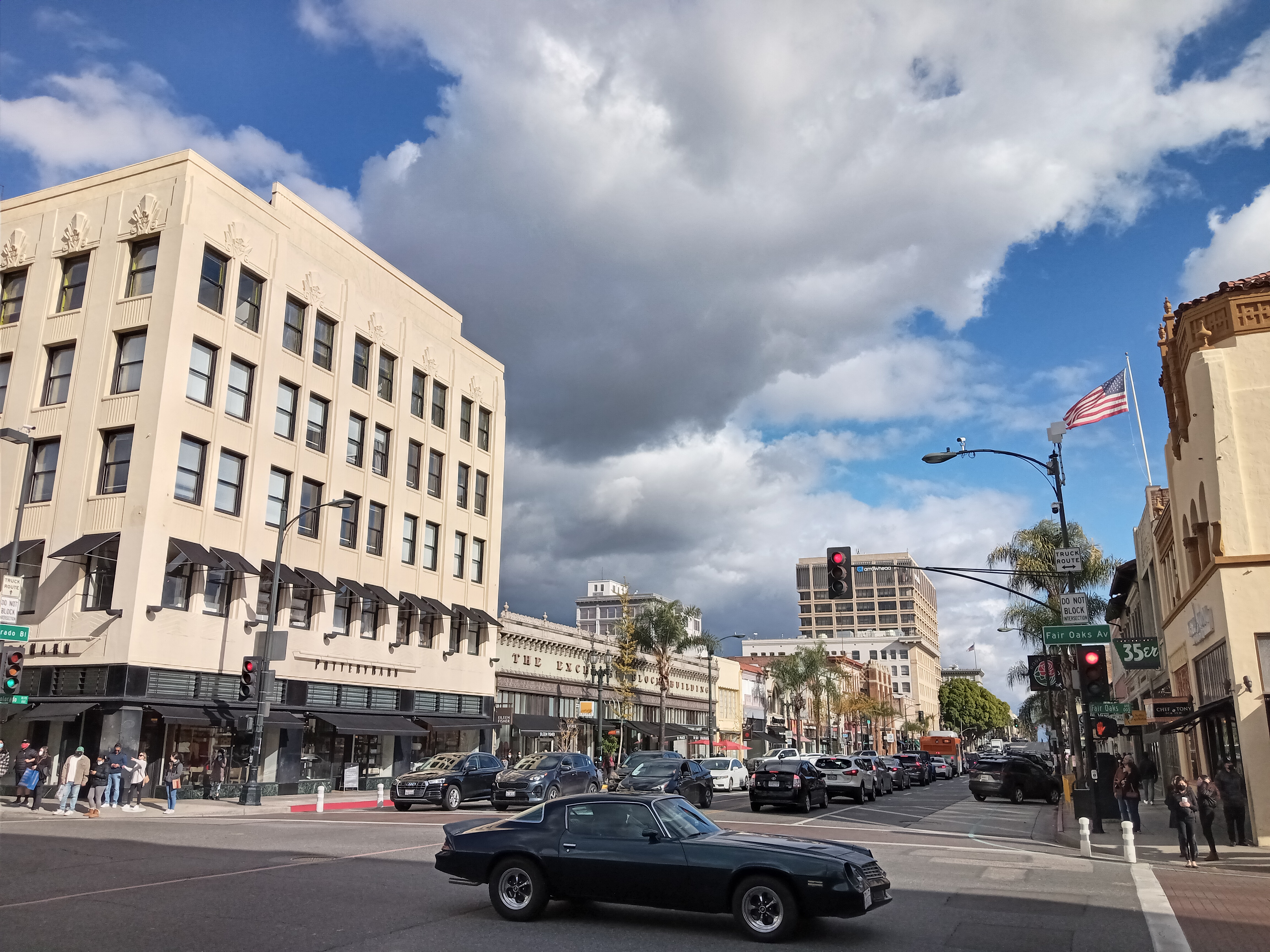
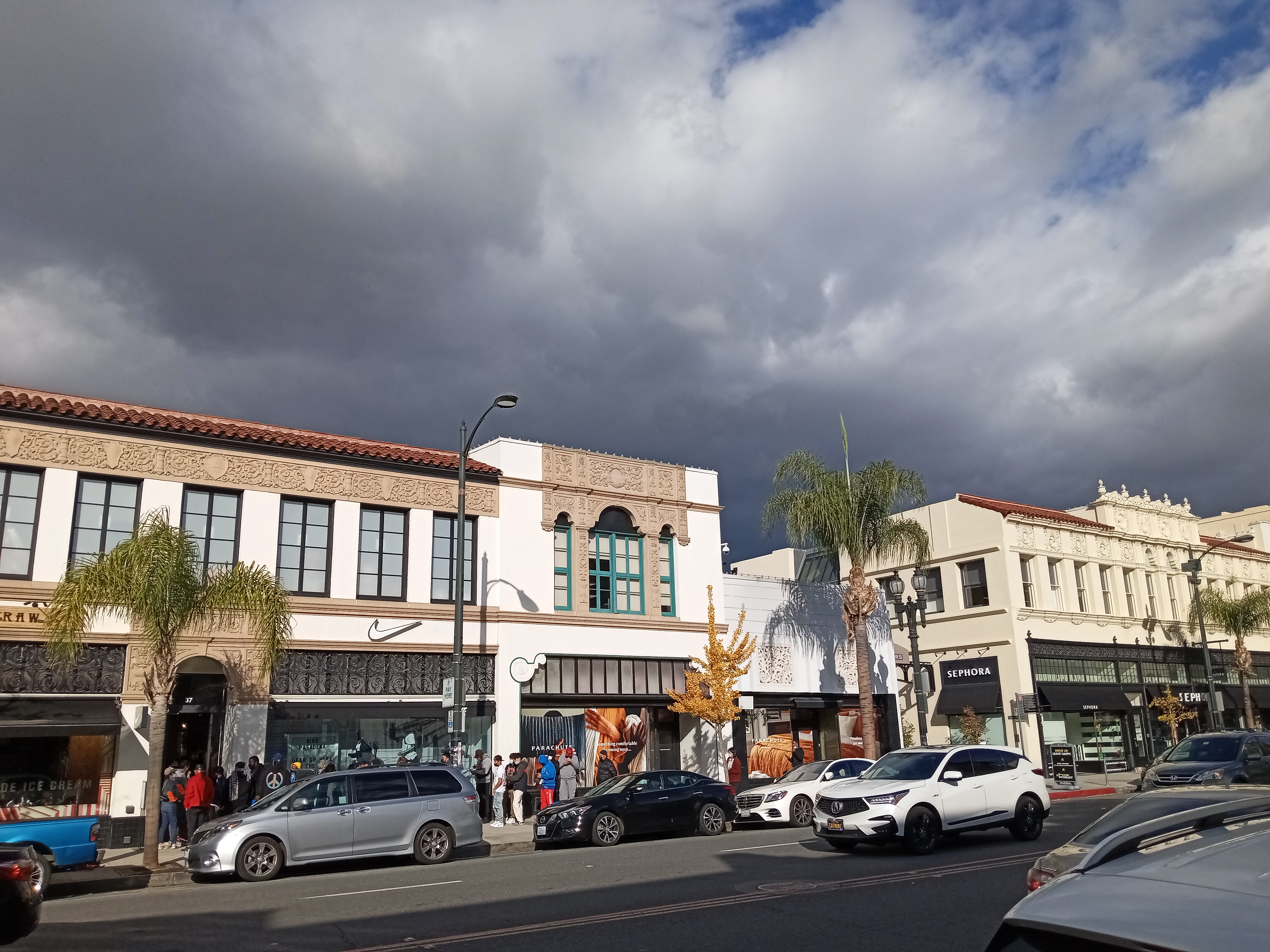
Colorado Blvd is dominated by shops, with a lot of high-profile chains like Tiffany & Co. and the Apple Store, while most of the restaurants are along paralleling Green and Union Streets. There’s a lot of local chains, while popular standbys like Bone Kettle and Ramen Tatsunoya sit just around the corner. It’s a great place to restaurant hop, just sampling from the menu from any place that appeals to you.
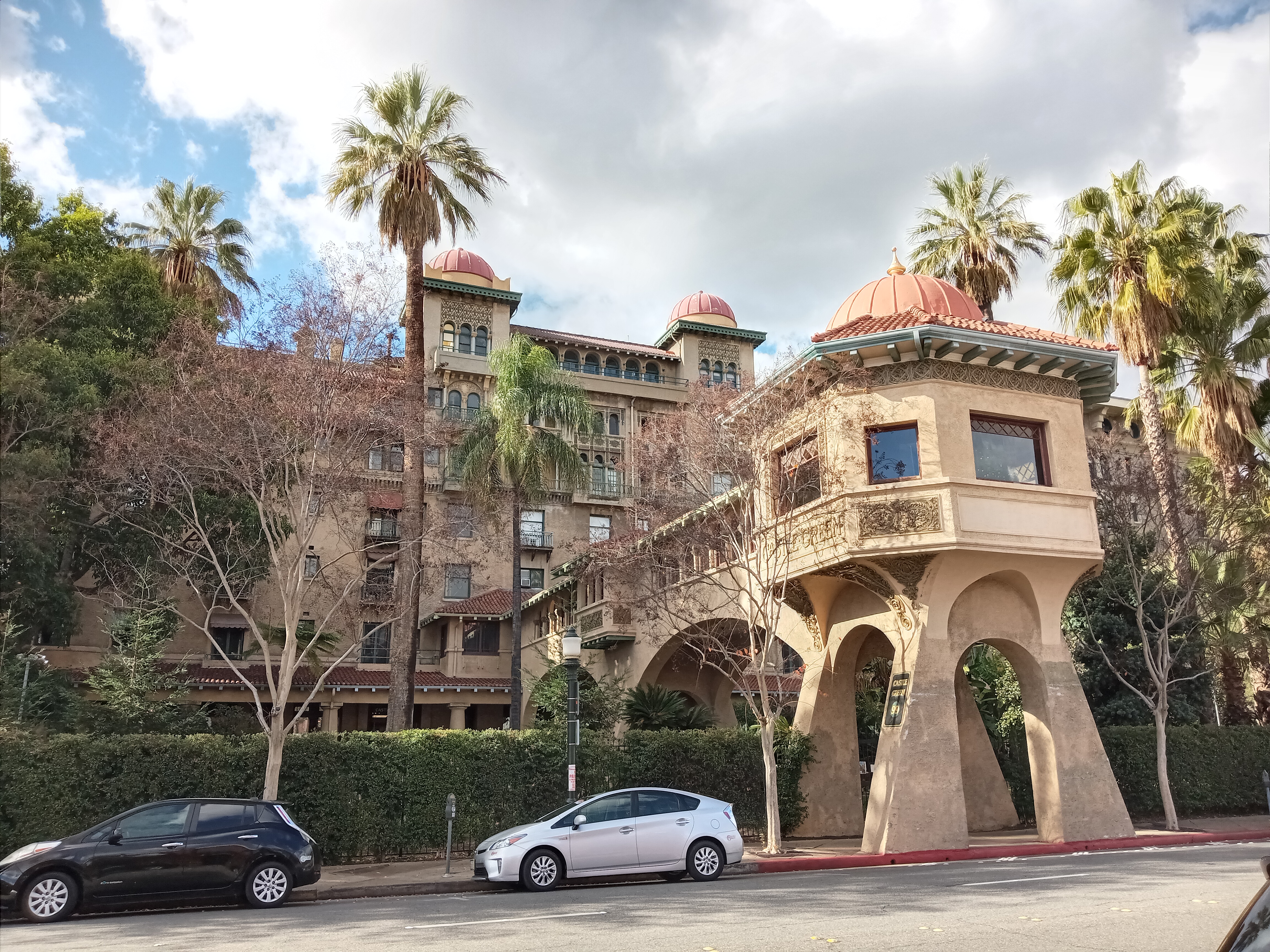
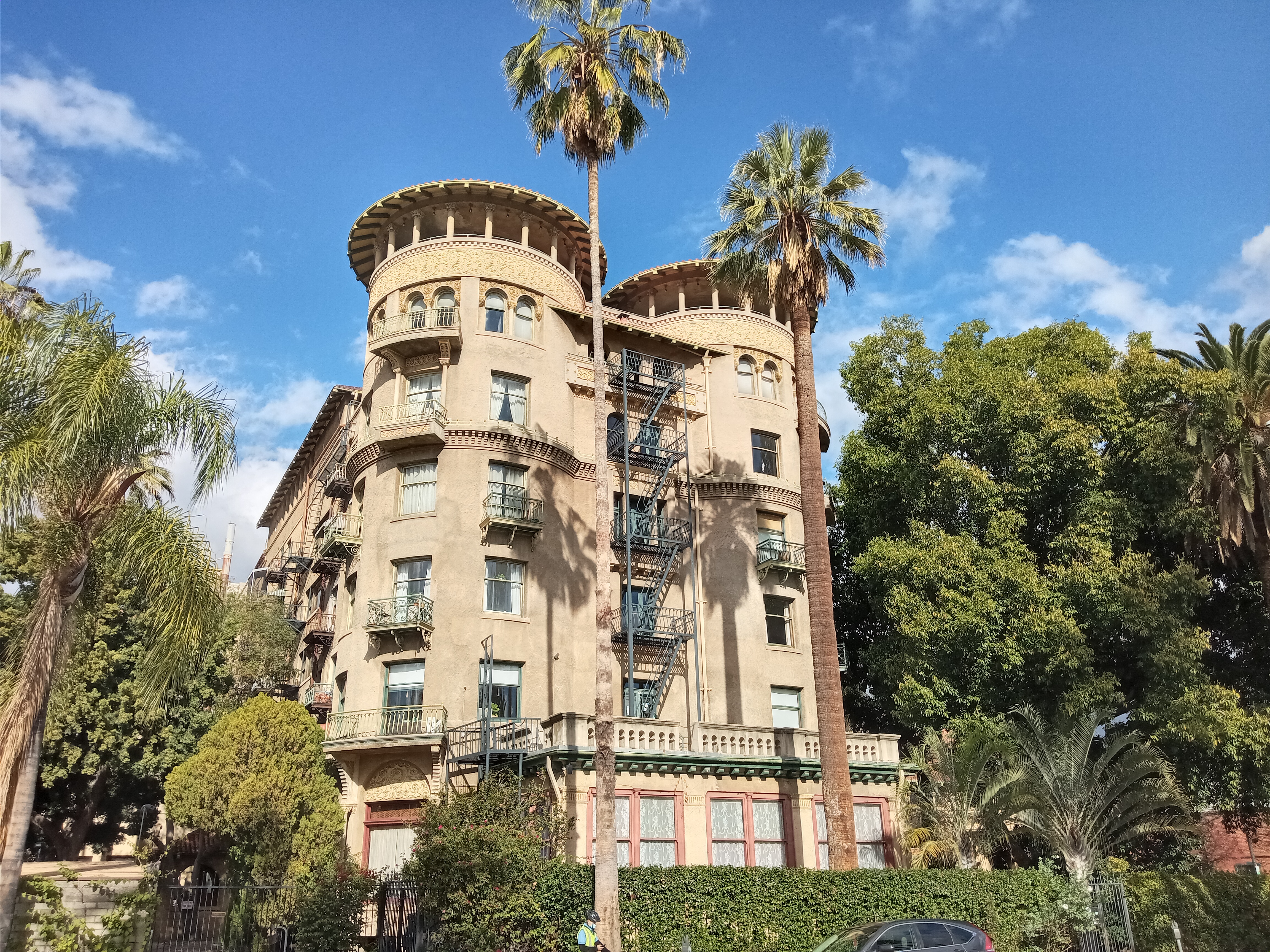
The district is bookended by two parks, both along Raymond Avenue on each side of Old Pasadena. On the north side is Memorial Park, perched above the Metro station of the same name. The park holds a bunch of war memorials as well as the ruins of the entrance to Pasadena’s first public library, tucked under a grove of trees on the corner of Walnut and Raymond. From here, you can look up the street at the beautiful Italianate bell tower of St. Andrew Catholic Church, a local landmark. On the south side of Old Pasadena is Central Park, a big grassy lawn across from the Del Mar Metro station that sits in the shadow of Castle Green, a spectacular old railroad hotel of turrets and balconies with Victorian and Mediterranean flourishes.
The first time I went to the Rose Parade, there was someone handing out cards to parade attendees promising free hot chocolate. It was only after looking at the card that we realized what the catch was: in order to claim your free hot chocolate, you had to go to the Scientology center in Old Pasadena, which likely meant sitting through an excruciatingly long sales pitch on the merits of Scientology for what would probably be heavily watered-down hot chocolate. No thanks.
Pasadena does play a big role in the history of Scientology, though they probably wouldn’t tell you it at their church. In the 1940s, L. Ron Hubbard briefly lived in Pasadena with his close friend, a brilliant young rocket scientist and occultist named Jack Parsons. Parsons was instrumental in the foundation of the Jet Propulsion Laboratory and, as a follower of English occultist Aleister Crowley, ran the California branch of Crowley’s church out of his own house. His mansion, situated on Orange Grove just south of where the parade floats now stage, served as a boarding house and social club for anyone Parsons deemed weird, interesting, or compelling enough to earn entry. Hubbard, who Parsons considered particularly adept at detecting supernatural phenomenon, fit the bill perfectly.
Hubbard and Parsons’ occult exploits have become the stuff of myth and legend. But the friendship did not last long, as within just one year Hubbard managed to defraud Parsons of his life savings and elope with his girlfriend, who herself would later have a turbulent marriage with Hubbard and play a vital role in the creation of Dianetics, a set of beliefs about mental health that lay the foundation for what would become Scientology. Parsons, for his part, would be killed in a mysterious explosion that ripped through his personal lab, just one month after Hubbard announced the formal founding of Scientology.
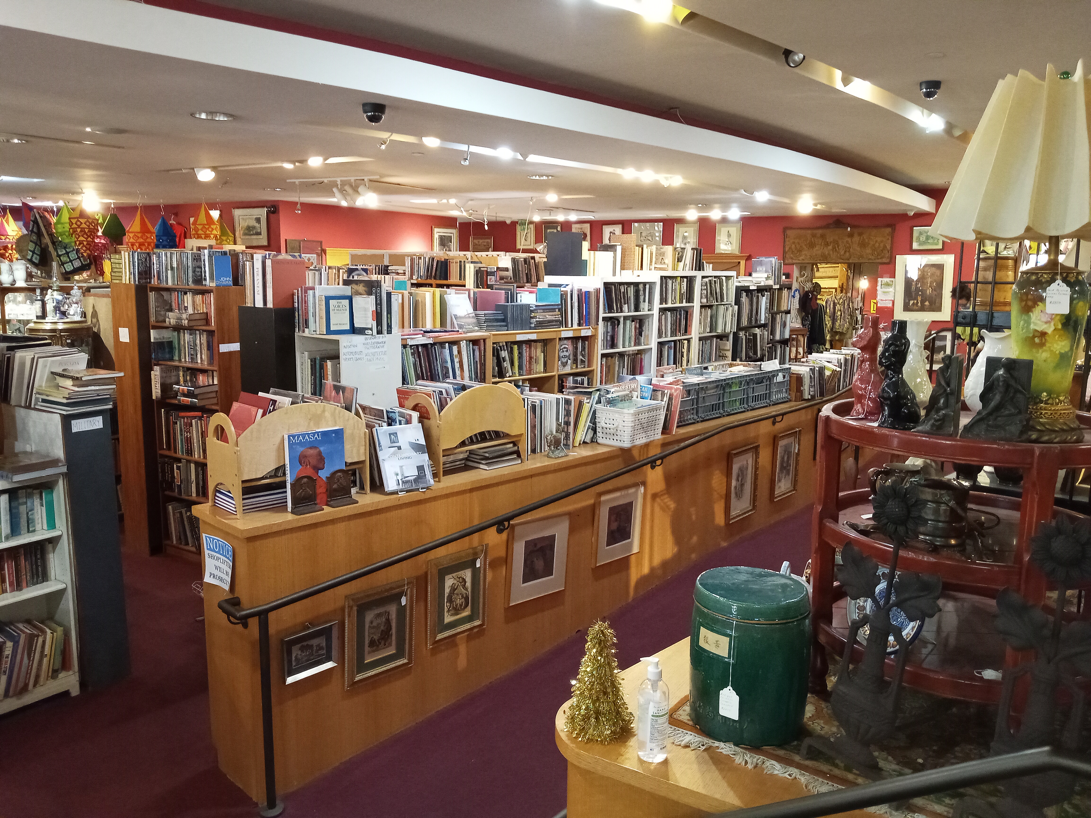
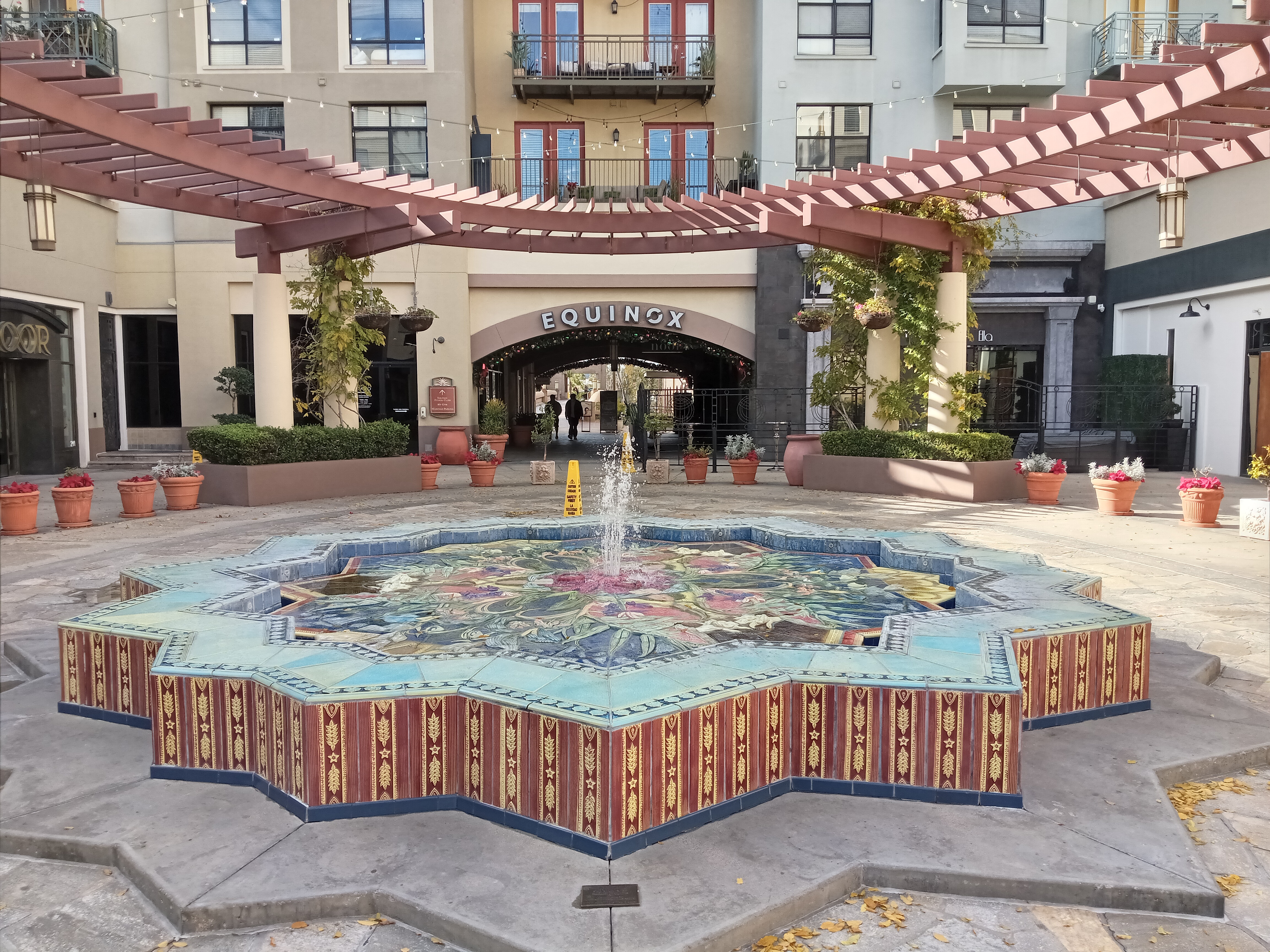
Past Marengo Avenue, Colorado passes through Pasadena’s Civic Center district. Along Colorado proper is The Paseo, a prominent open-air mall with fairly typical architecture but some really nice touches. The most interesting place in the mall is the Pasadena Antique Mall, one of Pasadena’s many excellent antique stores and a lot larger than it appears from outside, just across from the lovely Pasadena Civic Auditorium on Green Street.
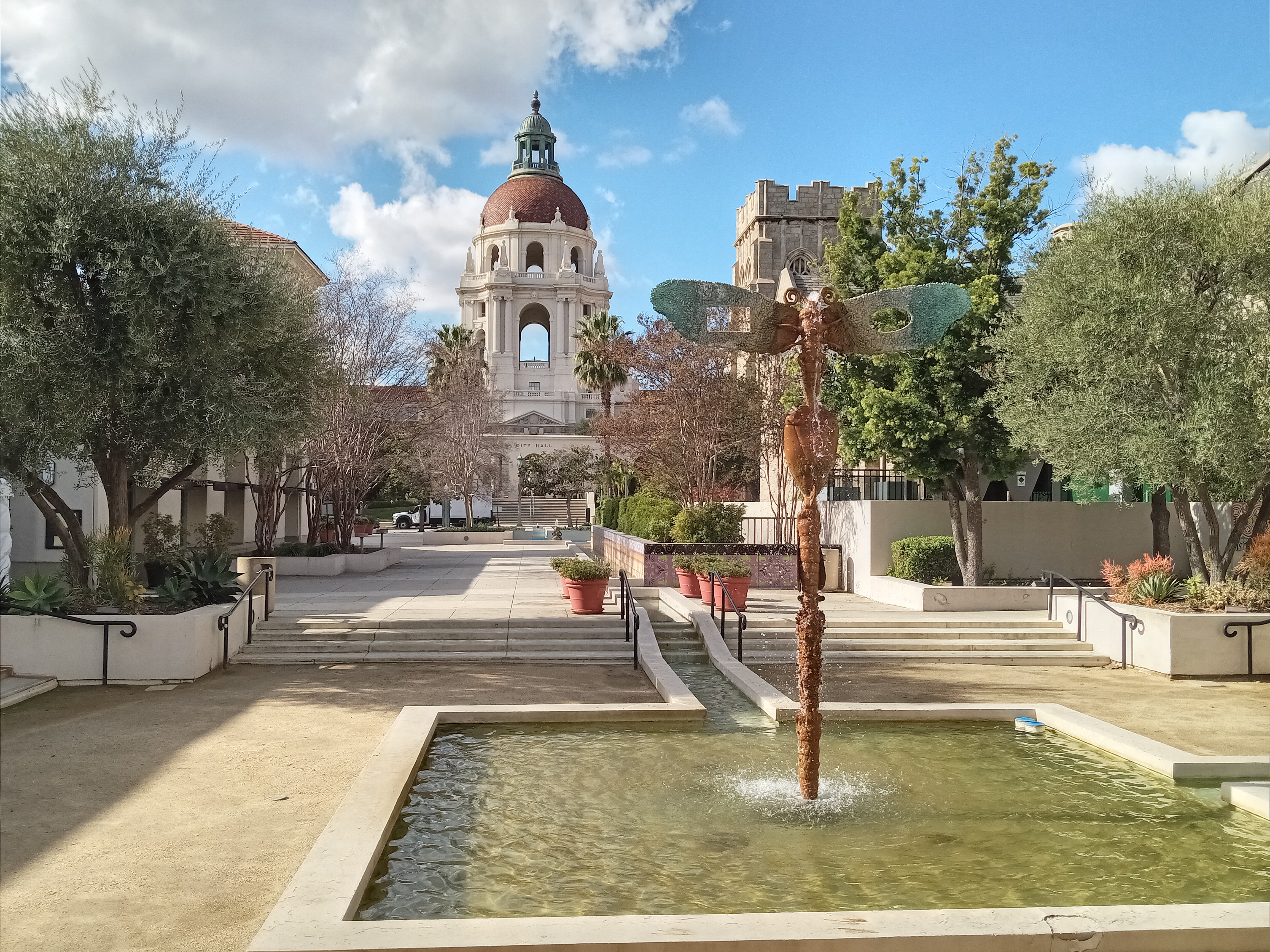
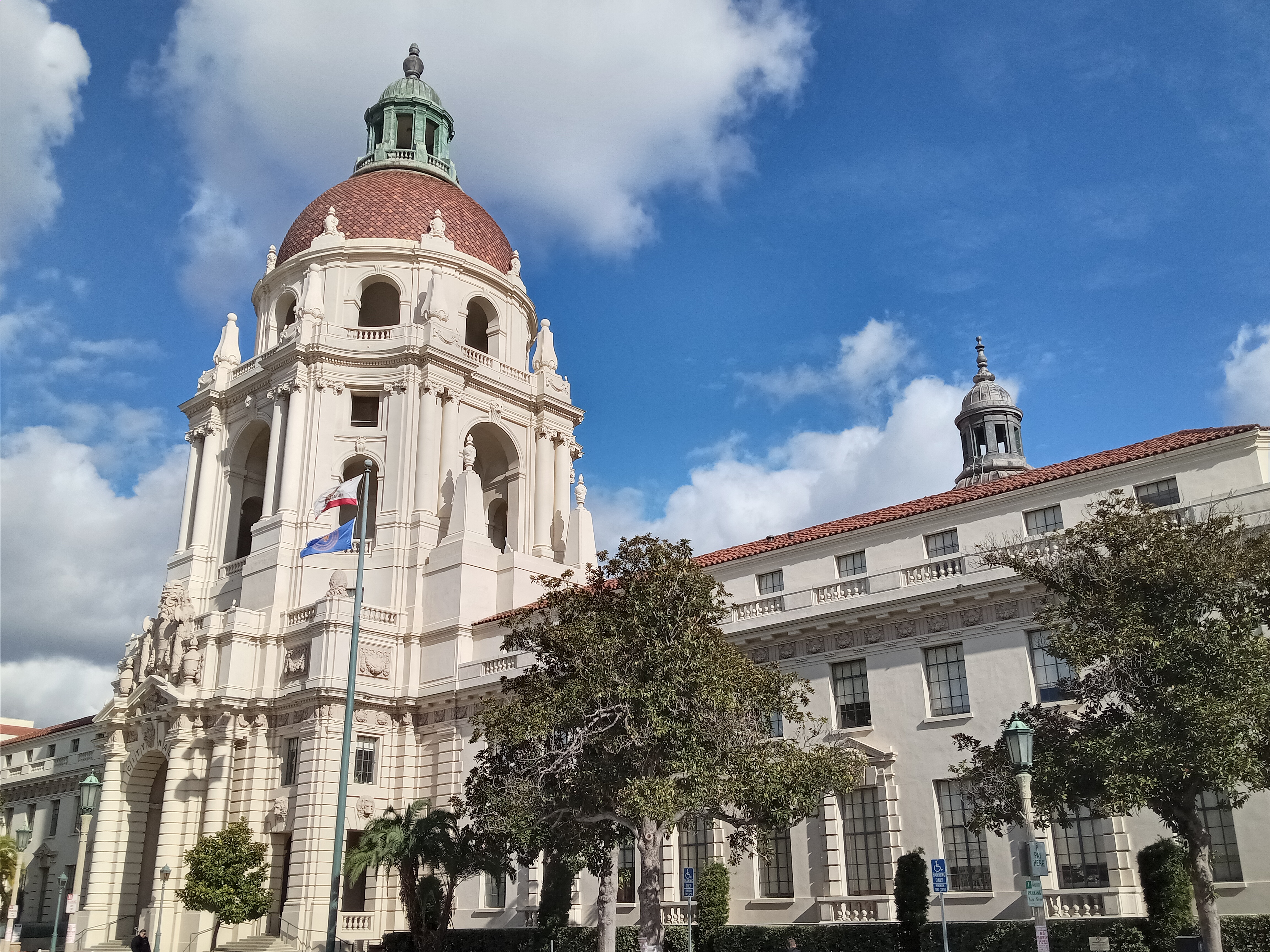
However, the real highlight of the area is the spectacular City Hall a block north of Colorado on Garfield Avenue. One of the most beautiful municipal buildings around, City Hall is a gorgeous Mediterranean-style building with a massive dome towering over the street and a scenic courtyard in the center. From the courtyard, you can climb one of the staircases to the second-floor landing, which circles the courtyard and has an open-air bridge along the east side of the building with a nice view. A lot of nice pedestrian paseos cut through the blocks surrounding City Hall, with some lovely fountains and public art.
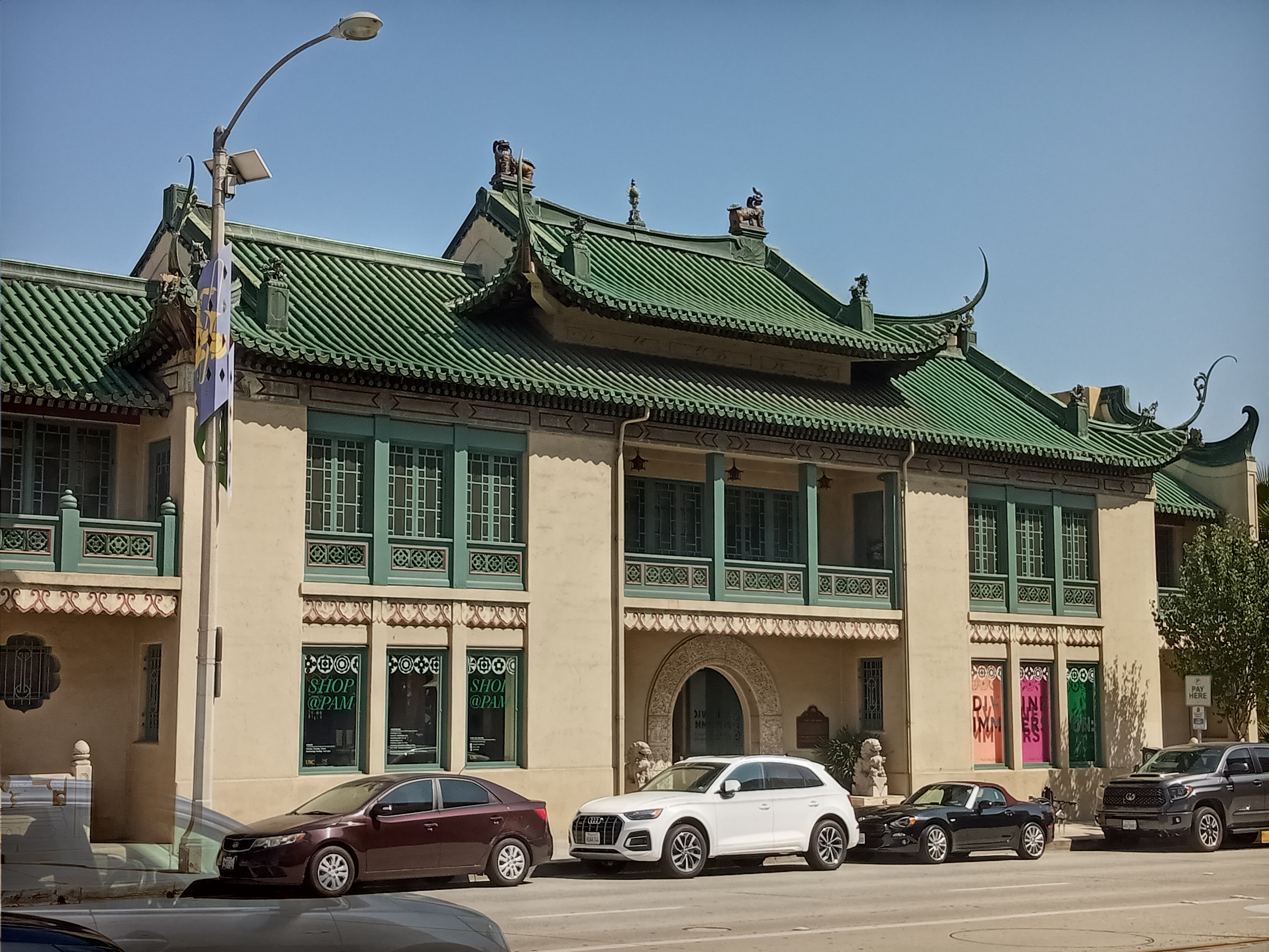
Just to the east of City Hall, at the corner of Union and Los Robles, is the USC Pacific Asia Museum, a wonderful little museum held in a very distinctive Chinese-style building. Inside, you’ll find a marvelous collection of art and artifacts from across East Asia, including Buddhist and Hindu sculpture, Japanese prints, and Chinese ceramics and jade sculpture. The museum also hosts some pretty solid changing exhibitions of more contemporary Asian art as well. See info on hours and admission on their website (note that they’re closed on New Year’s Day).
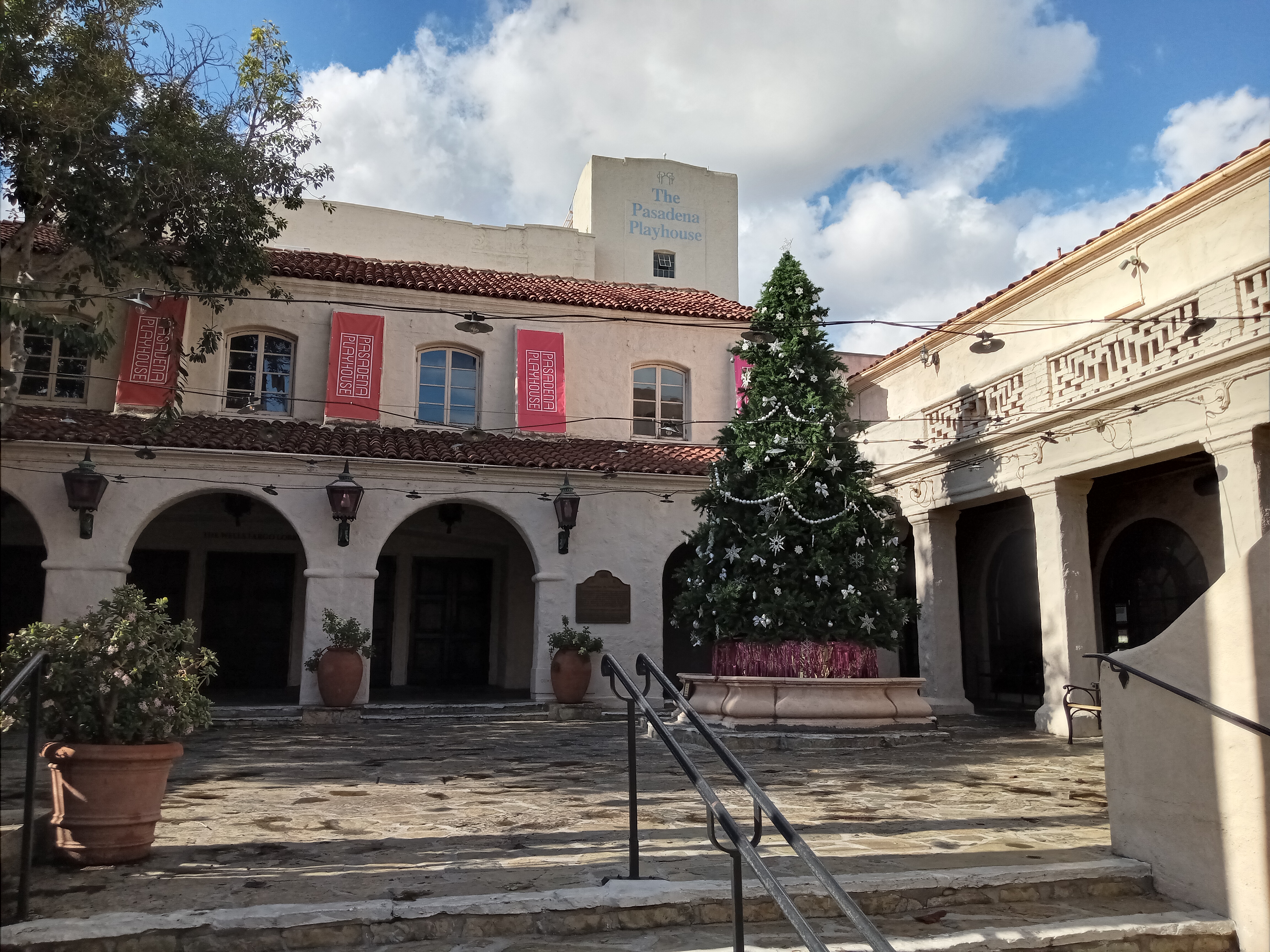
Between Los Robles and Lake Avenue, Colorado passes through the Playhouse District, named after the Pasadena Playhouse, a historic and rather prestigious performing arts theater on El Molino Avenue just south of Colorado. This stretch has some rather nice Art Deco-style buildings, including a couple old theaters that has been converted to other uses.
Watching the parade requires getting up pretty early in the morning. And this early in the day, you’re likely to hear some of Pasadena’s most charismatic residents: the famed wild parrots. California is home to multiple flocks of non-indigenous wild parrots, but the Pasadena flock is probably one of the largest and easiest to find. They’re more active in the summer than the winter, but you’ll hear their unmistakable screeching calls all year long, namely in morning and at sunset.
The most common parrots in Pasadena are Red-Crown Amazons, green parrots with a hint of red on the top of their heads, which are indigenous to northeastern Mexico. There are plenty of urban legends about how they wound up in California: one story is that they were released from the original Busch Gardens amusement park when it closed down, while another is that they were freed when a local pet store caught on fire. Another theory is that they’re descendants of victims of the exotic pet trade that managed to get free and form breeding pairs in the wild.
However they got here, they’re here to stay. You’ll always hear them before you see them; their loud screeches can be heard blocks away, and the unfamiliar are always taken by surprise. And then if you’re lucky, you’ll catch a glimpse of them: sometimes just in pairs, sometimes a flock of dozens, soaring high overhead. They feed from the fruit of palm trees, which are tall enough to offer the parrots a unique ecological niche. You never see them close to the ground, but for the sharp-eyed, you just might catch a flash of green high in the treetops.
Past Lake Avenue, the parade continues through East Pasadena along what is, for the most part, a fairly non-descript section of Colorado Boulevard. This stretch of street once served as a portion of Route 66, and in some places the old mid-century roadside architecture still stands: an unusual marquee sign here, a splash of streamline architecture there. It certainly becomes a lot more auto-oriented, with strip malls, drive-thrus, and auto repair shops becoming the norm.
One spot very much worth checking out is CAR Artisan Chocolate, at the corner of Colorado and Catalina, two blocks east of Lake. This bustling café specializes in chocolate made in-house, with the tastiest chocolate croissants and most decadent hot chocolate in town, a must-have on a chilly parade morning. Three blocks further east, at 1234 Colorado Blvd, is Andy’s Coffee Shop, a beloved old diner dating back to 1960 and open only for breakfast and lunch. Behind the unassuming storefront, you’ll find a cozy diner with excellent breakfast dishes, including a particularly delicious breakfast burrito. Between Hill and Allen Avenues, Colorado passes the pleasant exterior of the Pasadena City College campus, although the much more scenic campus of Caltech sits just a few blocks to the southwest; see our walking tour for more on what that campus has to offer.

At Sierra Madre Boulevard, the parade turns north and heads towards the mountains. After passing under the freeway, the parade concludes at Villa Street, with the floats taken a little further up the street to be parked at the viewing area, along Sierra Madre near the sports fields of Victory Park and just shy of the foothills of the San Gabriel Mountains.

One thought on “The Transiting Guide to the Rose Parade (and everything along the route)”