(If you would like a printed guide to the Baldwin Hills, you can purchase a lovely guide from us on our Etsy page! The printed version is inspired by national park brochures, with a full-color map, photographs, and information on the park’s history and attractions.)
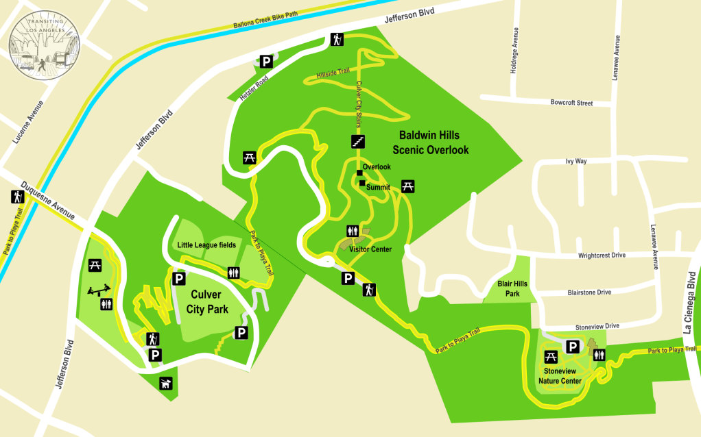
In late 2020, a pedestrian bridge over La Cienega Boulevard was opened, marking the completion of the Park to Playa Trail, a 13-mile hiking and bicycling corridor that connects the Crenshaw neighborhood to Playa del Rey, traversing the Baldwin Hills before dropping down into Culver City and following the Ballona Creek all the way to the Pacific Ocean.
The Park to Playa Trail traverses roughly four miles over the parks of the Baldwin Hills, treating you to the most spectacular views on the Westside and some of the most enchanting parks in the whole city.

Getting to the Baldwin Hills by transit does require a little planning ahead. The only frequent bus route that directly serves any of the parks is Metro #212, which runs on La Brea Avenue along the eastern edge of Kenneth Hahn Park, a short ride south of the E Line (formerly the Expo Line) station at Expo/La Brea. On the Culver City side, Culver CityBus #4 runs from the La Cienega/Jefferson station down Jefferson and past Culver City Park, but it only runs about once an hour at best, with no service on Sundays.
I should note that the county operates a shuttle directly from the La Cienega/Jefferson station to many of the park facilities, including the Baldwin Hills Scenic Overlook and the visitor center in Kenneth Hahn Park. This seems like a convenient option, but it only operates on the weekends and every 30 minutes at that. If you’re going on the weekend, this might be a great way to avoid a lot of climbing. But since we were traveling on a weekday, we opted to hike our way up from the E Line.
There’s a couple different ways to reach the Baldwin Hills on foot from the E Line. One is to get off at Culver City station and then navigate some residential streets south to Duquesne Avenue, where you cross over Ballona Creek and across Jefferson Blvd into Culver City Park (about a mile and a half). Or you can get off at La Cienega/Jefferson and take the Ballona Creek Bike Path down to Duquesne Avenue (about two miles), which is a somewhat more direct route that avoids a lot of traffic and offers the novelty of walking along some running water and a very popular bike corridor. Just be aware that the bike path is within the concrete channel of the creek, which means there’s virtually no shade. This isn’t much of a problem on a cool, breezy day, but probably something to avoid if it gets hot.
The elevated platform of the La Cienega/Jefferson station has gained a lot of company since it opened. A massive development across the street to the north has created a huge wall of apartments facing the station, while another new development has risen immediately south of the station. To the northwest, you still get a clear view of the Hollywood sign and the Downtown skyline.
Exit down the west side of the platform (to avoid having to cross busy La Cienega Blvd) and when you get to the ground, take the bike path that runs along the south side of the tracks, towards another newly-built tall building, this one with an unusual steel “wrapper” covering the façade.
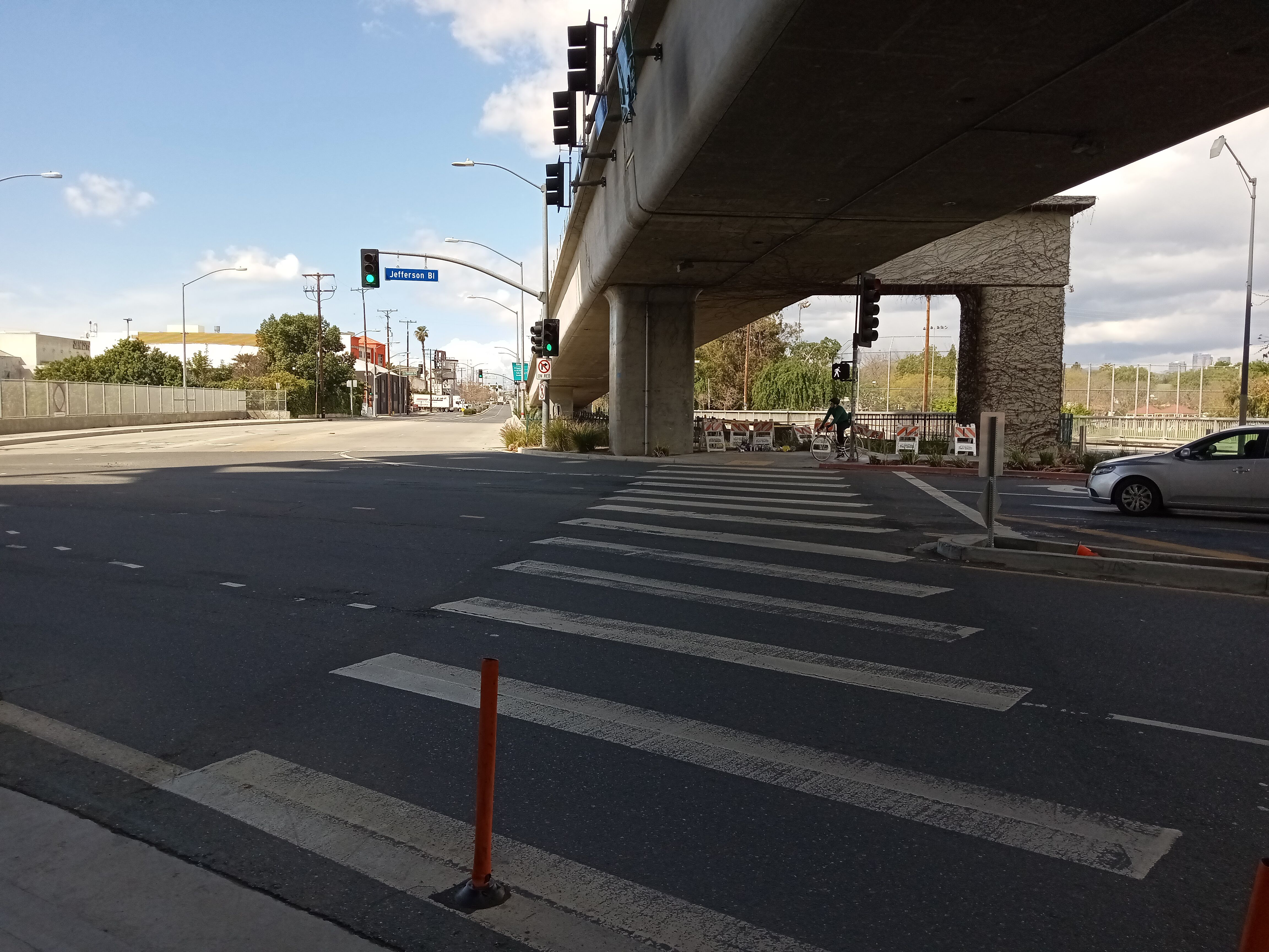
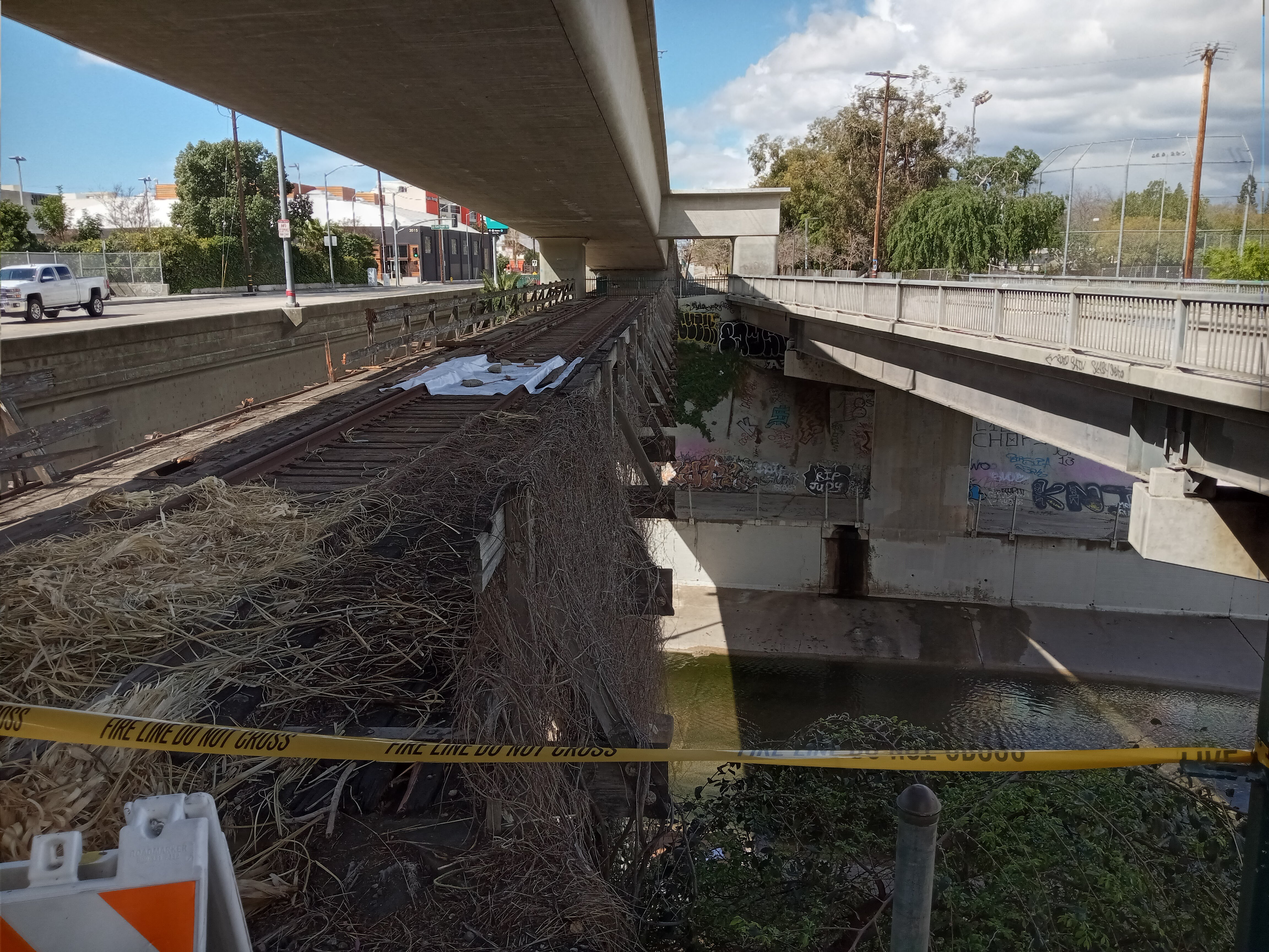
When you reach Jefferson Blvd, take the crosswalk under the Metro tracks and you’ll reach Ballona Creek. Over the creek is a really cool artifact: an old streetcar bridge that sits directly underneath the E Line bridge, which once served the Pacific Electric’s Santa Monica line, a distant predecessor of the E Line. Apparently, it proved too much trouble to remove, so it remains in place, rusting away as the wooden railings gradually fall apart.
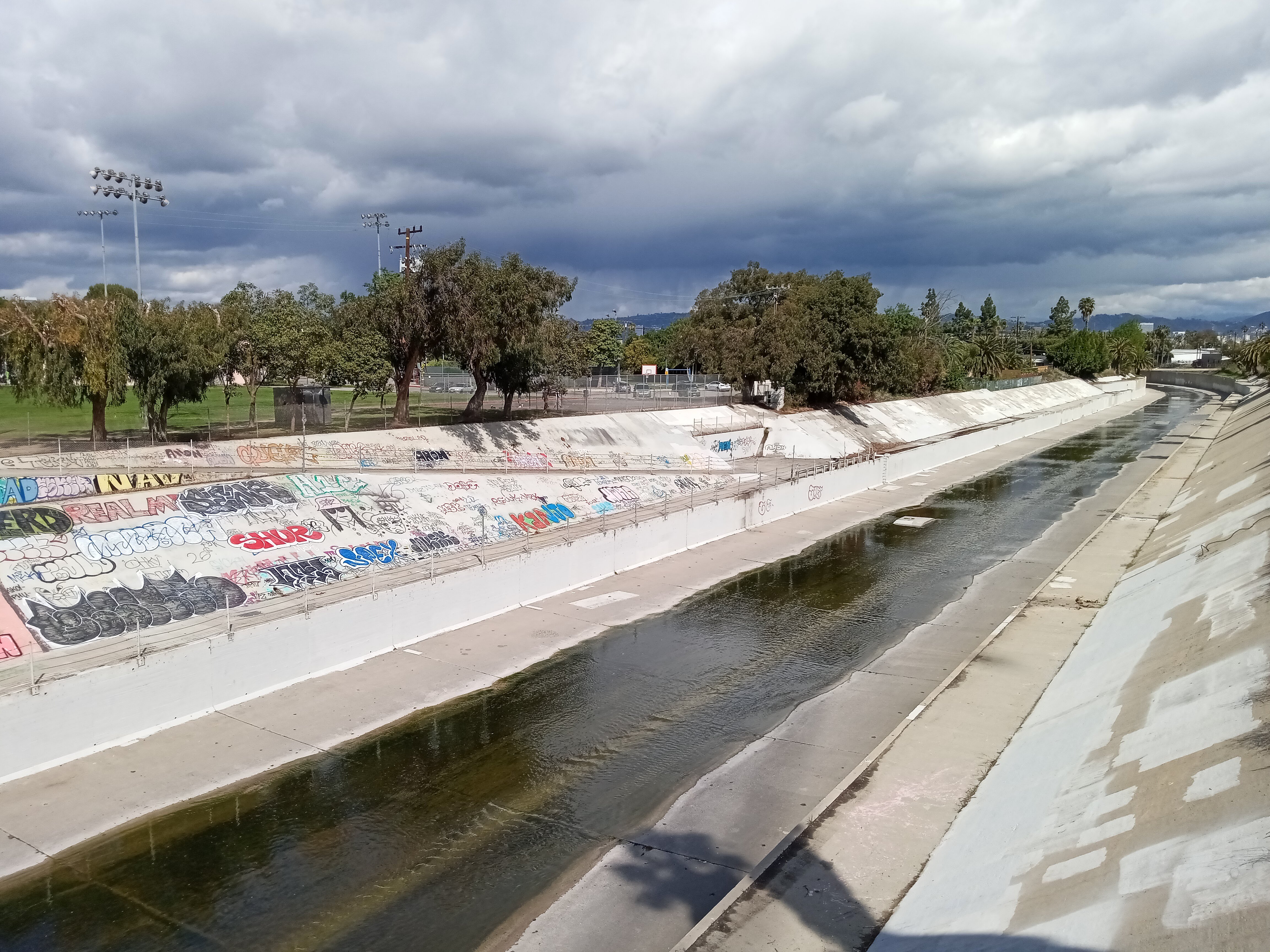
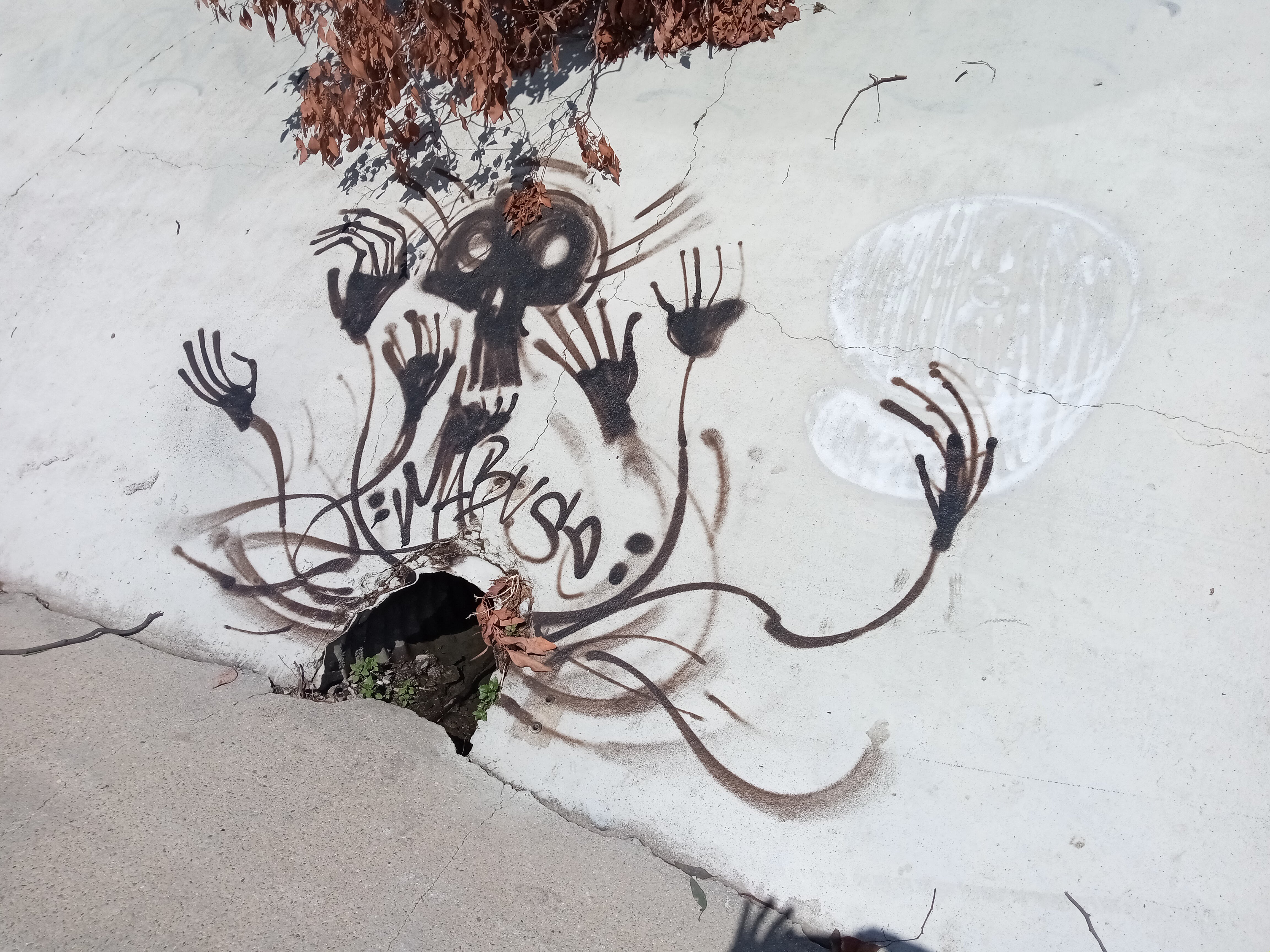
The bike path continues across an adjacent former road bridge. From here, you can see the ramp down into the channel on the other side, which marks the start of the Ballona Creek bike path. There’s a lot of graffiti covering the walls beneath the bridge, and some of it is really creative and artistic. As we walked along the creek we encountered a lot of bicyclists on the path. We also saw ducks floating down the stream and even a little waterfall where a separate channel was dumping rainwater runoff into the creek. As we rounded a bend, the Baldwin Hills came into view, particularly the popular Culver City Stairs, where you can watch lines of joggers and exercisers challenging the grueling steps.

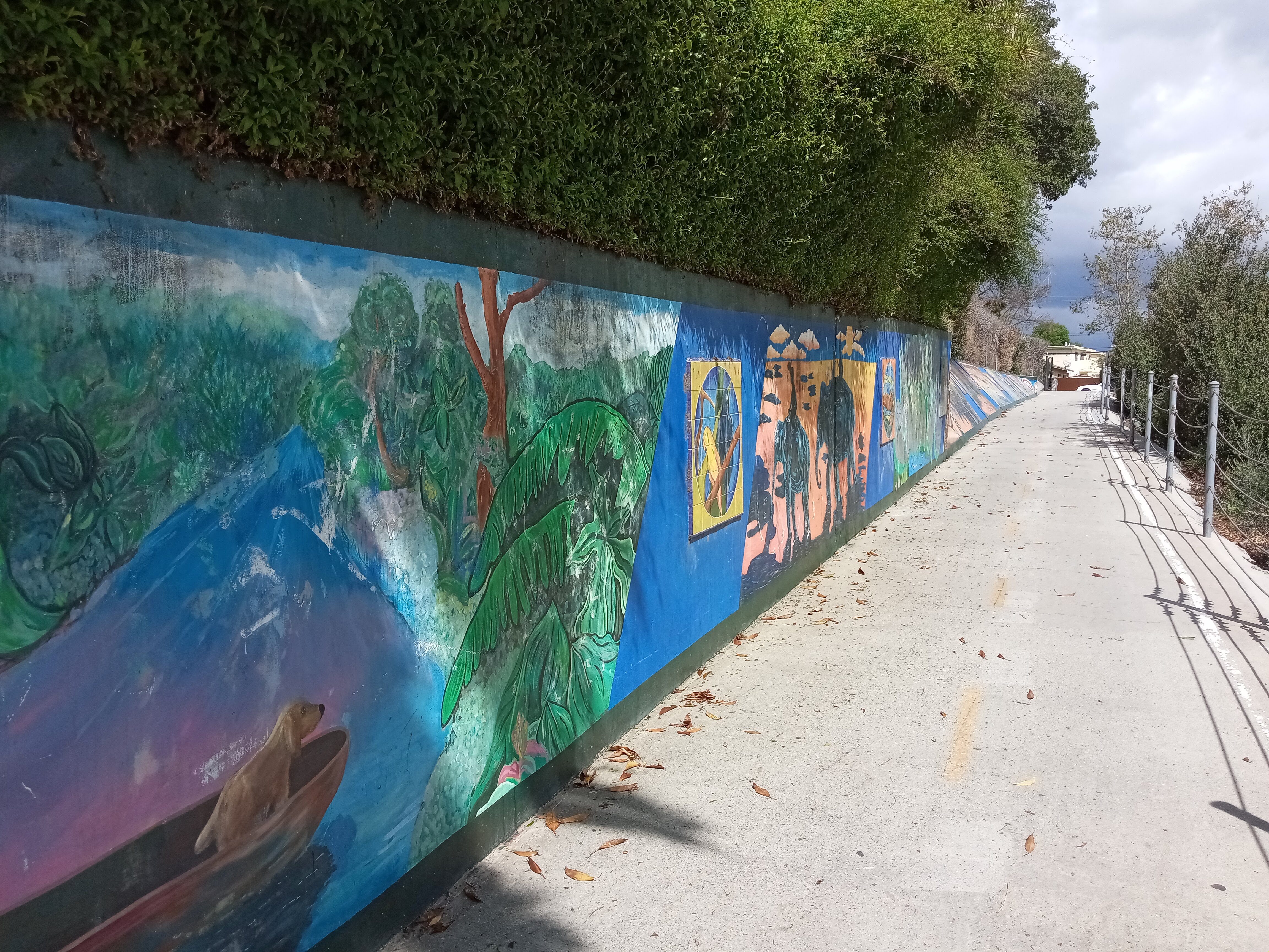
The first exit you’ll reach is Duquesne Avenue, and the ramp up to the street is decorated with a charming mural depicting famous rivers around the world, ending with the Los Angeles River at the top.
When you reach the street, turn right and cross the bridge. Walk pass the pineapple-shaped sculpture and cross Jefferson Blvd into Culver City Park, where the street will start climbing up the hill. A line of blue paw prints on the sidewalk will lead you towards a dog park at the back of the park, passing a playground and a picnic area on your right.
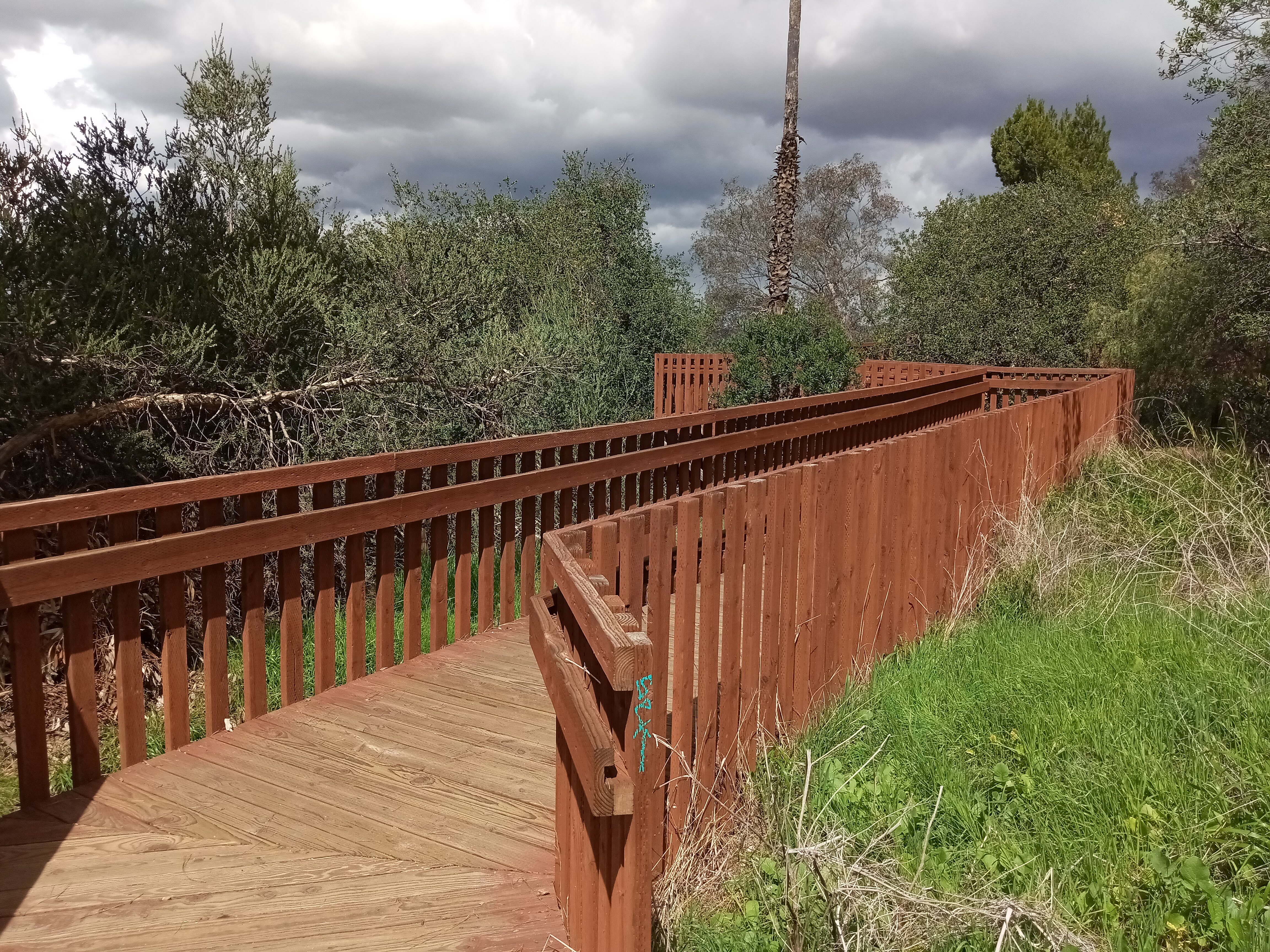
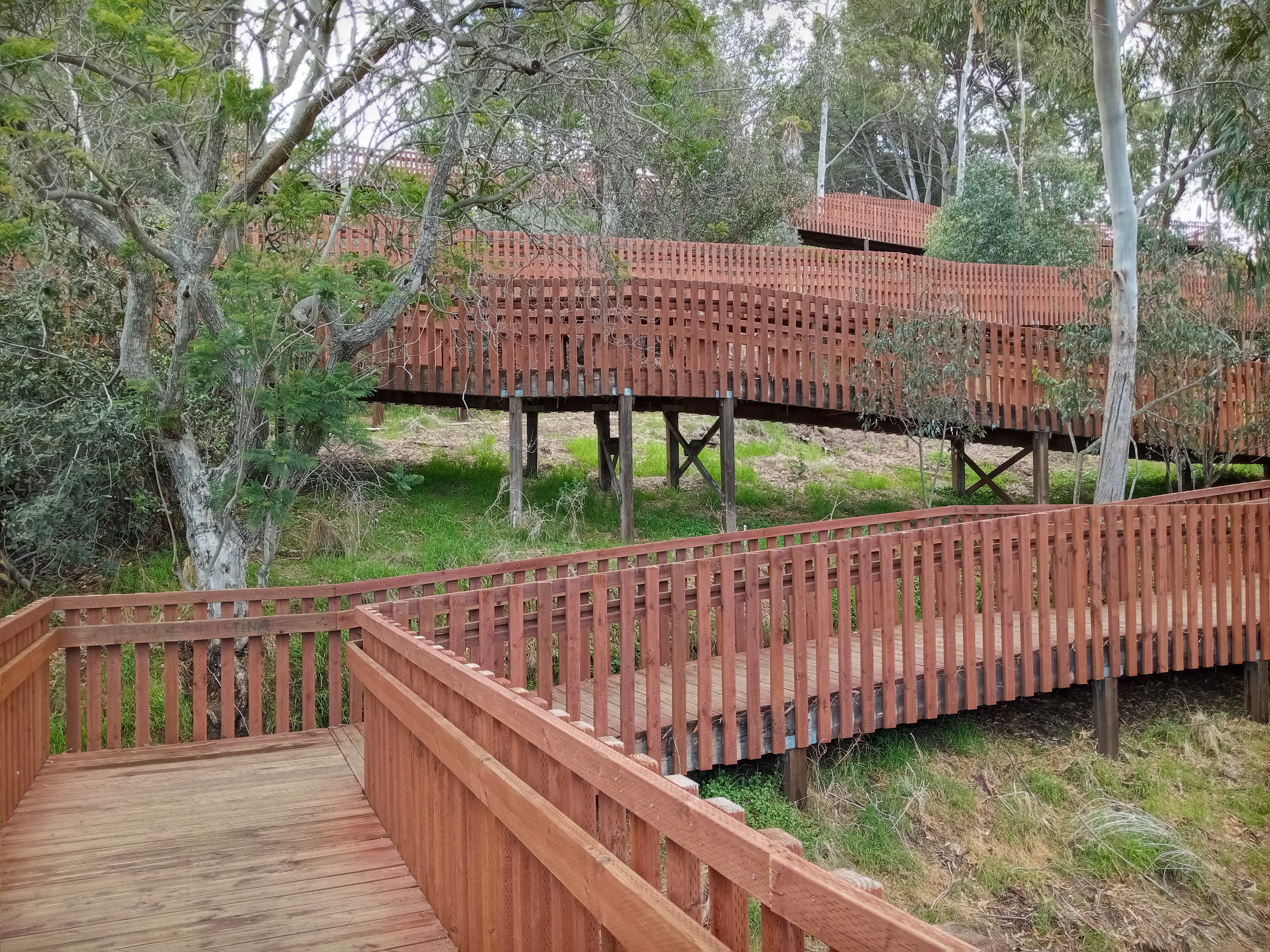
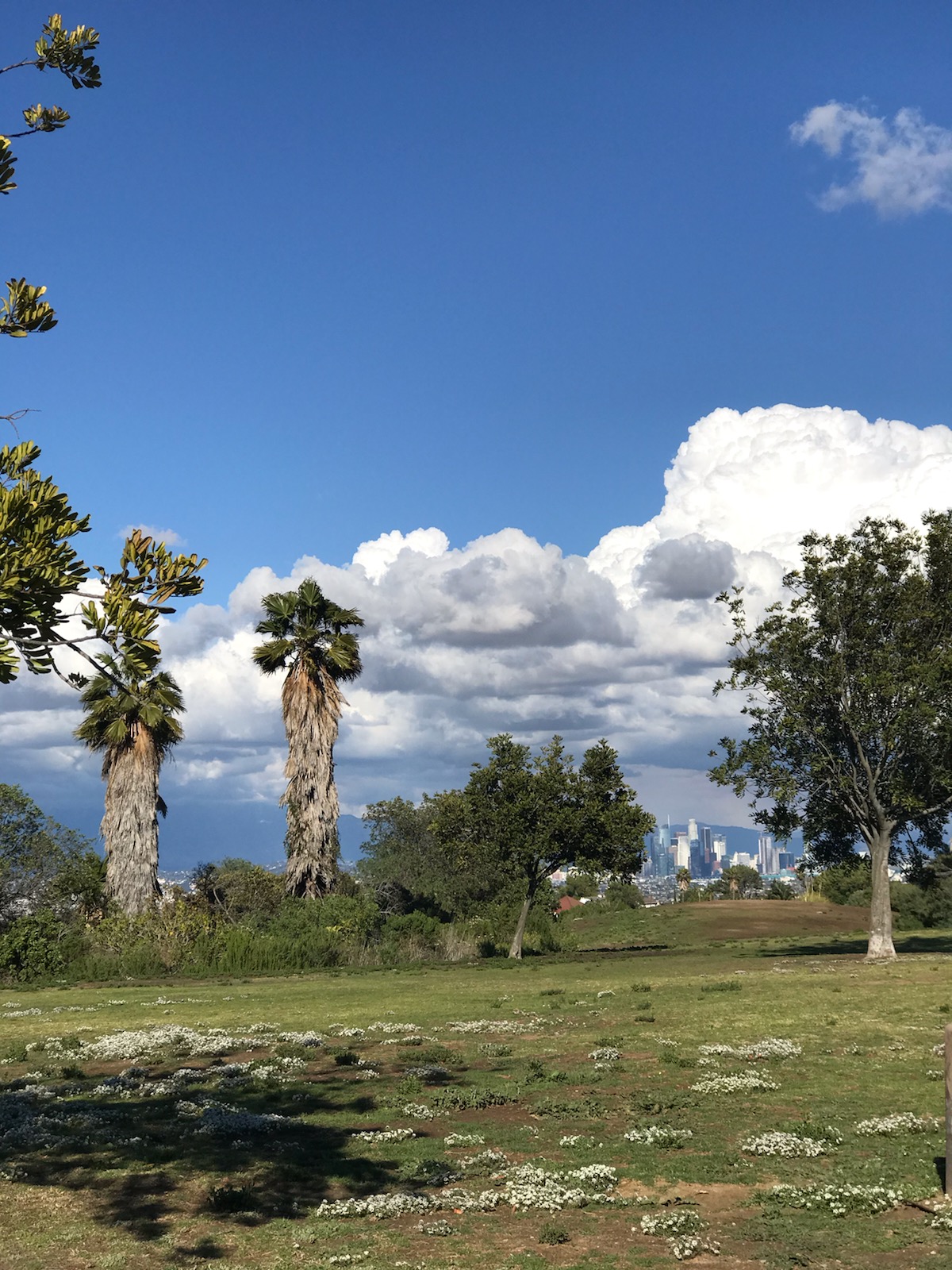
But before you reach the dog park, you should see a crosswalk that will take you to a parking lot on your left, marked with signs for the Park to Playa Trail (which you are now officially on, by the way!). Up the slope, you’ll see the trail switchback up the hill via a set of redwood boardwalks elevated above the ground. Make your way up past the elaborate challenge course, and then enjoy the views of Culver City as you gently ascend the hill, on what is definitely the most forgiving climb on the Baldwin Hills.

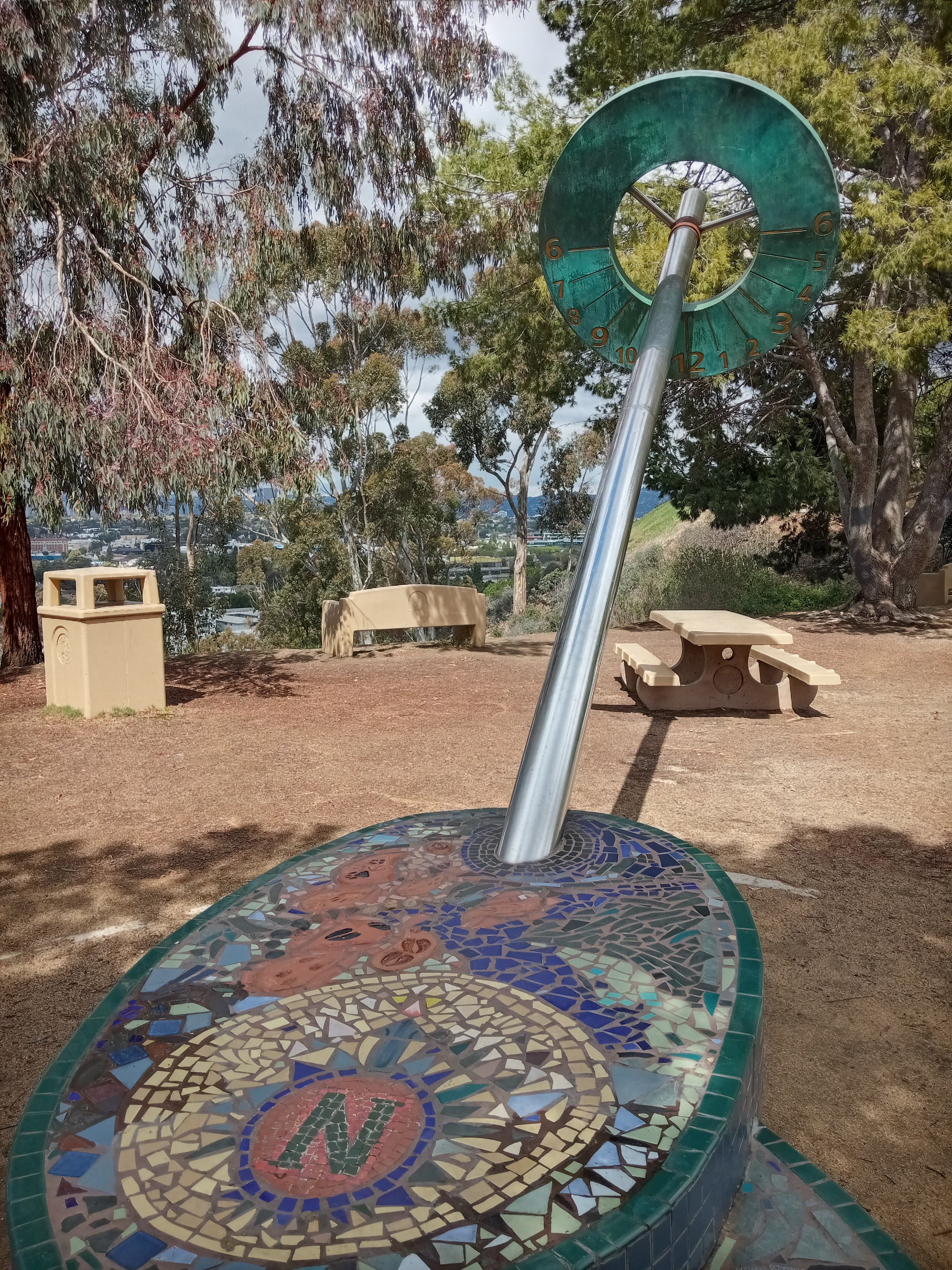
At the top of the boardwalk is a cool sculpture sporting a suspended sundial, along with some benches and picnic tables giving you the chance to enjoy the view of Culver City and the skylines of Century City and Westwood in the distance. From here you can spot the giant rainbow in the middle of the Sony Pictures lot in the middle of Culver City, and you can even catch your first glimpse of the ocean on this hike.
Continue along the parking lot past the sundial and climb the stairs directly ahead of you, leading up to the Little League fields. At the top of the stairs, make a right and walk past the Little League fields all the way to the last ballfield, then make a left and follow the trail that runs along the back of the field. After you’ve passed the field, you should see an elaborate wrought-iron gate that marks the transition from Culver City Park to the Baldwin Hills Scenic Overlook, which is maintained by California State Parks.
A short trail will lead you past some greenhouses and trailer for the park rangers, before you reach the access road for the Baldwin Hills Scenic Overlook. The trail continues across the road, through a little picnic area where you can stop and savor the view over the Westside before continuing up the hill.
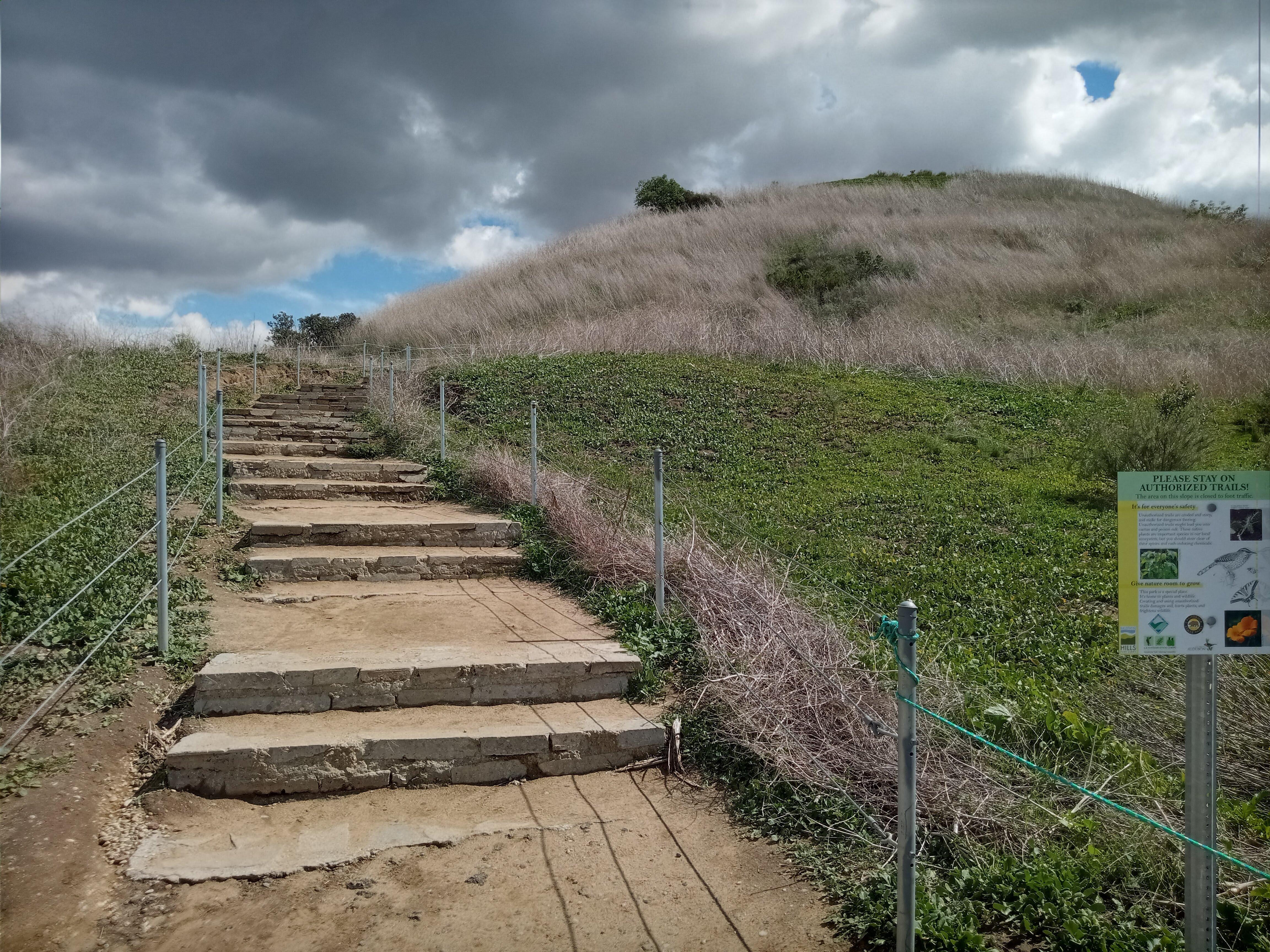
A lot of joggers use the access road, but there’s also a nice trail with steps that makes its way up the hill alongside the road. This is the steepest portion of the climb, making your way up the grassy slopes at the top of the hill.
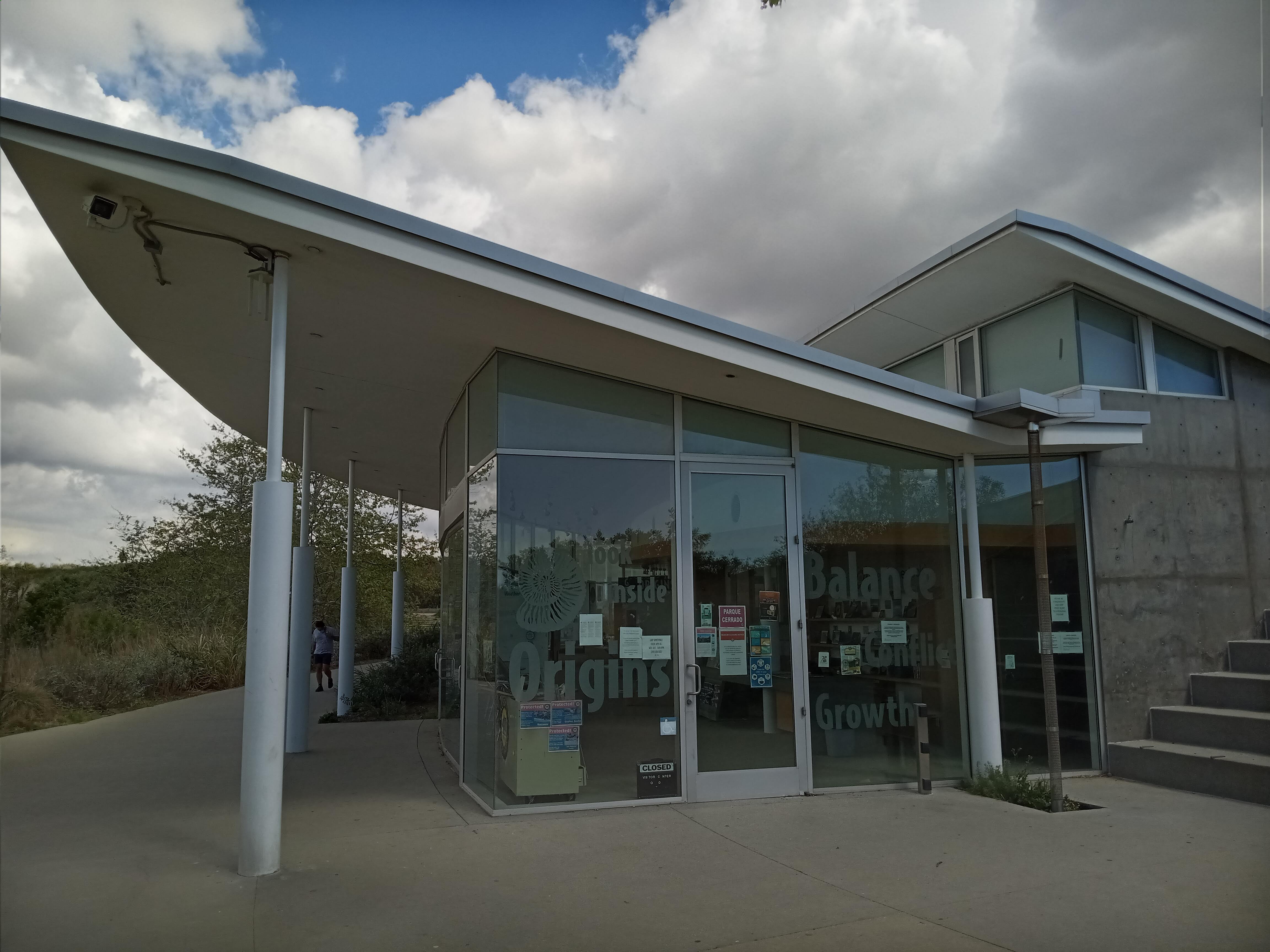
At the top, you’ll reach the parking lot for the visitor center, which is housed in a sweeping concrete and glass structure that curves along the ridge of the slope. Inside the visitor center is a little nature museum about the Baldwin Hills, although I’ve never seen it open, even before the pandemic. In the back of the building is a pair of clean restrooms and a nice garden of native plants overlooking Culver City.
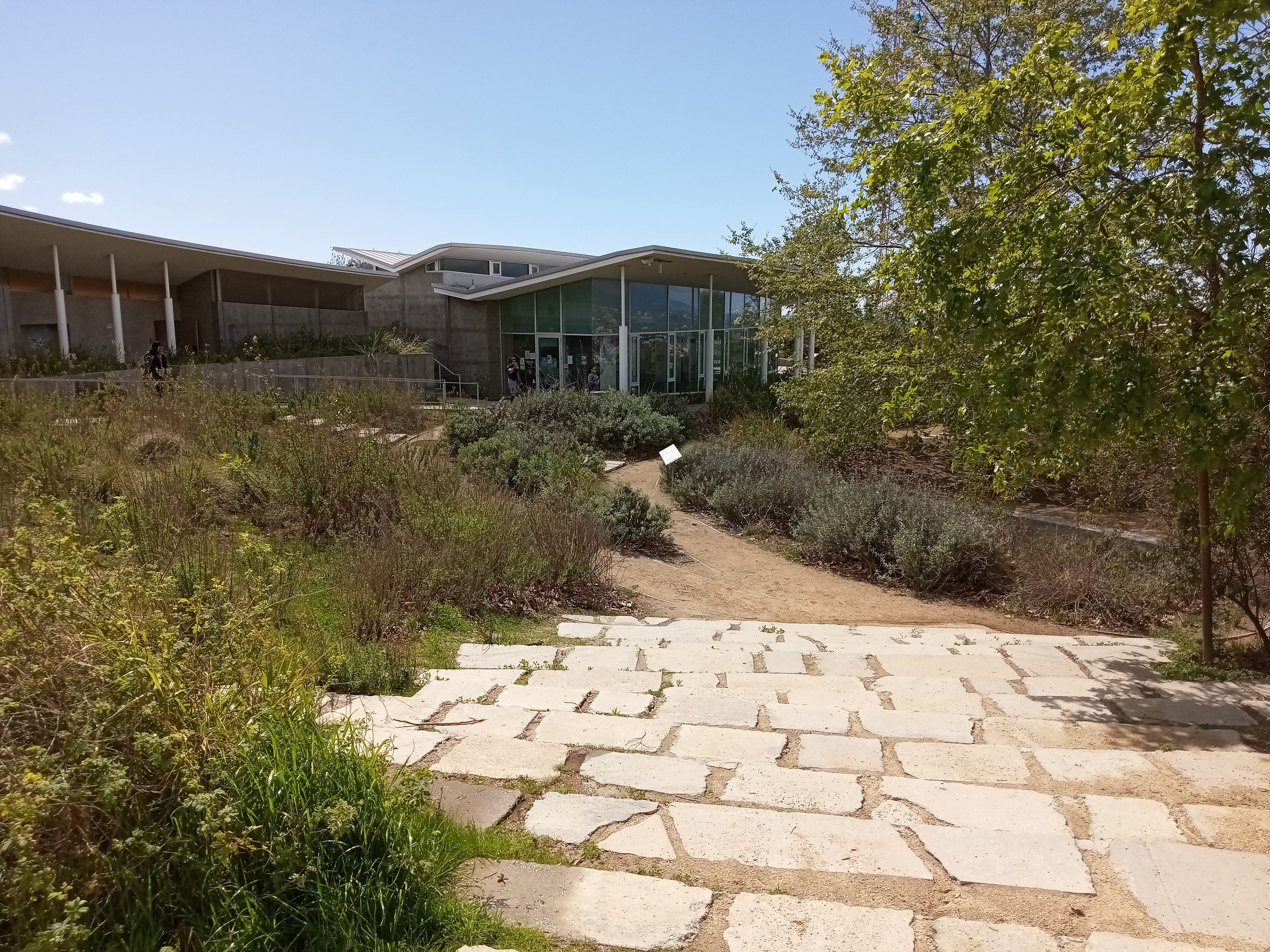
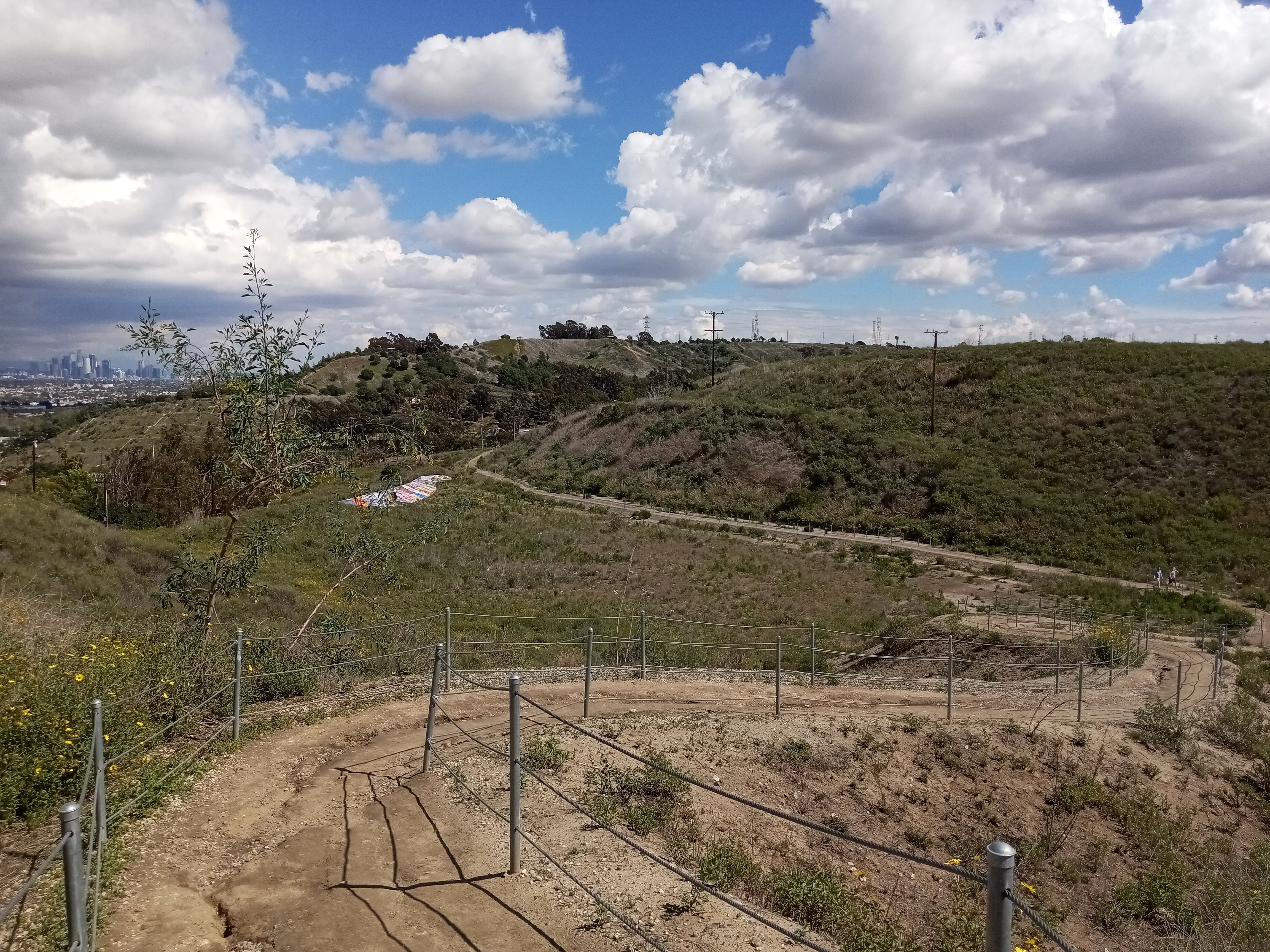
Continuing past the garden, a trail connects the visitor center to the overlook itself, and you’ll likely see a lot of people on this section of trail. This section of trail has also recently undergone some work, with restored habitat along the trail and new fencing to keep everyone off the plants. The landscape at the top has benefited greatly from it; everything feels much more lush than it did even just a couple years ago.
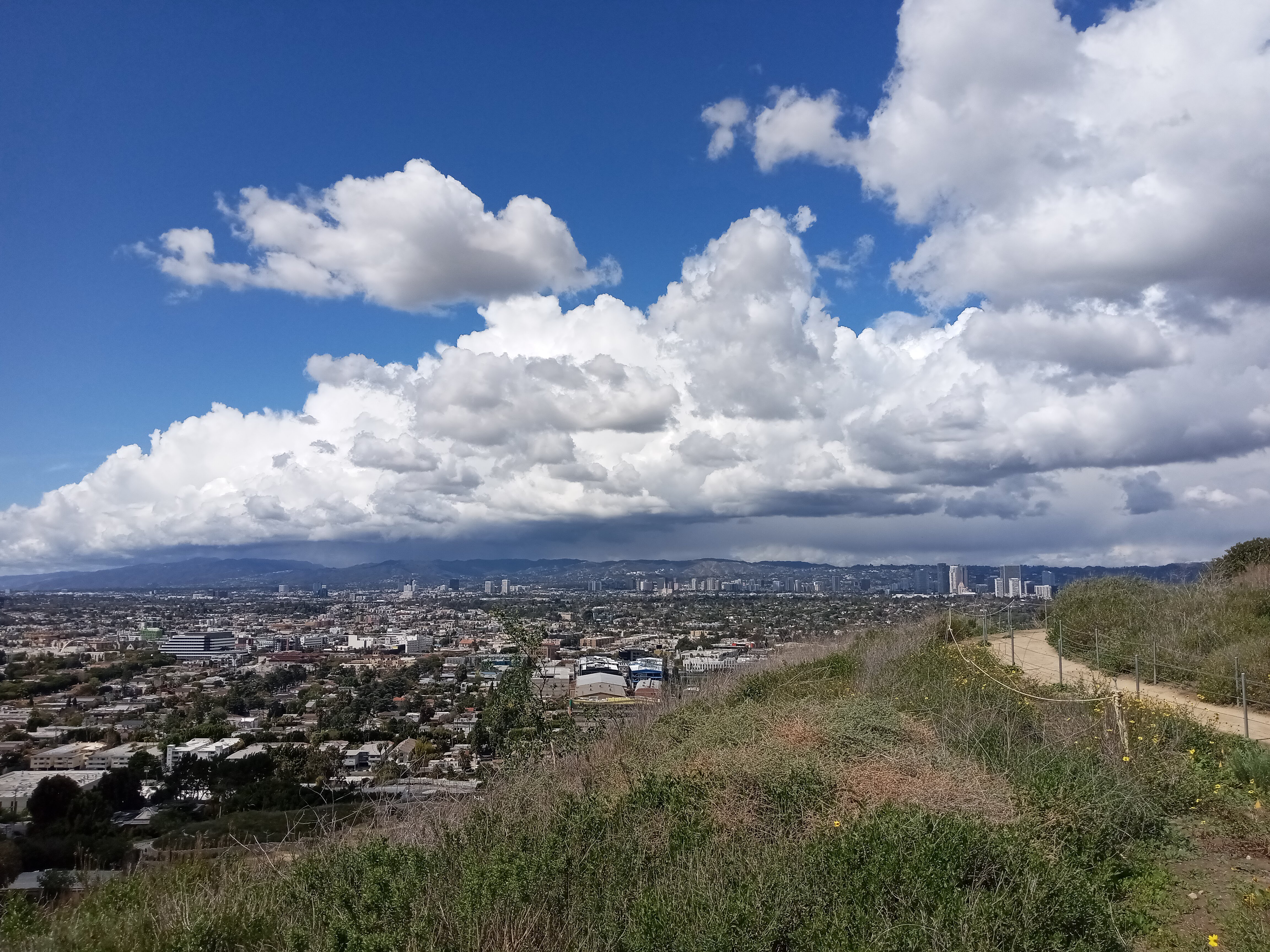
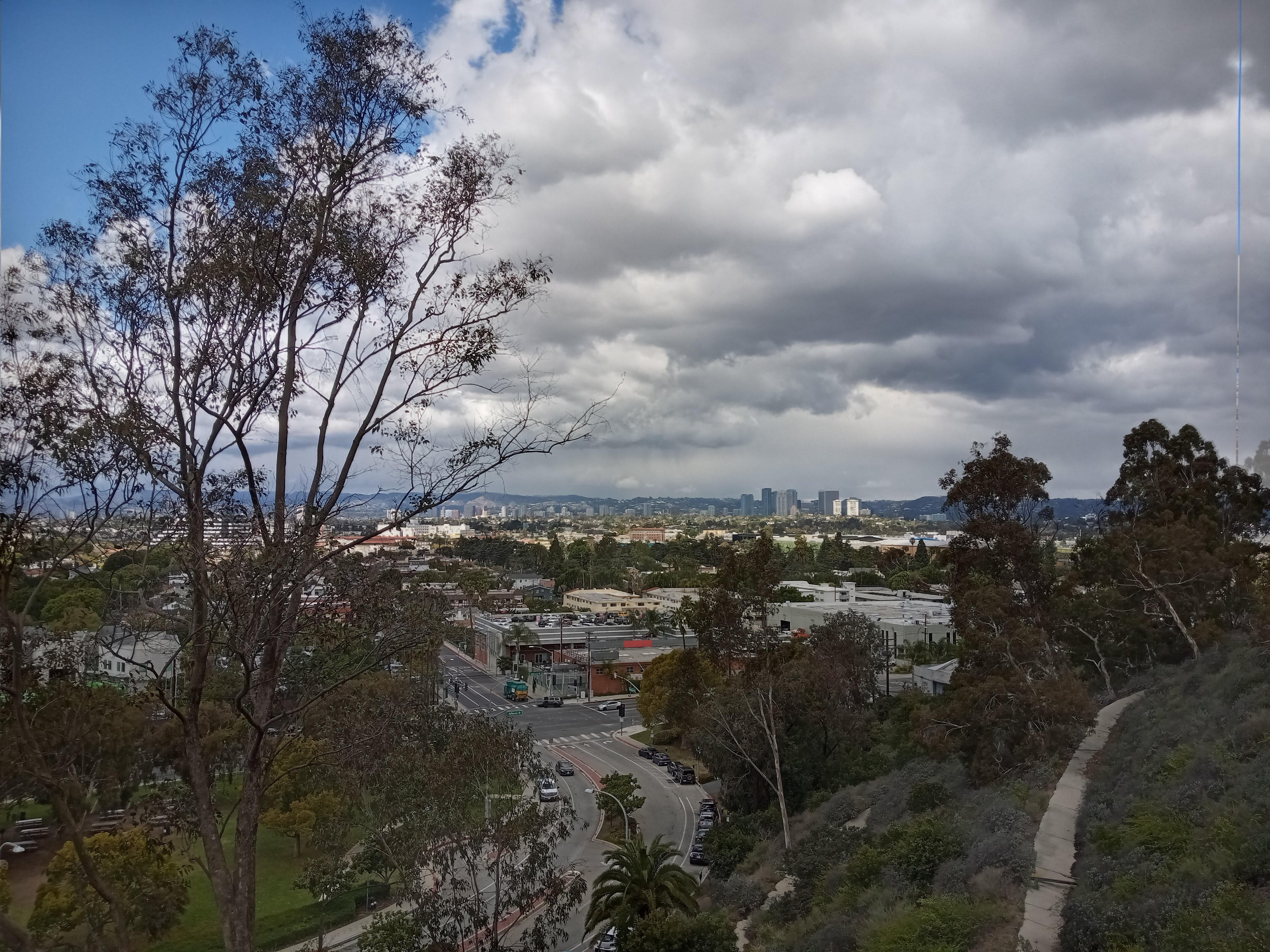
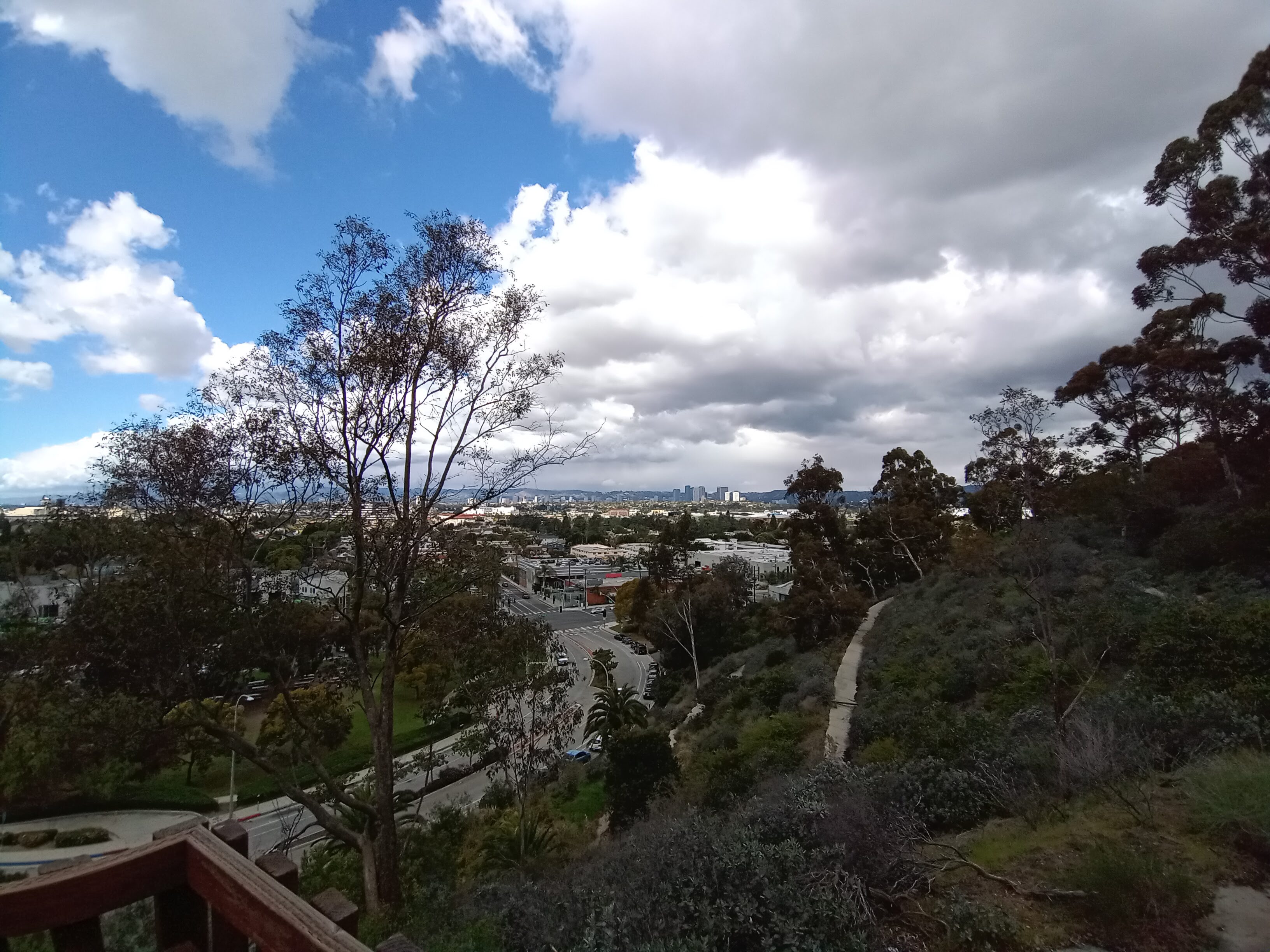
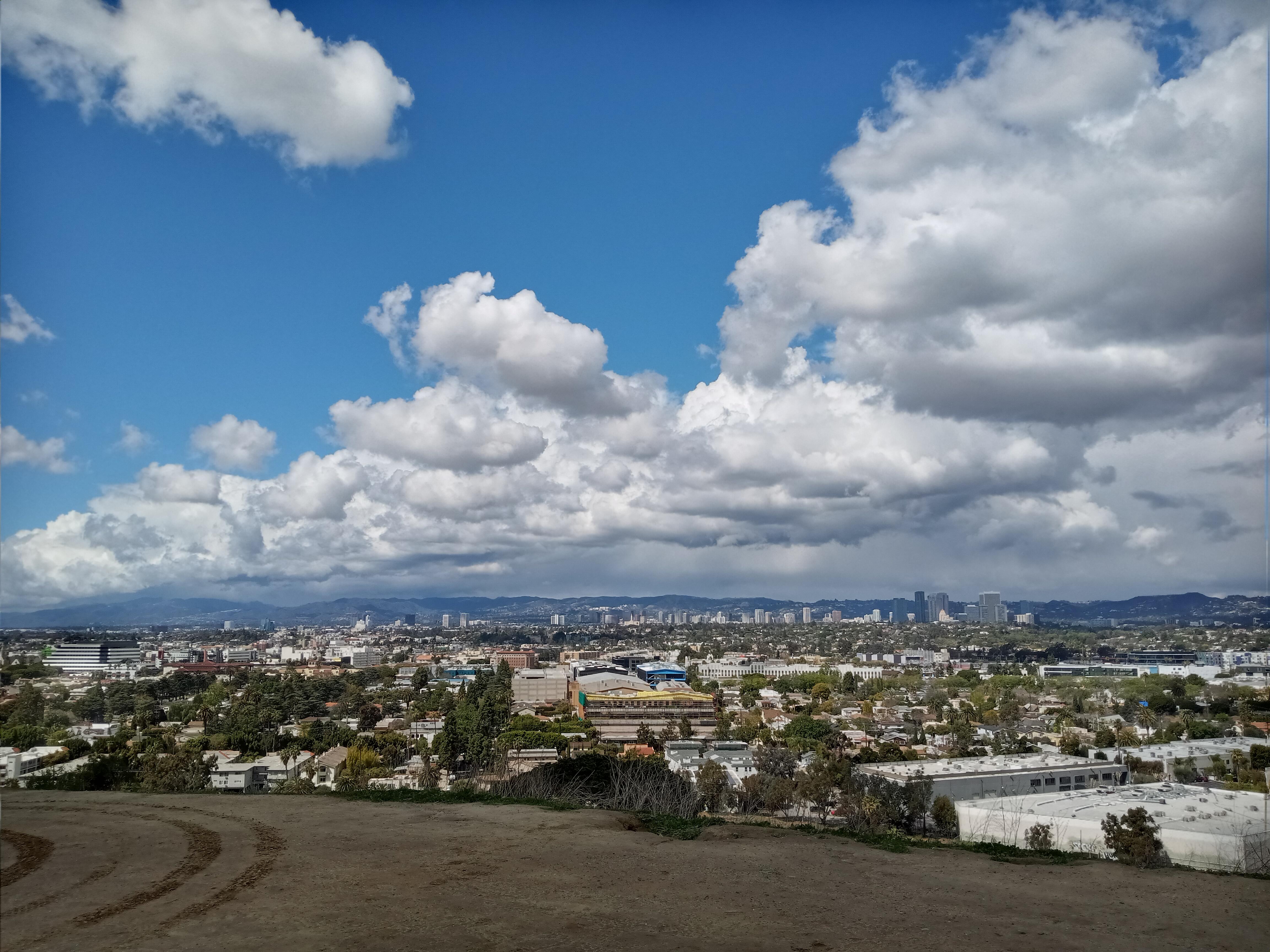
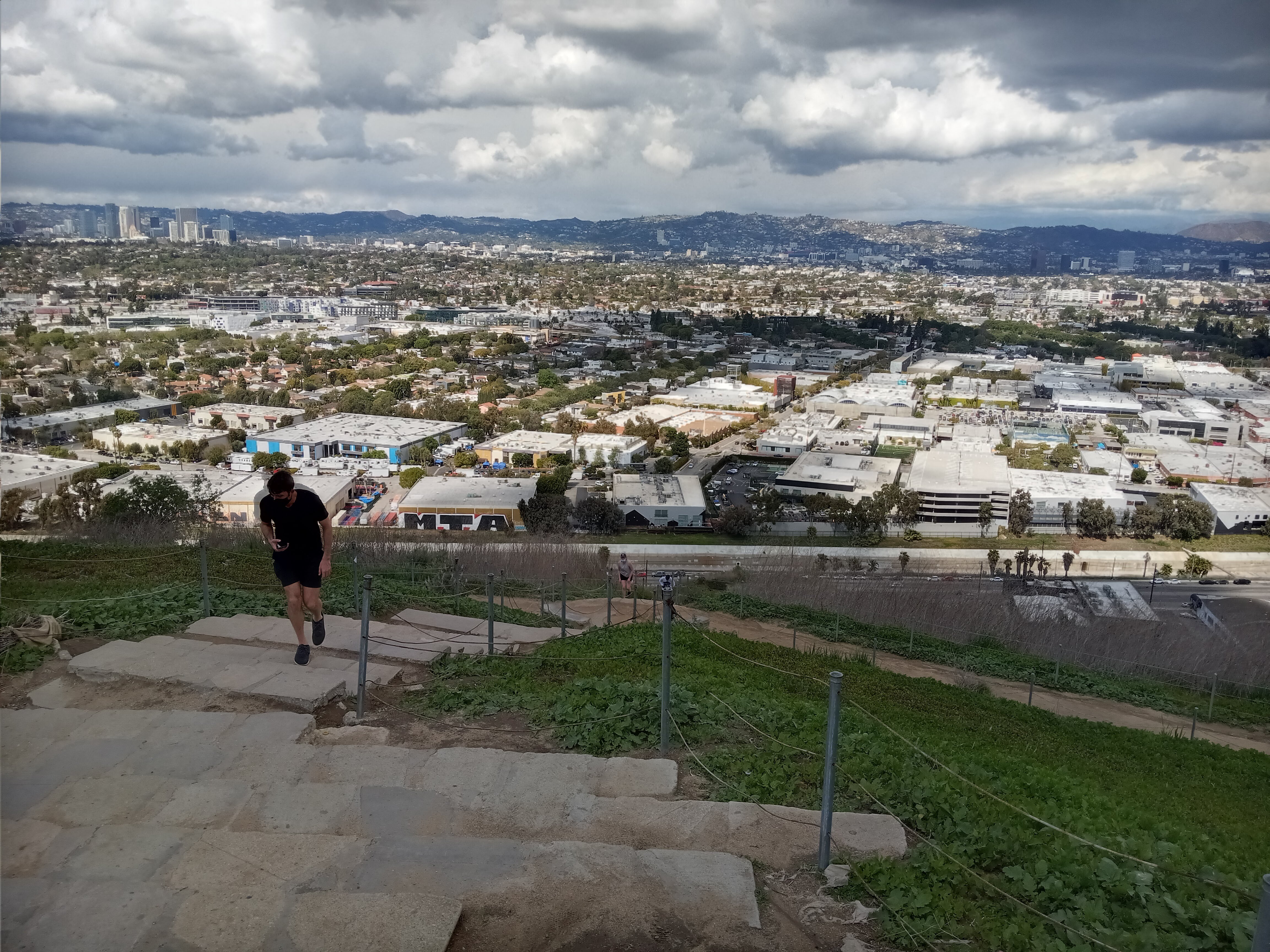
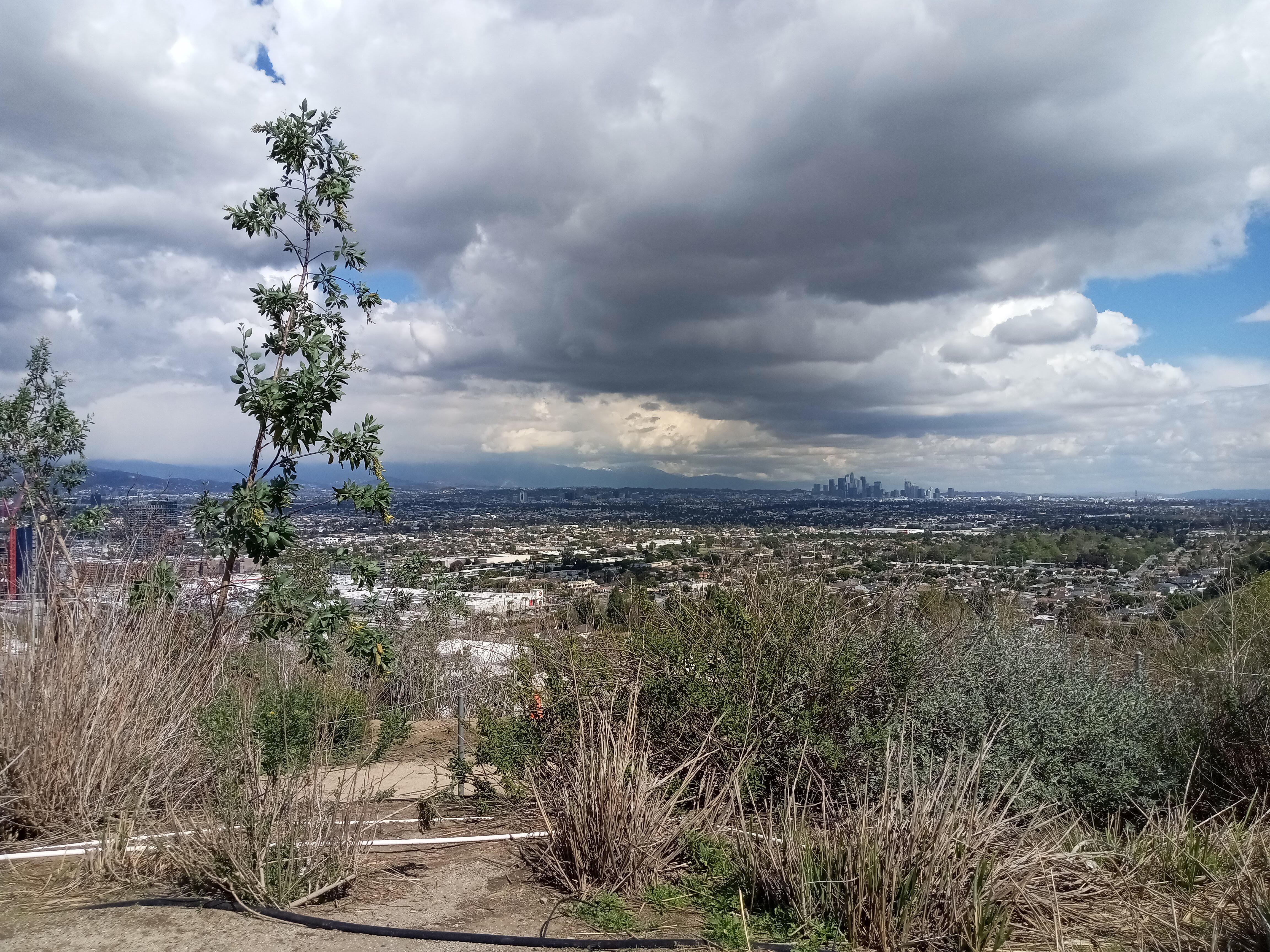
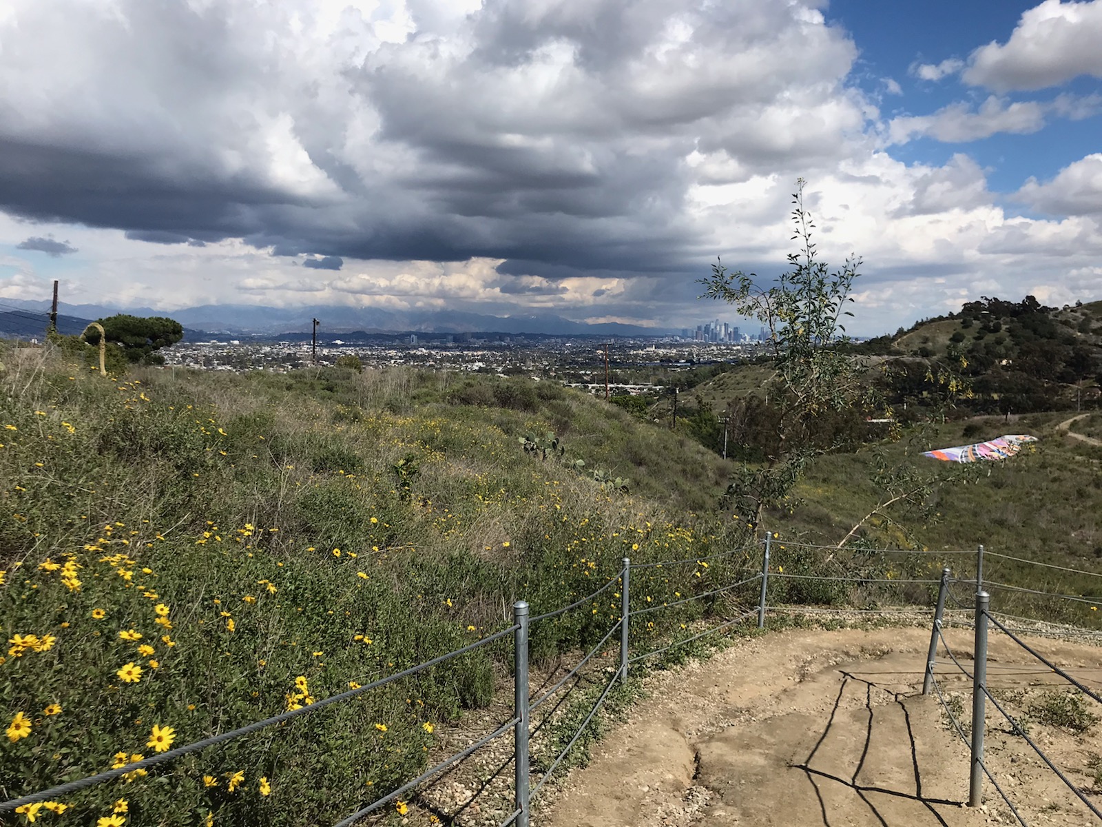
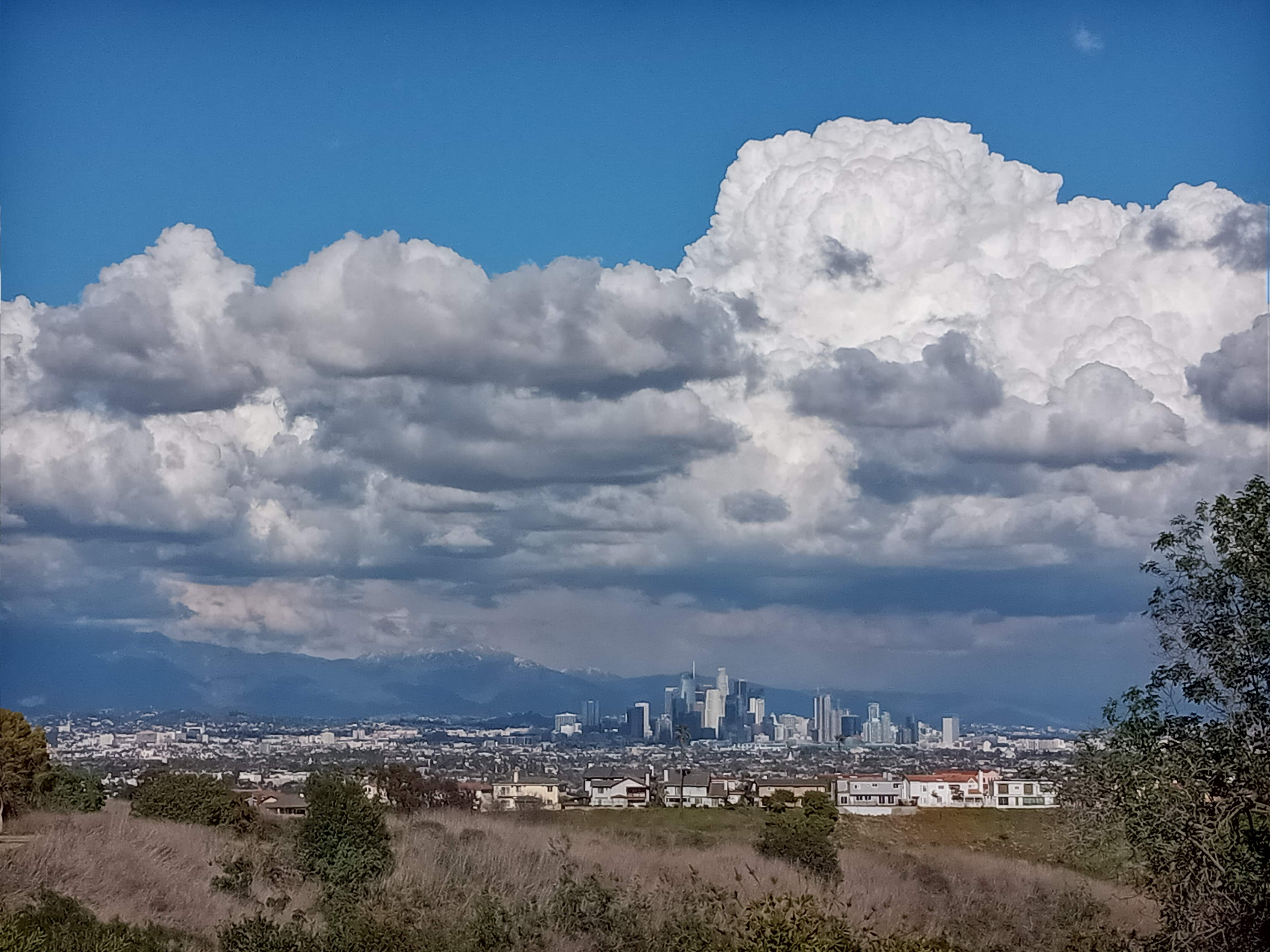
Winding along the ridge, you’ll finally reach the overlook. This is perhaps the most spectacular view you’ll get on the Westside, with everything between Downtown and the ocean laid out before you. Griffith Park might have the more iconic city view, but I’d argue that this one is even better. It’s just high enough that you can see for miles, but low enough that you still feel connected to the city. You can even hear the Metro trains pass by as you watch them cross through Culver City.
Looking down from the front of the overlook, you can catch a glimpse of the intimidating Culver City Stairs. As we stood there, jogger after jogger trudged up the stairs, gasping for breath as they reached the top.
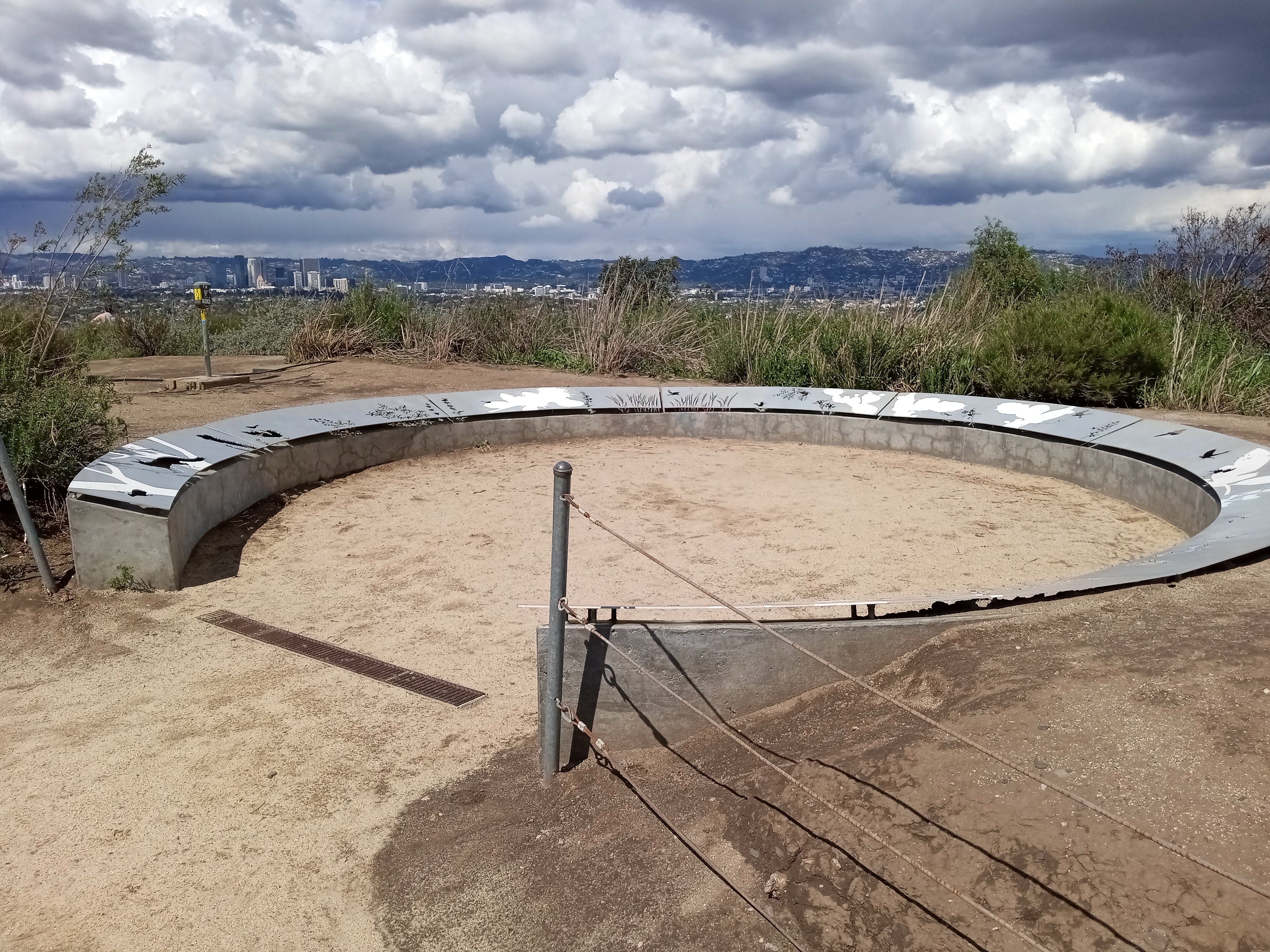
Tucked behind the overlook, at the very top of the hill (just a few feet above the overlook itself), there’s a little circular landmark adorned with depictions of the native flora and fauna of the Baldwin Hills.
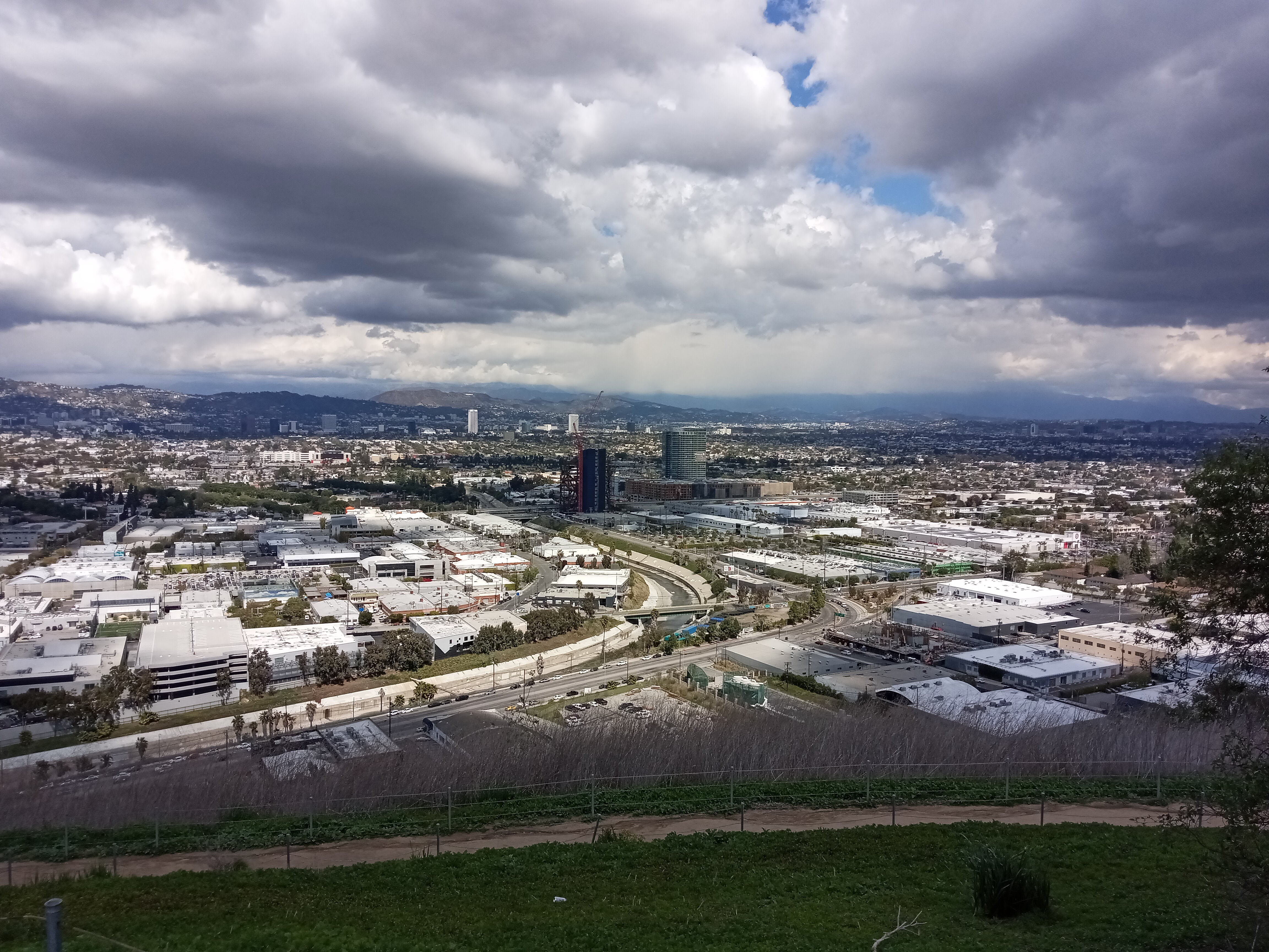
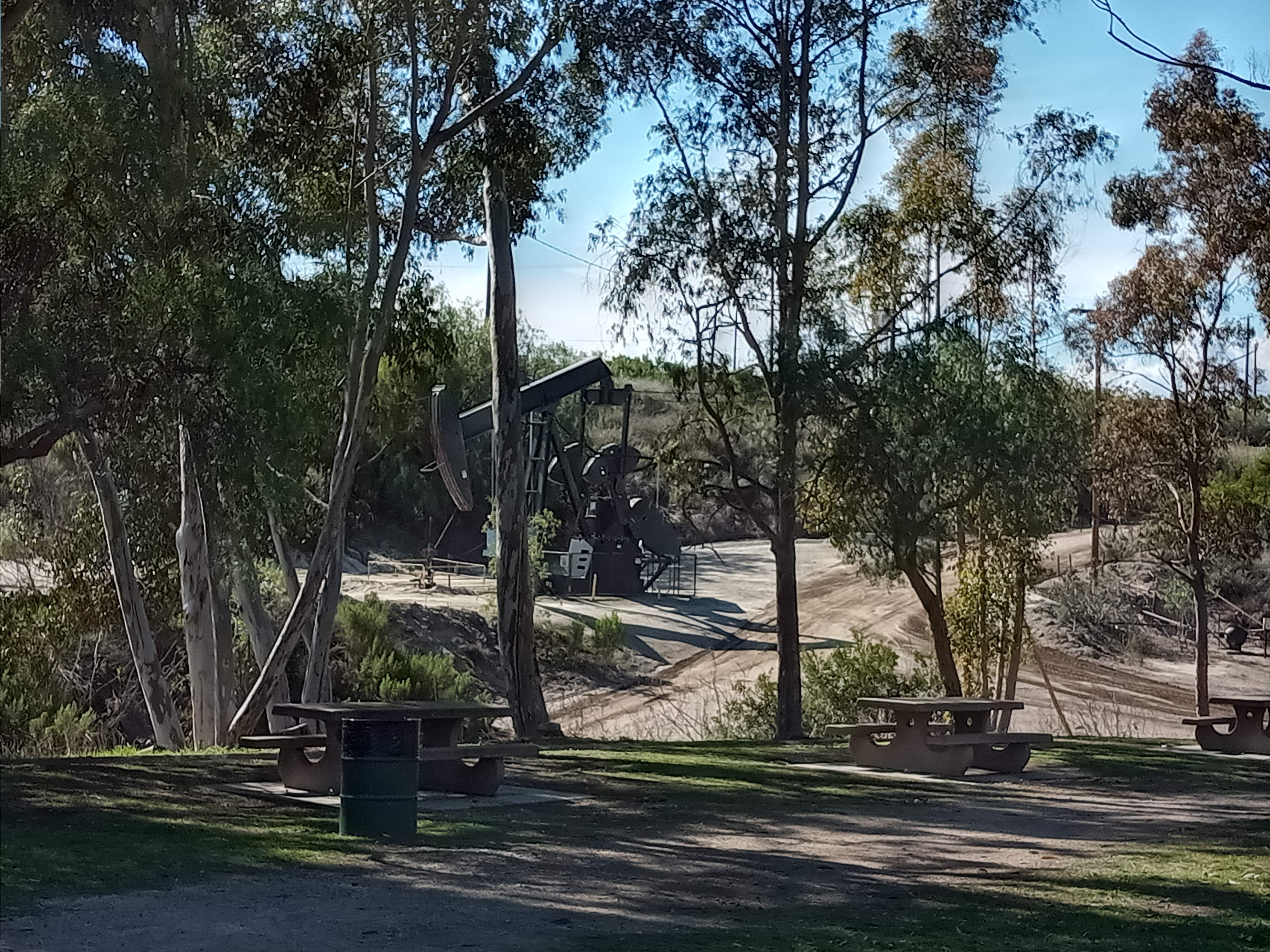
After getting your fill of the overlook, make your way back to the visitor center and then proceed through the parking lot. From here, you can spot a handful of oil derricks churning away on the adjacent hill, the first of many such derricks you’ll see. These mark the northern edge of the Inglewood Oil Field, which sits beneath much of the Baldwin Hills and is the largest urban oil field in the country. Dozens of active oil wells still dot the hills, draining them dry.
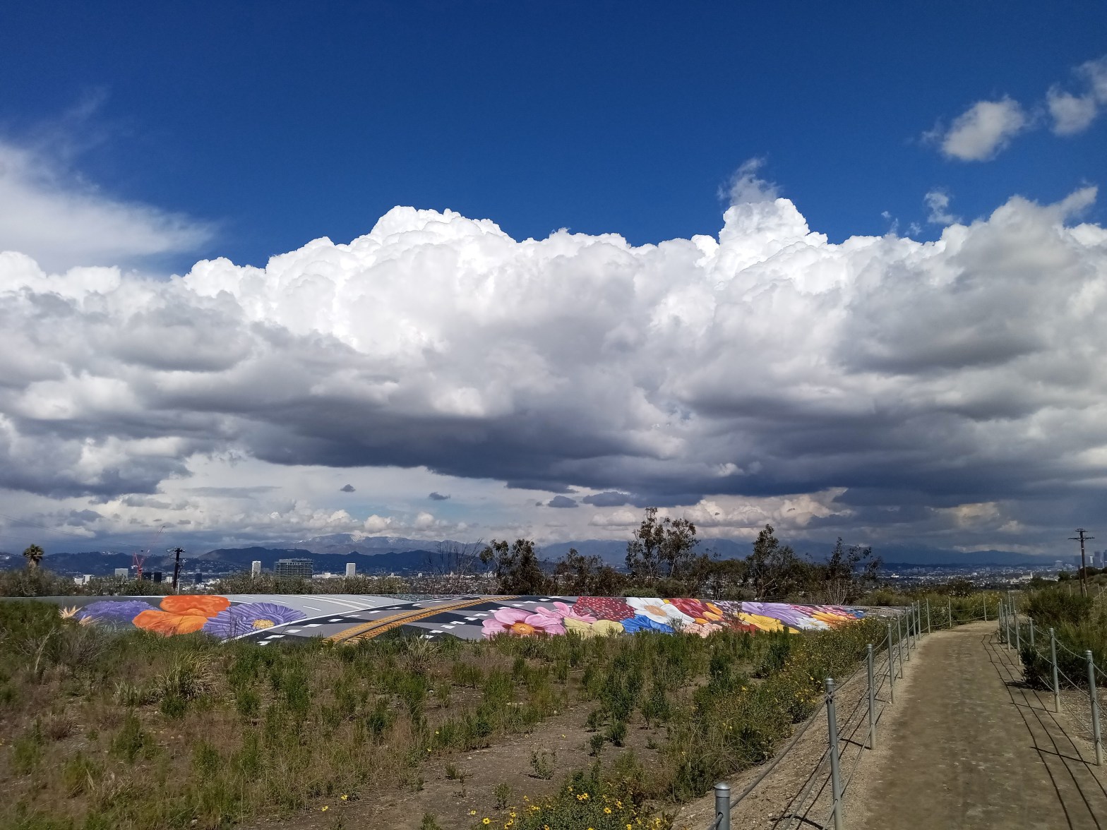
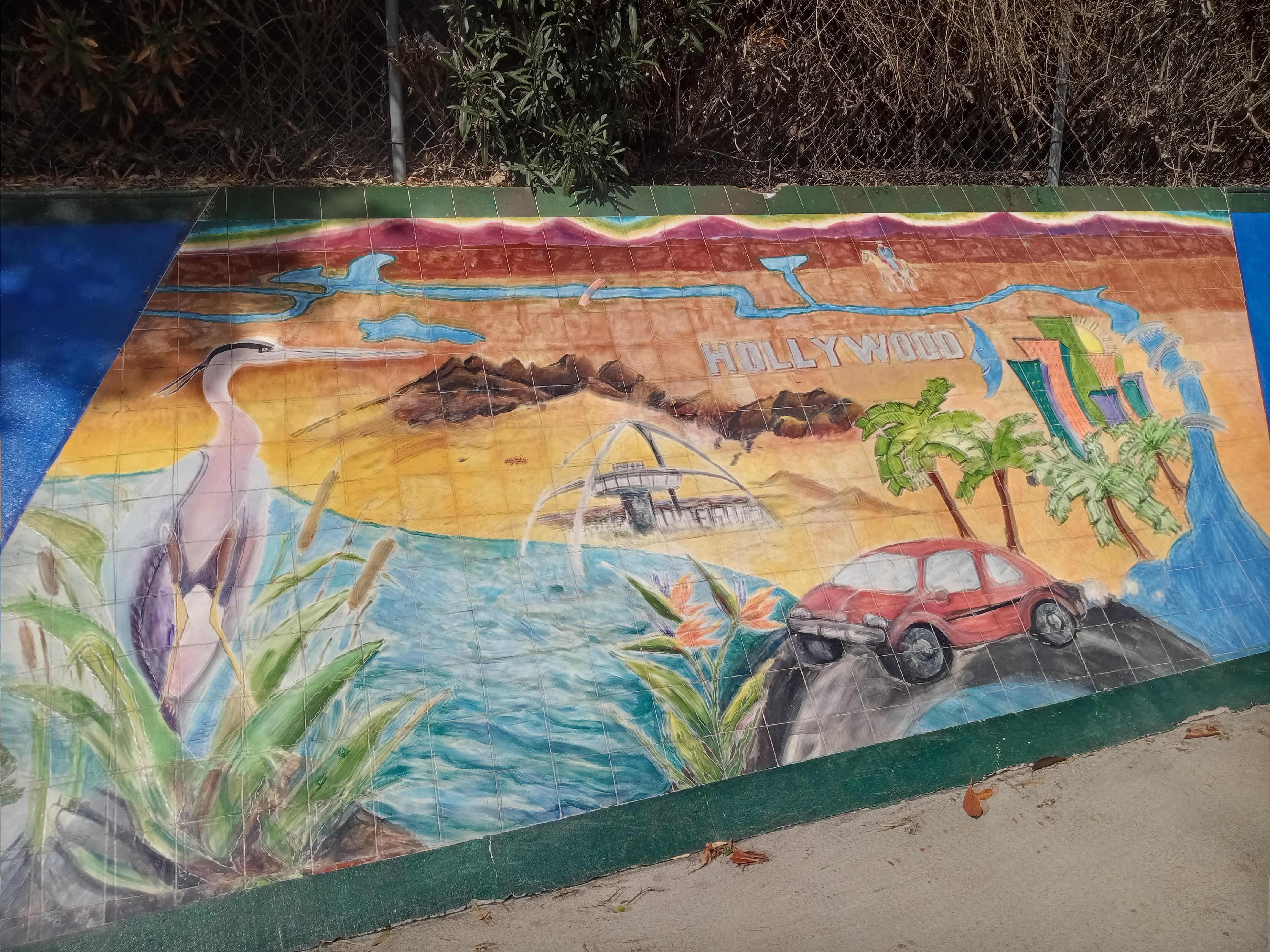
At the far end of the parking lot, you’ll find the stone and wood gateway that marks the trail. What follows is a rather steep drop down the backside of the hill before the trail winds its way down through a serene pasture filled with native plants and wildflowers. It’s remarkable how tranquil this part of the hike is; it feels more like you’re in the rural countryside than in the middle of a city. At the bottom of the hill, a concrete embankment has been adorned with a colorful mural of a roadway passing between fields of flowers.
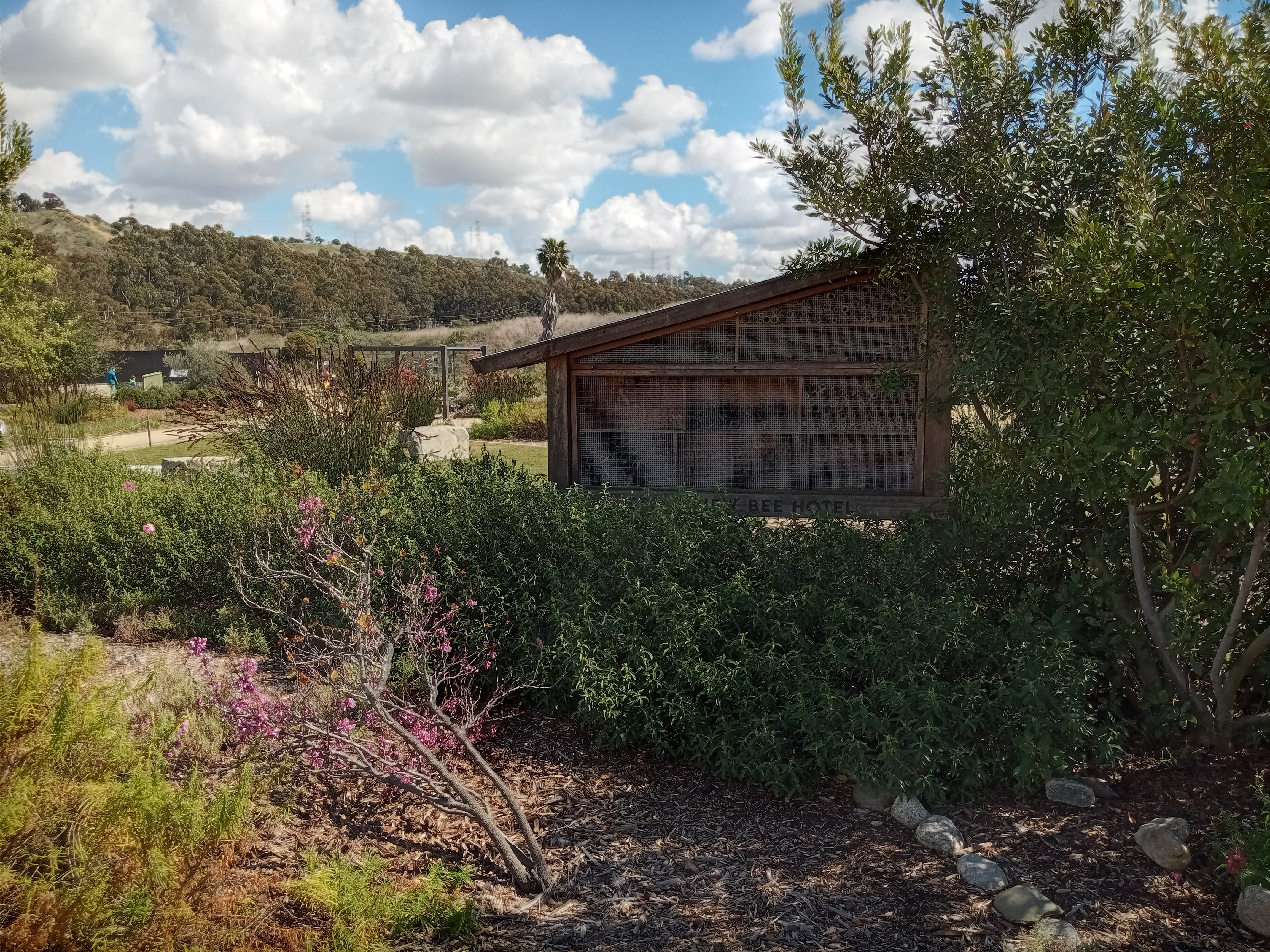
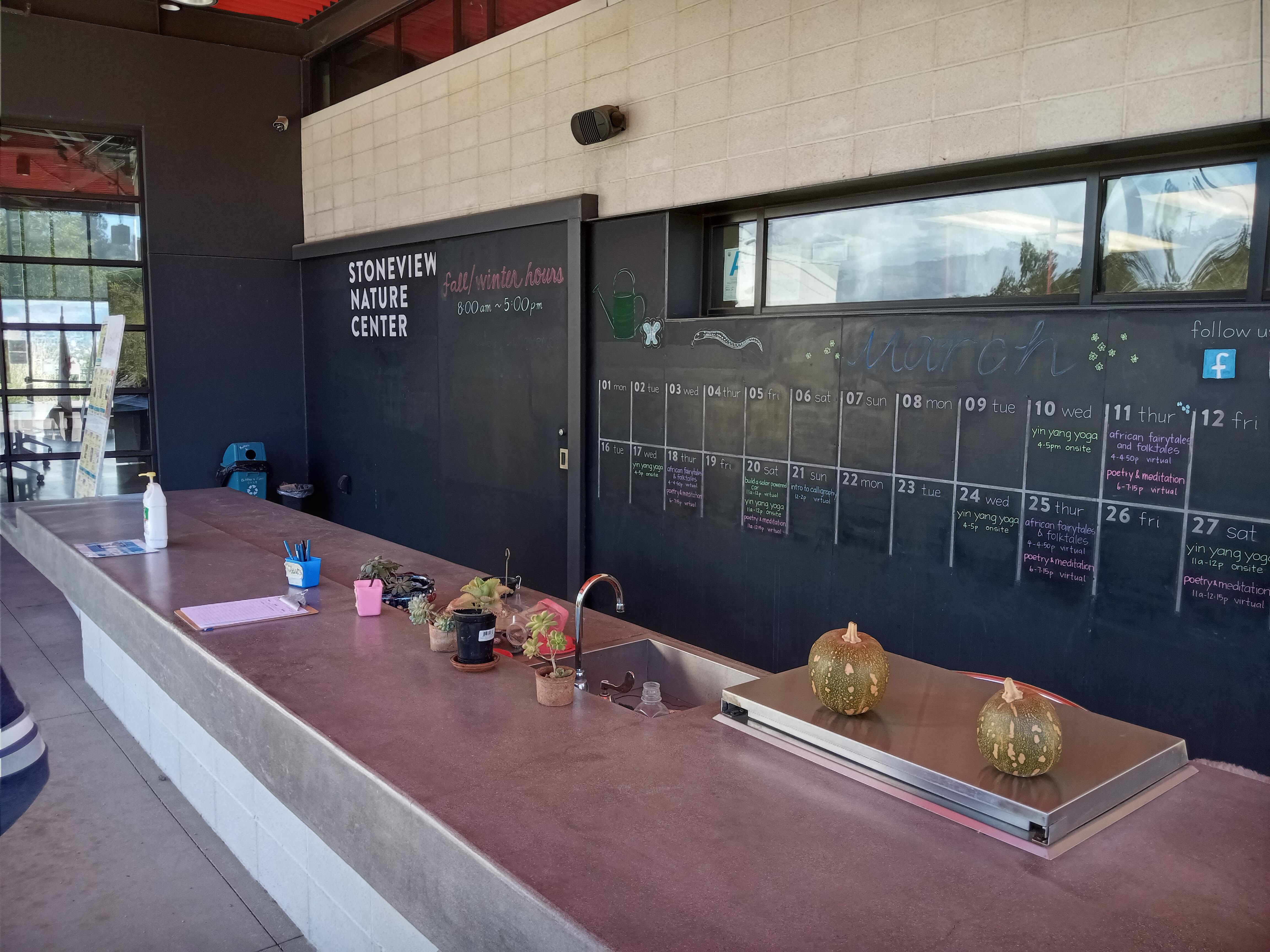
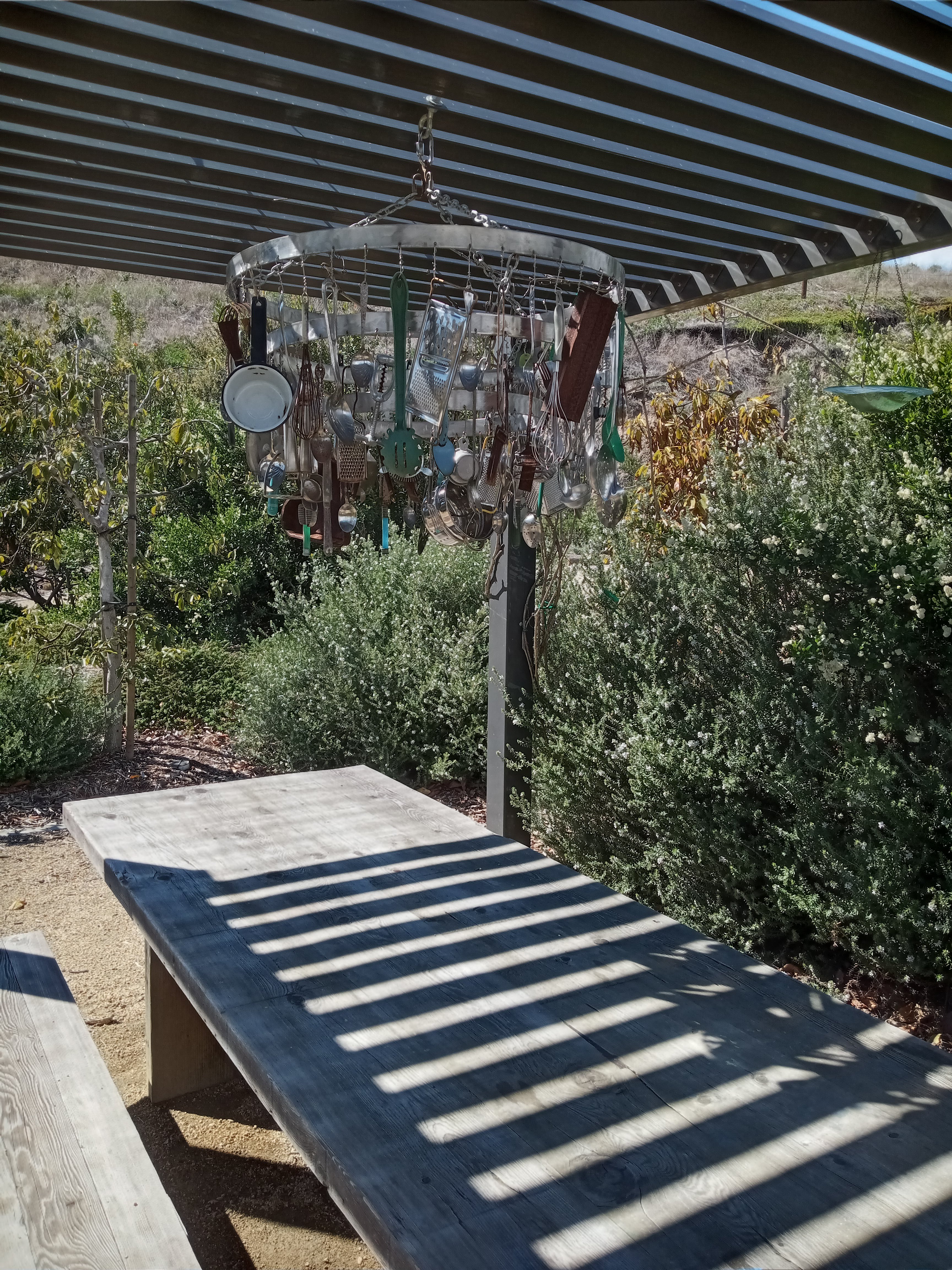
After rounding the next hill, you’ll overlook the Stoneview Nature Center, a very charming set of gardens with an educational center. A nice entryway onto the trail lets you into the gardens, which cover native plants and herbs, with features like bee hives (including an elaborate “bee hotel”), a butterfly garden, and picnic tables beneath chandeliers made of kitchen utensils. The nature center has a kitchen and classrooms and often holds classes on yoga, cooking, gardening, and nature, among other topics (in fact, the first time I visited the nature center was for a class held by the natural history museum that taught you how to use the iNaturalist app). A calendar on the outside shows upcoming classes.

Continuing on from the nature center, the trail winds down an as-yet un-landscaped slope to the brand new pedestrian bridge over La Cienega Blvd into Kenneth Hahn State Park. A fun feature of the bridge is a tiny “wildlife corridor” along the walkway, basically an extended planter that is meant to attract small animals and provide them a safe means of crossing the roadway below.

The side of Kenneth Hahn Park facing La Cienega is a lush woods, with plenty of fragrant eucalyptus trees planted along the main roadway through the park. As you step off the bridge, a meadow spreads out across the base of the hill to your left. Although the Park to Playa Trail technically continues along the parking lot to the right, we recommend taking the paved pathway up the hill a little to your left, which winds up the hill directly into the park’s lovely little Japanese Garden.
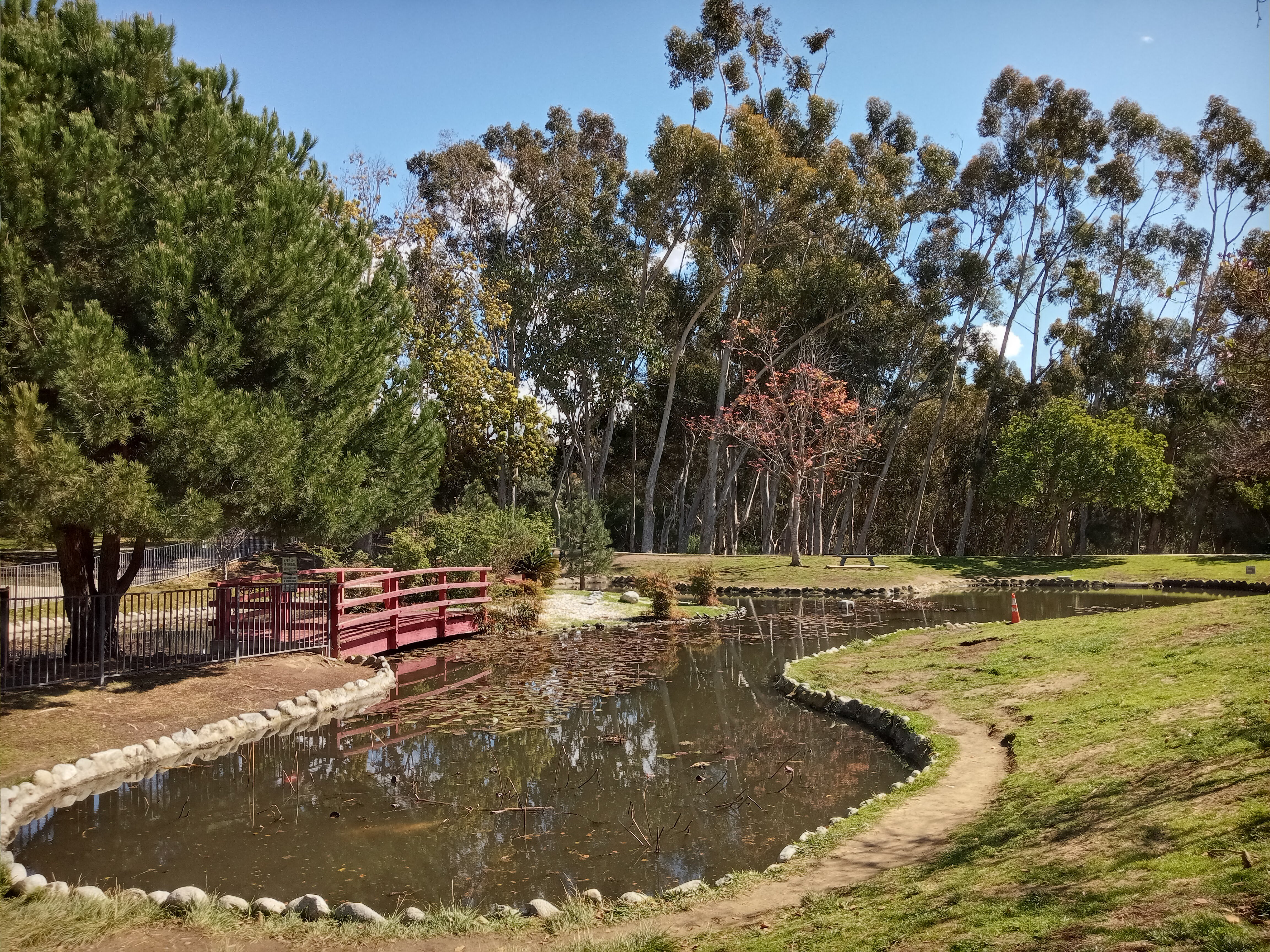
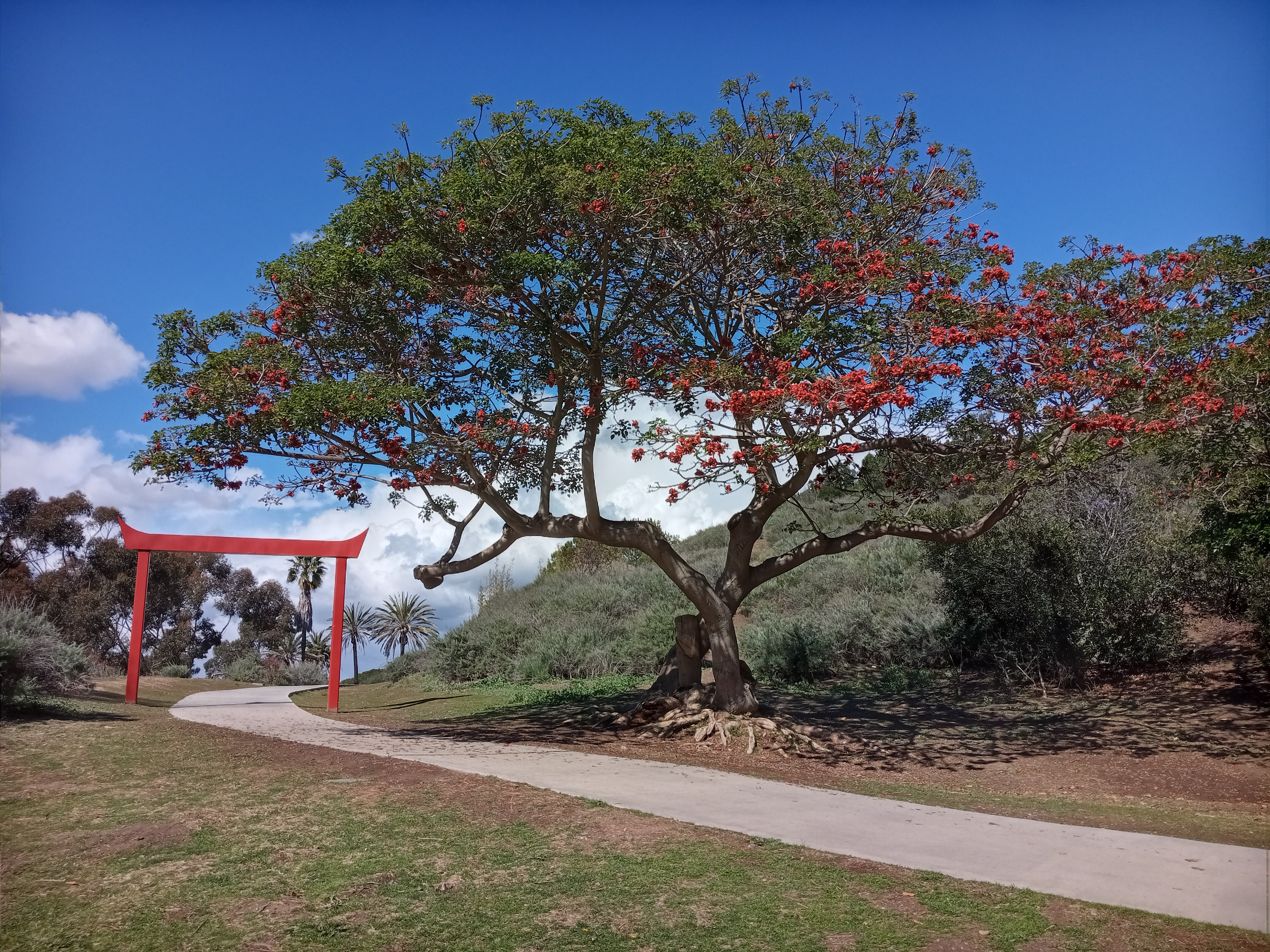
The Japanese Garden is small but quite pleasant, with a little pond stocked with koi fish crossed by a pair of decorative bridges (which, sadly, you can’t step on). A Japanese-style red archway at the top of the garden marks another paved trail which takes you to a small waterfall feature just up the hill. And throughout the garden are a lot of beautiful flowering trees.
From here, you’ve got a couple options for continuing through Kenneth Hahn Park. You can climb to the top of the hill above the garden, where you’ll reach a trail that continues along the ridge of the park, with plenty of overlooks offering great views towards the east. Or you can follow the road through the lower part of Kenneth Hahn Park, taking a more gradual climb across the park. We opted for the latter, walking out past the parking lot for the Japanese Garden and down the road, rejoining the Park to Playa Trail.
After continuing through the woods for a while, you’ll eventually reach a huge field, that occupies much of the lower portion of Kenneth Hahn Park. The field is about 1/3 mile long and is dotted with picnic tables and no less than three playgrounds. The Park to Playa Trail continues along the eastern edge of the field, closest to the hill, but we recommend crossing the road as soon as you reach the field, to enjoy the park’s scenic lake.
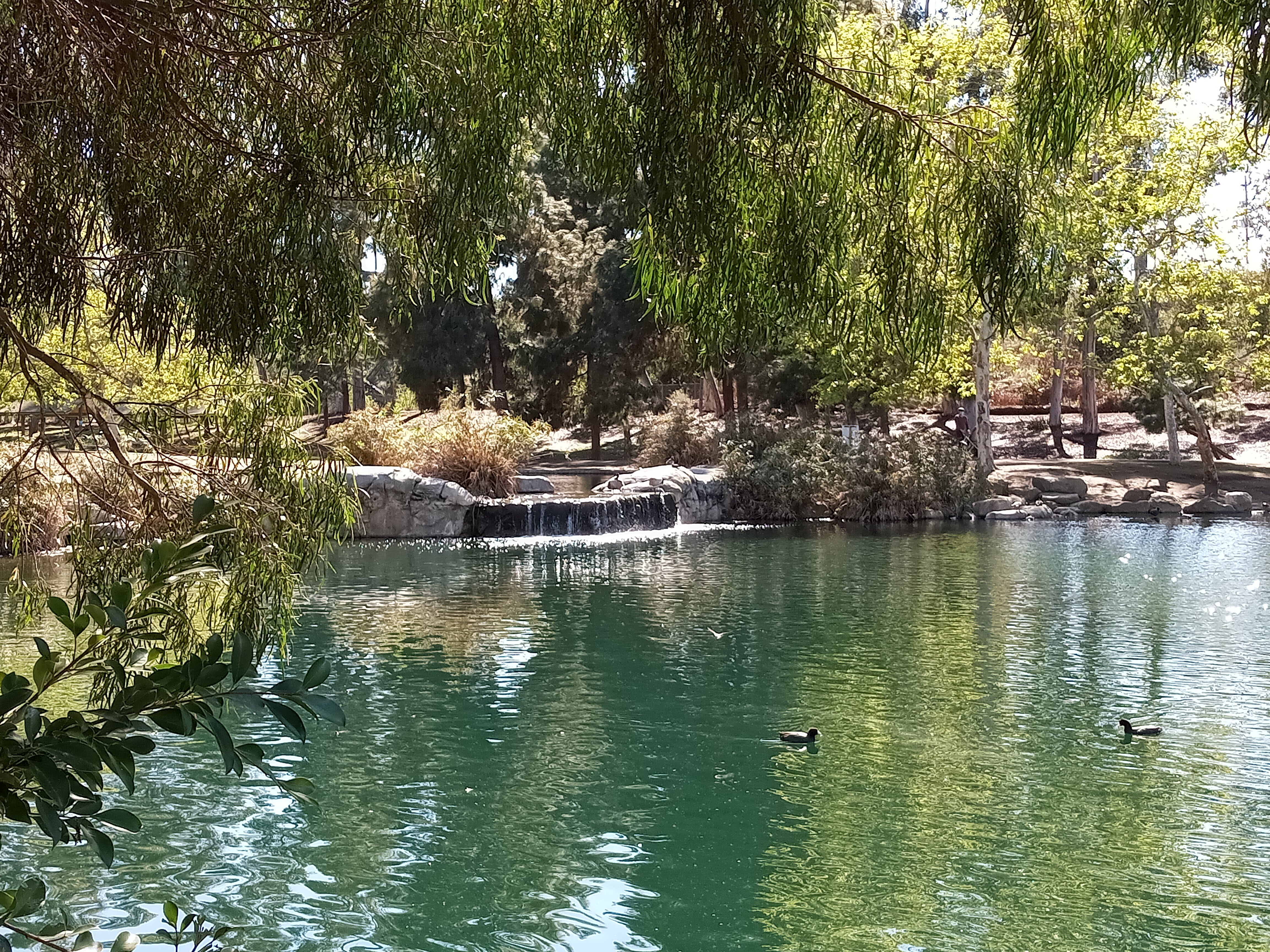
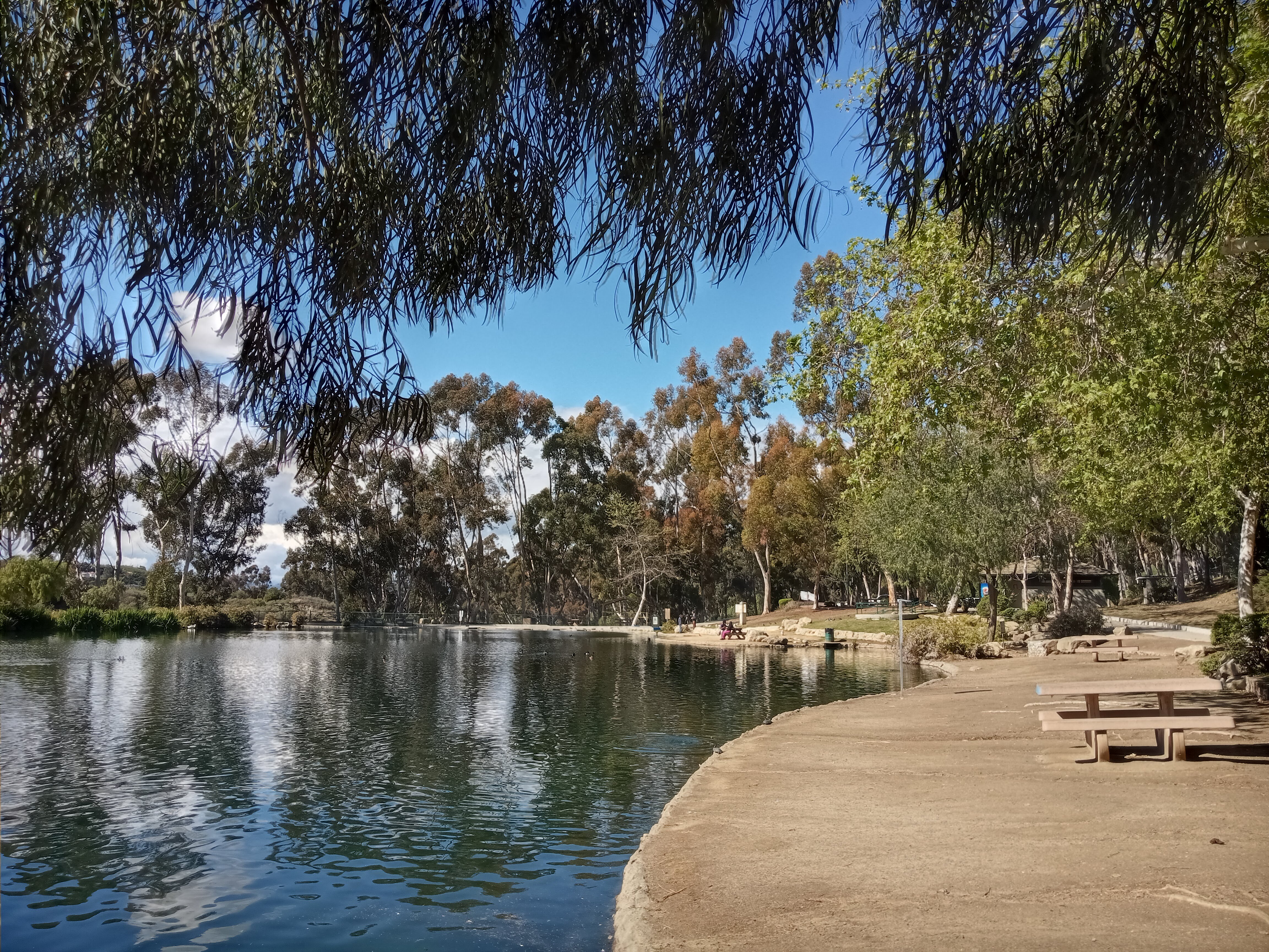
The fishing lake is a haven for wild birds. Large flocks of ducks and geese swim around and make quite a ruckus whenever they meet each other; we saw some very large geese honking at each other. But there were also countless smaller birds flying over the lake: swallows, finches, and even multiple hummingbirds darting over the water.
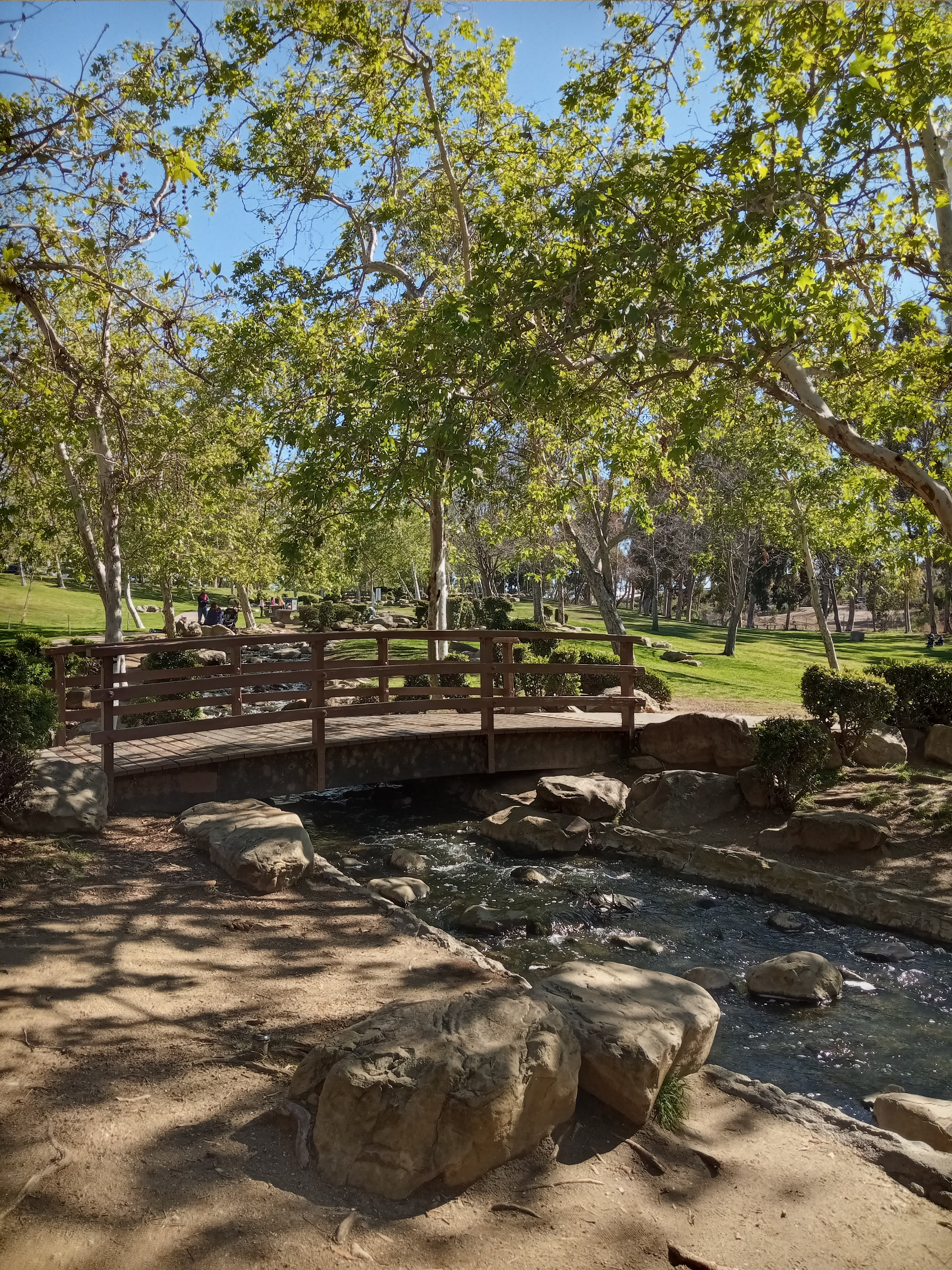
The lake is fed by a set of ponds, which are connected by a picturesque, rocky stream that is crossed by a few very cute little bridges. A nice meadow with more picnic tables sits across the stream, while more oil derricks—the closest you’ll get to on this hike—churn away just across the fence.
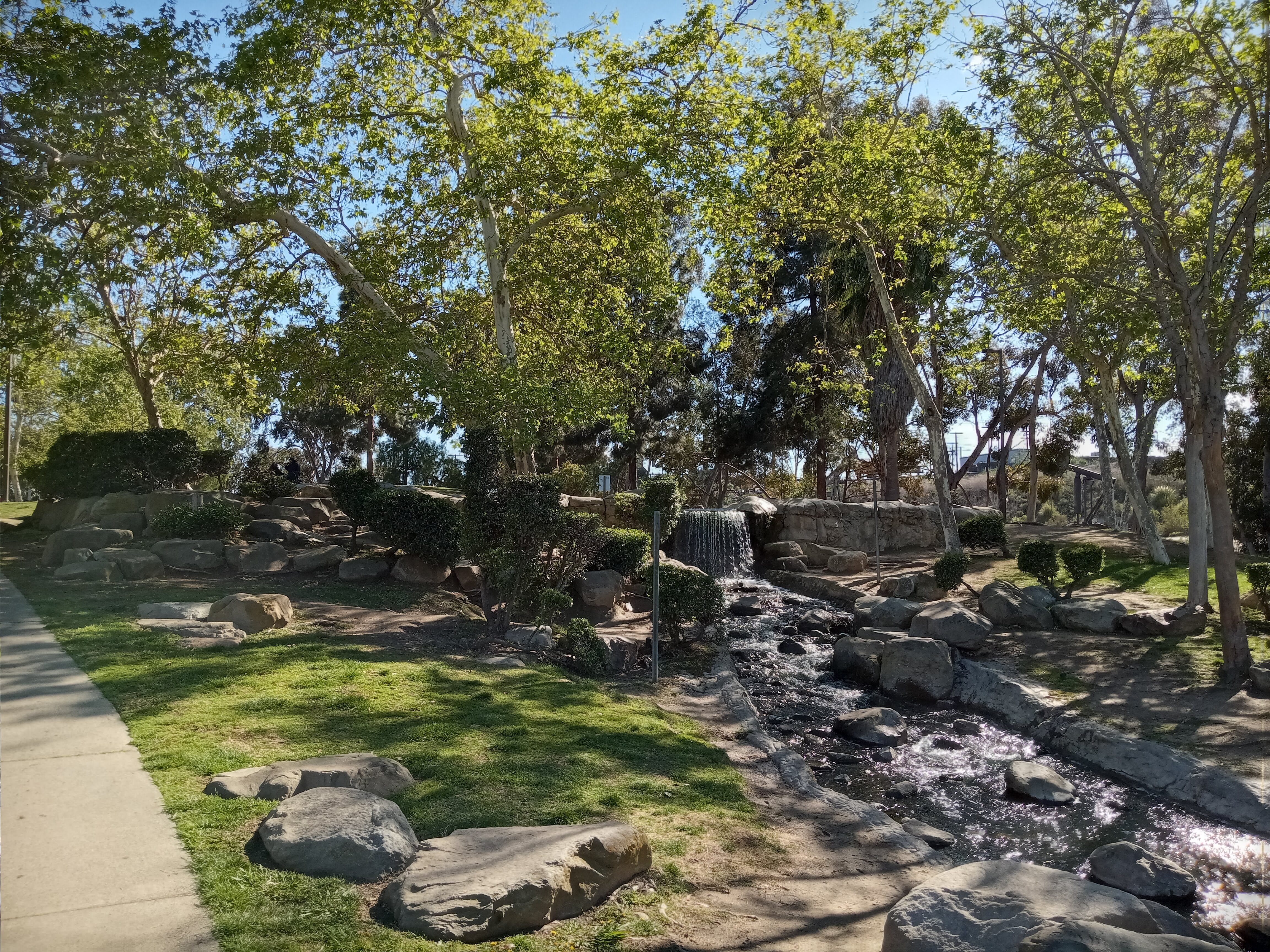
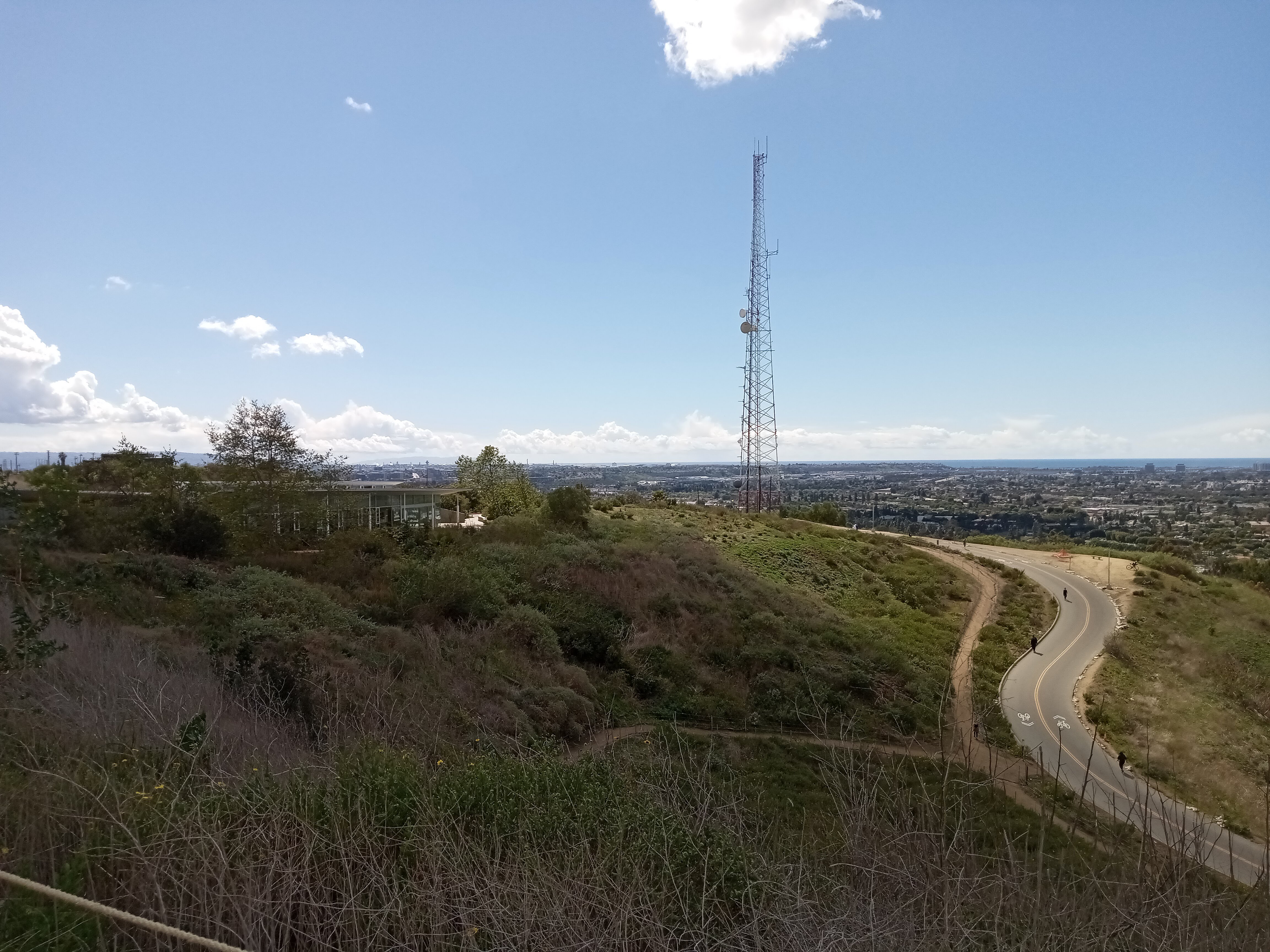
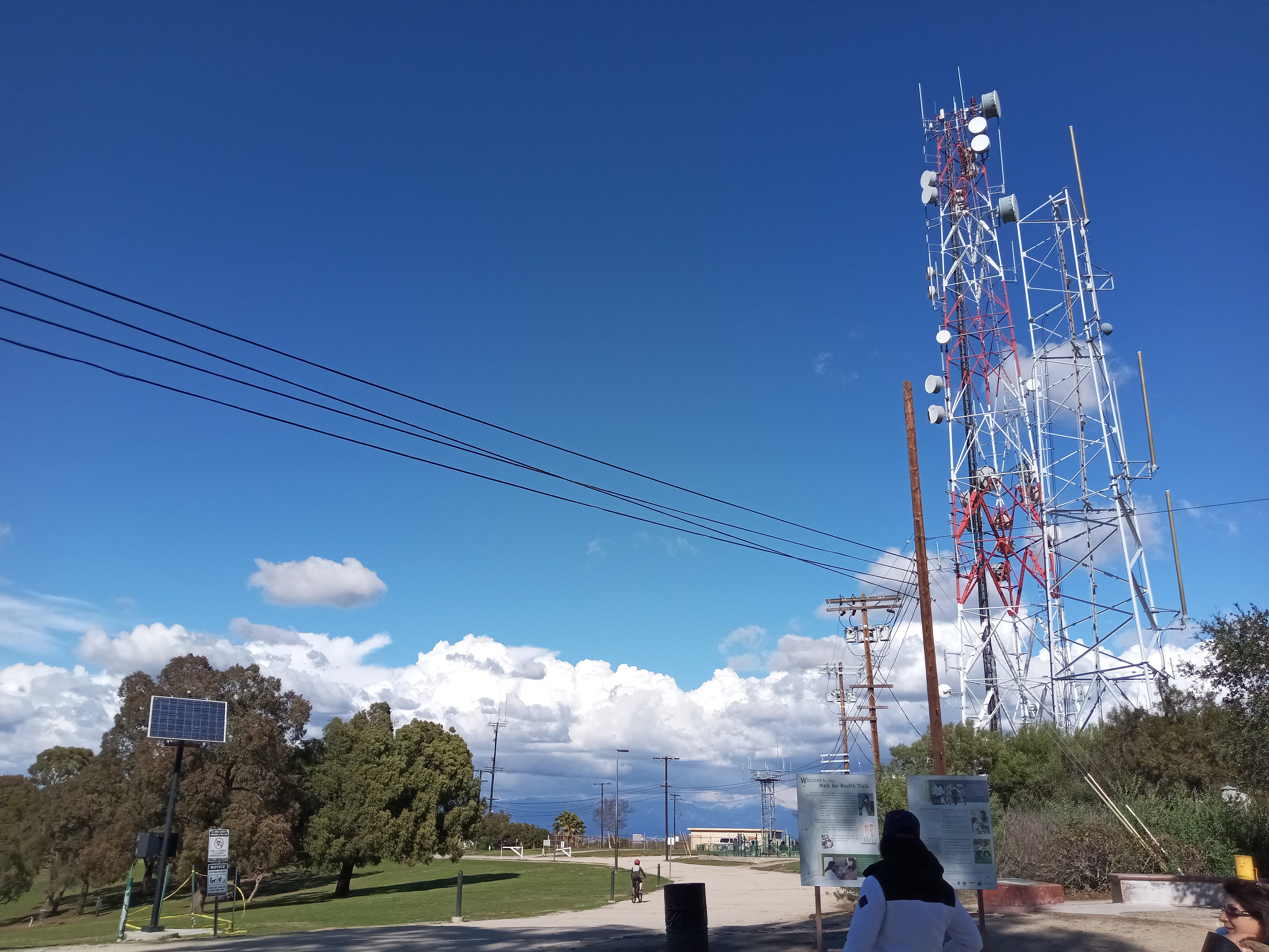
Past the last pond and the waterfall that feeds the creek, the trail loops to the east and reaches the park’s visitor center, which is housed in a handsome rustic lodge-style building. From here, the road climbs the hill past lines of eucalyptus trees. The Park to Playa Trail climbs the hill alongside the road, and after a short climb, you’ll be greeted by a pair of radio towers as you near the top. When you reach the summit, a massive field will suddenly reveal itself to you on your left.
This bowl-shaped field has a dramatic history. It was constructed as the Baldwin Hills Reservoir in the late 1940s as part of the city’s water storage system. But it turned out that it had been built atop an active fault line, and in 1963 the shifting fault beneath (possibly exasperated by the nearby oil drilling) caused the dam to break, sending a massive wave of water smashing through the houses on the north side of the hill. Remarkably, only five people died, a result of an evacuation order that went out when engineers realized what was about to happen.
As water rushed down the hill, KTLA dispatched a helicopter to the scene, capturing what is believed to be the first instance of live aerial coverage of a breaking news event.
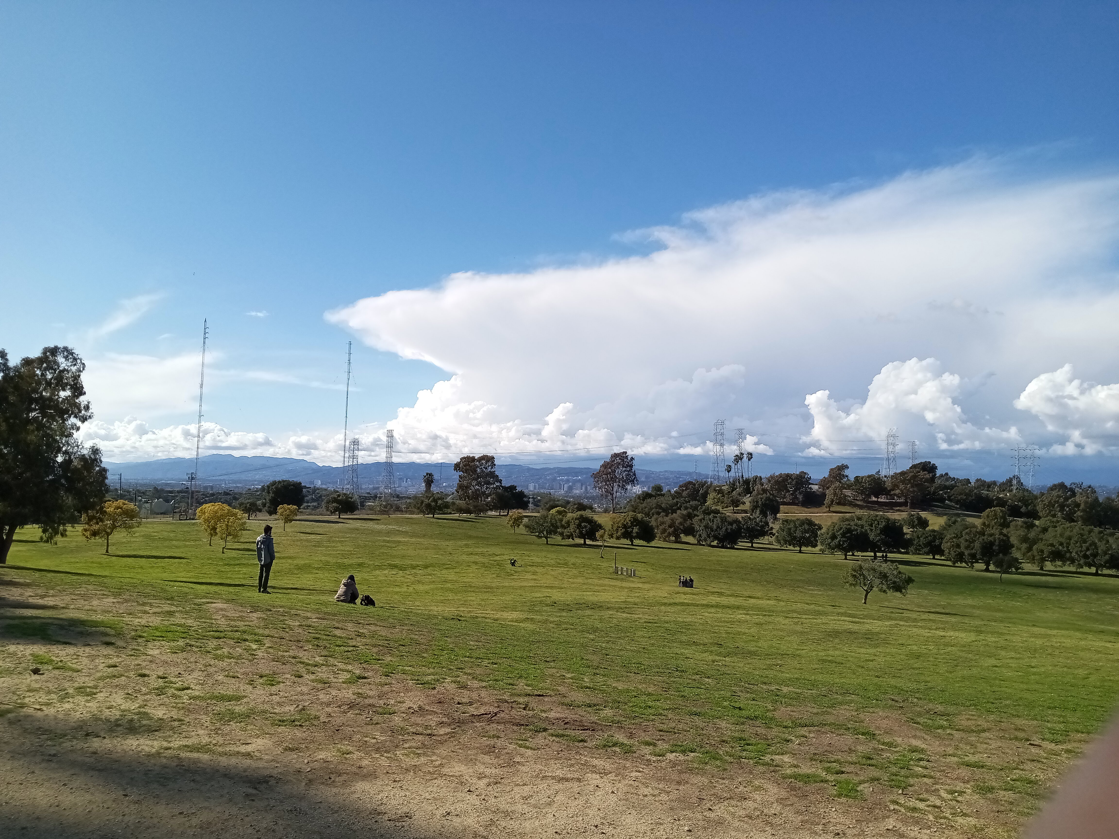
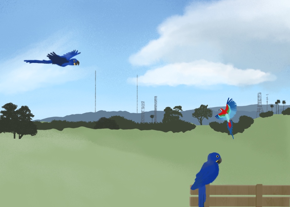
The failure of the dam inadvertently led to the creation of the park, as several years later, county supervisor Kenneth Hahn supported a proposal to turn the land into a park, which was realized in the 1980s. Today, a trail rings around the bowl-shaped field, where children play in the grass and birds soar from treetop to treetop. When we visited, we saw a man with no less than six macaws perched on him and watched him train the birds to fly around the field and return to him (we’ve since learned that the man in question was Chan Quach, or Chan the Birdman, who regularly free flies his macaws around LA parks, and you should definitely check out his Instagram to see videos of his birds).
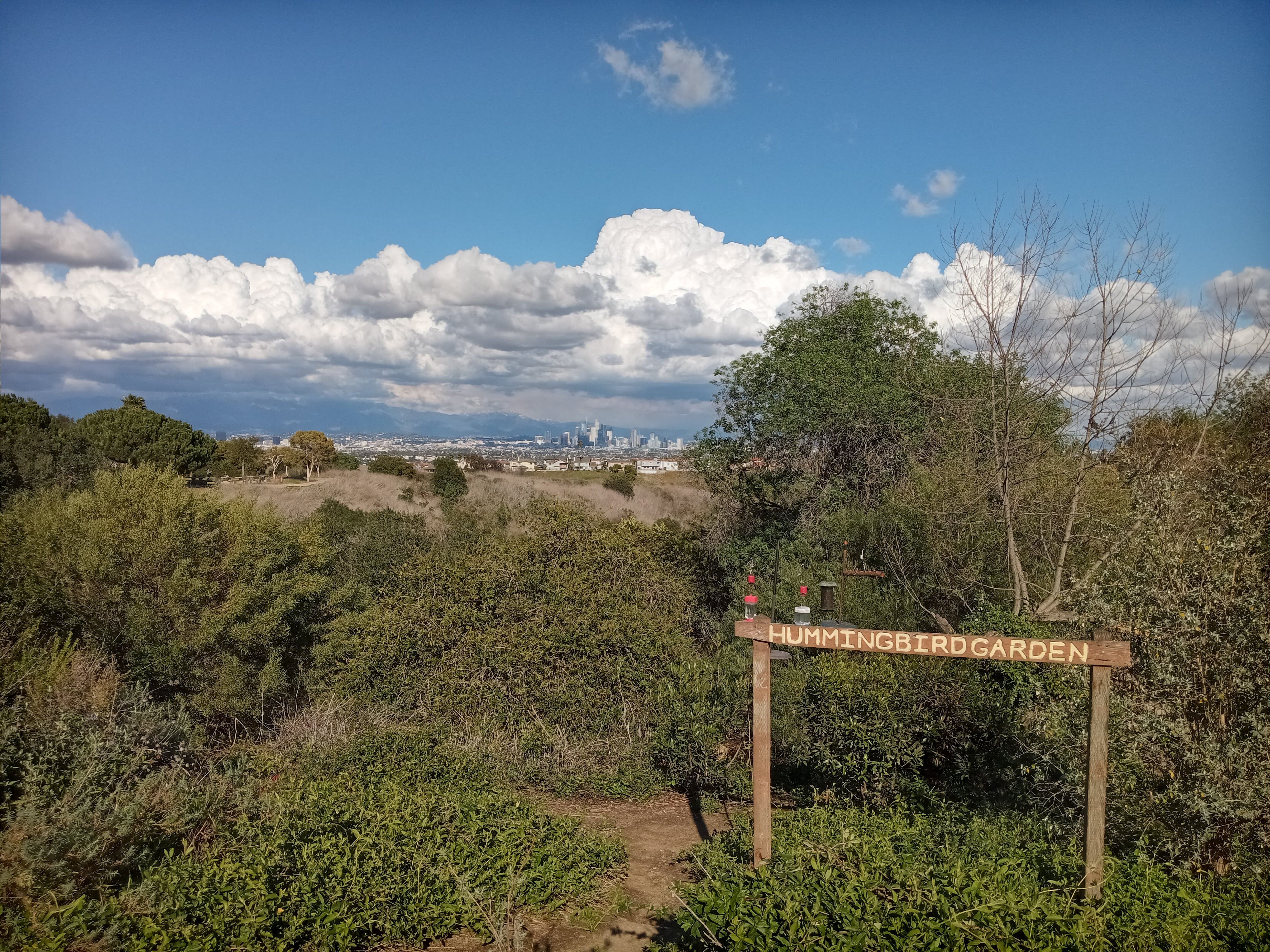
The park road ends at a large playground overlooking the city, but the Park to Playa Trail continues along the ridge to the south, following a wood-post fence along a dirt service road past a water tower and several radio towers. A short ways past the playground, you’ll pass a cute little Hummingbird Garden, perfectly situated with a spectacular view of the Downtown skyline. The garden was practically humming with the sound of dozens of hummingbirds and bees feeding from the many feeders, as well as numerous small birds covering the seed feeders, all within maybe 25 feet of the trail.
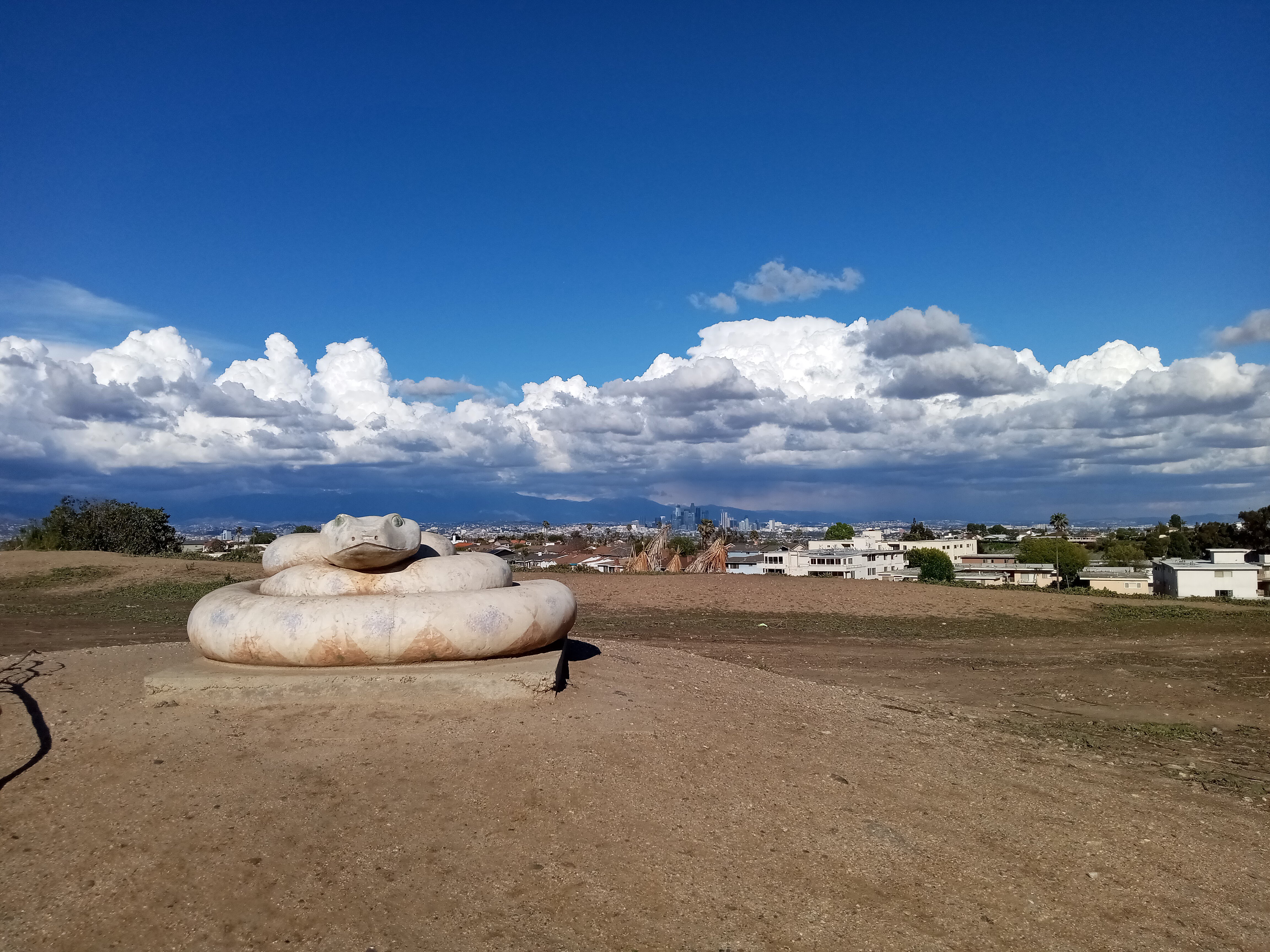
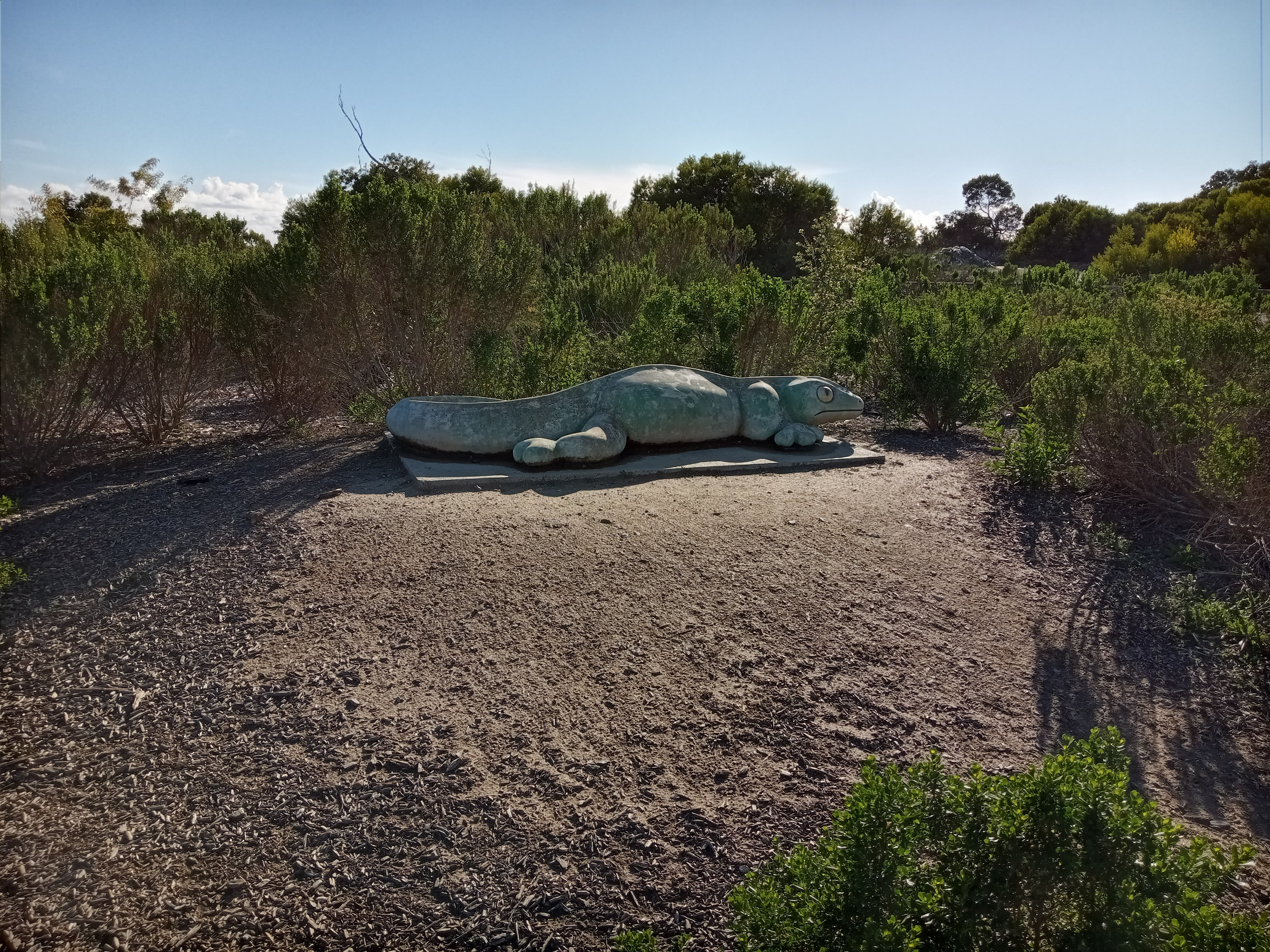
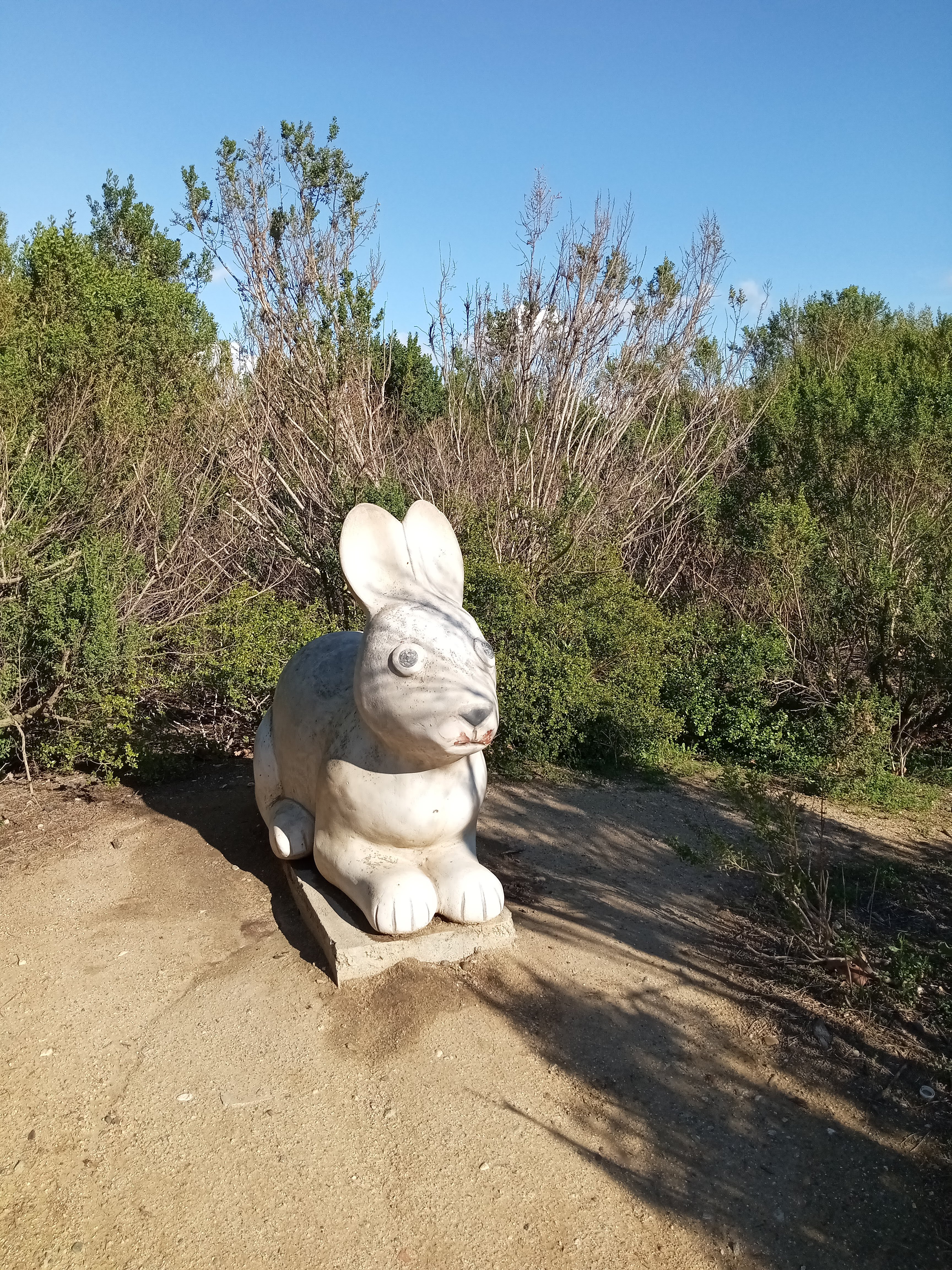
The trail passes more overlooks with excellent views of Downtown, including a large field covered in patches of flowers. As the trail winds down the ridge towards the tracts of housing lining the southern edges of the park, it passes through a scrubby area decorated with some colorful (and slightly goofy) sculptures of native animals tucked amongst the scrub.
At last, the trail descends to the intersection of La Brea Avenue and Stocker Street, exiting Kenneth Hahn Park. The intersection is incredibly busy and a little hairy (it’s actually a five-way intersection), but there are at least pedestrian islands in the crosswalks. The Park to Playa Trail continues another mile-and-a-half towards Crenshaw along the Stocker Corridor across the street, from a well-marked trailhead situated catty-corner to the entrance of Kenneth Hahn Park.
However, we opted to conclude our hike and take the #212 bus up La Brea back to the E Line. The northbound bus stop is situated next to a little garden with benches and a water fountain, so even if you miss your bus (which we did), this is still one of the nicer places in the city to have to wait for a bus.
