I’ve previously said that the prettiest stretch of the Metro Rail system is the section of A Line between Pasadena and Downtown L.A. Well, the second-prettiest section is probably the part that takes you past the foothills of the San Gabriel Mountains.
East of Pasadena, the A Line continues along the route of the old Santa Fe Railway, through quiet suburban communities and past views of the mountains before ending in Pomona, where the line intersects with Metrolink’s San Bernardino Line, where you can connect to trains continuing out to the Inland Empire.
Today we’ll be exploring some of the lovely communities along the line, where you’ll find quiet main streets, community historical museums, little cafes, and peaceful neighborhoods ideal for a walk.
Azusa
Heading east from Pasadena, the A Line passes through several suburbs before traversing the mostly industrial landscape in Irwindale, above the Santa Fe Dam. Along the line you’ll pass by a lot of gravel pits, retention ponds, the usually dry bed of the San Gabriel River (often swollen with water in springtime), and a large brewery currently owned by Pabst, with tanks decorated to look like Pabst beer cans. Past this, the train sweeps across the 210 into Azusa.
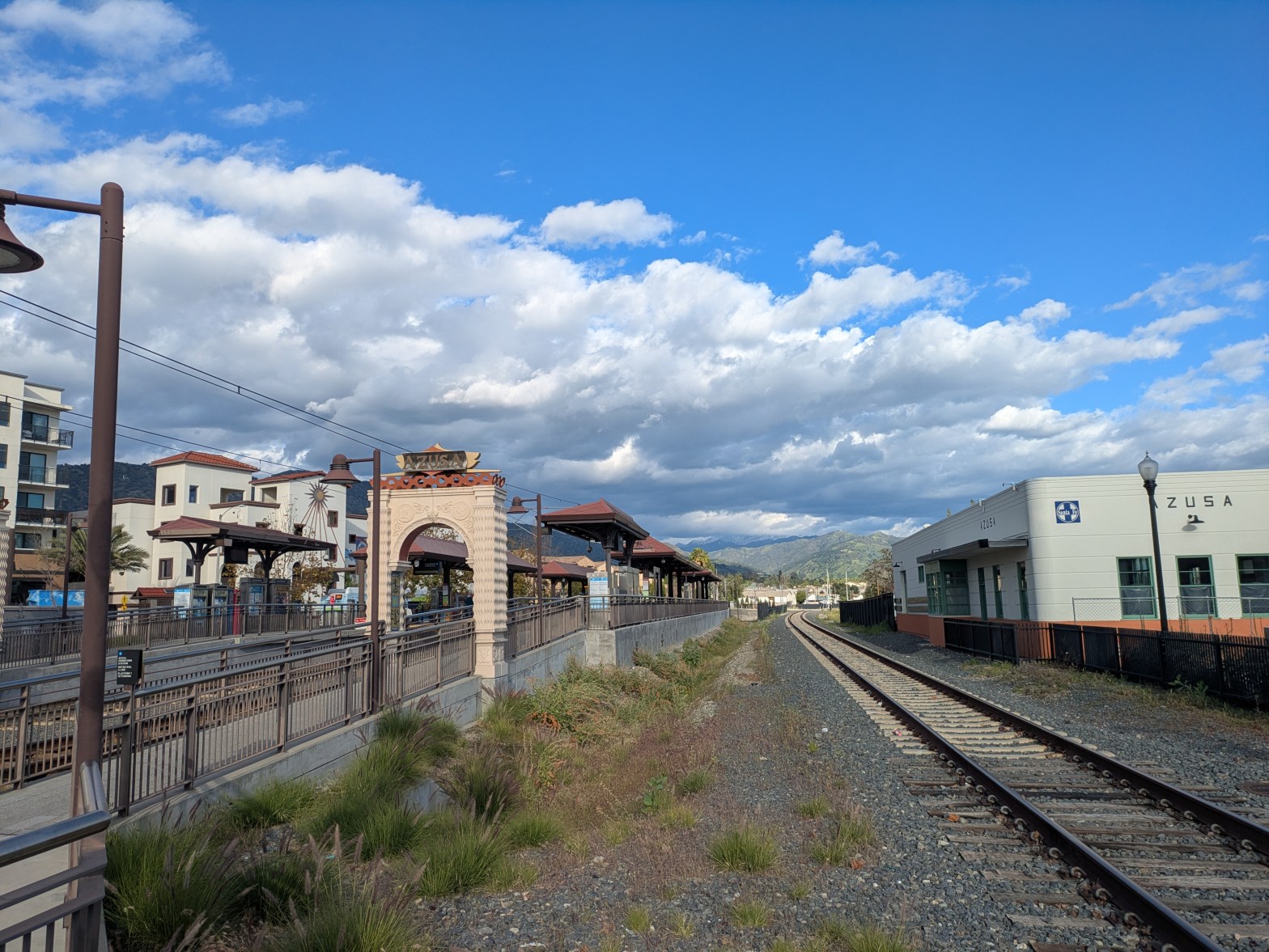
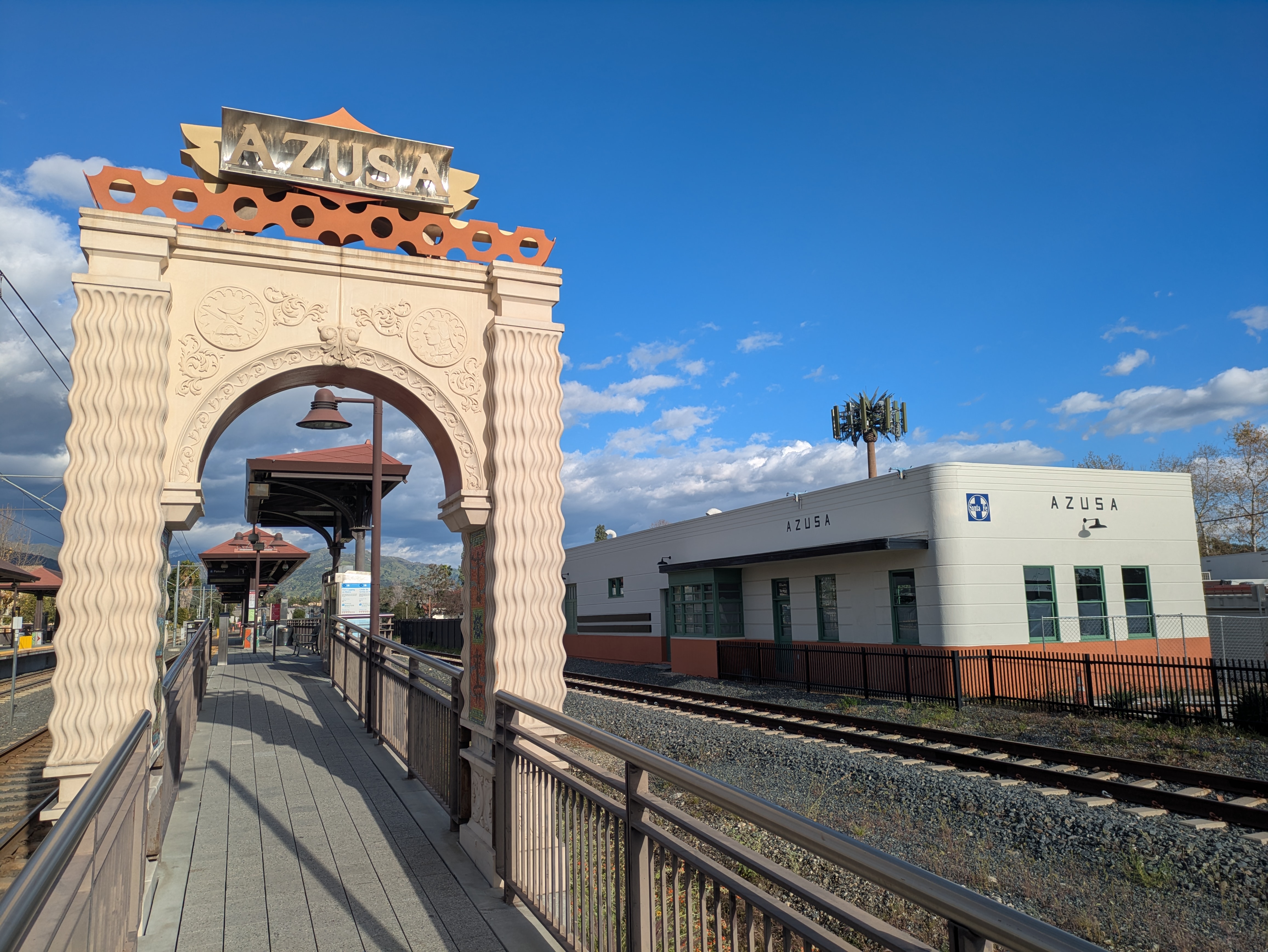
Downtown Azusa station has experienced a lot of new development since opening, with new apartment buildings and a two-story Target now surrounding the station. The station also sits just around the corner from Azusa City Hall, which sits a block just southeast of the station, just off the train tracks and past a former Santa Fe Railway building which still sports the logo of the old railroad.
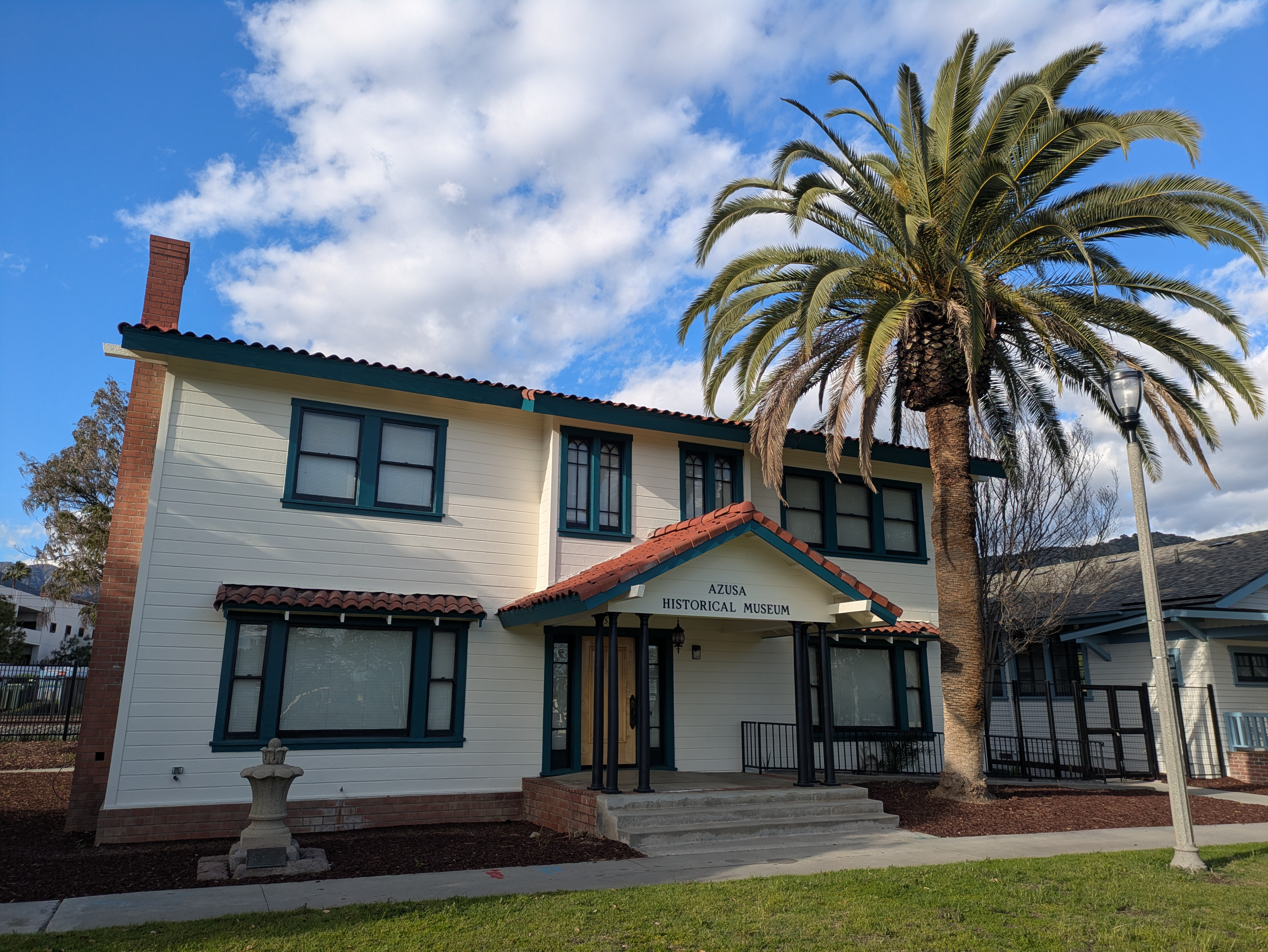
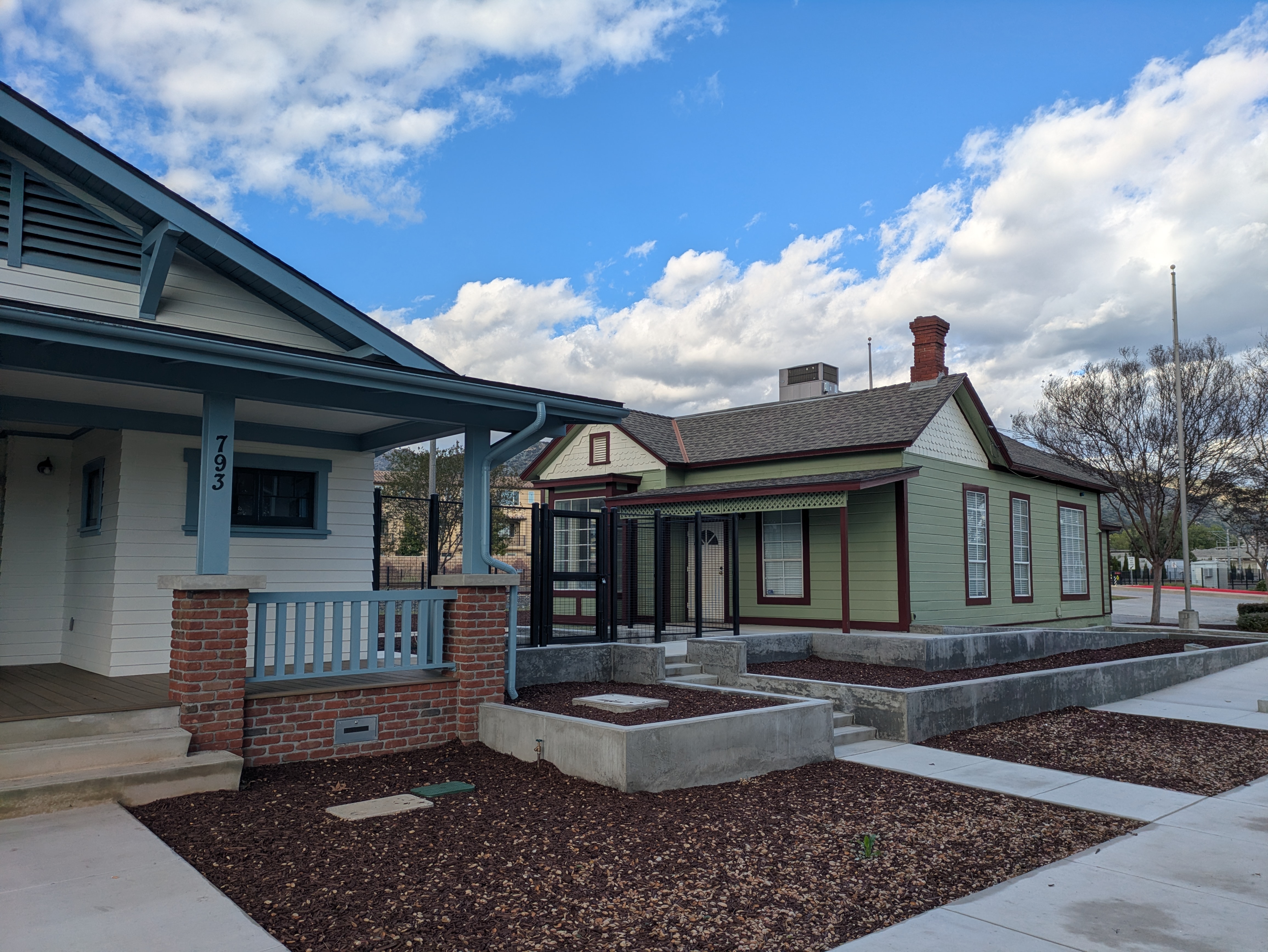
City Hall sits in the midst of a small civic center, where you’ll find a playground and the Azusa Historical Society, the town’s history museum, housed in a Craftsman house which dates back to the 1920s and once belonged to one of the town’s mayors. The museum is only open on Sundays from 1-3pm.
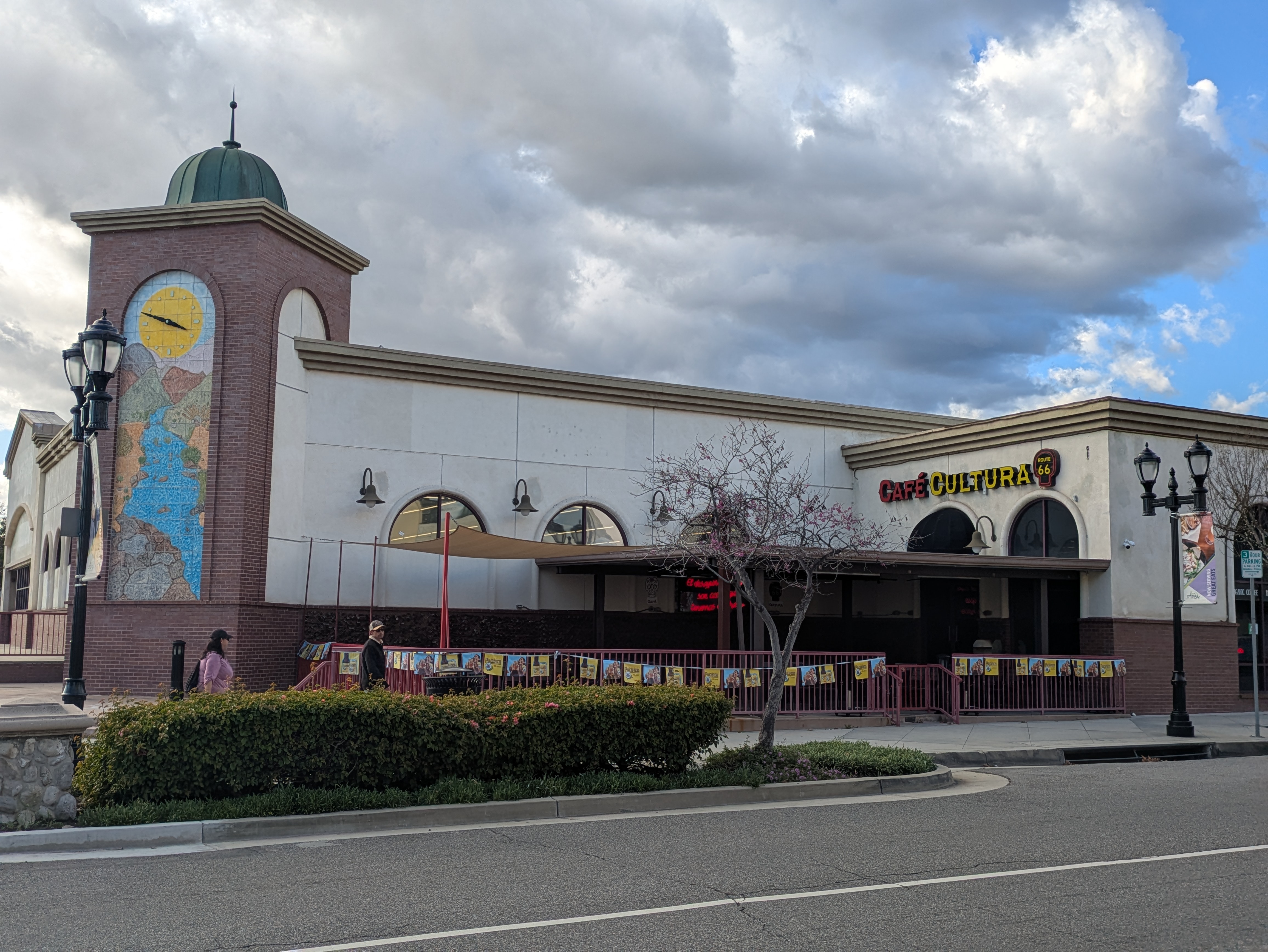
The block of Azusa Avenue south of Downtown Azusa station is lined with small storefronts, intersecting with the former Route 66 a block south of the station. On the corner is our favorite place to eat in town: Cafe Cultura, a popular Mexican brunch spot (with a sister location in Downtown Santa Ana) noted for its pancakes, chilaquiles, and lattes. There’s both indoor and outdoor seating, and while the line to get inside can be long on the weekends, once you’ve ordered the staff are good about getting your food out to your table quickly.
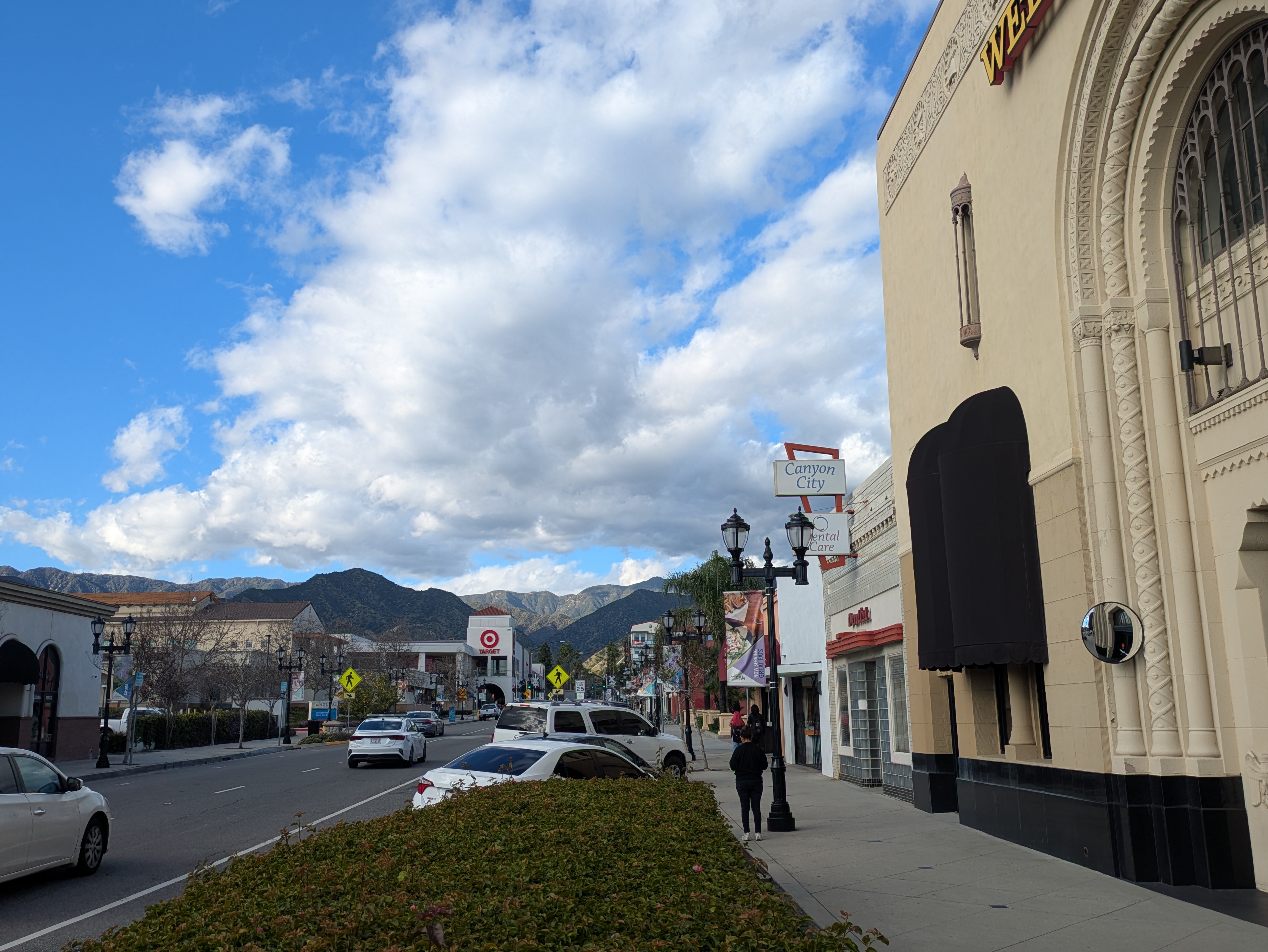
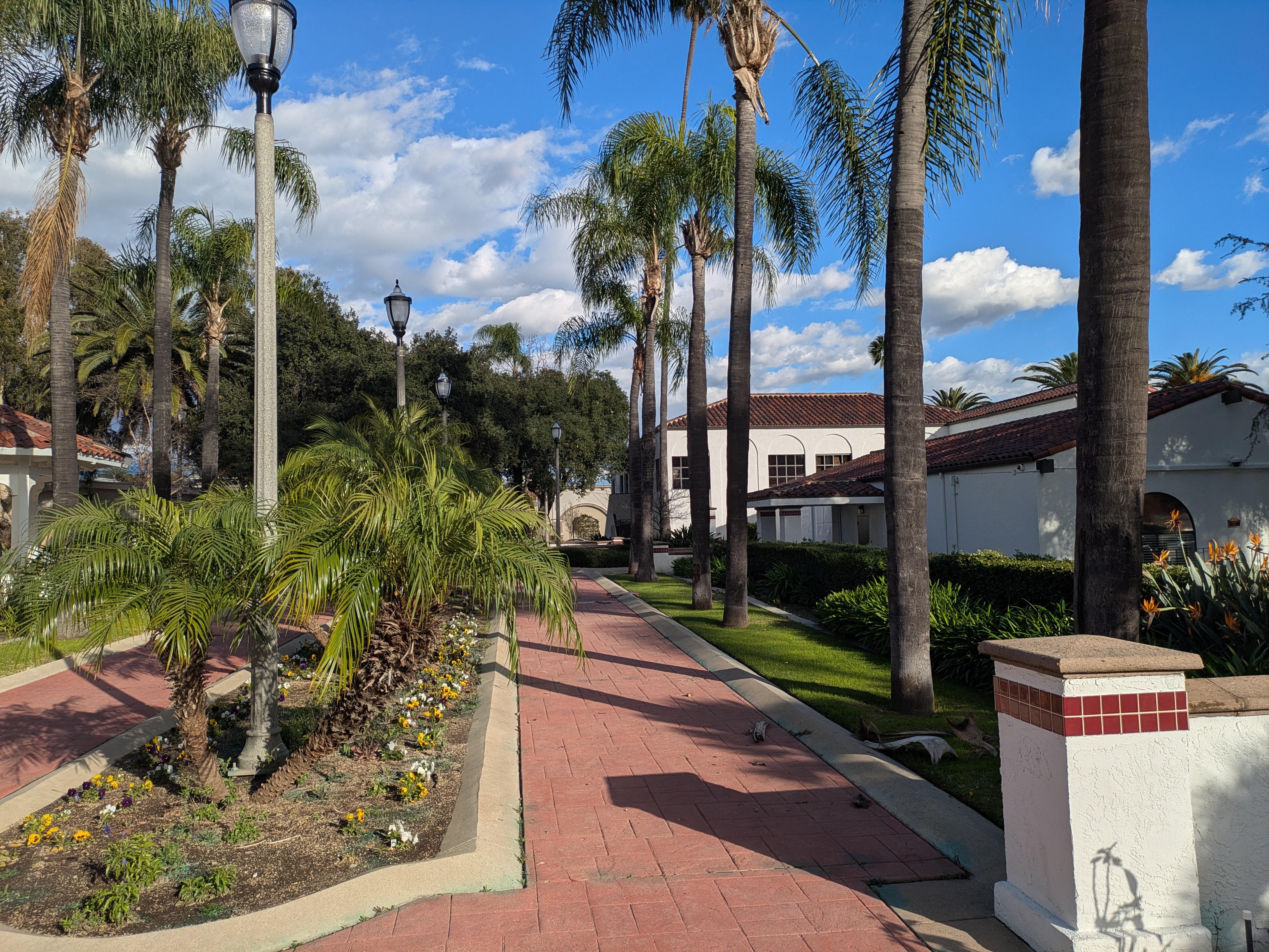
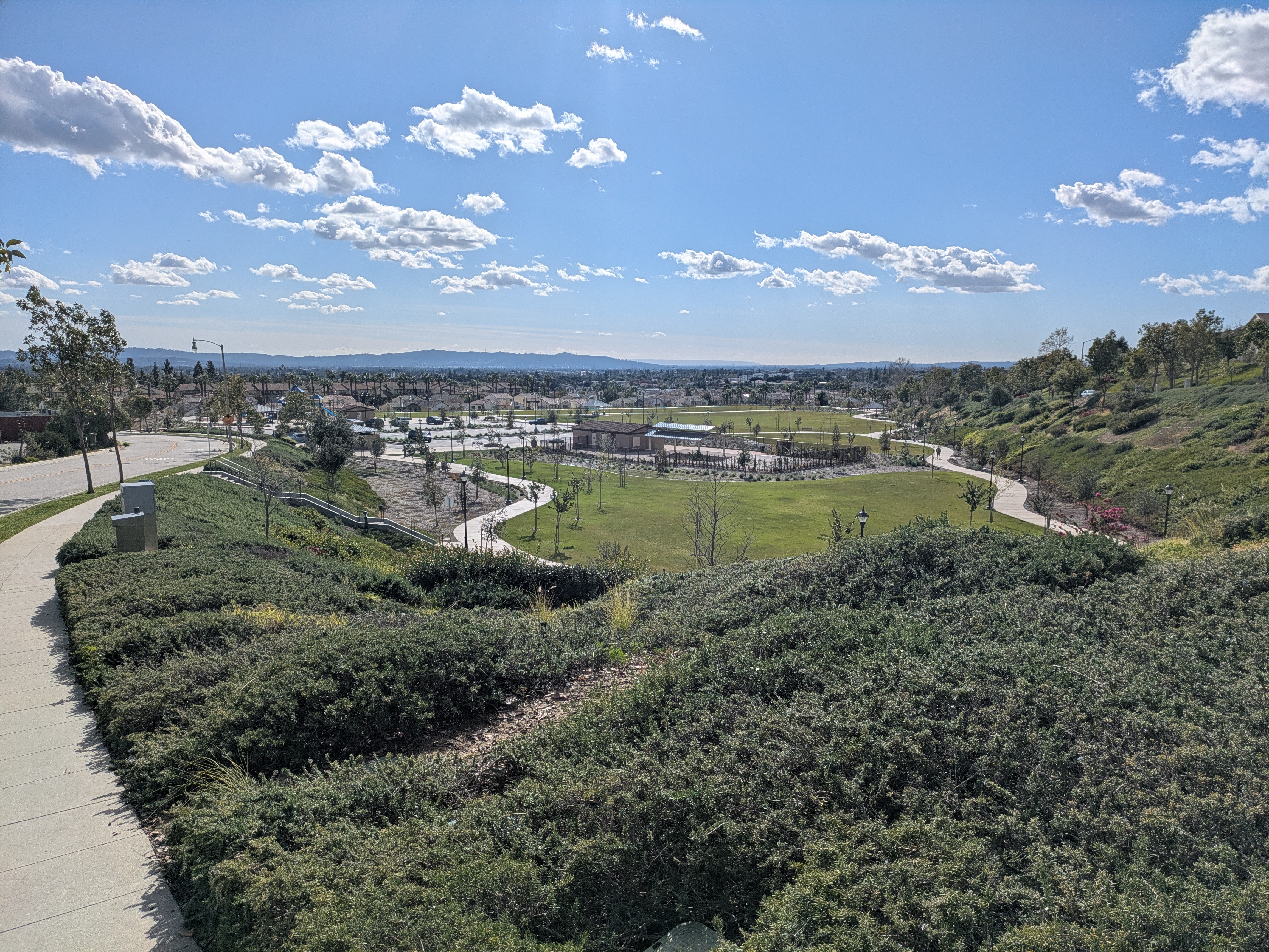
The next stop on the line, APU/Citrus College station, serves a pair of colleges just to the south, and sits at the point where the A Line comes the closest to the foothills of the San Gabriel Mountains. The neighborhood to the north is nestled in the foothills, beneath a large “A” painted on the hillside, and offers a park with excellent scenery.
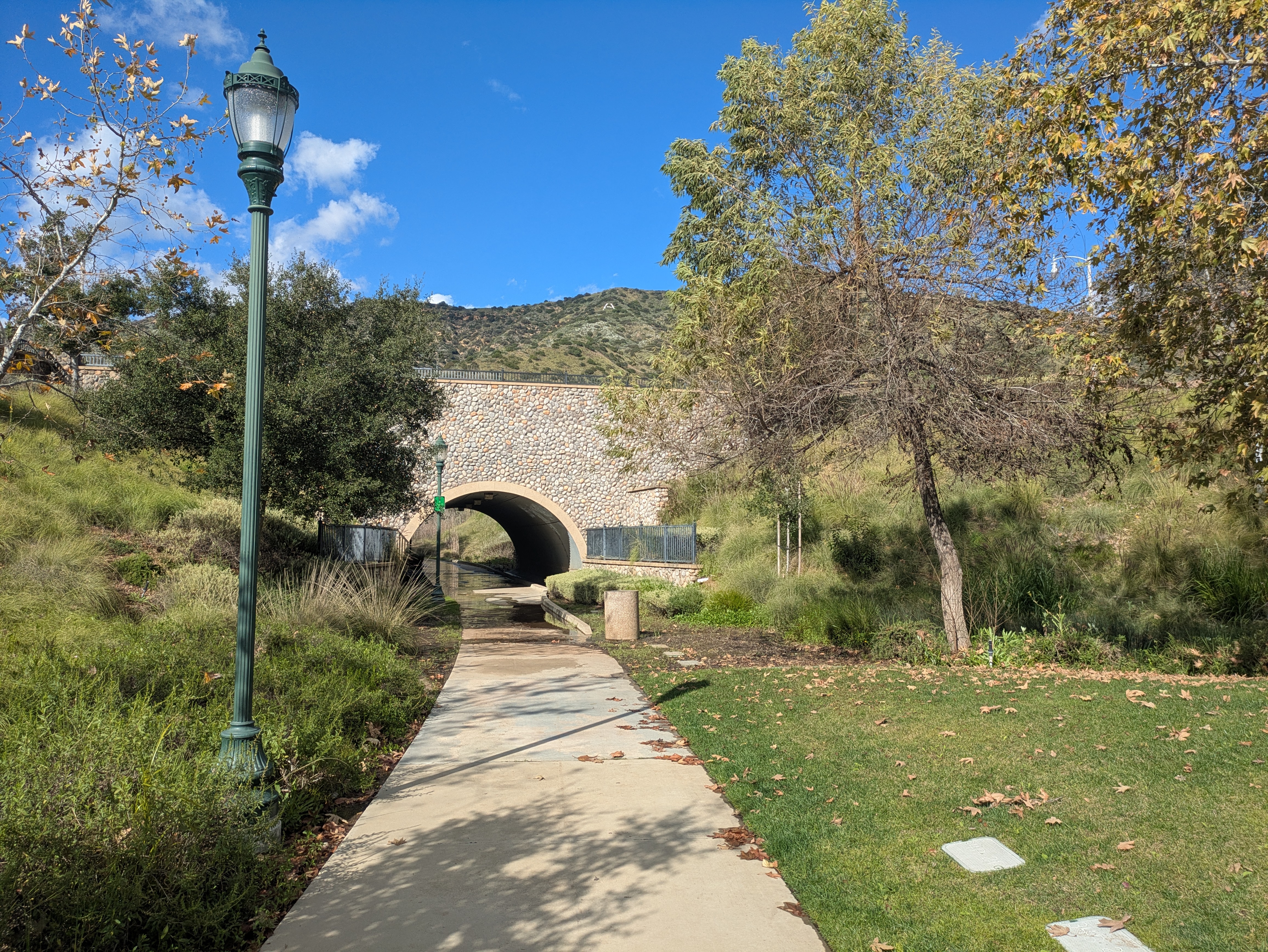
From the station plaza, head towards the mountains and make a left onto the street lined with palm trees. This is “The Promenade.” Continue straight past the large roundabout and then after another block, make a right onto Rosedale Avenue. Here, you’ll reach the base of Great Park, an expansive lawn with a playground and sports fields that link to an arroyo that stretches up into the foothills. Continue up the street and you’ll reach an overlook with picnic tables looking out over the whole town. Past this, a trail winds along the arroyo, lined with native plants and small, temporary wetlands that fill with water after a storm. It’s a lovely space that gives you the chance to get a little closer to nature.
Glendora
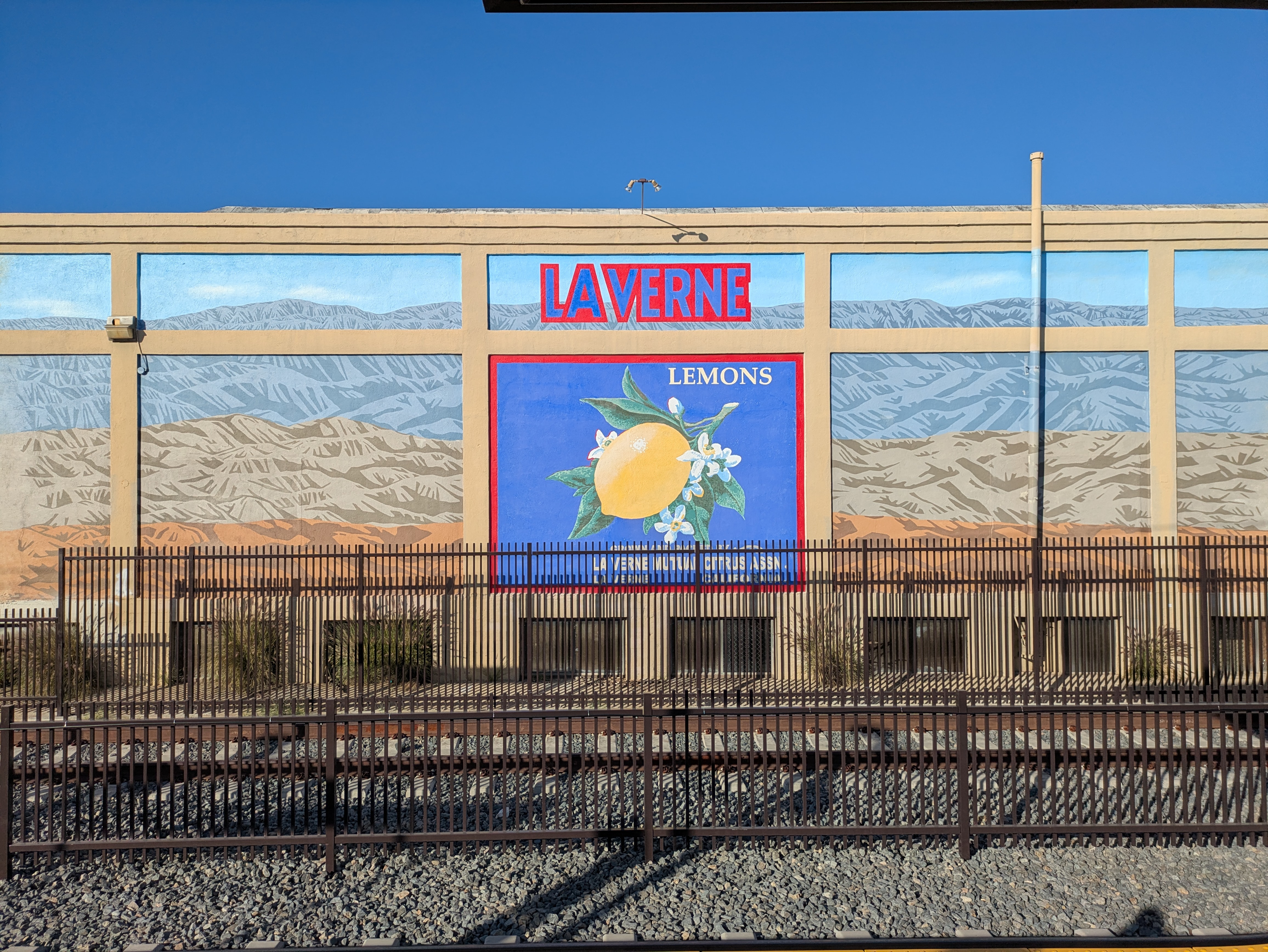
Carrying on to the next stop, Glendora station sits a few blocks south of the center of town. The station itself has some lovely tile art honoring the city’s citrus growing history, as well as another significant piece of local flora that we’ll visit in a bit.
From the platform, exit onto the street, make a right around the corner, and then walk a block until you reach Glendora Avenue, where you’ll make a left at the post office. After a couple blocks, you’ll cross Foothill Blvd and enter the town’s charming main street district.
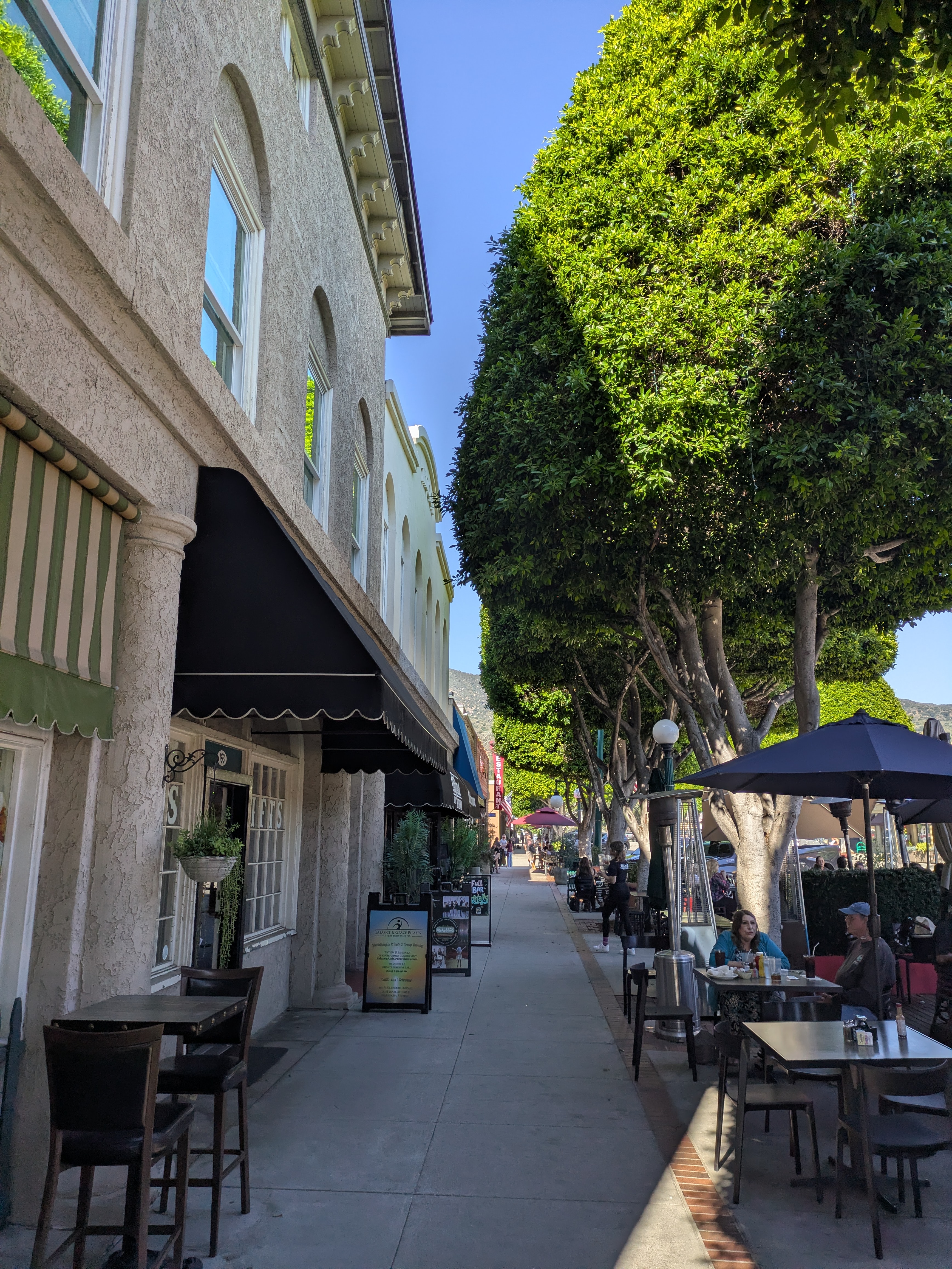
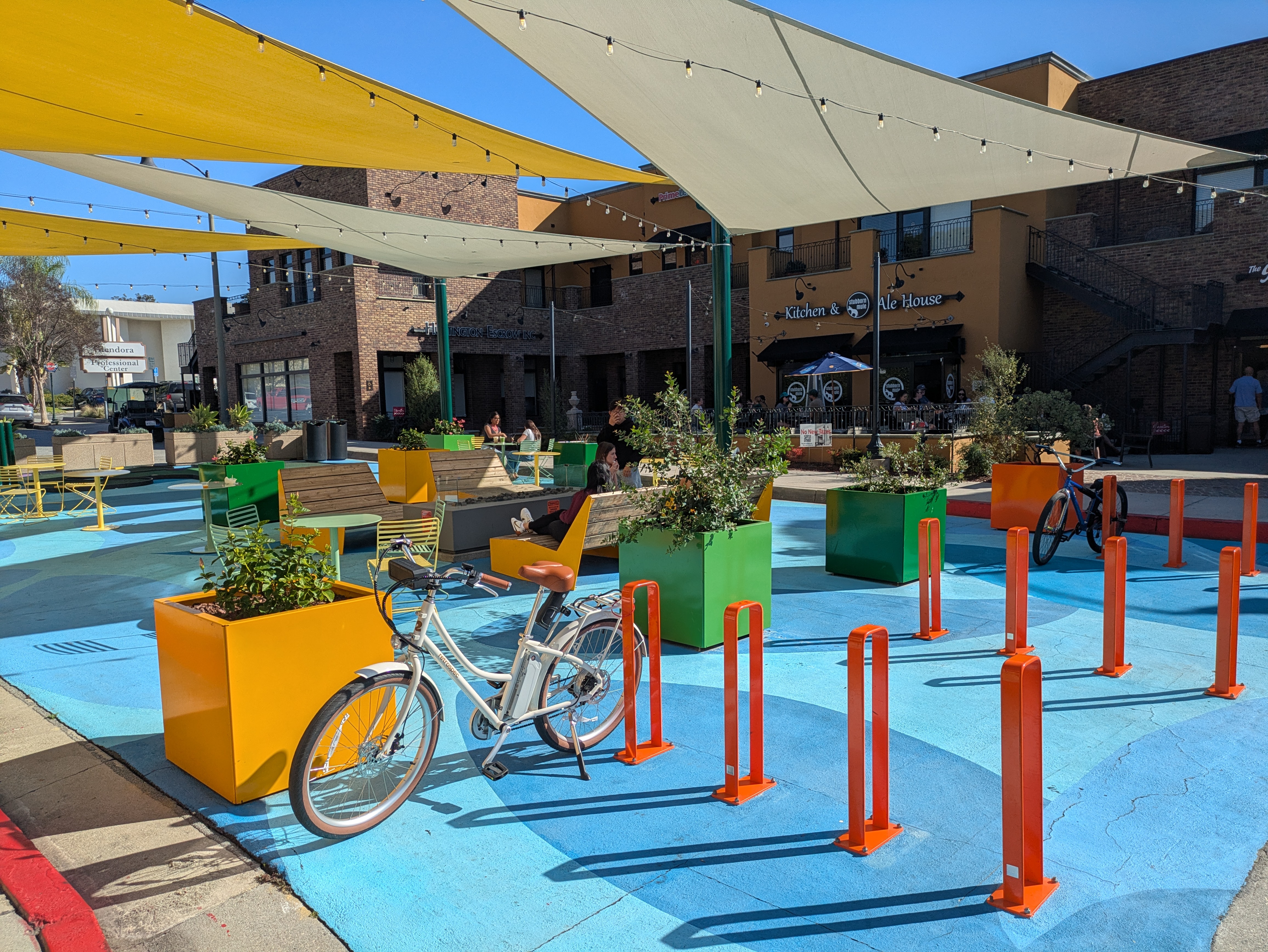
Behind the rows of ficus trees, this stretch of Glendora Avenue is lined with cafes, restaurants, and cute boutiques, all of which seem to be pretty well patronized on the weekends. There’s a few parklets along the way that offer plenty of seating and bicycle parking, and you’ll also find plenty of historical signage the town has installed to explain the significance of the various buildings.
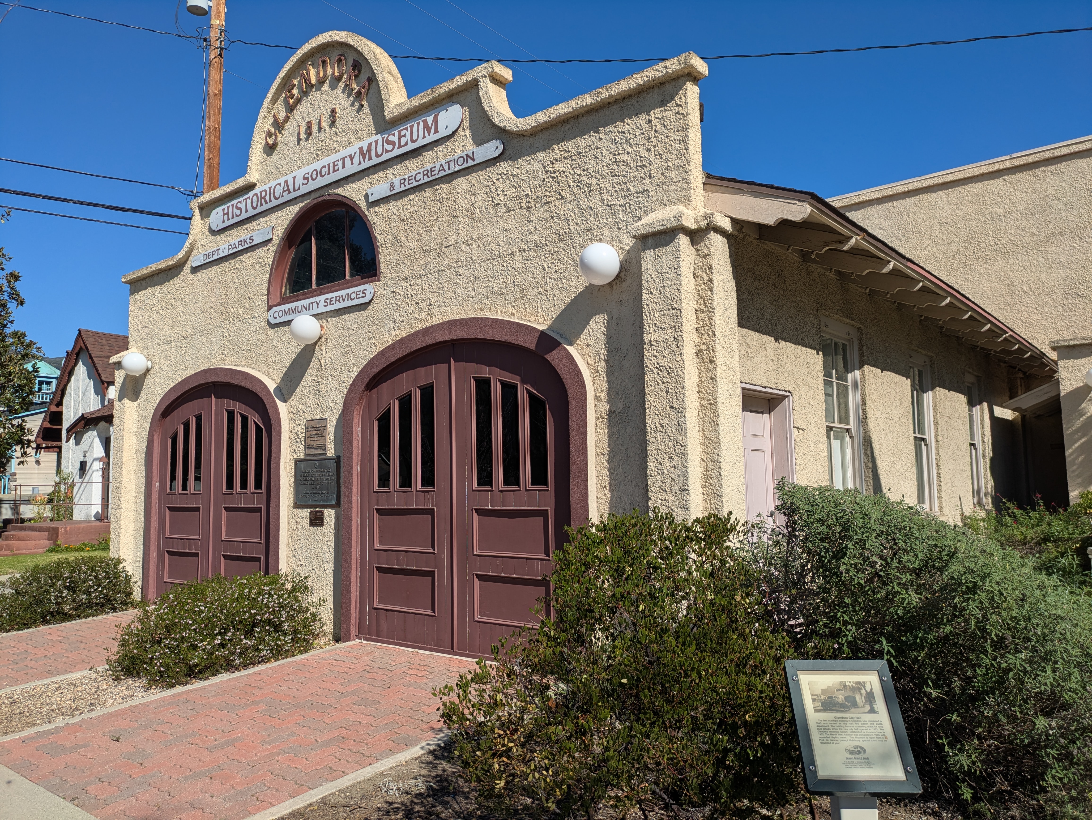
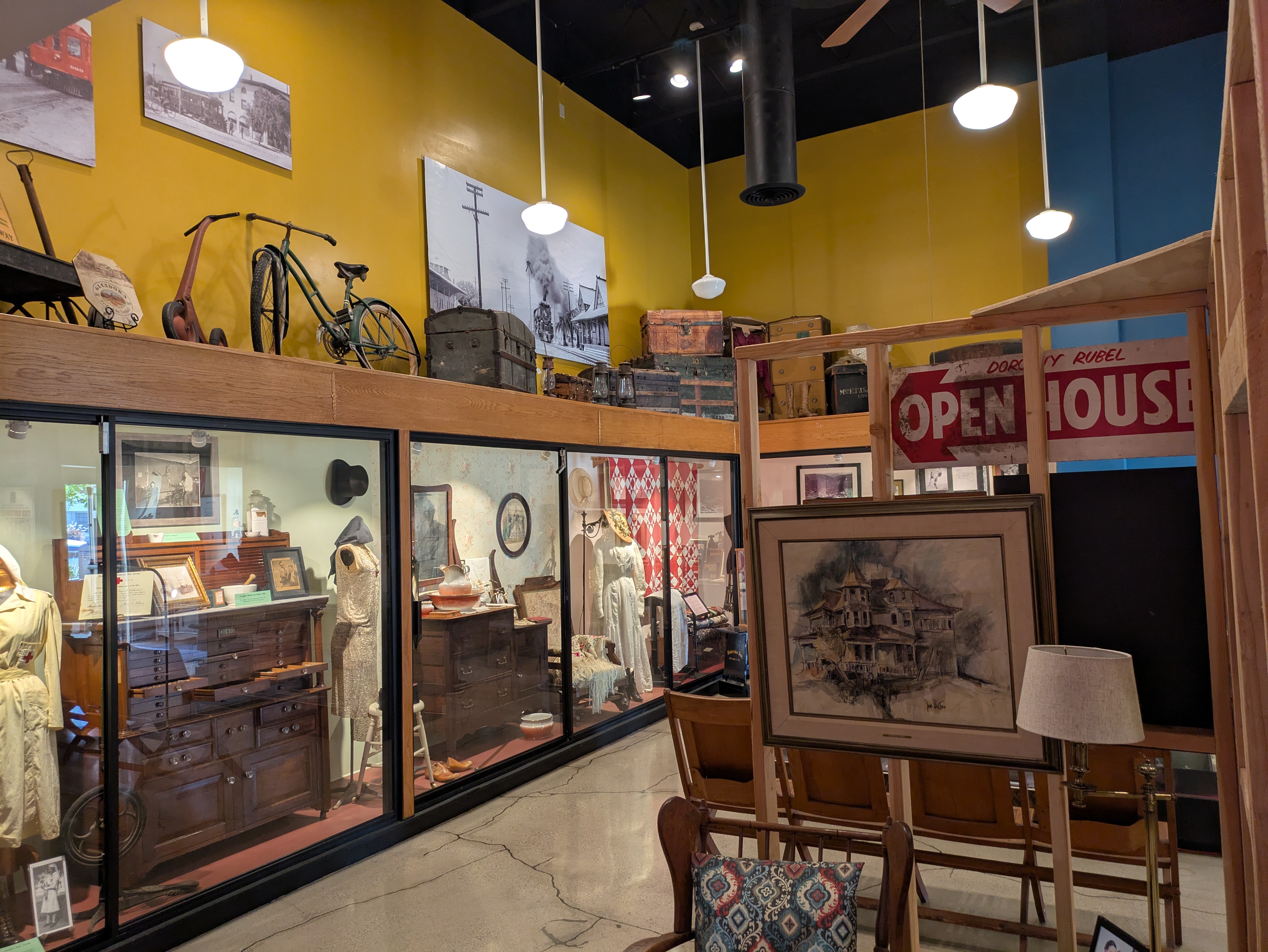
At the other end of the business district, just past a beautifully painted church, is the town’s museum, the Glendora Historical Society. Housed in a former fire station, the museum has two large rooms that hold numerous displays on the history of the town, covering topics like the native inhabitants, the town’s founding, the citrus industry, and some of Glendora’s most famous inhabitants (including Gumby, the popular claymation television character of the 1960s, which was produced at a studio in Glendora). There’s also plenty of antique furnishings and assorted objects from the 19th and early 20th centuries. Admission is free, but the museum is only open on Saturdays from 11am-2pm.
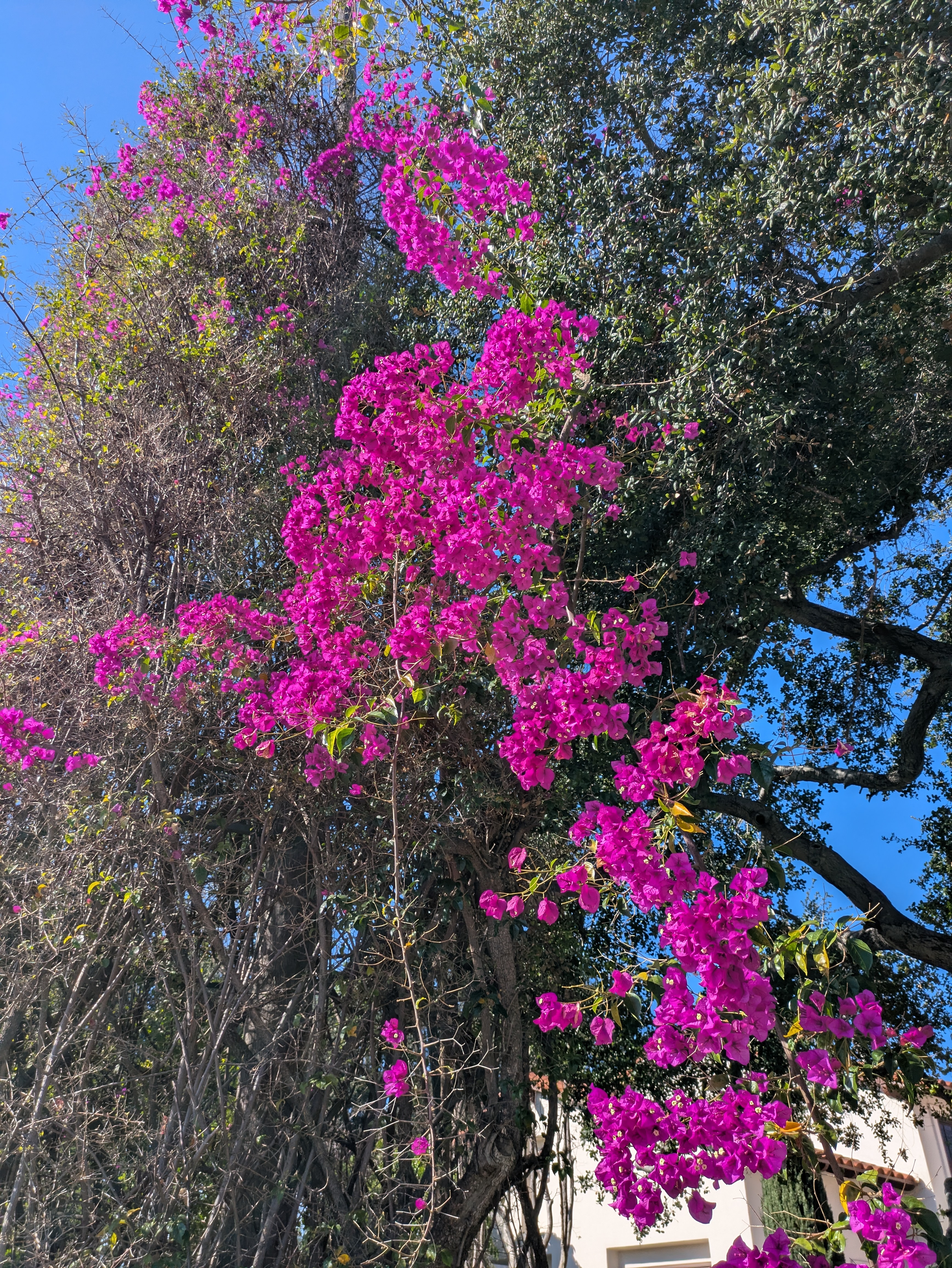
Near the museum is another historic landmark of Glendora. From the church next door, head east on Bennett Avenue for three blocks. At the corner of Minnesota Avenue, you’ll find the Glendora Bougainvillea, the largest growth of bougainvillea anywhere in the United States, dating back to 1870, when it was planted as a way of promoting California as a paradise capable of immense agricultural potential. The bougainvillea vines wrap around the base of the palm trees that line the block, forming dense bushes which tower over the sidewalk, and are covered in gorgeous pink flowers in the springtime.
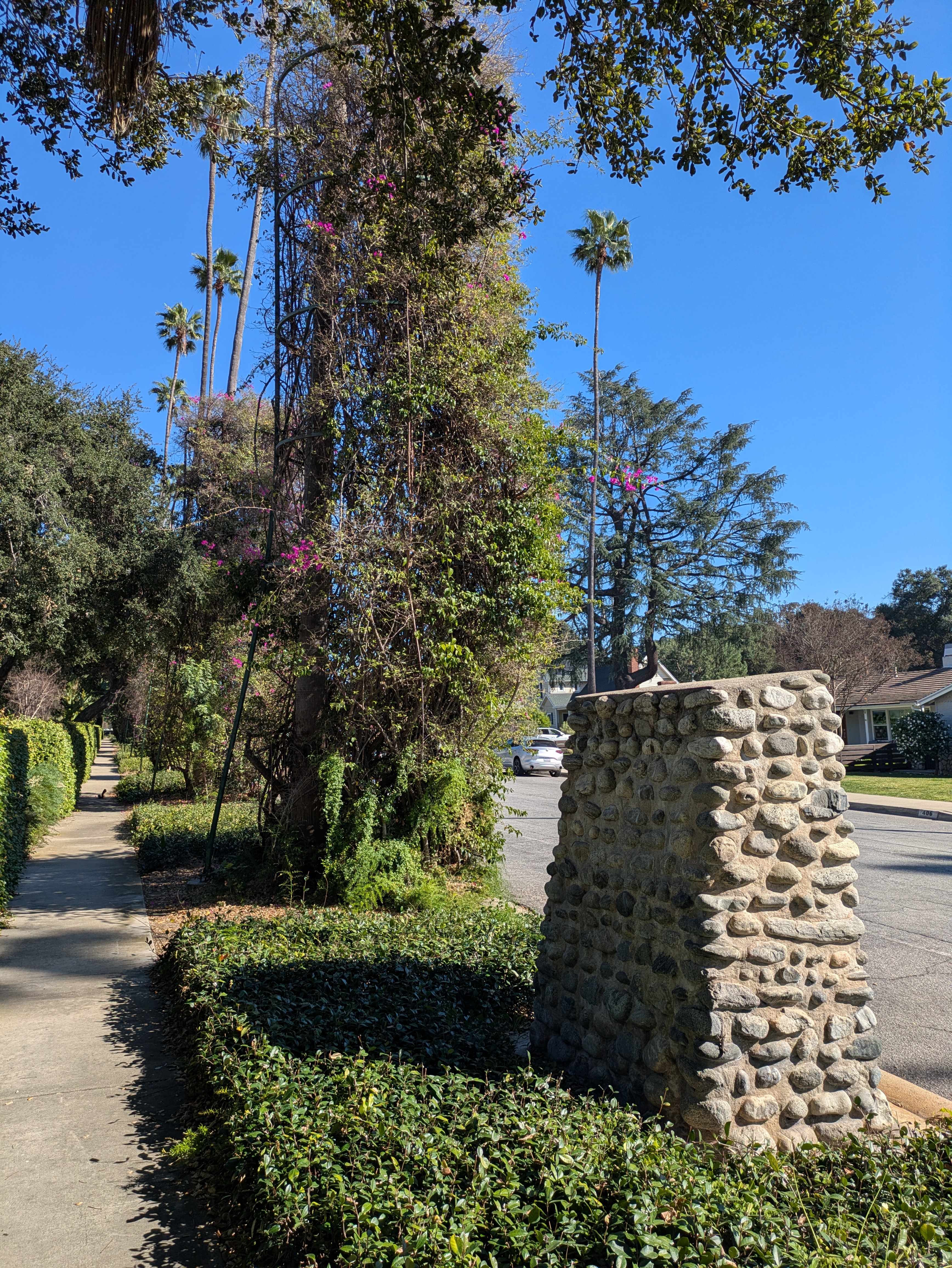
From the bougainvillea, you can retrace your steps back to the train station. It’s about a 20 minute walk.
San Dimas
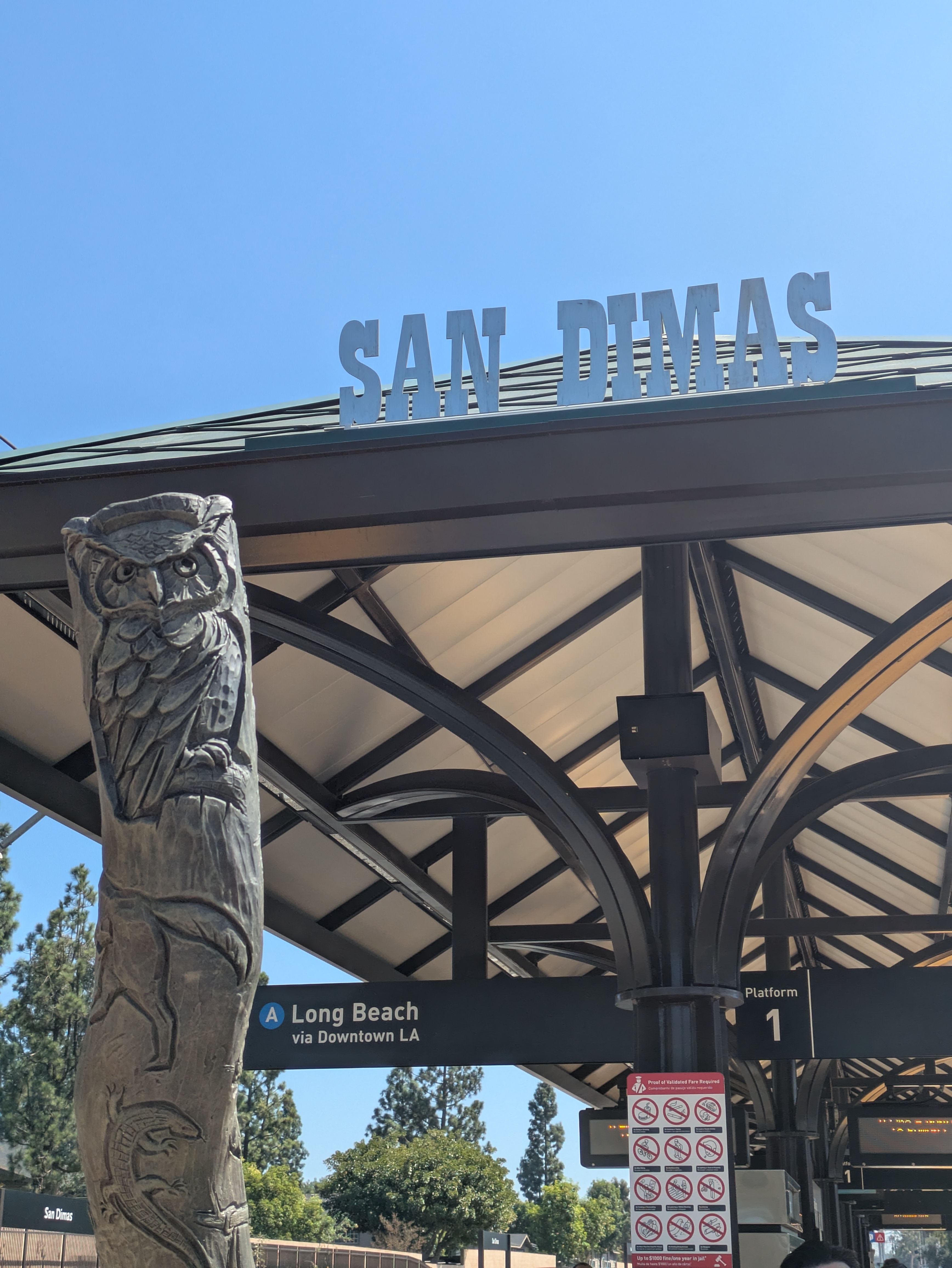
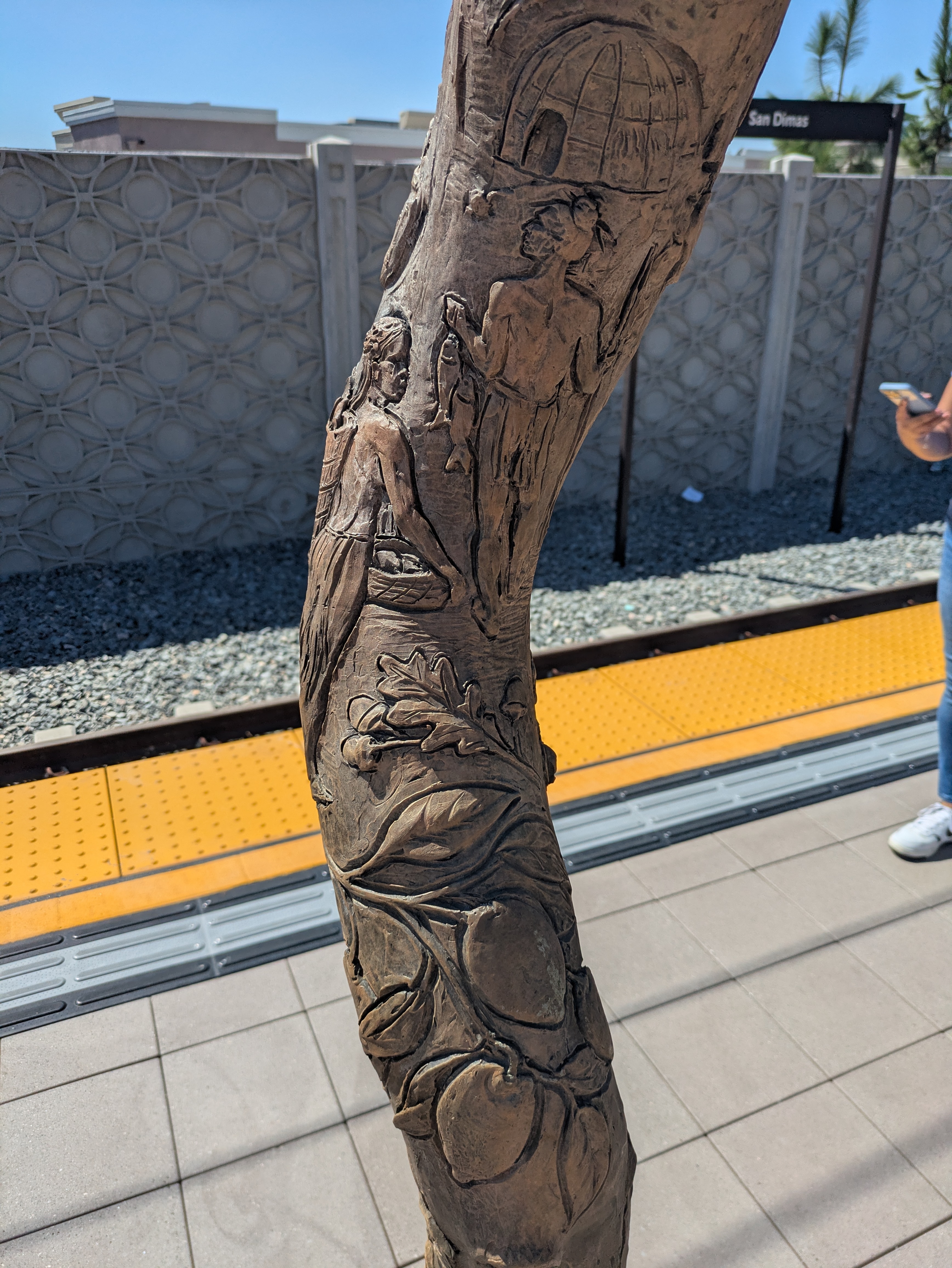
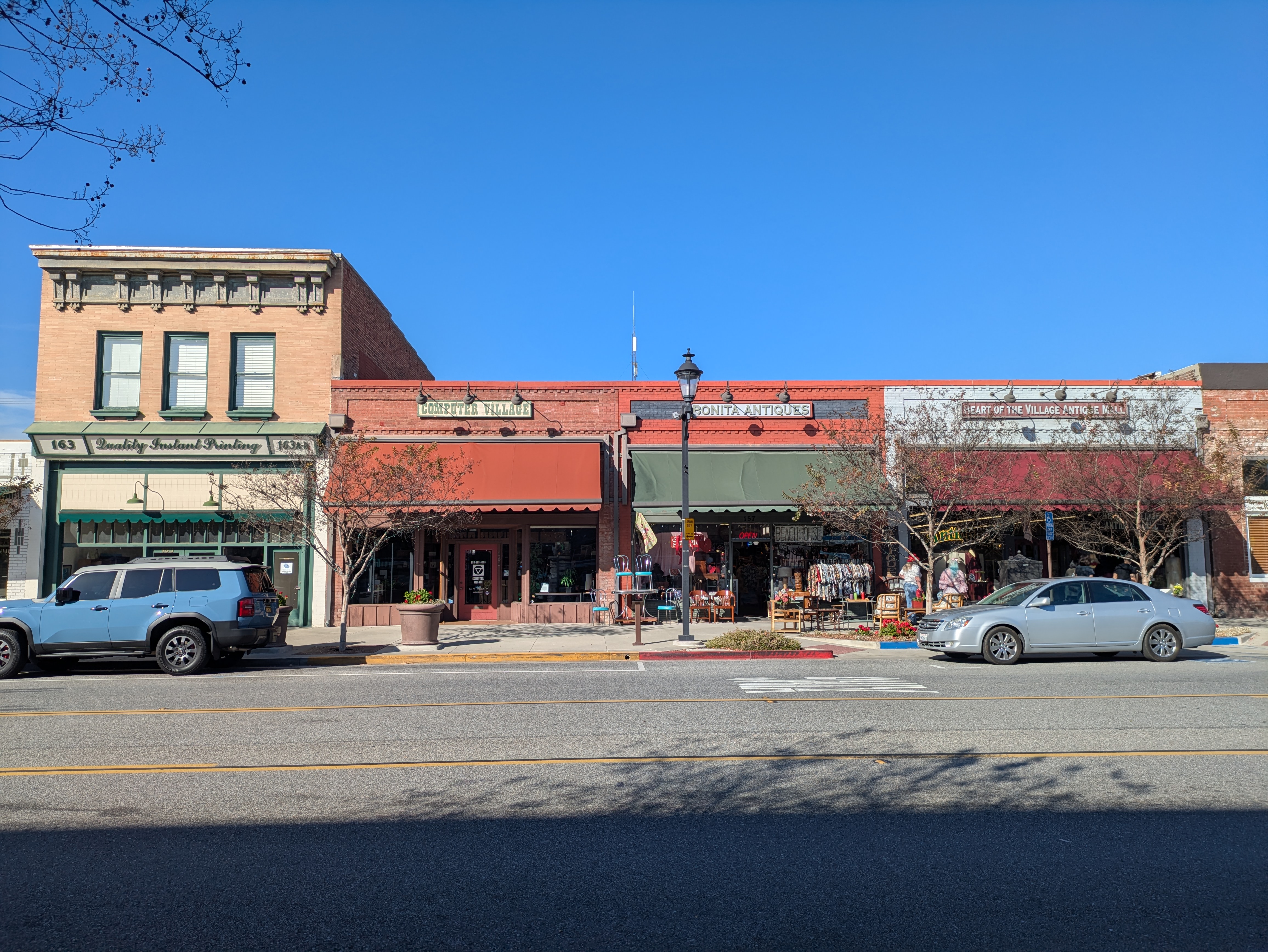
San Dimas station sits in the middle of the town’s old business district, which is centered along a few blocks of Bonita Avenue just north of the station. San Dimas has the most whimsical art of any of the foothill stations, with ceramic tiles depicting local wildlife and a set of walking stick-esque sculptures that are carved with various elements of the town, such as its history, nature, and local attractions. Although our favorite is the fantasy-themed one, which depicts a spiral staircase winding past imagery from children’s fairy tales.
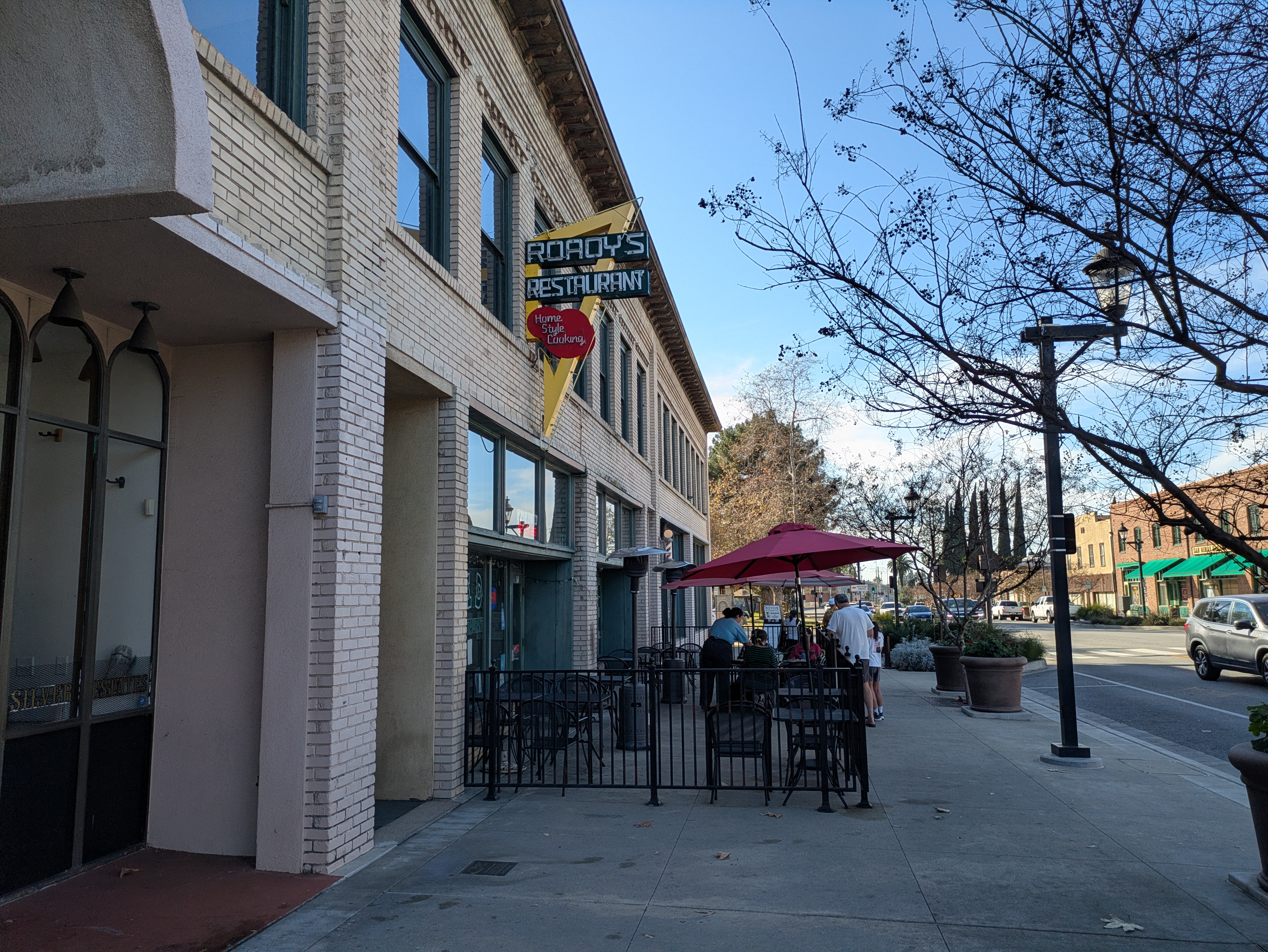
San Dimas has a goofy “Old West” motif going on, with the town name spelled out in vintage cowboy font on various signs and architecture that suggests old barns and brick storefronts. The block of Bonita just west of the station is lined primarily with antique stores, though you’ll also find cosmetic shops, a small indoor mall, a bakery, a diner with a vintage sign out front, and a charming pet store.
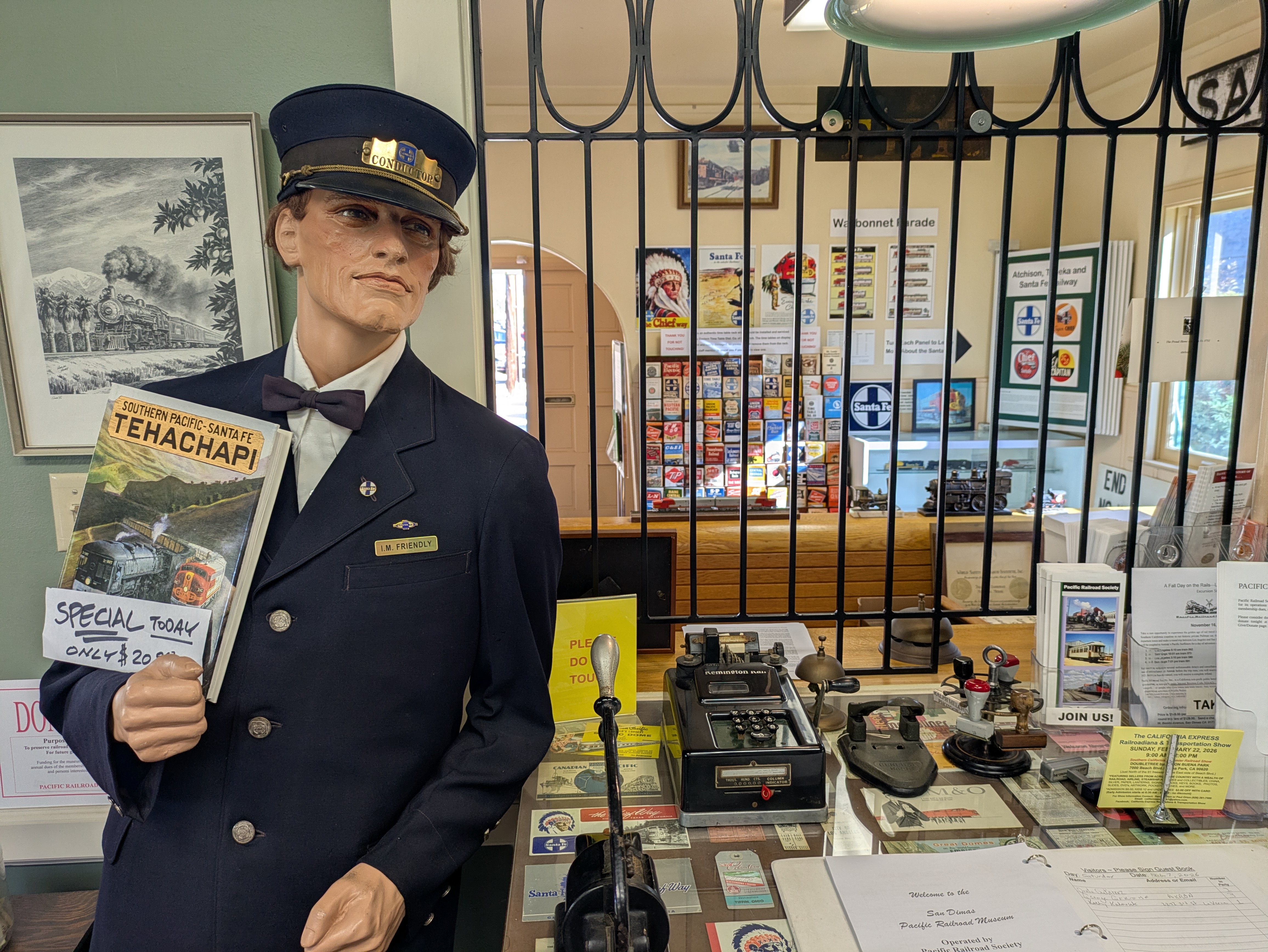
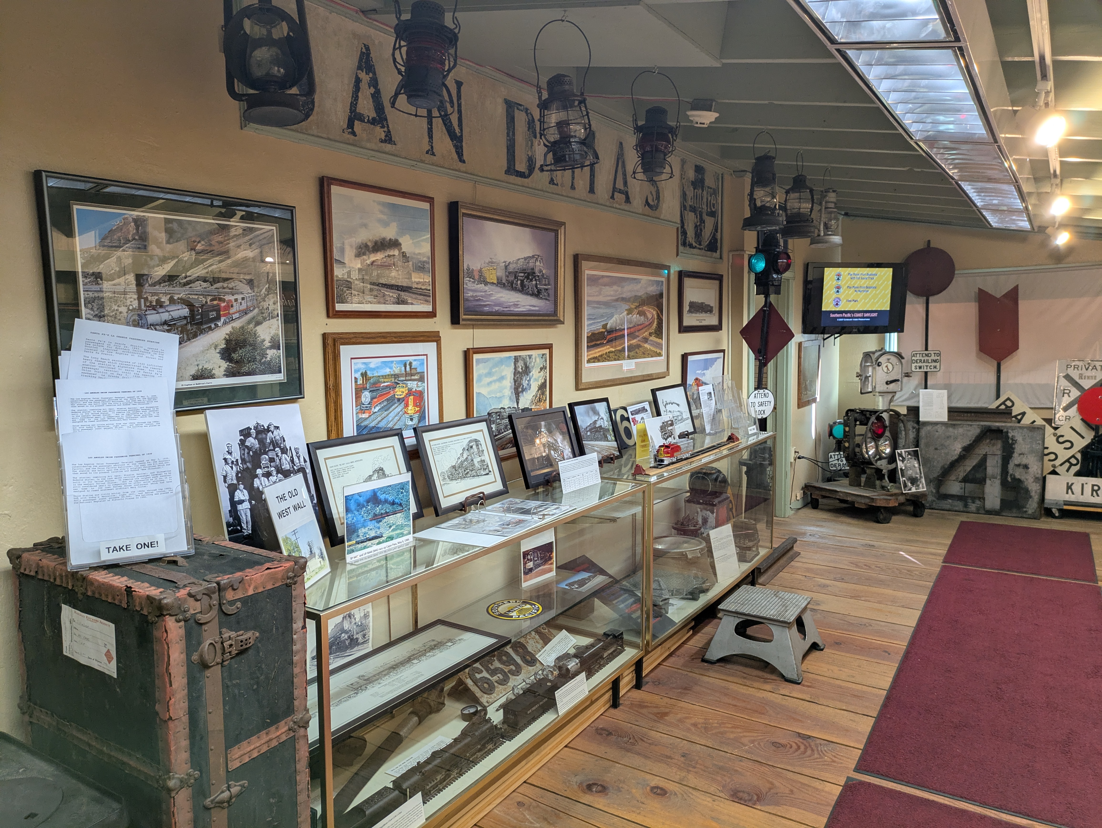
At the end of the block, behind a small park that holds a historic drinking fountain, is the Pacific Railroad Society, a local railroad history museum housed inside the town’s former train depot. The museum is splendid, jam-packed with displays on the railroading history of the San Gabriel Valley and even Los Angeles more broadly. The focus is on the Santa Fe Railway, which constructed and occupied the building the museum sits in today, but there’s also displays on the Southern Pacific and Union Pacific, the other two major players in California railroads, as well as lots of material on the streetcars that once traversed much of the region. There’s also a lot of vintage equipment on display, including a working wigwag which you can turn on.


The docents are extremely friendly and eager to strike up a conversation with you. A small research library sits in a room near the back, and the entire building is open to explore; be sure not to miss the great displays in the room in the very back. Like the Glendora Historical Society, admission is free but it’s only open on Saturdays, being open from 10am-4pm.
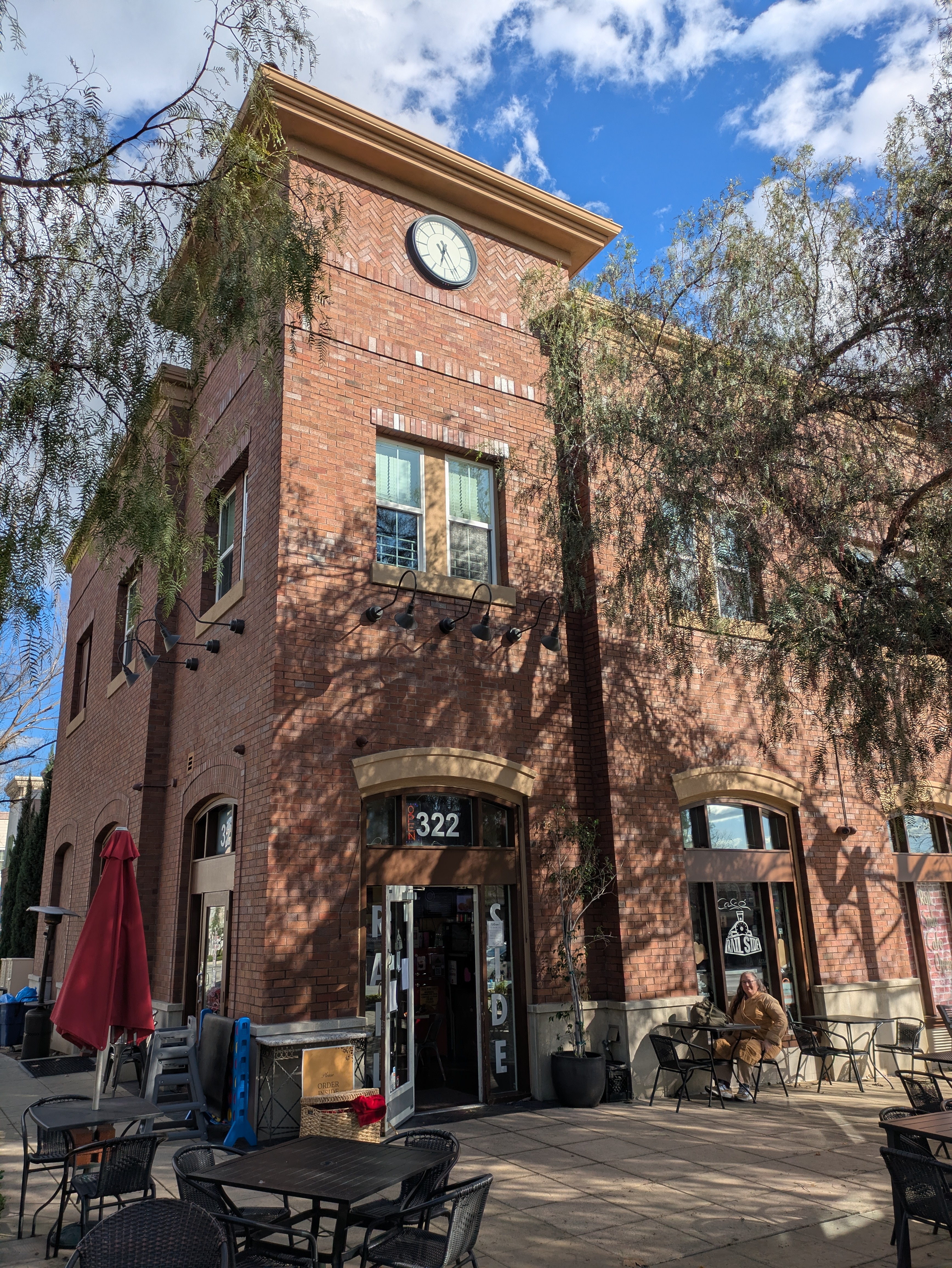
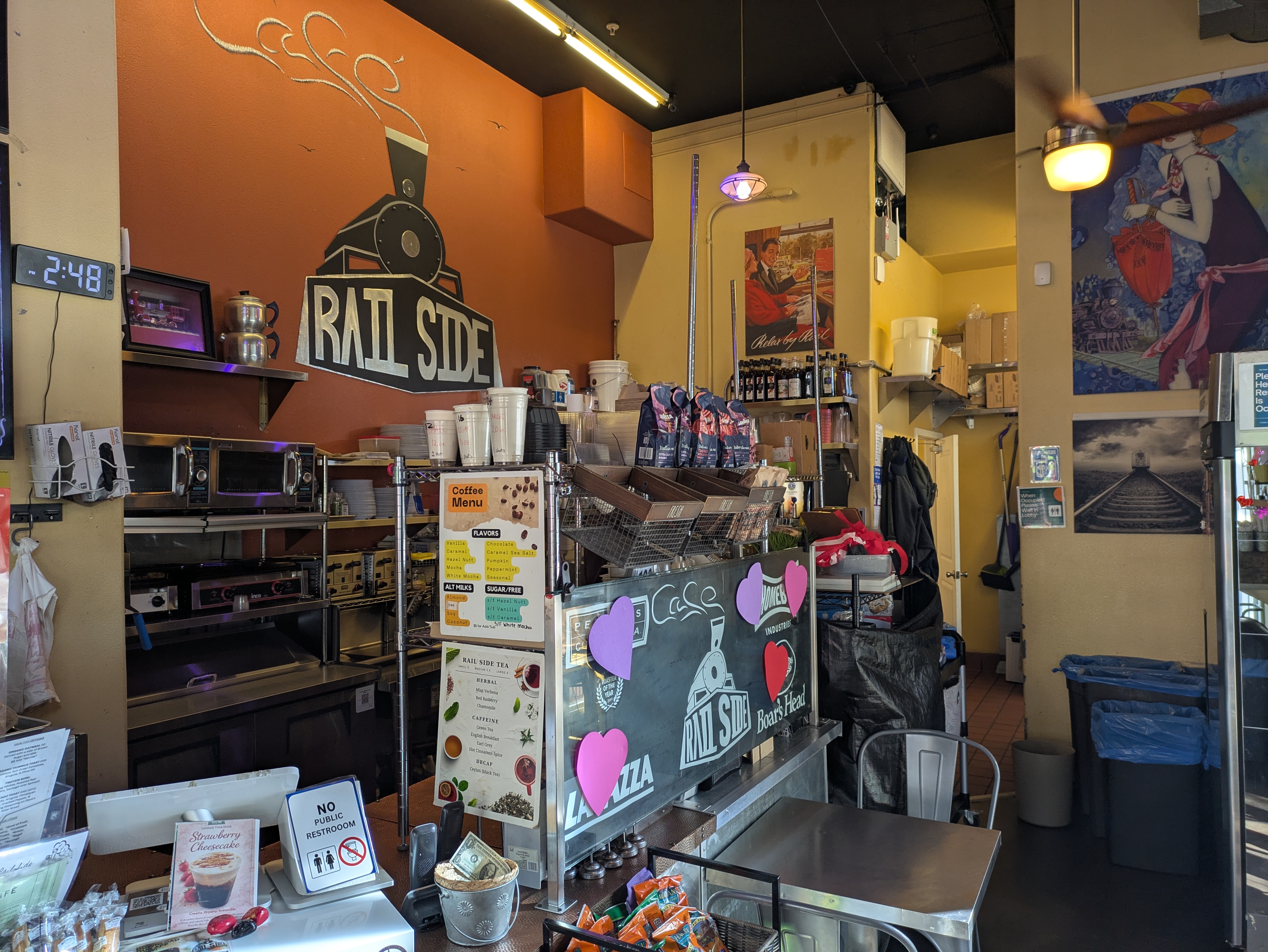
On the other side of the tracks, on the block south of the station entrance on San Dimas Avenue, is a train-themed eatery, the Rail Side Cafe. The place is only open for breakfast and lunch, closing at 3pm, but is noted for their good breakfast sandwiches.
La Verne
The La Verne/Fairplex station sits on Arrow Hwy, right across the road from the parking lot for the Pomona Fairplex, home to the L.A. County Fair every May. The fair offers a lot of great attractions, such as the restored steam locomotives of the RailGiants Train Museum (technically open throughout the year, but the fair is the best time to go), an art center with work by local artists, a large model railroad, a pavilion with elaborate floral displays, a wooded area with exhibits by the Forest Service, including a replica of a fire watch tower, and all the hallmarks of a typical county fair: agricultural competitions, barnyard animals, petting zoos, vendors, concerts, and carnival rides, but on a scale more akin to a state fair. If you want to avoid the high cost of parking for the fair, this is the stop to use!
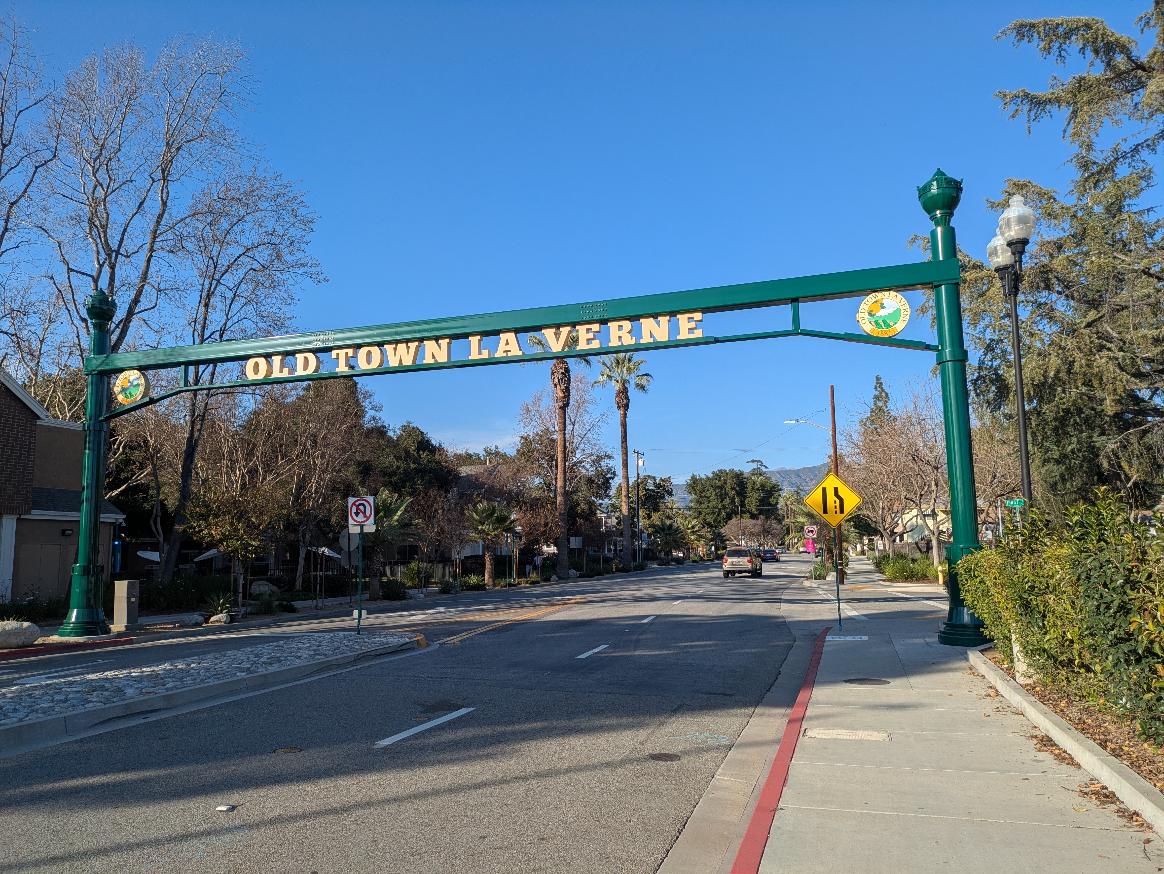
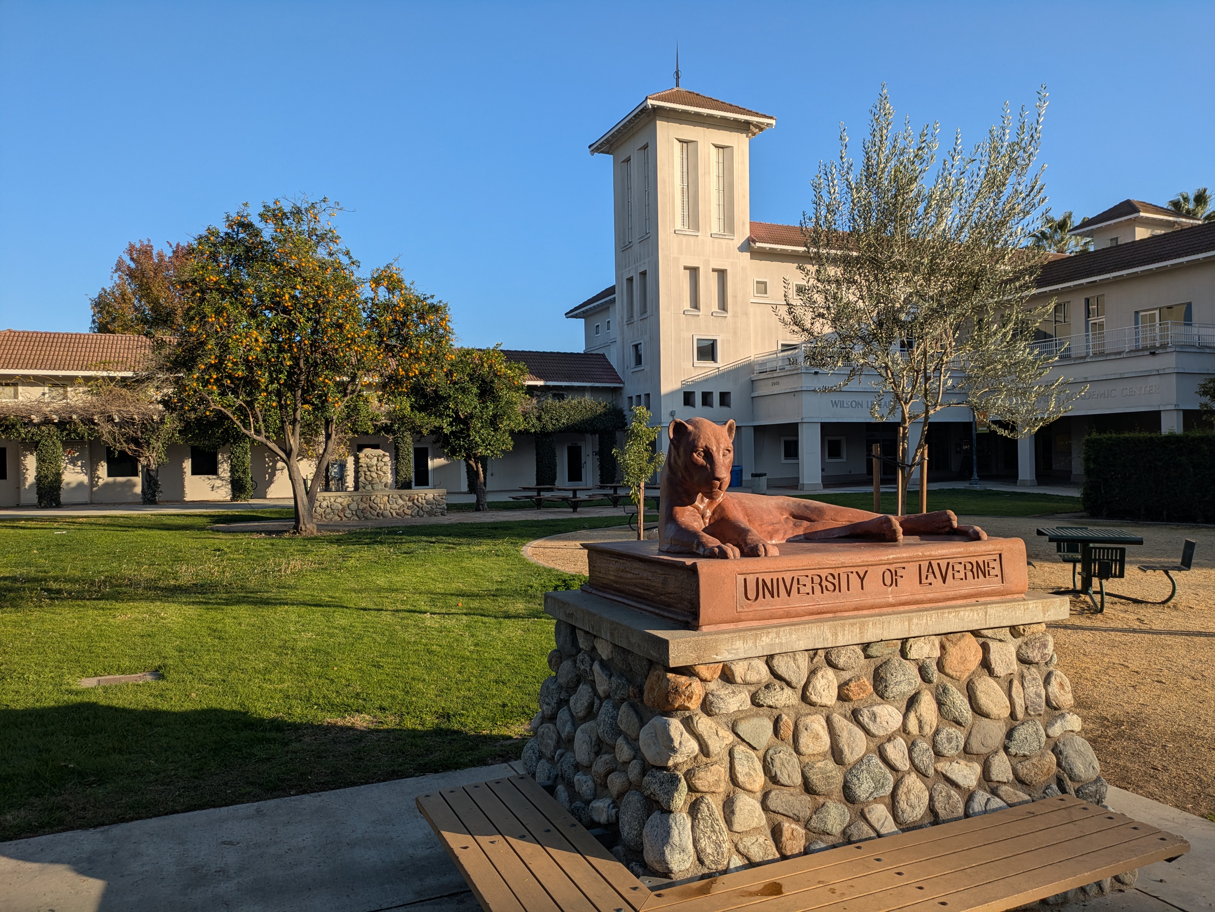
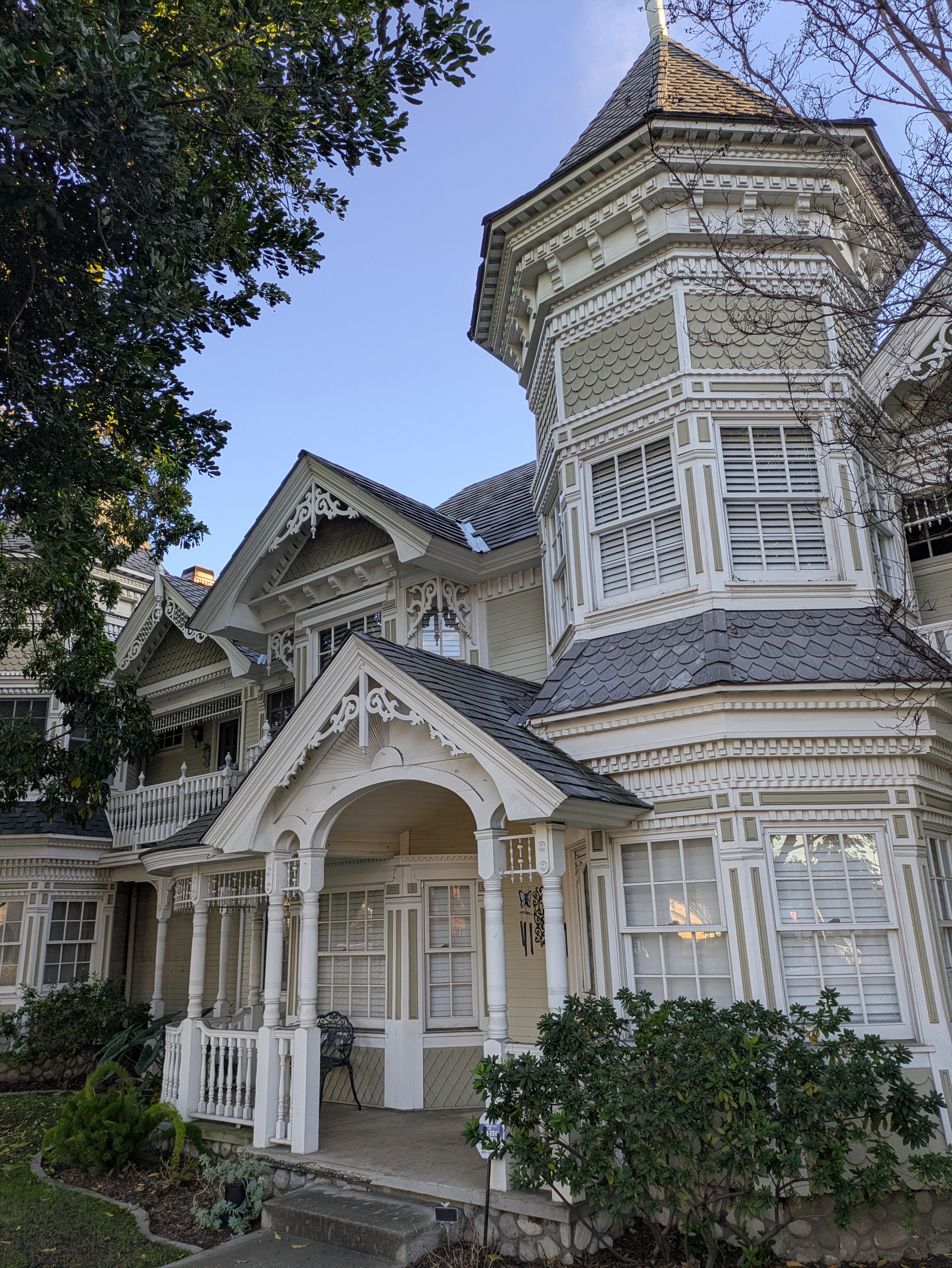
A convenient archway placed within sight of the station entrance marks the way into Old Town La Verne, a charming residential neighborhood with lots of lovely old houses built in Victorian and Craftsman styles. From the station, walk a block or two into the neighborhood, make a left on either 2nd or 3rd Street, and after a block you’ll reach D Street, La Verne’s small main street which sits of the edge of the University of La Verne campus.
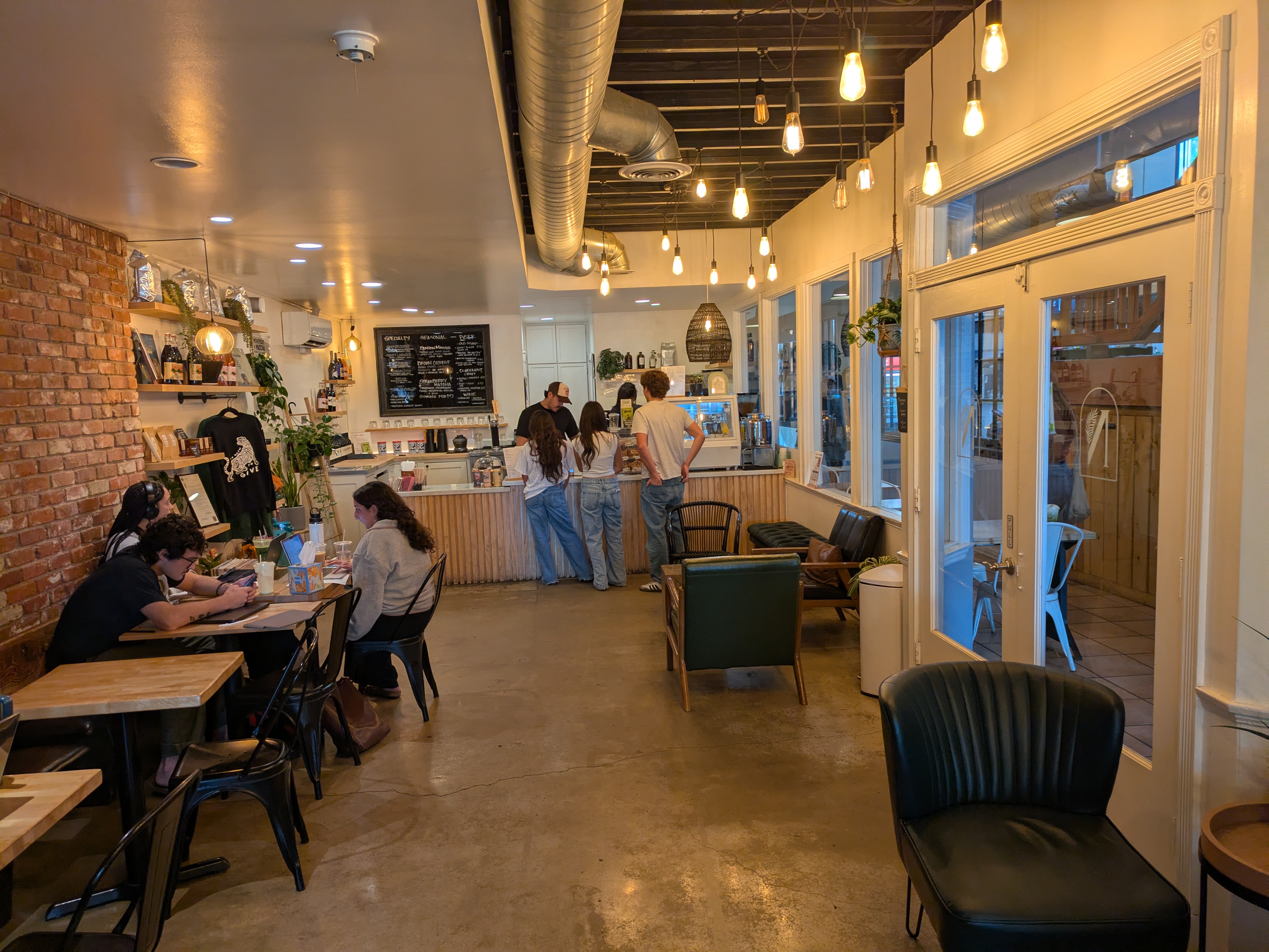
The stretch of D Street between 2nd and Bonita (a block further past 3rd) is lined with plenty of cafes and restaurants, notably the popular Warehouse Pizza on the corner of Bonita, with its pleasant outdoor patio, and Allegro La Verne, a much-loved Italian restaurant with sidewalk seating just around the corner on 3rd Street. And then there’s Nambah Coffee, which sits across from the campus proper and is a popular student hangout, with a cozy atmosphere and excellent matcha lattes.
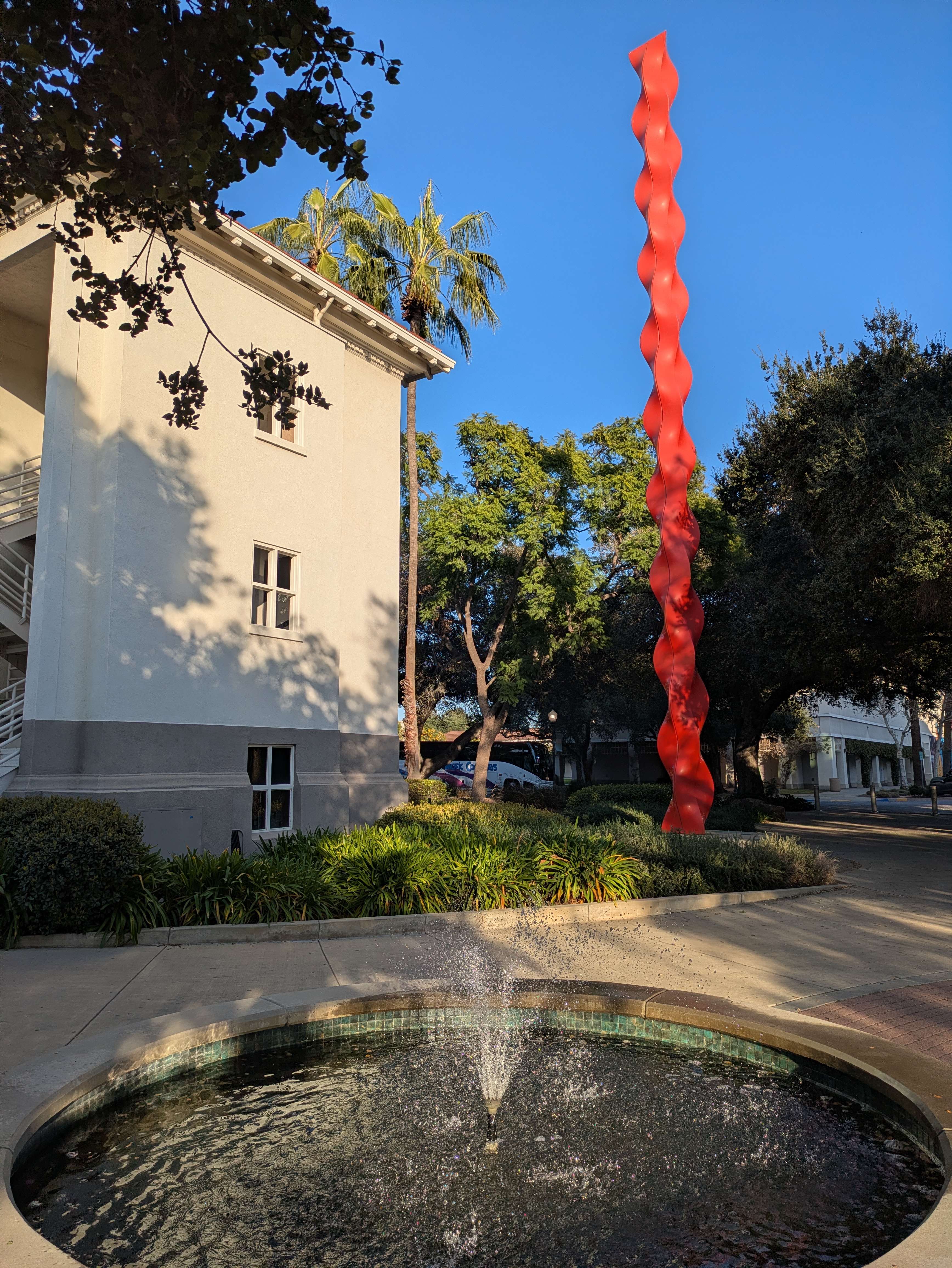
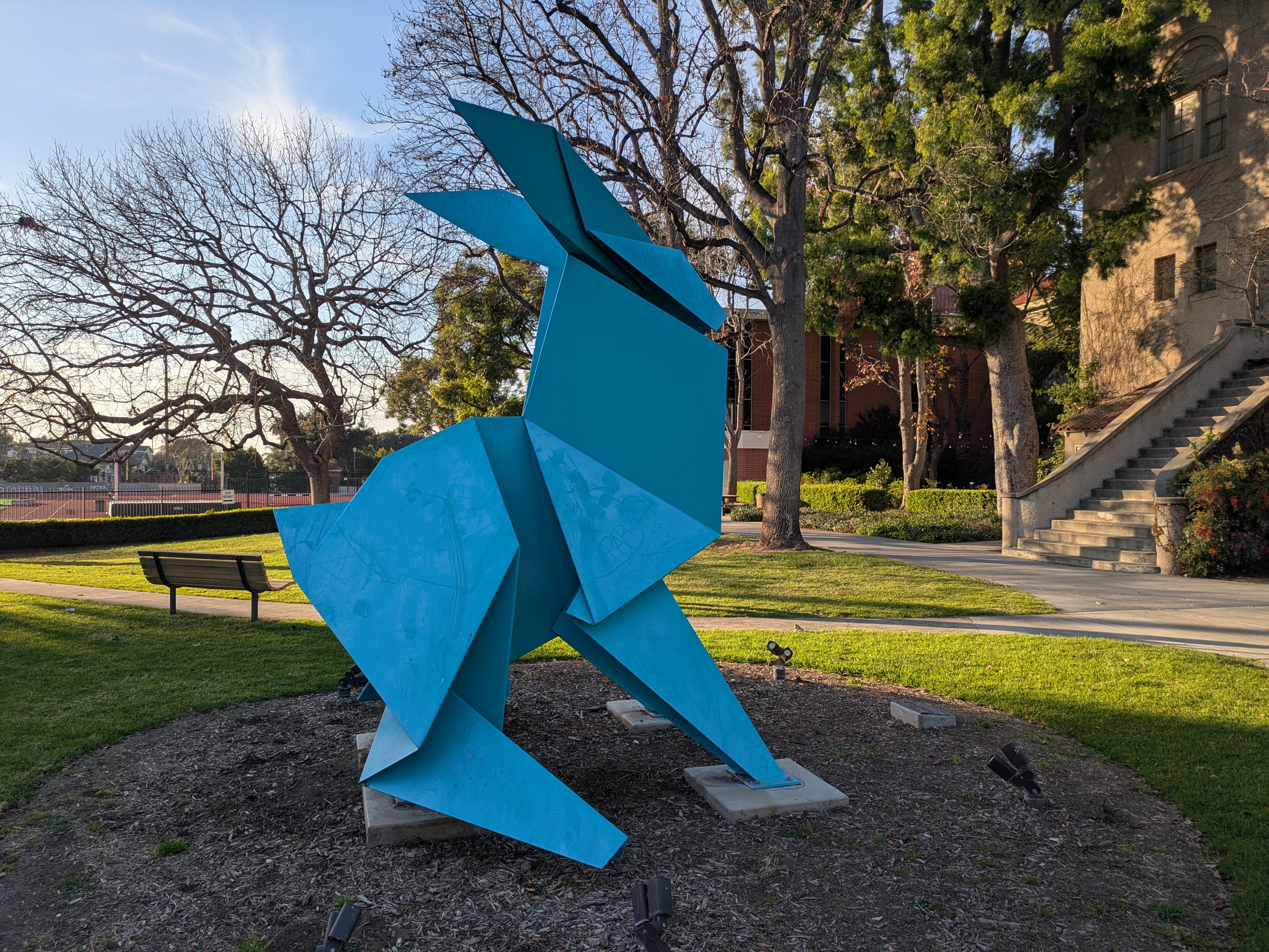
The University of La Verne campus is very small, only taking up a few square blocks, but has a lot of greenery and makes for a lovely stroll. There’s a few grassy areas, including one with a statue of the university’s mascot, and one wrapping around the athletics center (a modern structure which looks like a giant white circus tent) which also holds a small sculpture garden of interesting contemporary works, such as a twisting red pillar and a giant blue bunny.
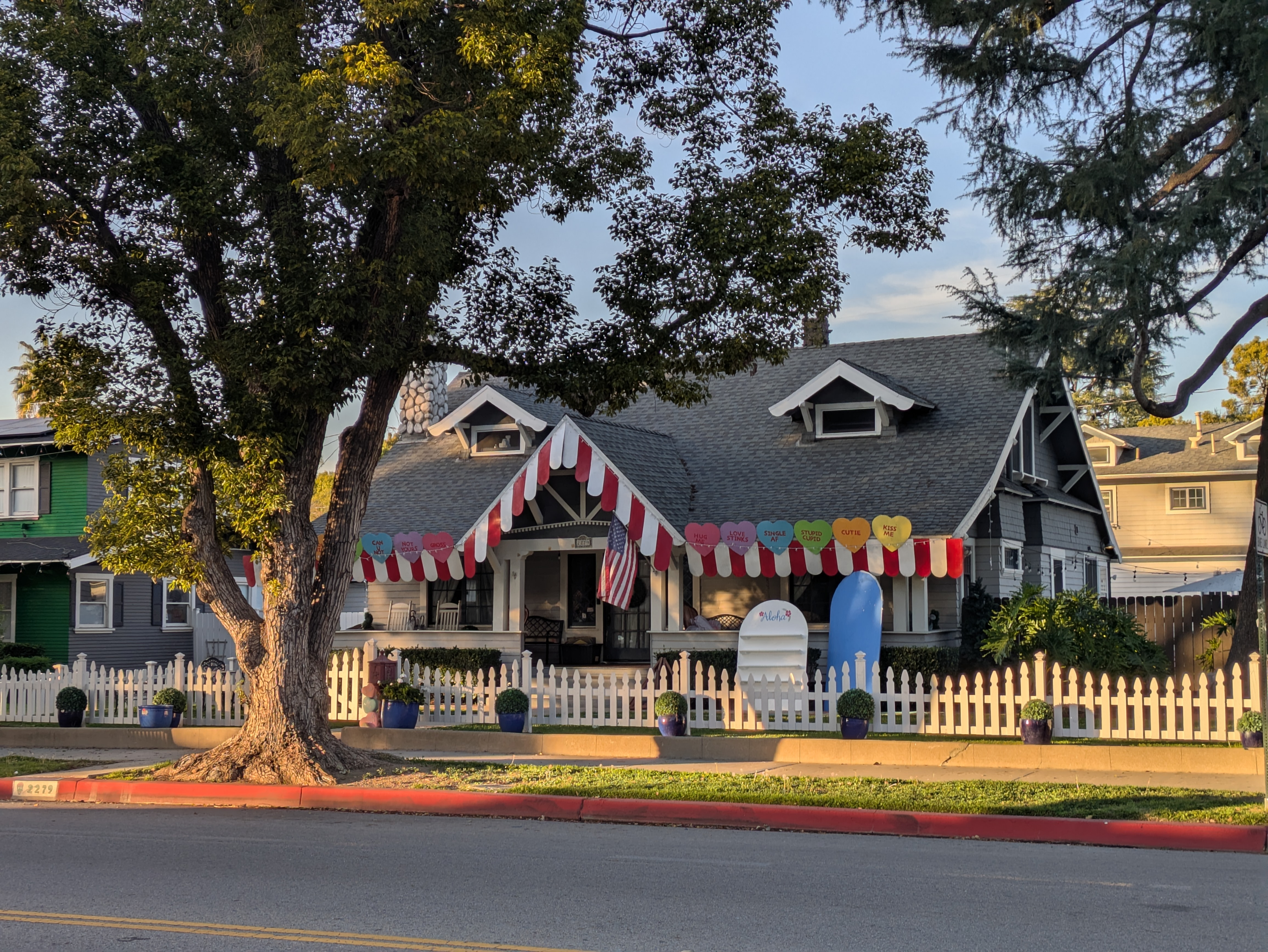
Bonita Avenue is more residential through La Verne, with a lot of quaint old houses. A couple of blocks east of D Street, there’s a pair of houses with white picket fences that are locally famous for their insanely elaborate holiday decorations, particularly around Halloween and Christmas, although they’ll decorate for just about any holiday (as illustrated by the Valentine’s decorations in the picture below).
Pomona
Pomona North is the last stop on the A Line, and serves as a transfer point to Metrolink’s San Bernardino Line. (Claremont, which has a wealth of attractions in its own right, sits one stop further east along the Metrolink line.)
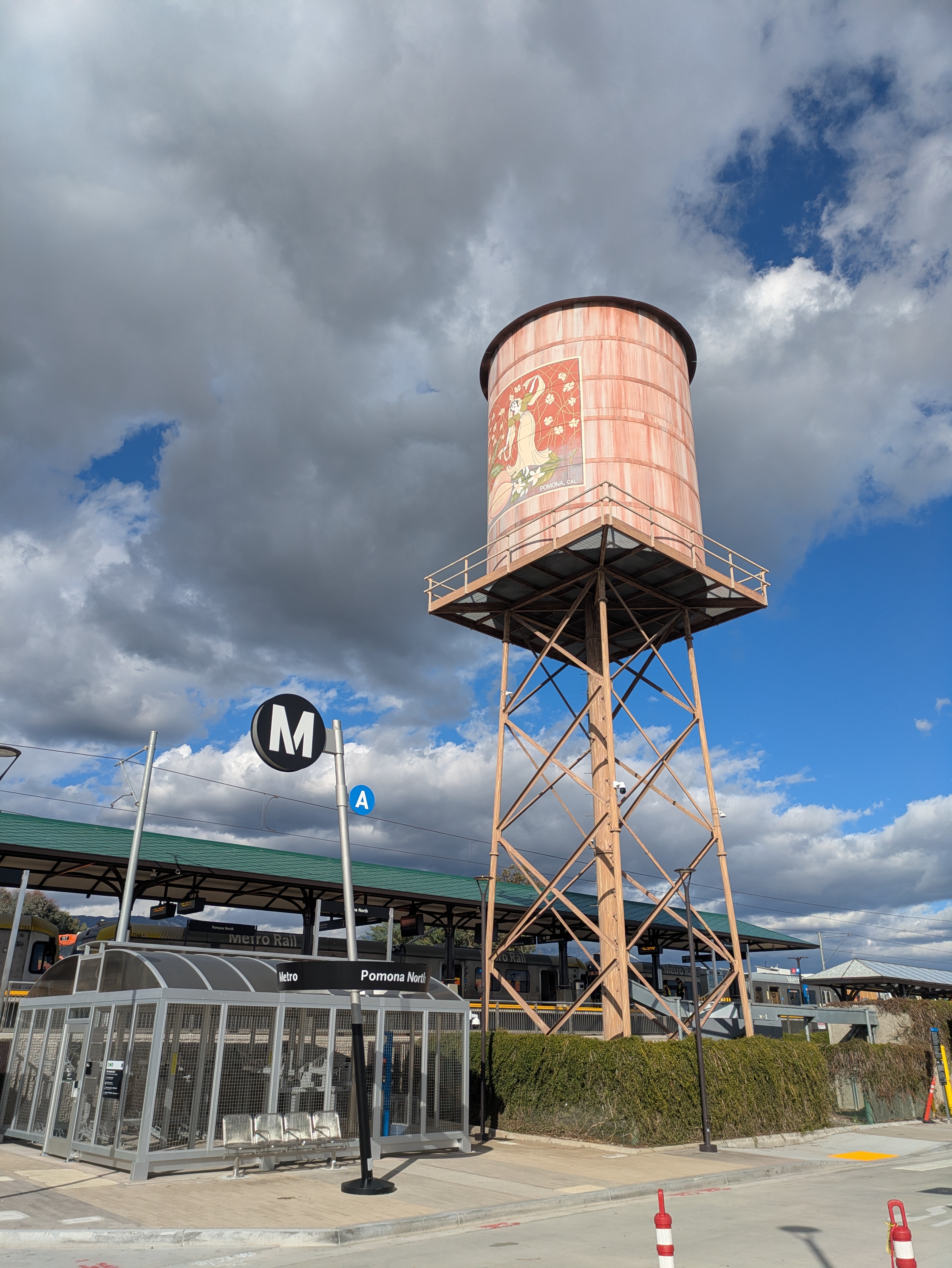
There’s not much to speak of about the station itself, other than its cell phone tower elaborately disguised to look like a vintage water tower. Pomona North sits in the middle of an area filled with warehouses, and there’s not much to see within comfortable walking distance.
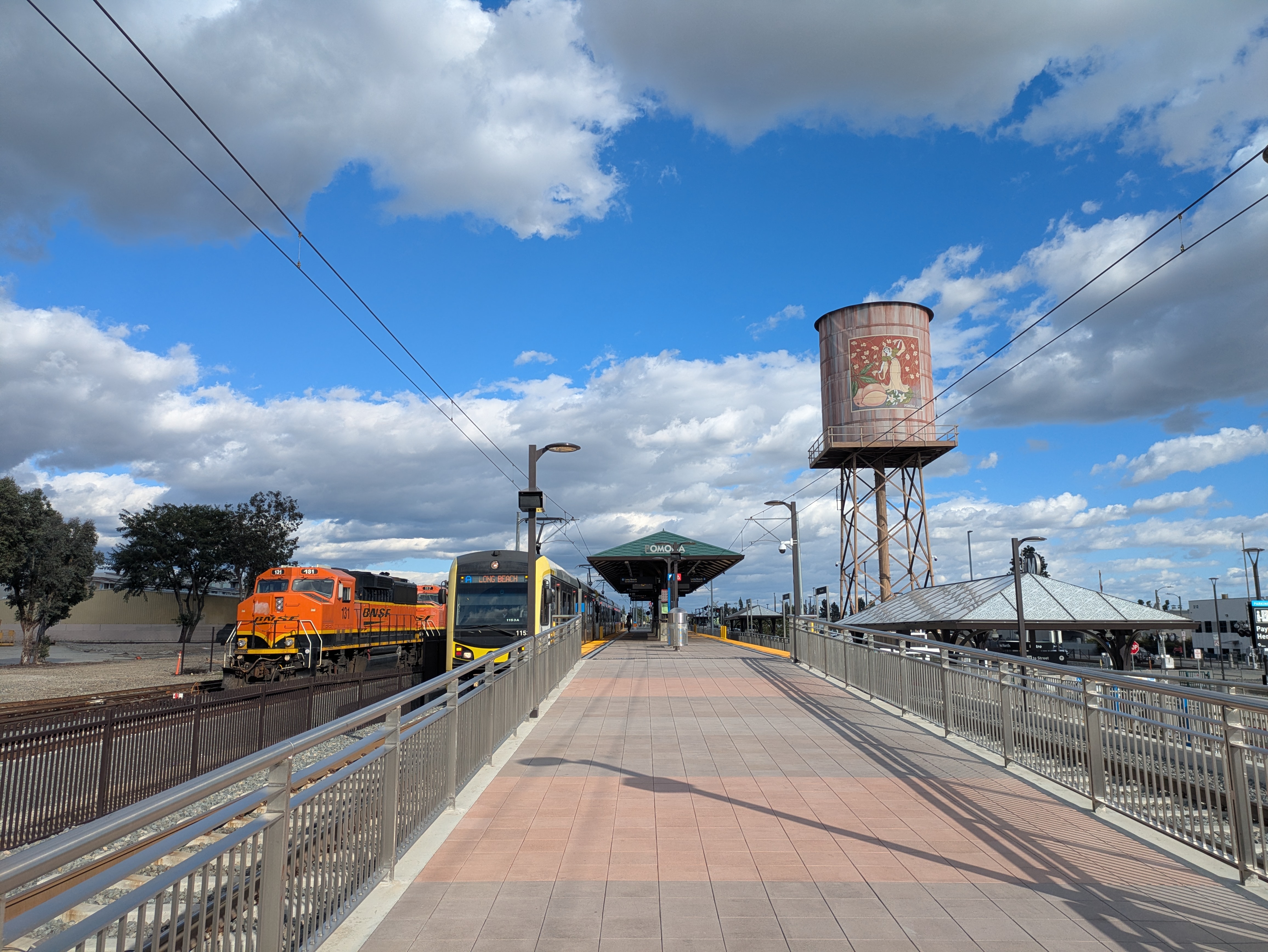
Pomona North is mainly valuable as a transfer point, and from here you can take Metrolink deep into the Inland Empire. You can also catch the Foothill Transit 291 bus straight south to Downtown Pomona, a walkable historic district which offers a lot more for visitors, including a couple of art museums, an old movie theater-turned-music venue, and plenty of good places to eat.
